1 Welcome to Grimethorpe
Hello! I’m Dick Bateman and I was born and brought up here in the village of Grimethorpe. We’re in the heart of South Yorkshire between the towns of Barnsley, Doncaster and Wakefield. Although we’re now surrounded by countryside of hills and valleys, woods and streams this used to be a landscape of heavy industry.

Beneath us is the South Yorkshire coalfield and Grimethorpe was one of Britain’s most well-known pit villages. It was also made famous round the world through the film ‘Brassed Off’ which told the story of the closure of a colliery through the eyes of its brass band; ‘Grimley’ in the film was based on the village of Grimethorpe.

The extraction of coal from below ground transformed the physical, economic and social landscape of South Yorkshire.

On this walk we will discover evidence of pre-industrial Grimethorpe, explore the impact of the coal industry on the village, learn about industrial decline and see recent efforts at regeneration. We will hear from a variety of people connected with the village. Some will share their memories of the past, looking back on work down the pit and life in a colliery village; others will give us their thoughts on the future, reflecting on new housing, re-landscaping and job opportunities.

This is not a depressing walk about industrial decline and what was once said to be the most deprived village in Britain, but a story of change and reinvention as Grimethorpe faces the twenty-first century with optimism.

The walk starts and finishes at the Acorn Centre, which is a small business park with a car park and cafe. The circular route is about 5 miles (or 8 kilometres) long and takes in three distinctive parts of Grimethorpe – The Village, White City and Red City – as well as venturing into some of the lovely countryside around the village. If locals stop and ask what you’re doing, tell them – we’re a friendly bunch Up North! I hope you enjoy the walk!


Aerial view of Grimethorpe Colliery
Courtesy of National Coal Mining Museum of England
Directions

If you are in the Acorn Centre car park in the centre of the complex, go through the gates at the ‘back’ entrance (i.e. not on High Street) and turn right onto Acorn Way.

If you are on the High Street and the Acorn Centre car park is closed (usually at weekends) you need to go around the perimeter of the site to the back. Next to the Acorn Centre entrance is Cudworth View. Walk along this road keeping alongside the wall on the right hand side. Where the road bears round to the left, continue straight on the footpath next to the wall and fence. When you reach the road (Acorn Way) turn right. Pass the back gates of the Acorn Centre.

At the mini roundabout turn left into Springvale Road. Go straight on at the first roundabout (junction with Long Royd). After 200 metres is a right turn into Springhill Road. Stop by this
junction.

2 A productive pit

We will start the story of Grimethorpe with two collieries that were both the making and unmaking of the village. You’ll have to use your imagination and look at archive images because nothing remains today on the sites.

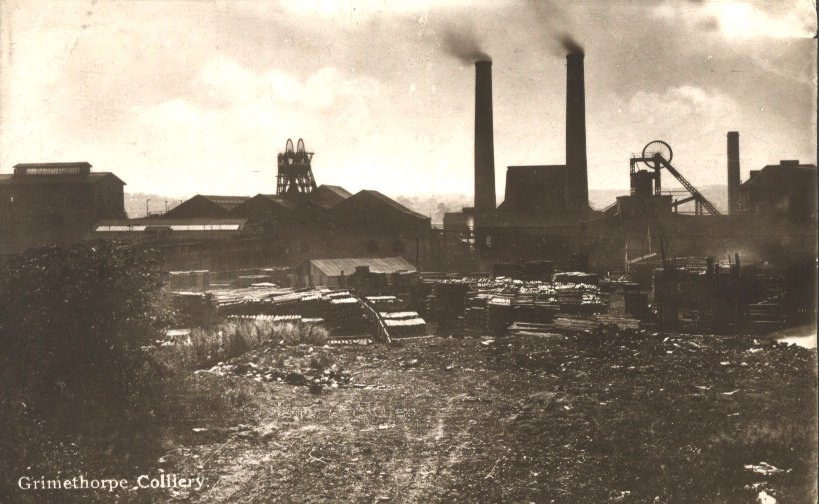
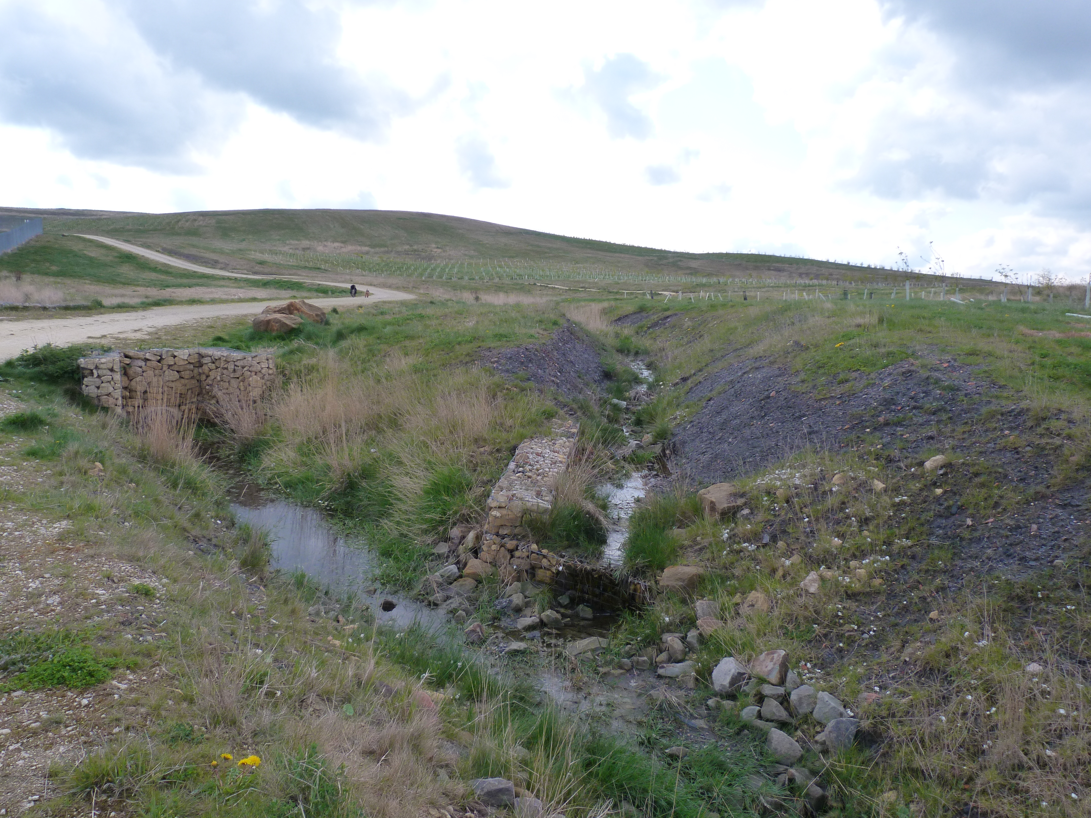
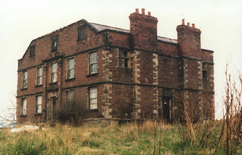
Grimethorpe Colliery opened near this point in 1896. It was one of Britain’s most productive deep coal mines due to the six-foot thick ‘Barnsley Seam’ of high-quality bituminous coal used for both ‘coking’ and ‘steam’ coal.

Most of the coal was used as steam coal in local power stations – there was one here in Grimethorpe and we’ll see the site of it later.

The coal was also used for local domestic consumption in the days before the UK Clean Air Act of 1956 when most people had an open fire in their house. Local industries also used the coal for fuel.

A second pit was started 600 metres away in 1915. Ferrymoor Colliery was a drift mine locating coal seams at an angle from the surface. It linked underground with nearby Riddings and South Kirkby Collieries in 1969.

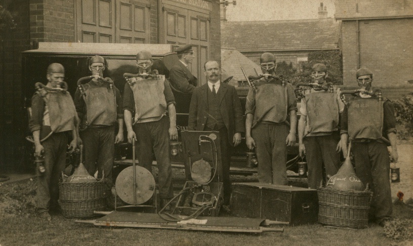
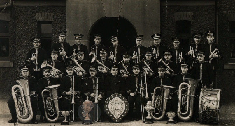
Terry Haynes, OBE was Under-Manager of Grimethorpe Colliery and a long-standing member of its prize-winning First Aid Team. Terry’s family has been involved with this pit for the best part of 100 years. No-one knew it better.

Terry: “My granddad came from Bolsover Colliery where he helped to sink shafts. He came here in 1884 to start sinking shafts. He decided to stay at this pit and he became a collier underground, a coal hewer as they were called then, and then he rose to overman.

He carried on working until he was quite old – he finally finished up at 74 years old in colliery security – he patrolled the grounds
with a big Alsatian.

Of course his five lads grew up in the mining industry. My dad was a deputy, my uncle was overman, my other uncle was a safety officer and my other one was a road layer. So I naturally followed in my father’s footsteps.

There were no interviews or exams or qualifications or references. If you could walk you could get a job in the pit. I started doing
pony driving in 1952, then I went coal filling – you had to fill 16 tons for £3 a day.

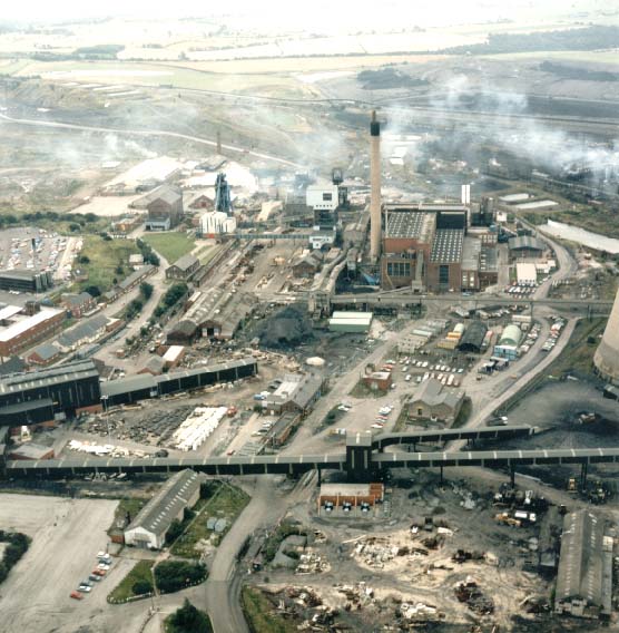
Grimethorpe was one of the most advanced collieries in the country. It was called the ‘golden pulley pit’ because we used to wind a million tons of coal a year, roughly 34,000 tons a week.

The winding engines were enormous – 1,200 horsepower. Number one engine, which was a steam-driven engine, went for 50 years continually – 16 hours a day winding coal.

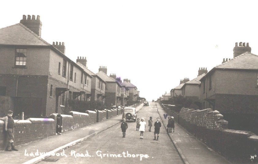
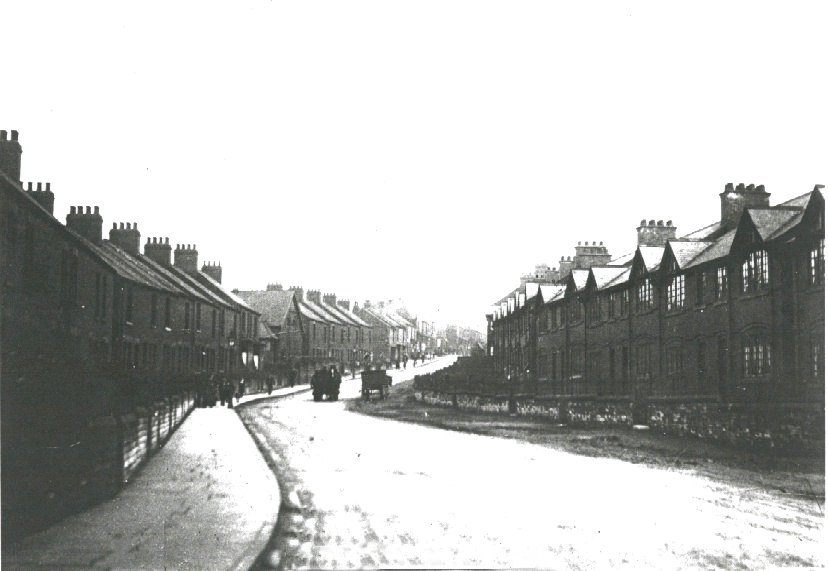
Of course the pit employed a lot of men. In its heyday it employed 3,300 men and they came from all round Grimethorpe. In fact it had its own train station in the pit yard. A train came from Barnsley, stopped at Royston and Cudworth picking up miners and dropped them off in the pit yard.

The occupations in the pit were enormous. We’d scientists, ventilation people, safety department, joiners, road layers, bricklayers. Any occupation you can imagine was done at a pit.

The coal from Barnsley Bed was so hard that you got it in lumps rather than shale or little bits. In the 1930s coal from the Barnsley Bed was used on the Flying Scotsman for its record run from King’s Cross to Edinburgh when it hit 120 miles an hour.

Grimethorpe also supplied Buckingham Palace with Barnsley Bed hards to fuel boilers. We had two men on the surface just picking lumps of the best Barnsley Bed coal for Buckingham Palace.“


Grimethorpe colliery
From the Brierley Grimethorpe and Shafton Living Archive
Directions

Note: If you are interested in seeing the site of the first shaft which Terry Hayes’ grandfather helped to sink go into Springhill Road and take the first left. Just where the road starts to
bend to the right go straight across the grass towards a tall pipe behind a high metal fence.

From the junction with Springhill Road continue straight along Springvale Road. Turn into the second road on the left which is Clayburn Road (if you reach a major roundabout you have gone too far). Pass the entrance to Carlton Brick Works on the left and continue to the top of the road. Stop at the metal gateway onto open land.

3 The dash for gas

We’ve come to what feels like the end of the village and it is an appropriate place to talk about the end of coal even though we’re just at the beginning of our walk. Although evidence of the colliery has disappeared there are millions of tons of coal left in the Barnsley Seam underneath us. Because of increases in productivity during the 1970s and 80s, Grimethorpe’s coal, like that of many other large Yorkshire collieries, was among the cheapest in the western world.

Yet in the 1980s and 1990s, the UK’s electricity generation industry moved away from using coal to natural gas. This was called the ‘Dash for Gas’, triggered by a change in EU regulations which allowed gas to be used to generate electricity. It was enthusiastically adopted by Mrs Thatcher’s Conservative Government which had decided to go for the cheapest energy available on the global market. A common perception is that the government also wanted to take on the mining unions who had carried out a successful miners’ strike about pay in 1974, prompting the fall of Edward Heath’s Tory Government.

With the shift to gas, the amount of coal used for UK electricity generation dropped from over 84 million tonnes in 1990 to less than 42 million tonnes in 1999. In addition, rather than use British coal mined underground, cheaper coal was imported mainly from Colombia and South Africa.

Britain’s mines began to close. Ferrymoor-Riddings-South Kirkby Colliery, though the top mine for productivity in Britain, at 8 tons per man-shift, was closed in 1988. Grimethorpe Colliery, though accounted to be economically viable in 1992, finally closed in May 1993, having been operational for 97 years.

Terry: “Well, it was disastrous. The year that we closed, 1993, we made a million pounds profit and employed 1,200 men. Nowadays that would be seen as a great business but Maggie Thatcher said shut it and it was shut.”

We will hear more about the impact of the closure of the collieries later.


Picket line (1984)
© Martin Jenkinson martinjenkinson.photoshelter.com   
Directions

Go through the metal gateway and follow the broad footpath. At the first junction take the left fork along the main footpath and follow it as it snakes gradually upwards. After about 400 metres turn right onto a smaller footpath that leads uphill towards the top of the hill. Stop after 200 metres where a path goes off to the left

4 The end of an era

At the last stop we heard about the closure of Grimethorpe Colliery in 1993. If you had been standing here back then you would have seen a highly industrialised view. By 1995 the coal-based businesses here had closed – the Power Station, the Coalite Coking Plant, the South Side Coal Preparation Works, the Fluidised Bed Combustion research project (a scientific centre for research into clean coal power) and The National Coal Board (NCB) area headquarters.

No evidence of any of these remains today except for the huge Carlton Clay Quarry and brickworks that we just walked past.

With the closure of the colliery and its related industries six thousand workers, most of them from Grimethorpe, lost their jobs between 1985 and 1995. In 1994 unemployment stood at 33 per cent and Grimethorpe was declared the most deprived village in Britain. Between 1993 and 2001, 1,917 residents moved away from the village.

The pit head gear was taken away and the mine entrance concreted over, although millions of pounds worth of equipment was still in place deep underground. The physical landscape had transformed and so had the social and economic landscape. But that was not the end of the story and we shall see why over the course of this walk.

To meet the challenge, Grimethorpe Regeneration Executive was created by Barnsley Metropolitan Borough Council, starting with consultations in 1995 and work on the ground from 1997. It worked until 2008 on a range of issues including land reclamation, housing, transportation infrastructure and job creation as well as some less immediately measurable targets such as community empowerment, health and restoring the self-esteem of residents.


Demolition of the cooling towers 
From the Brierley Grimethorpe and Shafton Living Archive
Directions

From the junction, take the path to the left and after 10 metres take the path to the right which leads to the top of the hill. Stop at the brick memorial and plaque.

5 Grimey muck stack

Coal was mined down to 700 metres then brought up to the surface for sorting. The saleable coal was transported away but the bits of shale, sandstone and small pieces of coal not suitable for sale were put out into tubs. These tubs ran on aerial cableways and dumped the waste material into nearby fields like this one.

Over time the millions of tons of material grew into a conical pile 100 metres high. These piles of mining waste were known as ‘spoil heaps’ or ‘pit tips’ although we used to call this one Grimey muck stack.

Such spoil heaps were a major landmark in all coal mining villages. You can only appreciate their size by looking at old photographs. You might wonder why these spoil heaps were allowed to accumulate. Well putting the spoil back underground, filling up spaces where coal had beenm removed, was thought to be too expensive. Meanwhile on the surface there was simply too much to remove and nowhere suitable to take it.

As part of the Grimethorpe Regeneration Initiative, and with European Union funding, this spoil heap was lowered, reshaped, drained by the stone-lined ditches we have just walked past, and planted with trees. New plant species have drifted in on the wind. Jeff Lunn, author of ‘The Yorkshire Plant Atlas’, has called this the ‘The Hanging Gardens of Grimethorpe’ because of the colour and variety of the plants and wildflowers that have colonised these slopes. With the new walks laid out which offer great views of the village and its surrounding countryside, this former industrial wasteland is now an asset to the village.

Danny Farrar walks his dog up this former pit tip most days. What do you think of the landscaping
of this pit heap?

Danny: “I think it’s brilliant. It’s just what you need for the dogs. It’s the best thing that’s happened to Grimey in a long time, definitely. Tyke loves it up here, chasing all the birds and that – it’s brilliant for him. You don’t get any bikes up here either – no disturbance – so he’s free to roam.”


Landscaped pit tip
© Dick Bateman
Directions

We’re now to go from the top of the hill to the exit in the northeast corner so take a moment to orient yourself as there are several footpaths around the hill. Look down towards the brickworks and quarry. Follow the line of the metal perimeter fence to the right of the quarry to where it meets some trees just below some houses. This is the exit to aim for.


With your back to the brick memorial and plaque follow the footpath immediately ahead. At the first junction turn right and then left onto the main track which slopes gradually downwards around the hill. Take the second smaller path on the right which goes up towards the trees in the corner. After climbing steeply go through the metal gateway and through the trees. At the junction of paths turn left following the line of telegraph wires with the metal perimeter fence of the quarry on your left. Follow this path straight for about 250 metres until you reach some large boulders. Go past the boulders onto the road and turn right into the cemetery.

6 A repository of memories

Most people in the village had some connection with the pit and within the cemetery are the graves of some of Grimethorpe’s most notable past residents. One of these was the late George Thompson, MBE. He was the Colliery Band’s conductor in the 1960s and 70s, a talented musician and a much-loved member of the community. He lies here with his wife, Elsie, who was a teacher at Grimethorpe Infants School in the 1960s. I was friendly with one of his daughters, Hilary, and one of my abiding memories of George was when I called round to find him arranging Tchaikovsky’s 4th Symphony for brass band – on the kitchen table! Very 1960s.

Every gravestone here in this cemetery tells its own story – some of them graphic about accidents at the pit and others about people who lived in Grimethorpe all their lives and had many stories to tell.


Grave of George and Elsie Thompson

Jenny Lunn © RGS-IBG Discovering Britain

Directions

When you are ready to leave, turn right onto the narrow lane with the cemetery on your right. Pass a school on the right and houses on both sides. Stop at The Red Rum pub on the corner of Nancy Road.

7 A community hub

There were several institutions important to working class communities such as Grimethorpe. We heard about the brass band at the last stop and will hear more about it a little later. There were also churches and chapels. Pubs were another important community hub. This one, The Red Rum, featured as The Colliers’ Arms in the film ‘Brassed Off’. It is one of the few pubs in the country named after – and opened by – a horse, the famous Red Rum who won the Grand National three times in 1973, 1974 and 1977.

Ken Hancock used to be the local Branch Secretary of the National Union of Miners but is now the landlord of the Red Rum.

Ken: “Originally there were three pubs in the village – the Manor, the Grimethorpe Hotel and this one. You also had the miners’ welfare club and the ex-servicemen’s club. The pubs and clubs were vitally important to the men and for comradeship. After a shift underground, most men called in to have a quick one if there was a pub on the way home – just to clear their throat of dust, relieve pressure and have a laugh.

This has always been a popular little pub but times have changed now. People are working different shifts and funny hours; some are not working at all so they haven’t got the money to drink. And the young don’t drink the same as we did back then. They just don’t have the same social input in the pub – they think three games of pool and a glass of orange keeps a pub going."


Red Rum pub

© Ian S, Geograph (Creative Commons License)
Directions

From the Red Rum pub, go along Nancy Road. After about 100 metres keep left into Nancy Crescent. Follow Nancy Crescent as it curves around for another 100 metres. Stop at
the junction with Ladywood Road.

8 The runaway pram

I was born here in Ladywood Road, just up the street at Number 81. Now it’s my turn for sharing a memory. My father moved here in 1942 with his brother, my Uncle Eddie, from County Durham, where the pits were closing. They both found jobs in Grimethorpe Colliery where they soon became Deputy/Shotfirers. My mother found a job as a teacher at Grimethorpe Infants School.

In the winter of 1943, a local lad called Charles Helliwell decided to fly his RAF training aircraft from Finningley RAF Station near Doncaster
over Ladywood Road where his mother was one of our neighbours.

At the time my mother was taking me, her new baby, out in a large, black, spring-loaded pram. When Charles flew out of White City Wood and down the length of the road she thought it was the Luftwaffe coming for her baby. She flung herself onto the pram to protect me, bounced off and knocked herself out on the pavement edge. Meanwhile my pram sailed off down Ladywood Road chased by some girls who had witnessed the whole incident! When Charles got home and boasted about his fly-past he got quite a stern telling off from his mother for scaring the village. He went on to have a glittering career as a commercial pilot!


Ladywood Road

From the Brierley Grimethorpe and Shafton Living Archive
Directions

Turn left along Ladywood Road and follow it downhill. Stop at the T-junction at the bottom.

9 White City

Along the route that we have walked you will have noticed the same kind of houses: semidetached houses built of red brick and with a grey-white pebble dash cladding on the top half. Because of the pebble dash feature, this area of Grimethorpe was known as ‘White City’.

Grimethorpe was originally a very small village. As the mine expanded its operations more workers were needed. People came to South Yorkshire from other mining areas where old pits were becoming exhausted, particularly Scotland and County Durham, including my father and Uncle Eddie. The miners and their families
needed somewhere to live. This residential area was built by the mining company in the 1930s and 40s.

After nationalisation of the coal industry in 1947 the houses were administered by the local authority as council houses. Some houses are now privately owned (after Mrs Thatcher offered the tenants to buy them cheaply in the 1980s) while others belong to community housing schemes. But look along Burntwood Road: some of the old houses have been demolished and replaced. Newly-built homes are for sale and are selling well.

You’ve already heard a little about my family and when they moved to Ladywood Road. Peter Wormald is another resident. How long have you lived in White City?

Peter: “For about 50 years – most of my life. My dad worked at the pit for 40-odd years but the village is so much cleaner and nicer now the pit’s gone. Everybody said it would be a ghost village when the pit closed because that was the only thing in Grimethorpe but it hasn’t – it’s thriving at the moment and it’s nice. The amount of new houses going up is just incredible. These here on Burntwood Road have got by far the best view in Grimethorpe. And they are nicely constructed. As soon as one’s finished it’s occupied, it’s unbelievable really. There must have been 600 houses in the last two years gone up in Grimethorpe particularly for the people working on the new industrial estate.”


White City
Jenny Lunn © RGS-IBG Discovering Britain
Directions

Turn right along Burntwood Road with houses on your right and fields on your left. Stop where the road ends, looking out onto open countryside.

10 A natural playground

We’re now on the edge of open countryside at the eastern side of the village and on the next part of the walk we will discover more about the story of this area before the days of coal mining.

The name of this wood is interesting to note – Lady Wood. There are some other place names round here with the word ‘lady’ including Ladycross and Ladywell.

In medieval times there was an important religious centre near here – the Priory of St Mary Magdalene at Lundwood, Barnsley, also known as Monk Bretton Priory. It was built by a twelfth century Norman knight called Adam Fitz Swain. It was a daughter house to St John’s Priory for Cluniac monks, founded by Ilbert de Laci (de Lacy) near to his base at Pontefract Castle, which was also dedicated to Mary Magdalene. Monks and pilgrims almost certainly walked along this path by Lady Wood on their way between the two Priories.

During the mining period these fields and woods were a natural playground where the lads and lasses of mining families loved to roam and walk their dogs. Len Linsey was born and brought up in the village. What was it like to have these woods and fields to play in as a child in a mining family?

Len: “Well, it was quite superb. From where we lived up in Cross Street, we walked out of the back garden and we were into the woods. There were no playgrounds or special play areas, we just played in the wood.

After working shifts down the mine, my father would like to walk in the fresh air round the woods with the dog. He also used to teach us how to find birds’ nests and snare rabbits, which would supplement the family food stock. Yes, it was quite superb. “

Terry: “Of course there were no televisions in those days so miners had various hobbies like boxing, football and cricket. Also a game called knurr and spell or nipsy. Miners also liked racing pigeons and greyhounds. People, especially kids, didn’t spend time in the house like they do nowadays. They would go out blackberrying and mushrooming and playing in the fields. They were good days. We didn’t go on many holidays but each club took a trip. I remember the working men’s club once took a trip away to Blackpool and there were 43 bus loads of people!”


Open countryside on the edge of the village
© Dick Bateman
Directions

From the end of Burntwood Road take the left hand of the two footpaths and follow it with the field on your right and hedgerow on your left. Follow it downhill to the lowest point. Stop about 50 metres further as the path enters a copse of willow trees.

11 Lord of the Manor

This footpath is part of the Barnsley Boundary walk, a Barnsley Metropolitan Borough Council initiative to encourage walkers to visit some of the more scenic and interesting parts of this area. However, the path itself is much older. It is part of the centuries-old route from Monk Bretton Priory (that we heard about at the last stop) to Hall Steads which was a fortified manor house near this spot.

Historical records show the existence of Brierley Manor as far back as 1066 and we also have a record of the Lords of the Manor over a period of seven centuries.
Brierley was an important Manor with a large regional estate.

Nothing remains of the house today but there is some evidence of its existence. In dry weather the outline of the building shows after the field has been ploughed. The building appears to have been L-shaped with a large hall used as a general living area on one wing and a chapel in the other wing.

We also know that the hall was built of local sandstone because many building stones have been found in the field. Fragments of fourteenth and fifteenth-century pottery have also been found. The hall was surrounded by a high stone wall and then by a moat. The spot that you are now on, known as Willowgarth, was part of that moat. The hall was probably owned by an Anglo-Saxon called Earnwine but it is not mentioned in historical records until 1284 when it was the home of Geoffrey Nevile of Brierley.


Barnsley Boundary Path

© Steven Ruffles, Geograph (Creative Commons License)
Directions

Follow the path through the willow trees and then as it climbs gradually between banks. In summer months this path may be quite overgrown. The path soon reaches the field level and you can stop to look at fine views towadrs the Pennines in the west. At the first rusty railing follow the signed path to the left. The path goes across the top of several fields towards a wood. At the edge of the wood is a crossroad of paths. Take the path on the left into the meadow just below the wood. Stop after about 20 metres.

12 Tom Bank

Earlier we saw Lady Wood which was a mature beech and chestnut plantation. This wood, known as Tom Bank Wood, is similar but newer. It was a plantation within Brierley Park, part of the land owned by the Lords of Brierley Manor that we heard about at the last stop.

Tom Bank Wood and this valley – known as ‘Tom Bank’ or, to the locals, ‘The Dell’ – has been a playground for the youngsters of the area for the last 100 years. There used to be two former mill ponds here that were used for unofficial swimming in the 1950s and 60s. Ken Johnson, who grew up just at the top of the hill, has some of memories of playing here.

Ken: “The childhood here was a very happy one. I was a baby boomer so there were lots and lots of children in the estate where I lived therefore lots of people to play with. Children were very creative and inventive in their play and we had these fantastic surroundings: the woods and the fields where we used to play quite often.

I remember that winter sports down the Dell were fantastic – sledging and tobogganing. People used to make their own sledges out of recycled bits of wood but if you were lucky enough to know somebody who worked in the workshops at the colliery then they’d make you some runners in metal. So it was a very happy childhood for me here.”

Since 2000 the area has been re-landscaped as part of the Grimethorpe Regeneration Initiative by the town council. Trees on the other side of this small valley are recent plantings and the ponds further down the valley have been stocked with fish including carp, bream and tench for local anglers. The intention is for this to be a lovely valley for local residents.


New ponds in The Dell
© Dick Bateman
Directions

Follow the footpath as it goes diagonally downwards across the meadow below the wood. At the far side of the meadow follow the path into the trees and turn left to cross the bridge over the stream. Where the path divides take the left fork as it climbs up the hillside.

Go straight across at the first junction to continue following the path diagonally upwards through the wood. At the next junction of paths also go straight on into a field where there are often horses. You can also see houses at the top side of the field. Stay to the right side of this field and then turn right though a gap in the hedge. Across the next field is a metal fence and there may be construction site signs. Stop here.

13 Pass or fail

A secondary school stood here at the top of Windmill Hill from the 1950s until 2011. In the 1950s and 1960s youngsters sat the 11+ exam. If they passed the exam
they were deemed worthy of a grammar school education and sent to Hemsworth Grammar School or Barnsley Grammar School. Those who failed the exam came
here to Grimethorpe Secondary Modern School. Ken Johnson was one of those people who went on to Hemsworth Grammar School. How important was education in the mining village of the 1950s and 60s?

Ken: “I think for the majority of families it was extremely important. Most of the fathers worked down the pit and they didn’t want their sons to follow them. So they were very supportive of their children within the education system and had aspirations for them to achieve much greater things.

About one in five of my age group passed the 11-plus and went to grammar school and the others that didn’t went up to the local secondary school. Most of these children at the secondary school would have left school at 15 years of age. They wouldn’t have done any formal examinations like GCE that we did when we were at the grammar school. A lot of them would have automatically gone to work down the colliery. Some got apprenticeships and therefore learnt skills and were able to do quite well and establish their own businesses but the majority of people worked down the pits. So the 11-plus was really a key factor in contributing towards people’s destinies.”

In the late 1960s Grimethorpe Secondary Modern School became an 11-16 comprehensive school re-named as Willowgarth High School. Willowgarth High became very successful but in 2011 it was merged with other local comprehensives to create a new 11-16 super-school of 1,350 students. The school site here has been sold for £40 million to developers who intend to build 400 new homes here: it seems that Grimethorpe is becoming a desirable commuter village.


Grimethorpe Secondary Modern School (1956)
From the Brierley and its people in photographs (Baipip) archive
Directions

At the top of this field is a tarmac path. Turn left to emerge by the houses at the top of Windmill Avenue. Walk down to the first junction.

14 Red City

Earlier we walked through ‘White City’, the part of Grimethorpe village characterised by semi-detached houses built in the 1930s with grey-white pebble dash cladding. By contrast we are now in ‘Red City’. As you can guess, the name comes from the red-brick houses. The bricks were made locally at Carlton Brickworks, which we walked past earlier, a business which predated the colliery and has survived its demise.

Like White City, Red City was built in sequence from the village up Brierley Road towards Windmill Hill at the top through the first 50 years of the twentieth century by the various local councils.

Windmill Avenue was furthest from the pit and the highest up the escarpment therefore the newest of Red City’s streets. It was built in the 1940s and 50s in the then-fashionable style of curved avenues. The semi-detached red-brick houses were a pleasant environment for people who spent all their life down the pit. You may have seen Windmill Avenue in the film ‘Brassed Off’ – it was where the euphonium player, Harry, lived. Mrs May Johnson also lives on Windmill Avenue.

Mrs Johnson: “I was brought up in Ladywood Road in White City. My mother lived there, down at the bottom looking on to the field. When I got married I had a house on High Street but I swapped with somebody for a house in Ladywood Road because I’d got small lads. Then I came out to this council house on Windmill Avenue. People kept saying ‘you’re mad for going up there’. But I preferred the houses – they were nice and roomy with a through-room and bigger kitchens.

When we first came up here the roads weren’t finished – there were only causeways. Only two houses of the houses above me were built; the rest were built after. Once the houses were done they finished the roads. I’ve been here for 60 years. They keep asking why I don’t sell my house and go in a bungalow but I don’t want to go down there to the village. “


Red City
Jenny Lunn © RGS-IBG Discovering Britain 
Directions

Turn left to follow Windmill Avenue as it curves downwards. After passing a bus stop there is a T-junction. Turn left down Manor Crescent to the main road. Cross the road and go slightly left. Stop on the pavement facing an old brick and stone building set back from the road.

15 The oldest building in the village

This is Grimethorpe’s oldest building, Grimethorpe Hall. It was built by a Robert Seaton in the 1670s and is one of the earliest classical buildings in the area featuring three stout Doric columns to support the ceiling of the entrance hall.

At the time of creating this walk it was derelict and its future uncertain. As we have already seen, though, new money is being pumped into the village and it is probably only a matter of time before someone buys the hall and has it renovated for a modern use.


Grimethorpe Hall
From the Brierley Grimethorpe and Shafton Living Archive
Directions

Continue down the right side of Brierley Road. After about 150 metres stop at the junction with Lilydene Avenue.

16 Redevelopment

Mining villages were famously, some would say notoriously, hard-working and hard-drinking communities. We stopped at the White City’s pub, The Red Rum, earlier meanwhile the new houses on the corner here are the site of what used to be Red City’s only pub, the Manor Inn.

Terry: “Going back to the Fifties, the Manor had its own band all dressed in red blazers and red ties. And it had waiter service! Unbelievable in a village like this for a pub to have waiter service and its own band. Those were good times.”

Pubs like the Manor Inn were very important parts of the community but with the pit closing and lots of unemployment, people had less money to spend. The pub trade dwindled and the pub was knocked down. Later the site was re-developed for new homes, as you can see. My Dad and my Uncle Eddie would have been shocked!

As we walk down to the stream, think about how many more of the sites along Brierley Road might be redeveloped for housing over the next few years, especially with any relaxation of planning laws.


The Manor
© Richard Spencer, Geograph (Creative Commons License)
Directions

Continue down the right side of Brierley Road. Stop after about 300 metres at a bridge over a stream.

17 Population boom

This is the heart of the original village from the days before the colliery. In the 1800s there was a village green, cottages, a farmhouse, a corn mill and at least one well. The farmhouse can still be seen on the opposite side of the road built in yellowish sandstone in contrast to the red brick buildings like those you have already seen on Windmill Avenue.

In 1881 the population of the combined villages of Brierley and Grimethorpe was just 484 with most of these people living in Brierley.

The pit was sunk in 1895-6 and by the next census in 1901 the population of Grimethorpe alone was 1,684. By 1972 the respective populations were Brierley 1,829 and Grimethorpe 5,559, a massive increase of almost 7,000 people in 91 years!


Looking up High Street
From the Brierley Grimethorpe and Shafton Living Archive
Directions

Continue along the right side of Brierley Road noting the triangular village green on the other side. Take the first right into Brighton Street (which at the time of creating this walk did not have a street sign) Stop at the first crossroads where the alleyways behind the terraced houses go off to the right and left.

18 By the seaside

At the last stop we heard about the precolliery village and the rapid increase in population with the opening of the pit. The first phase of new housing in the village was just round the corner from here either side of the High Street (see map on previous page). On the 1901 census only Joseph Street, One Street, Two Street and Three Street were named. Here we are on streets with more interesting and evocative names that were built in the first decade of the twentieth century.

In cities across the country you find housing developments named after things that take people’s imagination to nicer places. In industrial Grimethorpe this group of streets – Hastings Street, Margate Street, Cromer Street and Brighton Street – took people to the coast, to holiday destinations, places associated with sunshine, leisure and fun. Unsurprisingly this became known as the Seaside Estate. The names perhaps allowed people to imagine a better life but the reality was slightly different.

These red-brick Victorian terraced, two-up two-down homes with minimal gardens are like those seen on ‘Coronation Street’. They were home to miners, their families and their lodgers (many newly-arrived pit workers took lodgings with established mining families). As in many Northern towns, conditions were far from affluent but everyone knew each other, the children played together in the streets and walked to school together. There was a strong sense of community which existed though to the 1960s and 70s before the strike and pit closures in the 1980s and 90s.

After the pit closed, many of these homes were used for social or private rental to transient workers or unemployed younger people, many from abroad, and the area became very run down. It was a priority for the Grimethorpe Regeneration Board to re-vitalise this area. Old Victorian houses were knocked down and new private homes were built by Keepmoat Housing on one side of Hasting Street and in Trenchard Close, the first such development in Grimethorpe for 30 years. Note how
these new houses are very similar in design to the old Victorian houses on the other side.


Dereliction on the Seaside estate
From the Brierley Grimethorpe and Shafton Living Archive
Directions

Continue along Brighton Street and turn left opposite Trenchard Close. This is Hastings Street but at the time of creating this walk there was no street sign. At the top of the terrace, bend round to the left into the back alley and then the right to St Luke’s Road. Cross over St Luke’s Road and stop outside the church.

19 The heart of the community

Although there was an Anglican Church, St Paul’s, in Brierley the growing population of Grimethorpe required a new church. St Luke’s was built in 1904 ‘by the miners, for the miners’. Later a Methodist Chapel and Roman Catholic Church were also built to cater for families of different denominations.

St Luke’s is a spacious, imposing church which dominates the skyline of the village. You can judge how big it is from the outside.

It was designed to seat 500 people and the provision was left (if required) for an extension which would have consisted of an additional side chapel and south aisle. Church attendances dwindled through the twentieth century; by the 1960s the Sunday morning congregation was between 50 and 100 and by 1980 it was below 30.

As the village declined from the 1980s, so too the church building fell into disrepair and closure seemed inevitable but Father Peter Needham took it over in 2002 and St Luke’s once again became the thriving heart of the community.


St Luke’s Church

From the Brierley Grimethorpe and Shafton Living Archive
Directions

Go to the memorials outside the church.

20 The community remembers

The Memorial outside St Luke’s shows that 86 men from the village have died in wars since 1914 but it’s worth pointing out that the memorial also shows that 165 miners died in Grimethorpe’s pit from 1895 to 1993.

Terry: “There were a lot of serious accidents at Grimethorpe although we didn’t have many major accidents like they did in some pits – we never had explosions with gases or anything like that.

The first main accident was in 1911 with a steam boiler on the surface. They were welding it when it blew and killed three men. Then in 1950 three men were killed in the Parkgate seam when they were digging out a return wheel. The side came off and buried them. That was a disaster – I remember it – the church bells were ringing all night and it was terrible.”

My family was always involved in the first aid rescue teams at the pit. In 1910, December 28, the pit shut for New Year’s Eve holidays. My grandad, who was an Overman, went into the pit after the five days that it had been shut to open it up to ensure that it was safe for the men to go back underground.

Whilst travelling underground with just an oil lamp he heard some moaning and some shuffling and when he got to a certain point there was a man laid on the floor in agony – he could hardly talk. He’d been trying to eat his boots and lick the inside of the walls to get any moisture. He’d been down there five days.

My grandad was a first aider so he checked what he could of him then carried him to the pit bottom and got him out and the man recovered. My grandad was then awarded the Edward Medal for bravery. So although the pit had some serious accidents we also had top class first aid teams who could help in an emergency.

Rescue brigade
The Brierley Grimethorpe and Shafton Living Archive
Directions

With the church on your left, go along St Luke’s Road and follow it as it bends round to the right. Stop at the mini-roundabout by the supermarket .

21 Childhood memories

Here’s another place in the village with lots of memories for me. As a lad in short trousers, I attended Grimethorpe Junior School which stood on the site where the supermarket is now.

The school was established in the early 1900s as the mining village started to expand. Later, in the 1960s, two more junior schools were set up as the village’s population grew even further.

This school’s first headteacher named the school’s four Houses after nearby landmarks – Burntwood (Blue), Willowgarth (Red), Ringstone (Green), and Ferrymoor (Yellow) – two of which we have visited on our walk today. We pupils loved the evocative local names. They gave us a sense that where we lived was important and we loved to wander in the countryside between them.

Of course I was a very well-behaved pupil, but not everyone was. It is rumoured that in the 1980s a pupil set fire to Grimethorpe’s three junior schools, one at a time, in three highly-successful operations. The other two schools were replaced but this old Victorian building, then called Springvale First School, finally closed in 1990, with its students being shared between the two other primary schools, Milefield further down High Street and Ladywood in White City.

The High Street was – and still is – the shopping centre of Grimethorpe. Sadly, the fish shop in the film ‘Brassed Off’ called ‘In Cod we Trust’ has gone, but as you walk along note ‘Mo’s Plaice’. Many buildings have changed their function since I was at school. For instance, the old Colliery Offices are now the Acorn Centre and some businesses like the “Thrift” grocery store have gone out of business altogether. At least the new supermarket is on the High Street and not on a greenfield site on the outskirts of the village so people may use the businesses along the High Street during their shopping visits.


Grimethorpe Junior School
From the Brierley Grimethorpe and Shafton Living Archive


Directions

From the mini-roundabout go straight across into High Street. Continue as the road goes downhill passing the Acorn Centre on the left. At the bottom of the hill is a mini-roundabout. Go straight on, which is a continuation of High Street. At the large roundabout use the pedestrian island to go straight on into Ferrymoor Way. There is a large warehouse on the right hand side and a pond on the left hand side. Stop by the pond.

22 A brownfield site

Earlier in our walk we saw the former site of the colliery and the spoil heap, both of which have been completely erased from the landscape. Here we are at another former industrial site where there’s little left to see of what used to be here. This was the site of Grimethorpe Power Station. Just as the coal mine stretched under the
village, the power station towered over the village with a 100-metre high cooling tower and chimney.

The power station was built in the 1950s and used coal from the pit to generate electricity. It was closed in 1994 and demolished in the late 1990s. The site was levelled but rather than being abandoned it has been given new use, this time for light manufacturing rather than heavy industry.

We call this a ‘brownfield site’, where new developments are being built on former industrial sites as opposed to a ‘greenfield site’ where new developments are built on former agricultural land. We’ll find out more about the companies that have set up here at the next stop.

The pond here was part of the Power Station site. It has been re-landscaped by developers as part of the Grimethorpe Regeneration Executive and is now a popular place for local residents to walk and feed the ducks and noisy Canada geese.


Pond on former power station site
Jenny Lunn © RGS-IBG Discovering Britain
Directions

Follow the footpath all the way round the lake. Where the path meets the busy main road use the pedestrian island to cross. Follow the footpath straight ahead between fences and the warehouses of Park Spring Industrial Estate. The footpath becomes Long Royd road. Stop outside one of the industrial units.

23 Fences, mattresses, windows and disinfectant

Almost 10 kilometres of the road that you have just crossed is new. It is part of the Dearne Valley Link and is vital to Grimethorpe’s reinvention and future by placing Grimethorpe on a system of main roads linking the Sheffield and Rotherham area with that of Wakefield and Pontefract, vastly improving its relative isolation.

Since 1995 over £150 million has been invested (two-thirds private money and onethird public money) in physical infrastructure and economic incentives. Almost 70 hectares of land has been created here for business use. As you can see from all the new factories and warehouses around you, the investment has been very successful here.

About a thousand new jobs have been created. Among the products being manufactured in the factories that you have been walking past are fitted kitchens, wire, mattress springs, exhibition stands, hand-built furniture, heat exchangers, sash windows, hospital disinfectants and garden fencing! Obviously there is still more to do and investment will continue in the future.

In the days of coal, the village relied on just one industry for virtually all its employment so when the industry declined the whole village suffered. It’s now a much better scenario to have a diverse base of industrial activities, making a more secure economic future for the individual villagers, the community as a whole and the wider region.


New bypass
© Steve Fareham, Geograph (Creative Commons License)
Directions

Continue along Long Royd. At the roundabout turn left into Springvale Road. At the next roundabout turn right along Acorn Way and then left into the Acorn Centre car park where you started the walk. Find a door on the left with a sign for Grimethorpe Colliery Band rehearsal room and office. Stop here. If the Acorn Centre car park is closed (usually at weekends) stop by the gates.

24 Top brass

51 High Street might sound like a very ordinary address but it is actually home to one of the most famous brass bands in the world! Here’s Nigel Dixon, the manger of Grimethorpe Colliery Band to tell us more.

Nigel: “The band was formed in 1917 as a leisure activity for employees of the colliery. Although many of the bandsmen were full-time miners, they were also highly accomplished musicians. Between 1932 and 1945 the band entered 42 brass band competitions, winning 19 and never coming lower than fifth! The band was a source of great pride to the people of the village.

The band came to national and world prominence because of the film ‘Brassed Off’, which was based on the story of Grimethorpe Colliery Band. One of the lead actors, Pete Postlethwaite, came to live here for a month before they started filming to get to know members of the band and get a feel for the village. The band that you see on the film is the real Grimethorpe Colliery Band with one or two actors added in.

The events depicted in the film leading up to the National Brass Band Championships at the Royal Albert Hall are true to life. Twenty members of the band lost their job the week before they played in that competition so it was a very emotional day. Those boys came back home to no job and no future.

We hang on to the name of Grimethorpe Colliery Band because we’re proud of it. It’s a legacy that’s been left to us. We will make sure that the band continues to perform at the highest possible standard because we don’t want to let down the people that established this name.

Since the colliery closed, the band has been on a journey; in fact the whole village has been on a journey. Now there are few prospects for young people so we have set up a programme to pay for musical education at five local schools. This band gave a lot of opportunity to young people in the past and we want to take up that mantle again. We want to bring about social change through music; not necessarily training young people to be professional musicians but enabling them to
learn social skills that will stand them in good stead and perhaps broaden their horizons.”


Grimethorpe Colliery Band

From the Brierley Grimethorpe and Shafton Living Archive 
Directions

Stay within the car park of the Acorn Centre.

25 From despair to hope

We’re now back at the Acorn Centre where we started. At the previous stops we saw some of the large manufacturing companies that have established themselves on the new industrial estates here in Grimethorpe.

The Acorn Centre is more of a business park with small office units available for service sector companies. Gary Mallinson, who was born and bred in Grimethorpe,
now looks after the Acorn Centre in the heart of the village. What exactly is the Acorn Centre?

Gary: The Acorn Centre was set up as a community-based centre. As part of the regeneration they had courses for people to improve their skills so that they could get some qualifications – because many came out of school without any. So through Learn Direct people improve their skills in maths, English and so on. They can go on computer courses and get some qualifications. We’ve also got a job centre where people can get help with their CVs. And we’ve got a library here that people use regularly.

We’ve also got business units that people can hire. We have a gentleman who sprays window frames, we’ve got an auto electrician, a mechanic and a company who deal with the security fencing round worksites. So we’ve got all walks of employment. And of course we’ve got the Band here.


The Acorn Centre
Jenny Lunn © RGS-IBG Discovering Britain
Directions

Stay within the car park of the Acorn Centre.

26 A positive story

I hope you have enjoyed this walk around Grimethorpe and its surroundings, hearing from the people who live and work here, and finding out how the village has fared during different eras.

We have explored the countryside around the village where we discovered evidence of precolliery Grimethorpe including ancient pathways and medieval manors. We have learned about the opening of the colliery, its expansion and the consequent rapid growth of the village, as well as the important institutions of the church, pub and brass band.

We also heard about the decline of mining, the closure of the pit and associated industries and the despair of the village. But we have also seen the emergence of a new Grimethorpe helped by European Union funding, and administered by Grimethorpe Regeneration Initiative including a new road, environmental landscaping, new houses, industrial estates and new jobs. Each era of Grimethorpe’s history has had a dramatic impact on the physical, economic and social landscape of the village.

A long time has passed since I was growing up here in ‘Grimey’. A new generation of villagers is growing up who were born after the mining days. Many do not remember the depression and despair which came after the closure of the colliery. Their Grimethorpe is cleaner, brighter and more hopeful. The world-famous Colliery Band is still based in Grimethorpe and it is not the only thing to be proud of in the present and future of this remarkable village. Through this walk I wanted to show that the industrial North of England and the old pit villages in particular are not grim and depressing places contrary to popular stereotypes. Grimethorpe has survived and is facing the twenty-first century with realistic optimism.


Pit wheel

Jenny Lunn © RGS-IBG Discovering Britain

Directions

If you are within the Acorn Centre car park go through the car park to the exit at the other end onto High Street. If you are at the back gates of the Acorn Centre and the gates are closed, you need to go around the perimeter of the site to the front. Continue along Acorn Way for a short distance then turn left up a footpath which leads to Cudworth View. This leads to the High Street.

There are bus stops on either side of the High Street near the Acorn Centre. Alternatively turn right and walk up to the mini-roundabout at the top of High Street to find ‘Grimethorpe Interchange’.

Memories and futures

Grimethorpe Colliery, from the Brierley Grimethorpe and Shafton Living Archive

Grimethorpe walk

A walk exploring the legacy of Yorkshire coal mining 

Grimethorpe Colliery was one of Britain's most productive coal mines, bringing a million tons to the surface each year. Its ‘black gold’ fuelled power stations, factories, steam trains, and even the boilers at Buckingham Palace. 

But by 1994 Grimethorpe was declared the most deprived village in Britain. The closure of the colliery had led to unemployment, poverty and despair.

Then gradually regeneration funds built new roads and houses, attracted investors, created jobs - and rebuilt the community’s hope.

This walk tells the story of Grimethorpe in the days before, during and after coal, including thoughts from local people who reflect on the past and share their ideas about the future.

Follow the walk by clicking on the map pins
or downloading the guides below

Location: Grimethorpe, South Yorkshire
Start and finish point: The Acorn Centre, 51 High Street

Grimethorpe walk credits

Thanks to - 

Dick Bateman for creating the walk and providing the commentary

Nigel Dixon, Danny Farrar, Gary Mallinson, Ken Hancock, Ken Johnson, Len Linsey, May Johnson, Peter Wormald and Terry Haynes for kindly agreeing to be interviewed and sharing their memories

‘Our Norma’ for feeding the hungry walk team with delicious fish, chips, mushy peas and homemade pudding! 

Edwin Cessford, Angela and Frank Hardy and Ron Thomas for their valuable assistance

Jenny Lunn, Caroline Millar and Rory Walsh for editing the walk materials

Susan Nicholls for transcribing the interviews 

David McNeill, Map Librarian at the Royal Geographical Society (with IBG) for finding some wonderful old maps 

Ross Williams, Donald MannThe National Coal Mining Museum for England and the family of the late Martin Jenkinson for kind permission to reproduce images from their collections

Grimethorpe and its Colliery Band inspired the 1994 film Brassed Off - actor Pete Postlethwaite moved into the village for a month before filming began