Welcome to the Wrekin.This walk was created by George Evans who explains this area's appeal.
George: "I was born here in the town of Wellington in 1923. My home has been within sight of The Wrekin ever since; I simply haven’t found a better place to live.I was a teacher for 40 years, mostly of geography, and have been a Fellow of the Royal Geographical Society for over 60 years. When I retired in 1986 I began writing local interest books and have had 20 published as well as many magazine articles.
My last book was How to be a Happy Old Man. Age has not stopped me walking and enjoying my local area. I would like to share my special little mountain and its forest with you on this walk. My son Paul, who is fitter and better qualified than I, has helped to compile it.
While this is a wonderful walk with spectacular scenery, it’s more than just a walk. It’s about discovering what you’re walking over and past. It’s about finding out how humans have used (and abused) this landscape through different historical periods. The story unfolds as you go along but you will have to search for clues and have the curiosity to ask what, where, how, who, when and especially why about the landscape around you.
Through this walk we will explore three main topics. First we will explore the tremendous geological diversity around The Wrekin. Second we will find out what drew prehistoric people to this area and see their imprint in tracks and roads. Third we will discover how humans (both ancient and modern) have exploited the geological richness, physical characteristics and other natural resources of this area.
The walk is circular, starting and finishing at Ercall Wood on the outskirts of Wellington. It is about 8 miles long on a mixture of footpaths and minor roads. The route includes the summit of The Wrekin; parts of the ascent and descent are very steep so go at your own pace and take as many breaks as you want.
Although this is not an easy walk, do not be put off. I still do parts of it occasionally and I am nearly 90! I hope you enjoy this walk up my special little mountain and in its forest."
Across the bridge and down the hill is the historic town of Wellington, which is now part of the ‘New Town’ of Telford. Up the lane and through the trees is The Wrekin.
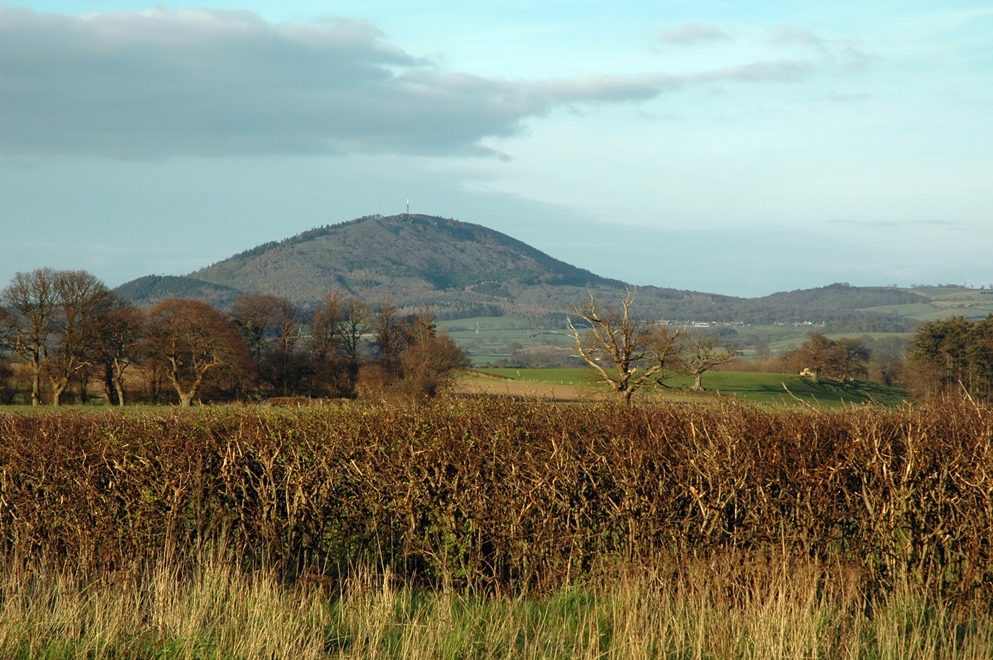
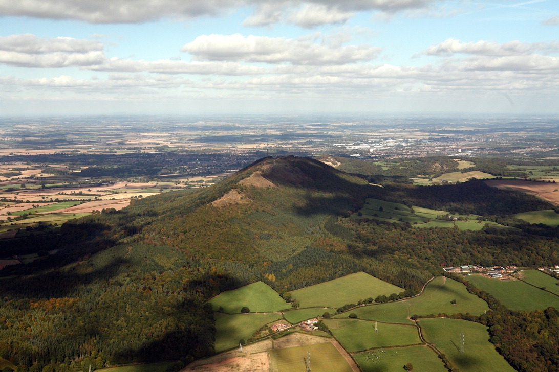
The summit of The Wrekin is 400 metres above sea level - so does that mean it’s a mountain or a hill? The Penguin Dictionary of Geography says a mountain is a high hill and a hill is a low mountain so please yourself! I like to call it our little mountain. It dominates the landscape in this region and can be seen from a great distance on clear days.
One of the reasons that The Wrekin is very special is because it is very old. By comparison, the Himalayas, Alps and Andes are brash young intruders on the Earth’s surface. The Wrekin’s oldest rocks were originally formed at the latitude of the Falkland Islands about 600 million years ago.
Movements of the ‘plates’ making up the earth’s crust have shifted these rocks to their present position. Their journey took hundreds of millions of years and along the way they have accumulated material from tropical forests, sea life, deserts and ice ages through which they have passed. They have also been subject to earthquakes, volcanic activities and erosion which have added and subtracted to the complexity of rocky materials.
As a result of all these forces of nature, we have one of the most varied geological landscapes on Earth concentrated into this small area. This geological diversity led to The Wrekin Forest being designated a Site of Special Scientific Interest.
The underlying rocks vary from the Precambrian Era (600 million years ago) to the postglacial era (last 10,000 years); from before the evolution of animals with hard skeletons to the present day. Even if you have little understanding of geology, I hope you will be able to marvel at the enormous variety of rocks beneath your feet on this walk.
There are volcanic lavas, granitic intrusions, Cambrian wave patterns, several sandstones and shales, Carboniferous Limestone, sandstones and Coal Measures, Permian sandstone, glacial deposits and hillwash. At different points along the walk you will be able to see most of these rocks visible at the surface, find out how they influence what grows and lives on top of them, and understand how humans found uses for different types of rock and the landforms they created.
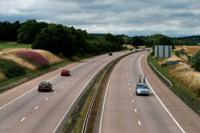
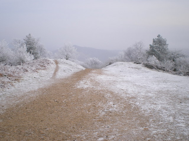
From Ercall Wood car park, go a few metres down Ercall Lane to the bridge over the motorway. Stop on the bridge.
3 The world’s worst-built motorway
Wellington was once famous as a traffic jam hotspot on the road between the West Midlands and the Welsh coast. The M54 motorway below you was built between 1973 and 1983 to relieve the traffic problem.
This man-made cutting is a brutal intrusion on nature but it’s also a geological treasure trove. The earth moving machines and rock cutters exposed the secrets of what lies beneath. Although vegetation has re-colonised the sides of the cutting, you can see all sorts if you know what you’re looking for.
Looking eastwards (towards Birmingham) is volcanic tuff, Cambrian Quartzite, Carboniferous sandstone and limestone, and boulder clay. Looking westwards (towards Wales) is boulder clay above Permian lower mottled sandstone. Again, don’t worry if you don’t understand these geological names; I just want you to marvel at the diversity for now!
The volcanic rocks (mainly lavas and ash) that the motorway passes over are weak - so they were not really suitable for road building. In places the motorway also passes over areas that had been mined so the ground surface was unstable. So it’s not surprising that initially the M54 was considered to be the world’s worst-built motorway and has needed almost constant repairs since its construction! It is better now!
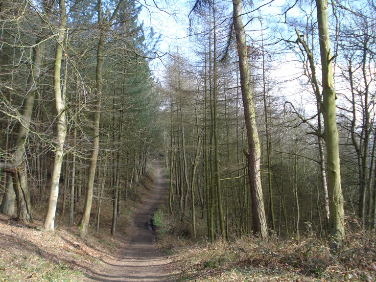
Make your way back past the car park and up Ercall Lane with the woods on your left and fields on your right. There is a footpath running parallel to the lane. Stop part way up the lane.
4 Ancient roads
At the last stop we saw the imprint of modern humans on this landscape in the form of a motorway but humans have been travelling across this landscape for much longer. Archaeological evidence suggests that there was an east-west routeway, probably a broad, grassy track, in the area used by ancient Britons in prehistoric times. It kept between the high ground to the south and the swampy area to the north.
In the first century AD the Romans adopted this ancient routeway and it became part of their road joining Dover, London, Leicester and the village of Wroxeter near here which was the Roman city of Viroconium.
The Anglo-Saxons called the road Wæcelinga Stræt (Watling Street) which means “the paved road pertaining to the people of Wæcel”. It must have been quite a challenge to pave a road hundreds of miles long. The small quarries to the left of the lane here contain a pink-coloured rock, which is an intrusive igneous Granophyre called Ercallite. This is a very hard kind of rock and it is believed that the Romans used it as a top dressing for part of Watling Street.
Fast forward almost two millennia to the Industrial Revolution and the modern expansion of the road and canal network in Britain. There was a need for fast and reliable transport between London and Ireland. The road through the Midlands and Shropshire then across North Wales to the port of Holyhead in Anglesey was the most important route.
The engineer, Thomas Telford, was tasked with creating a road suitable for the increasing stage coach traffic. He improved the existing road and, like the Romans before him, used the hard-wearing pink Granophyre, a granite-like rock which we will see more clearly later. Many of the quarries up this lane were extracted by Telford’s men for paving the Holyhead Road.
In Victorian and Edwardian times, Ercallite was marketed as ‘Ercall Gravel’ and used on the garden paths and drives of affluent villas. Telford’s Holyhead Road was later upgraded as the A5 and tarmacked for modern road vehicles and eventually superseded by the M54, as we heard earlier.
The pre-Roman track, Roman Road, Telford’s coaching road, A5 and M54 motorway all ran in an east–west direction. But predating all of those routes was this lane, running north east to south west up the mountain.
This was a Bronze Age (possibly earlier) track from the hill fort on top of The Wrekin that we shall see later to settlements in the Wellington area, where people had cleared the forest to create farms and pastures. This land was good for cultivation because it was underlain by glacial sand and gravel rather than heavier glacial clay found elsewhere.
Continue up the footpath alongside the lane. Stop along the path in one of the many quarries. Depending on the time of year, pick a point where you have a good view around.
5 Outstanding Natural Beauty
We have already heard that The Wrekin was designated as a Site of Special Scientific Interest for its geological diversity. It is also at the northernmost end of the Shropshire Hills which were designated an Area of Outstanding Natural Beauty in the 1950s.
However, the English idea of natural beauty has always been a balancing act between the need for agricultural land and the preservation of wilderness areas. Unfortunately, much of the natural landscape has been lost to intensive agriculture, open-cast mining, forestry, roads and urban development.
But The Wrekin with its hard rock, steep slopes and thin soils has largely escaped the conversion to agriculture that has happened elsewhere (although it has not escaped other human intrusion and we will see the impact of quarrying, mining, coppicing and recreation in due course). In my opinion, this makes what remains of The Wrekin Forest all the more valuable.
Beauty is not just what something looks like; it’s a quality of what it is. For us natives, these woods are our lifetime playground where we have climbed trees, scrambled slopes, dipped ponds, hammered rocks and examined tiny things with magnifying glasses.
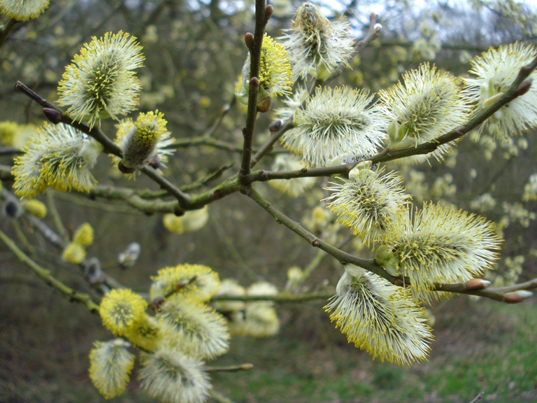
There’s more biodiversity in a square yard here than any hundred-acre field – so mind where you’re putting your feet! It’s also constantly changing as the seasons merge into each other, going forward and back with the weather. It would be quite impossible to detail all the life forms here but look out for trees of oak, ash, birch, holly, hazel, willow and yew.
On the thin soil grow heather, wavy-hair grass, bilberries, bluebells, wood anemone and an astonishing assortment of fungi. Keep your nostrils open for a whiff of wild garlic or honeysuckle. If you look closer you may see burrowing insects, such as solitary bees, as well as moths, butterflies, birds. Outside of your vision are the micro-organisms in the soil, in the water and in the air.
Keep your eyes open as you continue to walk and marvel at the beauty of nature around you.
When you reach the Buckatree Hall Hotel, drop down from the footpath onto the lane. Continue along the Ercall Lane past the hotel. After a short distance is a track off to the left signposted Ercall Wood Nature Reserve. Go through the gate and follow the track. After a short distance you will see a quarry on the left hand side. Continue up the track. Stop when you reach an even bigger quarry with an interpretation board.
6 Old rocks for a New Town
As we walked up Ercall Lane, we saw a series of small quarries dug out by the Romans and Thomas Telford, but here is a quarry on a much bigger scale. A complex series of rock movements and faulting in the geological past has left three kinds of rock here suitable for quarrying.
The oldest is the Precambrian volcanic rock called the Uriconian (taking its name from The Wrekin). Into this was intruded a mass of molten rock that cooled to form the Granophyre we saw earlier. After this had been uplifted and eroded, a rising sea about 540 million years ago left its mark in the rippled beds of Wrekin Quartzite which is a pure quartz beach sand like the white sands of Morar in Scotland today.
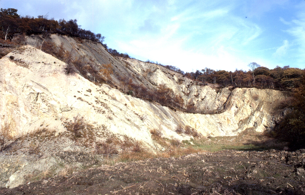
It was this Wrekin Quartzite that was heavily extracted between the 1960s and 1980s during the building of Telford. Telford was part of the second wave of post-war ‘New Towns’, designed to draw people away from the West Midlands conurbation. A collection of towns (including my native Wellington) were squashed together into a much bigger town. Agricultural land was built over with homes, schools, shopping centres, factories, offices, hospitals, roads and other services.
To build all of this, rock was needed. So they came here. The forest here on the south-west flank of The Ercall was cleared and the landscape turned into a moonscape of rubble and dust. Millions of tons of rock were trucked out. Hills were brought low. Wildlife was slaughtered or starved of its environment. Many local people who love this wonderful place were very upset indeed at the wanton destruction of life. It seems incredible now that an Area of Outstanding Natural Beauty was allowed to be desecrated.
But one good thing to come of the quarrying was the remarkable rock formations that were exposed. Nowadays geologists come from far and wide to look at them.
You may like to look at the information board which will show you where to look on the quarry walls to see the exposures of the Precambrian volcanic rocks, Cambrian Wrekin Quartzite and the softer overlying Shineton Shales. The Quartzite is now tilted at a steep angle to the east and clearly overlies the pink mass of much older intruded Granophyre. The line between the two is called an ‘unconformity’.
Although this quarry is a scar on the landscape and a brutal reminder of how twentieth century humans exploited the natural environment, you can see that nature is reclaiming the area. In fact, the pace of regeneration has been quite phenomenal in just a couple of decades.
Forty years ago these quarries looked like a lunar landscape, stripped of vegetation and soil. But eventually the massacre stopped. As soon as the bulldozers were gone, lichens and mosses began tentatively moving in. Wind, rain and sun encouraged microscopic soil organisms to re-colonise the dust and mud, gradually turning it into soil. Rain, wind, birds and squirrels spread seeds, pollen and nuts. Insects, beetles, worms moved in. Later shrubs and birches colonised the bare ground. A new ‘baby forest’ began to grow.
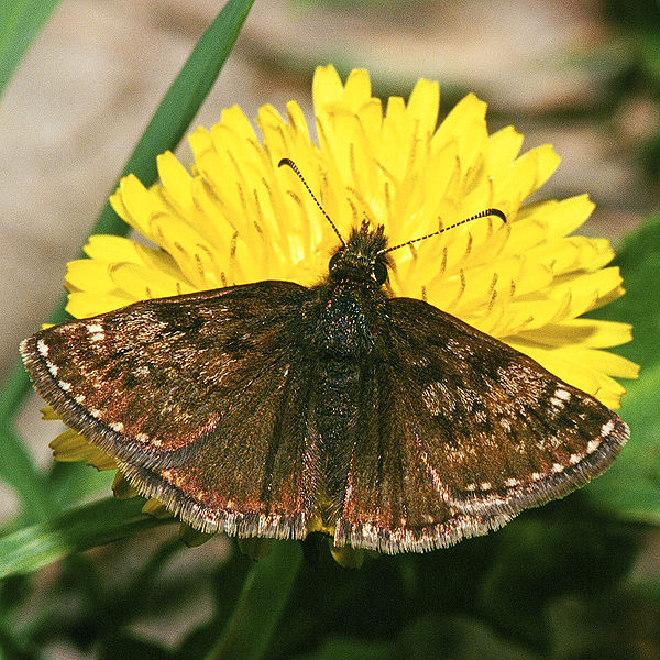
Look around you to see birch, pussy willow and rowan. Lower down the slopes of the quarry you can see heather, broom and gorse. This quarry is also home to the dingy skipper, a type of butterfly that thrives in this environment. Its almost exclusive habitat is old quarries with warm rock and a yellow-flowered plant called birdsfoot trefoil.
Some people may look around and see this area as ‘scrub’, a seemingly useless landscape but I see its wonderful diversity and admire the recuperative powers of Nature. Now the area is owned by Shropshire Wildlife Trust and I’m relieved that there has been a shift from extractive industries to nature and conservation.
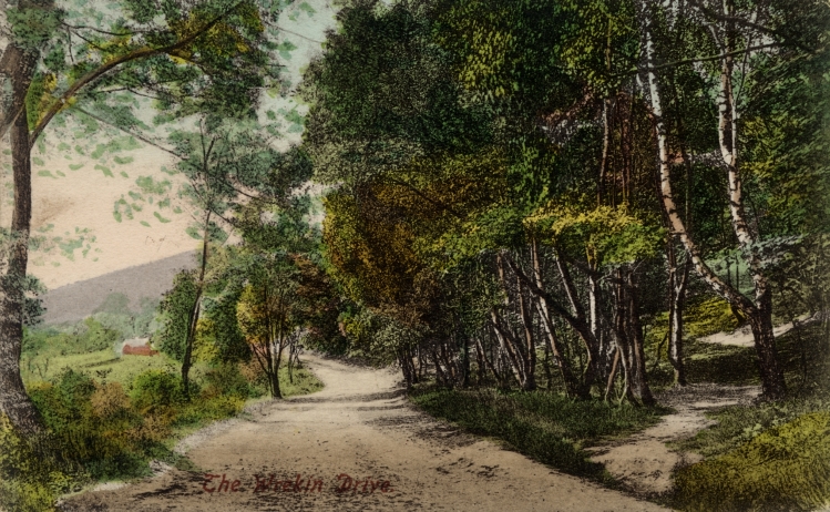
Retrace your steps down the track to Ercall Lane. Turn left and follow the lane. Note an old reservoir on the right hand side which will be referred to later. At the road junction, turn right (signposted Shrewsbury) then immediately left through the gate and up the track. This is what some of us call the Pilgrims’ Way. This is the easiest route to ascend The Wrekin and has for centuries been a popular pilgrimage for locals and returning ex-pats.
At the first major junction in the track, follow it as it bends up to the right. After a short way there is a house on the right hand side known as the Halfway House (yes we are about half way to the top now!) Stop here. At weekends and holidays they serve refreshments so you may wish to have a break here.
8 Resting place
I recommend that you should stop here for a bit of a rest because we’re only part way up. The Wrekin is a single mountain surrounded by a fairly flat landscape, rather than being part of a larger area of hills or mountains. It has a narrow base and steep slopes. Look on the OS map at the orange contour lines that link points at the same height – the closer they are together, the steeper the slope (and you’ve got some more steep slopes to come!).
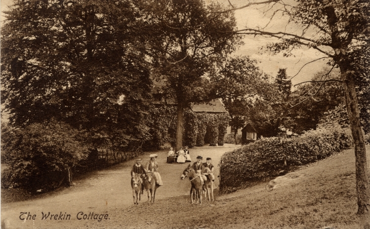
Ever since humans inhabited the area they would have hunted wild animals in the forest including deer, wild cattle, wolves, bears. In medieval times, this was a Royal forest with a ‘hay’ (deer enclosure) between Ercall Lane and Watling Street. This house, originally known as Upper Wrekin Cottage, was built in the eighteenth century as a hunting lodge. This hunting was for pleasure and would have involved pheasant and partridge shooting, which is still done in some of the lower woods.
In the nineteenth century the house was converted into a place of refreshment for walkers. Walking The Wrekin for recreation was first encouraged by Richard Reynolds, the owner of a nearby ironworks, for his workers. A diagram of the views from the top was published in 1834 and tourism increased after Wellington railway station opened in 1849. Henry Pointon of the Forest Glen Pavilion (that we shall hear about later) organised rail trips from churches and pubs in the Black Country in the late nineteenth and early twentieth centuries.
Four books about The Wrekin have been published over the last hundred years (including two by me). More recently the Wellington Civic Society, the Local Agenda 21 initiative and Wellington Town Council have all been actively promoting walking here through free maps and leaflets and various websites.
Believe it or not, someone still lives in the house. It’s somewhat isolated and the nearest neighbours are some distance away. But we discover later that this hill was actually quite a centre of population in prehistoric times.
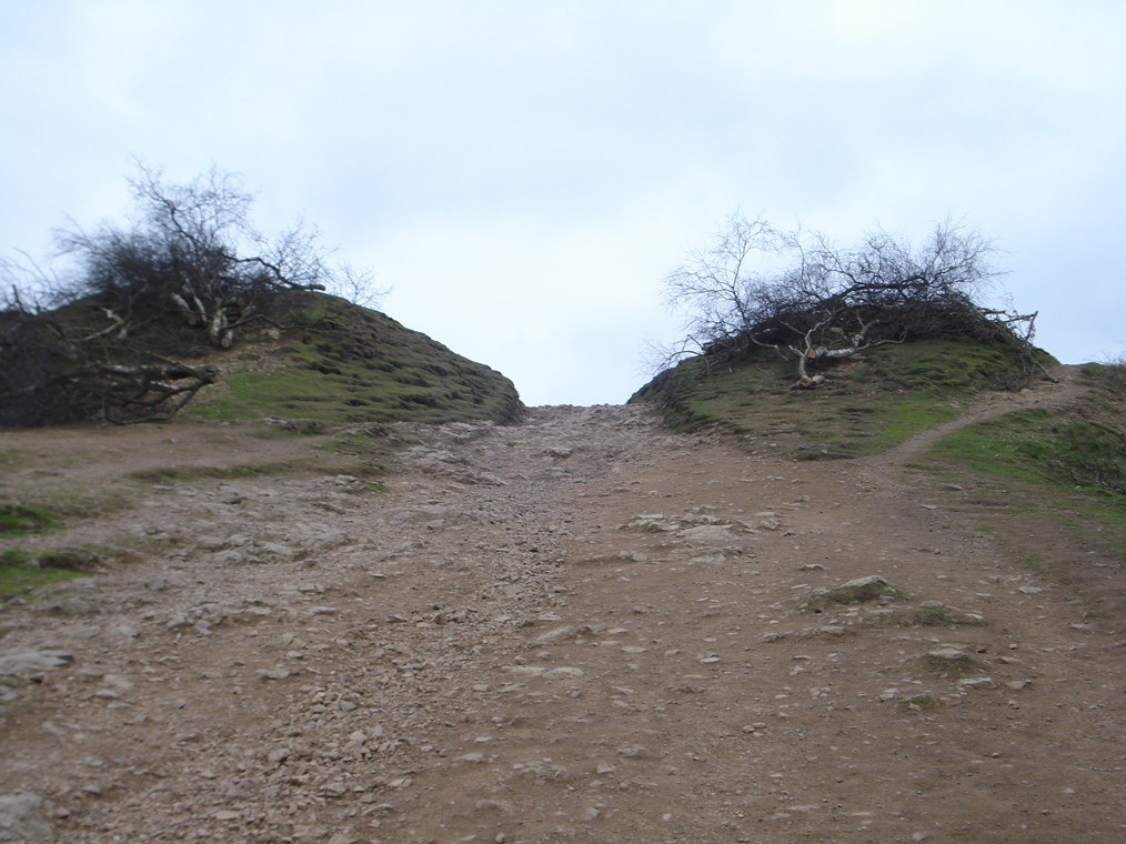
From the Halfway House, go through the gate and follow the main path up to the left. The path goes up the spine of the hill. Beware: there are two false tops before the real summit! After the first false top, the ground levels before climbing steeply again. Stop by the interpretation board.
9 Going through Hell
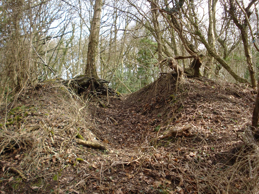
Look up the slope and you should be able to see that the path goes between two earth embankments. This was the outer entrance to a large hillfort. Having struggled your way up here you may wonder why on earth people would have wanted to live on the top of a mountain!
In the middle of the Bronze Age there was a significant change in the climate. This resulted in failed crops and starvation. Desperate for food, tribes raided their neighbours and warfare was widespread. Hillforts were built to protect the people from attack. And this was a superb defensive position. Surely any attacking enemy would be too exhausted to fight after climbing The Wrekin!
It was not just a defensive site but also on high ground away from the marshes, the flooding river and the dense woodland on the lowlands. The site was not only used as a fortress. Over the many centuries it would have been used for different purposes including a religious site, a place of pilgrimage, a market place, a status symbol, a school for warriors, a holy place, and a symbol of power.
After 2,000 years of neglect and weathering it is difficult to imagine the size of the walls, ditches and gateways. Look at the information board for a drawing that suggests what it might have looked like. Try to imagine the great wooden gates, the paling fence on top, the wooden towers for archers.
The earth mounds were faced with laid sandstone blocks carried up here. The in-turned entrances would provide extra strength at the most vulnerable points. Getting into the fort without the approval of its inhabitants would have been a difficult and dangerous task!
Continue on the main path upwards. Stop on the log seats above Hell Gate near Purgatory Wood (you’ve earned a rest).
10 Ancient revelations
At the last stop we were at the entrance to the outer part of the hill fort; this gap in the embankment marks the entrance to the inner part. The inner and outer sections may have been separated as sacred and profane areas. Perhaps the inner reserved for priests and royalty, the outer for the ‘common people’.
As the footpath here goes through the walls of the hill fort, the boots of thousands of walkers have eroded the track and revealed some of the geology beneath. Here you can see ancient Rhyolite, a creamy pink and purple volcanic rock which has beautiful fine banding in places. It’s a volcanic rock but The Wrekin is not an extinct volcano. Ash and lava never spouted forth from the summit of the mountain but came from some other part of a vast area of general volcanic activity.
As we heard earlier there were practical reasons for creating a fort on top of a hill but it almost certainly had symbolic and spiritual meaning too. As with many other prehistoric sites around Britain, there are things that we don’t fully understand. Look just south of the top for an outcrop of Rhyolite with a bowl shape on top, known as The Raven’s Bowl or Cuckoo’s Cup.
Just below is a small group of rocks that looks unnatural. At local noon (ten minutes after noon Greenwich) each equinox, a shaft of light comes through the westerly rock and shines on an easterly rock making a disc the size of an old penny. That’s if the sun shines of course.
This has been observed and photographed but is little known or understood. This phenomenon would enable the tribe’s priests to predict the sun’s movement and create accurate solar calendars (they were sun worshipers). Some people call these the Calendar Stones.
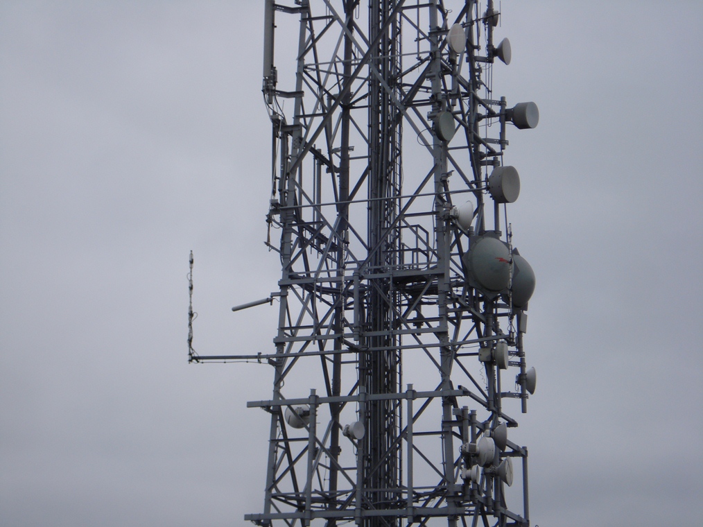
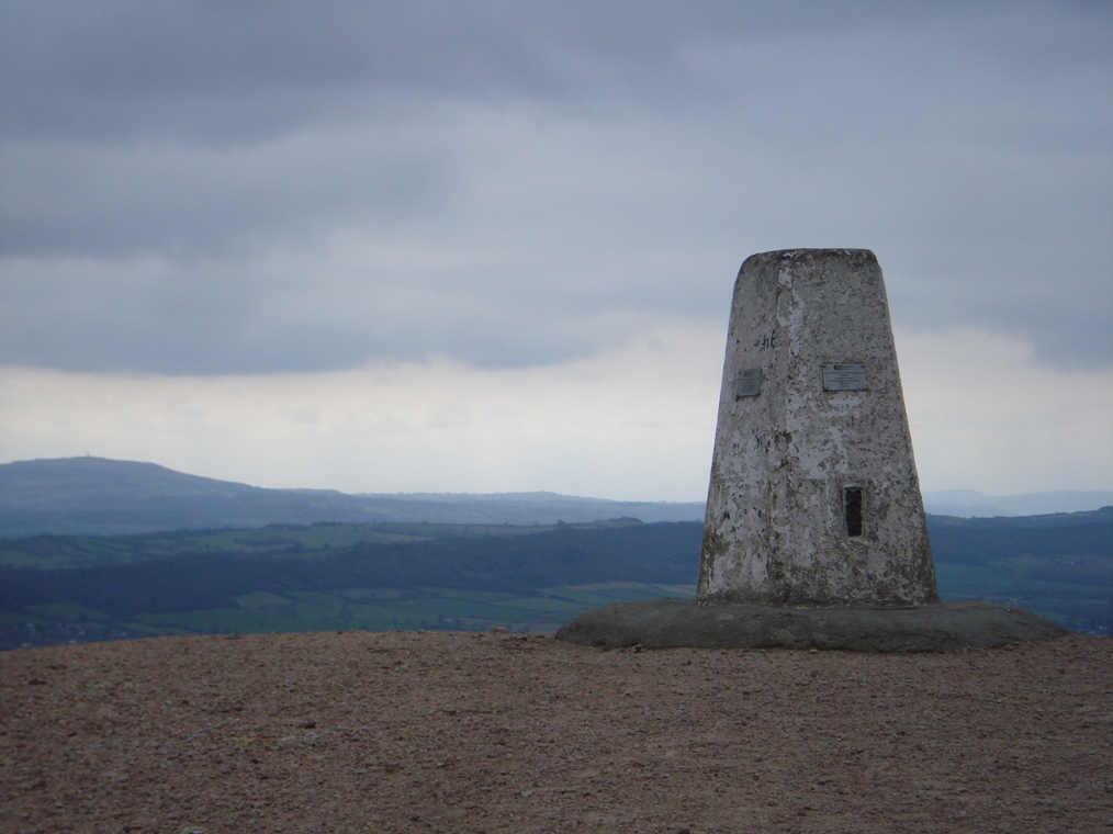
Continue on the main path upwards. Go past the communications mast. Stop at the trig point (white column at the summit).
11 The world at our feet
We’ve made it to the top – well done! From here there are fabulous 360 degree views (weather permitting!) of the whole of Shropshire and beyond to Wales. On clear days you can see Snowdonia to the north west and the Brecon Beacons to the south west. Look at the toposcope to find out what else you can see from here.
From looking out at the far horizon, look a little closer around the base of The Wrekin. To the north and west are the gentle farmlands of north Shropshire. We heard earlier about our prehistoric forbears who cleared this land of trees and started farming.
To the north and east was once an area of small towns and villages but the open farmland between them has been filled in by the brash New Town of Telford, which was built with rock extracted from the quarry we saw earlier. You can see the sprawling industrial estates and warehouses which are a source of employment for many but have expanded the human footprint on this landscape. And you can see the M54 motorway and A5 that slice across the landscape from east to west.
Looking down to the south east you can see the cooling towers of Ironbridge Power Station and, slightly closer, an open cast coal mine. More about both of those later. To the south is a much more pleasant prospect: the rolling landscape of the Shropshire Hills Area of Outstanding Natural Beauty. Part of this is the Long Mynd, a 7 mile long area of plateau, upland heath and steep valleys.
Although you can now get a full sense of how The Wrekin is an isolated mountain surrounded by a fairly flat landscape, look to the southwest and you can see that The Wrekin is aligned with the similarly elongated ridges of the Stretton Hills (The Lawley, Caer Caradoc and Ragleth) which form a hog’s back line of hills.
The Wrekin and the Stretton Hills are a geologically-ancient landscape that has been warped and cracked by movements of the earth’s tectonic plates and shaped by millions of years of deposition and erosion. During the last Ice Age this line of hills was surrounded by ice and the summit of The Wrekin and the ridges of the Stretton Hills poked up about 100 metres above the ice. This geographical feature is known as a ‘nunatak’.
While dramatic physical processes shaped this landscape, humans have used it for their benefit. We heard earlier about the prehistoric people who chose this as a defensive site because of its excellent views of the surrounding area. Because it can be seen from miles around, it has also been used as a communications site, for fire beacons in times past and for radio, television and mobile telephone signals in the modern age.
I campaigned against the building of the telecommunications mast in the 1960s and 70s, and again when a second mast was proposed a few years ago. Thankfully the second one was not built but the mast is still a blight on the beauty of my little mountain.
You have already heard the boring scientific explanation of how The Wrekin was formed by earthquakes, volcanoes, ice sheets and the like but the real story is much more interesting.
There was once a giant called Cawr who lived on the border between Shropshire and Wales. He loved to eat eels and had traps all along the River Severn to catch them.
One day he found no eels in one of his traps because a gang from Shrewsbury had stolen them. He was obviously very angry so picked up a huge shovel full of earth and headed towards Shrewsbury where he was going to dump it in the river and drown Shrewsbury and all the people in it.
On the way he met a cobbler from Wellington who duped the giant into believing that Shrewsbury was far away. The giant was tired and couldn’t face going further so dumped the pile of earth down where he was.
The big pile of earth became known as The Wrekin, the place where the giant scraped his boots is called The Ercall and the last bit off the shovel is the Little Hill. So now you know how The Wrekin was really formed. Don’t believe the geologists, they’re old fossils!
From the trig point, follow the path as it descends from the summit through the embankments of the hilltop settlement. After a short way the path leaves open ground and enters into woods. It descends very steeply and great care should be taken, particularly if the ground is wet.
After just over half a mile is a crossroads of paths at the saddle between The Wrekin and Little Hill. Turn left along the path which goes slightly uphill again. At the first rise in the track, look for a hillock with a flat top on the right hand side of the path. Stop here.
13 The windy cockarth
Earlier we saw how humans have exploited the rocks of this mountain; they have also exploited the vegetation that grows upon it. For centuries the forest’s timber was used for fuel, building, tools and furniture.
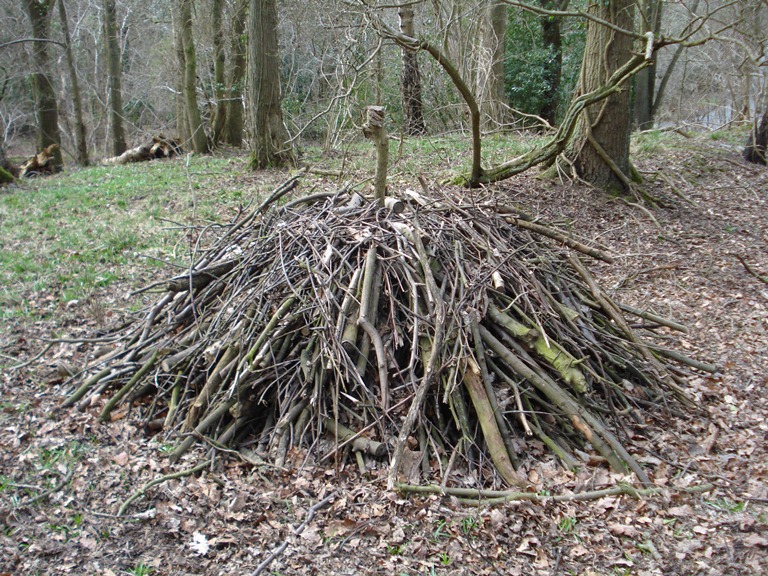
Although freshly-cut trees can be burnt as fuel, a more efficient fuel is charcoal. To make charcoal from timber a pile of wood was carefully built so that the air circulation could be controlled. This was covered with turf which could be opened or shut in various places.
A fire was lit in the middle and its burning was very skilfully controlled so that it burned slowly. The ‘cockarth’ (coke-hearth) had to be tended day and night until the wood was all ‘cooked’. Workers camped in small huts near the cockarth and tended the burning until it was finished.
There are cockarths scattered throughout these woods. Look for small flat platforms. Kick the leaves away and you will find that the soil below is black with charcoal. One such cockarth is here, just to the right of the path near the Little Hill. It was called ‘the windy cockarth’ because it was exposed to the south-west (prevailing) winds.
Local people used charcoal for cooking and heating but it was also very influential in the metalworking industry. An ‘ore’ is a type of rock that contains minerals and metals. ‘Smelting’ is the process of heating the ore in a furnace to extract the metals.
Since charcoal burns at a higher temperature than untreated timber, it is more efficient for the process of smelting. Iron, copper, tin and silver are all extracted from ore in this way but it is iron that was particularly significant in this area.
To the south east of here, the underlying geology of Carboniferous Limestone and Coal Measures contained iron ore in fist-sized lumps. There were two major phases of iron ore production which used charcoal from these woodlands for their furnaces: in prehistoric times (by the Celts, Romans and English) then during the Industrial Revolution.
There were cockarths here in the forest until the twentieth century. Then Richard Groom of Wellington discovered a way to create charcoal in his ironworks using a metal hearth. This meant that the timber did not need to be burned in the forest but could be carried down into the town by steam wagon and then processed there.
Continue on the path as it undulates through the woods. After about half a mile, a path joins from the right hand side and there are fields down to the right of the path. Stop after the fields end and you have woodland on both sides of the path.
14 Bent trunks
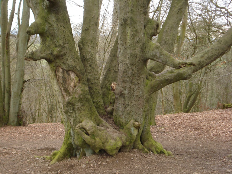
At the last stop we heard about the cutting of trees which were burned to make charcoal. The method of cutting trees here was called coppicing and you can see evidence of it all around you.
Have you noticed that some tree stumps have multiple trunks growing out of them, sometimes at strange angles? Trees were cut just above the base leaving a stump called a ‘stool’. The wood soon began to regrow and could be harvested again some years later.
My wife’s uncle, Alf Wilks, was the last foreman of the coppicing gangs on The Wrekin. He would use a twoman crosscut saw to cut trees about a foot above the ground. For the next few years he would watch the coppice stools for new regrowth. He’d say, “As ‘er took? No, this’n anner took yet we’n atter give ‘er another tuthree years”. Translation, “Has it taken? No, this one hasn’t yet. We’ll have to give it another two or three years”. Where there was enough space between the trees he would plant a new sapling. If that grew straight he might cut it for timber rather than charcoal.
Oak and ash trees were coppiced as well as hazel. In fact, one part of the wood is called Hazel Hurst. Hazel wood was used for many things including ‘wattle and daub’ walls, basket making, walking sticks, fork handles, fencing, animal traps, pea and bean sticks. Hazel is also the habitat of our native dormouse, the hazel dormouse, which is nocturnal, arboreal and more abundant than you may suppose in these woods.
Yews were mostly left alone by the coppicers. Some said it was unlucky to cut down a yew tree; perhaps this was one remnant of the old pagan beliefs. While you can find some clusters of elms you will find very few old elms now due to disease. But do look out for sweet Spanish chestnuts dotted about the forest, mostly near cockarths.
Alf last cut Wenlock’s Wood and Gibbon’s Coppice for ash timber in 1940 and it was used to build aircraft. Since coppicing stopped, the trees have been re-growing without disturbance. Find an old oak stool and try to count the number of shoots coming out. By now they are all well past their time for Alf to coppice again.
If Alf were here he may also be surprised to see how much holly is growing in the wood. It grows mostly where the ground is wetter. Look out in particular for soft, smooth-leaved holly without spikes that was originally planted for cattle-feed.
Continue about 200 metres. Stop by the conifer plantation.
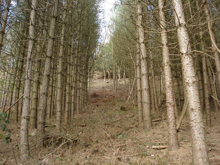
15 Straight trunks
At the last stop we looked at tree stumps with multiple trunks growing out of them and tree trunks that suddenly change direction. In contrast, here are trees with single straight trunks all planted in straight rows.
The practice of coppicing that we heard about at the last stop was a way to ensure a continual harvest of wood; the tree was not completely uprooted but left as a stump that could regrow. It was a sustainable way of managing a forest.
An alternative way of growing timber is by deliberately planting fast-growing species of wood, particularly conifers. Once they have grown to early maturity they are felled and new ones planted. Conifers won’t re-grow like deciduous trees.
As you continue along the path, see if you can notice a sharp difference in the way that the woodland is managed. This marks a division in land ownership. All of The Wrekin is privately owned - part by the Raby Estate and part by the Orleton Estate - and they have different views on how they manage the wood today.
The Raby Estate still manage their part of The Wrekin Forest on a commercial basis. They have a range of hard and soft woods growing and are gradually replacing the conifers with indigenous deciduous trees such as oak. The Estate has operated a sawmill nearby since 1915, although only open to the public for the last 30 years.
The company focuses on specialist restoration and conservation projects, as well as making fences, gates and cladding. They also supply Christmas trees. Their emphasis on supplying sustainably-sourced, local wood will hopefully ensure that the future impact of humans on this forest is gentler than in the past.
Continue on the path through the woods. When you reach the junction with the main track that you climbed earlier, go straight ahead to retrace your steps back down to the road. At the junction, turn right (signposted Little Wenlock). Stop by the car park on the left.
16 A drink and a dance
This car park is located in a long-disused quarry. The rock extracted from here and used for roadstone was the Uriconian volcanics that we heard about earlier. Look upwards to see walls of exposed rock rising dramatically above the vehicles.
The distinct layers of ash, lava and agglomerate (a coarse mixture of unsorted rock) can be seen dipping down into the hillside at the back of the quarry. At both sides of the main quarry are prominent almost vertical ‘ribs’ of a different, finely crystalline, blue-grey rock called Dolerite. Like the Granophyre we saw earlier, this was intruded in a molten state during Precambrian times up cracks in the other volcanic rocks, where it solidified into vertical walls or ‘dykes’.
The rock faces of the disused quarry have provided a challenge to climbers for the last hundred years. You may see rock climbers today, although it is against the policy of the Shropshire Wildlife Trust which now owns the bulk of The Ercall from here northwards.
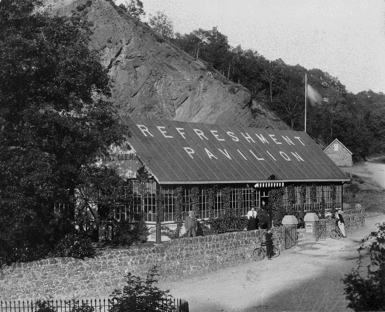
In 1899, a wooden building was constructed here in the old quarry called The Forest Glen Pavilion. It served refreshments to the thousands of walkers who came to climb The Wrekin. At night ‘The Glen’ hosted dinners and dances for local organisations such as the Masons, Plumbers and Rotarians; also wedding receptions. Most locals have memories of this place.
Sadly the building fell into disrepair in the 1980s but part of it was rescued and relocated to Ironbridge Gorge Museum nearby where it is still used as a restaurant.
From the car park follow the road as it goes gradually uphill. After about 500 metres, look on the left hand side for a gate and track. Follow this track for about 200 metres until you reach a large mound with a hole in the centre on the right hand side of the path.
Note: For a shorter walk you can finish the walk here and return back down Ercall Lane to the start point.
17 A strange enigma
Here is a small pool surrounded by four mounds about six feet high. It is known as the Dairy Pit or the Davey Pit. There is a local folk-tale of a ‘marmid’ or mermaid living in the Dairy Pit. But what is it and what does it signify? There are two possible explanations.
The first explanation is that it is a unique collection of Bronze Age burial mounds or ‘tumuli’ surrounding a small pool. Certainly a little further up the road there used to be a large number of tumuli of Bronze Age origin. Unfortunately those graves were robbed and the mounds flattened with the artefacts either given or sold to Shrewsbury Museum or other museums. So this site may have been part of a wider complex of burial sites in the area.
The second explanation for the existence of these mounds is that they are the debris left by a trial dig for minerals which was abandoned when none were found. So which is the most likely explanation?
I suggest that you come back here alone on a silent moonlit night. If the hair on the back of your neck stands up, then it’s an ancient burial mound site; if not, it must be the boring alternative.
The Dairy Pit Coppice and most of the surrounding Ercall and Lawrence Hill woods are now owned by the Shropshire Wildlife Trust. They use this area to demonstrate coppicing, charcoal burning and other traditional woodland skills. As you retrace your steps back down to the road you might see a reconstruction of a charcoal burning platform.
Retrace your steps back to the road and turn left. After a short distance, where the road bears round to the right, take the track straight ahead which is blocked by large boulders.
Ignore the path up to the left (also blocked by boulders) to another quarry, known as Maddock’s Hill. This was where hundreds of thousands of tonnes (half the hill) of ‘Camptonite’, a granitic rock were removed and used as hard core for the building of Telford. As we saw in Buckatree Quarry earlier, nature has now reclaimed the space and today you will find it difficult to spot the rock faces.
Continue straight upwards with farmland to the right. Do take time to look at the view back up to The Wrekin. From here you can see the Halfway House perched on the side of the hill and the communications mast at the top.
Shortly after passing a ruined building, you reach a farm track. Take the waymarked footpath on the left running into the woods. Stop part-way along the first straight section of path.
18 Round the Hatch
Although we are in yet another woodland, can you see that this one is quite different from the coppiced woodland and plantations that we saw earlier on The Wrekin?
Like the other woodlands however this one has also been significantly shaped by human activity. Geologically, you are standing on a junction between Carboniferous Limestone to your left (west) and Coal Measures to your right (east).
This geology is reflected in the place names – Limekiln Wood where the limestone was quarried and Black Hayes where coal was mined, as well as ironstone and clay.
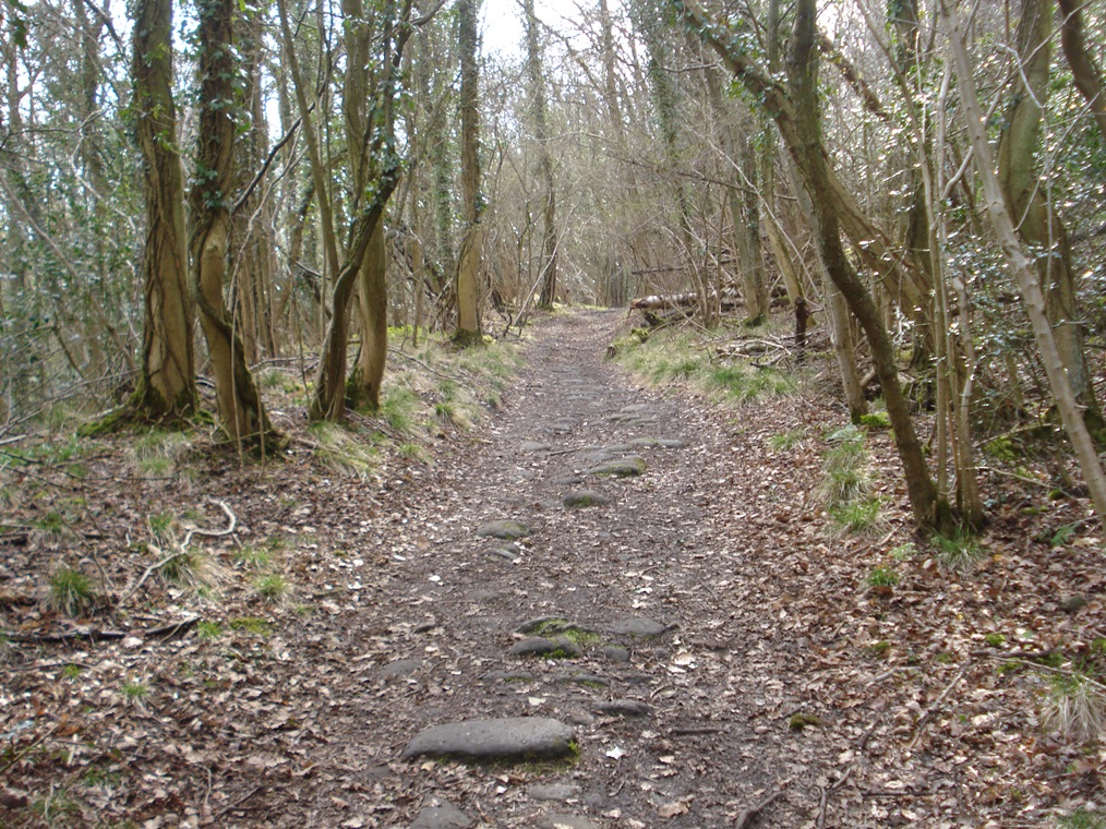
You can see that the path here is quite straight as it cuts through the woods. It is actually an abandoned railway line and one of many in this woodland. Narrow railways, known as Jinny rails, were used to transport the lime, coal and ironstone from the quarries and mines down to the town or furnaces. The trucks were pulled by mules or ponies.
We’ll hear more about both lime and coal at the next stops. The limestone and coal were exploited extensively so there are numerous abandoned holes, mines and quarries now covered by vegetation so I highly recommend that you do not deviate from the path.
While this natural-looking woodland has actually been significantly exploited and disturbed, just as we saw at Buckatree Quarry earlier, nature is reclaiming the landscape. On top of the exposed limestone and lime spoil you find ash trees and grasses growing. Orchids such as the commonspotted, pyramidal and marsh species also thrive in these alkaline conditions.
Where the track bends slightly to the left there is a view over fields to the right and to the open cast mine. Stop at this corner.
19 Environmental vandalism
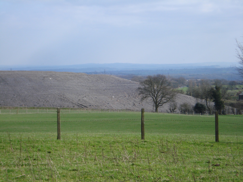
The quarries that we saw at the beginning of the walk and those around us in Limekiln Wood here have been closed to commercial exploitation for many years. But mining and quarrying is not just a thing of the past – it still goes on. Across the field you can see part of an ‘open cast’ mine and this mine is new.
Plans were announced to mine here in 2007. There was fierce and almost unanimous opposition from the local borough and parish councils, backed by several NGOs, medical experts, local groups and residents. There was a public inquiry but the mine was approved.
The local parish council website captured some of the reasons why many people disagreed with the decision: “What he [the Secretary of State for Communities] has consented to will wreck lives, scar the landscape for generations to come and harm the local wildlife. It will deter tourists from visiting the area and be seriously detrimental to future investment in Telford. It will destroy the image of Telford as a modern, clean town surrounded by green countryside. The mine will destroy part of an Area of Outstanding Natural Beauty which is part of the Shropshire Hills and the area around The Wrekin. For those living next to the mine it will result in years of noise, dust and misery. The health of children and those who suffer from chest complaints will be put at risk.”
Mining operations began in 2010. The site (of which you can only glimpse the edge from here) covers 93½ hectares and contains 900,000 tonnes of coal. The coal seams in this area are near the surface so this is an open cast mine. Extraction was completed in July 2013 and although the site is being re-landscaped, it will take a generation for the environment to recover to its former state.
While the time-span of mining was just three years, this was such as intrusive operation – you could call it environmental vandalism. And it seems to be for such little gain. If all the coal extracted were used at the local Ironbridge Power Station (which it wasn’t) it would only keep the power station going for 26 weeks.
At a time when national and local government policy is seeking to maximise electricity generation from renewable sources rather than fossil fuels it beggars belief that this scheme was approved.
Follow the path as it descends gradually through the woods still following the route of the Jinny rail. At the next split in the paths, keep straight. Where paths merge and split and there are farm buildings to the right, take the left fork. After a short distance, look on the left hand side for an old quarry and on the right hand side for two brick shafts. Stop here.
20 Lime
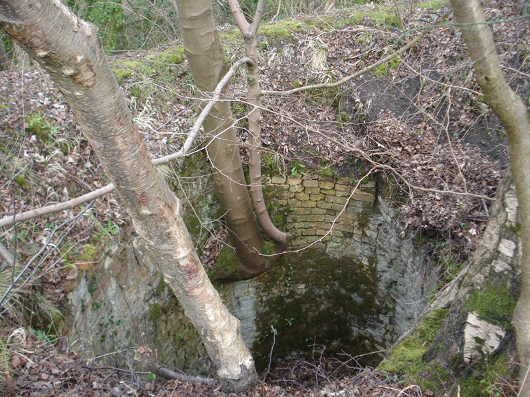
As we already heard, the name of this place gives the main clue as to its past – Limekiln Wood. Carboniferous Limestone has been extracted from here over a period of about 2,000 years.
Although there have been a variety of methods used to extract it, you can see evidence here of old quarries on the left side of the path.There are also several mine shafts, most of which have been sealed up.
Then if you look carefully on the right side of the path, you will find some old lime kilns. They are hidden in vegetation but well preserved. Do be very careful where you put your feet when looking for the kilns as there are some steep drops.
So why was limestone rock extracted? We heard earlier about ‘ores’, rocks that can be heated to extract the minerals and metals within. In a similar way, limestone can be heated to extract the lime.
Limestone was broken up in the quarries here and crushed. It was then put into the top of the bottle-shaped kilns which were heated by coal from below. The heating process produced quicklime and this was then raked out of the kiln. But quicklime is very dangerous and should not be handled. So water was added to ‘slake’ it and slaked lime is relatively safe.
Slaked lime was spread on fields. Many soils are too acidic for crops to grow well. Lime is alkaline so when spread on the fields it neutralises the acidity, thereby improving the soil and resulting in better crops. This method was used during the Agrarian Revolution which preceded the Industrial Revolution and continues to the present day.
Another use for lime was the iron industry. We heard earlier that charcoal was used to superheat ore to extract the iron. Lime was also added to the furnace. During the chemical reactions induced by heating, the iron separated and could be poured into moulds while the lime combined with other materials in the ironstone and produced slag. Slag was useful for road building and was also used in garden rockeries.
Continue along the footpath. When you reach a wider track, turn left with the woods on your left and a cottage on your right. Stop overlooking the cottage.
21 A hard life
This cottage and others like it on the edge of the woods would have been where the people lived who dug the quarries and managed the limekilns that we saw at the last stop. The jobs of mining, quarrying rock and burning lime were dirty, dangerous and backbreaking. Yet the men who did this work were paid little and were very poor.
Government inspectors sent to review mines and quarries between the two world wars found very young children hauling trucks along mine passages in terrible conditions for a pittance right here in these woods. The living conditions for families in these cottages would have been very basic.
When the mines and quarries in this area were in full operation this was a very busy place but as soon as the kilns and lime workings were closed there was no more work and people moved away. Now cottages like this – in a secluded, peaceful spot on the edge of the woods – are seen as highly desirable.
In many cases several cottages have been amalgamated into a single house and converted into attractive modern homes that fetch quite a price.
Shortly after the cottage, the path splits. Go straight on until you reach a pool on the right hand side. Stop by the pool.
22 Quenching thirst
Along this walk we have seen how humans have tapped into the natural resources on this mountain, from the rocks beneath the surface to the trees growing on top of it.
Another natural resource that was exploited was water. The lower slopes of The Wrekin were ideal spots for reservoirs – positioned to capture water from streams running down from the hills.
Early settlers of the area used natural streams and wells for their water needs but with the expansion of population following the Industrial Revolution, there needed to be more supply. There were several successive reservoir schemes to capture water from the hills from the late nineteenth century.
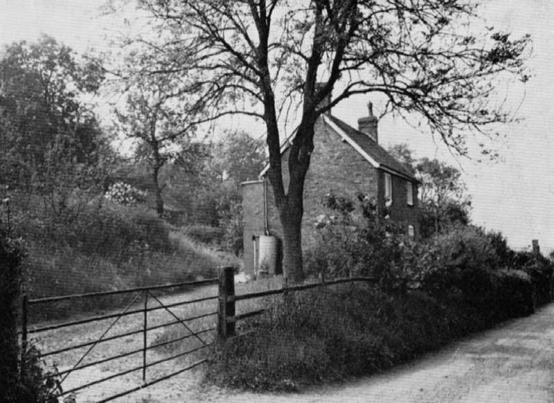
This reservoir was built in the early twentieth century to supply Wellington below. The small pool filtered the water from a little stream which then fed into a larger pool. It was stored here and then could be piped down to the town below.
However, this reservoir was soon found to be insufficient and was replaced in the 1930s by a larger reservoir fed by a bigger stream. We walked past it near the start of the walk on Ercall Lane shortly after Buckatree Hall Hotel.
With ever-increasing populations and the establishment of the New Town of Telford, yet more water resources were needed. In the 1950s, bore holes in the northern sandstone aquifer pumped water into the reservoir. By the 1990s, there were much larger pumping schemes in place, bringing water from the River Severn.
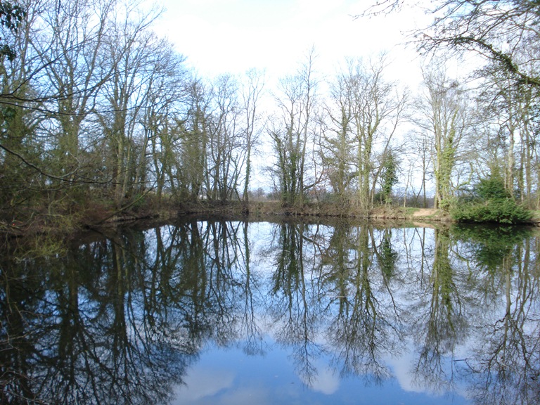
The disused open reservoirs are now a haven for wildlife and popular spots for fishing and two underground reservoirs have replaced the open ones.
Continue along the path with the old reservoir to the right. Go through the metal gate and through the trees onto the golf course. Turn right along the grassy path which is a public footpath down the side of the golf course. Stop along this path overlooking the golf course (somewhere safe from flying balls).
23 A landscape of leisure
The open fairways and manicured greens of the golf course feel quite a contrast to the dense woodlands that we have been walking through. The underlying rocks here are sandstone, shale and boulder clay, which are much softer than the more ancient rocks on either side.
The resulting geological structure had no commercial use to the extraction industries but produced reasonable soil which is why this area was farmland rather than mines, quarries or woodland until the 1920s when it became a golf course. This feels like an ultra-managed landscape and totally unnatural compared to the woodland.
But this serves as yet another reminder that much of the woodland that we have walked through is only semi-natural. It has been interfered with by humans who dug quarries to take out the stone, dug mines to extract coal and cut wood to make charcoal. If the golf course were abandoned tomorrow, just as with the quarries and mines, nature would soon reclaim this landscape.
This is also an appropriate spot to reflect on how humans continue to use this landscape. Natural resource extraction has largely disappeared and this is now a space for leisure and recreation. Both the features of the physical landscape and the industrial legacy are used for this.
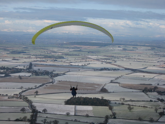
The Wrekin is a challenge for walkers and their dogs; old quarry walls are used for rock-climbing; other quarries are ideal for mountain biking and scrambler biking; and the summit is a favourite take-off point for paragliders. Down here, the sheltered valley between the woods with undulating ground is ideal for a golf course.
All these landscape changes provide different and new opportunities for people.
Follow the footpath down the side of the golf course. At the bottom, follow it to the left with the motorway on your right. Go over the stile, cross Golf Links Road and follow the footpath on the opposite side. Where the path splits, continue straight with the motorway on your right (you can follow the path on the left which takes a longer route through Ercall Wood). This path climbs and then falls again and takes you back to Ercall Wood car park where you started the walk. Stop in the car park.
24 Closing the circle
We have now come full circle back to Ercall Wood where we started. This walk has told the story of The Wrekin. It is an ancient site (whether you think that it was formed by dramatic geological processes or a clod of earth cast down by a tired giant).
Its steep slopes and elevation were an attraction for prehistoric people for whom the mountain top was of practical use and symbolic value. Once its geological diversity had been discovered, The Wrekin became a place for humans to exploit with quarrying and mining of a range of rocks on an extensive scale, which continues to this day in places.
Likewise, its other physical features have been – and still are – used and exploited including its woods and water. Although the scars of this human activity remain, we have seen the remarkable resilience of nature in reclaiming its territory.
Now The Wrekin has shifted from an industrial landscape to a leisure landscape; from humans appreciating it for its economic value to humans appreciating it for its intrinsic beauty. It is a place for walking, mountain biking, rock climbing and golf. It draws specialist geologists, ecologists and environmental archaeologists studying its unique characteristics and habitats.
As it was for prehistoric humans, The Wrekin retains a special symbolism in the hearts of locals like me. The town used to be known as ‘Wellington under The Wrekin’. Wellington is The Wrekin’s town and The Wrekin is Wellington’s little mountain.
It has also made its way into traditional sayings. “All around The Wrekin” is a common phrase in these parts to mean “the long way round”, in the same way that people use the phrase “go round the houses”. And “To All Friends Round The Wrekin” is a toast traditionally used in Shropshire, especially at Christmas and New Year, or whenever there’s a good excuse.
I hope you have enjoyed your walk up this very special little mountain. I began discovering it aged 12 and I’m still learning 77 years later. The town is a ‘Walkers Are Welcome’ town so do take time to divert there for refreshments and further exploration. Wellington is friendly, like The Wrekin.
Did you know that the area round The Wrekin has the most diverse geology found on Earth?
Journey through millions of years to discover different types of rocks and how people have used them, for mining, making metal, generating electricity, spreading on fields and carving into paving stones.
But this walk is about much more than geology.
Climb a little mountain created by an angry giant to follow in the footsteps of Bronze Age people, see the ‘world’s worst-built motorway’ and discover how old rocks built a New Town.
Follow the walk by clicking on the map pins or downloading the guides below