This walk tells the story of Leamington as a spa town from a geographical perspective. Along the way we will visit all the highlights of the town and explore three geographical themes.
First, we will discover how the physical landscape influenced the development of Leamington as a spa town, including the geology that created special spring waters and how the river influenced the creation of a network of parks and gardens.
Second, we will see how the growth of the spa led to the creation of a planned town with a deliberate street layout to emphasise magnificent terraces, mansions and crescents.
Third, we will find out the impact of the growth then the decline of the spa on the local economy and what alternative industries and services the town has used to sustain its economy.
This walk was created by Martin Haslett.
Martin: “I’ve spent much of my career as a town planner in this area of Warwickshire helping to protect the character of the area. Many people think of town planners spending their time working on new residential and employment areas, but, in fact, much of our time is spent protecting the character of existing towns and countryside. I’m passionate about preserving the heritage of this area and conserving its many spectacular buildings and I would like to share some of this with you on this walk around Leamington.”
Most place names in England give clues about history and geography. So what about Leamington?
Originally there was a village here on the banks of the River Leam. In Old English, ‘ing’ referred to the people belonging to somewhere and the ending ‘ton’ or ‘tun’ referred to a farm or enclosure.
So we have the people of the hamlet by the River Leam – Leam-ing-ton.
Leamington is mentioned in the Domesday survey of 1086 and the land had been owned by a Saxon earl.
Then in 1100, King Henry I gave the estate to the Bishop of Coventry and Lichfield.
It subsequently came to be owned by the priors (or monks) of Kenilworth. After that the village became known as Leamington Priors.
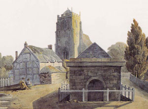
There were a couple of reasons why a village had developed here – first, the river was shallow at this point and could be crossed on foot; second, water from the well here was noted to have special qualities which the villagers used for salting meat.
There was an elaborate well house outside the church here until last century. The modern sculpture now marks the site of the original well.
Go round the side of the church and diagonally across the grass. Go through the gate onto Gloucester Street and turn left. Stop at the corner of Church Street and look diagonally across at a pair of smaller houses between larger houses.
3 An ancient village
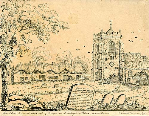
As we heard at the last stop, Leamington Priors was a very small village on the south bank of the River Leam.
It consisted of a church and a few dozen cottages, a few farmhouses, a couple of public houses, a vicarage and a smithy.
Even as late as 1801 the population of Leamington Priors was only 315.
It is very difficult to find traces of the old village apart from these two cottages on Church Street which are the oldest dwellings in the town.
They are timber-framed and date back to the late-sixteenth or early-seventeenth century, although they were re-fronted in a later period which changed the original appearance.
If it had not become a spa, Leamington might have remained a village. Almost everything that you are going to see on the rest of this walk owes its existence to the spa.
Retrace your steps to the front of the church. Use the pedestrian crossing to go onto the opposite side and turn right towards the river. Cross to the other side of the bridge and stop outside a stone building with columns.
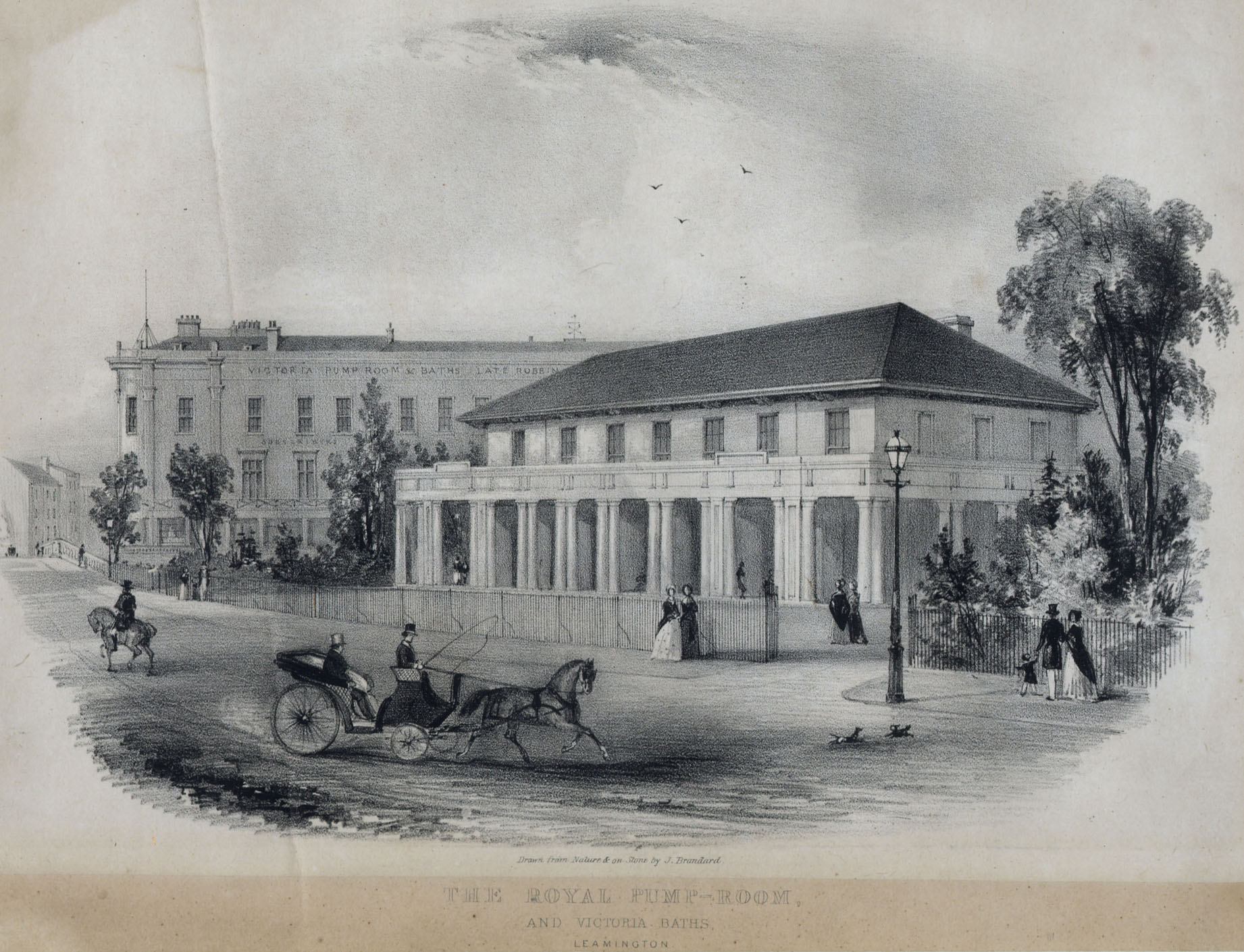
4 Taking the waters
Going to spas for beauty and health treatments is popular nowadays but it is nothing new.
There is evidence across Europe of prehistoric people travelling to hot or cold springs in hope of effecting a cure of some ailment.
Bathing for personal cleanliness, medicinal cure or as part of a religious ceremony was then developed by the Ancient Greeks and later spread across the Roman Empire, including to the Roman towns of Bath and Buxton in England.
By the Middle Ages, public baths often became places of licentious behaviour and the general belief was that frequent bathing promoted disease and sickness rather than curing it!
However, in 1326 a Belgian man discovered some springs in a place called Spa. A health resort eventually grew around these springs and the term ‘spa’ came to refer to any health resort located near natural springs.
In the seventeenth century, most upper-class Europeans washed their clothes but not their bodies (bathing the entire body was seen as a lower-class activity) but attitudes changed towards the end of the century and bathing was seen as a way to restore health.
The wealthy flocked to health resorts to drink and bathe in the waters. During the eighteenth century, there was a revival in the medical uses of spring water and by the nineteenth century bathing became a more accepted practice as physicians realised that cleanliness was linked to good health.
So how and when did the little village of Leamington Priors develop into a spa town? The underlying geology in this area is Bromsgrove sandstone, a rock which formed over 200 million years ago.
The water that issues from the springs in Leamington is rainwater that has percolated through the rocks from some considerable distance away - which has helped to purify it, but the rocks have also left their trace in the water, which you will discover when you drink it!
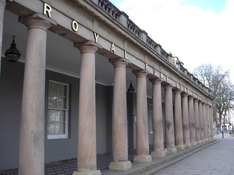
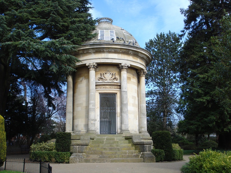
The medicinal qualities of the water of Leamington – particularly for the treatment of rheumatic diseases – were first noted by a Dr Kerr in 1784 and a Dr Lambe in 1797. The function of pump rooms was to provide a place for taking and bathing in the waters.
These Pump Rooms opened in 1814 and included the world’s first gravity-fed piped hot water system in modern times. The neo-classical columns on the front of the building are a grand reminder of the link with the baths of ancient Greece and Rome.
The spa treatment was claimed to cure or relieve a variety of disorders ranging from ‘stiffness of the tendons’ and ‘rigidity of the joints’ to ‘the effects of gout and rheumatism and various paralytic conditions’. The spa water was also a mild laxative!
Do take the opportunity to try the waters yourself. There is a tap in front of the Pump Rooms, adjoining the bridge. What do you think of the taste of the water?
You may like to come back here later to visit the Art Gallery and Museum where you can learn more of the history of the town and see some spectacular original rooms showing how the bathing was carried out.
Around the side of the Royal Pump Rooms, go past the modern entrance and follow the path into the park. Stop by the bandstand.
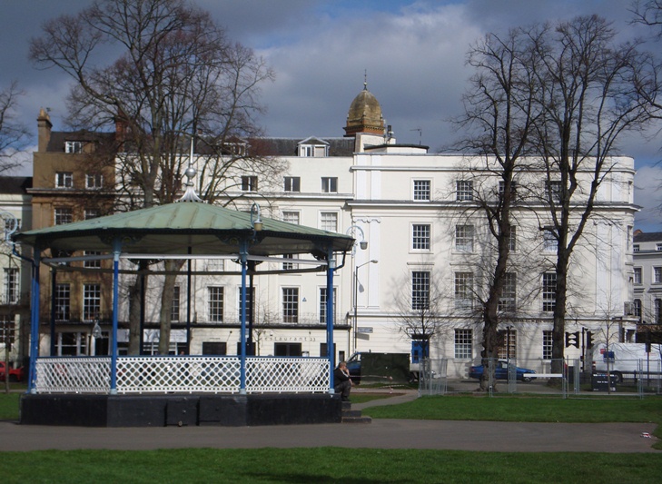
5 Water and air
Although ‘taking the waters’ in the Pump Rooms was the main attraction for visitors, ‘taking the air’ in the Pump Room Gardens was also part of the experience.
James Bisset, who wrote a pocket-size visitor guide in 1814, described the air in Leamington as “extremely pure and salubrious” and also noted that “endemic and epidemical diseases are so little known”.
Bisset described “beautiful public walks, flower and pleasure gardens laid out at the south end of the village”.
These Pump Room Gardens here were originally enclosed and were for the exclusive use of the patrons of the Pump Room “to afford them pleasant promenades”. A bandstand was erected and military bands played in the evening during the summer for patrons.
It was not until 1875 that the Pump Room Gardens became public. Times have changed but the bandstand is still regularly used and many people enjoy these gardens.
At the side of the Pump Room Gardens, not far from the bandstand, is a footbridge over the river, stop here.
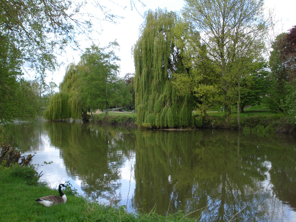
6 River – friend or foe?
Although this walk focuses on how spring water made this town’s name, the river water is also of significance in shaping and influencing the town. From the bridge, look at the rock on the far side. You can see where the river has eroded through the sandstone. This shows the potential power of what seems like a small and placid river.
In fact, there have been regular floods in Leamington, the most recent being at Easter 1998. Where you are now standing would have been under about a metre and a half of water at that time. Houses and shops were flooded and roads were closed.
The damage done to the town was enormous, not least because many people in the older parts of the town live in basements. It was very fortunate that no one was killed.
If you look on a map of the town, you will see a ‘necklace’ of open spaces following the River Leam through the town. These parks and gardens are on the floodplain – the lowest-lying land that is prone to flooding. That is why nothing has been built there – and means we can all enjoy open spaces and riverside walks in the heart of the town.
Cross the bridge and take the path on the left passing a block of flats on the left hand side and a large red brick building on the right hand side. At Avenue Road, go straight across and follow the pedestrian signs for the railway station. Follow the path though the underpass. Stop outside the station entrance.
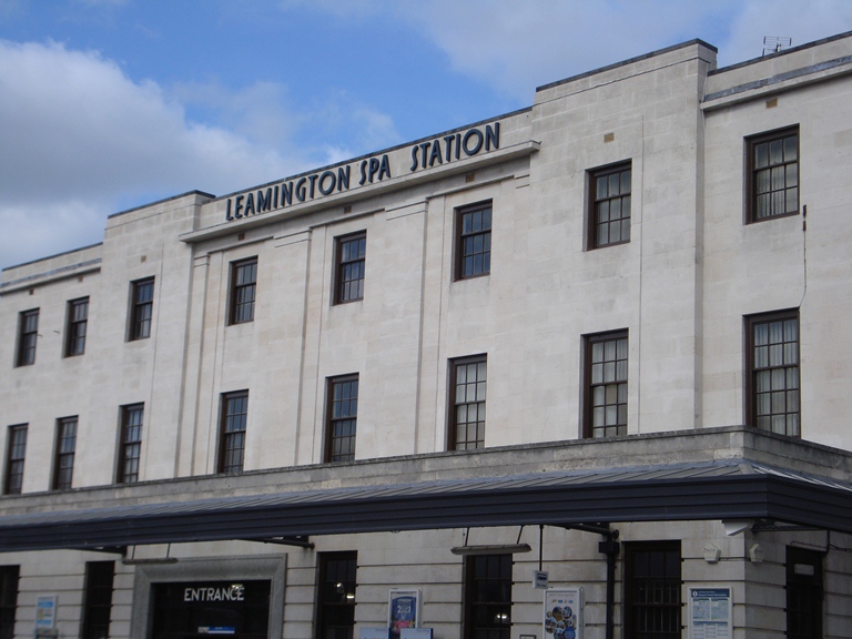
7 The beginning of the end
Our story of the growth of the spa town will continue shortly but here at the station and at the next stop we need to fast-forward to learn about the end of the spa’s heyday.
In so much British history we hear about the impact of the railways and how they made a difference to particular places and industries, facilitating the transport of goods and people and driving economic growth.
The coming of the railway had the opposite effect in Leamington. The first railway station serving Leamington – a branch line from Coventry – opened in 1844.
This station opened eight years later in 1852 and was served by through-trains on the Great Western Railway route between Birmingham and Oxford.
In the first half of the nineteenth century, the spa visitors you heard about at the Pump Rooms and gardens came to Leamington by coach and horses.
You might have thought that the railway would help the growth of Leamington as a spa town by bringing more visitors but it actually led to decline.
The railway brought the opportunity to travel further, perhaps to the newly-developing seaside resorts, or for the very wealthy, to the continent.
With your back to the station entrance, turn to the left past the end of the underpass. Look up the bank towards platform level. From here you can see part of a garden. Stop below the garden.
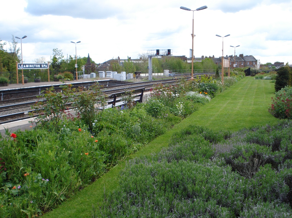
8 Restoration
We have just heard how the coming of the railway contributed to the decline of Leamington as a spa, but the town continued to flourish in other ways, due to the drive and determination of its inhabitants. We have here a small example of how local people can make a difference.
Until a few years ago, the station platform had an overgrown and neglected garden. Then a group of volunteers, the Friends of Leamington Station, set about restoring it.
The platform garden now includes a long lawn, flower beds, a 164ft herbaceous border, yew hedge and three plum trees.
In 2009 it won Country Life Magazine’s Best Country Garden Award. Since then the Friends, in partnership with the railway operating company, have been restoring heritage features of the station including the platform signs, waiting rooms and ticket office.
The station restoration, and particularly its garden, are an example of local people being involved in the place where they live. It’s not just the job of town planners and district councils to take responsibility for preserving historic buildings and maintaining pleasant surroundings.
In fact local people can often have an impact where public authorities and private companies cannot. We will see another important example of local people taking action to preserve Leamington’s heritage in a short while.
Make your way through the car park to the traffic lights. Use the pedestrian crossing to go up Tachbrook Road. After about 100 metres go down onto the canal towpath (there is access from both sides of the road). Turn left along the towpath with the canal on your right. Stop part way along the towpath.
9 An alternative industry
At the station, we heard how the coming of the railway in the mid-nineteenth century heralded the demise of the spa but that wasn’t the end of Leamington as a town.
It does not make economic sense for any town or city to rely on one particular industry for employment and growth; there should be alternatives. For Leamington, one of the alternatives to the spa came from industries located along the canal.
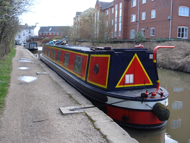
The Warwick and Napton Canal had opened back in 1800. It connected Leamington with the West Midlands and meant that raw materials could be brought to Leamington cheaply.
Coal was one item transported by the canal and it was used in gas works which were located on the other side of the canal where the apartment blocks are now. Leamington also developed as a centre for metal castings, particularly for domestic equipment, an industry that is carried on today by Flavells, the cooker manufacturers.
As the spa started to decline in importance, the industries along the canal became more important in the economy of the town. In the twentieth century, the automotive parts industry was a particularly important employer – and still is.
There are several information panels along the towpath giving more information about the canal and its history if you are interested to find out more.
Continue along the canal towpath. Immediately after going under bridge Number 40, turn left up to the street. Turn right down Clemens Street. Stop beside the last building on the left hand side immediately before (almost beneath) the railway bridge.
10 Sulphurous baths
From our slight diversion to the railway and canal, we return to our story of the growth of Leamington as a spa town.
In most spa towns, one main spring is the source of the special water. Leamington was unusual in that seven different springs were found, and each had water with particular properties.
As a result, competing pump rooms emerged, each promoting their own special spa water.
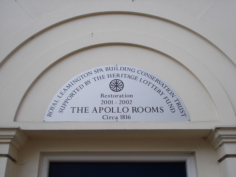
One of the seven competing pump rooms was here on Clemens Street. This was Smart’s Imperial Sulphurous Medicinal Fount and Ladies Marble Baths, now known as the Apollo Rooms.
Here ladies could bathe in sulphurous and chalybete (that is iron rich) water, with showers and water jets –designed to treat just about every medical condition that people might suffer from!
Like the gardens that we saw at the railway station, this building is another example of local people acting to preserve the heritage of the town. This historic pump room was threatened by dereliction some years ago. A local group stepped in to purchase it and, with the help of grants, to restore it and it is now let as offices.
The group formed a charity which restores buildings that would not be profitable for a company to take on. It’s another great example of how local people can have a considerable impact on their town and make it a better place to live.
Go under the railway bridge and use the pedestrian crossing to go straight across into Bath Street. Take the first road on the right, which is Regent Place. Go straight on at the crossing with Church Street, where the road becomes Chapel Street. Then take the next left into George Street. Stop on the opposite side, outside the Leamington Spa Mission.
11 A grand church
Visitors seeking health treatments were encouraged to come to spa towns not for a day trip but for a whole ‘season’ and it was the facilities and services provided for long-term visitors that really prompted the economic boom and physical growth of Leamington.
James Bisset, in his pocket guide of 1814, said that “the influx of visitors to Leamington during the two or three last seasons, has been really astonishing, and has contributed greatly to the prosperity of the place”.
For a start, visitors needed hotels and lodging houses in which to stay. Bisset lists all the hotels, inns and taverns and also notes that every house operated as a lodging house.
Visitors also needed shops to provide for their needs. In his revised edition of 1816, Bisset notes that the town now has “splendid linen, drapery, mercery and millinery shops”.
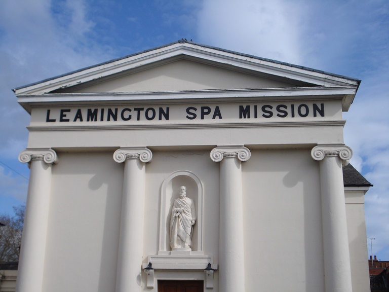
People also needed churches in which to worship. Built in 1828 at a cost of £1,000, St Peter’s was the first Roman Catholic church in Leamington, catering for visitors as well as residents. It’s a remarkably impressive building for a comparatively small street.
The Catholics moved to a larger building in the 1860s and it later became a youth mission then a social club. The Seventh Day Adventists took over the disused building in the 1990s and have restored it to its former glory.
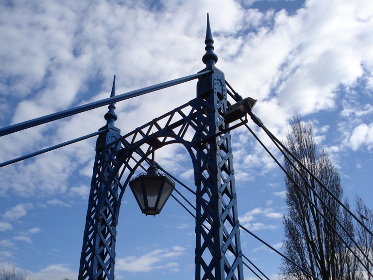
Go past the church and continue along George Street. At the next junction with Church Terrace and New Street, go straight across along Mill Street. At the next junction with Priory Terrace, go straight across into Mill Road. Straight ahead is a suspension bridge over the river (at the time of creating this walk it was painted blue). Stop on the bridge.
12 Washing elephants
When we were in the Pump Room Gardens earlier, we heard about a ‘necklace’ of open spaces running alongside the river. We are now a short way upstream from where we were earlier and across the bridge is another of these open spaces.
The area was originally laid out in 1831 as an informal riverside walk and known as Newbold Gardens. From 1846 it was developed as a more formal garden and pleasure grounds and renamed Jephson Gardens after Dr Henry Jephson, the town’s most famous doctor who advocated taking the waters.
There were improvements and additions to the gardens through the Victorian era culminating in the construction of this bridge as well as Mill Gardens and the boathouse on the south bank between 1901 and 1903, which created a single riverside park.
Before we explore the gardens, stand on the bridge and look downstream. Look on the left bank for a slipway. Believe it or not, this was where elephants were washed!
There was a range of entertainments provided for the many visitors to Leamington and one was the circus. This is where the elephant keepers brought their animals to be washed!
When you are exploring the gardens, look out for a sculpture featuring elephants that is a reminder of this part of Leamington’s history.
Cross the bridge and follow the path. Note the passageway and tunnel straight ahead but do not go through it. Instead turn right into the gardens. Stop in a convenient place and then take time to explore the gardens.
13 The jewel in the crown
As we heard earlier at Pump Room Gardens, the gardens were part of the spa experience.
After bathing or taking the waters, people came here to stroll, as well as to see and be seen!
Do take time to explore the gardens and note the grand central pathway lined with benches where people would have promenaded.
Nowadays Jephson Gardens are open for locals and visitors alike, but it wasn’t always so.
The gardens were free from 7 until 10 in the morning and after that they were restricted to patrons of Smith’s bath in Bath Street or paying customers.
After crossing the suspension bridge, did you notice a tunnel straight ahead? This was a public footpath through the gardens, but at a lower level so that people could not get inside.
It still serves as a public footpath when the gardens are closed.
The Jephson Gardens gained renown for their entertainments including band concerts and croquet competitions, fairy light displays and balloon ascents, leisure boating and flower shows, fireworks and archery!
In later years, more features were added including the ornamental lake, tea rooms, fountains and an aviary. No wonder that Jephson Gardens is considered the jewel in the crown of Leamington’s parks and gardens. Since 1999 the gardens have been restored and renewed and they remain an important centre of local life.
When you have finished exploring the gardens, find the exit at the top end by the clocktower which leads onto Newbold Terrace. Cross Newbold Terrace into Newbold Street with the Royal Spa Centre on your left. At the end of Newbold Street is a very wide tree-lined road. Cross over and stop on the pedestrian path in the centre.
14 Design against convention
You heard earlier that Leamington had seven different spas.
A quirk in the underlying geology – a fault in the sandstone – meant that they were mostly south of the river around the original village of
Leamington Priors where we started the walk. This left vast areas north of the river ripe for the creation of an elegant ‘new town’.
We are now going to explore this new town which was deliberately planned and designed to give a sense of grandeur, elegance and affluence.
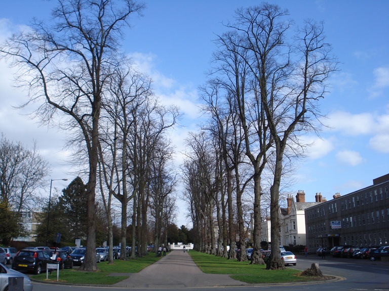
Here we are at the first of many deliberately landscaped roads. Look either way and you will see a broad tree-lined avenue.
The road is also gently curved rather than straight which was a deliberate part of the design to make it feel more rural in character. It implies that in this town you can have the best of urban and rural life. We shall see more of that concept later.
On either side are grand villas designed with a view out onto the tree-lined road- a very suitable home for a wealthy resident of the spa town!
Having a footpath down the centre and roads on either side – rather than the road down the centre and footpaths on either side – also makes quite a statement. The design was borrowed from French towns where such tree-lined avenues gave people shade from the sun.
Follow the pedestrian path up Regent Grove / Hamilton Terrace, which becomes Holly Walk and Brandon Parade. At Willes Road, use the pedestrian crossing to go straight across into Upper Holly Walk. After about 100 meters, turn left into Lansdowne Circus. Take your time to walk around the crescent, admiring the beautiful houses.
15 The best address in Leamington
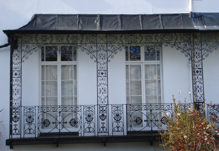
This is one of the most pleasant residential areas of Leamington. This group of semi-detached villas was laid out in the 1830s.
The whole area was the responsibility of a single architect, William Thomas, and this ensures a uniformity of design.
Look at the elegant balconies and the elaborate wrought ironwork. The central garden was for the use of the residents and still is (look for the gate at the far end).
Like so many buildings in Leamington, these buildings are listed, which protects them from unsympathetic changes.
Owners of listed buildings need to have Listed Building Consent before making changes which would affect the architectural character of the building.
These requirements also apply to the walls and railings. In this way the local planning authority can ensure that the character of the buildings and of the area is protected.
Today Lansdowne Circus is considered one of the ‘best’ addresses in Leamington. It is a sought-after location with house prices to match.
Some of the residents who live here may commute to Coventry or Birmingham or perhaps even to London – but can return here to this very special place after a day’s work.
Leave Lansdowne Circus by the other exit (not the one where you came in). At Willes Road, turn right and immediately right again into Lansdowne Crescent. This is a private driveway but you can walk along it.
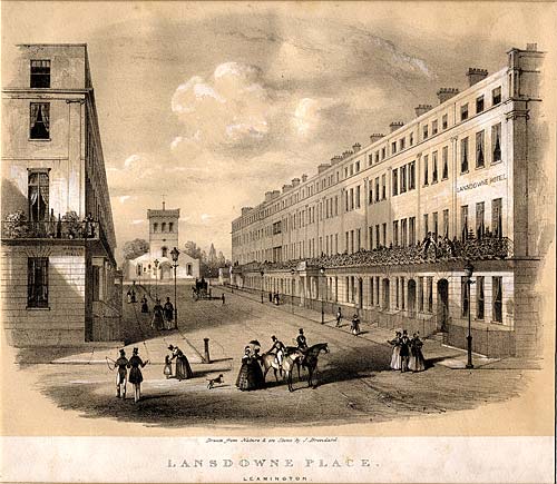
16 The finest crescent in Leamington
Just around the corner from the quiet oasis of Lansdowne Circus is Lansdowne Crescent, which is the finest crescent in Leamington.
Where residents now park their cars was originally the carriage approach and you can still sense the splendour of this piece of property development.
The falling popularity of spas in Victorian times meant that many ambitious schemes for development had to be abandoned and this has left Leamington with rather fewer ‘grand designs’ than some other spa towns in Britain such as Harrogate and Cheltenham.
Again note the beautiful wrought ironwork. In fact, there used to be more.
A lot of it was removed during the Second World War to help with the war effort.
However, where iron formed part of the building or was a safety feature it was allowed to remain.
Many of these houses are now divided into flats but the listed building status still protects their character.
Continue to the end of Lansdowne Crescent and back onto the pavement of Willes Road. At the traffic lights, go straight on into Warwick Street. At the second junction, turn right into Chandos Street. Stop by the car park on the left hand side.
17 A major new development?
At our previous three stops we saw a sinuous avenue, houses arranged around a circular garden and a curved crescent. But as you have walked along the last few streets you might have sensed the straight roads and a grid system.
Most ‘new towns’ since the first ones, in Ancient Greece, have been planned as a grid. This is the simplest way to lay out a new area; the sinuous tree-lined avenues are the exception rather than the rule.
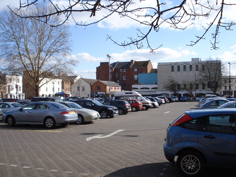
As you can see, the Council car park here in Chandos Street takes up one whole square of the grid system.
At the time of creating this walk it was a car park but changes are afoot and maybe when you visit things will have changed.
Though the town’s heritage as a spa town and its beautiful buildings are very important in attracting visitors and tourists, the town cannot depend solely on this for its economic survival. The town needs other means of attracting people. In fact Leamington has become something of a shopping hub. The town has far more shops than are needed for the local population and the shopping centre as a whole attracts visitors from a wide area including Coventry and Birmingham who want to shop in its pleasant surroundings.
There are proposals to use this car park site for a major new shopping centre which would be connected to the main shopping street that we shall see later. Unsurprisingly the proposals have divided opinion. Some people would prefer Leamington to stay as it is and to retain its charms. Others want Leamington to keep pace with new shopping developments in other towns in the region in order to remain competitive. What do you think?
Continue up Chandos Street hen turn left onto Clarendon Avenue. Use the pedestrian crossing to go onto the opposite pavement. At the junction with Kenilworth Road, cross over to the grassy area. Make your way under the large trees beside the junction with traffic lights. Stop when you have a good view down the Parade.
18 The focus of attention
The grand road straight ahead of you is The Parade, the main street of the town and the centre of the spa town’s planned layout.
We shall go down Parade shortly for a closer look but from here you can appreciate the grandeur of this street which is created by the uniform design and height of the buildings. The gentle slope of the road also adds to the perspective.
A church used to stand here at the top of Parade. Christchurch was opened in 1825 as The Leamington Episcopal Chapel and admission was by ticket only! This was, at the time, the only Anglican church north of the river.
Parade was a grand street made all the more grand by having the church as a clear focus of attention at its end. You can see just how important the church must have been in the townscape of Leamington.
Eventual lack of use led to its demolition in 1959. It was one of the earliest Norman revival churches in England and its loss was sad.
After demolition of the church, only the gardens remain to bear the name of a lost feature of Leamington.
Continue along the right hand side of Clarendon Street for about 200 metres until you reach Clarendon Square. Walk along the pavement beside the houses, cross the road and then walk through to the garden in the centre of the square.
19 The finest square in Leamington
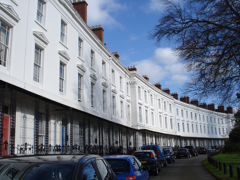
We’ve already seen the town’s most spectacular circus and crescent and here is its finest square, Clarendon Square.
Like the Parade that we saw at the last stop the buildings are of uniform size and colour to emphasise the grandeur of the design.
Three sides of the square were completed in the 1830s with the fourth side comprising individual large houses of a later Victorian date. You might wonder why the four sides were not completed at once?
Well, the development of the spa tended to move forward in a succession of booms followed by periods of recession. Boom periods saw property developers building and flooding the market with new houses. In times of recession builders went bankrupt and were unable to complete or sell the houses they had built. The same is happening in the contemporary recession in Britain.
Look diagonally across the square, to the left of the terrace of four-storey houses, into the far corner of the square. Here you will see a more modern development.
Originally this was a gap and part of the planned design of the square. The idea was that you could see the countryside whilst being in the town and have the best of both worlds.
We saw a similar concept used earlier at the sinuous avenue giving a feeling of a country road rather than a city street.
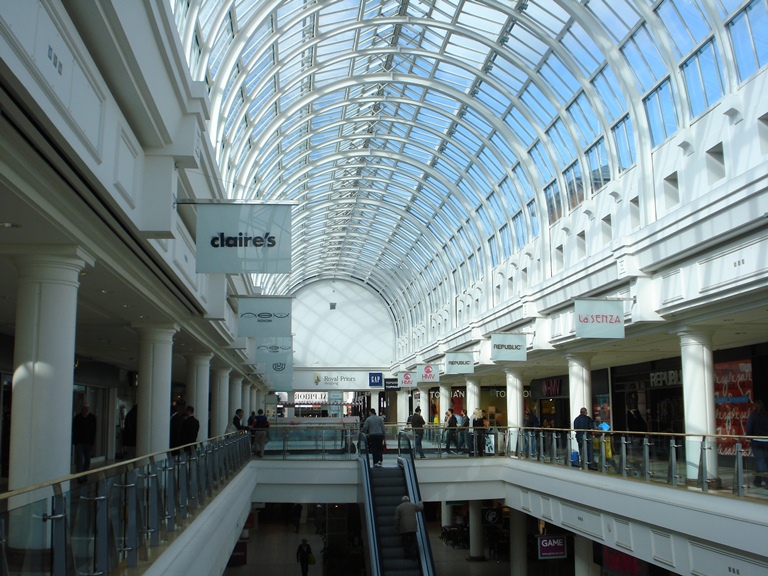
Retrace your steps back along Clarendon Street and turn right down Parade (the road that you looked down earlier). Go straight across at the junction with Warwick Street. In the next block on the left hand side are several entrances to the Royal Priors Shopping Centre. Stop outside and read part 20, then go inside the shopping centre afterwards.
20 An invisible shopping mall
I hope you have enjoyed walking down Parade, this grand street dating back to the early years of the nineteenth century. But behind the façade you might be surprised to know that there is a large shopping centre built in the 1980s.
In some other towns big shopping centres built in the 1980s are architecturally uninspiring and are detrimental to the townscape. Here in Leamington the architects designed what I think is a brilliant solution. Go inside one of the entrances to the Royal Priors Shopping Centre and you will find over 50 shop units over two levels and over 450 parking spaces over 6 levels!
This large development has been very cleverly integrated with the fabric of this historic street with minimal disruption to the appearance of the main frontage. The entrance porticos are new but blend into the character of the street and the enormous car park is invisible.
It’s also a clever design from a shopping centre management perspective. Normally in shopping malls on two levels, the ‘upstairs’ units are more difficult to let because shoppers are less willing to climb stairs or use escalators unless there is a good reason to do so, such as a big-name shop.
However, in this case both levels can be entered directly from Parade, the first (higher) entrance giving access to the first floor and the second (lower) one giving access to the lower floor. There are also good links between the new centre and the adjoining shopping streets.
If you went into the shopping centre return onto Parade and continue down the road. Go straight across at the junction with Regent Street. Shortly after stop outside the Regent Hotel on the left hand side.
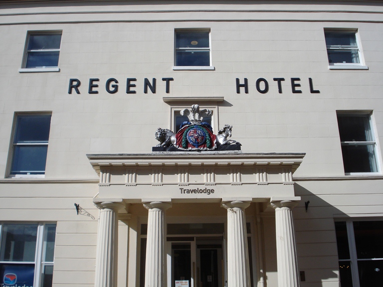
21 An old hotel with a new look
The Regent Hotel was one of the largest hotels in Europe when it was opened in 1819.
It remained an independent hotel until the late 1990s when it closed and was subsequently refurbished and opened as a Travelodge.
It still serves visitors to the spa as it has always done. The visitors have changed but their reasons for visiting spa towns have lived on.
The refurbishment of the hotel was part of the development of the shopping street that you can enter between the hotel and the Town Hall.
In contrast to the Royal Priors Shopping Centre that we saw at the last stop, this one uses the architectural concept of an open street.
During this walk we have seen several different approaches to shopping from the original shops on Parade to the ‘hidden’ shopping mall and this twenty-first century style street.
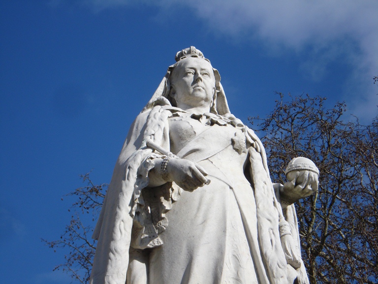
Next to the Regent Hotel is the red-brick Town Hall. There is a statue of Queen Victoria outside. Stop beside it.
22 Royal approval
This stop brings us to the end of our walk and also back to the beginning of our story.
We heard at the beginning how the village of Leamington became Leamington Priors. This lady was responsible for another name change.
The eleven-year old Princess Victoria visited the spa with her mother in 1830. They stayed at the Regent Hotel that we saw at the last stop.
After the royal visit, the spa town grew in popularity and respectability. In 1838, just a year after she had become queen, leading residents of Leamington Priors petitioned the Queen and she agreed that the town could be known as Royal Leamington Spa and this remains the official title of the town today.
During this walk we have seen how an insignificant village developed into a fashionable spa town due in large part to the far-sightedness of local residents, land owners and property developers.
The American writer Nathaniel Hawthorne, who stayed in Leamington in the 1850s, wrote that from the springs “have gushed streets, groves, gardens, mansions, shops and churches and spread themselves along the banks of the little river Leam”.
We traced the rise and subsequent decline of the spa town but we have also seen how industry and more recently shopping became important aspects of the local economy.
Throughout we have seen how town planning and architectural design have been used to create an impression of grandeur, of affluence and of a town in the country.
Proposals to build anything new in this historic town will always cause debate but local voices are involved in making decisions about new developments. We have also seen some examples of local people taking the initiative to get involved in heritage and restoration. Here in Leamington there seems to be a shared sense of something special that will hopefully be preserved sensitively for many generations to come.
To return to the starting point continue straight along Parade past the Pump Rooms and over the river to the Parish Church. To return to the train station continue along the Parade then turn right into Spencer Street. Alternatively you may wish to revisit some of the stops on the walk or go shopping.
Your browser is out of date, and unsupported by this website. Please upgrade to the latest version to use this website.
Did you know that the spring waters of a West Midlands town can cure gout, rheumatism and paralysis?
This walk explores how healing waters turned an unremarkable Warwickshire village into one of England’s elegant spa towns.
Discover how Leamington was deliberately laid out with crescents, squares, avenues and a grand Parade. Find out why the spa declined and what industries and services took its place.
Follow the walk by clicking on the map pins or downloading the guides below