1 Welcome to Dudley and the Black Country

Welcome to Dudley in the West Midlands. During the nineteenth century, this area to the north and west of Birmingham was transformed from green valleys and fields to a landscape ‘blackened by day and red by night’.

The clouds of smoke, black soot and heaps of iron waste that covered the area are probably the origin of its name - the Black Country. In fact some see the fiery factories and furnaces as the inspiration for Mordor, the wasteland in Tolkien’s The Lord of the Rings.

The Black Country became the industrial heartland of Britain but have you ever wondered why? A big part of the answer lies right below our feet. This is a geologically rich landscape. An incredible wealth of minerals lies under this area including rich seams of coal and ironstone - two of the raw materials needed for making iron. The Industrial Revolution would have been impossible without iron, which was used to make everything from steam engines and railway lines to kitchen pots and kettles.

This walk is all about the third key raw material needed to make iron; limestone. Here, four limestone hills rise up out of the relatively flat land around. One of them, Wren’s Nest, is one of the most important geological sites in Britain.

We will learn how these hills came into existence and contemplate views of the Black Country from a spot named after a famous nineteenth century geologist. We will get the opportunity to search for fossils in the limestone and peer into the prehistoric world when this whole area sat at the bottom of a warm sea.

We will also discover how people have exploited limestone from these hills; first as an early building material, then to make lime to improve the surrounding fields and finally how it was extracted in huge quantities for iron making, turning the Black Country into one of the most industrialised places in Britain.

Mining has long since ceased and now these limestone hills are protected as nature reserves. Trees have grown up on them and the old workings harbour a wide variety of plants and wildlife
suited to limestone soils. Today this five-mile walk follows a green corridor in the heart of the Black Country.

 
Dudley Priory floor tiles
© Caroline Millar
Directions

Find the information board near the archway of Sutton Chapel. Stop here.

2 Building blocks

We begin the walk by the impressive ruins of Dudley Priory. Built in the twelfth century, it is one of the oldest buildings in Dudley.

People have lived around here since at least the Anglo Saxon times when the town was known as Dudda’s Leah (‘Dudda’s clearing’). Dudley Castle, which you can just make out on the hill ahead, was built soon after the Norman Invasion in 1066.

The original castle would have been built of wood but it wasn’t long before it was rebuilt with stone. From here you might just be able to see the top of a turret and a flag but we will get a better view of the castle later.

The priory was built about 100 years later and dates from about 1150. It was founded by Gervase Paganel, the Lord of Dudley Castle. Take your time to explore the ruins of the priory, particularly the arches and stone walls that have been preserved. Pay particular notice to the stone it is built from.

Early builders of structures like the castle and the priory would have looked to see what materials they could find nearby. In this case they didn’t have to look far. You can see some red sandstone in the priory ruins but most of it is built of a grey stone. This is limestone and it was quarried from nearby Castle Hill and Wren’s Nest Hill, which are both on our route today.


Ruins of Dudley Priory
© Mike Jackson
Directions

Leave the priory by crossing over Paganel Drive. Turn left into Gervase Drive by a red postbox. Walk the length of the road until you reach Woodlands Avenue on the left. Take the footpath opposite on the right (through the trees). Turn left after 50 metres at a T junction ignoring a path to the right. Stop when you reach a huge crater-shaped hole in the ground to your right.

3 That sinking feeling

We are now on the edge of Castle Hill which is the first of the four limestone hills that we are going to cross on our walk today. The first thing to notice is the huge crater just off the path to the right. This is not a natural landscape feature. Instead it’s evidence of the large scale limestone quarrying which took place here.

As a result of this quarrying, Castle Hill is riddled with tunnels and caves. This hole is where the land has collapsed into the mine workings below. Like an inverted volcano, when the earth around the mine opening collapsed, it drew the ground down around it creating this deep chasm we can see today. These craters are known as ‘crown holes’ or ‘crowners’ ends’ and we will see several of them on our walk today.

The second thing to notice is that this hill is wooded. The ash, sycamore and beech trees may seem ancient but like the crown hole, they too are not part of the natural landscape.

When Castle Hill was extensively mined for its limestone from the eighteenth century onwards, it became something of an eyesore, ruining the view from Dudley Castle at the other end of the hill. Lord Dudley began a programme of tree planting to hide the destruction caused by the mines (one of the earliest known examples of planned landscape restoration!). Lord Dudley himself was responsible for the mining in the first place of course.

We have already seen back at the priory how limestone was used as a local building material but this wasn’t its only use. By the fifteenth century limestone, was being burnt in limekilns to produce lime which in turn was spread on the fields as a fertiliser to improve the heavy, clay soils.

By the beginning of the eighteenth century another use for limestone was found that created a huge demand for it.

In thick seams underneath the Black Country there are rich deposits of both coal and iron ore. These are rocks which can be heated to extract iron. Iron was being worked in this area from as early as the thirteenth century but it was a complicated process that required large quantities of charcoal to melt the iron. This meant that iron-making was centred in forests where wood could be easily obtained.

A big change took place in 1619 when Dud Dudley patented a method for using coal instead of charcoal. Limestone was also needed in this process. It was heated alongside the iron ore and
caused impurities in the molten iron to float to the surface as slag which could easily be removed. This new process heralded an era of plentiful and inexpensive iron, one of the key factors that lead to the Industrial Revolution.


Castle Hill Woods
© Mike Jackson
Directions

Continue along the path until you come to a T junction with a green metal fence in front of you. Turn left here and follow the fence (keeping it on your right) until you see a path uphill. Go up the steps and turn right off the path by a large beech tree (with tree roots twisting up the trunk). Climb the bank and walk until you can just see over the green metal fence into the water at the bottom of the cavern below.

4 Going underground

Behind the green metal fence (about 100 feet down) lies another collapsed limestone cavern that is too dangerous to approach from above. However this cavern did not collapse on its own. It was deliberately opened up and flooded to create a canal basin.

In the eighteenth century a great network of canals was built around Birmingham and the Black Country to support the growth of heavy industry. They provided a cheap and efficient way to transport raw materials such as local coal and limestone out of the quarries to the blast furnaces where they were heated to produce iron.

Canals also provided an efficient way to transport finished products such as heavy machinery, domestic ironware, pottery and glass to markets in Britain as well as to ports for export around the world.

In 1775 Lord Ward of Dudley built a canal to link his colliery at nearby Tipton to the Birmingham Canal. Then three years later he built a 227 yard underground canal into his limestone mines here deep under Castle Hill. Later it was decided to create a link to Stourbridge so that coal and limestone could be carried to the iron and glass works there. This required a long tunnel to be built and it was then that the roof of the limestone cavern below us here was removed to create a canal junction.

Four tunnels lead off from Castle Mill Basin, connecting to a number of underground canals. The main tunnel goes north to the Birmingham canal system and south to Parkhead locks and the Stourbridge canal. It is almost 3,000 metres long and is the second-longest tunnel on the British canal network. Another tunnel goes west into the mines of Wren’s Nest (which we will visit later). The last tunnel opened in 1989 to connect to the ‘Singing Cavern’ under Castle Hill. This got its name from the eerie hum created by the wind and was even used as a concert hall in Victorian times.

If you would like to explore this network of tunnels and canals, the Dudley Canal Trust now run boat trips into Castle Mill basin and on to the spooky, subterranean world of the limestone caverns.


Castle Mill basin
© Mike Jackson


Directions

Retrace your way back to the path at the top of the steps. Continue on the main path (ignoring paths off to the right) until you reach a road. Turn left here into a residential road and continue until to a busy crossroads. Go straight over at the crossing and into Bluebell Road then bear right up steps into the woods. Continue straight over at a crossroads and through a metal kissing gate. Go straight up through the woods and stop when you pass a large outcrop of grey limestone either side of the path.

5 428 million years ago

This outcrop of grey rock is our first example of limestone. Take a closer look to see the different layers of rock which have been tilted up at an angle. You might be surprised to learn that this rock was laid down horizontally on the sea bed. Movements in the earth pushed it up through the softer surrounding rocks to where you see it exposed here today.

We are now inside an area known as Wren’s Nest, which is the second limestone hill on this walk. It is a National Nature Reserve and one of the most important geological sites in Britain.
Geologists from all over the world come here to see its spectacular limestone outcrops and the abundant fossils preserved within it.

Wren’s Nest might seem a strange name for a hill. In the thirteenth century it was known as ‘Wrosne’, which is thought to be derived from a word meaning a band, link or a chain. Wren’s Nest
and the other limestone hills on our walk, form a band of rocks that rise up above the surrounding land. They were pushed up by great earth movements just after 428 million years ago.

This was when two continents finally collided, forcing the landscape to arch up and fold into ridges - like wrinkles in a carpet. The tougher limestone pushed up and the surrounding softer rocks were deposited on top later. Eventually these younger softer rocks were eroded away again, leaving the surface as the rocky outcrops we can see here.

As you walk over Wren’s Nest you will be able to see evidence of this in the many exposed limestone beds like this one which are tilted at a great angle.

These hard limestone rocks were formed during what is known as the Silurian Period when Dudley lay at the bottom of a shallow, tropical sea. Coral reefs, seashells and small sea creatures
flourished. As these creatures died, their shells and hard bony parts built up on the sea bed and formed layers. Over millions of years those layers were compressed and became hard limestone rock.

By contrast the low lying valleys between these hills are made up of much younger rocks including muds, coals and ironstones. These were laid down during the Carboniferous Period about 310 million years ago when the land was covered by a vast steaming swamp. This was when the land mass we now know as Britain was actually 2,000 kilometres south of where we are now at the Earth’s equator!

Fast-forward to 250 million years ago and a scorching desert covered the land, leaving a layer of red sandstones and pebble beds on top of the muds, coals and ironstones. You can see why the Black Country was of great interest to both geologists and industrialists!


Tilted limestone outcrop
© Caroline Millar
Directions

Continue ahead then turn left at a crossroads. Follow the main path up some steps and then downhill through the woods and until you reach an obvious set of steps leading up the hill on the right. Stop at the top of these by the information board.

6 King of Siluria

The reward for climbing all those steps is a magnificent view. Dudley Castle is visible ahead with the town of Dudley to the right. Over to the left you can make out the skyline of Birmingham and the Black Country. This spot is named Murchison View, after one of the most distinguished geologists of the nineteenth century. Sir Roderick Murchison was also one of the founders of the Royal Geographical Society and became its President.

Layers of rock can be seen as the pages of the Earth’s diary and the fossils are like the words on those pages. Murchison was trying to unravel page by page, rock layer by rock layer, events that had happened on the earth millions of years ago.

Through studying fossils, he recognised that particular life forms could define a particular time period on Earth. He and his wife Charlotte spent some time studying, recording and illustrating rocks in the Welsh Borders near Much Wenlock. Murchison also came to study the limestone hills of Dudley.

And it was right here that he found the greatest body of evidence to define a new time period in the history of the Earth. By comparing fossils from both places Murchison was able to identify that they were outcrops of the same aged band of rock.

As we heard at the previous stop, the land here was once the bottom of a tropical sea where the shells of dead creatures gradually compressed into limestone. Millions of years later the rocks
pushed up by great forces inside the Earth created the limestone hills here and the outcrops on the Welsh Borders.

Murchison named these limestone layers after an ancient Welsh tribe, the Silures, and published his great work ‘The Silurian System’ in 1839. This defined a period of geological history which
began about 440 million years ago and lasted for about 20 million years.

The book features sketches of many fossils that Murchison discovered on Wren’s Nest. These were drawn by his wife, an accomplished artist. He also included Charlotte’s sketch of the view from here looking over the Black Country. When Murchison returned to Wren’s Nest in 1849 with a party of top scientists it was reported that 15,000 local people gathered to hear him speak. He was mobbed by the crowd, carried out on their shoulders and pronounced ‘King of Siluria’.


Murchison's View by Charlotte Murchison
© Dudley Museum and Art Gallery
Directions

Continue on the gravel footpath and stop when you reach entrance to the Seven Sisters Mine.

7 Digging deep

This viewing platform overlooking a rock face is the entrance to the Seven Sisters Mine. A major roof fall occurred here in 2002 and the entrance was filled with loose gravel to prevent further collapse. However even from the outside it is impressive and we can still learn about this curious mine by examining the rocks here.

Look at the layers of rock at the side of the mine entrance and you can see the different layers (strata) and thickness of the seams. The limestone seam comes to the surface here.

At first only surface outcrops like this were quarried but over time the miners began to dig deep underground to get at the purest and most valuable limestone deposits. By the beginning of the nineteenth century the quarrymen had excavated vast caverns with massive limestone pillars to support the roof. To make them safe many have now been filled in with stone.

Limestone was mined on Wren’s Nest until as recently as 1927. Just imagine how hard this work must have been for the early miners. The deeper they dug the more difficult the miners found it to haul the limestone to the surface. A solution was found by building a network of underground canals. The limestone could then be loaded directly into barges to be transported on to the furnaces of the Black Country.

In fact there’s a canal tunnel some 70 metres below our feet, part of the network we heard about earlier above Castle Mill Basin.

The miners worked very long hours, in dark and dangerous conditions deep inside the earth, for very little pay. There was one way, however, that they were able to supplement their income. The limestone here is rich in fossils which could attract a good price from the fossil hunters of the time. It is said that a good fossil could earn a miner as much as three weeks’ wages. We will get a chance to search for fossils at the next two stops.


Sketch of Seven Sisters cavern
© Dudley Museum and Art Gallery
Directions

Continue along the footpath until you reach an interpretation board with a view of Marsh’s Quarry below and rows of residential houses in the distance.

8 Fossil hunt

From here we have a good view over Marsh’s Quarry, the last place where limestone was ever quarried on Wren’s Nest. In the distance beyond you can see the Sedgley Beacon which marks the end of our walk.

Since the quarry was abandoned, plants have adapted to the limey soil and colonised the slopes. In early summer you will find a beautiful show of wild flowers such as the small purple scabious, delicate milkwort, white flowered fairy flax, beautiful bee orchid and heart-shaped pendants of quaking grass which thrive in abandoned limestone quarries like this.

This is also a good place to find fossils. Fossils are the prehistoric remains of plant or animal life which are embedded in rock. They are typically preserved when they are buried under layers of sand and mud which then comes under great pressure and becomes sedimentary rock. The limestone rocks at Wren’s Nest were formed at the bottom of a warm sea when there was little life on land. So the fossils found here are of sea plants and animals.

Over 700 different kinds of fossils have been found here with many of them unique to Wren’s Nest. Why not take some time to see if you can find any. You are welcome to search the loose material on the ground here and at the next stop. But you must not use hammers or take fossils directly from rock faces.

Some of the easiest fossils to find are brachiopods, which look like small clams. You might also find fossils of corals and crinoids which were sea creatures related to starfish or sea urchins. But the most famous fossils found here are the trilobites. These were arthropods (creatures with jointed limbs) which are related to modern crabs and lobsters. There are thousands of different species of trilobite but one called Calymene blumenbachii was so commonly found that the nineteenth century quarrymen called it the ‘Dudley Bug’ and adopted it as their mascot and emblem.


Dudley Bug
© Mike Jackson


Directions

Take the path left down the steps and go into the bottom of the quarry. Follow the path bearing round to the left and stop by the green gate and information board in front of a large limestone cliff.

9 Dudley under the sea

We are now standing at the bottom of an impressive limestone cliff which offers us a window into the prehistoric world. Some 428 million years ago this area was underwater. The land we know as Britain was then covered by warm tropical seas, a beautiful landscape of coral, turquoise and tranquil green-blue waters.

Look carefully at the cliff and you should be able to make out ripples in the rock. These marks were made at the time this rock was being formed at the bottom of the sea. The ripples were made by the action of waves, much as you might see patterns left in sand when the tide goes out.

Geologists believe that the tropical sea was normally calm but that a series of massive storms sometimes disturbed the seabed. These storms created ripples and scattered broken fossils across the seafloor. In between the storms the ripples in the seabed filled in with mud which preserving them forever.

The Ripple Beds are fenced off today because they are unstable and also to protect them from damage. You can see that on the right hand side a huge chunk of rock has slipped down into the
trench below leaving a yellow patch of rock underneath. This didn’t happen naturally. A fossil dealer cut out a complete and perfectly preserved fossil of a sea lily here. He left a gap at the bottom of the flat rock so the rock above eventually slipped down.


The ripple beds
© Mike Jackson

Directions

Retrace your steps but instead of going back up the hill by the quarry, continue on the path below it until you reach a road with the Old Caves pub on your right. Cross over the road to the footpath on the other side and stop just after the entrance to Mons Hill.

10 Natural recovery

We are about to enter a part of the Wren’s Nest reserve called Mons Hill. This part of the reserve is a peaceful place covered by woodland which makes it hard to imagine how it would have looked in the past.

Like the southern part of Wren’s Nest, limestone was extracted from the hillside here but by the middle of the nineteenth century the seams had been exhausted. There are some signs that trees
were planted after quarrying ended and now a large part of the hillside has reverted to woodland.

The thin soil on top of the limestone is alkaline which suits ash trees. These have light airy crowns and come into leaf late in the spring and that encourages a shrub layer of field maple, hazel and
wych elm. Beneath this the woodland floor is carpeted with wild flowers that enjoy these alkaline soils. If you are here in springtime then look out for the flowers of dog’s mercury, bluebells, wood
anemone, enchanter’s nightshade and sweet violet.


Enchanter's nightshade
© Mike Jackson
Directions

Continue along the path through the wood, bearing right where a path leads off until you reach a junction where a path comes down some steps from your right. Turn left here and continue down some steps to a road. Turn left onto the pavement of Parkes Hall Road. Cross Wren’s Nest Road and Pool Street and then take the path immediately across the road. Stop when you have a view of the reservoir to your right.

11 Water to the people

This is Parkes Hall Pool which was built as a reservoir in the nineteenth century to supply Dudley with water. We have already heard about the technological advances of the Industrial
Revolution but this is a good reminder of the social effects.

Huge quantities of limestone were mined from Wren’s Nest to go into the blast furnaces of the iron making industry. This industrial growth meant the population of the Black Country increased dramatically. Providing people with clean water became a growing problem.

Inhabitants of the towns at that time depended on inadequate wells, ponds and rainwater cisterns. Organised supplies were not generally provided until the beginning of the nineteenth century.
Initially these were often arranged by private groups (for profit) rather than local authorities. The first company to supply water to Dudley was set up in 1834 and built this reservoir. However it only provided Dudley with a partial supply and by 1850 only about a quarter of the houses in the town had water. The supply was also intermittent and the water quality was poor.

Perhaps it is no surprise then that Dudley suffered outbreaks of cholera in 1832 and 1848. During a great water shortage in 1851 people resorted to drinking from the canals. These events lead to the creation of a Board of Health and an official report described Dudley as the “most unhealthy place in the country”. Proposals were made for improved water supplies and the South Staffordshire Waterworks Company was formed to do this in 1853. In 1862 the company took over the Dudley Waterworks.

The last water from Parkes Hall Pool was pumped in 1872. Today it is managed as part of the Wren’s Nature Reserve, providing a tranquil haven for wildlife and recreational activities.


Parkes Hall Pool
© Mike Jackson
Directions

Continue along the side of the reservoir until you reach the corner where the path turns right. Leave the reservoir by taking the footpath through a gap in a wall into a field. Turn right and cross the field to a road. Cross Tipton Road carefully and follow the footpath left for about 150 metres. Turn right into Brook Street and continue downhill past The Brook pub, then uphill and around a bend to your left. Turn left into Turls Hill Road and stop just before a gate by a bridleway.

12 The old ways

We have been walking on Turls Hill Road which follows the route of an old country lane that linked the villages of Sedgley and Coseley. The medieval landscape here would once have been dotted with small farming communities some of which went on to develop into villages. Nine villages made up the ancient manor of Sedgley and there would have been tracks connecting them to each other.

These tracks sufficed until the Industrial Revolution brought more people and goods to be transported longer distances. Some tracks were improved into roads and turnpikes while others remained as small footpaths.

The track we are on can easily be seen on a map of 1798 and it probably dates back to before 1600. After it had fallen into disrepair it was restored in 2009 by a Charitable Trust. The bridleway ahead now provides a tranquil place for local people to stroll and enjoy. It also provides excellent views back towards Wren’s Nest and Castle Hill where we began the walk.

To the right of the bridleway here is Hurst Hill, the third limestone hill on this walk. Today, like Mons Hill, it is wooded and in spring it is full of nesting woodland birds like nuthatch, tree creeper and woodpeckers. However it too has been exploited in the past and it still bears the scars of quarrying.


Sunken path of Turl's Hill Road
© Caroline Millar
Directions

Continue to the end of the bridleway (ignoring the path to the right). Just before a white gate onto the road, turn right onto a footpath along a stone wall. Follow this until you reach a main road. Turn left and immediately right into Beacon Lane past the Beacon Hotel and Sarah Hughes’ brewery. Continue uphill past a radio mast and stop by a round brick tower.

13 Sandstone signal

We have now reached Beacon Hill, the last of the four limestone hills on this walk. This is Sedgley Beacon and at 237 metres above sea level it is one of the highest points in the West Midlands. As the hill’s name suggests this was where a beacon would have been lit. It formed part of a network of signals across the country that was used to warn the nation of major events, such as the approaching Spanish Armada.

Today there is a radio mast here so the hill still acts as part of a communication network. The mast stands close to a stone tower dating from the nineteenth century although it is not clear who built it. Some suggest that it was Lord Wrottesely who was an amateur astronomer; others say a local landowner built it as a folly, which may account for the narrow arrowshaped slits that mimic a medieval castle.

Take a look at the stone used to build the tower. Notice that it is not built of the grey limestone we have seen so far but of a yellowish stone. This is Gornal gritstone, a type of sandstone quarried from Gornal about two miles south of here.

This stone is also of Silurian age - about 420 to 23 million years old - though younger than the limestone on the walk. Gornal gritstone was created from river sand and fine gravels which
accumulated in estuaries and deltas. These were formed when the sea beds were lifted up by huge earth movements caused by colliding continents.

Quarrying for this distinctive honey-coloured stone continued up until 1950 and many buildings in the area were built using it. As a consequence Sedgley was known as the ‘Cotswold Village of the Black Country’. Gornal stone had an industrial use too. It is almost 100 per cent silica, which has a very high melting temperature. This meant it was useful in steel making. Ground down into sand and mixed with fireclay, it was applied as a coating to moulds. As well as providing a smooth surface gornal stone also acted as an insulator which protected the moulds from cracking when hot molten metal was poured into them.


The Sedgley Beacon
© Graham Worton
Directions

Do not take the surfaced road downhill but take the grassy footpath along the ridge of the hill. Stop when you reach a flat plateau near some picnic benches with fantastic panoramic views.

14 Black Country panorama

From the hill here there is a wonderful panoramic view. To the west is the mainly rural county of Shropshire with the Shropshire Hills in the distance including Wenlock Edge and The Wrekin. Wenlock Edge is another exposure of the same limestone we are on here.

To the east you can see Birmingham and the industrial area of the Black Country. In fact there is no land higher than this to the east until you reach the Ural Mountains in Russia!

If you take any of the tracks down the side of the hill to your left you will quickly find evidence of limestone quarrying. Beacon Hill quarry was used from the seventeenth century right up until the First World War. However this limestone is different to the grey Much Wenlock limestone we saw at Wren’s Nest.

This limestone is known as Aymestry limestone. It is still from the Silurian Period but it is younger than the limestone we have seen so far, dated at around 425 million years. Geologists believe that the thin limestones and brown silty mudstones here (known as the ‘brown lime’) were formed in a shallow sea close to land, from which it received heavy flows of sediment. This limestone still contains fossils and you might be able to find some brachiopod shells (which look like tiny clams) in the loose rock. Sir Roderick Murchison was able to use these fossils as evidence to identify this limestone as the same type as at Aymestry near Ludlow.

The quarry is now an important site for nature conservation because of the rare plants that grow on the limestone, including milkwort and carline thistle. It also attracts some unusual butterflies
including Wall Brown and Green Hairstreak.


View acros the Black Country
© Mike Jackson
Directions

Retrace your steps back to the beacon and follow the surfaced path downhill until you reach a concreted area. Take the path through the green fence downhill and head towards two houses (one with a dark gabled roof with white V-shape). Emerge into a field and exit over a stile by a wooden gate onto Wolverhampton Road just up from the bus stop.

15 Limestone legacy

This bus stop marks the end of our walk exploring the limestone hills of Dudley.

People have made good use of these limestone hills. We have seen where limestone has been extracted, first as a building material, then to make lime to improve the fields, and then in huge
quantities to feed the blast furnaces of the Black Country. We have seen where miners dug ever deeper in search of the best quality limestone and heard how canal tunnels were dug deep into the hills to carry the rock away.

From the top of Wren’s Nest we looked out over the West Midlands and learned why the hill is such an important place for geologists. We searched for fossils in the footsteps of Sir Roderick Murchison and heard how his discoveries lead to him being proclaimed ‘King of Siluria’. We have seen the ripples in exposed limestone that tells us that these hills were created at the bottom of a tropical sea over 400 million years ago.

We have also been able to walk along a pleasant green route where trees and wildflowers have colonised the old limestone workings. We hope you have enjoyed this walk and now know more about these amazing limestone hills. If you would like to explore the limestone caverns from inside then a canal boat trip into the mines is highly recommended.

If you want to learn more about Britain’s wonderful landscapes why not try another Discovering Britain walk nearby. Not far from here you can follow ‘The Crystal Canal’ walk which explores the glassmaking industry that grew up along the canal at Stourbridge and used some of the limestone from these hills.


Younger outcrop of limestone
© Mike Jackson
Directions

To return to the centre of Dudley take the number 1 bus from this stop.

From fossils to fiery furnaces

Fossils © Dudley Museum and Art Gallery

Dudley walk

A walk through the bedrock of the Industrial Revolution

During the nineteenth century the West Midlands became the centre of industrial Britain. The area's green valleys and fields became "a landscape blackened by day and red by night".

But have you ever wondered why?

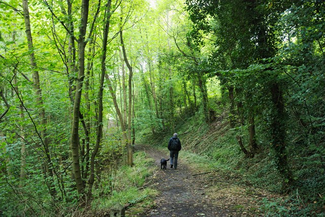
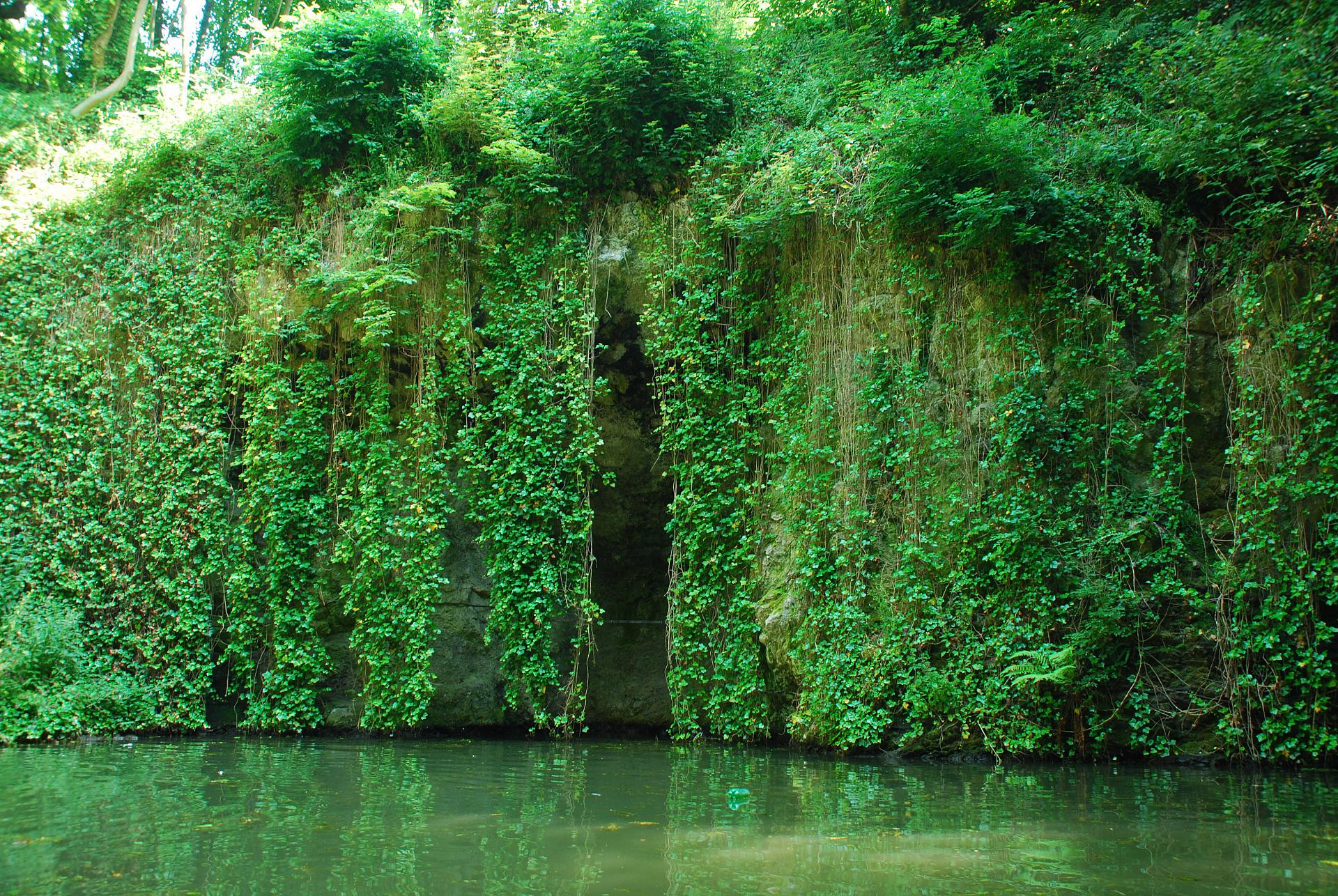
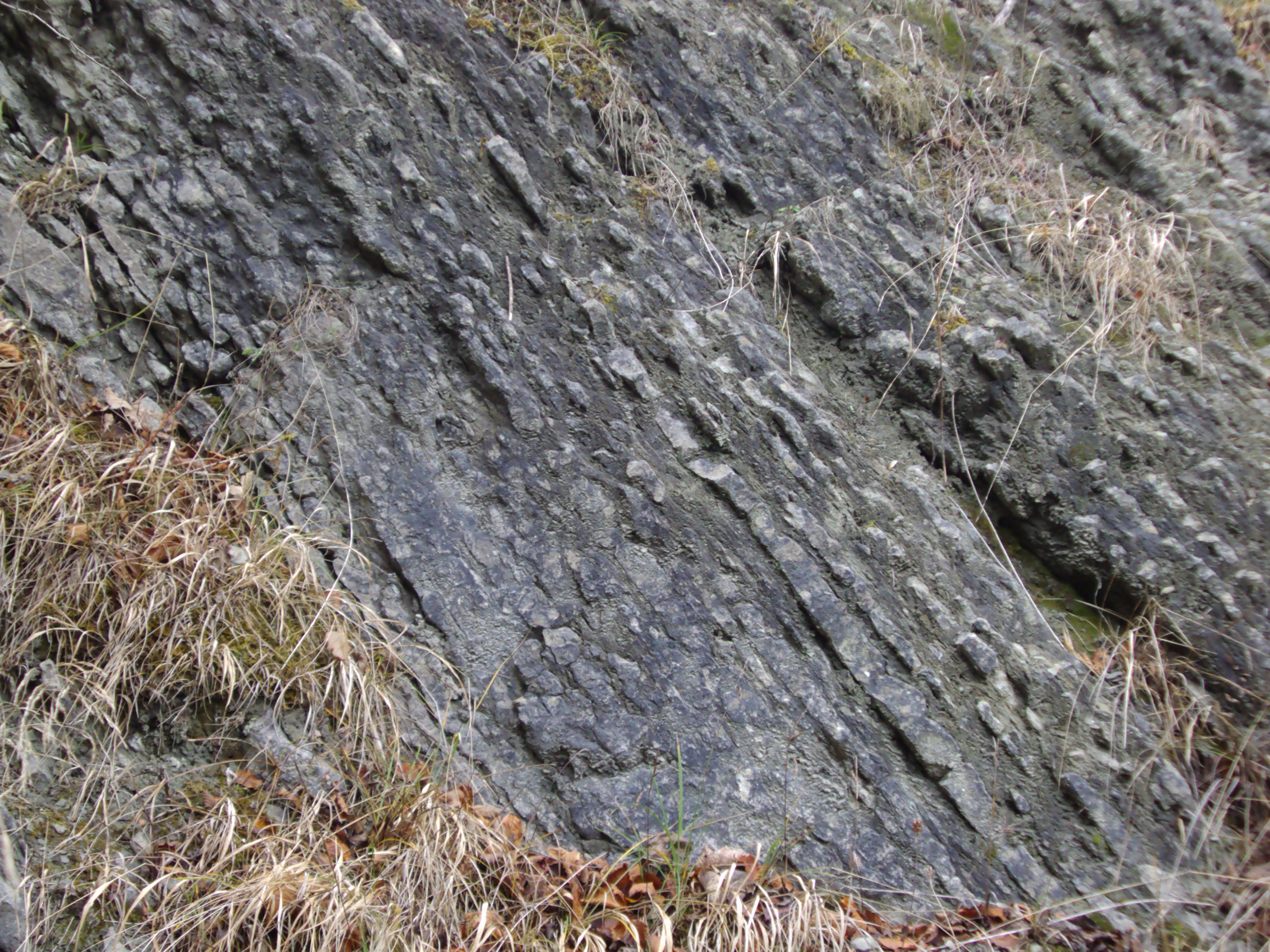
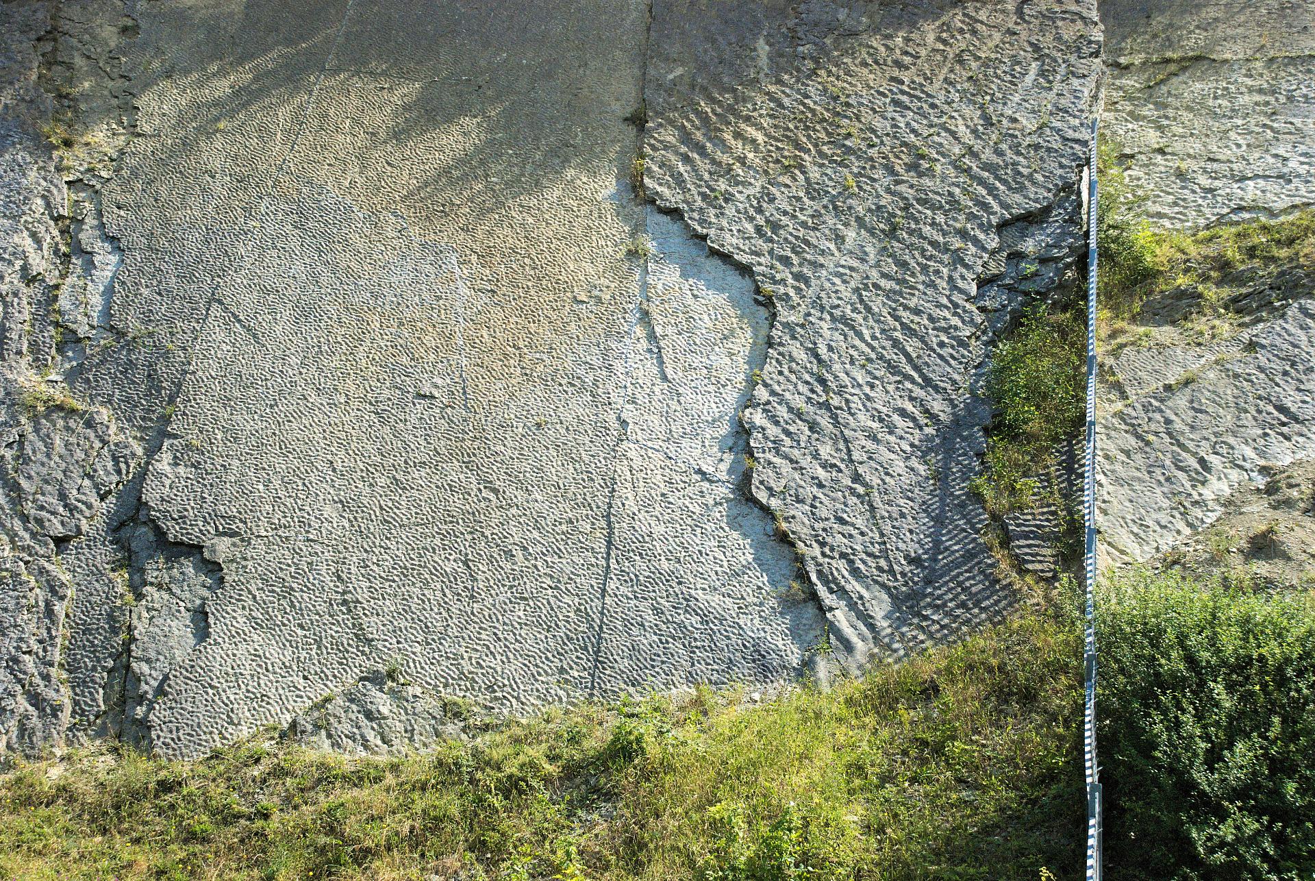
This walk answers that question by crossing four limestone hills and journeying through 428 million years of the Earth’s history.

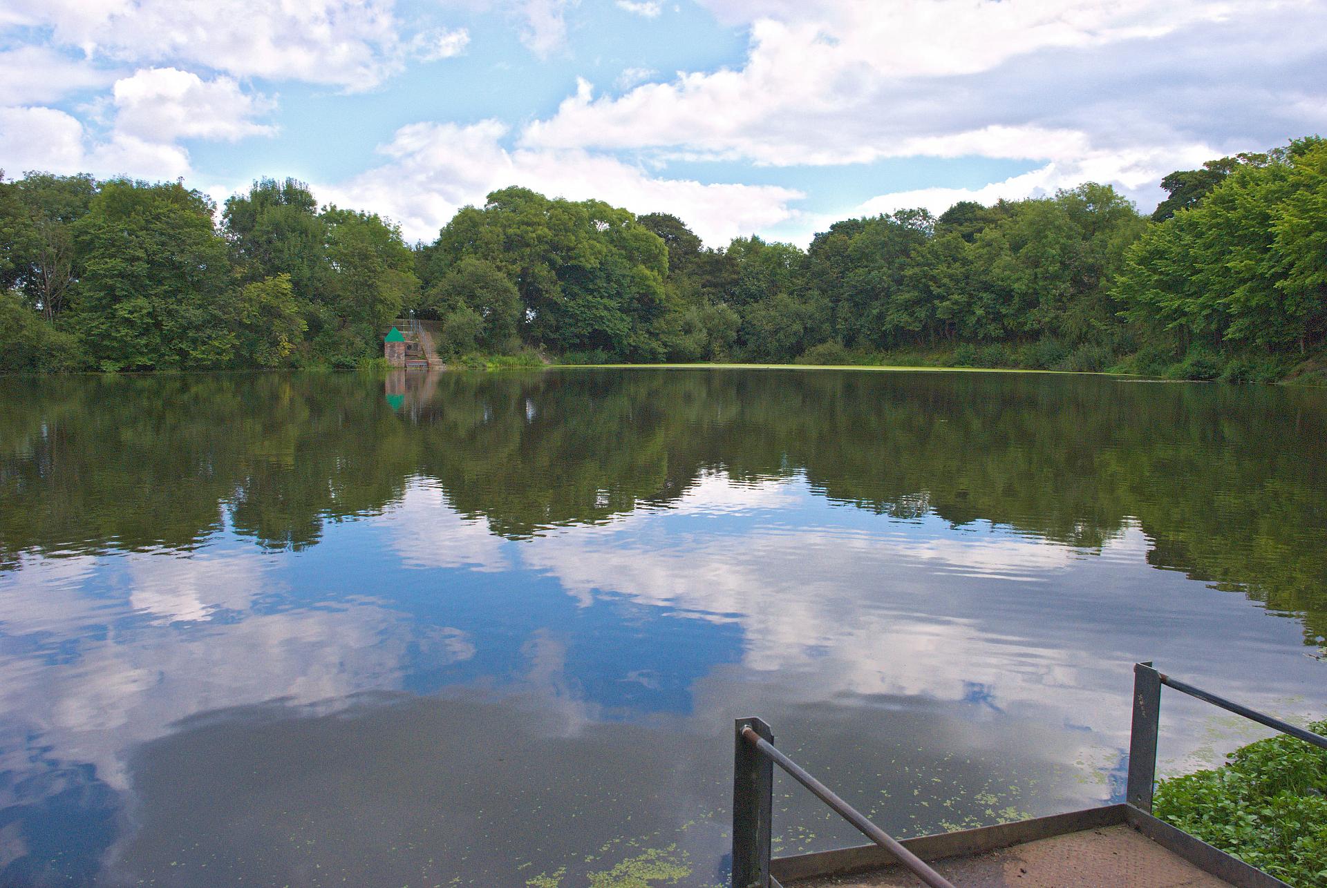
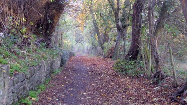
Enjoy panoramic views over the West Midlands, explore a leafy green corridor through the heart of the Black Country and even search for fossils. 

Follow the walk by clicking on the map pins
or downloading the guides below

Location: Dudley, West Midlands
Start point: Dudley Priory, Priory Park, DY1 4AY
Finish point: Wolverhampton Road, Sedgley, DY3 1QR
Keep an eye out for: 'Dudley bugs' - a fossil unique to the area

Dudley walk credits

Thanks to - 

Mike Jackson for creating the walk and providing photos

Graham Worton, Keeper of Geology at Dudley Museum and Art Gallery for photos, advice and the audio interview

Caroline Millar and Rory Walsh for producing the walk materials

Wolverhampton Art Gallery and Dudley Museum and Art Gallery for kind permission to reproduce images from their collections

Other photos are reproduced under Creative Commons Licenses

Some suggest the Black Country's factories and furnaces inspired JRR Tolkien's Mordor in The Lord of the Rings