Welcome to Kenilworth Castle.Today it is not just the castle we will be exploring, but the landscape surrounding it.
It has some fascinating stories to tell us about how people have used, adapted and transformed the local environment, for a variety of reasons from war to sport, spectacle to solitude, from medieval times to the present day.
Let's discover how 800 years of war, vanity, profit and pleasure have shaped this landscape.
From the car park face uphill (with castle on your left), look between the grassy mound and the castle walls, and take the footpath you will see there. Descend past a metal railing into the castle moat and follow the walls until you reach a stile. Cross the stile and take the footpath which leads up the little bank to your left. At the top of the bank you will see a gate in the wall just ahead and to the left; stop here.
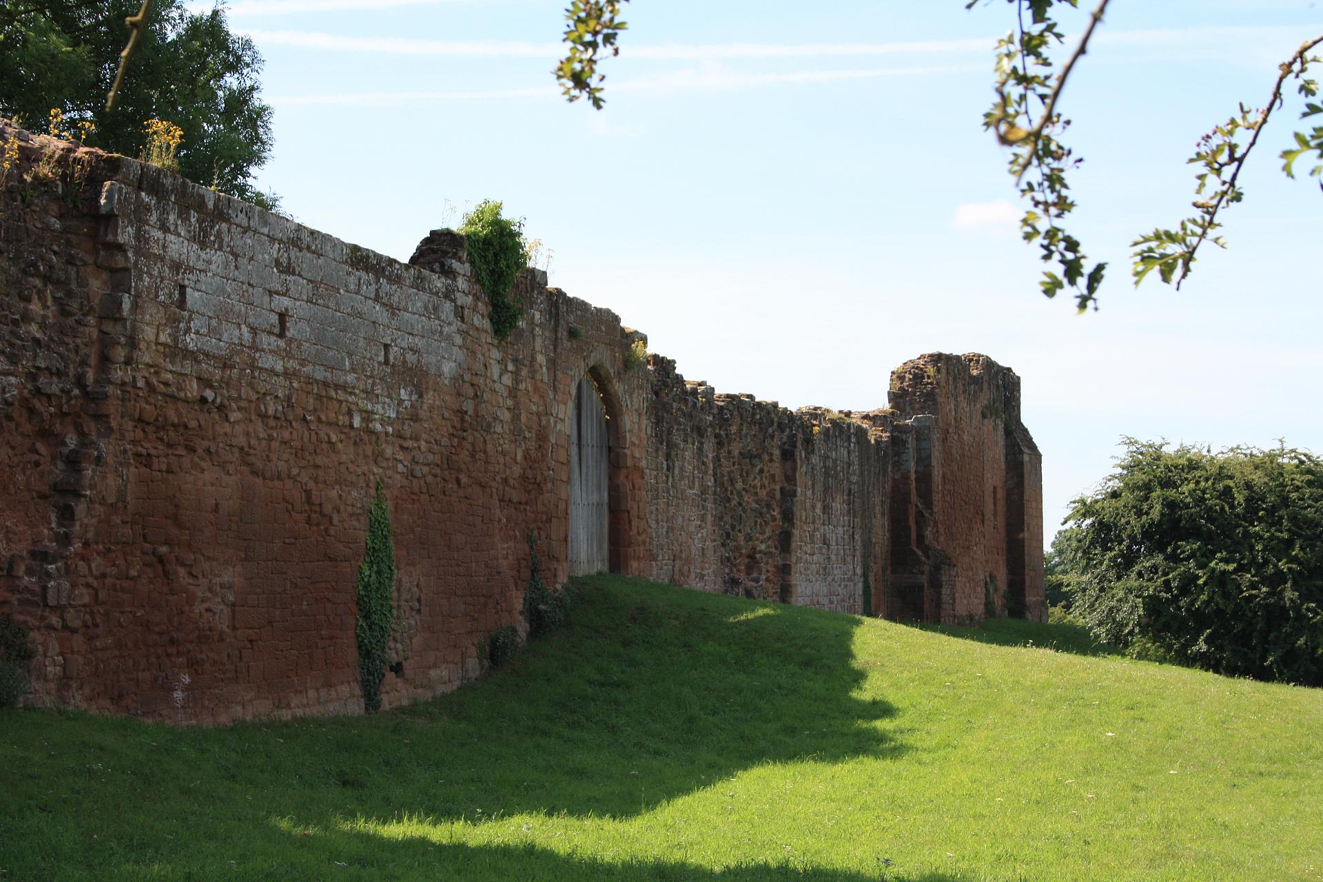
2 Water Gate
This gate in front of us is called the Water Gate. Normally a water gate provides direct access from a lake or the sea - but look around at the countryside here: do you see any water?
There are meadows, fields and hedgerows aplenty but there is no lake, and the castle is about as far from the coast as you can get. So why did they build a water gate? The next stop on our trail will reveal the answer but for now look over to the lowest point in the meadow to our right. The line of trees and shrubs marks the course of a small brook.
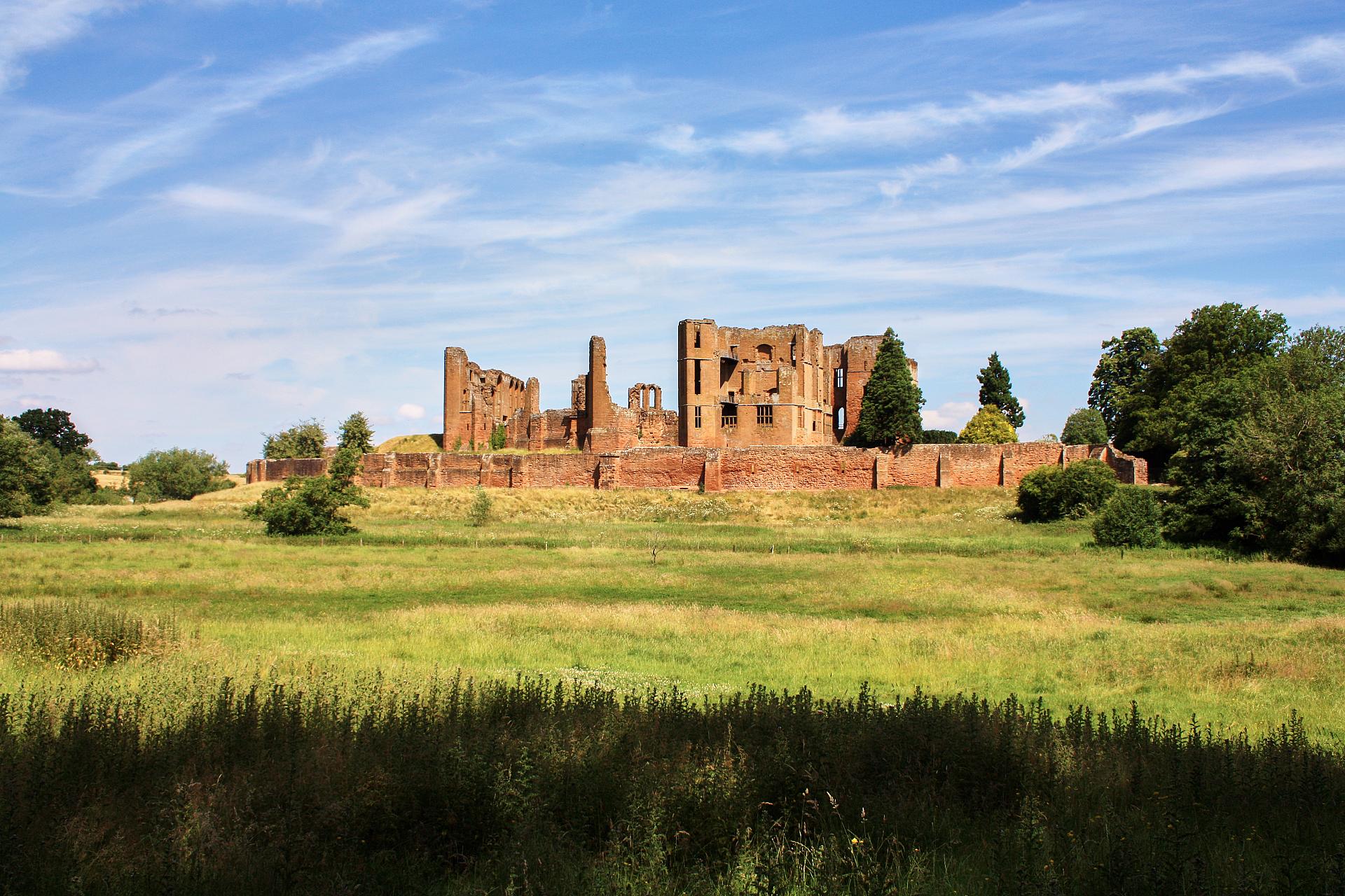
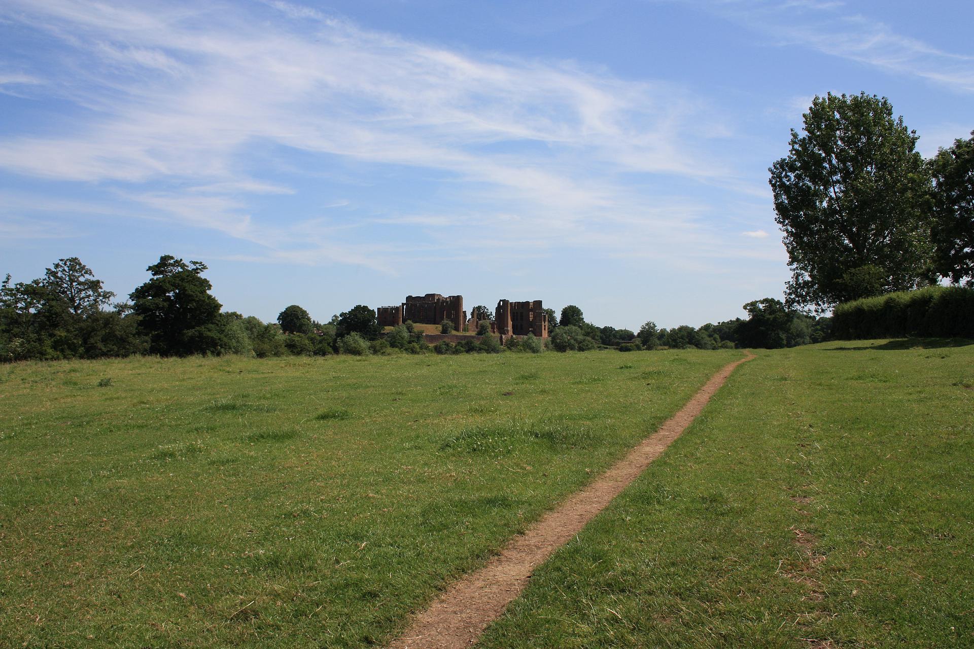
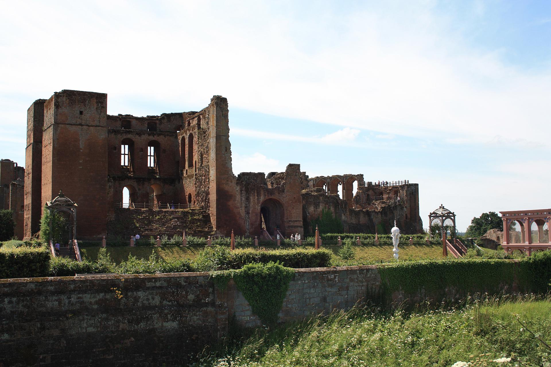
Before we move on, take a closer look at the castle walls. Did you notice their lovely warm orange-red colour? The castle is built of New Red Sandstone, which was mined locally. From where we’re standing by the outer walls it is clear the castle sits on higher ground above the meadows below. Geoffrey de Clinton, who built the first castle here in the early 1120s, chose the location because of this natural knoll, or hill. It meant the castle looked out over the surrounding area and was more difficult to attack.
From its earliest days then, people used the natural features of the landscape to their benefit. As the years went on the adaptations they made here became even grander.
Follow the path alongside the castle wall. After 200m the path begins to bend to the right, away from the castle, to head slightly uphill. Almost immediately you will see a gap in the hedge and a footpath sign. Go through the gap and follow the path alongside a small bank for 20m until you see a small set of steps leading up it on your left.
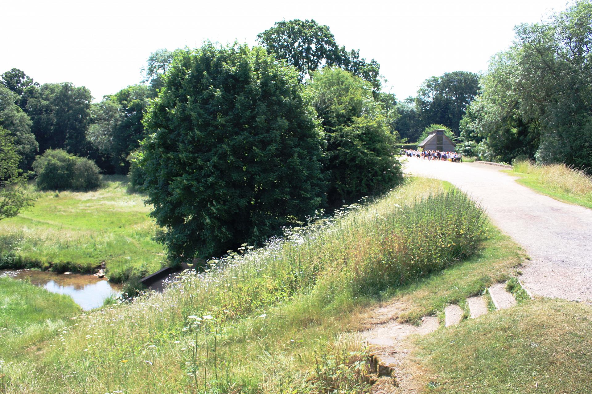
Climb the steps onto a wide causeway and turn left to see the castle up ahead and an information board about Mortimer Gate. Directly across the causeway from where you came up another set of steps leads down the bank on the other side. Go and look down here and you will see a brook flowing through the meadow below.
3 Causeway
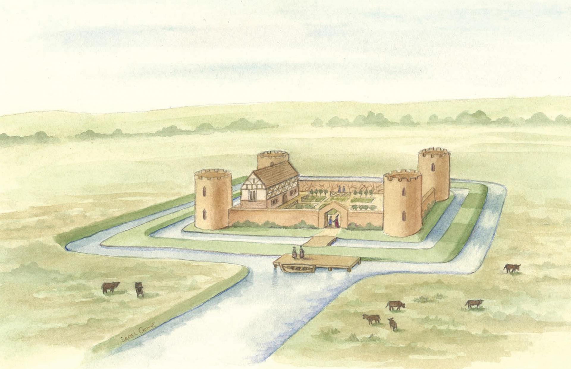
A causeway is a path of compacted earth, often used to cross low or wet ground. In this case, it provided a route over a stream called the Finham Brook, which we saw evidence of at the last stop. However, here the causeway did not just cross the brook, it acted as a dam to stop the brook.
By the 13th century King John owned the castle and decided to extend the building and increase its fortifications. Between 1210 and 1216 he ordered the brook to be dammed. This flooded the meadows, creating a large mere or lake called the Great Mere. Like a moat, this added another layer of defence and helped protect the castle from attack. The water stretched for 100 acres (the size of 135 American football pitches) and became the largest defensive lake in England.
The Mere made it very difficult for enemies to approach the castle. It also drastically altered the natural environment from meadowlands to a water-world full of fish and wildfowl. This is why we found a water gate at the previous stop; it provided access from the castle directly onto the Mere, allowing people and supplies to travel in and out.
Fifty years later these water defences were really put to the test. King John’s son Henry III had given the castle to a nobleman called Simon de Montford. However, de Montford went on to lead a movement of rebels against the King, who they felt was abusing his power. De Montford was defeated in battle but his comrades retreated to Kenilworth Castle and refused to surrender.
In June 1266, Henry’s son, Edward I, laid siege to the castle but he could not get past the Mere. He even bought barges in at night to try to reach the castle walls, but the rebels kept them at bay by throwing missiles. The siege lasted for six months until an agreement was reached. The longest siege in English history owed its success to a great lake.
With your back to the castle, walk along the causeway, past the ticket office and cross a small bridge over a ditch to reach the road. Turn right and after a few paces leave the little road and follow the footpath down to your right to a gate with footpath sign. The gate is labelled ‘Kenilworth Millennium Trail’. Pass through here and walk a short way along the footpath until you have a good view of the castle to your right across the meadow.
4 Meadow opposite Castle
Look across the meadows to the castle - if you had been standing here over 750 years ago the water would have lapped at your feet and stretched as far as you can see to your left (west). This really gives a sense of the scale of the Mere; you can imagine what a big a transformation it must have been to the local environment.
Now imagine you were trying to attack the castle from here: a catapult would hardly reach the walls and a boat would make you very vulnerable to the castle’s archers. The Mere and other fortifications, including battlements and walls, made Kenilworth a famous defensive site. Over the centuries it changed hands between the Crown and local noblemen, acting as a stronghold for whoever held the keys.
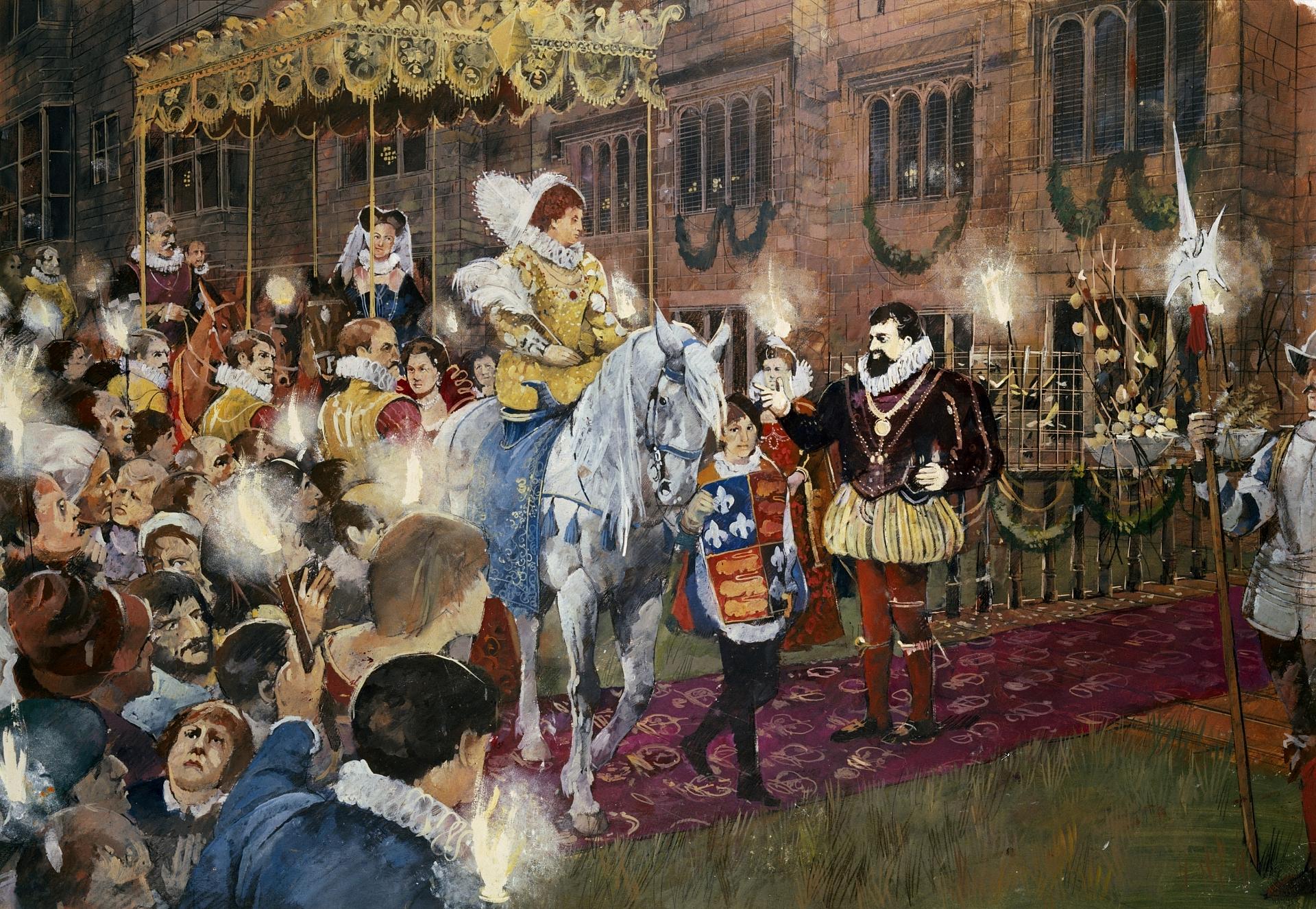
Over time, however, as defence became less important, the Mere was put to other uses, most notably entertainment. Jump forward 300 years to the reign of Elizabeth I, and the castle was owned by Robert Dudley, Earl of Leicester. Dudley hoped to marry the Queen so to attract her attention he modernised the castle, turning it into a palace.
Elizabeth visited several times, but in 1575, Dudley put on a particularly grand show for her. There were hunting parties, banquets and pageants, but the Mere provided the pièce de résistance. No expense was spared to transform it into a watery wonderland.
Being a guest that night must have felt like stepping into another world; not only were there fireworks and boats but an entire artificial island was created. Nymphs frolicked in the waters and a Lady of the Lake welcomed revellers to lose themselves in this alternate kingdom.
Shakespeare would have been 11 at this time, and living just up the road in Stratford-upon-Avon. Some say the spectacle of this extravaganza inspired his vision for the fairy kingdom of A Midsummer Night’s Dream.
Continue along the footpath through the meadows gradually heading away from the castle. Pass through the first gate and continue onto the second where there is a sign with information about the Mere (it is often partially overgrown).
5 Gate and information board
Turn and look back across the meadows to the Castle: the Mere would still have reached this point, indicating the huge scale of change that people can inflict on the landscape.
At the last stop we found out how the Mere was used to stage spectacular entertainments. But it returned once more to its original defensive purpose during the English Civil War. Early in the conflict the Castle supported the royalists. King Charles I used it as his base when he advanced on Edge Hill, just to the south-east of here, to fight the war’s first battle.
The Castle ended up in Parliamentary hands however and in 1649 Parliament ordered parts of the building be dismantled so that it could not be used against them again. Most critically they breached the dam and drained the Mere, dramatically changing the local landscape once again in the interest of defence.
Today we have little need for a defensive site here so the area has become a place for entertainment again, with walkers and cyclists making the most of the open space so close to the town centre. It may not be as spectacular as partying on the Great Mere, but today's visitors can enjoy the wildflowers and butterflies that flourish in these grass meadows.
The local farmer and Natural England carefully maintain the meadows and the habitats they provide. This includes grazing cattle to prevent the meadows from becoming overgrown.
Go through the gate and follow the path to the right, diagonally across the field towards another gate. Go through this gate, cross over a brook and follow the footpath to next gate, which has an old boat next to it. Go through this gate too and follow the footpath until it starts to bend left. Here you will find a gate with a footpath sign and a board. Stop here.
6 The Pleasance
Gaze across the expanse of the field; can you make out a series of grass-covered mounds and ditches? If you have time go and explore a little closer.
The ditches and mounds are all that remain of The Pleasance. If you were here nearly 600 years ago, before the Mere was drained, you would be standing on the edge of a small island and looking at a small castle or banqueting house.
King Henry V built the banqueting house in the early fifteenth century as an escape to leave the demands of the kingdom behind for a while. This building was out of sight of the castle as it was hidden by a small ridge of higher ground and the King reached it by boat. This hideaway was known as The Pleasance from the French ‘le plesans en marais’ or ‘the pleasance in the marsh’. Once again the natural features of the local landscape were put to use for the pleasure of the monarch.
Take the footpath by the information board, which disappears into a gap in the hedgerow. In summer the hedgerow is overgrown and the path seems more like a tunnel. Keep following the same footpath, which emerges from the hedgerow near a sign for Kenilworth local free range produce on left, and after a while Kenilworth Castle emerges across the fields to the right.
Continue on this path to head back to the Castle passing Swan Tower Cottage and Purlieu Gate Cottage until you meet the road (B4103). Either climb the grass bank to your right or cross the road to Castle Green and stop to look at castle.
7 Castle gardens
If you look over the Castle wall here you can see pagoda-tops, sculptures and a terracotta-coloured wooden aviary. These knot gardens were created between 2005 and 2009 by English Heritage, who manage the Castle.
They were reconstructed using a letter from 1575, which described the original Elizabethan knot garden. The gardens cost £2 million to recreate. Some people enjoy them as an attractive addition to the castle, but others feel they are an inaccurate simulation of the past.
Whatever your view, the gardens are a good example of how even today we continue to manipulate this environment for our entertainment. While the gardens are a relatively small-scale change, more grandiose plans have been suggested.
In 2008 a proposal was put forward to flood the meadow and recreate the Mere at an estimated cost of £16 million. Supporters say it will boost tourism and the local economy, as well as provide habitats for wildlife such as wading birds. Those against the scheme argue it would require a commercial partner to be economically viable. This would probably mean adding a hotel and leisure complex on green belt land.
Kenilworth Castle and meadows provide a fascinating spot to explore how the landscape has been used and manipulated over the centuries for protection and pleasure. The proposals for a second Great Mere suggest we are as keen as ever to change our environments to suit our needs and whims. What do you think should happen here? How do you think people will judge our activities in 800 years’ time?
One of the most important bases of the War of the Roses, Kenilworth Castle was where the longest siege in English history took place in 1266.
This trail explores the castle and the landscape surrounding it. Both have some fascinating stories to tell us.
Discover how 800 years of war, vanity, profit and pleasure have shaped this landscape. And how people have used, adapted and transformed the local environment from medieval times to the present day.
Follow the trail by clicking on the map pins or downloading the guide below
“Her Highness all along the tiltyard rode unto the inner gate, …where the Lady of the Lake with two nymphs waiting upon her, arrayed all in silks …from the midst of the pool, where upon a moveable island, bright blazing with torches…” Robert Langham, describing the visit of Elizabeth I to Kenilworth Castle, 1575