Hello and welcome to this Discovering Britain walk in mid-Wales. My name is Marianna Dudley and I am a historian at Bristol University.
For the last few years I have been studying the UK Defence Estate – that’s all the land that the military owns in Britain.
I have walked around a number of military training areas and can assure you that this walk takes you to one of the most impressive of them all. We are in Sennybridge Training Area (or SENTA) which covers 12,000 hectares of Welsh upland.
On this walk we will explore the landscape of this mountain plateau and find out about the different habitats found here including grasslands, peat bogs and forest plantations. We will also find out about some specialised and rare flora and fauna that thrive in this open and windswept environment including wild ponies, Waxcap fungi and red kites.
We will discover evidence in buildings, walls and place names of the close-knit communities who lived here before the military’s presence and find out how they made their living as hill-farmers. We will also find out why the military requisitioned this area, how they use the landscape for training, and how they are opening up parts of their land for more public access and recreation.
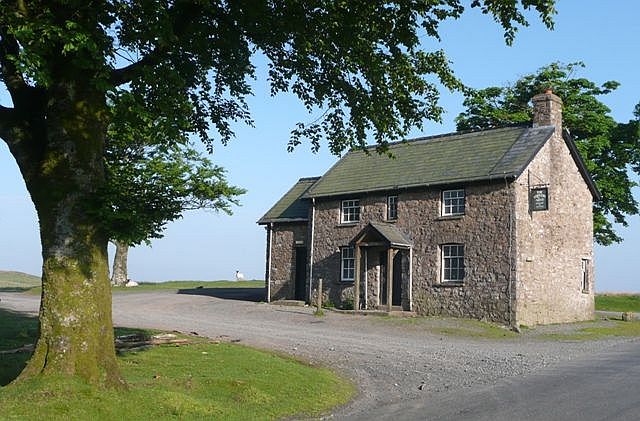
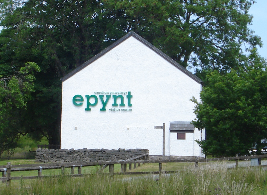
This is a circular walk, starting and finishing at the Epynt Visitor Centre. It is about 12 miles long and one of the longest walks in the Discovering Britain series so I would recommend it for more adventurous and experienced walkers.
Either before setting off or at the end of the walk, pop into the Visitor Centre and look at some of the information boards which give a good overview of the area as well as pointing out the military equipment and activity you may see and hear. Other visitors have left their comments, as have a few soldiers who have used the building as an overnight shelter on particularly stormy nights out on the mountains! I’m really looking forward to introducing you to this spectacular, empty and unique landscape. I hope you enjoy the walk!
When you are ready, go down the driveway of the Visitor Centre, over the cattle grid and stop by the road.
2 The dividing line
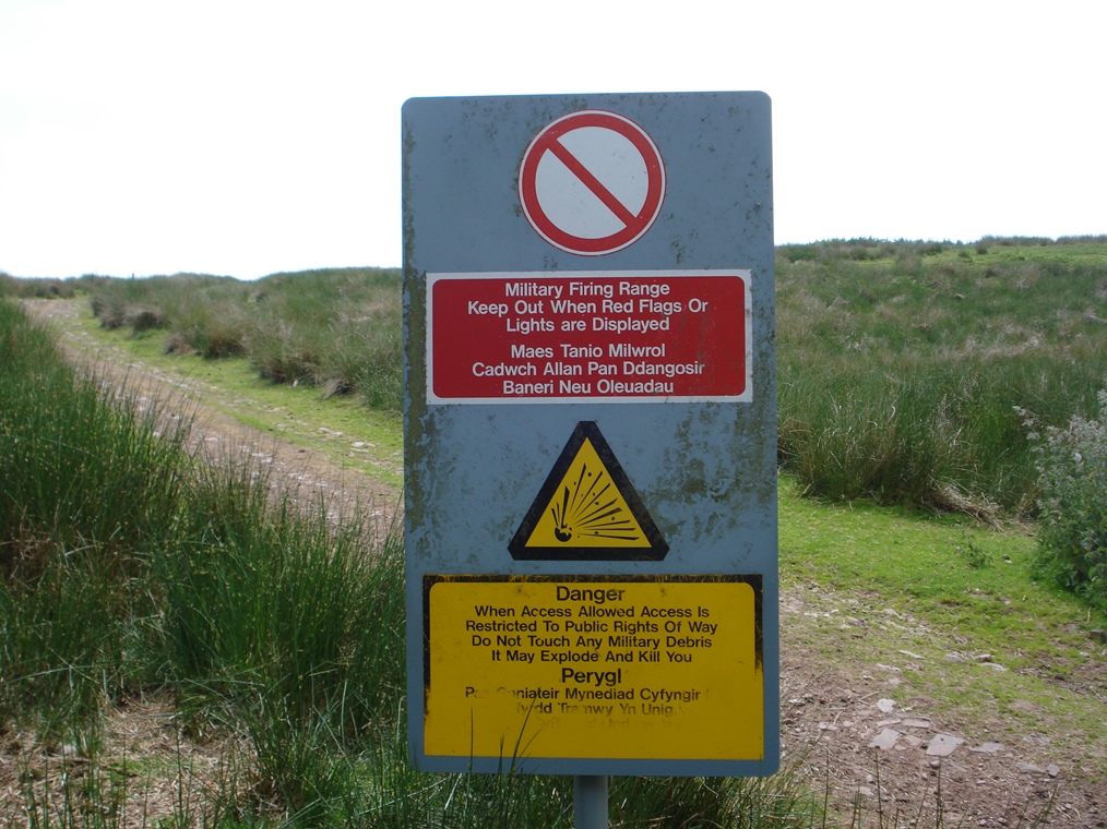
Military sites can often be intimidating to us civilians with their high fences and signs saying ‘Keep Out!’ and ‘Danger’. In fact, this country road crosses the Sennybridge Training Area but there are no signs and fences to be seen just here.
This road is actually the dividing line between two parts of the training area. In the ‘dry’ training area, soldiers do training exercises, troop manoeuvres, survival training and orienteering.
This is where we will be walking so keep your eyes peeled and you may spot some in action – camouflaged, of course! Remember that the soldiers are in active training so you must respect the fact that they are working. Learning survival skills up on the mountain is no easy business!
The other part of the training area is the ‘live’ firing area where tank manoeuvres, shelling practice and exercises using live ammunition take place. There is a high risk of unexploded ordnance in the ground so it is unsafe (and forbidden) for civilians to walk in that area. Although we can’t enter the ‘live’ firing area there are vantage points along the way from where we can see right into its heart.
Also look out for red and white flags. When red flags are flying, this means that military training is taking place in the impact zone. This happens on most weekdays so be aware that you may hear sudden noises from artillery, and see helicopters, overhead jets and pyrotechnics.
Red flags mean that permissive routes are out of bounds but the Epynt Way which we will be following is an exception. It is a special permissive route and open to walkers and riders all year round even when live firing is going on. You will be quite safe – just stick to the route which is marked by wooden posts.
Turn left onto the B4519 road. Almost immediately turn left again through a gate. Follow the track steadily uphill for about 600 metres passing two visitor viewpoints each with picnic benches and an information board. Shortly before the track reaches its highest point, it divides. Take the left track which takes you up to a third viewpoint with picnic benches and several information boards. This is marked on the OS map as ‘Observation Posts’.
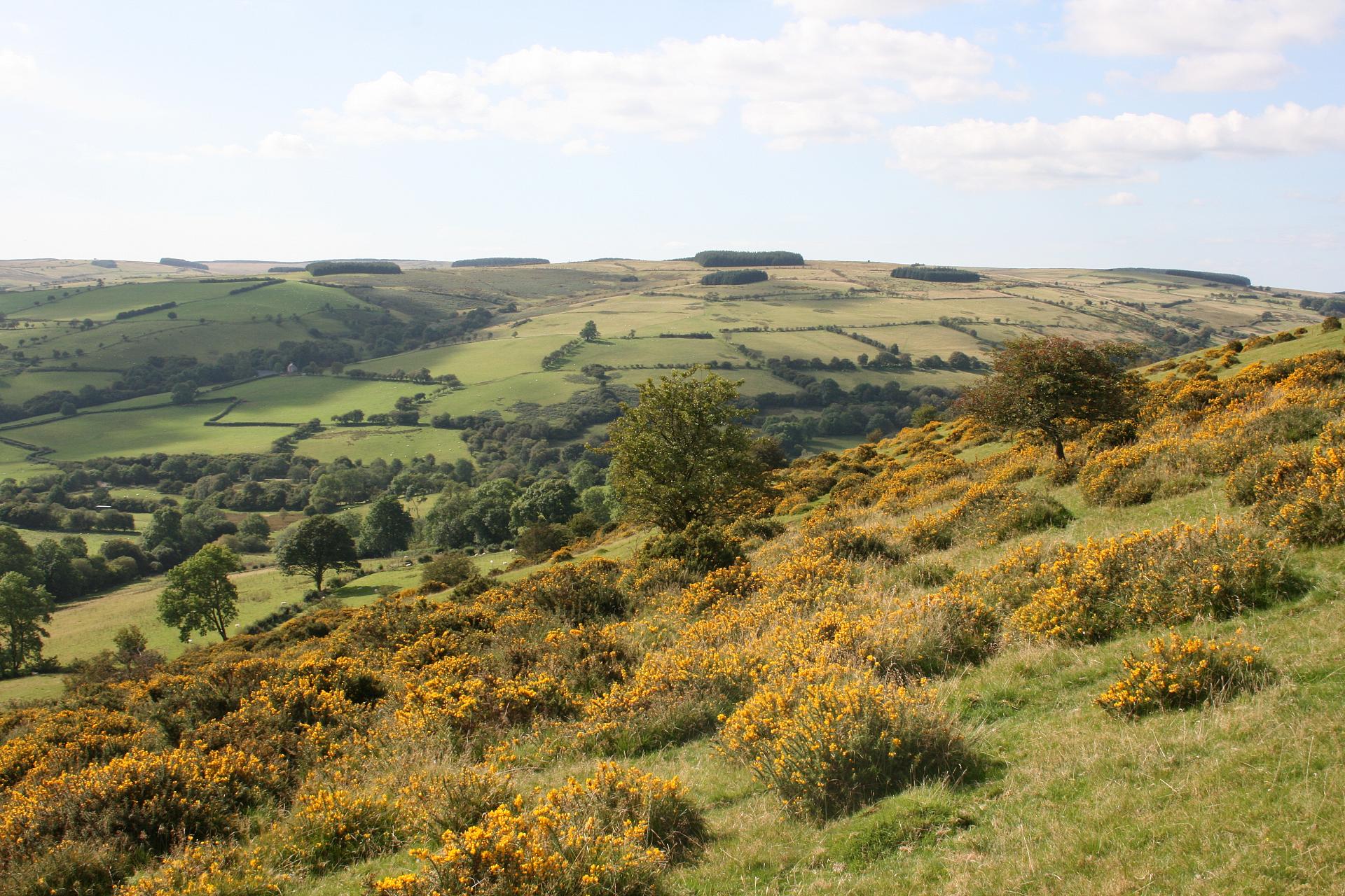
3 Upland country
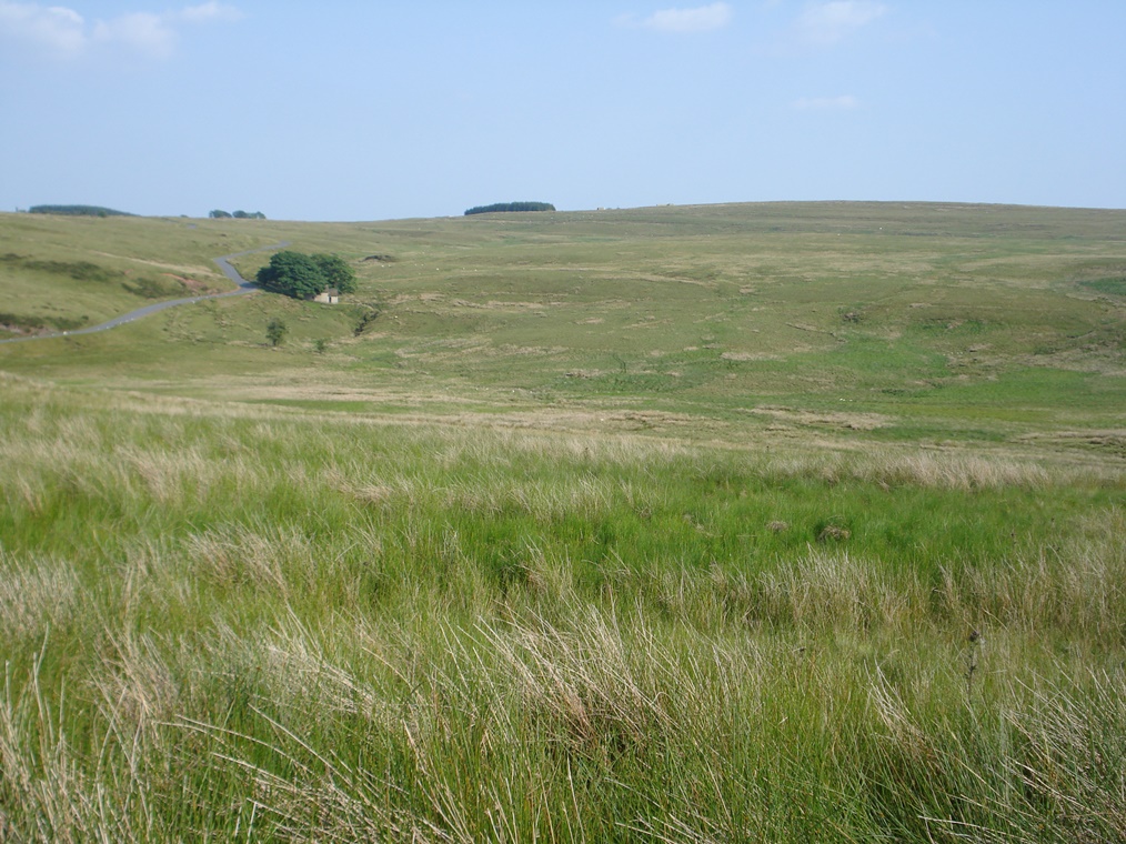
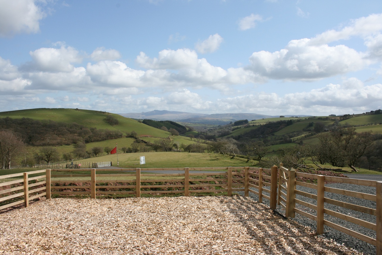
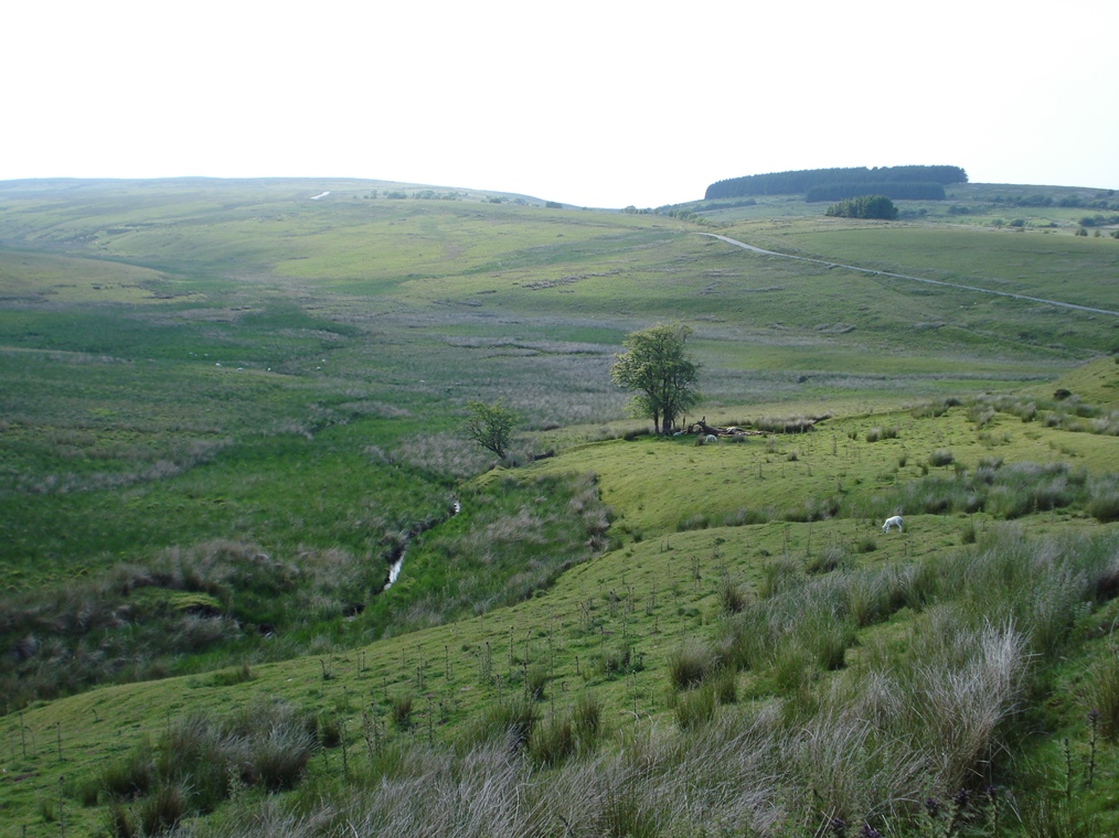
Look around at the open, largely treeless moorland that surrounds us. This is a mountain plateau, an extensive area of upland.
Wales is largely an upland country of hills, mountains and moorlands. In fact, did you know that 40 per cent of the whole territory of Wales is classified as upland (which is measured as over 250 metres above sea level)?
The uplands of Wales are actually very diverse in character.
For example, the long fingers of high ground separating the densely populated South Wales valleys are quite different from the steep scarp faces of the Brecon Beacons; the rolling moorland of the Cambrian Mountains stands in contrast to the craggy summits of Snowdonia.
This upland area of mid-Wales is called Mynydd Epynt. Mynydd means mountain in Welsh and we’ll find out more about what Epynt means later. This landscape has been sculpted over millions of years by different forces.
Underlying this area is a type of rock called Silurian shale. It was formed when this area was under the sea. Over time, movements of the earth’s crust caused the layers of rock to crack, crumple and fold into different shapes. Then came the ice ages when the movement of glaciers eroded the rock in some places and deposited vast amounts of sediment in others. So the landscape that you see today has been shaped by a geological drama that has occurred over almost incomprehensible measures of time.
Take the track away from the viewpoint along the ridge of the hill to a fingerpost. Turn left following the sign for the Epynt Way which takes you downwards to the left to cross a stream and then traverses diagonally right up the hillside for about 500 metres towards a plantation of trees. Stop when you reach the corner of the plantation.
Note: At the fingerpost, the walk route joins the Epynt Way which follows the edge of the military training area, mostly just inside the boundary fence. We will be following the Epynt Way for the next 8 miles. There are wooden posts every 100-200 metres and you should use these to guide you. Full directions are not given in this guide.
4 Forests and woods
Although we’ve just arrived at the edge of a wood, this upland environment is largely a treeless place. The poor soil quality and high winds make it difficult for tree species to thrive on uplands so they tend to cluster in the more sheltered combes and valleys that are cut by streams and rivers.
However, look on the Ordnance Survey map of this area and you will see a number of small green rectangles of woodland.
These woods are not remnants of ancient forest that covered this area but rather have been deliberately planted by the military.
They provide strategic markers, shelter, camouflage and cover for troops during exercises in contrast to the otherwise open terrain.
Elsewhere in Wales, in other upland areas that are not owned by the military, there has been large scale plantation of trees called blanket forestation by the Forestry Commission.
During the First World War, Britain had difficulties in meeting the demand for timber so the Forestry Commission was founded in 1919 with the aim of rebuilding and maintaining a strategic timber reserve.
The Second World War again placed a huge demand on our national timber reserves with Commission forests producing an estimated 51 million cubic feet of wood between 1939 and 1945.
In the aftermath of the war, the Forestry Commission embarked upon a great replenishment and expansion of its forests, particularly in upland areas where the land was not suitable for agriculture. Dense tree plantations were established across Wales in the 1950s and 60s.
These are managed as commercial forests and are planted with evergreen trees such as conifers. The trees are fast growing and have straight trunks providing a renewable source of good timber; in contrast our native deciduous trees are much slower growing so are less suitable for commercial exploitation.
Again look on the OS map, particularly to the west of the training area, to see these very different types of forest.
Blanket forestation has a big visual impact on the skylines and views of otherwise open, naturally un-forested upland areas so it is not a popular practice.
Furthermore, the dense planting of single species does not encourage biodiversity.
Other than these small patches of trees, military areas have remained relatively free of blanket forestation in comparison to other uplands.
Follow the edge of the plantation and go through a gap in the stone wall at the far corner. The route then traverses grassland towards the bottom edge of the next large plantation. After going along the bottom side of the next plantation, go round the far corner and then diagonally left up the hillside until you reach a gravel track. Turn right onto the gravel track which immediately bends round to the left. Follow the track for about 500 metres until you reach the highest point where there is a trig point and flag post.
5 Empty and exposed
Did you know that military land makes up one per cent of our entire national territory?
Much of this military land is located in uplands which are ideal because the open spaces allow large scale troop manoeuvres.
For example, troops were trained on Dartmoor in the early 1800s when Britain was at war with France and the United States of America.
Through the nineteenth century the War Office began to lease land for ongoing training – parts of Dartmoor were leased from the Duchy of Cornwall and parts of Salisbury Plain were purchased from 1897 onwards.
The military added to its landholdings bit by bit through the early decades of the twentieth century with the two world wars accelerating the process. The collection of land owned by the military is called the Defence Estate and is managed by the Defence Infrastructure Organisation. The Defence Estate today continues to be a mixture of lease and freehold land.
This area of Mynydd Epynt was established as a military training area in 1940. It was identified as being particularly suitable for several related reasons.
First the natural features of the landscape – a highland plateau – provided the open ground for testing machinery and weaponry.
Second the location – in mid-Wales away from large towns and cities – meant that military manoeuvres could be carried out without bothering too many people, but it is not so remote as to be inaccessible.
Third the predominant weather – including rain, snow and strong winds – provided tough conditions to test the mettle of troops and create a range of fighting conditions.
The bleak moorlands were particularly useful in preparing soldiers for similar environments in the Falkland Islands and the testing conditions were also used to prepare British soldiers for recent engagements in Afghanistan.
Not only are British troops trained here. Soldiers from other NATO countries are sent to be trained on these Welsh mountains. The weather here is renowned among troops for being particularly testing
From the trig point, follow the track downhill for about 350 metres. Where a track joins from the left, keep to the right. Immediately before the cattle grid onto the B4520 road, turn along the track on the left. Go between two plantations. At the far end you can see down the hillside where there is a pond and a building that used to be a roadside pub.
The route traverses left down the hillside for about 400 metres to a flat area of ground at the bottom. Follow the track uphill at the other side of the flat area. A short way up the track, the Epynt Way bears off to the right onto the top of a knoll. From the knoll follow the marker posts down the other side and over to the left.
The path crosses over a track and goes up the hillside to a plantation. Go through the plantation and exit at a metal gate at the far side. Go right around the plantation and follow the path across grassland to a steep ravine of Nant Bwch. Go down the ravine, cross the bridge, and climb up the other side. Follow the path across the grassland (there may be a few streams to cross here) to a metal gate which leads into farmland.
6 Unimproved grassland
This gate takes us through the boundary fence of the military area and into a farmer’s field.
From here we can really appreciate the difference in land use between the military land on one side and farmland on the other side. Look at the difference in colour and form.
The agricultural land is a rich green pastureland of farms with the fields separated by hedgerows.
The military land is a palette of yellows, browns and green with little to no hedging.
The farmland is heavily managed. It is ploughed by machinery and grazed by animals. Natural and manmade fertilisers are added to increase productivity.
The military land is managed in a very different way. It is classified as ‘unimproved grassland’.
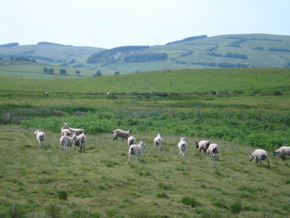
For centuries, local hill farmers grazed their sheep on these uplands but did not interfere with the land in any other way by ploughing or fertilising.
After the arrival of the military, they allowed grazing to continue as it provided a cheap and natural way of maintaining short grass which is good for training as it allows soldiers and machines to move around easily.
Unimproved grassland is also highly valued by conservationists because of the high density of plants and wildlife it can support.
Much unimproved grassland has been lost due to the intensification of agriculture and building on former farmland so remaining areas like these are very significant as they provide rare habitats for some equally rare species of plants and animal, as we shall see in due course.
Go through the metal gate and follow the path across the bottom side of the field by the ditch and hedgerow until you reach a track. Turn left along the track and follow for just under 1 kilometre. Stop where the track skirts around the left side of a bog.
7 Bogged down
Earlier in the walk we discovered that this upland landscape was moulded over millions of years by movements in the earth’s crust as well as erosion and deposition of material by ice sheets.
Most of this upland area is above 1,250 feet (380 metres) and is buffeted by winds and rain and, in wintertime, snow.
In this environment several types of habitat are dominant including woodlands, grasslands, blanket bogs and heathlands. We will encounter each of these on this walk. Here is an excellent example of a blanket bog.
The ground is usually sodden. This is caused by a high level of rainfall and a low level of evapotranspiration (which means how moisture evaporates from soils and plants into the air). These wet conditions reduce the rate of decomposition of plant matter – oxygen simply can’t get through and the dead plants eventually turn to carbon-rich peat. The water in a bog is acidic; if it were alkaline it would be known as a fen.
Specific and distinctive plants grow in this ecosystem, the most common being Sphagnum moss, but bogs are important habitats for a whole ecosystem of plants and animals. Take a moment to look closer at the green blanket – all manner of mosses and small plants will reveal themselves.
Continue along the track. After a short distance there is a fingerpost and the track crosses a stream. A short way further along the track the Epynt Way bears left up the hillside (shortly before a metal gate).
Follow the path up and across the hillside of mainly grass and bracken for about 1½ kilometres. It is boggy in places and there are several streams to cross. Keep following the Epynt Way marker posts and ignore the signposts for other paths and tracks. The route passes through a few modern metal gates.
After passing by the end of a plantation on the left the path descends steeply into a sheltered valley. There is a stream at the bottom and this is a pleasant spot for a break
8 Haunt of the horse
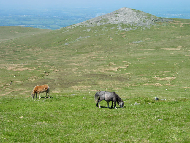
We have already discovered that this upland area is called Mynydd Epynt and that Mynydd means mountain in Welsh.
Epynt derives from Brythonic, an ancient Celtic language from which Welsh evolved. It means ‘Haunt of the Horse’ and is likely to have come from the herds of wild ponies that used to roam this area.
Welsh mountain ponies are descended from the prehistoric Celtic pony. They developed as a hardy breed in order to survive the tough climate and poor-quality grazing that these upland habitats provide.
Many wild ponies in Britain are really ‘semi-wild’ which means that they are owned but allowed to roam freely on open land. However, there are a few truly wild ponies that have never been owned or handled. They exist in the most remote Scottish islands and in the highest Welsh mountains.
Sadly, famers monitoring a herd of 200 wild ponies in the Carneddau mountains in North Wales reported that the harsh winter of 2012-2013 had a devastating effect on pony numbers with an estimated half of the herd dying due to cold.
When the military arrived in the 1940s the wild ponies in this area were caught and relocated to other areas. They can be seen today in other upland areas in Wales such as the Brecon Beacons and Snowdonia National Park. However their ancient presence in these mountains is recorded forever in the Welsh name of Mynydd Epynt that endures beyond the presence of the ponies themselves, and is captured in the logo of the Epynt.
When you are ready to move on, climb up the other side of the valley. Follow the path for about 500 metres as it traverses upwards across the hillside. Stop at the highest point (marked on the map as 400 metres) near a plantation from where there are expansive views down the Blaen Duhonw valley.
9 Special status
The unimproved grassland and the blanket bog that we saw earlier are both important habitats for native species.
Several areas within the military training area have been designated as a Site of Special Scientific Interest (SSSI).
This is a conservation designation that legally protects areas from damage through development or unsustainable management. T
welve per cent of land in Wales is protected in this way (in contrast to seven per cent in England).
Many SSSIs are internationally important for wildlife so they are also designated as Special Areas of Conservation (SAC) protecting them even further.
SACs are part of the European Habitat Directive which has created a network of important, high quality sites across Europe that are protected for the quality of their habitat and of individual species.
Sennybridge Training Area has been awarded SAC protection which goes to show what an exceptional landscape this is with such rich habitat and species thriving here.
Follow the marker posts as the route traverses across and steadily down the hillside. After about 700 metres you reach the bottom and cross the stream, Blaen Duhonw.
Turn right up the gravel track. After a short distance the footpath bears off to the right following a more level route below the ascending track. After passing a field boundary the path climbs the hillside up to the left, past a fingerpost and through some trees. Then it traverses the hillside to the right to a small ravine.
Go carefully down the ravine and up the other side. The path then climbs steadily with a wall and field boundary of Cae’r Mynach farm on the right. Stop part way up this grassy hillside.
10 Fabulous fungi
At the last stop we heard about the SSSI and SAC designation that protects particular habitats and species.
One of the rare species thriving here on the Sennybridge Training Area are waxcap fungi. (hygrocybe).
They are found in drier stretches of grassland like this hillside rather than wet and boggy areas.
They depend on nutrient-poor grassland but disappear immediately if fertiliser is added to the soil.
Waxcaps are lovely, colourful fungi. The ‘fruiting’ season runs from late August to November with the peak time here in October. If you are here during this late summer or autumn period look out for little jewels of red, purple, pink and yellow studding the grass beneath your feet.
After a short distance the path joins a gravel track. Turn right along the track and follow it for about 1 kilometre. The track is relatively level and starts to curve round to the left. Stop when you have a steep escarpment and views to the North on your right side.
11 Opening up
Along most of the walk route we’ve been just inside the boundary of the military area; here the steep escarpment marks the edge.
It’s actually only relatively recently that this area was opened up to public access. In 2000 the Countryside and Rights of Way Act updated and expanded the legislation that allows public access to the countryside. The Act provided the British public with a right to roam on open, uncultivated and upland areas – a right that walking groups such as the Rambler’s Association had been campaigning for since the mid-nineteenth century.
Military areas have unique access restrictions, mainly due to safety issues of live weapons and ammunition in the soil, but the Defence Estate committed to increase access to militarised areas. In the last decade they have worked hard to open up some military land for more public access and recreation yet without limiting training activity.
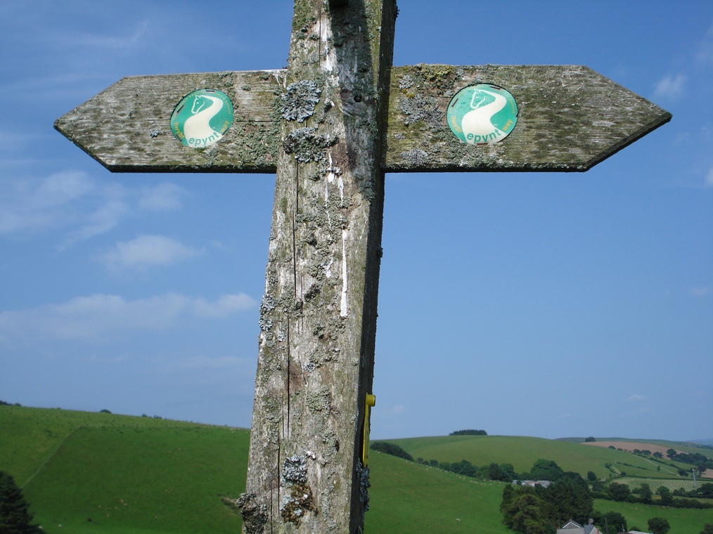
Sennybridge Training Area was identified from among the various military sites in Britain as having the greatest potential for improving public access. Part of the reason for this was the proximity to the town of Brecon and the Brecon Beacons National Park, both of which are popular tourist areas. Sennybridge Training Area has pioneered the provision of better public access and the centrepiece of this strategy is the Epynt Way.
The Epynt Way is a permissive footpath and bridleway which traces the edge of the training area and, in places, takes you right inside it. It was conceived and launched in 2003 with support from Powys County Council as well as walkers and other local recreation groups. The entire Epynt Way is 50 miles (80 kilometres) long and our walk follows it for 12 miles around the northern section of the training area and this is the most northerly point.
The beauty of the Epynt Way lies in its simplicity. Military areas are dangerous by their very nature and it is very difficult to provide full public access when they are constantly being used for training. By tracing the edge of the training area, the Epynt Way keeps walkers and riders a safe distance from the central impact zone (where the live ammunition is used) yet gives them expansive views of the training area and a really good experience of being in a militarised landscape.
Continue along the track along the top of the escarpment for just over a kilometre. Stop near where a track comes down from the left
12 Epynteering
At the last stop, we found out about the creation of the Epynt Way in response to calls to open up more of the countryside for public access and recreation.
The Epynt Way is designed for walkers and riders and has information points, parking areas, horse unloading and holding areas, and viewing points dotted along the way.
A group of local people who use the Epynt Way regularly have named themselves the ‘Epynteers’.
They aim to encourage others to use the Way and provide information about it. You may encounter some of them during your walk. I have always found them happy to stop and chat about the landscape and point out interesting features. And upon completion of this walk, feel free to anoint yourself a new Epynteer!
The Epynt Way has been a great success and is seen by the Defence Estate as a shining example of opening up access to military landscapes. It has received 2 Silver Otters, the award given for outstanding contributions to conservation, public access and heritage on the Defence Estate.
I expect that more paths like this will be introduced over the next few years at other training areas in the UK, allowing us to experience more landscapes in Britain that have previously been out of bounds to the public.
Continue along the track. After a short distance the Epynt Way veers right off the track and traverses the hillside. It follows the contour for about 1 kilometre with the spectacular Cwm Graig-ddu down to the right.
Pass the bottom corner of a plantation and follow the path up the hillside for another half kilometre to the Garth viewpoint where there are picnic benches and a car park. If you are in luck, there will be an ice cream van parked here and you can enjoy a well-earned rest and refreshment break!
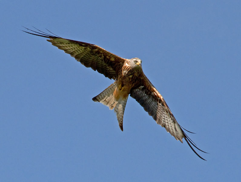
13 Soaring above
This is the highest area of the entire Sennybridge Training Area, reaching almost 1,500 feet (458 metres). Do have a rest and enjoy the spectacular views of Cwm Graig-ddu below (if the weather is clear!)
Also look upwards and see if you can spot any Red Kites. These elegant birds of prey have a reddish-brown body, white patches under the wings and a pale grey head, as well as a distinctive forked tail.
Their wingspan of two metres means that they can soar for hours without a beat of their wings, gliding on the thermal updrafts here at the edge of the steep escarpment. This is one of the best places in the country to see Red Kites in the wild.
Red Kites were actually persecuted as vermin for centuries. They are predominantly predators, feeding on a range of small mammals, amphibians and birds but they also scavenge and are known to feed on sheep carcasses. Today research has shown that they wait for larger birds such as buzzards and ravens to open up the carcasses for them but their association with dead livestock is likely to have contributed to their reviled status.
By the late eighteenth century they were extinct in England and Scotland although a few breeding pairs survived in rural mid-Wales.
Here, the rarity of the birds prevented them from being seen as vermin and instead they became valued as the symbolic ‘bird of Wales’. Generations of farmers, landowners and the rural community unofficially protected these last few birds.
In the past 20 years the number of Red Kites has soared and the birds are now a common sight here.
Elsewhere in England and Scotland their numbers are increasing too following re-introduction programmes using birds brought over from Sweden and Spain.
The Ministry of Defence plays a role in safeguarding the birds on its lands. In fact, in 1993 the RSPB asked the military to help protect vulnerable nest sites. The 160th (Wales) Brigade stepped in with a military operation.
Hides were constructed and soldiers posted around the clock to keep watch over the nests, ready to apprehend ‘enemy forces’ – in this case egg thieves. The operation was also used as training for surveillance duties in Northern Ireland.
The mission succeeded in protecting the birds. Chicks hatched in all three nests and the RSPB wrote to thank the Brigade. This is one example of how the military and conservation can complement one another.
With your back to the viewpoint, turn left along the B4519 road. Stop after a short distance where a gravel track joins the road from the left.
Note: This is the last leg of the walk (about 3 miles) and will follow the road all the way back to the Visitor Centre. Take care as you walk along the road as some people drive rather too fast for a winding country road. Stick to the verges where possible. Also remember that the land to the right (southeast) of the road is a Live Firing Area and must not be entered.
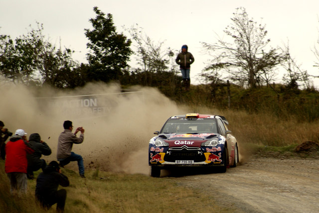
14 Rally together
We have been following the Epynt Way, a route that allows walkers and horse riders' access to this military landscape, but one motorised kind of leisure activity takes place here on the military roads too.
In its early days as a military training area the Ministry of Defence gave the Builth Wells and Carmarthen Motor Clubs permission to run the Mainland Tourist Trophy Motorcycle race on the Epynt.
It was Britain’s largest mainland mountain circuit and the race ran every year between 1948 and 1953.
An estimated 35,000 spectators congregated on the mountain to watch each weekend that it was held.
Although the military encourages lowimpact, environmentally-friendly activities in and around its lands, such as walking, horse riding, mountain biking and bird watching, the tradition of motorbike and car rallying does continue.
The Epynt remains a stage on the Wales Rally GB, part of the World Rally Championships.
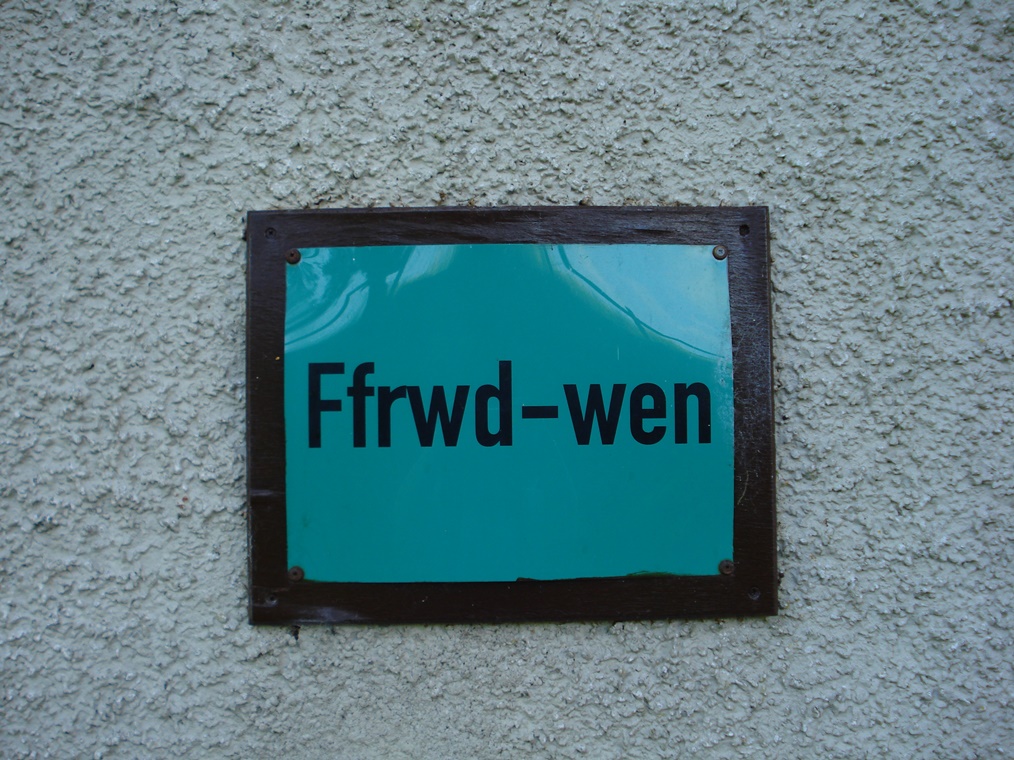
Continue along the road as it descends gradually. At the lowest point it crosses the headwaters of Blaen Duhonw. Follow the road upwards and round the corner until you reach a building on the right side which is marked on the OS map as ‘Ffrwd-wen’.
15 The end of an era
This building is a troop shelter but it was built on the site of an old farmhouse.
The Visitor Centre where we started the walk was another former farmhouse and there were others scattered across the mountain plateau.
Life for Welsh hill farmers centred upon sheep. Life on the Epynt was hard.
By the 1930s this area, along with many other rural areas across Britain, was experiencing decline.
The number of pupils at Cilieni primary school fell from 39 in 1882 to just 13 in 1939. But the community was close and by no means dead.
In the autumn of 1939, just after the outbreak of the Second World War, the War Department announced that they would be requisitioning the land for military use.
All farms were put under compulsory purchase orders.
This news came as quite a surprise to the local people. Ronald Davies who was a boy at the time remembered:
“As the army car drove off there was a terrible silence... No-one knew what was in store for them.”
They managed to get a short reprieve: the eviction date of 30 April 1940 was pushed back to 30 June to allow farmers to lamb before they moved or sold their stock.
The evictions were made in the name of wartime sacrifice although there were more vociferous protests by the Welsh Nationalist Party who saw the isolated hill-farming communities as important cradles of Welsh language and culture that were becoming threatened as the twentieth century progressed.
On the side of this building you can see a sign that gives the original Welsh name of the farm that stood here, Ffrwd-wen.
In fact many of the farms in the area have such signs after a campaign by the Fellowship for Reconciliation in Wales, a pacifist organisation that protests against the ongoing training of military troops here. The MoD permitted these signs to be put up.
Welsh place names had been replaced by English ones when the military took over. Roads, junctions and viewing points were all given names including Burma Road, Gun Park Road, Piccadilly Circus, Canada Corner and the rather uninspired Concrete Road!
These new signs help to assert the memory of the former community and way of life here before the military. I think it is good that the pre-military history of the Epynt now has a place in the military landscape, as for decades there was no recognition of the previous inhabitants.
Continue along the road as it ascends gradually. Stop at the highest point where, on the right side amidst some trees, is another building which is marked on the OS map as ‘Drovers Arms’
16 Hardy inhabitants
Throughout this walk you will have seen a lot of grazing sheep. In fact, there have been sheep here for millennia. With their warm wool coats and ability to survive solely on grass, sheep are able to survive on the rough pasture of the high hill and mountainsides all year round.
This allowed farmers to wrest a living from otherwise unproductive land. When they were fattened up, farmers moved their sheep in ‘droves’ through Wales to sell in the big English markets, taking them as far as London, Norfolk and Kent. At these large markets they could get the best prices for their prized Welsh lambs and wool.
There is an ancient network of droving routes across the Welsh mountain terrain running from west to east and from north to south. One such droving road passed through the Epynt. Here are some memories of David Jones, who as a lad helped drovers pass through Epynt in the 1920s:
“The droves were often large. On one trip from Brecon, Jones and three other men drove 1,250 ewes, and a slow lot they were! We travelled six miles by night in pouring rain...”
This derelict building was a public house called the Drovers Arms. It served the local community of hill farmers and drovers passing through the area. It would have offered them some respite from the weather and a chance to exchange news by a warm fire.
As we have already heard, the requisition of this land by the military led to the eviction of the local population.
However, farmers on land just outside the military zone were permitted to graze their sheep on the training area.
As we have already discovered, sheep are an effective means of keeping the grass short which is better for military training.
This practice continues to this day.
Unlike civilians and military personnel, sheep are free to roam the entire area, including the central impact zone where shells are fired. They occasionally pay for this freedom, though.
The Ministry of Defence keeps records of sheep deaths. In 2005, for example, a total of 51 sheep were lost – 20 of these on the firing ranges and 31 were on the roads.
Continue along the road as it descends gradually until you reach the Visitor Centre on the left side.
17 One place, two identities
I hope you have enjoyed this walk. We have explored one place with two identities: Mynydd Epynt, the ancient Welsh mountain plateau, and Sennybridge Training Area, the modern military landscape.
Mynydd Epynt is a stunning natural landscape which was shaped by tectonic forces and ice sheets. It is an upland area characterised by open moorland, unimproved grassland and blanket peat bogs. Here thrive birds of prey and colourful fungi. It is also a landscape inhabited for many centuries by farmers and their sheep.
This walk also told the story of the requisition of this land by the military at the beginning of the Second World War and its rebirth as Sennybridge Training Area. The local population was evicted, their farms and community buildings left in ruins and the traditional names of places wiped from the landscape. The natural landscape and the climate made it ideal for training troops and testing weaponry. For many decades, only soldiers and sheep inhabited these open, windswept slopes.
However, the presence of the military has protected this land from intensive agriculture, housing development and other human interference. This has preserved habitats and species that have died out elsewhere and led to much of the area being designated and protected under special conservation status.
We also discovered that public pressure at the turn of the twenty-first century prompted the Ministry of Defence to open up sections of their military training areas to the public. The Epynt Way has been a tremendous success, encouraging walkers and horse riders to enjoy these spectacular natural and militarised landscapes.
I hope you have enjoyed the exhilarating experience of openness and emptiness that is rare on our crowded island. If you did not go into the Visitor Centre at the start of the walk then I recommend that you call in now. If you would like to explore another military landscape then you might like to try the Discovering Britain walk that I have created on Salisbury Plain in Wiltshire.
Mynydd Epynt is an ancient mountain plateau and a modern military training area. Sheep roam freely on artillery ranges and red kites soar above troops on exercises. The sound of the wind is punctuated by booming mortars.
A change in legislation has encouraged the MoD to grant greater public access to its land. This walk explores the part of the Sennybridge Training Area.
You’ll be quite safe as you follow the Epynt Way footpath through a unique upland environment with dramatic landscapes, spectacular views and some surprising stories along the way.
Follow the walk by clicking on the map pins or downloading the guides below
We advise getting a copy of the Epynt Way Official Route Guide
Mynydd Epynt walk credits
Thanks to -
Marianna Dudley for creating this walk, providing the commentary and taking photos
Jenny Lunn and Caroline Millar for editing the walk materials and providing photos
Richard Brooks (Senior Environmental Advisor, Access and Recreation, Defence Infrastructure Organisation) and James Nevitt (Environmental Advisor, Access and Recreation, Defence Infrastructure Organisation) for advice on the Defence Estate
The Ministry of Defence for permission to use images of soldiers training on SENTA
Hilary Williams for kindly sharing pictures of her Great Grandmother, Caroline Evans, who ran the Drovers Arms
Anne Burgess, Graham Horn, Ian Nadin, Joshua Folks, Nigel Davies, Peter Evans, Quartl, Richard, Rosemary Winnall, Tim Cole and Tony Higgett for additional photos
The Arts and Humanities Research Council (AHRC) for providing funding for the production of this walk under the programme ‘Enhancing the Role of Arts and Humanities Perspectives on Environmental Values and Change: Policy, Practice and Public Discourses’

 Crown Copyright.jpg)