Welcome to this Discovering Britain walk in Llandudno. My name is Martin Haslett. I am a town planner and am fascinated by Britain’s beautiful towns, particularly those from the Victorian era.
Being a geographer, I’m interested in how geography influenced the growth of towns.
When I travel to a town or city that I haven’t visited before, I always ask myself, ‘Why is it here?’ and ‘Why does it look the way it does?’
The lie of the land, the climate, the local economy, historical events and people are all factors that influence the shape, layout and design of urban areas.
On this walk around Llandudno we will discover why the Victorians created a seaside resort here and how the physical landscape and coastal position influenced the design.
Clues in street layouts, building styles and open spaces will reveal a story of people with an ambitious vision and a grand plan to create something spectacular.
The walk starts and finishes on the lower slopes of the Great Orme. It is about 3 miles long and most of the route is on flat pavements and the seafront promenade. There are some steep sections and steps at the beginning but it is possible to avoid the steps with a slightly amended route. There are a few main roads to cross so do take care. I hope you will enjoy the walk!
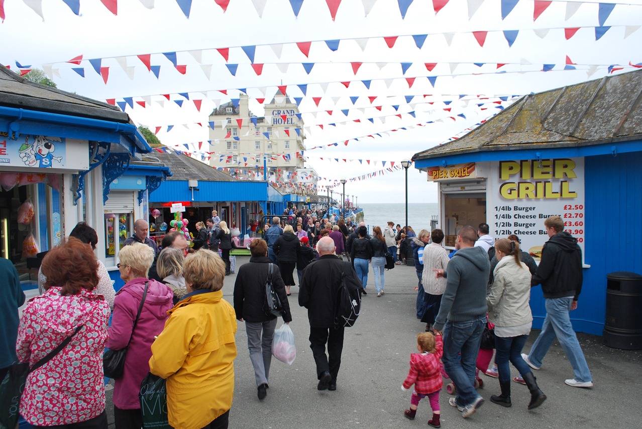
This little hut is a Camera Obscura, a darkened room where an image of the view outside is projected onto a screen. It is an invention that dates back to Antiquity but it became popular in the Victorian era as an entertainment.
It is located here on the hillside because this is one of the best vantage points for a panoramic view of the town and coast. That’s why this spot is ideal for us at the start of our walk too, to get an overview of our surroundings and understand the setting of Llandudno.
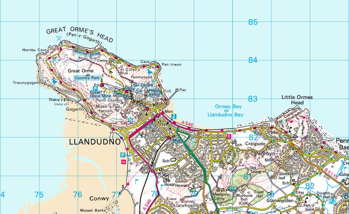
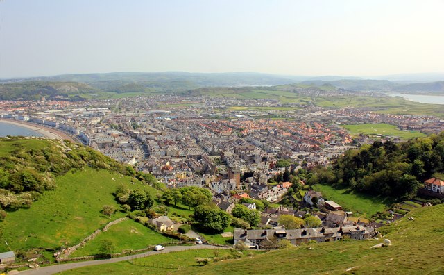
We’re on the coast of North Wales, which stretches from the Dee Estuary in the west to the island of Anglesey in the east. Look at a map and you will see that most of the North Wales coast is relatively straight but Llandudno juts out. It is a ‘peninsula’, a strip of land that projects into the sea from the mainland and surrounded on three sides by water. The curved bay that you can see from here – the North Shore – is one of the sides; the hill behind you where steep cliffs fall down into the sea is the second side; and the West Shore which you can just glimpse is the third side. If you look at an OS map you will be able to appreciate this layout better.
We are on the lower slopes of what is known as the Great Orme and the hill at the other end of the bay is the Little Orme. These rocky outcrops are made of Carboniferous Limestone (formed over 300 million years ago). Sandwiched in between – on the low-lying flat land where the main part of the town is – are older rocks from the Ordovician age (a period of geological time over 400 million years ago). Over millions of years the power of the sea has not been able to erode the limestone leaving these rocky hills but it has eroded the softer rocks in between creating two curved bays. The Victorians decided to capitalise upon these natural features in the landscape in the design of their resort, as we shall find out later.
Go down the steps or slope behind the Camera Obscura. Turn left and follow the path to Hill Terrace. Go down Hill Terrace, which is steep at first then levels off. At the end turn right up Ty-Gwyn Road. The pavement is narrow in places so take care. After about 50 metres, look for a flight of steps leading down to the left signposted to Tan-yr-Ogo Terrace. Go down the first 5 steps and stop at the corner.
3 An ancient village
Although this walk is all about the establishment of Llandudno as a Victorian seaside resort there was a settlement here long before then.
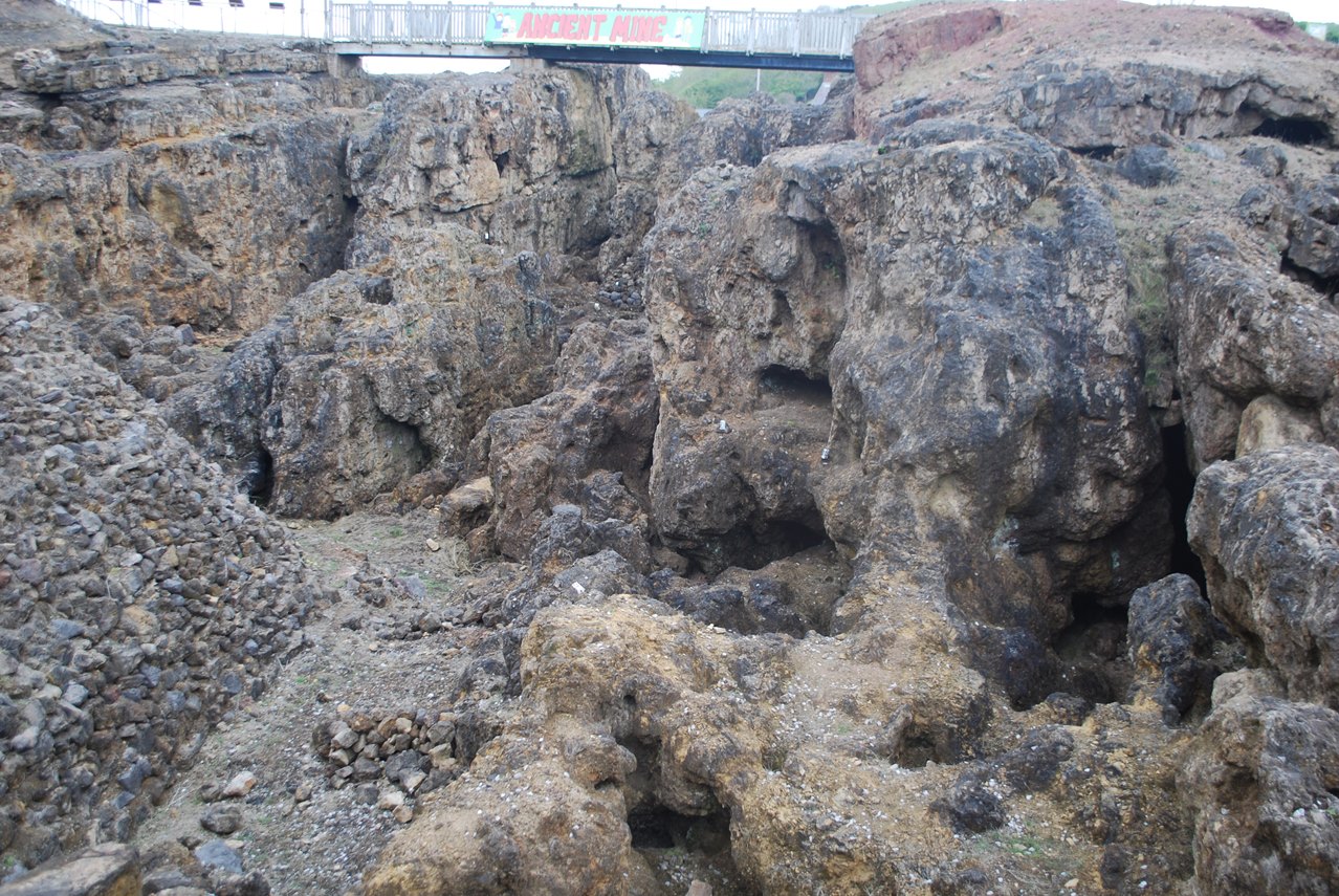
The rocks of the Great Orme contain seams of copper ore and this has been mined here since the Bronze Age nearly 4,000 years ago. Recent archaeological work has revealed that the copper mined here was traded across Europe.
Copper mining was still going on here in the eighteenth century. Many residents of the little village of Llandudno on the lower slopes of the Great Orme were involved in mining and cleaning the rock; other local people were farmers and fishermen. In 1801, the year of Britain’s first census, the population of the village was 318.
Here on the lower slopes of the Great Orme was the obvious place for the village to be situated in those days. It was close to the main source of employment – the mineral workings – but also convenient for access to the sea. The low-lying land would have been marshy in those days and sometimes swept over by the sea. This would have made the soil salty and made it of little use for agriculture so it was a rather barren and inhospitable area.
From here and as we walk to the next stop note the winding road pattern here on the slopes of the Orme and look out for irregular-shaped plots of land.
Although most of the original buildings have been replaced or modernised the street pattern and the irregular plot boundaries are evidence of the original settlement which grew in an unplanned fashion in response to the needs of the local inhabitants.
It is also interesting to note that the streets in this older part of town have Welsh names whereas they tend to have English names in the new part of the town.
Continue down the steps taking care as they are uneven in places. Before the bottom set of steps turn right into Ty-Coch Road which is a narrow lane. Continue to the end of the lane and ahead is the tram station. Turn right up Old Road, cross over the tram tracks and stop outside the Kings Head pub.
Note: To avoid the steps continue up Ty-Gwyn Road then bear left down Plas Road. At the end cross over Old Road and stop outside the Kings Head pub.
4 Changing times
The Kings Head is Llandudno’s oldest inn, built in the late 1700s. It was at the heart of the old village but it also played an important role in the development of the new town.
It is said that plans for the new town were the result of a conversation over a meal here. Before finding out more about that meeting we need to appreciate what was going on in Britain at the time.
Around the British coast you can find seaside resorts that were developed in the early Victorian era such as Brighton, Weston-superMare and Scarborough.
One of the main reasons behind this was the building of the railway network. Previously, road travel by stage coach was slow and expensive and therefore only available to the very rich. Trains made travel over long distances much quicker and cheaper.
The railways opened up the seaside to two types of people. The working classes who were employed in the factories and mills of Britain’s industrial cities were not well off but many had just enough money for a family trip to the seaside once a year. For people who worked long hours in poor conditions, it was a chance to let their hair down and enjoy themselves.
For the better-off the attraction of a seaside visit was just as strong. The Georgian spa towns, which had for so long been the places to visit, seemed rather dull after the railways brought the opportunity to visit the seaside. Bracing air and sea bathing were thought to promote good health in addition to the chance to socialise.
The North Wales Main Line was built between 1844 and 1850. It was a major railway line with trains shuttling between London and Holyhead where they connected with boat services across to Dublin. There were some people in Llandudno who saw the potential opportunity of this new railway line which passed close by.
As we’ve already heard it is alleged that here at the Kings Head plans were hatched for the development of Llandudno.
In 1846 an architect and surveyor from Liverpool called Owen Williams met local copper mine shareholders and all agreed that the town was ripe for development as a fashionable seaside resort.
Much of the land in this area was owned by the Mostyn family, who agreed to the proposals. In 1848 Williams presented Lord Mostyn with his plans for Llandudno’s avenues and promenade.
Mostyn obtained an Act of Parliament to make land available for development and his agent, John Williams, was put in charge of a building project which spanned 955 acres.
It was a planned town with a seaside promenade and a grid of wide streets. Regulations were drawn up to control the layout of the plots and designs of the buildings so that the new town of Llandudno would be a most impressive place. It was the foresight of these people that has given us the beautiful town that we are going to explore today.
Although it doesn’t fit here with our chronological telling of the story of Llandudno we can’t go past the tram station without mentioning it. The Great Orme Tramway was opened in 1902 to enable visitors to more easily reach the summit of the Great Orme. It is unusual in being a cable-hauled tram which, although modernised and re-engineered recently, still retains its original tramcars. It is now a major tourist attraction and we highly recommend a ride.
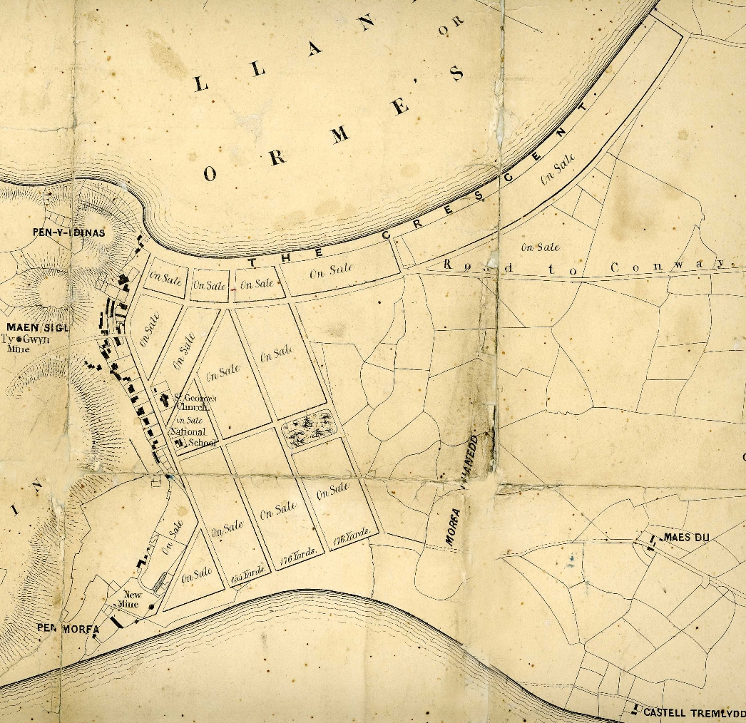
Plan showing plots for sale (c1849)
By kind permission of Conway Archive Service
Directions
Turn back down Old Road away from the Kings Head. Immediately below the tram station turn left along Church Walks which goes downhill gently. Stop at the first junction outside the Empire Hotel.
6 A bent grid
With your back to the Empire Hotel, look down the wide street ahead. This is Mostyn Street, the main street that goes through the heart of the town, and it is no surprise that it is named after the local landowner, Lloyd Mostyn, who did so much to develop this new resort.
This is where we leave the old village with its twisty roads and irregular plots of land and move into the new town with its planned layout. It was designed for both aesthetic and practical purposes – the broad streets looked impressive and were wide enough to accommodate horses and carriages.
The layout of most planned towns, particularly of this era, forms a grid pattern. Although this is the main street that goes through the centre of the town we cannot see right along it from here because the road curves to the left out of sight.
This curve of the road reflects the curve of the bay which we saw earlier from the Camera Obscura. So the natural curve of the bay has ‘bent’ the grid pattern! Look on a street map and you will be able to see this clearly. This is very unusual. In fact Nice in the south of France has a bay of broadly similar proportions but its grid of the streets doesn’t have the bend like Llandudno.
As we move on to the next stop, look out for The Tabernacle Chapel on the right at the corner of Llewellyn Avenue as we will hear more about it later.
Walk down Mostyn Street away from the Empire Hotel. At the bottom is a roundabout which has a clock tower in the centre. Stop on the corner.
7 Design principles
From here we can start to appreciate Mostyn and Williams’ plan for a grand town. There are some deliberate architectural devices used to maximise the visual effect.
First, the heights of the buildings were not allowed to exceed the widths of the streets in order to keep a sense of proportion.
Second, there is a succession of streets that lead from the main street to the sea front and junctions like this offer an enticing glimpse of the sea. In fact this road, North Parade, widens like a funnel mouth to take maximum advantage of the sea views.
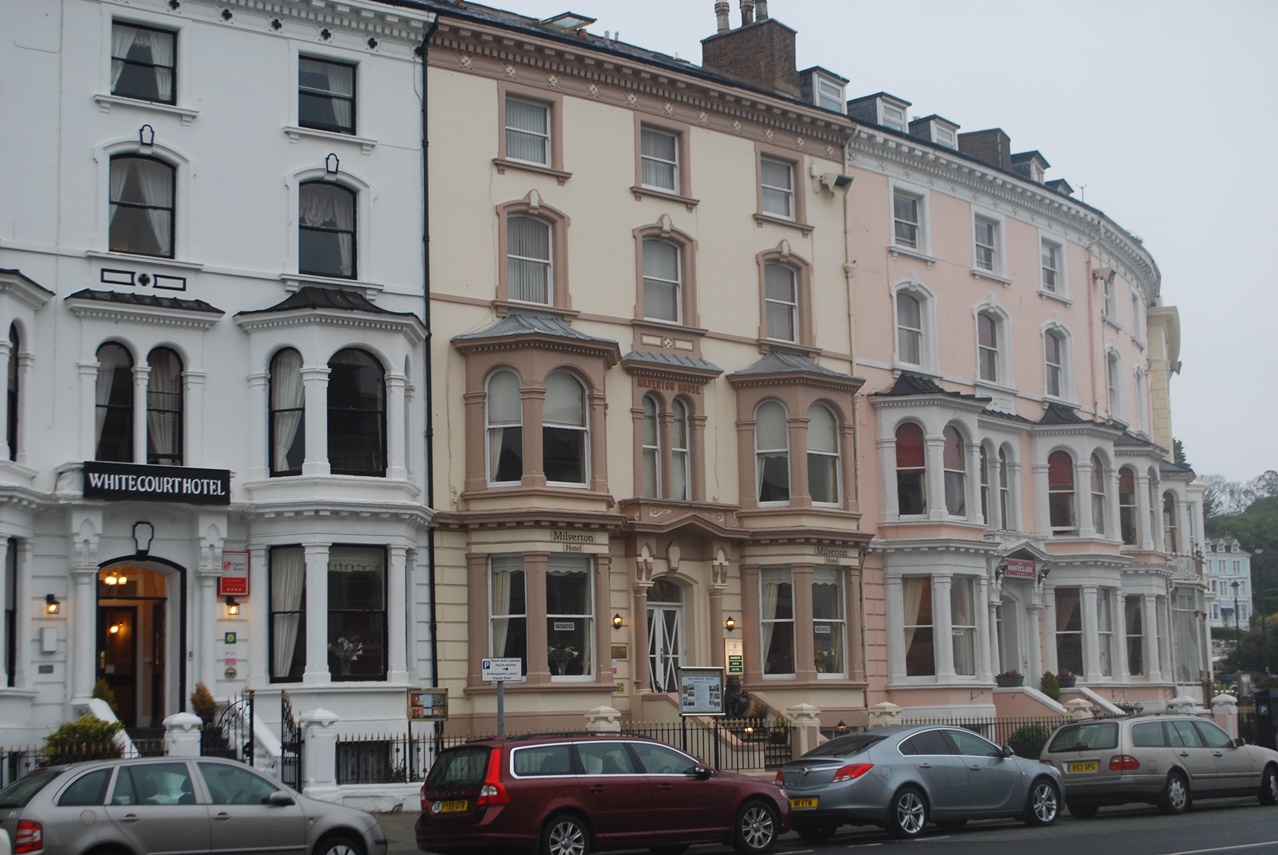
The buildings here are not the grandest in Llandudno (we’ll see some of those later) but they are still specifically designed. Each building along the terrace has the same dimensions and design.
Look above the shop facades to see how the bay windows are just on the lower two storeys of each building and reduce in size up the building.
These design principles follow those of Georgian architecture which were derived, ultimately, from Ancient Greece.
The buildings here were probably originally small hotels and lodging houses and the people who stayed here would have been less prosperous than those who stayed at the grander hotels that we shall see later.
Cross over South Parade and continue along Mostyn Street for about 50 metres. Stop by the junction with Market Street which is a narrow lane to the right.
8 Iron and glass
In this next section of Mostyn Street you can see that there is less uniformity in the design of the buildings on either side. This street has changed through the decades and some of the original buildings have been replaced but each new one has still had to follow the original design principles regarding its height that we heard about at the previous stop. You won’t find any modern office blocks or buildings that are completely out of character.
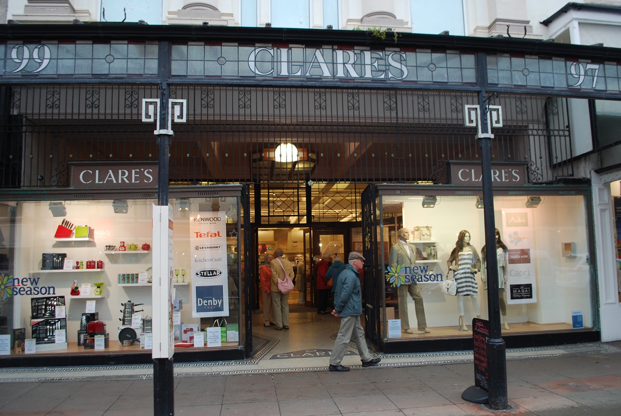
This is also a good place to see one of the special features of Victorian buildings in Llandudno: cast iron.
Look at the verandas on the front of many of the buildings with decorative glasswork giving the name of the shop. There are good examples here next to Barclays Bank and at WH Smiths. Decoration was an important part of building design to the Victorians as it helped to emphasise the importance of a building and of the people who were using it, but here the decoration has a function as well because these structures provided shoppers protection from the rain.
Continue along Mostyn Street for about 100 metres. Stop at the major crossroads with St George’s Place and Lloyd Street.
9 Urbs in rure (Town in country)
The building plan set out by Mostyn and Williams stipulated that “the town that is to be shall resemble, as far as practicable, the country”.
The Victorians were always keen to show how you could have the best of both worlds: the comfort and facilities of the town and views of the beautiful countryside and coast.
This junction is a good place to appreciate how this was achieved. Whichever one of the wide streets you look along, care has been taken to create a fine townscape.
Looking along the curve of Mostyn Street that we have just walked along the impressive buildings are framed by the Great Orme behind.
Likewise along Lloyd Street there is a view of a distant mountain beyond. Looking the opposite way along St George’s Place we have another enticing glimpse of the sea and ahead along the continuation of Mostyn Street there are distant hills.
You can see more cast iron here too. As well as the shop verandas (which we have seen along Mostyn Street) there are some cast iron lampposts in St George’s Place. These were originally gas lamps (gas had come to the town in 1860) and later converted to electricity.
The preservation of features like these helps to retain the Victorian character of the town. Look out for more decorative ironwork as you continue along Mostyn Street.
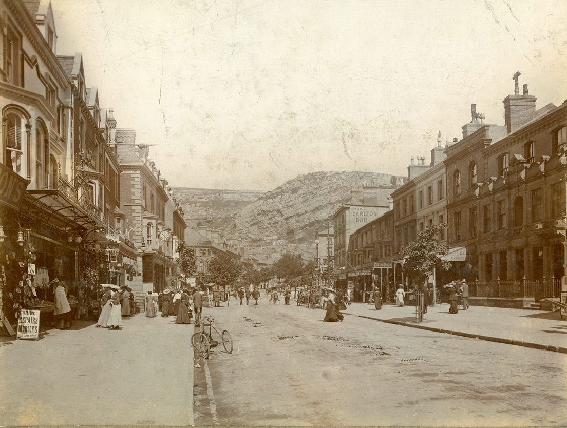
Mostyn Street (c1900)
By kind permission of Conway Archive Service
Directions
Cross over the junction and continue along Mostyn Street. Pass a church with a spire on the left then stop at the next major crossroads looking at the church with a tower.
10 A corner of Wales that is forever England
Some people came to Llandudno for holidays and others stayed for a season. Visitors to the town didn’t only need places to stay; they also needed other services including shops and churches.
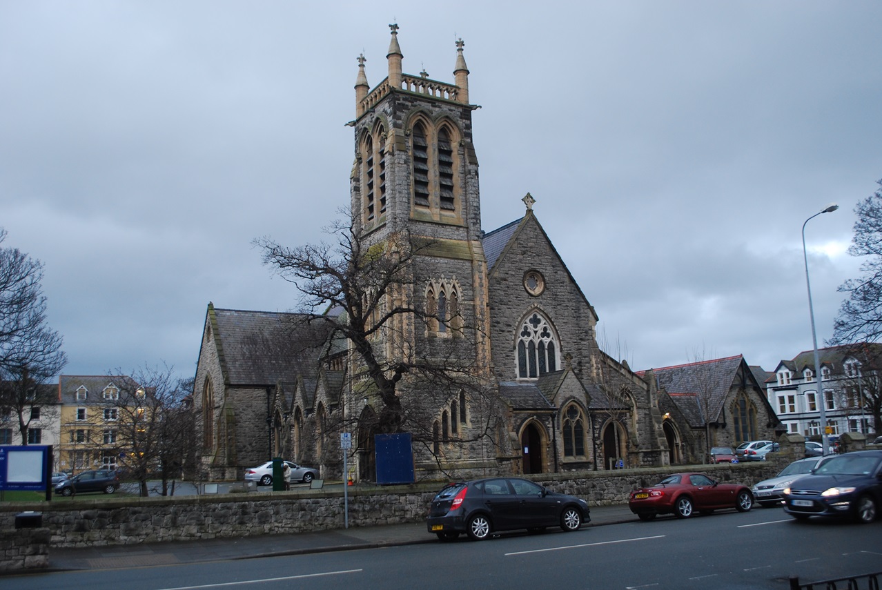
Here a whole block of the grid plan is taken up by Holy Trinity Church, designed by the architect George Felton, an associate of Mostyn.
This church was designed in an ‘English’ architectural style for English-speaking visitors to Llandudno.
Do you remember The Tabernacle Chapel that we passed at the other end of Mostyn Street? That is a well-preserved Victorian Baptist chapel.
In contrast to the largely Anglican and English-speaking visitors to Llandudno, local residents were predominately from the Non-Conformist tradition and often Welshspeaking.
At the Tabernacle, not only were services in Welsh but the architectural style was also very different, reflecting the very different religious traditions of the two communities.
Turn right along Trinity Square with the church on your left. At the end turn left into Augusta Street. Stop outside the railway station.
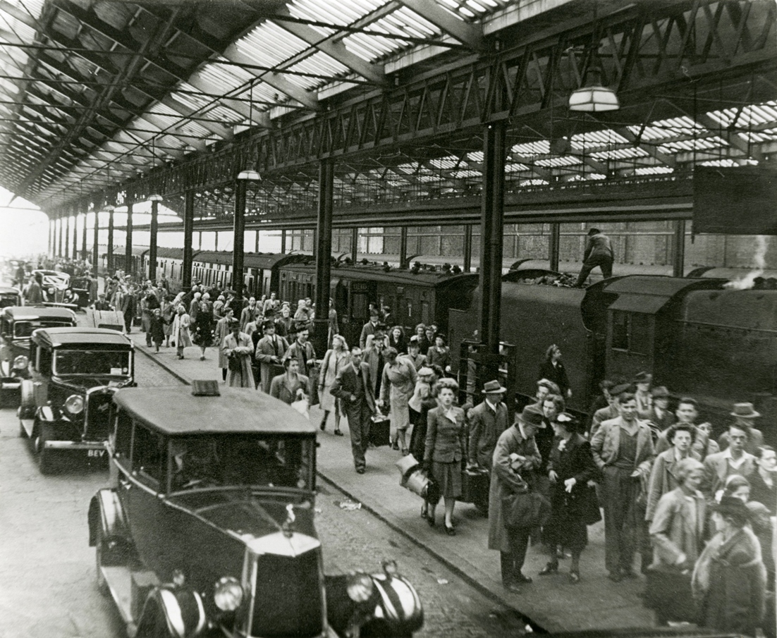
11 Let the train take the strain
The first holiday makers to visit Llandudno travelled by ship from Liverpool and were rowed ashore with their luggage. The town could not really take off without the means to bring larger numbers of visitors.
The main railway line to Holyhead did not come into Llandudno so a branch line was planned to aid the development of the resort.
The first station opened in 1858 but the resort proved so popular that a new extended station was erected in 1892. The station is situated a little out of the town centre perhaps for ease of construction and to ensure that the beauty of the town was not spoiled.
It is difficult to know how many people used the station in Victorian times as passenger numbers are not available but by the 1880s there were certainly more trains a day than there are today and they were probably fuller.
When the fortunes of the resort began to decline (as we discover in due course) so too the number of people coming by train dwindled. A significant part of the station was demolished in the late twentieth century.
However, despite the ‘car age’ train passenger numbers are generally on the rise and Llandudno station currently deals with nearly a third of a million passengers a year.
We are now going to walk along Vaughan Street, which was built in 1858 to link the new station to Mostyn Street and the Promenade.
Holiday crowds at Llandudno station (c1940s)
By kind permission of Conway Archive Service
Directions
With your back to the station go straight ahead along Vaughan Street. Stop after about 150 metres at an open space on the left side called North Western Gardens.
12 Open spaces
This attractive little triangular-shaped space is called North Western Gardens. The name came from the North Western Hotel (later renamed the Tudno Castle Hotel) which overlooks the space.
It is known to locals as Bog Island – island because the traffic once went all the way around the garden and bog because of the underground toilet block below the grass. The toilets have now been fully restored and can be accessed by the grand staircases beneath the shelter in the centre.
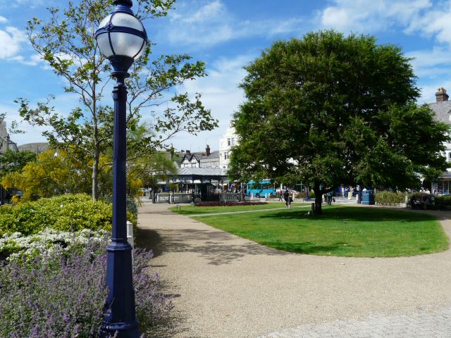
Many of the holiday makers who came to Llandudno were used to noise, dirt and overcrowding in the industrial towns and cities. They lived in terraced houses without gardens. Resorts such as Llandudno wanted to show how different life could be here. Gardens gave visitors the chance to take the air, to promenade to see and be seen, or, perhaps just admire the flowers.
As well as North Western Gardens here another popular spot to stroll was Haulfre Gardens on the lower slopes of the Orme. There were pathways between flower beds and rockeries and a tea shop.
Meanwhile, Happy Valley was a former quarry turned into pleasure gardens including formal gardens and lawns as well as an open air theatre. Walking up to the top of the Orme or all the way around it via the various paths was also a popular pursuit for holiday makers. Whatever your preference, there were plenty of opportunities to enjoy the fresh air and open spaces.
From the gardens continue along Vaughan Street towards the sea. When you reach The Parade (the seafront road), use the pedestrian crossing to go over onto the promenade.
13 People watching
Within the grid system of Llandudno there are two main streets. Mostyn Street which we have already walked along is the main shopping street; The Parade runs in parallel along the seafront.
In addition to The Parade for vehicles there is a separate paved surface for pedestrians – the promenade. You will find promenades in most seaside resorts but the one here in Llandudno is particularly wide.
This was a place deliberately created for people to walk, enjoy the sea air and views. It was a place to see and be seen. The Victorians were just as interested in ‘people-watching’ as we are today.
Old photographs show bathing machines lined up along the promenade here. There were also various entertainments on the promenade including brass bands and Punch and Judy shows. In fact, the original Punch and Judy show still performs in the summer months down at the pier end of the promenade.
Down on the beach parents could hire deckchairs while children had donkey rides or played in the sand. Over on the West Shore there were sand dunes in addition to the main beach, as well as a large model yacht pond.
As mentioned earlier, the area where the town now stands was once marshy land and in rough weather the sea would run right across it. It was an inhospitable area with no clear distinction between the end of the land and the beginning of the sea.
The building of the promenade was a major project which made a very clear boundary between the land and sea. It also acts as a sea defence protecting the low-lying area behind from the sea. Note the low sea wall which provides additional protection from high tides and storms. This is another example of the Victorians combining aesthetic and practical purposes.
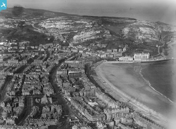
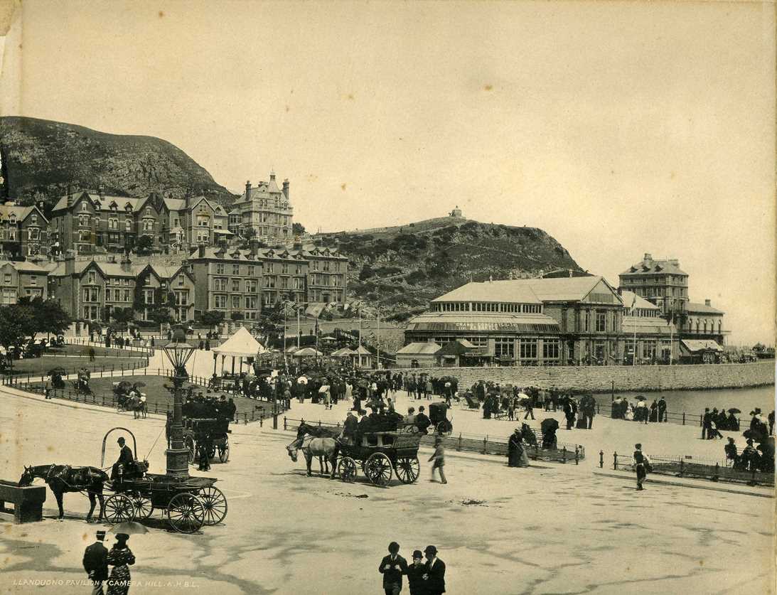
Promenade and Pier Pavillion (c1895-1900)
By kind permission of Conway Archive Service
Directions
Walk along the promenade with the sea on your left. Stop after about 400 metres opposite a modern building with a glass frontage.
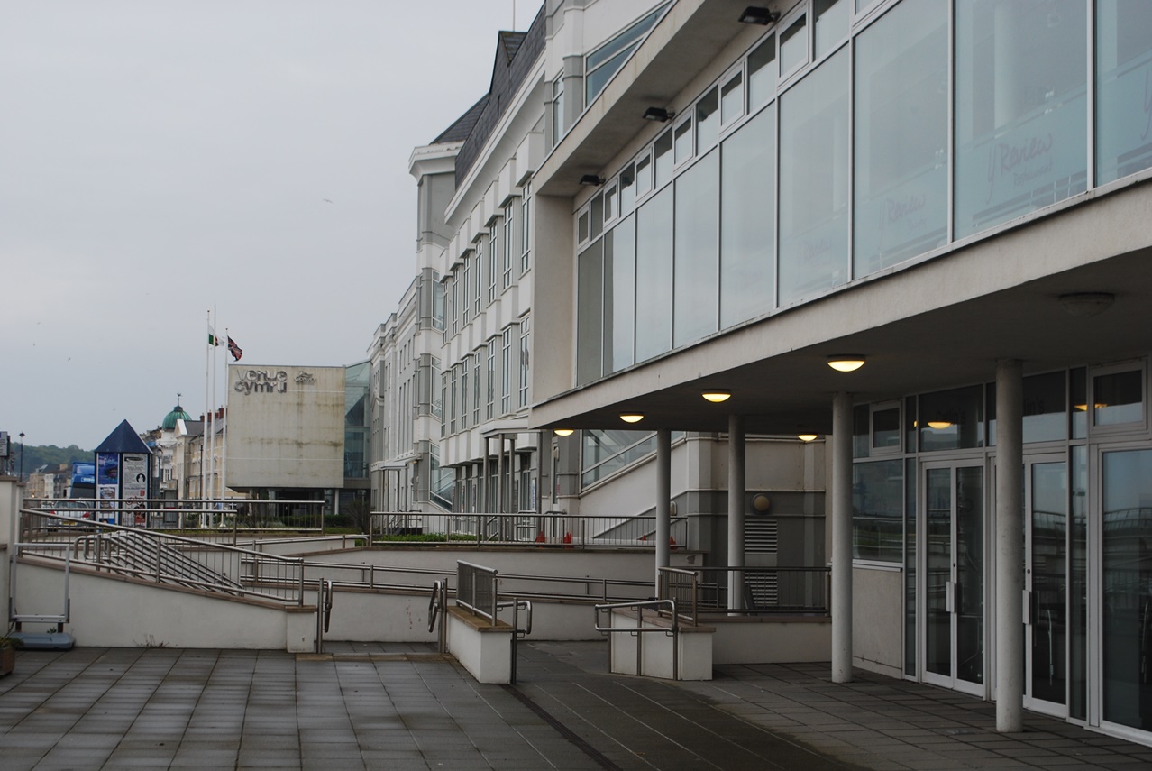
14 Let me entertain you!
Being at the seaside was – and still is – all about leisure and pleasure. In Victorian times Llandudno had six theatres which provided theatrical and musical entertainment.
Most seaside theatres went out of business many years ago; the only one to survive was the one here at Venue Cymru although the building has undergone several phases of modernisation and redevelopment.
The theatre has survived by widening its appeal. Venue Cymru is a multi-purpose theatre with three separate auditoria and conference facilities owned by the local council.
It puts on opera, ballet and classical concerts but it also hosts comedy nights, pop concerts and ‘West End’ shows. It’s quite remarkable for this small and comparatively remote town to host such big productions but that makes it another attraction for visitors. The complex is also used for conferences and trade shows.
Some people have criticised the brash, modern design of Venue Cymru which is set forward from the rest of the buildings along the Promenade. It’s a major site, taking up most of this block on the grid, and incorporates car parks which are accessed from the road behind.
The positioning and design has been done to emphasise the modernity of the scheme and to say that ‘Llandudno is going places!’ but I’m not sure what Lloyd Mostyn would have thought.
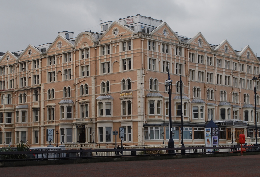
Retrace your steps back along the promenade towards the pier. Immediately after passing the end of Vaughan Street stop opposite The Imperial Hotel.
15 Know your place
This is the grandest part of the Promenade and the Imperial Hotel was one of the grandest places to stay.
The importance of this hotel is reflected in the additional height of the building and its central position on the Promenade: it is one of the best places to view the great curve of the bay.
Although all the Victorian resorts catered for a variety of visitors, Llandudno aimed to be a ‘European’ resort rivalling the great resorts of the Mediterranean.
Helped by the relatively mild climate, Victorian guidebooks billed Llandudno as the ‘Naples of the North’. Thus it always attracted a higher calibre of more prosperous visitors.
Victorian society was very class-conscious. People staying at The Imperial and other hotels along the seafront would have been more well-to-do than those who stayed at the smaller lodging houses that we saw earlier.
The Imperial Hotel played another important part in the history of the town and indeed the nation. During the Second World War the government’s tax collecting department, the Inland Revenue, was moved here to avoid the bombing in London.
In 1940 the first 200 civil servants arrived and made the Imperial Hotel their headquarters; soon 400 hotels, boarding houses and private houses were requisitioned to house the Inland Revenue departments, staff and their families.
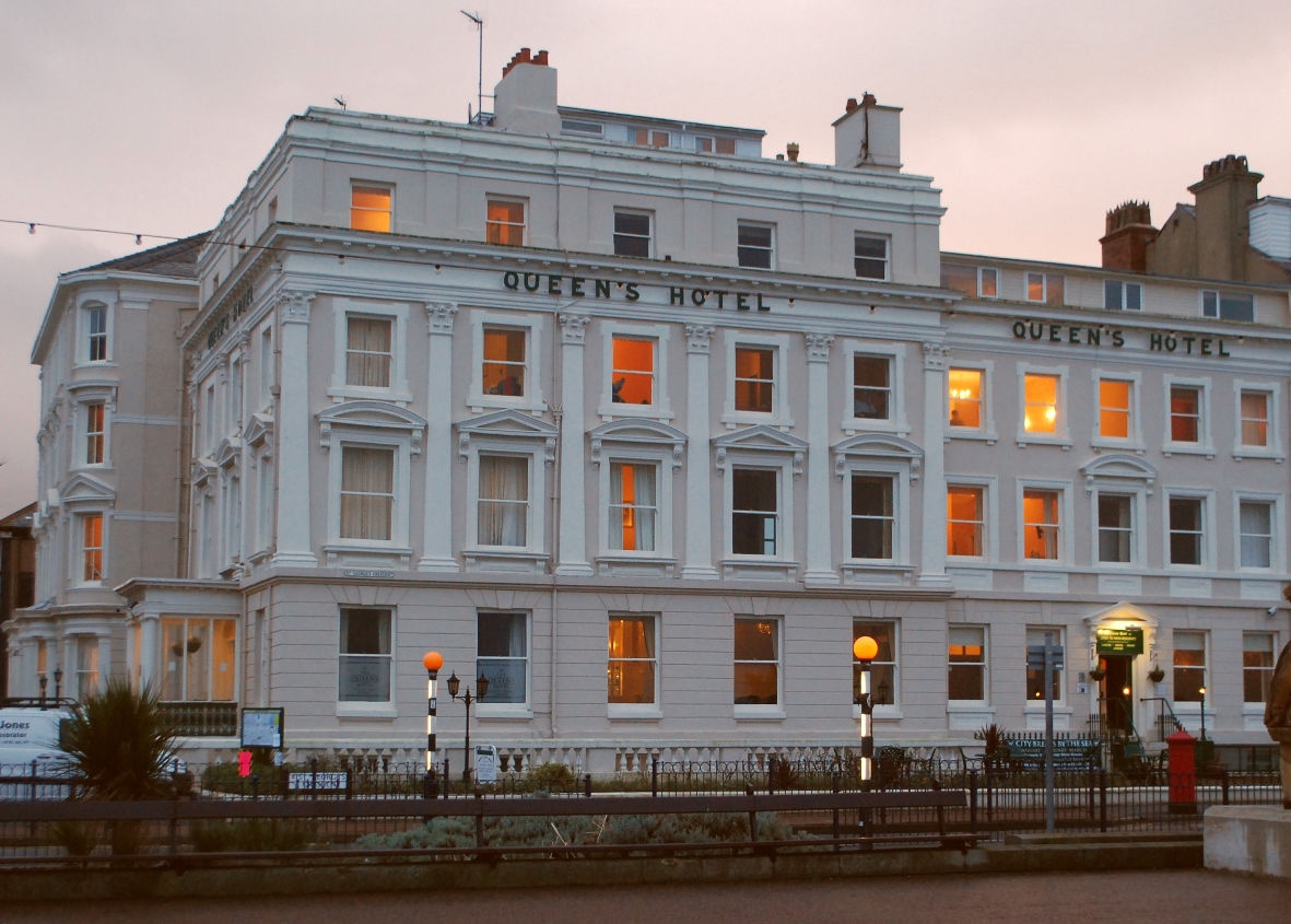
Continue along the promenade for about 200 metres. Immediately after passing the end of Clonmel Street stop opposite The Queen’s Hotel.
16 A commodious hotel
This is The Queen’s Hotel, Llandudno’s second oldest seafront hotel. It was built in 1854 by Owen Thomas who then leased it to Miss Elizabeth Hersee. She placed the following advert in Slater’s Directory of 1856:
“The Hotel is most commodiously arranged to meet the requirements of Families, Tourists and Invalids and E H hopes by every attention to their comfort. To receive the patronage which she now respectfully solicits. Hot, Cold and Shower Baths on premises. An excellent billiard table.”
We’re now going to walk along the full length of this continuous terrace of seafront hotels.
The uniform style is another example of the strict building code set out by Mostyn and his architect to ensure that the town was built to the standards that they expected.
Each hotel has three storeys plus an attic except for Queen’s and St George’s on the corners where an additional storey was allowed to mark the end of the terrace.
Continue along the Promenade for about 200 metres to the far end of the terrace. Stop opposite St George’s Hotel.
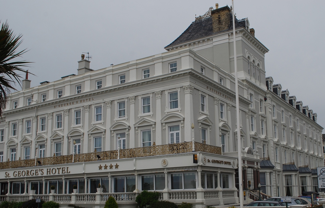
17 Important guests
St George’s Hotel was built by a 24 year old called Isaiah Davies. He was born in a farm on the Great Orme and later married the daughter of the owner of the Kings Head pub that we saw earlier.
Isaiah acquired this plot of land in a rather unusual way. John Williams, who was agent for Lord Mostyn’s family, owed drinking debts to the Kings Head.
Isaiah exchanged the debts for some land on the seafront. At the time this was not particularly valuable land but it certainly paid off in the long run.
St George’s Hotel opened in 1854 and claimed to be the first luxury hotel in Llandudno. From 1856 it ran its own bus service to take guests to and from Conwy Railway Station (before Llandudno station was built). The hotel also had the first lift to be installed in Llandudno.
It has certainly attracted important guests, including Napoleon III, Bismarck and no less than seven British Prime Ministers who stayed here on business and for pleasure.
In 1862 Dean Liddell, his family and their maids stayed at the St George’s for the summer. His eight year old daughter, Alice, was later immortalised in the Alice in Wonderland stories by Lewis Carroll. You may have seen wooden sculptures of characters from the books scattered around the town.
Queen Elizabeth of Romania stayed at the hotel for five weeks in 1890 and was delighted with her visit, describing Wales as ‘a haven of peace’. In more recent years John Major, Tony Blair and Gordon Brown used St George’s as their base during conferences.
Continue along the promenade. Stop at the entrance to the pier.
18 Like a Maharajah’s palace
The middle and late Victorian period was the heyday for piers and most resorts had at least one.
The first pier here in Llandudno was much shorter than the one you see today. It was just under 75 metres long and built on wooden piles. It opened in 1858 but suffered severe damage during a great storm in 1859.
It remained open and was used for a further 16 years but it was not really adequate as it could only be used by ships at high tide.
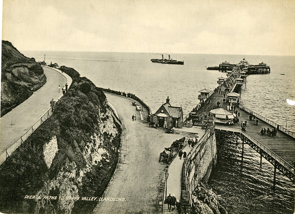
The replacement pier that you can see today took two years to build and opened in 1877. It was constructed of wrought iron lattice girders resting on cast iron columns which provided extra strength and finished with a traditional wooden decking. A landwards extension with the same design was opened in 1884 and a new landing stage added in 1891. Because of the comparatively shallow water here in the bay the pier is 700 metres long, over half of which is over the water, making it the longest in Wales and the fifth longest in Britain.
As you walk along the pier you will be able to appreciate the deliberate attention to detail in the design. Admire the elegant shelters and kiosks and the wrought iron decoration especially in the delicate balustrades and lattice work railings.
The pier was intended to be beautiful as well as functional. A British Tourist Authority report of 1975 said:
“It zooms out of the sea in a spectacular Indian Gothic style rather like a Maharajah’s palace floating on a lake. Cast iron, brackets of iron lace work, an outstandingly pretty balustrade like an enlarged fish net, ogee roofs curling away to the sky, all add up to a totally pleasurable experience.”
Walk all the way along the pier and stop at the end.
19 Walking on water
Here at the end of the pier was where steam ships docked. The Liverpool and North Wales Steamship Company operated passenger steamers from Liverpool. There were also services to Douglas on the Isle of Man. Preserved steamers still occasionally call in on excursions during the summer months.
As well as being the berthing point for steamers the pier also had a leisure use. People would have found it quite a thrill to walk out over the water. Until the Second World War there was an admission charge to go on the pier and in return the promenaders received musical entertainment from a band or the orchestra inside the Pier Pavilion.
The success of the orchestral performances contributed to the development of that great British summer entertainment of the promenade concert which lives on today as ‘the Proms’ at the Royal Albert Hall in London every summer.
Llandudno’s Pier Pavillion also had a theatre. There were other entertainments for holiday makers including penny-in-theslot machines. Going to the pier would have completed the Victorian and Edwardian day out.
The pier still retains its splendid Victorian and Edwardian elegance and is sometimes referred to as the Queen of Welsh Piers. It is certainly one of the best preserved in Britain – and Grade II listed – and is often used as a filming location for period dramas.
Steamer approaching the pier (c1900)
By kind permission of Conway Archive Service
Directions
Remain at the end of the pier.
20 Diversification
From the 1850s through to the 1950s many British people spent their holidays at the seaside and enjoyed all the facilities of resorts that we have seen today including fresh air along the promenade, playing in the sand, entertainment in the theatres and walking in the pleasure gardens. But the great British seaside resorts could not last for ever. Times were changing.
Cheap package tours to Spain and Greece became available from the 1950s. Within a couple of decades many British people were holidaying abroad and resorts like Llandudno lost their main source of income. We saw earlier how part of the railway station was demolished because of the fall in visitor numbers.
Although people started to take their main family holiday abroad increasing disposable income has meant that many can afford additional holidays, weekend breaks or day trips closer to home. Resorts have widened their range of attractions to entice visitors. Some of the activities and facilities on offer in Llandudno may have surprised our Victorian forebears: a skate park, two golf clubs, art galleries, night clubs, a dry ski slope and toboggan run, and a cable car that we shall see at the next stop. There is also the Great Orme Mine where you can visit a Bronze Age copper mine. Conferences are also an important part of the diversification of the economy of the town as they bring plenty of bookings to local hotels.
Llandudno has successfully balanced diversifying the activities on offer and appealing to wider audiences while retaining the Victorian character and elegance of the town. Along the promenade there were no fairground rides and amusement arcades as you find in many other seaside resorts; they are restricted to the pier. Successive generations of the Mostyn family have been very proactive in ensuring that Llandudno grows and prospers yet remains unchanged.
Retrace your steps along the pier. Use the exit on the right before the Grand Hotel. Turn right along Happy Valley Road. After passing the parking area look for some steps on the left side. Go up the steps and slope and turn left at the top. To avoid the steps, continue along Happy Valley Road to the Toll House. Fork back left up the sloping path. Cross the road at the mini roundabout and go up the steps to the cable car station.
21 Conservation and change
We have seen various attractions catering to Llandudno’s visitors and here is another, which remains popular today.
The Great Orme Cable Car was built in 1969. At one mile long it is the longest Aerial Cabin Lift in the UK. The leisurely journey offers magnificent views over the town and out to sea as well as giving a bird’s eye view of the Happy Valley gardens and other attractions of the Orme.
The cable car is a suitable place to end our tour of Llandudno as it is symbolic of the way in which the town has adapted and reinvented itself in response to changing circumstances. The old mining village of Llandudno was transformed into a fashionable seaside resort. With the shift to holidaying abroad the town offered different forms of accommodation and new attractions to ensure that people will still visit.
Although Llandudno has changed it has kept the best of the past and retained its character: the promenade and its impressive hotels, the pier and pleasure gardens, and the spectacular shopping street with its cast iron decorations. I think Llandudno has been fairly successful in combining conservation with change. It’s a town in good health with a promising future. The natural beauty of the landscape which was exploited by the Victorians to create an impressive seaside resort remains a key attraction today.
We hope you have enjoyed this walk around Llandudno and seeing how the legacy and vision of the Victorians lives on.
We highly recommend that you take the cable car up to the summit of the Orme.
There’s a wonderful view from the top and on a clear day you can see the Isle of Man, the Lake District and Ireland. From the top you can come back down by tram.
Donkey rides on Llandudno beach (c.1890), Conway Archive Service
Llandudno walk
A coastal walk exploring the seaside sights of Llandudno
Promenades, piers, Punch and Judy – you can find these and much more in Llandudno on the North Wales coast.
In the 1840s marshland behind Llandudno Bay was deliberately chosen to create a new seaside town, intended to rival the great resorts of the Mediterranean.
Discover why and explore the 'Queen of Welsh Resorts', from broad avenues to elegant hotels, a quiet stroll in well-tended gardens to the thrill of going on the pier.
Also find out how Llandudno has adapted to changing holiday trends while maintaining its unique character.
Follow the walk by clicking on the map pins or downloading the guides below