Welcome to this Discovering Britain walk in the Elan Valley, home to a series of dams and reservoirs built during the Victorian era that supply drinking water to Birmingham.
My name is Martin Haslett and I remember first coming to the Elan Valley on a family holiday when I was a child. I was very impressed then by the size of the dams and the enormity of the project that had created them.
Little was I to know that I would later study Geography at Birmingham University and live in the city for many years and therefore enjoy the drinking water that is the fruit of all this engineering work.
The Victorian era was one of tremendous technical advances and engineering feats ranging from bridges and tunnels to engines and ships. The period also saw the construction of some enormous and spectacular buildings.
While buildings, structures and objects were designed for specific functions they were also decorated in an elaborate way.
Examples can be seen across Britain and the former Empire but the Victorians not only built to impress in the cities where their structures would be seen by many people.
Even here in this remote part of mid-Wales they built dams that were beautiful as well as functional.
On this walk we will discover why the dams and reservoirs were created here, particularly in terms of the physical characteristics of this landscape. By looking at different features of the reservoir system including the dam walls, railway and aqueduct we will find out what challenges the engineers faced in construction and operation.
We will discover the impact of the dams and reservoirs on the habitat and wildlife of the area as well as the local communities affected by their construction. We will also find out how this water resource and the wider area is managed and protected now.
I spent my career as a town planner. I have not spent all my time planning towns but have worked in rural areas too. This sort of work nearly always means protecting the countryside from unsatisfactory development while still encouraging the rural economy to thrive. This is not an easy balance to maintain.
I have never had the opportunity to work in scenery as magnificent as this but through this walk I wanted to explore the role of the planning system in rural affairs and in protecting the countryside, from the magnificent to the mundane.
The walk is circular starting and finishing at the Elan Valley Visitor Centre. It is about six miles long and there is an option for a short extension at the end. Much of the walk is on good tarmac paths but there are some steep rocky sections too which can be slippery in wet weather so take care. We hope you enjoy the walk!
From the Visitor Centre entrance turn left and left again to walk down the full length of the car park with the embankment on your right. At the end of the car park continue on the paved footpath. Go through the gate and past the stone building. Stop at the base of the dam face.
2 An expanding city
Until the late 1800s the city of Birmingham relied on local supplies of water from wells and rivers but these were often of poor quality.
With industrialisation the population of the city expanded enormously as people moved there in search of work. Living conditions for the working classes were generally cramped and squalid resulting in periodic outbreaks of waterborne diseases such as cholera and typhoid.
There was an urgent need to supply good quality drinking water and to create an adequate sewerage system. This was a problem being faced by all of Britain’s major industrial cities at the time but nothing fazed the Victorians!
The Birmingham Corporation (as Birmingham City Council was then known) had been considering the Elan Valley as a site for reservoirs for some years.
The area had all three key geographical requirements to make the project a success: rainfall was high (1,830 millimetres per annum), the water was of good quality and the elevation of the land was high enough for the water to run gradually downhill to Birmingham by the force of gravity without the need to be pumped.
The Corporation decided to purchase 18,400 hectares (over 45,000 acres) of land which comprised the entire upland area that drains into this part of the River Elan. This was a major project and it required an Act of Parliament. The Act not only covered the purchase of the land in the Elan Valley but also took account of the needs of people downstream from the dams and along the line of the aqueduct which was to be built to transport the water to the city.
Relief model of the Elan and Claerwen watershed (1891) Courtesy of Powys Digital History Project
Directions
From the base of the dam face take the steps up the embankment. Follow the footpath as it zig-zags upwards. Take care as this path can be slippery in wet weather. At the top turn left and go through the gate. Go over to the left to the viewpoint looking over the top of the dam.
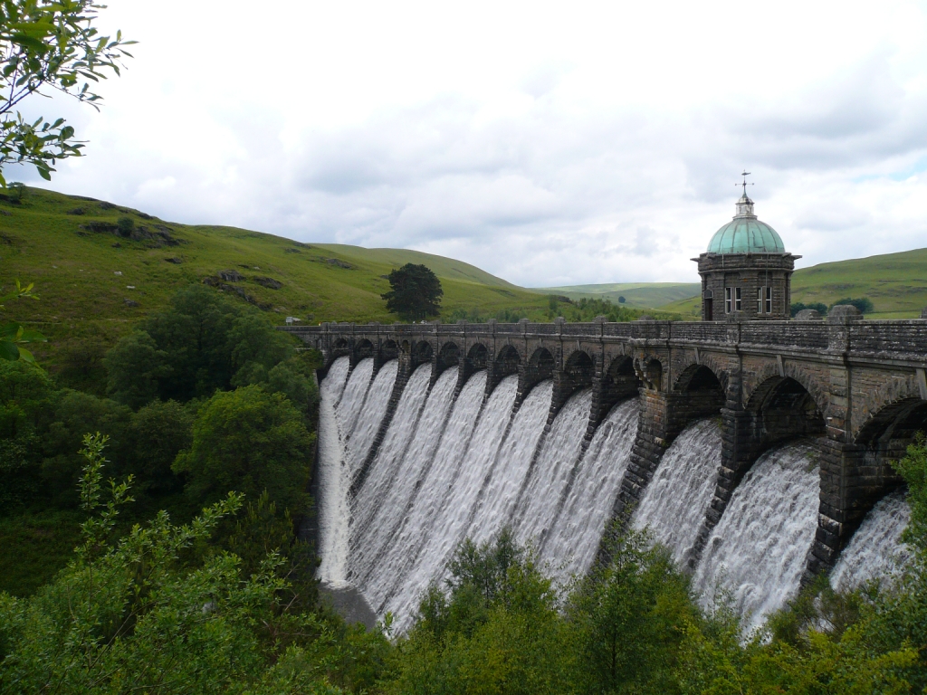
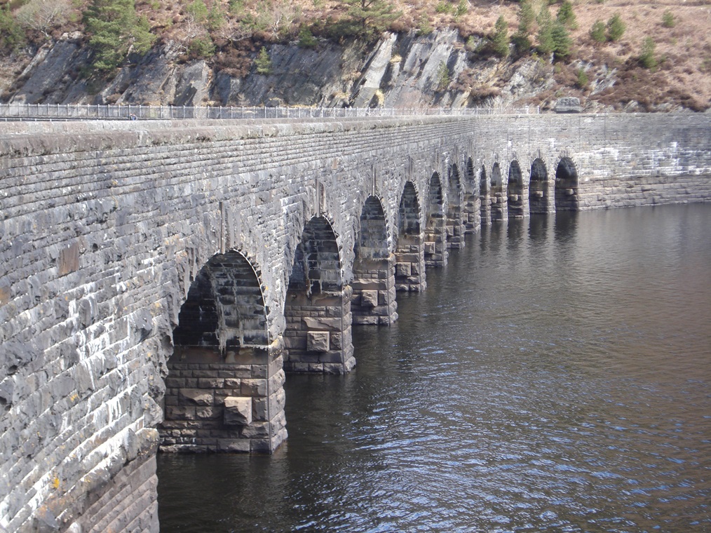
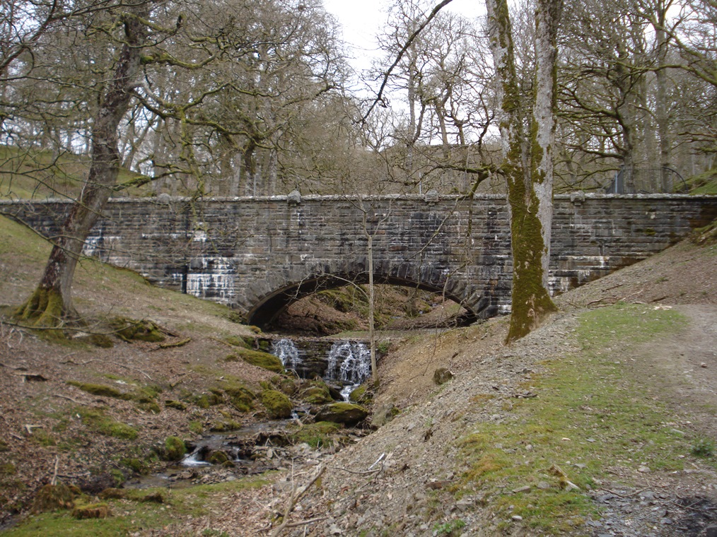
3 A magnificent dam
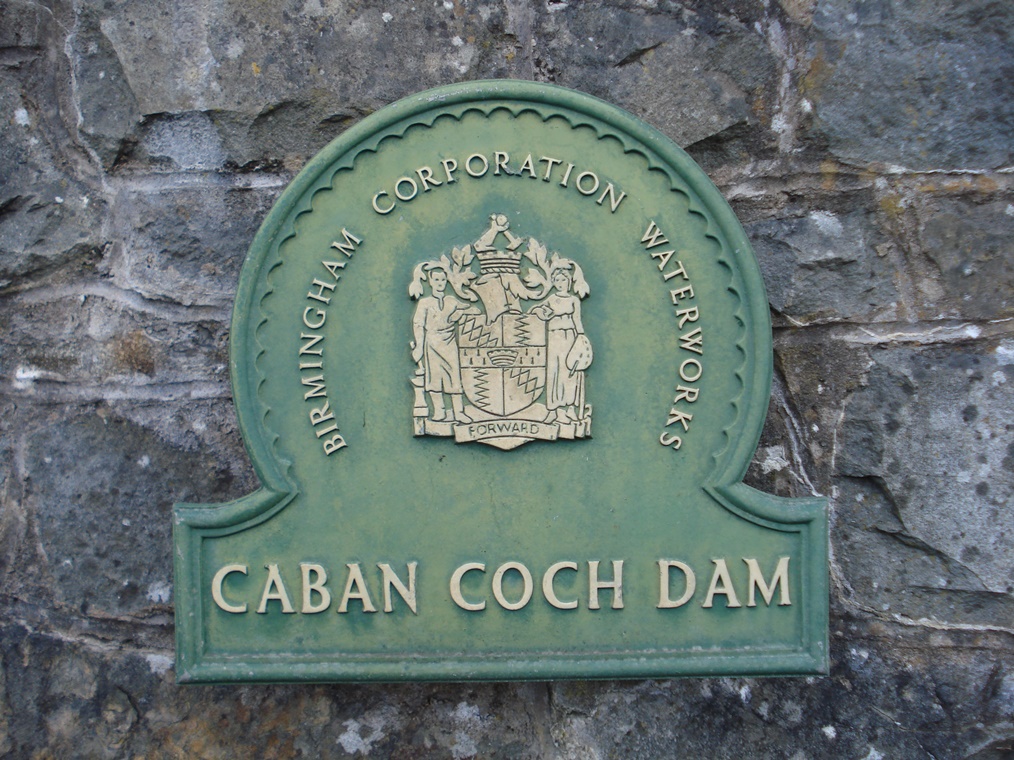
This is the Caban Coch dam, the lowest of the series of four dams here in the Elan Valley. The others going up the valley are Garreg Ddu, Pen y Garreg and Craig Goch.
In terms of water storage capacity Caban Coch is the largest reservoir of the series. As the lowest reservoir its completion was the culmination of a project that had been many years in the creation. The dam is 37 metres high, 186 metres wide and, at its base, 38 metres thick. It holds back over 35 million cubic metres of water. It was opened by King Edward VII in 1904.
Whether you think about children playing in a stream or Victorian engineers in this river valley the purpose of a dam is to create a barrier to block the flow of water.
Logically the best place to build a dam is the narrowest point of the valley where it will be easier to construct, require fewer construction materials and be stronger. As you can see from here the site for this dam was chosen at the point where the valley is at its narrowest point.
Dams of this size were at the cutting edge of engineering technology at the time and great care was taken in the method of construction to ensure that the project would be a success.
The machinery used to construct the dams was also technologically-advanced for the time. Steampowered cranes, drills, stone cutting saws and stone crushing plants were all transported here by a specially-constructed railway that we will find out about later.
From the top of the dam go through the gate onto the road. Cross the road into the quarry.
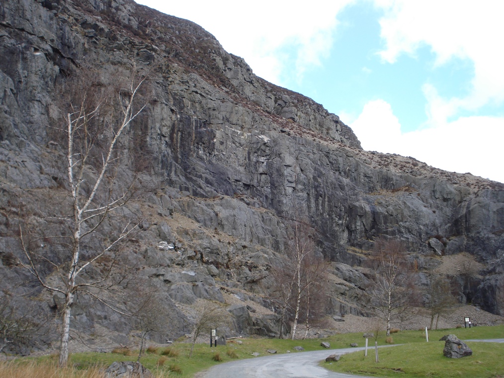
4 Ancient rocks
Even though the dam is sited at the narrowest point in the valley a lot of material was still needed to build it.
Rocks can be broadly divided into two types: permeable and impermeable. Permeable rocks such as chalk and limestone allow water to soak through while impermeable rocks such as granite and slate do not allow water to pass through.
Therefore, when building a dam, it is essential to use impermeable rocks so that the water doesn’t leak out.
In creating the dams, the first step was to create solid foundations in the river bed. Next the bulk of the dam wall – the bit inside that we can’t see – was built from rough stone from this quarry and embedded in concrete. Finally the outside wall of the dam was ‘faced’.
The rocks in this quarry, which formed 420 million years ago during the period of geological time known as the Silurian, were suitable for the body of the dam wall. Look up at the quarry to appreciate just how much stone was extracted to build the dams.
However this rock was not of sufficient quality to be used as ‘dressing’ material for the outside face of the dam. For this higherquality stone was brought in from Builth and Pontypridd in South Wales and masons hand-cut blocks of it.
From the quarry car park go back across the road and turn right. Go through the gate and follow the footpath. Stop after about 200 metres.
5 A special railway
At the last stop we found out that stone was brought from Builth and Pontypridd in South Wales to ‘face’ the outside of the dam walls. It was brought here by railway and the evidence for this railway is the footpath that we’re walking along.
The railway line, which took three years to build, was constructed specially for the dam project to transport men and materials to all parts of the Elan Valley.
It was a private line, 33 miles long and built at standard gauge. It was connected to the national network at Rhayader (this mid-Wales line is now closed).
The railway brought supplies from the surrounding area. Branch lines were also built down into the valleys to the individual dam construction sites from where cranes ran on tracks along the dam faces. Stone joists which supported the scaffolding for these tracks can still be seen projecting from the front of the Pen y Garreg and Caban Coch dams.
Eight locomotives were used on this line to carry passengers and building materials. We’ll discover more about what happened to the line later in the walk.
Continue along the path for about 800 metres. Stop at the first bench you reach.
6 Protecting the water
This is a good spot to look at the hills surrounding the reservoirs. The Birmingham Corporation purchased all this land for the project. In geographical terms it is a river ‘catchment’ which means the full extent of the area from which rainfall and groundwater will run into a river valley.
The reason that the Corporation wanted to buy not just the land that would be inundated by the reservoirs but also the surrounding land was to protect it from pollution and keep the water supply pure. Farms in the area were required to improve their methods of dealing with waste by properly organising manure heaps and keeping animals away from the water.
The approach today is much the same. The land in the Elan Valley catchment is owned by the private utility company, Welsh Water, and managed by the Elan Valley Trust which the water company set up in 1989. They work closely with local landholders, particularly farmers, to identify and then minimise or eliminate risks to water quality. The role of the Trust is to implement good agricultural management practices such as limited fertiliser and pesticide use and to ensure that animals do not have direct access to the water.
Although it is possible with modern technology to remove pollutants from drinking water it is much better to ensure that the water is not polluted in the first place. This means lower treatment costs for the raw water and better quality water for the public. They also promote careful woodland management. For example, thinning the trees rather than felling whole sections means that soil erosion is minimised. A good spread of tree cover slows the speed of rain water and reduces the quantity of sediment draining into the reservoir. The Trust also looks out for the impact of visitors and recreational activities on water quality, for example by providing toilets. You will have to go a very long way to find such a plentiful supply of excellent, free public loos!
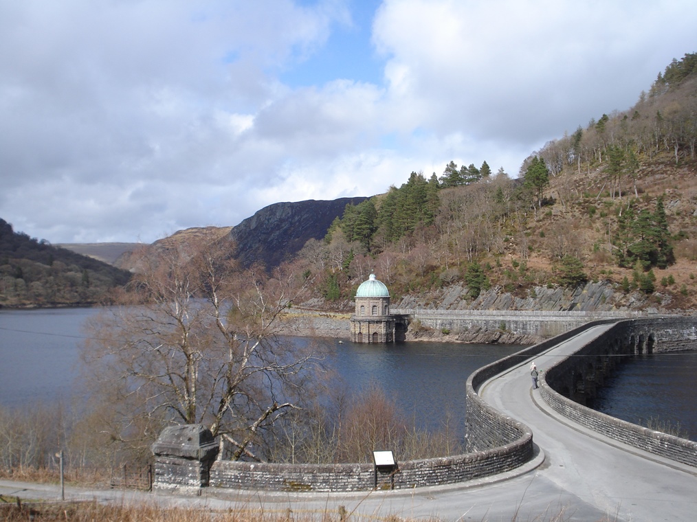
Continue along the footpath beside the reservoir as it gradually bends round to the right. At the end of the path go through the gate to the road junction. Go straight across through the gate onto the path beside the road. Go past the tower with the green dome and stop just before the next gate.
7 Careful measurement
This is the Foel Tower. Like all the buildings connected with the reservoir it is in the ‘Birmingham Baroque’ style – we heard at the beginning about how Victorians liked to build in a decorative way.
Look down at the base of the tower and you will see a barred archway. This is the point at which water is extracted to flow to Birmingham. You might be wondering why the extraction point is up here above the bottom of the Caban Coch dam that we saw earlier. Surely the lowest reservoir in the series would be the obvious extraction point.
As we discovered earlier one of the reasons for siting the reservoirs here was the elevation – water could flow all the way to Birmingham by gravity without being pumped. While the gradient between here and Birmingham city is enough to allow this (1 in 2,300) the water is actually sent to holding reservoirs at Frankley on the outskirts of the city.
The altitude difference between the bottom of the Caban Coch dam and Frankley reservoir is only 30 metres which would not create enough pressure for the water to get there without pumping hence the extraction point is here at the higher dam.
It’s worth reflecting for a moment on the skill of the Victorian engineers who calculated this. If their distance and altitude measurements had been inaccurate the whole aqueduct would have been a costly failure. And it’s worth remembering that all the heights were calculated using the traditional surveying techniques of levelling – there were no modern gadgets or satellites!
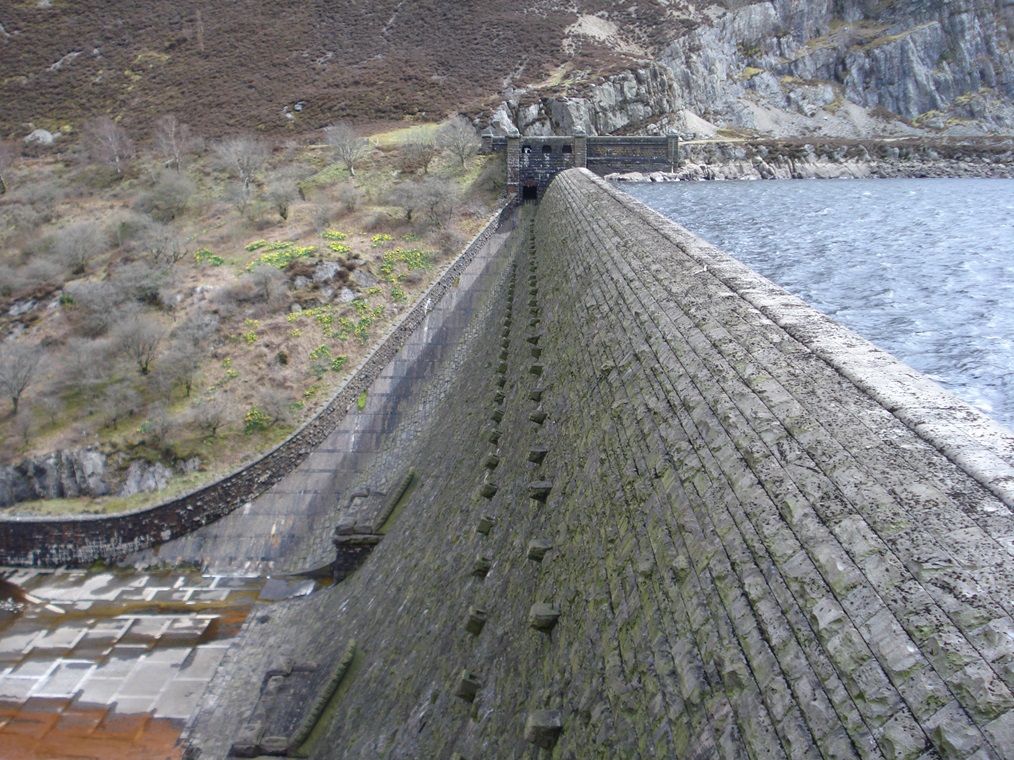
There is another important feature of the design here too. There is actually a submerged dam under the bridge across the reservoir.
The top of this dam is 13 metres below the maximum water level so that there is a separate reservoir (Garreg Ddu) on this side of the bridge. Without this feature both reservoirs would need to be kept full in order to reach the height of the Foel extraction point.
The submerged dam means that when water is in short supply only the upper Garreg Ddu reservoir needs to be kept topped up from the higher dams while the level of the lower Caban Coch reservoir can be allowed to fall.
This then provides compensation water to the River Elan to ensure its continued flow to support fish and wildlife and supplying drinking water to the local community.
Retrace your steps back along the path to the road junction. Turn right onto the bridge across the reservoir. At the far side take the road on the left and then turn right up the path to the church. Go through the gate into the church grounds.
8 The lost valleys
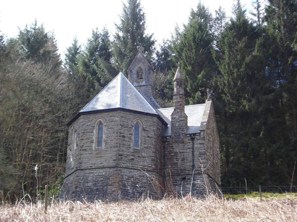
We have been admiring what the Birmingham Corporation and Victorian engineers created but part of the story is also the destruction that was caused too.
This area of hill country is quite remote and was not a heavily populated area but there were some local residents. When the reservoirs were created the homes of over 100 people and several farmhouses were destroyed.
Although landowners were reasonably compensated for their loss tenant farmers and farm labourers lost their jobs and could not always find new ones. Servants who worked in large houses and the local miners of metal ores also became unemployed. Some of these people may have migrated to the growing towns and cities.
Birmingham Corporation built this church as a replacement for one lost to the waters but it could not replace the little bit of Welsh history and culture that was lost forever below the reservoir.
New reservoirs are still being created over a century later in Britain to meet our ever-growing demand for water and the same issues arise about the displacement of people and the loss of land. Every effort is made to reduce the impacts on local communities but do spare a thought for such people next time you are tempted to waste water.
The church is usually open so do go in. Inside are various archive photographs of the old church and dam construction. When you are ready retrace your steps across the bridge over the reservoir and turn right onto the path beside the road. Follow the path as it gradually bends round to the left and stop at the first bench you reach (the bench you stopped at before).
9 A wonderful natural view?
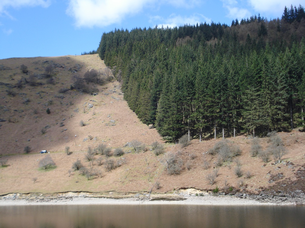
Here we are back at the bench with the wonderful views of the Caban Coch reservoir and the surrounding hills. It is very easy to think that we are looking at an entirely natural scene – the hills, the trees, the water – but we are not! We have already learned about the manmade reservoir but the hillsides are shaped by human activity too.
The natural vegetation of these upland areas of mid Wales is ‘Upland Oakwood’ consisting of oak with some birch, holly, hazel, rowan and hawthorn. This type of habitat was once common across the wetter parts of northern and western Britain but most has been lost.
Thousands of years ago the first farmers started to cut down trees to create pasture and used the wood to build houses and make fires.
This process has continued into modern times with any remaining natural vegetation being threatened by sheep grazing (which prevents the regeneration of young trees) and plantation forestry.
Look across the reservoir and you should be able to see the distinct difference between the rather scraggy Upland Oakwood on the lower part of the slope and the regimented plantations of conifers above.
The natural woodland provides a habitat for distinctive animal and plant communities whereas the plantations of non-native trees support much less diversity of species.
The value of natural woodland has now been recognised and it is designated as a Site of Special Scientific Interest and protected by European legislation. An important part of protection is the installation of fencing to prevent sheep grazing and long-term monitoring is taking place to see the changes that this can bring. There have been spectacular improvements to trees and woodland plants as a result of this work.
Welsh Water which owns the land is trying to increase the area of natural woodland by planting saplings of native species where conifer plantations have been felled. They use saplings grown from seeds of nearby woodlands; this use of locally-sourced seed helps to protect the distinctiveness and diversity of the woodland. Natural regeneration is also encouraged and the fences are maintained and extended to keep out grazing animals.
The many decades of protection of the water catchment area – firstly by Birmingham Corporation and more recently by Welsh Water – has meant that a vital and threatened habitat has been protected and enhanced.
Continue along the path back alongside Caban Coch reservoir. Go past the top of the dam and retrace your steps down the zig-zag path to the base of the dam. Go round the right side of the stone building and stop on the bridge over the River Elan.
10 The river still flows
You may see water coming through the sluices at the bottom of the dam. The technical term for this is ‘compensation water’ and this water allows the River Elan to continue to flow despite being dammed and to supply drinking water to the Rhayader and Llandrindod Wells area.
The requirement for compensation water was incorporated into the original Act of Parliament and continues to this day. The flow of water down the River Elan and then on into the River Wye means that Elan Valley water makes a contribution to the water supply of the many towns in Southeast Wales.
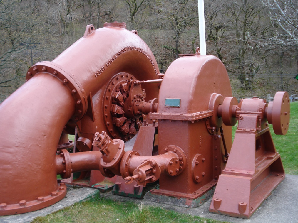
As well as being for drinking the water from the dam also drives hydro-electric turbines to generate electricity. This is not a modern project as part of greater moves towards ‘sustainability’ but was actually part of the original design of the dams. The equipment is housed in these two stone buildings on either side of the river. You may be able to peep through the windows at the turbines and equipment inside.
The combined capacity of all the dams here is over four megawatts of electricity and the annual output of 11 million kWh is fed into the National Grid through underground cables. This is a quite substantial contribution to sustainable energy.
If there has been a lot of recent rain the reservoir may be quite full and you may see water flowing over the top of the dam. The sight and sound of so much rushing water is quite mesmerising. Although the Victorian engineers were intent on building a lasting piece of civil engineering you can clearly see that they also had an eye to the beauty of what they were creating.
Continue across the bridge and around the other stone building. Turn left past the building and go through the gate. Follow the track as it climbs gradually upwards through Upland Oakwood vegetation (see Stop 9). Where the track forks bear left and follow it downhill. At the bottom turn left through the gate and stop by the two bridges.
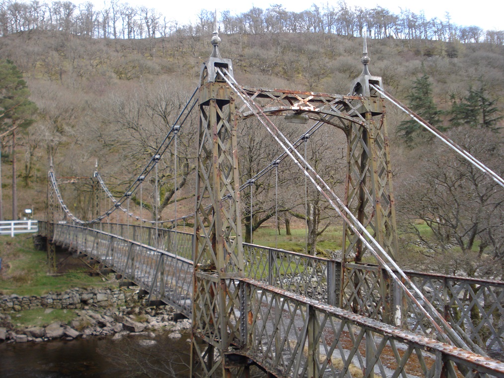
11 Keeping out the scruffs
This suspension bridge was the entrance to Elan Village. Here in mid-Wales we are quite far from any major towns or cities so workers could not be brought in daily from their place of residence. Instead the first part of the construction project was to build a temporary village for the workers.
Up to 5,000 men were employed on the construction works at any one time and over the 11 years of the building project a total of 50,000 men are thought to have worked here incuding skilled masons for shaping the stones and navvies for the unskilled work not to mention the men who ran the railway.
This bridge was gated and guarded in order to keep out ‘undesirables’ and ensure that infectious diseases were not brought in. New workers had to spend several days on the other side of the river before being allowed in to prove that they were well-behaved and in good health.
The buildings of the village were mainly wooden with occasional brick walls as a fire-break. Married men had separate houses and single men lived in groups of eight.
The village was quite advanced for its time with a school, shop, library and recreation room. There was even a bar, profits from which were used to subsidise education and recreation facilities.
There were also two hospitals, one for injuries and the other for infectious diseases such as smallpox. The village was lit by electricity generated by a turbine on the dam and there was, of course, plenty of fresh drinking water!
Do not cross the bridge but follow the road with the river on your left. There are toilets on the right. Pass two stone houses on the right then stop at the roofed shelter with benches.
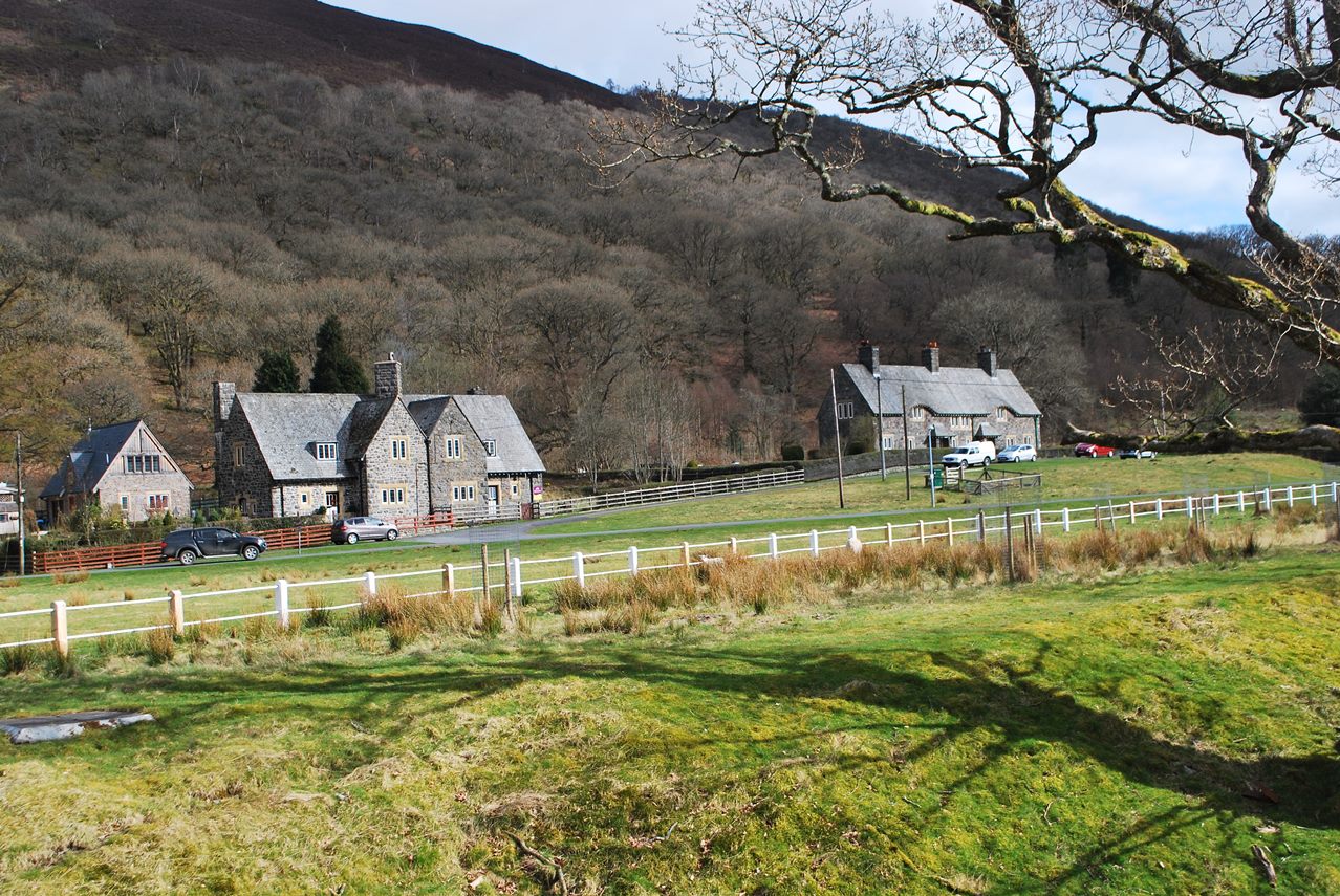
12 A Birmingham village
Elan Village was not only the site of temporary homes mainly built of wood for construction workers but it was also intended as a permanent village for those involved in maintaining the reservoirs and the filter equipment.
The design of the village – both the buildings and the landscaping – was quite deliberate. You will find similar buildings in planned suburbs of Birmingham that were created in the same era such as Bournville which was built around the Cadbury’s chocolate factory.
The buildings were sited well apart from each other, an arrangement that creates quite a rural appearance just like a garden suburb in a city (although the construction materials for the permanent buildings here is local stone rather than red Birmingham brick).
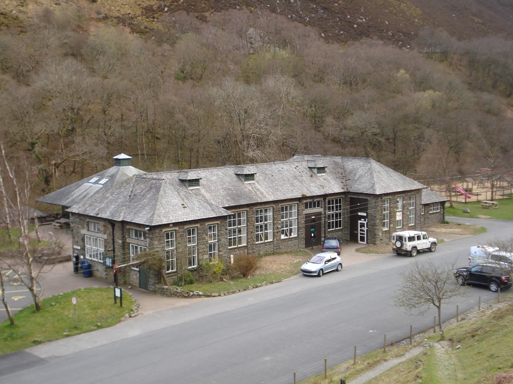
The large building on the embankment above where we are standing was the school. It’s quite a grand building for a small village.
As we continue through the village look for ‘Arts and Crafts style’ cottages where you can see the skills of the craftsmen in designing them. They also have simple natural forms using local materials which seem to grow out of the surrounding countryside.
The main street was deliberately landscaped too. Parkland trees were planted to create a very pleasant setting for the village although many have now been lost.
Continue along the road through the village. Where the road bears to the right take the footpath on the left and cross the river by the wooden footbridge. At the end of the bridge turn right and follow the path past four houses. Where the lane bends up to the left go straight on towards a grey and red church. Go through the gate into the church grounds.
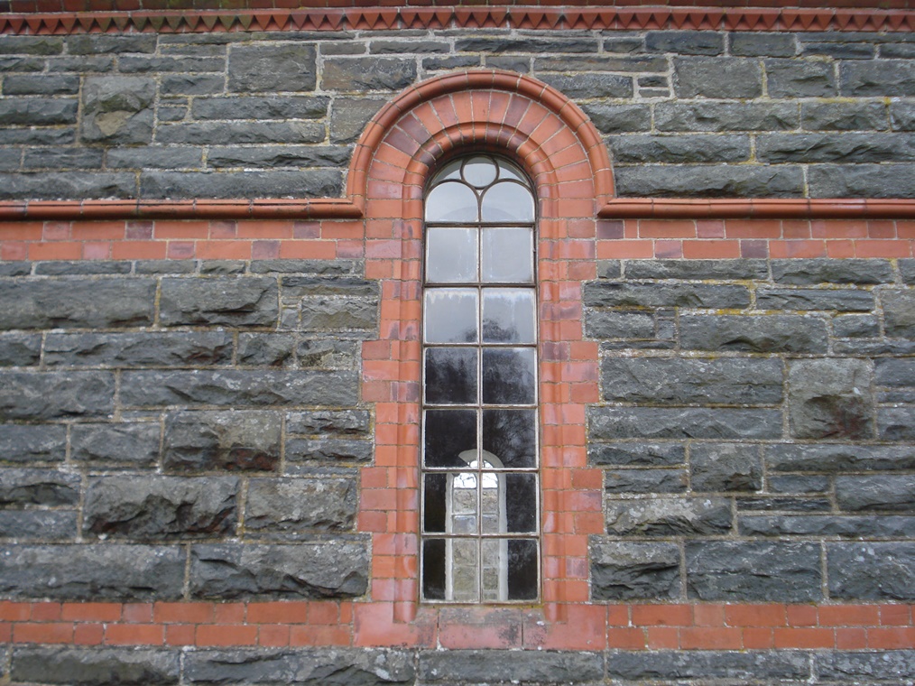
13 A very Welsh chapel
Earlier we saw a chapel that was built to replace one that was submerged under the reservoir. This chapel is another which was built in 1900 to replace Garreg Ddu Baptist Church that was submerged under Caban Coch reservoir. Graves on the original site were opened and the coffins were re-buried here.
Have you noticed that this church looks quite different to the one we saw earlier? This is a typical Welsh chapel in that it is very plain without the towers and steeples found on many churches.
The interior is also plain with simple furnishings. The design reflects Non-Conformist attitudes to a simpler form of worship and a non-hierarchical view of the clergy.
A hundred years ago the local people in this area would have been Welsh-speaking (some still are today). Some of the migrant workers would have been Welsh speakers too so this chapel served them.
However, it is likely that many of the migrant workers spoke only English. This influx of English speakers was a major stage in the anglicisation of the area as native Welsh-speakers would have needed to speak English to the incomers.
The chapel is usually open so do have a look inside. When you are ready go back through the gate towards the row of houses. At the lane turn right and then right again onto a footpath with the road on the left. After a short distance the path crosses an entranceway to a sewage works and campsite. Stop on the next straight section of path with the campsite on the right.
Note: If you wish to omit Stop 15 leave the church and turn right to the road. Turn left along the path alongside the road. Follow the path and then go through the gate to the road junction where the left turn leads to the Visitor Centre. Here you can look at Stops 14 and 15 and resume the route at Stop 16.
14 From industry to leisure
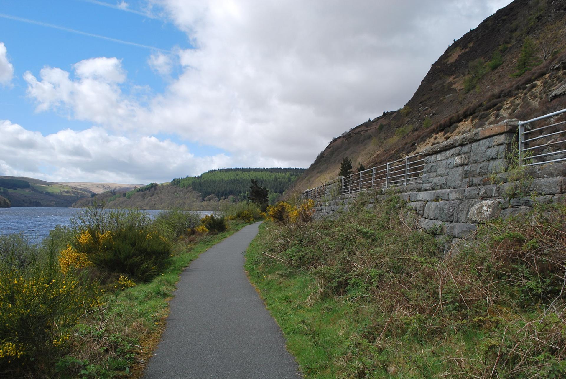
Earlier we heard about the speciallyconstructed railway line that brought building materials and workers to the dam construction sites. Although the engineering work to construct the railway was enormous the line was only needed for a few years and by 1916 it was dismantled.
However, the old route of the railway lives on as the footpath that we are on now which is part of the Elan Valley Trail running for eight miles from Cwmdauddwr (just outside Rhayader) to the Craig Goch dam at the top of the valley.
As you may have seen on the signposts this path also forms part of National Cycle Route 81. Sustrans, the sustainable transport charity, has created a National Cycle Network which consists of 13,400 miles of walking and cycling routes.
Many of these make use of disused railway lines and canal towpaths. It’s great to see industrial routeways created in an earlier age being reinvented as leisure routeways.
Continue along the path passing the Elan Valley Hotel. When you reach the entrance to a cottage on the right side leave the path and turn right along the road. There is no pavement so take great care. After about 150 metres take a left back fork through a gate and onto a farm track. At the farm buildings go straight on. Immediately after going through the gate take the path which goes diagonally right up the hillside (do not continue on the track). Stop at the gate at the top.
15 Channels, tunnels and siphons
We have already heard about the original plans to transport water from the reservoirs to Birmingham under the force of gravity along an aqueduct. Look both ways along the fence from the gate and you can see the stone tops of two bridges that each cross a small valley. Inside these bridges is the pipe of the aqueduct. The aqueduct consists of three basic construction types.
About 25 of the 73 miles of the aqueduct were built using the ‘cut and cover’ technique. This is a brick-lined channel, roofed-over and concealed underground. About 12 miles are in a tunnel under high ground or in places where it was necessary to maintain the downward gradient.
There are also siphons which are used to cross valleys which use the pressure of the water from high up on one side of the valley to force the water down into the valley and up the other side so that the flow continues. In fact the aqueduct had to cross eleven major valleys. The siphon that crosses the Rivers Severn and Stour is over 17 miles long.
What we have here is essentially just a large pipe but the designer has given the structure a traditional appearance with stone facing making it look like a bridge even though very few people will ever see it.
Retrace your steps back down the path, through the gate, past the farm and along the track back to the road. Turn right onto the road then rejoin the footpath on the left where you left it. Follow the path back past the hotel. After passing the chapel continue straight on the path alongside the road. Go through the gate to the road junction where the left turn leads to the Visitor Centre.
16 Rejoicing and resentment
The enormous embankment and stone wall on the other side of the road marks the beginning of the aqueduct.
How long do you think that the water took to travel the 73 miles from here to Birmingham under the influence of gravity? When the aqueduct was first opened the water arrived in Birmingham seven days later – exactly as had been predicted – and to great rejoicing.
In some parts of Wales there was considerable resentment against water being ‘taken’ by English cities although apparently this was less true of the Elan Valley area where many local residents saw the reservoirs as a local asset. Elsewhere there was concern that the various aqueducts could be sabotaged so they were not shown on many maps.
These concerns were largely addressed by the reform of the water industry in 1974. The various city and district waterworks were re-organised into Water Authorities which covered much larger areas and were based on the natural catchment areas of rivers rather than local authority boundaries.
Later the Water Authorities were privatised. The Elan Valley catchment, the reservoirs and the water are now the property of Dwr Cymru, Welsh Water.
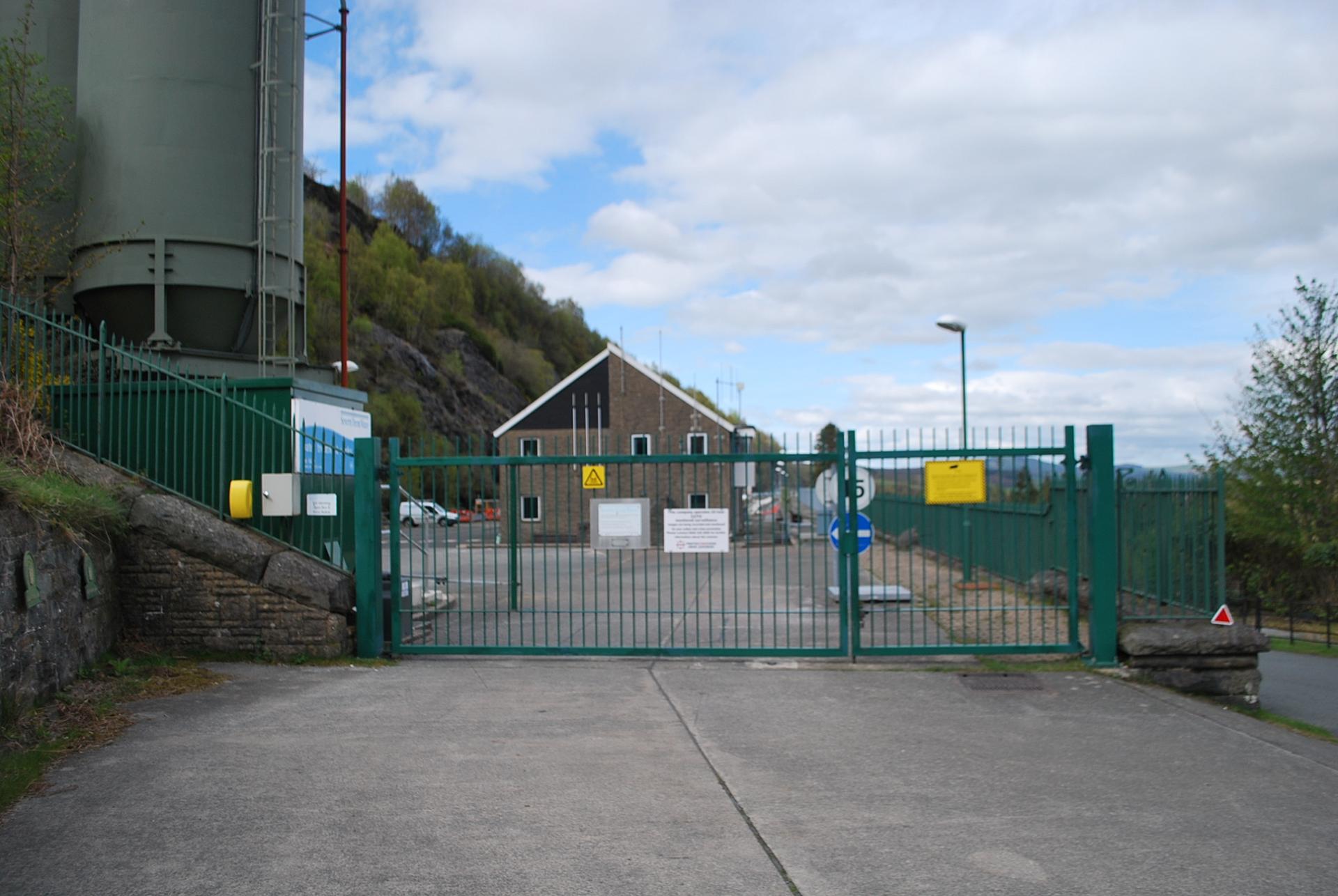
Above us, behind the embankment, is a water treatment works. After the water has been extracted from the reservoirs it is treated before commencing its journey along the aqueduct to Birmingham.
Earlier we found out that one of the reasons for constructing the dams in this area was the purity of the natural water. So you may wonder why it still needs to be treated if the natural quality is high. Two main processes happen here.
The first process is to adjust the hardness of the water. ‘Hard’ water contains carbonate dissolved out of limestone and similar rocks that it passes through. You can recognise places with hard water because it leaves a limescale deposit on taps, shower heads and kettles. In contrast ‘soft’ water does not contain much carbonate and slightly dissolves metal pipes and taps. The Elan Valley water is very soft so it needs to be hardened. This was originally done by passing the water over chalk but it is done nowadays by adding chemicals to the water.
The second process happening here is a filtering of the water. Although the quality of the water is high it contains sediments and materials that have accumulated during its time in the reservoirs such as peat and other debris. These materials can clog water pipes and need to be removed. The reservoirs in North Wales which supplied Liverpool’s drinking water had been affected by this problem so this filtration plant was added here in 1901 to avoid the same problem. The filtration is carried out by passing the water through beds of shingle and sand. The process removes an incredible 150 tons of dried solids every year!
The treatment works belongs to Severn Trent Water the private utility firm that is the successor to Birmingham Corporation Waterworks. So it is here that the responsibility passes from Welsh Water (which owns the catchment, reservoirs and dams) to Severn Trent Water (which supplies the water).
Take the road on the left signposted for the Visitor Centre. Take care as there is no pavement in places. At the suspension bridge go straight on. Stop outside the Visitor Centre.
18 Giving back
We’re now back at the Visitor Centre where we started the walk.
The road that we have just walked along was a branch line of the railway and there were sidings here where the car park now is. The main building was a series of workshops where materials were prepared for the dam construction.
The Visitor Centre is an excellent way to encourage people to visit the area whether they are interested in the dams, wildlife or just a good walk. The Centre is owned and run by Welsh Water and attracts 200,000 people a year; there are also 400,000 visitors a year to the Elan Estate.
The recent policy of opening the Visitor Centre through the year every day except Christmas Day has increased tourist numbers and ensures that the Elan Valley continues to be a leading Welsh tourist attraction.
Of course some people are employed directly in the centre but it also makes an important contribution to the local economy: people spend money here in the cafe and the gift shop and also stay in local hotels, bed and breakfasts, farms and cottages, and eat in local restaurants.
In this way the engineering project that had such an impact on these valleys is now giving something back to the local community.
We have now come to the end of the main part of the walk. This walk has told the story of this remarkable feat of Victorian engineering in the heart of mid Wales.
We have seen what characteristics of this natural landscape made it ideal for building a series of dams and some of the physical challenges that the Victorian engineers faced in the construction.
We have seen different aspects of the project including the dams and reservoirs, the outlet pipe and aqueduct, the railway and hydroelectric turbines.
We’ve also learned about the local people who were displaced from the land when the valleys were drowned but also the thousands of workers who were brought in for the construction. We found out about the politics of the project including disquiet about the water being ‘exported’ to England and the later expansion to assist water supply to South Wales.
We have also seen how the original protection of the catchment area continues over a hundred years later with the water company embracing habitat restoration and visitor management.
Over the past few decades the emphasis of many public bodies has moved towards recreation, environment and sustainability in addition to their core aims. It is remarkable to think that the work of the engineers employed by the Birmingham Corporation over a century ago has now become an important tourist destination and driver of the local economy.
If you have not already been inside do have a look at the displays in the Visitor Centre which cover the history of the dams and local wildlife habitats; there is also a film to watch.
You can also visit the cafe which is an extension to the original building where you can have anything from a cup of tea to a full meal while enjoying the views over the river.
A glass of water. A flushing toilet. A hot shower. It’s easy to take these things for granted nowadays.
In Victorian Birmingham though clean water was scarce and people were dying from diseases like cholera and typhoid. So the city authorities began an enormous engineering project to solve the problem.
Over 70 miles away, the dramatic natural landscape of the Elan Valley in mid Wales became home to a series of ornate dams and large reservoirs.
Find out why this site was chosen and marvel at the precision engineering that still supplies the West Midlands with clean water today.
Follow the walk by clicking on the map pins or downloading the guides below