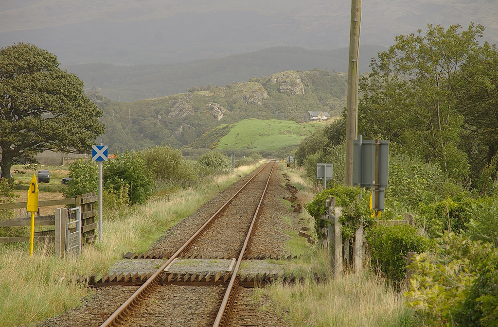
However you got here today, Talsarnau railway station is a good starting point for any visit to the tidal island of Ynys Gifftan, But before we venture towards the coast, it is well worth exploring this remote and isolated outpost of the national railway network.
The Cambrian Coastline Railway was originally built to serve the local industries, transporting Welsh slate from the quarries at Blaenau Ffestiniog and granite setts from Minffordd to Wales’ growing cities. When road infrastructure improved in the 1960s, the demand for rail transportation declined. Talsarnau, unlike other stations, survived the Beeching Axe that fell on so many rural branch lines during this time, but only just.
The station building is now a private property and there are no facilities except for the station platform itself. Talsarnau is a request stop station, one of several on this stretch of line. Trains and passengers only appear every couple of hours, so it is worth paying close attention to the timetable if you want to successfully hail a particular train!
It may well be easier to drive here than travel by rail, but where is the sense of adventure in that?
Directions
With the platform behind you, begin the half-mile stroll from Talsarnau to the estuary by following Station Road and taking the first left turn. Walk as far as the tarmac takes you, then go through the level crossing gates and across the railway line. Walk through the pastoral farmland and beyond until the marshland meets the estuary sands
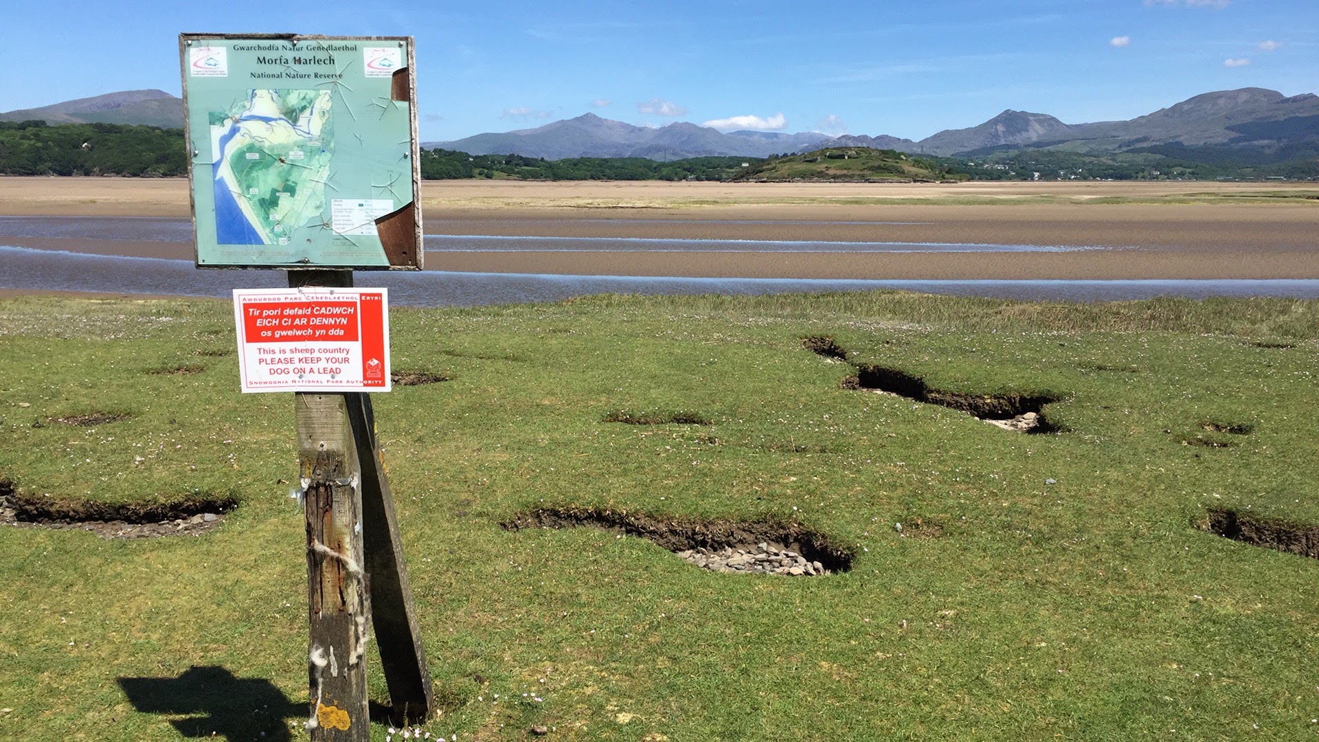
2 Footpath where pasture meets estuary
You might think that the pastoral farmland here is completely natural, but the entire landscape has been sculpted both by nature and human activity.
At the end of the last Ice Age when temperatures began to rise and the ice sheet that had covered much of Britain began to melt, the land unburdened by the weight of ice began to rise. As a result of this post-glacial uplift, the land here is higher than it once was and the coast has receded.
Also, active sand dune building and the growth of a sand spit along the coast from Harlech has formed a protective barrier between this area of low-lying, flat land and the powerful waves that travel across the Irish Sea. As a result, sea waves have been unable to erode the sand and it has instead been deposited in the mouth of the estuary - allowing the wide saltmarshes to form. The land here is so flat that nothing stands between you and some fantastic views including the mountains of Snowdonia National Park which frame the views to the north.
The coastal plain is protected from flooding by the low-slung sea walls you can see ahead of you. Made of turf, soil and sand, these embankments enclose over 100 acres of drained pasture here at Draenogan Mawr. On a sunny day, the peak of Snowdon can be seen, but when storms drive onshore the landscape takes on a more sinister character and the railway line behind flooded and closed down. Such storms are becoming more common, raising concerns for the local community.
Stand quietly for a minute and listen for the sound of the animals in the fields, the wildlife and the birds high up in the sky. If you are taking a winter walk be sure to look out for regular visitors such as over-wintering pintails, grey plover, redshanks and oystercatchers.
Continue along the main path (farm track) until it turns to the left through 90 degrees. Here, instead of following the path, continue in a roughly straight line towards the island. As there is no obvious path, pick your way between shallow creeks and grass turfs, known as swards.
The sward (which is only ever covered at spring tides) includes flowering tufted grass like the tiny pink flowers of the Sea Milkwort and Buck's-horn Plantain with its distinctive rosette of toothed leaves and tiny four-petalled flowers. Soft rushes can grow to over a metre in height and can be found much closer to the sea wall.
There are only two channels of significant depth to navigate. So you have a choice. You can either hop from turf to turf or take your shoes off and wade through the shallow waters. Turf grown in the wet pasture is of such high quality that between 1953 and 1962 it was cut and supplied for football fields and bowling greens. It even appeared on the tennis courts at Wimbledon. Unfortunately, this turf industry was short-lived as rolled turf,a cheaper alternative was quickly developed.
Directions
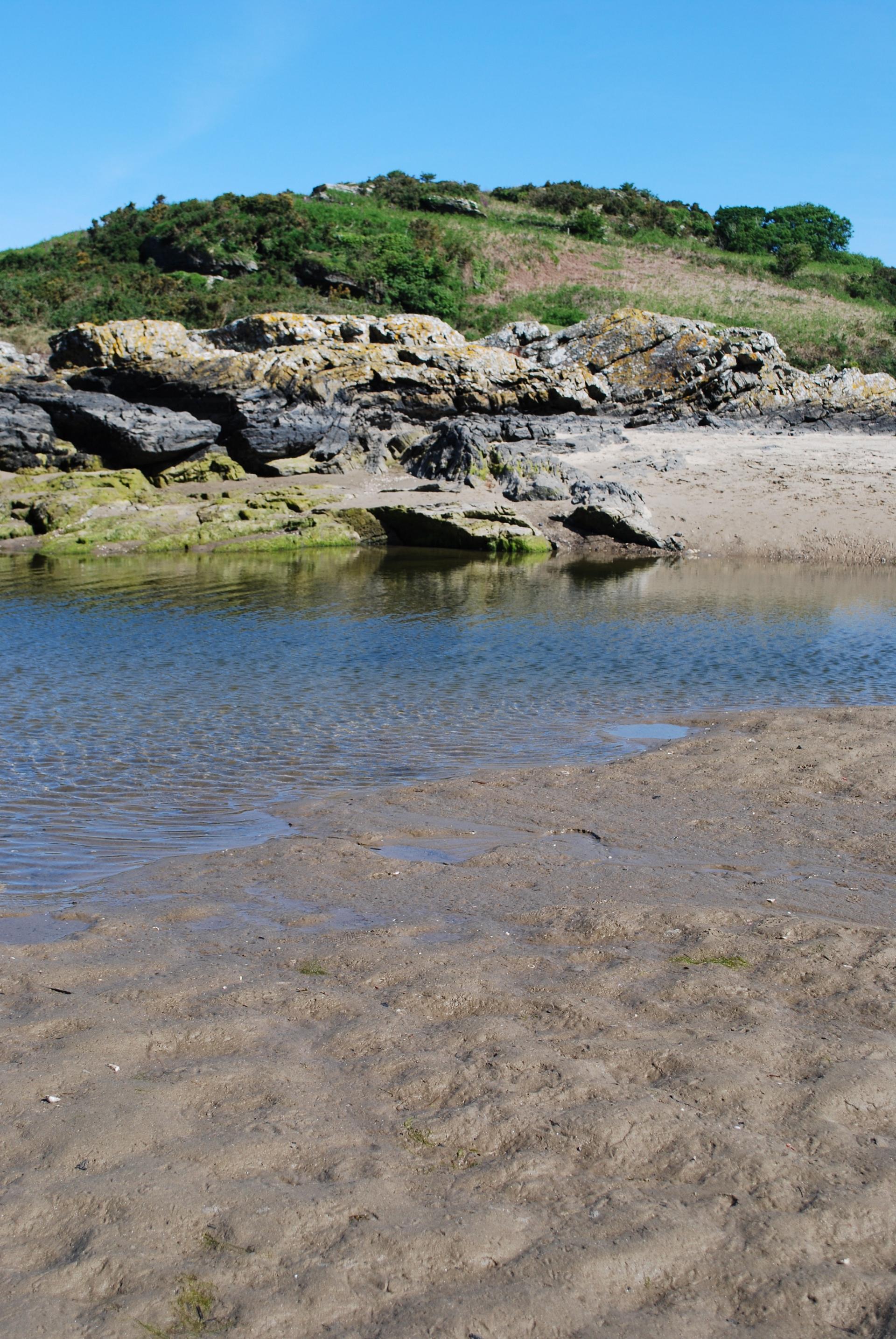
Cross the estuary sands and walk towards the island, weaving your way where necessary to find the best places to cross the little creeks. Walk towards the southern tip of the island where you will find a large pool. Walk around the right of this and go up onto the island
3 Large pool south of the island
Like most tidal crossings in Britain, this one has no causeway or easily definable routes. However, you do not need to rely on a map to guide you as Ynys Gifftan is well within sight. Just a word of caution, there are two river channels that flow between you and Ynys Gifftan, if you reach these and they are too deep to cross, for safety, you must turn back.
As you reach the edge of the marshes, step onto the rippled sand of the estuary. Take your time to explore the temporary pools, shallow channels, extensive sandflats and habitats of the inter-tidal landscape. The estuary is flat, but the sand and river channels can be uneven underfoot.
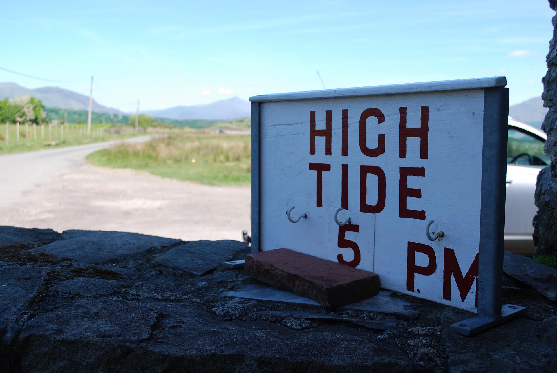
The difference between high and low tide (known as the tidal range) is four metres. This means that the island is completely cut off and impossible to reach at high tide without a boat. Yet, on the ebb tide it only takes five minutes to walk the 400-metre route to the island.
Look on an OS map and you’ll see that this estuary is vast. To the south-west, towards the Irish Sea, you can see where the Dwyryd and Glaslyn Estuaries unite to form one of the largest and most unspoilt estuaries in Cardigan Bay.
This is a dynamic landscape where nutrient-rich sediments constantly shift and channels meander with each tide. Over 348 hectares of sand flats and salt marshes are a haven for wildlife, home to wildfowl, otters and water voles. If you are lucky, you might even catch sight of osprey diving for fish. When the sun is high in the sky, estuary sands dry and skip seawards on the wind. These sands have built the dunes at Morfa Harlech, a living museum of rocks broken down and deposited through time to form one of our longest and active sand dune systems.
Directions
Stay near the pool and find a spot to climb up onto the island itself (the rocks are not as steep here on the south side of the island).Take a walk around the entire island. This will only take you 10 or 15 minutes, although curiosity may make your journey longer.
(When you climb up onto the island at the south side you will see there are 3 paths. The right hand path takes you to the house; the middle path goes anticlockwise around the island; the left hand path goes clockwise and over the top of the island).
4 Ty-gwyn-Gamlas cottage
The landscape here changed significantly as a result of the 1806 Enclosure Act. Permission was given to build two turf embankments, allowing the land behind the embankments to be drained.
Pasture could now be grazed by sheep and cattle. By 1810 the embankments were complete and farm cottages including the ones here at Ty-gwyn-Gamlas were built for the farmers (see photo 3.). A new coastal road (the A456) was built to take advantage of this newly reclaimed land and improve accessibility between Blaenau Ffestiniog and Harlech.
The final stretch of this trail takes you along the 1810 embankment. As you continue to walk, observe how different the landscape is on either side of the wall and imagine how it might look if the Enclosure Act of 1806 had never been passed. Would the turf industry have been possible? Would the railway have been possible? Could you have even travelled here today?
In our busy lives and interconnected world there is something to be said about exploring the remote corners of Britain, such as the inaccessible island of Ynys Gifftan. If you have enjoyed this trail, why don’t you turn your attention to one of the 42 other tidal islands dotted around the mainland? Some popular ones include the Holy Island of Lindisfarne off the northeast coast of England and St Michael's Mount off Cornwall, but what about the lesser travelled Dova Haw off Cumbria or Northey in the estuary of the River Blackwater, Essex?
Directions
Take the path to the south west, past the front of Ty-gwyn-Gamlas cottage and walk 400 metres along the sea wall, then cross the Afon (River) y Gllyn and pick up the sea wall again (keep the marsh on your left and pasture to your right) and return back to Talsarnau railway station.
Your browser is out of date, and unsupported by this website. Please upgrade to the latest version to use this website.
A short walk exploring the tidal island at the edge of Snowdonia
Overlooked by the Moelwyn Mountains that stand just in front of Snowdon, and the Rhinogs to the south east, the small island of Ynys Gifftan is a distinctive and unique feature of the Dwyryd Estuary.
Look across the estuary at high tide and Ynys Gifftan may seem insignificant, unworthy of exploration and impossible to visit without a boat. But visitors prepared to roll their trousers up can be rewarded with an adventure unlike any other.
This short walk to the tidal island at the foot of Snowdonia is particularly enjoyable in the summer months, when waters have absorbed the heat of the sun.
Important information before you start the walk
The recorded public right of way terminates at Mean High Water.
There is no general right of access over Ynys Gifftan under the Countryside and Rights of Way Act 2000 and access onto the island itself would therefore require the permission of the landowner.
Public rights of way to Ynys Gifftan can be dangerous under tidal conditions, and users should exercise appropriate caution.
Follow the trail by clicking on the map pins or downloading the guide below.
Talsarnau railway station, Station Road, Talsarnau, Gwynedd LL47 6UA
Keep an eye out for:
The tide - the island is only accessible for up to three hours either side of low tide. Tide timetables are available online at www.tidetimes.org.uk
Like most tidal crossings in Britain, this one has no causeway or marked route. There are two rivers that flow between the mainland and Ynys Gifftan. If you reach the river channels and they are too deep to cross, for your own safety you must turn back.
Wear wellies or take your shoes off for a paddle!
Note:
Please take a compass with you so you can walk on the correct bearing back from the island. If at any point you feel unsure about crossing water channels retrace your steps rather than risking it.