1 Welcome to South Devon

This walk follows the South Devon railway line between Teignmouth and Dawlish Warren stations. For much of the route we will follow the railway tracks positioned precariously on the coast. Along the route we will explore how geography and geology have influenced this railway in a variety of ways.

First we will investigate different rock types, landscape formations and coastal processes in this area. Second we will discover how the characteristics of this landscape posed
challenges to the engineers that designed this railway - and continue to cause problems today. Third we will find out about the strategic importance of this railway to the economy ofSouth West England and ponder its future.

The walk was created by Pat Wilson, a Fellow of the Royal Geographical Society. Pat: “A few years ago I left landlocked Bedford behind to live by the sea in Teignmouth, South Devon. One of my favourite walks is along the coast from Teignmouth to Dawlish Warren. Of course I love this walk for the sea air and lovely views but there’s much more to it than that.”

“As a geographer, I have always been interested in the conflict between the land and sea. But it becomes all the more dramatic here where a vital communication link lies on the junction between the two. There are some fascinating stories and hidden secrets along this stretch of coastline and I hope to share some of them with you.”

Do note that before starting this walk, you should check tide times carefully. Access to part of the route - Smugglers Lane at the end of the Teignmouth seawall and the Langstone Rock between Dawlish and Dawlish Warren - may not be possible at high tide. Please use the alternative directions included.


Teignmouth sign
Pat Wilson © RGS-IBG Discovering Britain

Directions

From the station cross the road near the roundabout and go past the anchor to the Teign Heritage Centre. Find the old Teignmouth to Dawlish toll road milestone outside the Heritage Centre.

2 The Great Marsh

Since our walk is all about the South Devon Railway it is appropriate that we start at Teignmouth station. The railway line was completed in 1846, which was also when this station opened. Originally not much thought was given to the station buildings and a temporary wooden structure served for 48 years.

The building we can see today dates from 1894. It was designed in what was known as the ‘French Pavillion’ style and built of local Devonian limestone. Apart from the booking hall, which was enlarged in 1980, it remains almost unchanged today.

What has changed significantly over time is the landscape between the Heritage Centre and the station. Look for the name of the street to the left which runs towards the rear of the Waitrose supermarket. It’s called Lower Brook Street and that gives us a clue.

Until about 200 years ago the River Tame, now culverted, flowed down this steep valley behind the station. On reaching this flatter land it slowed and created the ‘Great Marsh’ in the area around you. This was drained in the early 1800s creating the land that the station was eventually built upon. The river then used to flow down the line of Lower Brook Street into its marshy estuary with the River Teign. The draining of the Great Marsh is our first example of humans intervening in the physical landscape in Teignmouth.


Teignmouth station foundation stone 
Rory Walsh © RGS-IBG Discovering Britain
 
Directions

From the Teign Heritage Centre walk along Dawlish Street towards the church with a tower. Go through the church gate and follow the path around the right hand side of the church. Leave the churchyard by the other gate. Cross the road and go up the ramp on to the seawall. Stop by the information board.

3 Natural or manmade protection

We are now on the sea wall where we can start our story of the conflict between the land and the sea.

From here is a good view of St Michael’s Church and its precarious site. It is located on a narrow ridge between the sea and the sloping left bank of the now-hidden River Tame we have just walked up. Until this sea wall was built the waves went right up to the churchyard. There are accounts of great storms, including one in 1744 that washed away graves.

Human settlements by the sea are always vulnerable to the power of waves and tides, particularly severe storms and extreme weather. In some places, natural coastal processes create a protective barrier against all but the most extreme events. In other places, people have built their own barriers to protect their land and property. From here you can see examples of both.

Look along the seawall towards the pier. We are at the beginning of a large sand bank now known as ‘the Den’. It was created by natural processes over several millennia as the tides deposited sand across the mouth of the River Teign. This is known as a ‘spit’. It acts as a natural barrier from the sea and you will often find human settlements built behind spits for protection.

In the twentieth century residents felt that the spit didn’t offer enough protection. Since severe floods that occurred in 1980, extensive work costing £85,000 has been completed. This included making the sea wall concave to throw back water. Look for the heavy gate in the sea wall. It can be closed to protect the town centre from high tides and flooding. It seems to be almost permanently closed during the winter

Throughout this walk we will see the contrasts between natural coastal processes of erosion and deposition and human attempts to stop or control them.


Gate in the seawall that protects the town
Pat Wilson © RGS-IBG Discovering Britain
 
Directions

Walk along the sea wall with the sea on your right past the Lido, East Cliff Café, Yacht Club and toilets. At the end of the elevated platform, stop by the set of 5 steps with grey pillars either side.

4 Two contrasting rocks

From here we can look back from an elevated position and see the naturally-created spit and the man-made sea wall mentioned in the previous stop. Both have helped to protect the settlement of Teignmouth behind them. Look in the opposite direction you can see the railway line making its way along the coast with the sea wall as protection.

Facing the steps, now look closely at the red rocks to the right. Within the red rock are large, angular broken fragments of several other rock types. This is known as a ‘breccia’. You should be able to pick out a lighter grey rock. This is the older Devonian limestone. We saw an example of its use in the station building at the beginning of the walk.

Now look at the pillars either side of the steps down to the sea wall. These are also made from Devonian limestone. Look on the top of the pillars for small wheel-like circles. These are corals. Coral reefs are found in warm, tropical seas. About 380 million years ago the sea here was tropical and that’s when this rock was formed.

It is easy to walk past rocks and not pay any attention to them but they actually have many hidden secrets and stories to tell.


Breccia
Jenny Lunn © RGS-IBG Discovering Britain
 
Directions

Continue along the sea wall with the sea on your right. Look up at the red breccia cliffs on the left for engineering attempts to strengthen them. After a short distance you reach an area jutting out into the sea called Sprey Point. Walk around to the seaward side.

5 An unlikely place for a railway

Looking back to Teignmouth this seems a good place to consider why on earth a railway was built along this difficult route.

Railway expansion in the mid-nineteenth century led to the first serious proposal for an Exeter to Plymouth railway being mooted in 1835. Engineer Isambard Kingdom Brunel suggested an inland route between Teignmouth and Dawlish, using tunnels between the two towns. Meanwhile the Exeter Corporation favoured a route several miles inland through Chudleigh, roughly following the line of the A38. Both proved too costly.

The third option was a route along the edge of the sea, though support for the idea was not overwhelming. Some said the route “would certainly drive away many residents and perhaps all visitors” while others worried “enemy vessels would be able to shell trains running along the wall”. But eventually an Act of Parliament was passed in 1844 accepting the so-called ‘sea wall route’ and Brunel started work.

As we continue on the walk we will see some of the physical obstacles and practical problems that Brunel met in the construction - as well as challenges that railway engineers, maintenance teams and train operating companies have faced ever since. The latest challenge in this section came after the February 2014 storms created several landslips which blocked the line. A year later engineers were still trying to control them and save a house at the cliff top from falling onto the track below.


A train leaving Teignmouth for Dawlish (1896)
Copyright The Francis Frith Collection ® www.francisfrith.com
 
Directions

Walk around the seaward side of Sprey Point. Stop when you are above a broken breakwater.

6 The breakwater broken

In this area of the coast landslips have always been a problem. To build his railway Brunel created Sprey Point in 1839 by flattening a massive landslip and walling it to protect it against the sea. In 1931 another big landslip occurred here. You should have already seen rock bolts and netting on the cliffs which are put in place to stabilise these very crumbly breccia.

Between 1918 and 1940 Sprey Point became a favourite spot for holiday visitors. There was a ‘Halfway Café’, a tea garden and a games area for bagatelle and ping pong! When Second World War defences were installed on the Point the café was forced to close and all its equipment was thrown unceremoniously into the sea by the War Office. Sadly it never reopened.

While there are threats to the railway line from the land side - such as falling rocks and loose slopes - there are also threats from the sea. In 1986 the sea undermined the wall. In a matter of a few tides, strong waves created a hole under the railway track. The waves then sucked out the ballast, the heavy loose rock the railway track is laid upon. The rails were left hanging in mid-air.

By the red cliff in the distance you can see massive ‘rock armour’. This is composed of very large strong rocks, such as granite, which are put down to prevent damage. Despite the use of rock armour the sea wall has been destroyed since. In the winter of 2011, the breakwater on the north side of the Point here was almost completely removed – and it had only been rebuilt and strengthened the year before!

If the tide is out you will also see groynes, which are usually wooden structures built at right angles to the coast. Normally the power of waves and tides moves beach material such as sand and pebbles naturally along the coast. The groynes stop the lateral movement of this material. The material is an important buffer – like a shock absorber taking the power of the waves rather than the concrete sea wall behind.


Broken breakwater
Jenny Lunn © RGS-IBG Discovering Britain
 
Directions

Continue along the seawall with the sea on your right. Watch out for the extensive work to stabilise the 2014 landslips about halfway along the sea wall towards the railway tunnel. Look especially for the monitoring devices on the slopes for tracking future movement. Shortly before the railway tunnel the footpath descends some steps to go under the railway. Stop at the top of these steps.

7 Building the tunnels

This is the Parson’s Tunnel, one of five original tunnels cut through the red cliffs on the Teignmouth to Dawlish stretch of the South Devon Railway. At 513 yards it is also the longest.

There have been several major changes to all five tunnels since they were originally built. The first significant alteration was a process of widening when the railway line was doubled
from one to two tracks. This was put off for as long as possible and only finished in 1905. The monumental nineteenth-century tunnel mouths were also replaced by the brick entrances we can see today.

There were continued rockfalls between the Parson’s Tunnel and the next tunnel on the line, a shorter one (58 yards long) called Clerk’s. So it was decided to lengthen the tunnel in 1917 to avoid more rockfalls damaging the line.

Work did not start until 1920 when another completely artificial brick tunnel 139 yards long was added to the far end of the Parson’s Tunnel. It proved a very expensive addition and also cost the lives of two workmen. It is now impossible to spot except from the sea.

Plans to improve the remaining four tunnels were shelved so today the three other tunnels – Phillot (49 yards), Coryton (227 yards) and Kennaway (205 yards) – are the originals following the 1905 doubling of the line.


Parson's Tunnel entrance
Jenny Lunn  © RGS-IBG Discovering Britain
 
Directions

Go down the steps and through the tunnel. Take care as it can be slippery. Go past the toilets and walk up Smugglers Lane. When you reach the main road (A379) cross over with care and turn right along the opposite pavement. When you reach the bus stop, look at the house opposite called Sunnylands.

8 Smuggler's tales

We have just walked along Smugglers Lane, a name that hints at what used to go on here. This is a steep and secluded lane and therefore ideal for undercover activity. Goods could be landed at Holcombe Beach below and then brought up the steep lane to the village of Holcombe.

In one local report from the turn of the 1800s the smugglers apparently left Torbay then landed “the remainder of the cargo at Holcombe”. Meanwhile an Exeter Collector’s Report from 1807 noted that that there is “a break in the high cliff [at Holcombe Cove]...Horses can come down to this place, but the roads are very bad”.

Not all the smuggled goods came up the road, though. According to local folklore there is a cave at the shoreline near the Parson and Clerk rocks that leads to a tunnel which has an exit in the grounds of this house, Sunnylands. Rumour has it that when the railwaymen were building Parson’s Tunnel they blocked off the entrance to the smuggling tunnel. By the 1830s smuggling had almost died out completely. But you never know on a dark and stormy night...


Sunnylands
Jenny Lunn  © RGS-IBG Discovering Britain
 
Directions

Continue up the pavement alongside the main road and cross over in a safe place. Take the first right into Windward Lane. Shortly after going sharply upwards and around to the right, take the footpath on the left signposted Coast Path. Follow the path between hedges. Where the hedgerow on the left finishes you can see the Smugglers Inn below. Stop by the bench just over the brow of the hill.

Note: The next section of the coastal path is steep so if you want to avoid this continue walking on the main road for about half a mile past the Smugglers Inn. At the brow of the hill turn right into Old Teignmouth Road. Stop outside the first house on the left, called The Toll House and resume the walk at Number 11.

9 Crumbling cliffs

From here we can see two examples of the coastal erosion that threatens the railway. First look down to the first set of red cliffs. Beside the cliffs that are attached to the land are some selfstanding towers in the sea. You may have seen some earlier on the walk too. These are called ‘stacks’.

These particular ones are known as the Horse Rocks. They used to be part of the main cliffs. Whenever you see stacks at the seaside they are evidence where the cliff line used to be and the extent of erosion.

Notice that the land slopes down towards the sea. Erosion by the sea occurs at the base of the cliffs. Over time the rocks at sea level are worn away by relentless waves. This leaves the rocks above hanging over thin air. This process is called ‘undercutting’. This process is made easier here because the undercut rocks slide down lines of weakness called ‘bedding planes’ into the water.

The sea stacks and the bedding planes are a reminder that the coastline is never a fixed and static part of the landscape; it is constantly changing. With coastal erosion here so active and rapid you once again have to question the wisdom of building a railway line here. People can only do so much to protect their assets against natural processes.


Accident to the South Devon Railway, London Illustrated News, 1855
By kind permission of Devon Libraries
 
Directions

Continue along the footpath as it descends and turns sharply to the left. It is steep in places and can be slippery if wet. On the descent you can glimpse the entrance of the Clerk railway tunnel. At the bottom cross the West Brook. Go up the steps on the other side and stop at the top. Look back to where the stream is.

10 Ice, frost and a waterfall

From here we can see another example of the power and scale of natural processes in shaping the landscape.

This part of Britain was never covered by ice during the Ice Ages but it would have looked rather like the tundra lands of Arctic Canada do today. The ground would have been completely frozen with only the surface thawing out during each Arctic summer. Any unfrozen soil and rocks would be very wet and would move down the slightest slope over the permanently frozen ground underneath, leaving over time a smooth landscape surface. That is why the slopes of this valley are quite gentle and rounded.

After the Ice Ages two important events happened. First there was far more water in the streams than today. The larger a stream is the more power it has to erode the rock and create a deeper and wider valley. As you can see there is only a tiny stream in this valley and that amount of water would not have been capable of creating a valley this wide. That is how you look for clues in the landscape about the processes that formed it.

The second thing that happened after the Ice Ages was that sea level was much lower than it is today. Streams and rivers run into the sea, normally in a steady gradient. Here there was a (geologically) sudden drop in sea level and so this stream was left hanging at the coast above sea level, entering the sea as a waterfall.

At this point the railway below is between the Parson’s and Clerk’s tunnels. The land beyond the fence used to be a popular picnic place shown in old photographs but it is now well and truly sealed off!


West Brook Valley
Jenny Lunn © RGS-IBG Discovering Britain
 
Directions

Continue along the footpath as it climbs and then flattens. At the end go up the steps to the main road. Turn right and keep to the right along the Old Teignmouth Road rather than the main road. Stop by the first building on the left called the Toll House.

11 A new road

Although our walk is all about the South Devon Railway it’s worth mentioning how people and goods moved around the area in the days before the railway was built.

We have just left the modern A379 Teignmouth to Dawlish road and come onto the old road. Remember we started our walk in Teignmouth next to the toll road milestone. This is an original toll house. In 1823 there was a Turnpike Bill which improved road communications between Teignmouth and Dawlish. Before then there had not been a coastal road but only local inland tracks over Holcombe Down.

Until the Turnpike Act the local parishes were responsible for looking after their roads. In 1830 toll collection was put out to public auction. Groups of wealthy local men joined together to become the Trustees of the turnpike responsible for constructing and maintaining the road by charging tolls for its use. In 1839, for example, £1,100 was paid for collecting tolls between Teignmouth and just beyond Dawlish. By 1836 there was a local coach service established between the two settlements. The Smugglers Inn pub that you saw earlier from above (originally called the Country House Inn) was built around 1831 to capture the passing trade of carts and coaches.

By 1873 the cost of the full area toll collection had dwindled to £955. Although the use of the road had increased the impact of the railway was beginning to be felt. By 1877 legislation was passed and Local Government Boards were required to take over the roads. The toll houses were sold – one similar to this for £80.


Toll house
Jenny Lunn © RGS-IBG Discovering Britain
 
Directions

Continue along the Old Teignmouth Road noting the names of the houses on the right such as The Cliffs. After descending the road narrows and then becomes a footpath taking you back to the main road. Follow the pavement for a short distance then take the footpath on the right signposted Coast Path which cuts through red breccia rocks. In the park at the top follow the path to the right. Stop at the corner with a view over the cliff.

12 Headlands and bays

From this elevated position we can observe more clearly some of the physical obstacles facing the railway engineers. The coastline is a series of bays or coves interspersed with rocky headlands. Evidence of how the coastline has retreated from its previous position can be seen in the Horse Rock stacks and in the distance the famous Parson and Clerk stacks (which the Parson Tunnel and Clerk Tunnel are named after).

The sea has exploited weaknesses in the rocks, especially where earth movements have brought weaker rocks against more resistant ones as in Coryton Cove below. This created many of the engineering problems for the railway.

All the headlands between Teignmouth and Dawlish needed tunnelling – five in all. We saw the Parson’s Tunnel earlier on and from here you can see the 1905 brick mouth of the
Coryton Tunnel. The final Kennaway tunnel is now below our feet.

Coastal erosion threatens more than just the railway. As you walked down the lane did you notice the names of some of the houses, such as Lyme View, Coryton Cliff and The Cliffs? These names may be evocative and romantic but they are also a constant reminder that the houses are perched precariously on the edge of the cliff and therefore at risk from
erosion.


View over Coryton Cove
© Stephen Craven via Geograph (CCL) 
 
Directions

From the viewpoint follow the path around the edge of the park on the cliff side. Pass a shelter on the left. Stop in front of the second shelter at the viewpoint looking down over Dawlish.

13 Obstructing the view

From here you can see quite a different coastline ahead. The high cliffs disappear with the wide valley of a river, called Dawlish Water, separating them from lower red cliffs beyond. The reason for the change is that the crumbly red breccias rock predominant since Teignmouth gives way to a group of softer rocks known as Dawlish Sandstones. These are very different in character, as we shall discover.

In the distance is the distinctive Langstone Rock. On a good day you can see the mouth of the River Exe and the beginning of the Jurassic Coast, the spectacular section of the Southwest coast known for its rich geology and dinosaur fossils.

This view also gives a first glimpse of Dawlish town and its relationship to the railway after it leaves the Kennaway Tunnel and Dawlish Station. You can see that the railway divides the town from the beach area. This was controversial from the very beginning. The wealthy residents of the Georgian seafront houses, known as Marine Parade, imposed a variety of conditions on the railway’s construction. One was that it should be no higher than the road so their sea view would not be interrupted.

The residents kept their view for a short time but as houses came on the market the South Devon Railway bought them up. Later, when the raised walkway - called the King’s Walk - on the seaward side of the rails was built in 1902 to celebrate the coronation of Edward VII, it restricted the view even more but there were no complaints!


View over Dawlish (c1850)
By kind permission of Devon Libraries
 
Directions

From the viewpoint follow the path downwards which doubles back down the cliff. At the first bend where there is a shelter go right down the steps below the cliffs. Follow this path as it descends to the promenade. Turn right and go down the ramp onto the beach.

Note: The path down from Lea Mount to Coryton Cove is steep. If you would like to avoid it take the path from the viewpoint which leads to the main road. Turn right and walk down the road. When you reach the arches that go under the railway to the promenade go under and resume the walk at Stop15.

14 The Gentlemen’s Bathing Place

One of the things that people did at the seaside was bathe in the waters. We are now at the ‘Gentlemen’s Bathing Place’. It was well away from the ‘Ladies Bathing Beach’ near the station which we shall see shortly!

The claim to fame of the ‘Gentlemen’s Bathing Place’ is that Fred Holman, who won a gold medal in the 200 breaststroke at the 1908 London Olympics, trained here. Today it is a good place to explore the significant amount of engineering work below the track which keeps the trains running.

The breakwater on the far side of the cove slows the waves down, the solid rock barrier at beach level below the tunnel prevents the waves undermining the crumbly cliff, and the massive sea wall built directly on the beach with sand banked against it stops the waves getting in and sucking out the ballast as happened on the Teignmouth wall that we saw earlier. This substantial seawall is needed here because the cliff at this point is made of a very fine loose sandy rock.

Look up at the cliff and you can also see the house we saw earlier. If you were a planning officer would you have allowed ‘The Cliffs’ apartments to be built there? In February 2007 twenty five metres of land fell away from the garden next door!

Now look at the entrance to the Kennaway tunnel. Here there is a major fault in the rock. The rocks have been moved and the weaker sands have been brought against the breccias, allowing the sea to erode out Coryton Cove.


Crumbly cliffs in Coryton Cove 
Jenny Lunn © RGS-IBG Discovering Britain
 
Directions

Retrace your steps from the beach up the ramp. Stay on the lower level past the beach huts. Go through the gap between the cliff and an old sea stack. There are toilets here in Boat Cove that are open all year round. Note the entrance to Kennaway tunnel on the left. Follow the walkway with the railway line on your left and the sea on your right. This is the walkway known as the King’s Walk that was mentioned at the last stop. Stop when you reach three pedestrian archways that go under the railway line.

Note: If the tide is very high and crashing over the sea wall you may need to use the footbridge by the entrance to Kennaway tunnel and walk along Marine Parade on the other side of the tracks. Continue to the end of the raised King’s Walk and follow it to the Colonnade Tunnel.

15 The Ladies’ Bathing Place

These passageways under the railway are known as the Colonnade Viaduct. The beach area here was known as the Ladies’ Bathing Place. Some ladies used bathing machines to go into the water, so the passageway under the viaduct had to be high enough to allow these to pass underneath. You can see one of these bathing machines in the Teign Heritage Centre where we began the walk.

The railway came into its own from the 1900s as middle-class people started to take seaside holidays. The South Devon Railway, with other resorts such as Torquay and Paignton, was known as ‘the Holiday Line’. A poster campaign promoted Dawlish and Teignmouth. Some of the original posters can be seen today in the General Waiting Room at Paddington Station in London.

The 1920s saw increases in day trippers to the seaside and weekly holiday makers. Between the wars there were plans to build ‘an Alternative Line’ which would allow four rail lines instead of two and increase capacity significantly. It was ready to be implemented by a 1937 Act but rising costs and the Second World War prevented it from going ahead. The plan was finally shelved in 1949. It left the two line system, with a passing place for the fast trains at Dawlish Warren station.


Colonnade Viaduct
Jenny Lunn © RGS-IBG Discovering Britain
 
Directions

Go under Colonnade Viaduct. (Note: for a shorter walk you can return to Teignmouth from here - turn right to the station or left for the bus stop) To continue the walk turn right to the station entrance. Cross the road into Richmond Place. About 50 metres past the Brunel Court flats you will see a turreted archway in the stone wall. Go through it and up the steps. Continue around the grounds of the Lanherne flats to another stone gateway onto the main Dawlish road. Turn right then turn into a track signed Coastguard Cottages. Follow this until you get a clear view back to Dawlish Station and the two inshore construction platforms.

16 A well-used line

As you look back to the station you can see that the platforms are very long. This is because the passenger trains stopping here can be up to eight carriages. Today about four First Great Western trains a day stop at Teignmouth and Dawlish en route between London and Cornwall.

There are also CrossCountry trains that stop here – three a day to Manchester and two a day to Leeds and Edinburgh. In between there are 23 or so local trains a day to Exeter St Davids or Paignton.

From Dawlish or Teignmouth it is possible – with only one change – to reach most parts of the UK. This was an important factor in me deciding to move to Teignmouth! In 2009-2010 two million passengers used this line and Network Rail estimated that growth in the following year would be 19 per cent.

By contrast in 2011 only six freight trains a week used the line, carrying timber, sand, fuel, cement and aggregate. In addition to these passenger and freight trains there are occasional special tourist steam trains that run between Exeter and Paignton attracting enthusiasts to the sea wall. So it is a well-used railway line but since the storms of February 2014 its future has been seriously questioned, as we shall find out later.


A First Great Western train at Dawlish station
© Geof Sheppard, Geograph(CCL)
 
Directions

Return to the main road and turn right. Continue for about 400 metres. As the main road begins to bear to the left opposite Henty Avenue you will pass two white houses on the right. Follow the path between the house called ‘The Lookout’ and a small electricity substation for the Rockstone Hotel. The path leads between stone walls to a junction. Ignore the left path signed ‘Coastal Path’ - instead take the right path which leads onto a railway footbridge. Stop in the middle of the bridge.

17 The atmospheric railway

From the footbridge look down the line towards Dawlish Warren and Starcross. It is worth remembering that when we think of the glorious days of the railways we generally think of steam trains. But for a year along this stretch of railway there was a very different method of powering railway engines: the Atmospheric System.

The Atmospheric System was a means of propelling trains along the rails by air pressure. A series of pumping houses, powered by steam engines, were built at three mile intervals along the line. These stations exhausted air from 15-inch pipes laid between the rails thus creating a vacuum. Along these pipes were pistons suspended through sealable slots.

As the train passed, the piston allowed air into the pipe. The atmospheric pressure then pushed against the back of the piston and forced the train silently along.

The Atmospheric System was used for a year between 1847 and 1848. The trains were cheaper to run, fuel efficient and cleaner. Sadly, however, two railway workers were killed when they failed to hear an oncoming train.

The system was also affected by the weather. The leather seals froze and were prone to deterioration by salt spray while the grease used attracted rats. The Atmospheric System didn’t last long and was abandoned in place of steam. You can still see one of the old pumping stations towards Exeter at Starcross station.


Section of the South Devon Atmospeheric System, Didcot Railway Centre
Wikimedia Commons
 
Directions

Now go down to the seawall and turn left under the footbridge. Stop immediately after passing under the footbridge. Look at the red cliffs on the opposite side of the railway line.

Note: If the tide is very high and walking along the sea wall is dangerous you can use this footbridge. Follow the Coast Path along the cliff edge as far as the next footbridge between Langstone Rock and Dawlish station where you can resume the walk at Stop 20.

18 An ancient desert

Do you remember the corals that we saw in the Devonian limestone rock earlier in the walk? They were evidence that this area was under a tropical sea 380 million years ago. Here we can see evidence of a very different landscape.

Look at the cliffs behind the railway lines. The rocks here are called Dawlish Sandstones. They look red like the breccias that we saw earlier but they are a very different kind of rock. You should be able to see slightly curving lines within them going in all sorts of directions; this is called ‘dune bedding’.

This is evidence that these sands were not formed by sea erosion but by the wind. The changing directions you can see within the rocks enable geologists to accurately tell the wind directions of 280 million years ago.

What you have in front of you are probably some of the best-preserved fossil sand dunes in Europe formed in a desert not unlike the Sahara of today. It is the sea erosion of these soft sands east of Dawlish that have formed the lower, straighter cliffs enabling a clearer and less hazardous track for the railway.

This evidence of ancient climatic change serves to remind us that the changes in the Earth’s climate and landscape processes that we see today are part of a much longer and larger cycle of natural processes.


Dune bedding in the Dawlish Sandstones
Jenny Lunn © RGS-IBG Discovering Britain
 
Directions

Continue along the sea wall until you reach a headland on the right known as Langstone Rock. If the tide is out go down on to the beach and around the rock towards the breakwater. Stop around the far side at the arch. If it is not safe to go on to the beach remain on the sea wall.

19 The power of the sea

This massive breccia rock once was part of the headland known as Langstone Point until Brunel cut through it to build his railway. As you walk around the base you can see several geological features.

First you can see how the waves attack the base of a cliff, eroding the rock at that level but leaving rock overhanging above. This is known as a ‘wave cut notch’. Second you can see small caves being formed where weaker sections of rock – usually faults where there has been slight movement in the rocks – are attacked.

Small caves gradually get bigger and bigger. Sometimes the sea attacks both sides of the cliff and the caves erode back towards one another. Where they join it creates a natural arch.

If the arch collapses the rock nearest the sea would be left isolated and this is known as a ‘stack’. We saw some stacks earlier when we were up on the cliff top. You can see all these processes happening if you go through the arch. Take care as it can be very slippery.

The building of both the railway and its protective breakwater has altered the natural movement of material along this section of the coast. The position of the breakwater has also caused more easterly wave attacks on the north side of the Rock. The waves have created a cave and where the cave has broken through to the surface is a ‘blowhole’. Just as a whale blows out water so too here the sea blows out water on the surface. This has also created the need for protective rock armour and you will see this on the way to the next stop.


Arch in Langstone Rock
Jenny Lunn © RGS-IBG Discovering Britain
 
Directions

If you went on to the beach return to the sea wall. Continue along the path between railway and Langstone Rock. Just past the Red Rock Café you can stop to look behind it at the large blowhole eroded in the rock by the sea behind the café. Also note the massive pieces of rock beside the path that protect the railway from the waves. Go on to the next footbridge over the railway.

20 The end of the line or not?

Throughout this walk we have seen the geological challenges faced to build the railway line and the work that continues over 150 years later to keep protecting it. Many have questioned whether it is worthwhile to keep this line open. Since the devastating storms of February 2014 an answer to this question has become imperative.

On February 4 2014 one of the worst storms ever recorded hit Dawlish, which was battered until the seawall gave way. Thousands of tonnes of ballast were washed out to sea. The main London to Penzance railway line was suspended over the hole - effectively cutting off Devon and Cornwall from the rest of the country.

The consequences for people and businesses were massive. Pat: “Every resident’s life was affected. Even mine - I was on on holiday in New Zealand when it happened and Dawlish’s plight was headline news there! With the railway destroyed I didn’t know how I was going to get home.”

There was no question the line had to be restored as soon as possible. Network Rail’s ‘Orange Army’ swung into action. A 100 engineers worked day and night where some 80 metres of track and seawall had gone. The priority was to shore up the damaged section. Old sea containers filled with rocks were used as a temporary measure to prevent further damage.

After the storm there were investigations into alternative rail routes for the Southwest. After a lengthy consultation Network Rail concluded “an additional rail route avoiding Dawlish would be poor value for money” and that “strengthening the existing railway at a cost between £398 million and £659 million over a period of 20 years” was preferable.

With much jubilation the line reopened in April 2014 but by February 2015 the seawall breach had still not been repaired. A local consortium have set up ‘The Pensinsular Rail Task Force’, focusing on a modernisng/resilience package to keep the Dawlish route open.


Continual maintenance along the seawall
Pat Wilson © RGS-IBG Discovering Britain
 
Directions

Dawlish Warren station is just 200 metres further on. You can get there on either side of the railway line, either past the amusement park on the seaward side or through the car park on the landward side.

21 The continuing debate

We have now reached the end of our walk and this story about the South Devon Railway. We have seen a dramatic physical landscape of cliffs and coves, stacks and spits and learnt about the geology of this area dominated by soft and crumbly rocks.

Despite the physical challenges a railway was built here in the mid-nineteenth century and we have seen the tunnels and cuttings, embankments and walls that the engineers and workmen created. We have seen how coastal erosion and bad weather threaten the operation of the railway and require continual and expensive engineering work.

We have seen a range of measures including sea walls, rock armour, groynes and netting designed to hold back the forces of nature and keep the trains running. These have not proved sufficient so engineers are now using pre-cast concrete blocks to strengthen and raise the seawall in the breached area. This has proved a difficult and timeconsuming operation needing two large offshore sea platforms with heavy lifting gear to be used.

We have also discovered why it is important to keep this line open as it is an economic lifeline for the local area and the wider region.

Pat: “This walk has taken us to the heart of a debate that affects many parts of the British coastline. Should we allow natural processes to operate even if land, property or infrastructure is threatened? Or should we build defences to protect our assets and in doing so interfere with natural processes? It’s a question that is not easy to answer but I hope that you have enjoyed this walk and that it has given you some food for thought”.


The railway line weaving along the coast
Jenny Lunn © RGS-IBG Discovering Britain
 
Directions

There are four trains an hour during peak times back to Teignmouth or on to Exeter. Alternatively you can catch the bus from the landward side of the station. Dawlish Warren National Nature Reserve is also worth a visit; just follow signs for the Warren and visitor centre.

Crumbling cliffs and crashing waves

Travelling the Teignmouth-Dawlish line © Jenny Lunn RGS-IBG Discovering Britain

South Devon railway walk

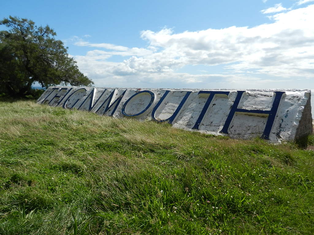
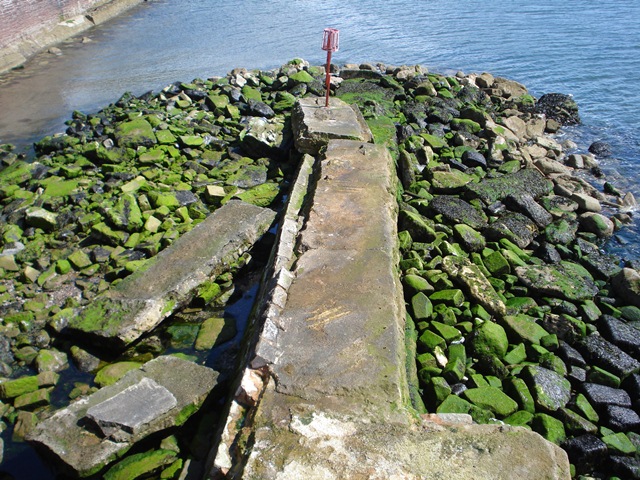
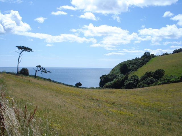
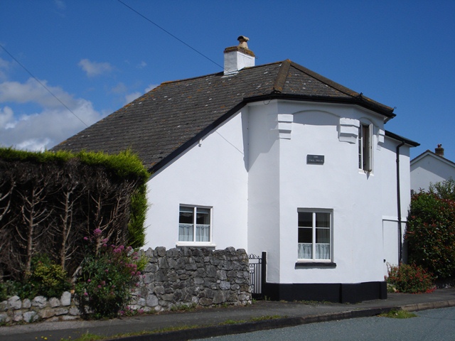
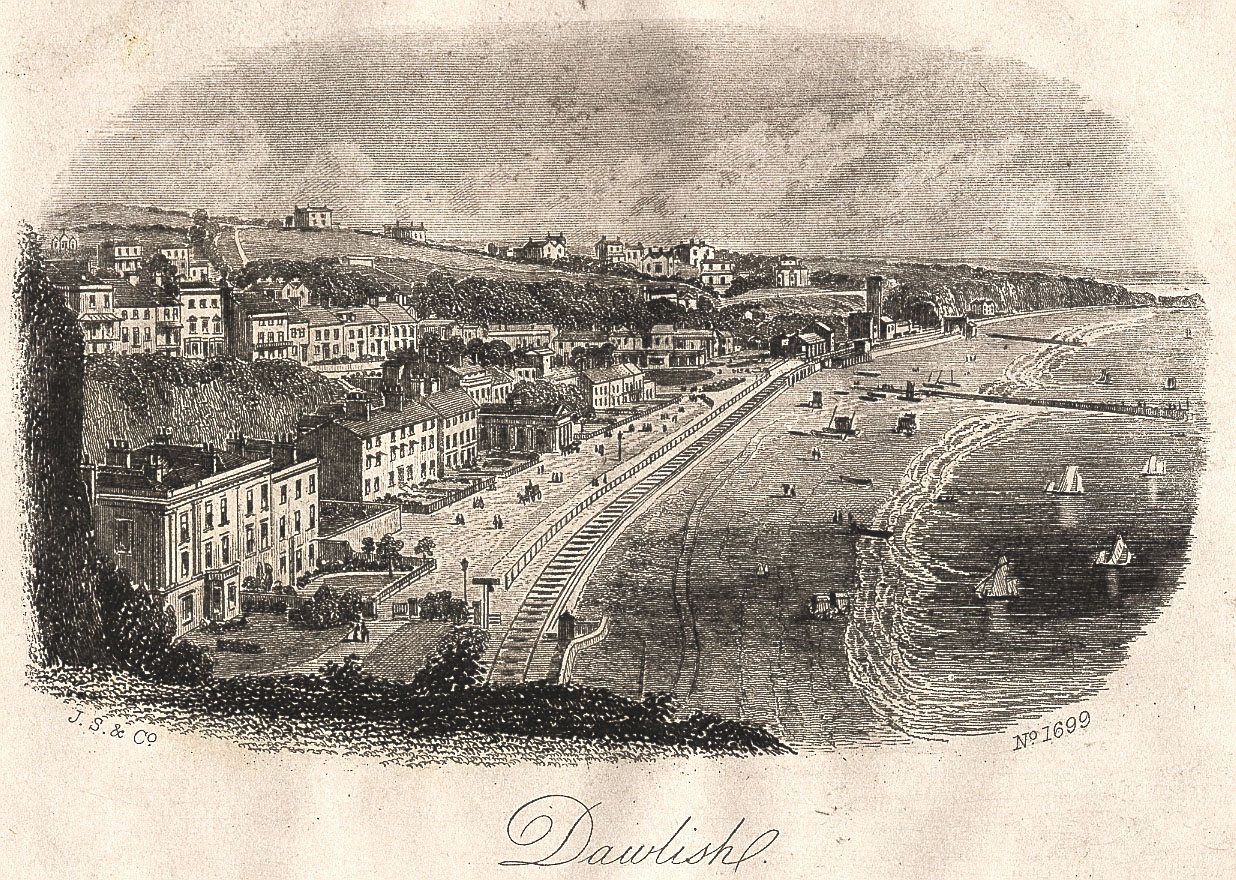
A walk along the South West Coast Path from Teignmouth, Devon

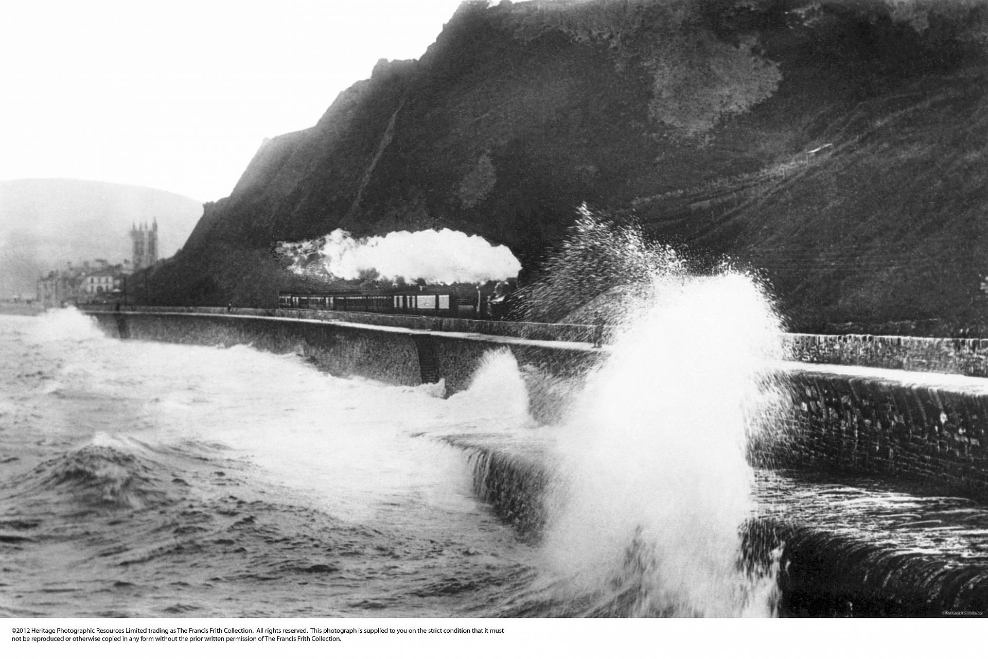
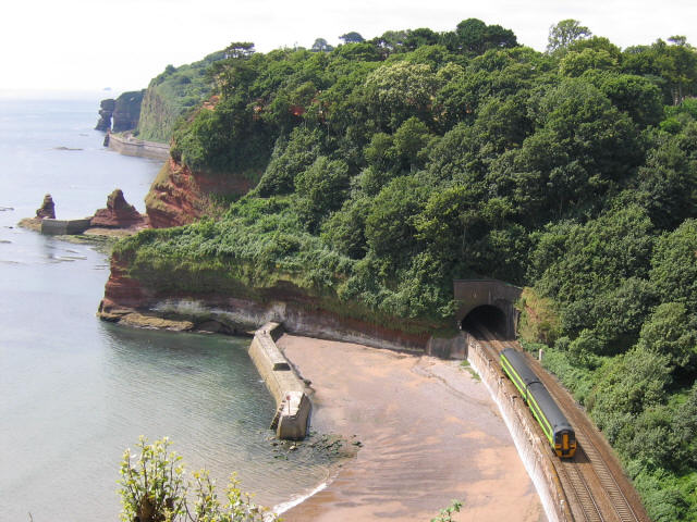
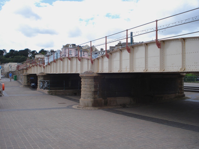
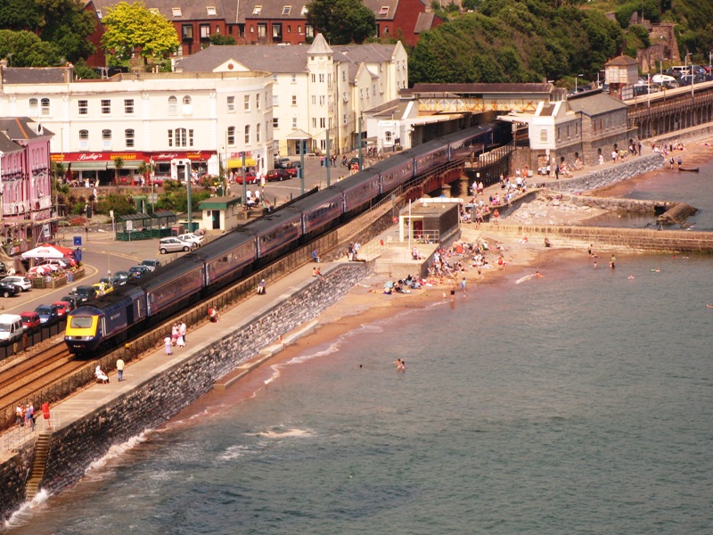
Seeing is believing! Travelling by train between Exeter and Newton Abbot is one of the most spectacular railway rides in Britain.

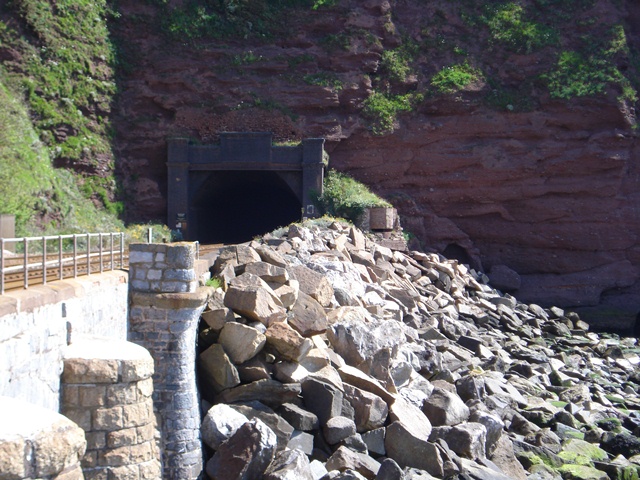
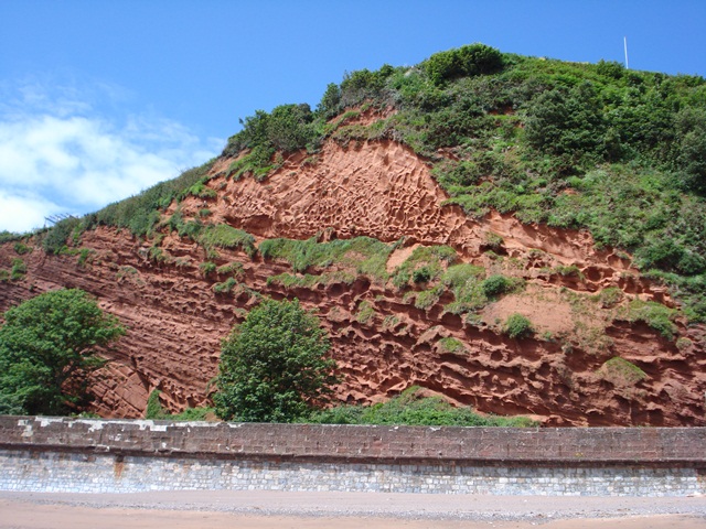
The line threads along the coast, follows estuaries and tunnels, and balances between steep red cliffs and the deep blue sea.

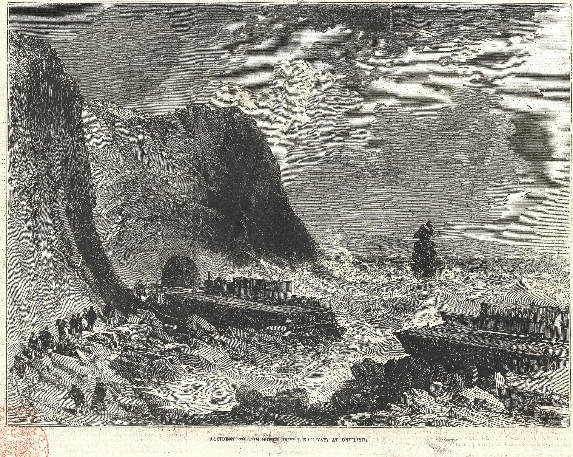
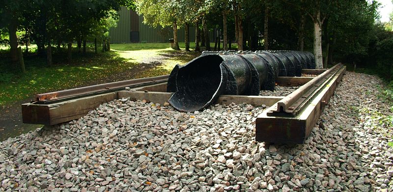
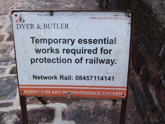
Since it was built in the 1840s the line has been closed many times by cliff collapses and seawall breaches. Trains are affected by gale force winds and flooded tracks. So why is it kept open? 

This walk explores why by following the railway between Teignmouth and Dawlish Warren. Along the way are stunning views, some fascinating stories and hidden secrets to discover as you are walking.


IMPORTANT NOTE: 
In extreme weather the railway is subject to closures and the Coast Path can be closed or diverted. For updates and information see the South West Coast Path website.

Follow the walk by clicking on the map pins or
downloading the guides below

Location: Teignmouth to Dawlish Warren, Devon
Start point: Teignmouth railway station, TQ14 8PG
Finish point: Dawlish Warren railway station, EX7 0NF
Keep an eye out for: Big waves - don't try the walk in stormy weather

South Devon railway walk credits

Thanks to - 

Pat Wilson FRGS for creating the walk, providing photos and the audio

Jenny Lunn for editing the walk materials and providing photos 

Caroline Millar and Rory Walsh for editing the walk resources

Tony Steel, Devon Libraries, Francis Frith and The National Railway Museum for kind permission to reproduce images from their collections

Daniel Davidson and Falmouth Art Gallery for kind permission to reproduce his painting

Florence Lee for additional assistance 

Other images reproduced under Creative Commons Licenses

The mid-19th century was a time of ‘railway mania’ in Britain with 4,300 miles of track being laid between 1845 and 1851 alone.