Despite the presence of soldiers, tanks and shells, some military sites in Britain are very important habitats where rare species thrive.
Others are the sites of prehistoric monuments. In fact, the Defence Estate employs professional conservationists and archaeologists to protect sensitive sites and species.
This walk takes us through beautiful chalk grassland scenery and to some impressive prehistoric sites so that we can see ‘military environmentalism’ in action.
This walk will explore three themes: first what characteristics of the natural landscape make it suitable for military training; second how the presence of the military has led to both accidental and deliberate conservation; and third how this military landscape is also a mythical landscape full of stories and legends.
This walk was created by Marianna Dudley, a historian at Bristol University.
Marianna: “For the last few years I have been doing research on the UK Defence Estate, which is all the land the military owns in Britain. As an environmental historian, I am interested in the gradual ‘greening’ of the military and its increase in environmental awareness over the twentieth century. I hope you enjoy the wonderful scenery and beautiful fresh air of this area as you learn more about military environmentalism.”
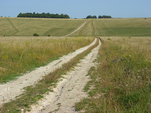
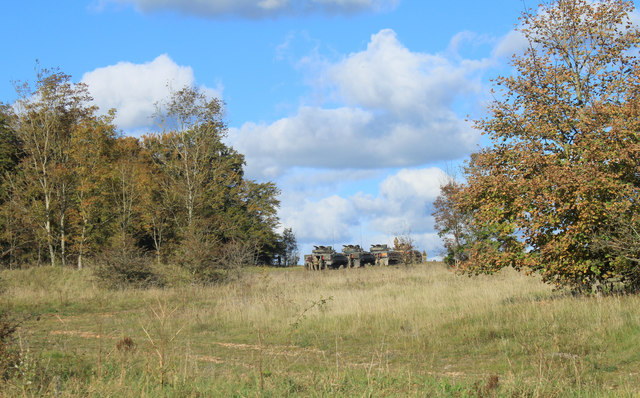
Tank tracks
Andrew Smith, geograph (Creative Commons License)
Directions
From Tilshead Garage at the western end of the village take the minor road opposite signposted Chitterne which heads straight upwards towards some trees. After about a third of a mile at the brow of the hill turn left into a large car park signposted “No access for civilian vehicles”. Stop at the left hand side of the car park.
2 Keep out!
Any country with armed forces needs space in which to train its soldiers as well as to test machinery and weaponry. For obvious reasons, this needs to be located away from populated areas.
Over the years, the British military has bought or leased land in less populated areas of the country that is characterised by its emptiness and wide open spaces including here on Salisbury Plain, Dartmoor, areas of Mid Wales and the far northeast of Scotland. In fact, the UK Defence Estate currently makes up 1 per cent of our entire national territory.
Land used by the military does not contain towns or villages; new roads are not built across it; intensive farming and industrial activities are kept out.
This means that military land is largely undeveloped and kept in a natural state making it some of the most unspoiled and exhilarating landscapes in the country.
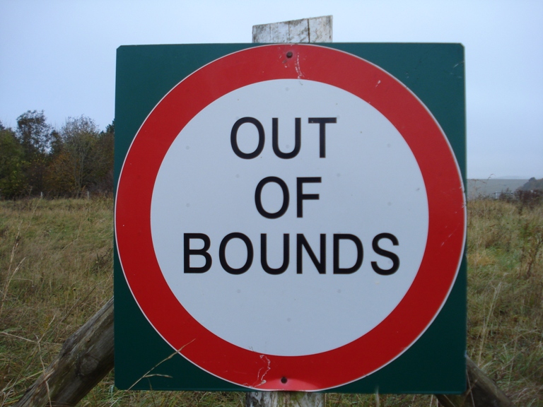
You have probably seen military areas marked on maps – they are blank spaces simply marked with the words “Danger Area” in red. In fact, you might be wondering how we can do this walk if the military like to keep people out. Warning signs saying ‘Keep Out!’ and ‘Danger!’ can be intimidating to us civilians, and we still think of military lands as out-of-bounds.
However, military land is much more accessible – and less threatening – than most of us realise. Also the Ministry of Defence is working to open even more of it up to the public. There are public byways and rights of way running through and around many training areas, including here on Salisbury Plain.
Go towards the left corner of the car park away from the road and the water tower. Follow the track and it goes gently downhill, through a dip and up the other side. Stop at the top where there is a line of trees stretching to the left and right.
3 Biting wind and bitter cold
It may not look or feel like it yet but you have arrived in Salisbury Plain Training Area (SPTA). At 38,000 hectares it is the largest military training area in the UK.
The expansive grasslands of the Plain are big enough to cope with the full range of British military weaponry.
Meanwhile Westdown Camp, on the outskirts of Tilshead village, is home to the Defence Infrastructure Organisation which runs the entire UK military training estate.
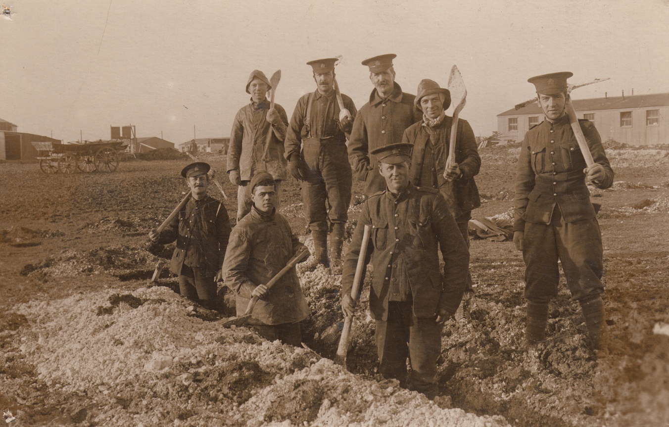
The military has had quite a long presence on Salisbury Plain. It began to buy land for training in 1897, in between the first and second Boer wars.
At this time, soldiers slept in tents and a sketch from the time shows horses pulling a cannon in the shadow of Stonehenge nearby.
Over time the War Office gradually acquired more and more land and the number of soldiers on the Plain increased. Training conditions were unforgiving, particularly in winter when a biting wind whips across the open Plain.
During the First World War the harsh conditions experienced by Canadian troops preparing to fight in France were so bad that Lieutenant Harcourt of the Canadian Armed Forces wrote a letter of complaint to Earl Kitchener, who was then Secretary of State for War.
“I understand that, up to yesterday, there were 11,000 soldiers in huts and 20,000 in tents... They had regular shooting practice and went out for 2 or 3 days maneuvering under regular service conditions. On Salisbury Plain they have none of this, and owing to the conditions of the soil, they cannot even learn to trench...”
The hard ground and bitter cold of the wintry plain in 1914 was nothing compared to the hellish theatre of war the men would soon join, but it was still a cause for concern, even for Canadians used to the cold!
Nowadays, troops are housed at Westdown Barracks, just the other side of Tilshead, although they still have to do survival training on the Plain and the weather conditions haven’t improved!
As you walk through this landscape, consider how the lie of the land and the changeable weather conditions must have challenged soldiers-intraining for over a century.
From the track, turn right along the footpath through the avenue of trees. After about 200 metres is a break in the trees and it is obvious that you are standing on an embankment.Stop here.
4 A fossilized landscape
Salisbury Plain may be unpopulated now but it wasn’t always so. From early Neolithic times, the Plain was the focus of intensive ritual and monument building, and contains some of the best-known prehistoric monuments in England such as Stonehenge.
Then intermittently for 2,000 years, from the middle Bronze Age to the post-Roman period, it was densely settled and farmed. After that Salisbury Plain was abandoned for settlement and cultivation as people moved to more productive and easier to work land.
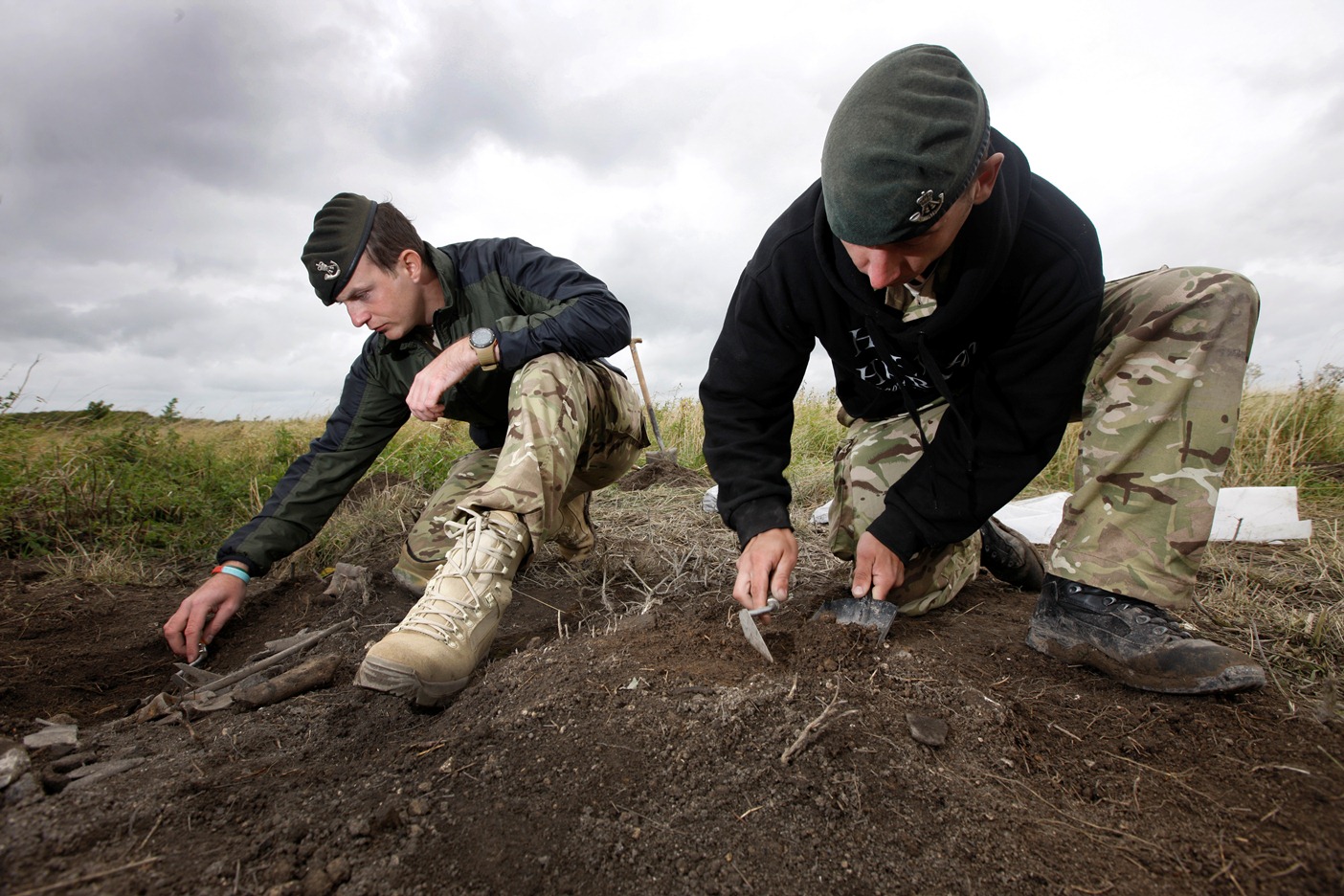
Archaeologists have found evidence of some cultivation in medieval times in some areas but large parts went out of cultivation as long as 2,000 years ago, and have been mostly left alone since. Hence this is one of the most remarkable surviving prehistoric and Roman landscapes in Europe.
Thousands of archaeological sites here have survived intact. In fact, on the training area itself, there are 2,300 sites dating back to 4,000BC. Look on an OS map for words such as tumulus or tumuli, earthwork and long barrow in an old-fashioned font – these all indicate prehistoric sites. In fact you have been walking along a Long Barrow.
You might be surprised that tanks and troops haven’t ruined these archaeological remains.
In fact, much more damaging to archaeological remains than military training is ploughing.
Archaeologists regard Salisbury Plain as a ‘fossilized’ landscape because it has been protected from decades of farming by the presence of the military.
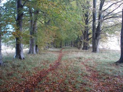
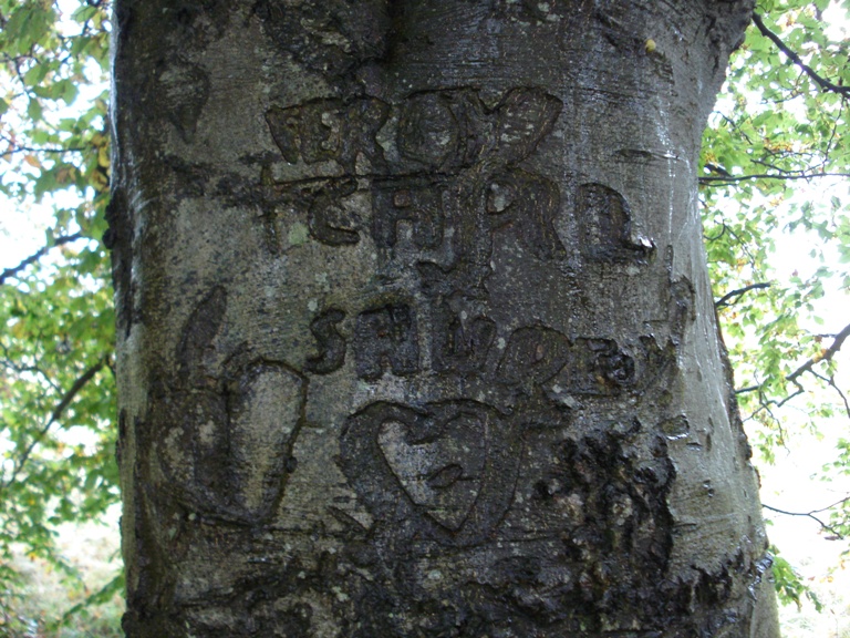
Continue following the footpath along the embankment as it heads back into the avenue of trees. Look carefully on the tree trunks for graffiti. Stop when you find some.
5 Tree graffiti
Humans like to mark their presence in a landscape. The prehistoric inhabitants of the plain did it in grand style, leaving earthworks such as the Long Barrow as memorials that have lasted millennia.
The soldiers who have passed through this place have at times felt compelled to mark their presence here too.
Look carefully at the trunks of the trees along the path and you will see etchings and carvings made by soldiers over the years. The proper name for tree graffiti – carved into the trees by bayonets – is arborglyphs.
Chantel Summerfield, a PhD student at Bristol University, is studying these tree markings and has uncovered some fascinating stories.
One mark among these trees was made by an American GI as he awaited being dispatched to take part in the D-Day invasion. It says ‘Frank Fearing – Hudson, Massachusetts, 1945’, followed by a love heart and the name Helen. Chantel managed to track down a Barbara Fearing in Hudson, whose parents were Frank and Helen. Barbara was thrilled to see a picture of the mark on the tree and filled in more of the story. Frank had secretly married Helen just a few hours before leaving for Europe to fight. He survived the war and lived until 2001. He had told Helen he would carve her name into a tree everywhere he went in Europe but she didn’t believe him. Although Helen has recently passed away, she was alive when Chantal got in touch, and was able to see a picture of the tree her husband had engraved for her all those years ago.
The prehistoric earthworks and the Second World War graffiti are both marks left in the landscape by humans that endure well beyond their lifetimes.
Continue following the footpath through the avenue of trees. When you reach a broad gravel track turn left. After about 100 metres is a crossroads of tracks where you should go straight on. After another 50 metres the line of trees on the left ends and the track starts to descend. Stop here with expansive views to the south.
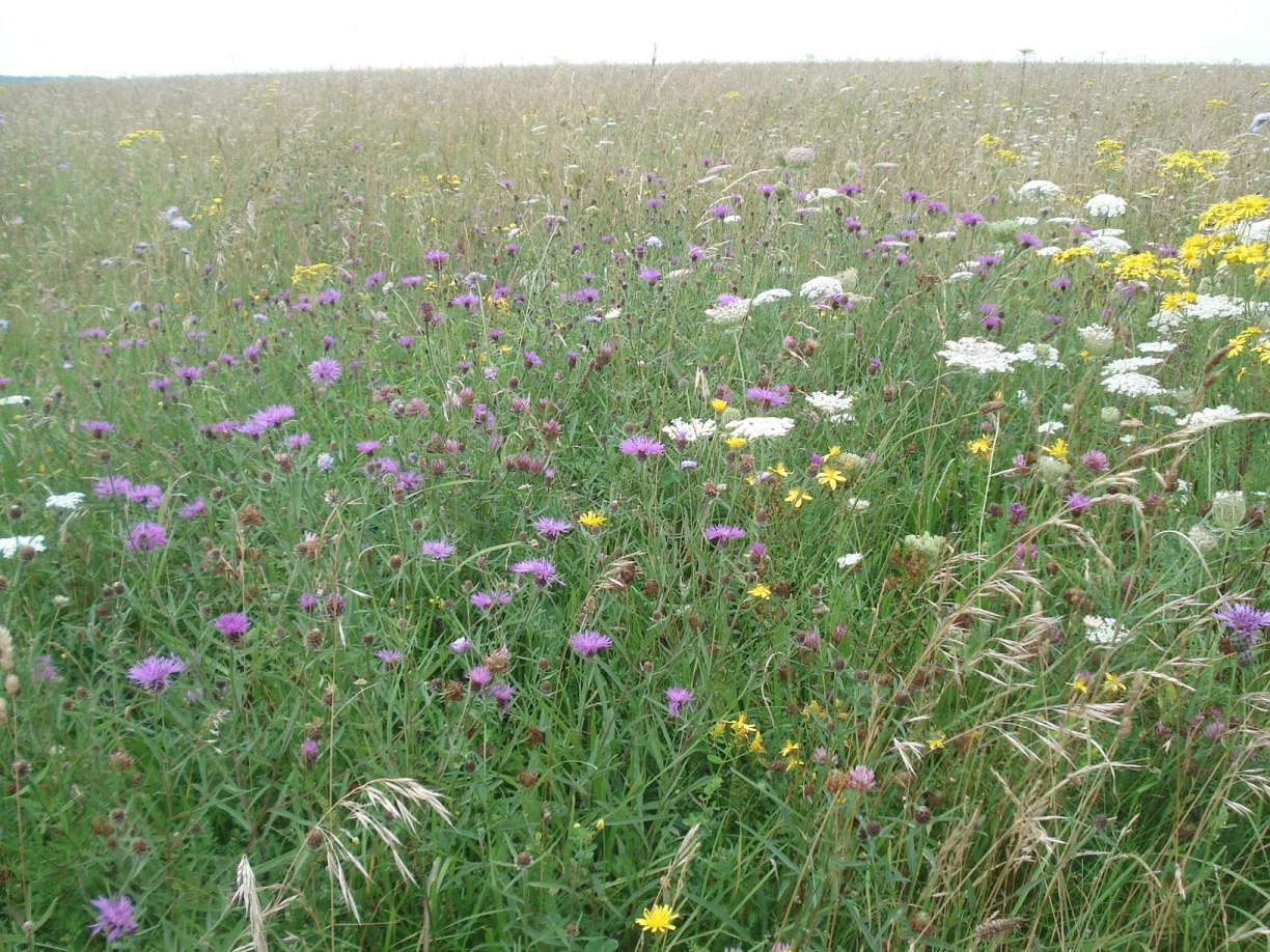
6 An ancient grassland
From here you can really appreciate the scale of the grasslands. These grasslands develop where the underlying rock is chalk.
Salisbury Plain sits on a band of chalk that lies underneath much of southeast England stretching from Dorset to the Wash. This particular area from Warminster in the west to Tidworth in the east is characterised by its undulating hills.
Chalk was formed during the Cretaceous period about 65 – 90 million years ago when global sea levels were much higher.
Northern Europe, including Britain, was covered by a shallow and warm sea.
Over millions of years, the remains of microscopic sea creatures accumulated on the bottom of the sea and these were gradually compressed, eventually becoming chalk.
Chalk rock is ‘permeable’ meaning that water can pass through it. Rain water that falls on it quickly drains through leaving a very dry rock and soil conditions. This attracts particular flora and fauna that have adapted to these conditions.
In summer, chalk grassland suffers from heat and drought; in winter, frosts and poor soil nutrient status. Together with regular grazing, these prevent any individual species from reaching its full potential. The result is a very diverse habitat where no single species can out-compete the others.
Trees struggle, but grasses thrive. Cowslips, kidney vetch and orchids are also found. These support important populations of insects; and beetles, bees, moths and butterflies particularly flourish here on the plain. These in turn support bird and animal life. We will hear more about some of the rare species of bird that thrive on the grassland a little later in the walk.
Being so hard to cultivate, Salisbury Plain has been free from ploughing since Roman times (although a few areas were cultivated during the medieval period) and has also escaped the use of pesticides and fertilisers in the modern era. Then because of the military presence, this grassland has survived significant further human interference.
In fact Salisbury Plain is now the largest surviving unimproved chalk grassland in Northern Europe and makes up 40 per cent of chalk grassland left in the UK. It is also protected as a Site of Special Scientific Interest and a Special Area of Conservation. These designations recognise the environmental importance of this place, and ensure its protection in the future.
Continue along the track as it heads down into the dip and up the other side. Immediately after a line of trees begins on both sides of the track take the track on the right which is signposted as a Byway. Stop after about 50 metres where you have a good view of the village.
7 A little bit of Iraq in Wiltshire
Having walked across the open grasslands in a very natural landscape we have now come to a small settlement. But this is no ordinary village; it is a Fighting in a Built-Up Area (FIBUA) village.
The majority of the village was built during the Cold War and was designed to look like a ‘typical’ East German village. Sections have since been added and modified.
Marianna: “When I was given a chance to explore inside the village by the MoD, a training exercise recreating Iraq had just finished. Adobe desert dwellings had been built with Arabic signage on the walls...”
“Washing was hanging on lines, there was also the wreckage of a helicopter and fake blood spattered in the dirt. You may find this level of detail surprising, but the military go to great lengths to create realistic battle conditions, even if the grassy plain has to stand in for dry desert.”
About 8 miles to the northwest, in the top corner of the training area, a new FIBUA has been built that recreates typical Afghani compounds.
FIBUA village
Chris Talbot, geograph (Creative Commons License)
Directions
Remain in the same place but stand with your back to the village to look north.
8 Ghost village
We’ve just seen a specially-created training village but there’s another training village nearby that is quite different.
To the north, just out of sight tucked down in a fold of the plain lies Imber, a village that was evicted in 1943 to make room for training which ultimately prepared troops for the D-Day landings.
Villagers left under the impression that they would be able to return to their homes when peace resumed, but the village was retained for training and remains in use today as our Armed Forces prepare for operations.
The ghost village of Imber is a recent addition to the stories, myths and legends that have been inspired and set in this unique landscape.
As we think about the prehistoric people and training soldiers that have populated this landscape at different points in its history, let’s not forget the people that were living and working here until 1943.
We are now going to circumnavigate the village. Don’t be alarmed if there is activity within the village – the footpath around it is a public right of way and safe to use. Any shooting or firing here is simulated, as we are in a dry training area where live ammunition is not used.
Continue along the track with the village on your left. When you reach a crossroads of tracks go straight on into the trees. This is signposted as a Byway. About 100 metres further is another crossroads surrounded by trees. Stop here.
9 Ambush
We have reached a crossroads. The thickets of trees on all four sides make it a quiet spot, shielding us from the wind and noises that travel so far across the open plain.
If you look a little closer you can see that the trees are in straight lines. In other words they are deliberately planted not natural.
These dense patches of woodland provide shelter for troops out on operations and act as a strategic landmark in the open countryside.
In fact, if you look at the OS map of this area you can see various small plantations like this one and lines of trees scattered across the training area, often on the crests of hills, along ridges and roads and other such strategic places.
Soldiers out on manoeuvre appreciate the cover and the shelter that the trees provide but so do the wildlife of the plain. Tree-nesting birds flock here. Stand still for a moment and see if you can hear birdsong. Mammals such as rabbits and deer also use this dense cover on the otherwise open plain.
This tree plantation is a good example of accidental environmentalism: the military planted the trees for training purposes but they have also become habitat for a variety of species.
Tanks between trees
Maurice Pullin, geograph (Creative Commons License)
Directions
At the crossroads turn left (note that all four directions are marked as Byways) in a southerly direction. Follow this track for about half a mile. Along the way look for ruts in the track, particularly ones filled with water. Stop when you find one.
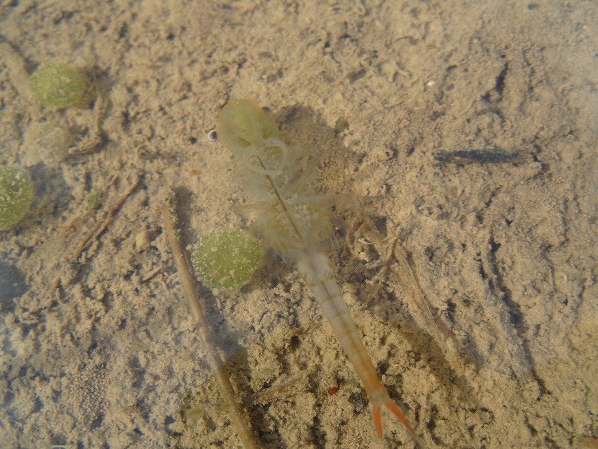
10 The curious tale of the tank and the shrimp
The unrestricted space of this open grassland is ideal for tank training. You might spot some rumbling in the distance. Tanks are formidable machines with the capacity for destruction built in to their very being.
Although they can move around this landscape well, during wet weather they make ruts in the muddy ground. These ruts are then filled with rain water. And in these puddles live the tiny, translucent Fairy Shrimp.
This is the tale of perhaps the most surprising relationship on the plain: the enormous tank and the tiny Fairy Shrimp.
Fairy Shrimp are no bigger than your little fingernail. They live in puddles and ditches and are one of only a few species able to undergo cryptobiosis, which is a state of torpor in which they shut down to survive extreme droughts and temperatures. This means their eggs can survive up to 15 years, even when their pools dry out, and hatch when water returns. Historically, the shrimp were dispersed in puddles around the plain by the hooves of grazing cattle. But cultivation of this area declined in the nineteenth century and the shrimp’s survival was under threat. It was even protected under Schedule 5 of the Wildlife and Countryside Protection Act of 1981.
But now the little Fairy Shrimp has made a comeback thanks to the tanks. Rather than cattle hooves, the shrimp use the tank tracks to move from puddle to puddle and reproduce. The tanks are constantly creating new habitats for the shrimp as they gouge out new ruts. If you see a shallow puddle, have a look to see if you can spot some of these resilient creatures! They look a bit like tiny blades of grass in the water. It is quite incredible that these tiny, fragile things not only withstand the movement of tonnes of metal through their environment but also actively benefit from it. This story reminds us how nature can be more opportunistic and resilient than we often appreciate.
Continue along the track. At the next junction turn left along the track signposted Byway and Imber Range Path. After about 150 metres this track merges with a wider gravel track – continue straight on. After another 150 metres is a major crossroads of tracks with the FIBUA village entrance to the left – continue straight on with the village on your left. After another 500 metres is another crossroads. Stop here.
11 Bleak and bare
This kind of empty, open space is really rare in southern England so you can understand why the military wanted to use it but the emptiness of the Plain wasn’t always so highly valued.
Several myths and legend exist that depict the Plain as a wild and mythical landscape. The presence of ancient burial sites and standing stones fed into stories of ghosts that roamed the grasses.
The emptiness made it a hostile place for travellers, who passed quickly through to more familiar and peopled landscapes.
Here are two excerpts of poems inspired by Salisbury Plain that express the fears and superstitions people have held about this landscape.
The first is ‘Salisbury Plain’ by William Wordsworth, whose walk across this landscape in 1793 inspired these words:
The troubled west was red with stormy fire, O’er Sarum’s plain the traveller with a sigh Measured each painful step, the distant spire That fixed at every turn his backward eye Was lost, tho’ still he turned, in the blank sky. By thirst and hunger pressed he gazed around, And scarce could any trace of man descry, Save wastes of corn that stretched without a bound, But where sower dwelt was nowhere to be found... Hurtle the rattling clouds together piled By fiercer gales, and soon the storm must break. He stood the only creature in the wild On whom the elements their rage could wreak...
A legend set on Salisbury Plain plays upon similar themes to those of Wordsworth’s poem, and became popular in the nineteenth century.
It is the story of a drummer boy, killed upon the Plain and who continues to haunt it.
It was included in the Ingoldsby Legends in 1837. It lacks the finesse of Wordsworth’s language but presents a similar view of the plain as a hostile environment.
Oh, Salisbury Plain is bleak and bare, At least so I’ve heard many people declare. For fairly I confess I was never there; Not a shrub nor a tree Nor a bush can you see: No hedges, no ditches, no gates, no stiles Much less a house, or a cottage for miles; It’s a very sad thing to be caught in the rain When night’s coming up on Salisbury Plain
Herman Melville also mentions Salisbury Plain in Moby Dick. He compares its open grasslands to the open oceans, and concludes that it is one of the bleakest places on the planet!
Today, this openness and emptiness is rare on island Britain, and we can appreciate and value it more than it has been, perhaps, in the past.
At the crossroads turn left on the track that leads between trees and with the village on your left. Stop after about 250 metres where there is another entrance to the village.
12 From protests to conservation
During the 1960s and early 1970s there were a series of protests against military training here on Salisbury Plain. As military training in the countryside was becoming more unpopular, the government ordered a committee to look into military landholdings and suggest ways to improve relations with surrounding communities and to take better care of their lands.
The Nugent Committee recommended a more environmentally-aware approach and said the military should recognise and respect the fact that civilians valued the landscapes in which they were training, and should be allowed to enjoy them too.
The report, published in 1973, laid the foundations of military environmentalism which has ensured responsible stewardship of Salisbury Plain and other precious landscapes.
The report asked the military to take more responsibility for both the archaeological and natural heritage of its lands. Conservation groups were set up at every military base with a dedicated conservation officer and membership open to members of the public. There is also a conservation magazine called Sanctuary that lets people know about conservation efforts involving the military environment.
Military environmentalism, or ‘khaki conservation’, is now an important part of how the military uses the training estate. Training remains the top priority, but it is now coordinated with the environmental needs of the site. Indeed, passing on awareness of the natural and archaeological environment to troops has become an important part of their training.
Take the track opposite the entrance to the village which is signposted as a Byway. After about 300 metres and just before a major crossroads, take the minor track to the left across the grassland which is signposted Byway and Imber Range Path. This will take you across Copehill Down. Stop somewhere along this path on the open grassland.
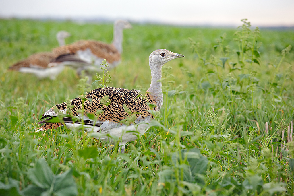
13 Big birds
At the last stop we heard about the military becoming more aware of their environmental responsibility and there is one outstanding example of military cooperation with civilians over conservation: the Great Bustard reintroduction programme.
As we heard earlier, the chalk grassland here on Salisbury Plain is a special habitat. It supports lots of rare species such as ground nesting birds like Stone Curlews and Great Bustards.
The Great Bustard is the largest bird species in Europe. It grows to about a metre high and long, and can weigh up to 18 kilograms. It is the heaviest flying animal in the world but it tends to run if frightened.
The Bustard’s natural habitat is open grassland and they were once a common sight on Salisbury Plain.
In part of the poem we heard earlier Wordsworth describes the eerie shriek of the birds across the plain.
But Bustards were a prize hunting trophy, and due to their size and slowness, they were hunted to extinction in Britain by 1840.
Some dedicated individuals have devoted themselves to reintroducing this magnificent bird and Salisbury Plain has been chosen as the best place to do it.
The Great Bustard Group approached the military about reintroducing birds to the training area, where they would be protected from poachers and hunters.
The military agreed and in 2003 the Department for the Environment, Food and Rural Affairs granted a 10-year licence to reintroduce Great Bustards to the UK. The birds have been brought over from the Saratov region of the Russian Steppes, and released on Salisbury Plain Training Area where they are doing well.
The Great Bustard is a similar shape to a goose but much bigger with rich brown plumage and a grey-blue head. It is a noble bird but quite shy so you are unlikely to spot one.
However, if you are curious to see one and find out more about the reintroduction programme, the Great Bustard Group organizes viewing trips. Alternatively you can go to the Bustard Inn at Shrewton where there is a stuffed Bustard on display. The pub also serves Stonehenge Ale’s delicious Great Bustard beer!
Continue along the track across the open grassland of Copehill Down. For some distance it stays on the highest ground. There are several crossroads of tracks but continue straight following the signposted Byway and Imber Range Path. After some way the track starts to drop steadily downhill and merges with another track coming from the right.
Continue following the Byway and Imber Range Path which becomes a gravel track. Look out for the White Barrow owned by the National Trust on the right side. You may wish to go over the stile into the site to have a look. Stop about 100 metres beyond the White Barrow.
14 A buffer zone
From here you can see the low green-roofed buildings of Westdown Camp where soldiers training on the plain are based and also the home of the Defence Infrastructure Organisation.
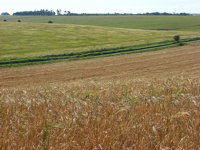
Look around and you might notice that we have moved into a different kind of landscape to the open grasslands where we were earlier. In fact around you are farmed fields.
What you can actually see will vary depending on the time of year but it is likely to be an arable crop of some kind. You may also be able to see cattle grazing around here.
We heard earlier about the lack of farming on the plain over recent centuries and also how the military presence has meant that there has been no ploughing or crop-spraying which may have damaged the prehistoric archaeological sites or grassland ecosystems. So you may wonder why there is farmland here.
In fact the military leases land to farmers around the perimeter of the training area and particularly around the villages and roads that cut through it. This land is leased at a good rate to farmers in exchange that the military can use it when they need to for training. In return the farmers graze livestock which keep the grass short (good for soldiers and tanks) and healthy (good for habitat).
Thus this farmland forms an important buffer zone between the areas of more intensive military activity and the places where civilians live and work. The reciprocal relationship between farmers and military ensures good management of the land and benefits both.
Fields near Tilshead
Andrew Smith, geograph (Creative Commons License)
Directions
Continue down the gravel track for a short distance then take the footpath on the left signposted Imber Range Path. Follow the path as it rises gently between fields. Stop before you reach the trees at the right side of the path.
15 Defender of the nation and nature
As we approach Tilshead village we’re almost at the end of our walk. We hope you have enjoyed the wonderful scenery and beautiful fresh air of these open grasslands.
Grasslands on a scale like this are normally associated with North America or the Russian Steppes. But this wonderful landscape is in the heart of southern England and is more accessible than many people may think.
It is a dramatic landscape where ancient people built their ritual sites; its features have become the stuff of myths and legends were formed; and its desolation was a place of fear for travellers.
Its physical characteristics also made it ideal for military training which is why it was appropriated by the Ministry of Defence over a century ago. For most of the last hundred years the military presence on this land protected the natural chalk grasslands and prehistoric archaeological sites from human interference.
For many decades this protection was not planned; it was just a by-product of military use and not given much thought. But over more recent decades the military has developed a sense of responsibility towards the environments that it uses. Furthermore, conservationists and wildlife enthusiasts – particularly birdwatchers – have brought particular issues to the MoD’s attention.
The MoD now recognises its role in both conservation efforts and archaeological protection. The stories of the Fairy Shrimp and the Great Bustard are just two examples of how wildlife and the military can not only coexist but also benefit from one another.
We hope that this walk has drawn your attention to the often paradoxical nature of military environmentalism. The role of the military is as defender of our nation but should it also defend our nature? Military conflict is invariably associated with damage and destruction against both humans and nature. This walk has shown that in some ways the presence of the military can also be constructive and preservative.
Most people would probably agree that if we must have a military then the more environmentally aware and responsible it is the better. The more us civilians know about military environmentalism, the more of a stake we have in these landscapes.
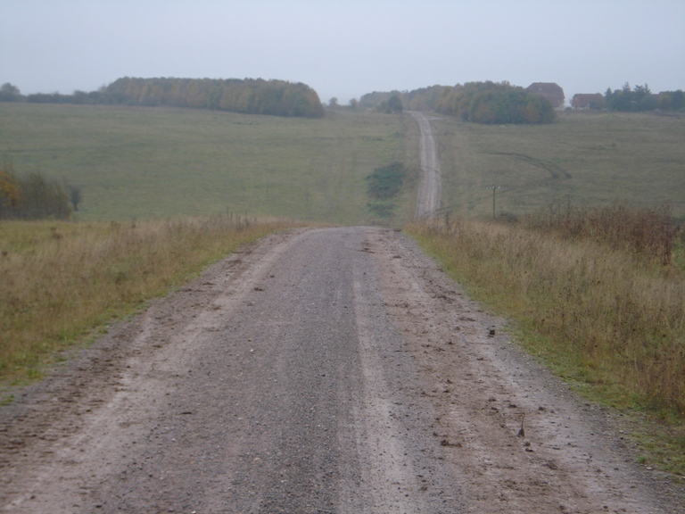
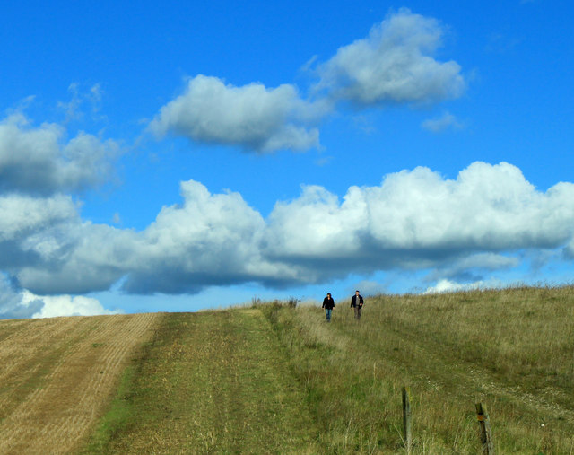
A walk on Salisbury Plain
Maurice Pullin, geograph (Creative Commons License)
Directions
Continue along the footpath with a row of trees on the right and fields on the left. When you reach a junction of paths bear left following the Restricted Byway sign. This path takes you behind the houses of the village to High Street.
The garage and car park are to the left; the bus stop southbound towards Salisbury is on the opposite side; and the Rose and Crown pub and bus stop northbound towards Devizes is to the right.
Your browser is out of date, and unsupported by this website. Please upgrade to the latest version to use this website.
An ocean of grassland and a sweep of big sky. Ancient monuments loom out of the mist; camouflaged soldiers crouch in the undergrowth. Salisbury Plain is a landscape of extremes.
It is the largest remaining area of chalk grassland in Northwest Europe, home to 2,300 prehistoric sites and also the largest military training area on British soil. Surprisingly the military presence benefits the archaeological sites and natural habitats.
This walk follows public footpaths deep into the military training area, taking you out of your comfort zone to experience a totally new kind of landscape. Don’t worry - it’s safe and legal!
Walk along Britain's largest prehistoric long barrow to an East German village. Hunt in puddles for tiny shrimp and look out for the largest birds in Europe.
As you are walking, enjoy this spectacular landscape to stretch your legs, blow away the cobwebs and fire the imagination.
Follow the walk by clicking on the map pins or downloading the guides below
PLEASE NOTE: We have received feedback that the route is blocked after point 4 due to a fence. If you undertake the walk please let us know what you find if whether there is an alternative route. Please email your feedback to [email protected].
Marianna Dudley for creating the walk and providing photos
Peter Coates for his support and for assistance
Richard Osgood from the Ministry of Defence for advice and images
Jenny Lunn and Caroline Millar for editing the walk materials
The Arts and Humanities Research Council (AHRC) for funding the production of this walk under the programme ‘Enhancing the Role of Arts and Humanities Perspectives on Environmental Values and Change: Policy, Practice and Public Discourses’
Iain Perkins, The Mary Evans Picture Library, David Kjaer (the Great Bustard Group) and Paul Reed (Great War Photos) for kind permission to include photos from their collections
Other images reproduced under Creative Commons Licenses
"Daily I walked in the wide grassy way between the flint slopes, past chalk valleys rubbled white and looking sometimes like a Himalayan valley" - V.S. Naipaul on Salisbury Plain