Hello! I’m Dick Bateman, a retired teacher and I’ve lived in Saltford village for 30 years. I walk this route up onto the Cotswold Hills and back most Sundays with a pal, John Neil, and a dog, one of which is usually good company.
Another pal, the late Tom Scott, invented this Sunday morning walk with his Ordnance Survey map and the three of us kept each other entertained as we walked until Tom’s untimely death in 1992.
John and I keep up the routine and we reckon we’ve completed this walk some 800 times. But it’s always fresh! There is always something new to watch and comment on in the fields and villages we pass through.
This walk takes us over fields, along routeways and past buildings that have changed their function many times over the 7,000 years since Mesolithic people chipped flints on the top of Kelston Round Hill. You will learn about the different ways in which this landscape has been used for economic activity over the centuries and millennia. You will also see how, as in many other parts of Britain, people have moved progressively downhill, with most now living in the towns and cities of the valley.
The walk is circular and is about 6 miles long and it should take between 2 and 3 hours. The first section is easy then there is a steep climb up onto the top of the Cotswold Hills which is not difficult but will make an average person puff. After crossing the flat top of the hills there is a moderately steep descent down the Cotswold Escarpment through North Stoke village, not difficult but hard on ancient knees. The last stretch back to Saltford is easy. I hope you enjoy it.
To start the walk make your way to Saltford Brass Mill. From The Shallows car park, the Mill is about 200 metres on the left hand side of the lane. Stop outside the Mill.
2 Pots and pans
We’re starting our walk on the banks of the River Avon. For centuries, humans have captured kinetic water power to drive production of different goods. In fact, there has been enterprise and industry right here from some of the earliest written records.
A watermill was registered here in the Domesday Book of 1085, probably a wooden building grinding corn. Then in the medieval period, there are references to a cloth-fulling mill.
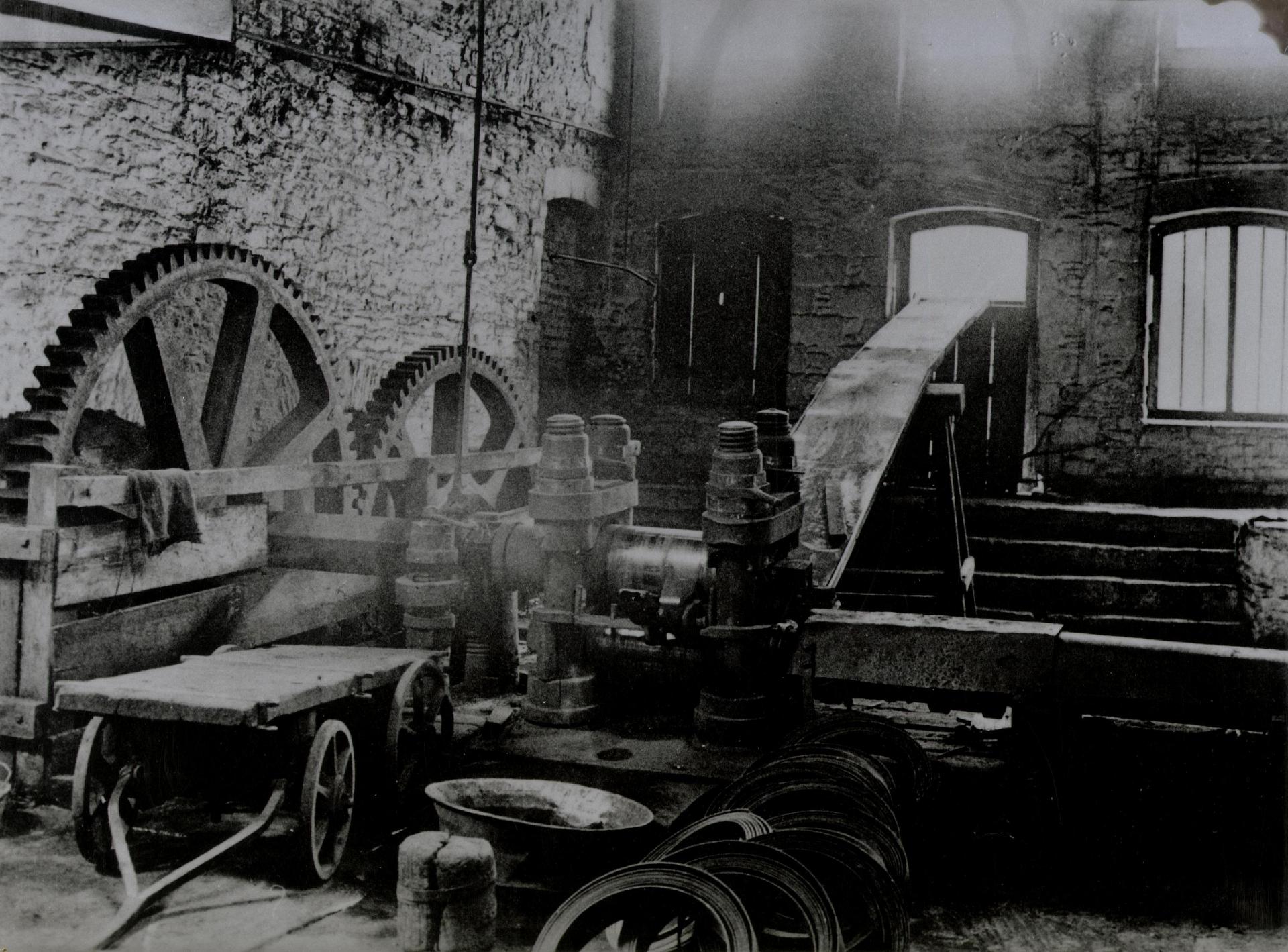
This mill was converted into a stone building in the late seventeenth century and from 1721 until 1925 it was used for hammering brass made in Bristol into pans and kettles and rolling brass to produce thin sheet from which wire was produced. But to tell you more about this, here’s Tony Coverdale – he’s the Secretary of Saltford Brass Mill Project.
Tony: Saltford Brass Mill was just one of a series of mills working in brass in the Avon Valley during the eighteenth century. Bristol’s earliest brass mills were built in 1704 at Baptist Mills, the site now being the location of the roundabout at the end of the M32.
The works were managed by Abraham Darby, better known for his work with iron at Coalbrookdale. But he had been an apprentice in Bristol and developed his early prowess in metallurgy, and in particular the use of coal as a fuel, here in Bristol.
Darby made brass at the Baptist Mill works by alloying copper from Cornwall, smelted on the banks of the River Avon using coal from the Kingswood coalfields, and using calamine (a zinc ore) mined on the Mendips.
The waterwheels in this mill were used to power hammers and rolls, the hammers being used to beat cast brass slabs called ‘naps’ into pans and kettles, called hollowware, and the rolls being used to produce thin sheet.
The beating process was known as ‘battery’, so Saltford Mill was known as a brass battery mill. The hammered and rolled brass had to be periodically heated or ‘annealed’ in one of the four furnaces to prevent the brass from becoming brittle or cracking. And this mill is the only surviving one in the valley still with a furnace and working water wheel. And it’s run by a group of volunteers and is open from May to October.
Brass rolls at nearby Avon Mill Keynsham (1925)
By kind permission of Saltford Brass Mill Project
Directions
Retrace your steps along The Shallows past the car park. On the opposite side from the public toilets is a gateway leading to a permissive footpath. Follow this footpath and up the steps onto the embankment of the old railway. Turn right and cross the bridge. Keep to one side as the track is often busy with speeding cyclists. Pass the River Avon Trail information board and look for a stone bridge parapet on the left a few hundred metres further on. Take the path at the side of the parapet leading steeply down to a stile and the track below. Turn up the track. Stop before the first gate.
3 Natural beauty
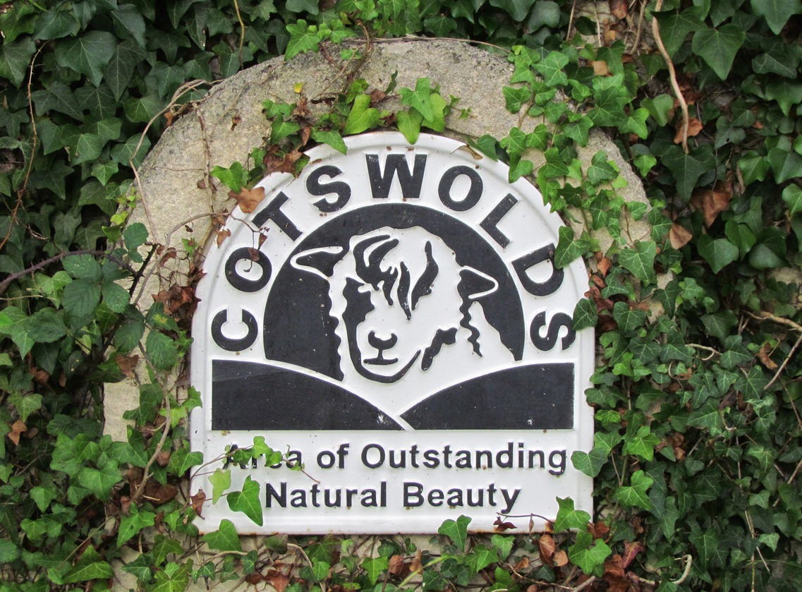
This area north of the River Avon is part of the 790 square miles of the Cotswold Area of Outstanding Natural Beauty. This is the largest AONB in England and Wales. It was designated in 1966 and was further protected by the Countryside and Rights of Way Act in 2000.
The primary purpose of AONB designation is to conserve and enhance the natural beauty of the landscape. There are also two secondary aims – to allow people to enjoy the countryside and to respect the interests of people who live and work there.
In trying to achieve this balance between conservation of natural areas which are also inhabited and often working landscapes, the AONB uses planning controls and practical countryside management.
That said, it is interesting that in the 1980s, a field known as Barrow’s Style, a steep but shallow valley above Kelston village on the hill in front of us, was used as a landfill site for two years. It is now grassed over and you would never guess this previous, temporary land use.
Looking back to the left, on the flat land of the river terrace above the riverside houses of Mead Land and Saltford Sailing Club, is Saltford International Airport. Well, Clive Shipley keeps a plane there on a field which used to be sometimes arable and sometimes sheep pasture, and occasionally flies it to France, whence his wife, Monique comes.
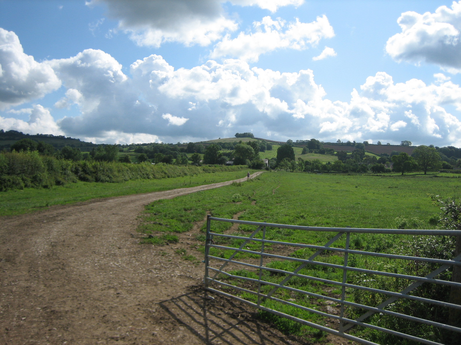
Go through the gate and continue following the track through the fields. Stop at the second gate.
4 Changing fields
We are now in the fields of Park Farm. The fields on this farm and those on this hill look very different from what they might have looked like just 300 years ago, for then there would have been more patches of woodland. The open land would have either been very large fields divided into strips owned by local families, or – especially on less productive and steeper areas – common land, owned by no-one where locals could graze their animals.
However, between 1700 and 1840, the fields were increasingly ‘enclosed’ and bought up by the more wealthy farmers and businessmen. The strips of land were collected into larger fields, bounded by hedges or, on the hills, dry stone walls.
Continue to follow the track straight up the field. At the white painted farm buildings take the footpath on the right between two fields. Then follow the track past a thatched cottage and a cattery. Follow the road into the village. Stop at the junction, with Kelston Village Hall and St Nicholas’s Church off to your right.
5 Village of calves
Many names of villages, towns and cities in Britain have historic origins which provide clues about the original inhabitants or the activities carried out there. Here in Kelston village, there are different possibilities about the origin of the name.
Kelston has been interpreted as ‘Calves-tun’, an Anglo-Saxon word meaning ‘village of calves’, which seems apt, considering the dairy herd we have just seen at Park Farm. The earliest record of ‘Calveston’ is from 1123.
An alternative, original and perhaps more fanciful meaning of Kelston has been proposed. ‘Ton’ means enclosure or farm but it is perhaps a corruption of ‘dun’, meaning hill. K was not a letter in Saxon language, so if we change it to a C, making it Cel. So Celsdun is the Hill of the Celts. It was probably called this by the Romans when they occupied Bath.
Take the road to the left and after a very short distance is the entrance to Park Farm. Look for the sign for cheese. Stop at the gate of the farm.
6 Soft cheese
Here we are at the gates of Park Farm looking at Graham Padfield’s cheese shop. With me is the farmer himself – Mr Graham Padfield – and Graham, I’d like you to tell us all about your successful farm and your farm-based industry, that of cheese-making.
Graham: All the buildings in this farmyard are hundreds of years old. Nobody can remember when they were put up. My grandmother made cheddar cheese in what was converted into a garage – just over there. Next to that is what we used to call the ‘ten house’, which was where ten cows were tied up by the neck to be milked. In fact, they were kept in there all winter – they were fed hay and roots.
Anyway we’ve converted those buildings – what was originally the cheese room and ten house – into a cheese making area. The reason for this is that we wanted to add value to our milk because milk quotas have sort of stultified the industry. And it seemed like a good idea at the time to have a good bash at increasing the value. And cheese, of course, sells for ten times the price of the milk.
When we were toying with the idea of making cheese, we found that there was a cheese made in Bath called Bath Cheese. And it was actually recorded that Admiral Lord Nelson had been sent two cheeses of the Bath variety by his father who was the Reverend Nelson. And his father put in the note that accompanies these cheeses: “I send you two cheese of the Bath variety. I know that Lady Hamilton is much gratified by their flavour.” You can read into that what you like!
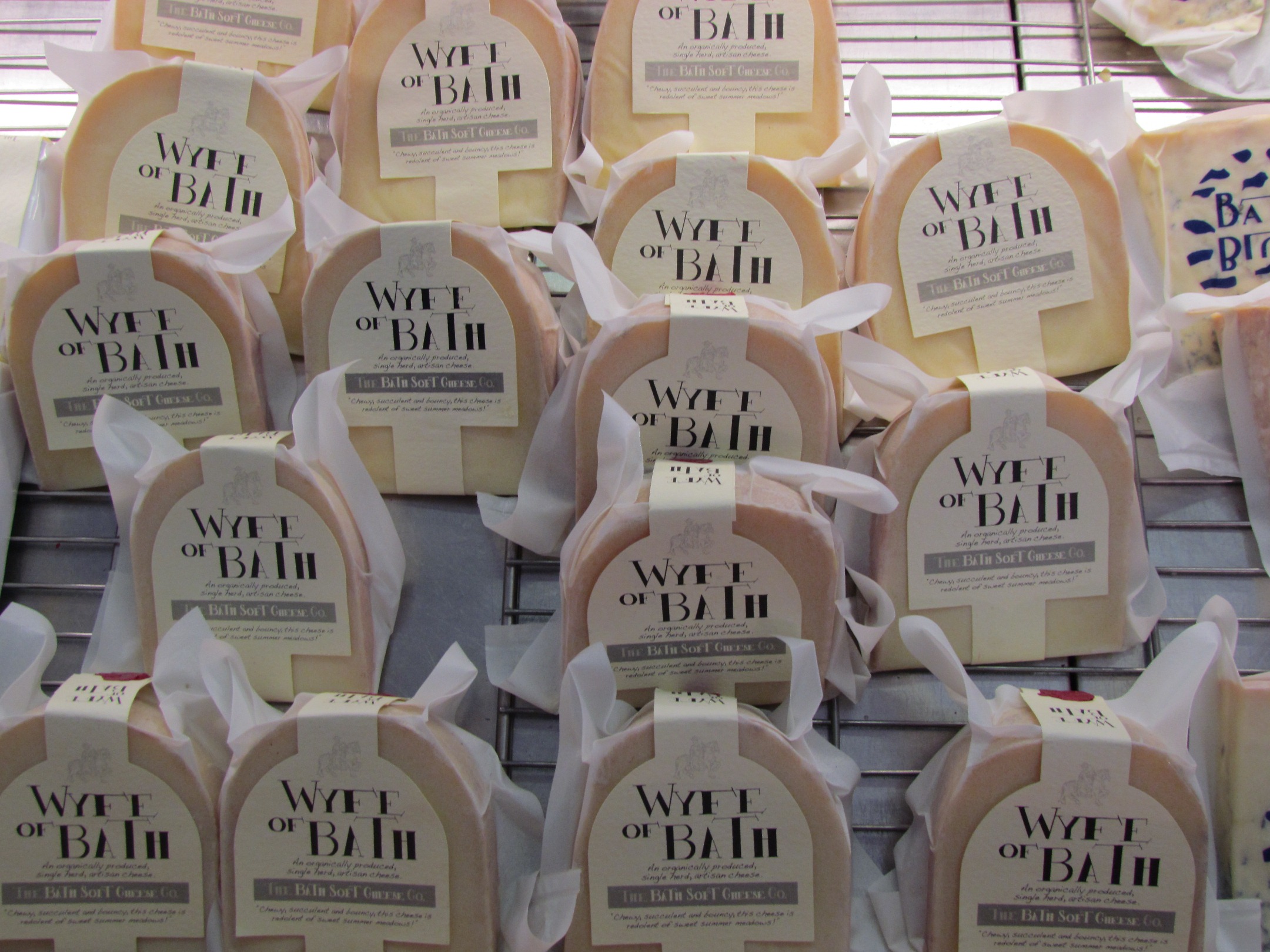
Anyway, we’ve developed since then. We’ve made a couple of other cheeses. We now make a hard cheese which is called the Wyfe of Bath after the character in Chaucer who was an expert on human relations – she’d been married five times and she could out-talk most men! It’s a great story, The Canterbury Tales, so we thought that would be a good name for this particular cheese, which is actually made in a basket in the old way – in the way that the mediaeval people used to make cheese – you just place the curds in a cloth-lined basket and then turn the cheeses. So the cheese are a round shape, basket shape, and you can see the imprint of the cloth on the outside.
So we were feeling our way, trying to do it in the old-fashioned way and we think we’ve got it pretty good now because we actually won a Gold Medal this year at Nantwich – the World Cheese Awards – and we got a gold the previous year with it as well, so it must be reasonably good. We also make a blue and we call this Bath Blue, as one would guess. It’s the hardest cheese to make because you’ve got to encourage the blue mould into the cheese. But it’s great to have this staple of three different cheeses.
And now we’ve moved across into the other stone barn on the other side and converted that and so the whole yard is converted to cheese-making. And it’s rather nice really because people have milked cows here for generations. I’m the third generation to be milking cows here and it looks like we will have a son to carry on.
We’re organic as well – we went organic 11 years ago – and that’s rather nice as well to be able to produce something without using sprays or fertiliser, because one always felt a little bit guilty about that. We’ve got 160 milking cows and altogether about 400 cattle. We produce about a million litres of milk. It’s quite fulfilling, I think, to produce calves – you have to produce calves to produce milk – and then convert that milk into cheese and then to sell that cheese throughout the country, and win awards, and meet lots of other fellow cheese-makers who are putting their life into producing food from the land.
Dick: Well it’s not compulsory to buy cheese from here to eat at the summit of the walk but you will regret it if you don’t! Wyfe of Bath is my particular favourite.
To make a viable business, you need to have volume and really the big demand for specialist food or niche food is London. It’s Londoners that earn the money and they are prepared to pay over the odds for something that is worth eating. And so London is our big market. I don’t know how many million people live in London – probably about ten – and so it’s a huge place and with lots of affluent people who want to eat our cheese.
The popular Wyfe of Bath cheese on sale in the shop at Park Farm
After visiting the cheese shop and purchasing provisions for later in the walk (!), turn left out of the farmyard up the road. As you reach the junction with the A431, stand on the left pavement to look over the wall to the Tower House.
7 Widows and mistresses
Although this is primarily an agricultural landscape of farms and fields, there is also some other land use.
Just to the south of the village is Kelston Park, which was home of Sir Caesar Hawkins, the physician to the king. The mansion was built in the 1760s and the famous landscape architect Lancelot‘Capability’ Brown was commissioned to lay out the park.
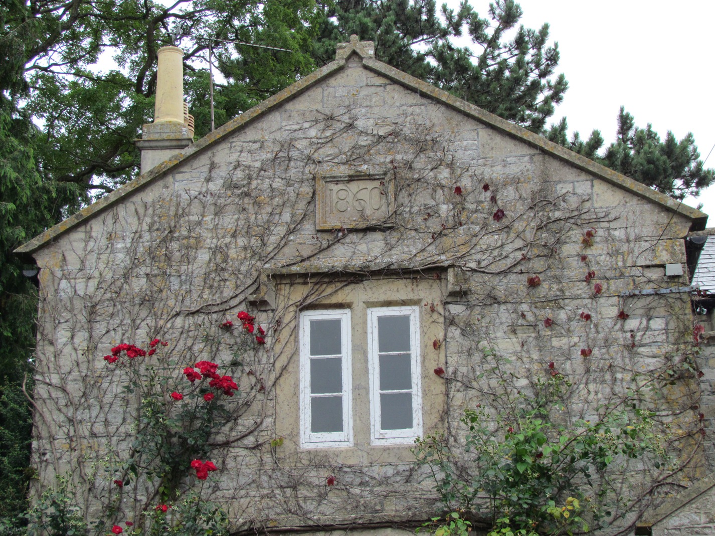
The spectacular Tower House here in the village was built in 1835 as a dower house for the Kelston Park estate.
A dower house is usually a moderately large house on an estate which is occupied by the widow of the late owner. However, it is said that it was built by a wealthy Victorian called Joseph Neeld for his Italian mistress who could watch him from the towers and turrets as he hunted in Kelston Park.
It is a very unusual building and now Grade II listed. It is in Italianate style with various towers and turrets. But it is also distinctly asymmetrical. Look out for the elaborate stone work and circular windows.
Turn left along the A431 pavement, keeping on the left hand side. Look out for unusual symbols carved on different buildings. You may wish to stop at the The Old Crown for refreshments or food. Continue past the pub and stop at Kelston Forge by the red telephone box.
8 Bakery or smithy?
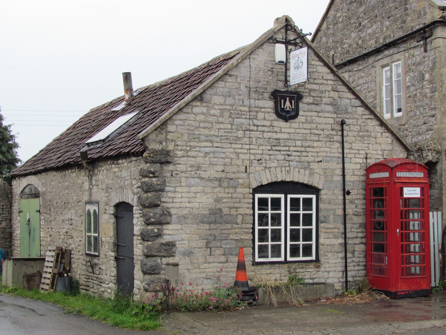
Many of the present buildings in Kelston were built in the 1850s and 60s by Colonel Inigo Jones. Look out for his unique symbol inscribed on many of the buildings. The horse trough opposite and last terrace house beyond the Forge have lovely examples. Perhaps because it is a conservation area that the whole village still retains that early Victorian feel.
Inigo Jones’s original estate forge, Kelston Forge, is still open, thanks to the hard work of local blacksmith, Mr John Holder and his son, Max. But from examination of an interior wall, John thinks that the Forge at some time could well have been a bakery.
Some of the other village properties have changed use too. All over Britain, farmers have found making profits hard from farming alone in the twentieth and twenty-first centuries, and many have worked with development companies to find planning permission for farm conversions. As we continue to the end of the village, Mill Farm Cottage just round the corner off to the right, is one of several examples in the village of a barn conversion.
Cross the road carefully and turn right past Mill Farm Cottage. Follow the lane uphill, past industrial units, also converted from former farm outbuildings. Continue upwards and stop when you reach Coombe Barn Holiday Cottages.
9 Room with a view
Here we find another barn conversion. A set of three barns have been converted into the Coombe Barn Holiday Cottages.
From here there are splendid views over the Avon Valley and, on a clear day, Severn Vale and Wales.
What do you think about developments like this in a Green Belt? Could this be said to be the ‘commodification’ of farm buildings with a view?
Local planning committees take each case on its merits; they are rarely applauded and often criticised.
My view about this development is a positive one. It has provided tourists with a lovely place to stay – just look around! – and it has allowed the surrounding land to be kept in gainful farming use by the Cullimore family who are the farmers.
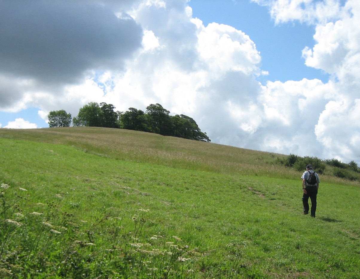
Continue up the land from Coombe Barn. After 100 metres the track bends to the left and continues steepening. After another 400 metres, where the track takes another bend to the left, turn off the track to the right. Climb up the bank, over the stile and follow the permissive footpath climbing through the steep pasture land to the wooded summit of Kelston Round Hill. Stop at the summit. There is a bench where you can recover from the climb!
10 Roman remains
Here you can take advantage of the bench overlooking a magnificent view to the west. On a clear day, both Severn bridges are visible.
Kelston Round Hill is exposed to winds from several different directions and would have been a great place for a windmill. There is oral evidence of a mill and some people think the foundations are still there within the copse of trees. But there is evidence of earlier human activity here too.
Just near Coombe Barn cottages, where we stopped before, a coffin was found in 1945 while people were digging a trench for pipe laying. It contained the remains of a 60 year old Roman woman. The coffin was dated to Roman times, making it about 2,000 years old. The woman’s remains were re-interred in Kelston cemetery and the coffin was sent to Bristol Museum but somehow it has since been destroyed.
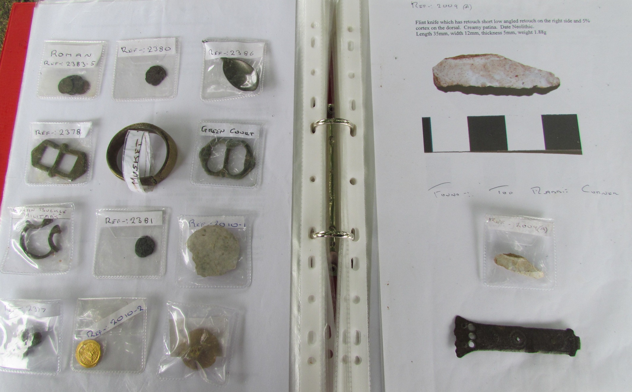
With me is the ex-farmer of Round Hill Farm, Andrew Dinham. Andrew is a keen metal detectorist and has found a number of Roman coins on the lower slopes of the hill. How long have you been doing metal detecting, Andy?
Andy: I suppose it all started off about three years ago. While we were working the farm we had a number of metal detectorists coming up here. When my son took the farm over I thought I’d play about myself. We must have found about a dozen Roman coins. It’s nice to find a coin but there’s so much more satisfaction with regards to finding the history of it all - the Roman coins date from somewhere around 260 AD back up to around 500 AD.
Remain at the bench at the top of Kelston Round Hill.
11 Prehistoric finds
The history here goes back way before the Romans. Archaeologists have identified two flint knapping floors in the field in front of the trig point.
Their finds included flakes, cores, scrapers and knives. They could have been made anytime between 10,000 and 2,500 before the present day.
During his metal detecting, Andrew Dinham has also found a flint scraper, dated by Bristol Museum to Neolithic age, and other finds in this field date back to Mesolithic times 7,000 years ago.
Andy: We’ve found a couple of flint knives – one was Neolithic and the other was Bronze Age – and a flint tool which was found lower down the hill and dated somewhere about 4,500 years old. It’s incredible to think that things we’ve picked up today dated to that age – I’ve possibly been the first person to have seen those things in 7,000 years!
Dick: Conventional thinking suggests that people in the Stone Ages lived near coastal beaches, coastal marshes, or high on hills because in those environments trees were sparser and people could move about more easily than in the thick forests of river valleys. So just imagine skilled flint knappers working away on this sunny, south face of Kelston Round Hill 7,000 years ago.
They would have been creating tools and weapons for their clan and perhaps passing travellers on this ancient ridgeway. The nearest raw flints to here would have been found down the hill on river terrace deposits between Saltford and Kelston. Did other members of the clan venture into the dangerous lowlands to find them and bring them up here for the knappers?
A small selection of Andy Dinham’s prehistoric finds
Continue round the top of Kelston Round Hill, keeping the copse on your left. Go over the stile into the next field and pass the trig point. Continue around the top of the hill until you have come almost full circle, then head downhill to a gate. Turn left along the Cotswold Way footpath. Go through the next metal gate and stop after turning left through a second metal gate.
12 Roman routeway
You are now standing on a Roman Road, which provides yet more evidence of the Romans who inhabited this area two thousand years ago. This ancient routeway is believed to have linked the Roman city of Bath with the port of Abonae, which is now Sea Mills, now a suburb of Bristol near the confluence of the River Avon with the River Severn. Imagine this routeway busy with Roman traffic.
Uphill to the right, through the wooden swing gate, is Shiner’s Wood and Mrs Chrissie Cullimore, the farmer of this area, has a lovely story about how the wood got its name.
She said that Shiner was a horse belonging to the family. Before the First World War, the Cullimore farming family lived in Wiltshire. But times were hard and the family moved cheaper land in Abergavenny in Wales. They walked all the way there with their two horses and all their possessions.
During the First World War, the horses were conscripted for work in France. Happily, Shiner survived the war and, because he was an important hunter horse, he was allowed to come back to Britain. And he survived the return journey back to Abergavenny.
Later, the family moved here to Mill Farm in Kelston and Shiner spent his last few years here. Long after his death, he was still fondly remembered and the wood was named after him. This lovely story shows that there is still room for sentiment in the hard, often insecure life of farming hills like these.
Turn right through the wooden swing gate. You may like to stop and read the information on the Shiner’s Wood notice board on the left. Follow the Cotswold Way footpath upwards and then through the gate at the top. Stop at the viewpoint and topograph at Prospect Stile.
13 A day at the races
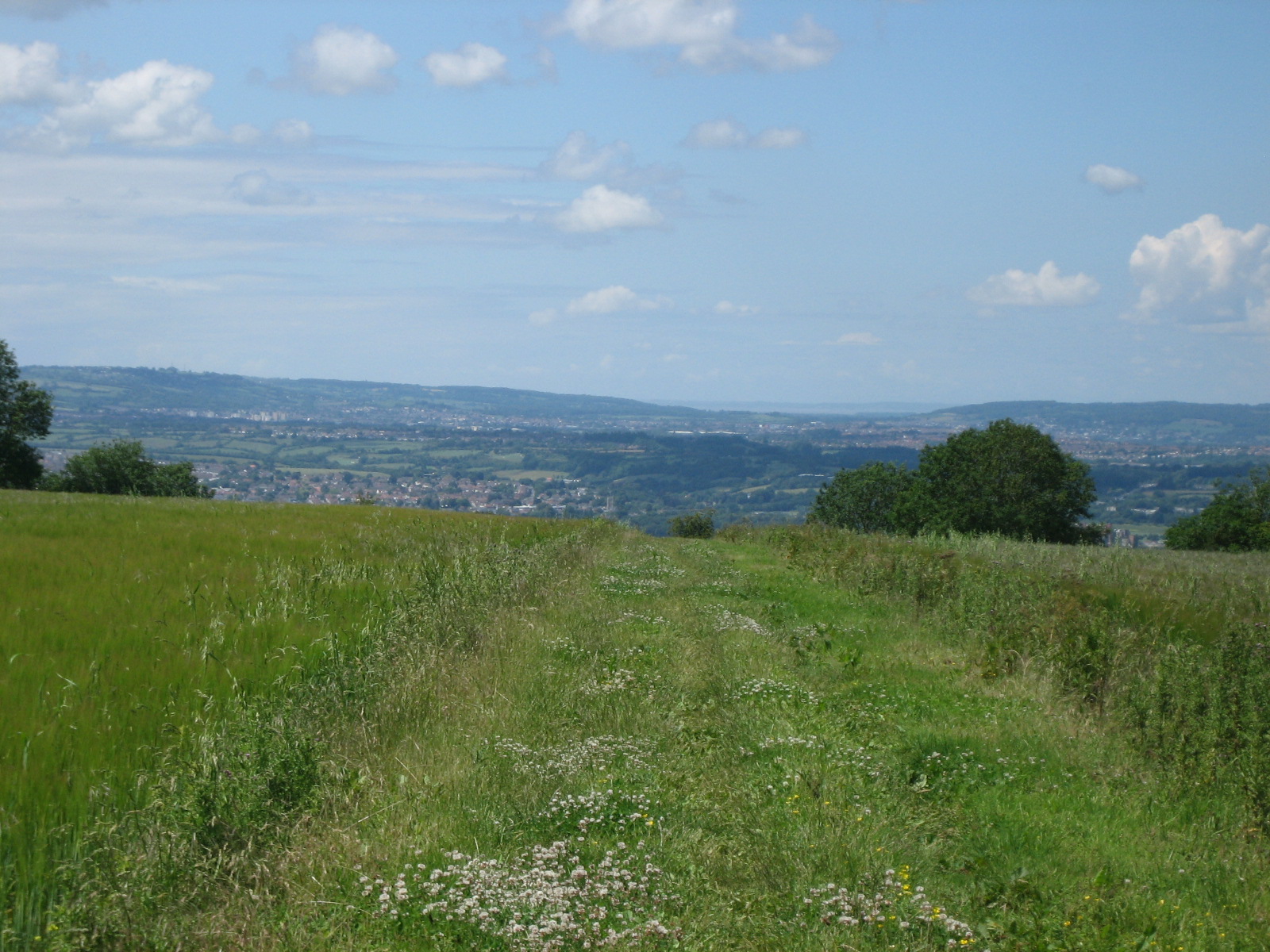
A topograph is a stone built base topped by a metal disc marked with directions and distances to local landmarks. Using the topograph on clear days you can see into the distance to King Alfred’s Tower on the southern edge of Salisbury Plain, the Penn Hill Mendip TV transmitter, and the aircraft warning masts and lights on Dundry Hill to the south of Bristol.
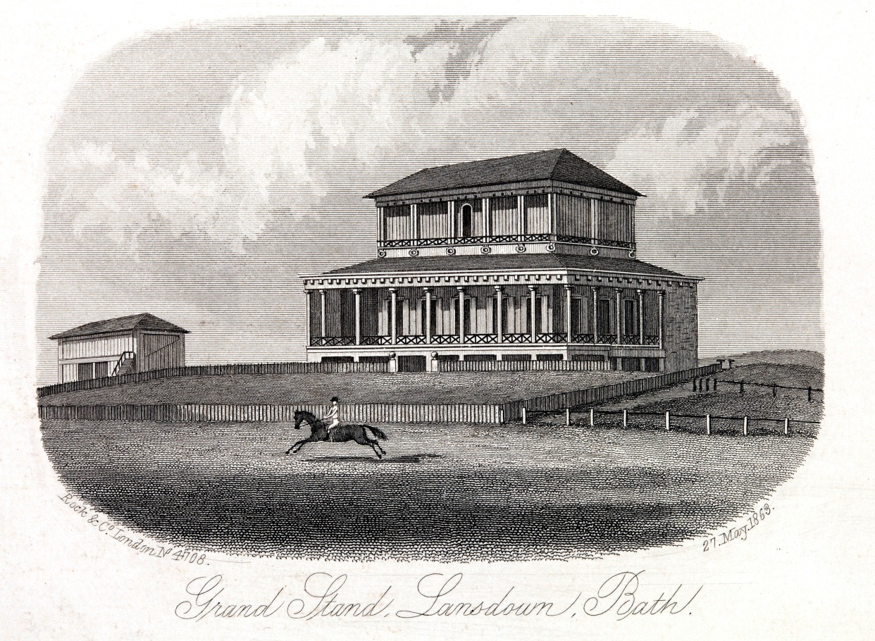
Behind us is Bath Racecourse, the highest racecourse in the British Isles. There has been horse racing as an organised spectator sport in Bath since 1728, and here at Lansdown since 1811.
These flat plateau top fields were relatively inexpensive and were within an hour’s walk from central Bath. During the Second World War, it was used as a landing field by the RAF. It’s another good example of adapting the uses of land.
Just 30 metres behind the topograph we can find further evidence of more ancient human activity here. The mound is thought to be the remains of a Bronze Age round barrow. There are three other known round barrows which we will see as we walk across the plateau to the south and east of the racecourse. They are thought to be burial mounds and some artefacts have been excavated. There have also been many finds of Roman and Romano-British pottery nearby.
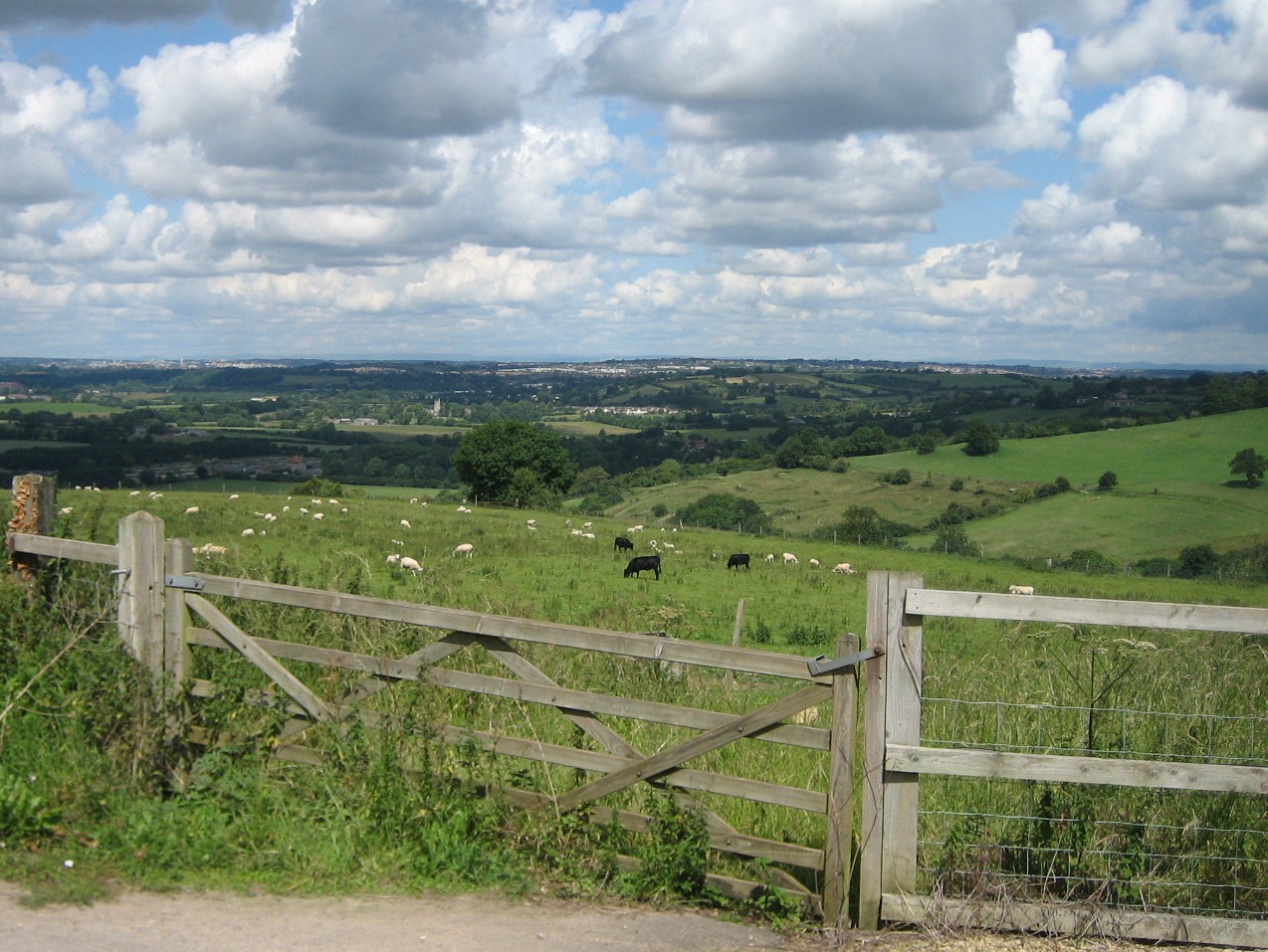
Follow the Cotswold Way footpath with the hedge on your left and the racecourse on your right. After the racecourse field, go through the gate and continue following the path. At one point, the path takes a right turn and there is a ditch and rampart on the left hand side. After about 200 metres, the path takes a 90 degree left turn through a break in the ditch and rampart. Go through this gap to the field beyond which is marked on the map as ‘fort’. Straight ahead the field slopes gently downhill. Stop overlooking the expansive views to the west.
14 Moving downhill
The ditch and rampart here enclose the Little Down Iron Age Hill Fort, which dates back to 2,500 to 2,000 years ago. It was a good defensive site, with excellent views and steep slopes to the north, west and south, which would be difficult for attackers to surmount.
The fort was protected by a deep ditch and rampart at its eastern approach. With so many stones littering these fields, I believe that the ramparts might have been built as dry stone walls, probably with a wooden palisade on top. Inside these walls, the Iron Age people would have cultivated the flat land, reared animals and built small huts to live in.
At the last few stops, we have seen how Stone Age, Bronze Age and Iron Age people occupied this plateau top. There is evidence of forts, settlements, burials, and economic activities. The hill top sites had a number of advantages, particularly defensive, but also of open land above the thick woodland of the valleys.
However, evidence suggests that by Roman times, people preferred to live further down the hill. Perhaps springs and sheltered folds in the hillsides made life easier for them in the peaceful times of the Pax Romana – Roman Peace – from 1,950 to 1,650 years before present.
Then when the Romans left 1,600 years ago and Anglo-Saxon settlers found this area, they settled even lower down the hill on the valley slopes and river terraces, like Kelston and Saltford villages. So over many centuries, people have chosen to gradually move downhill.
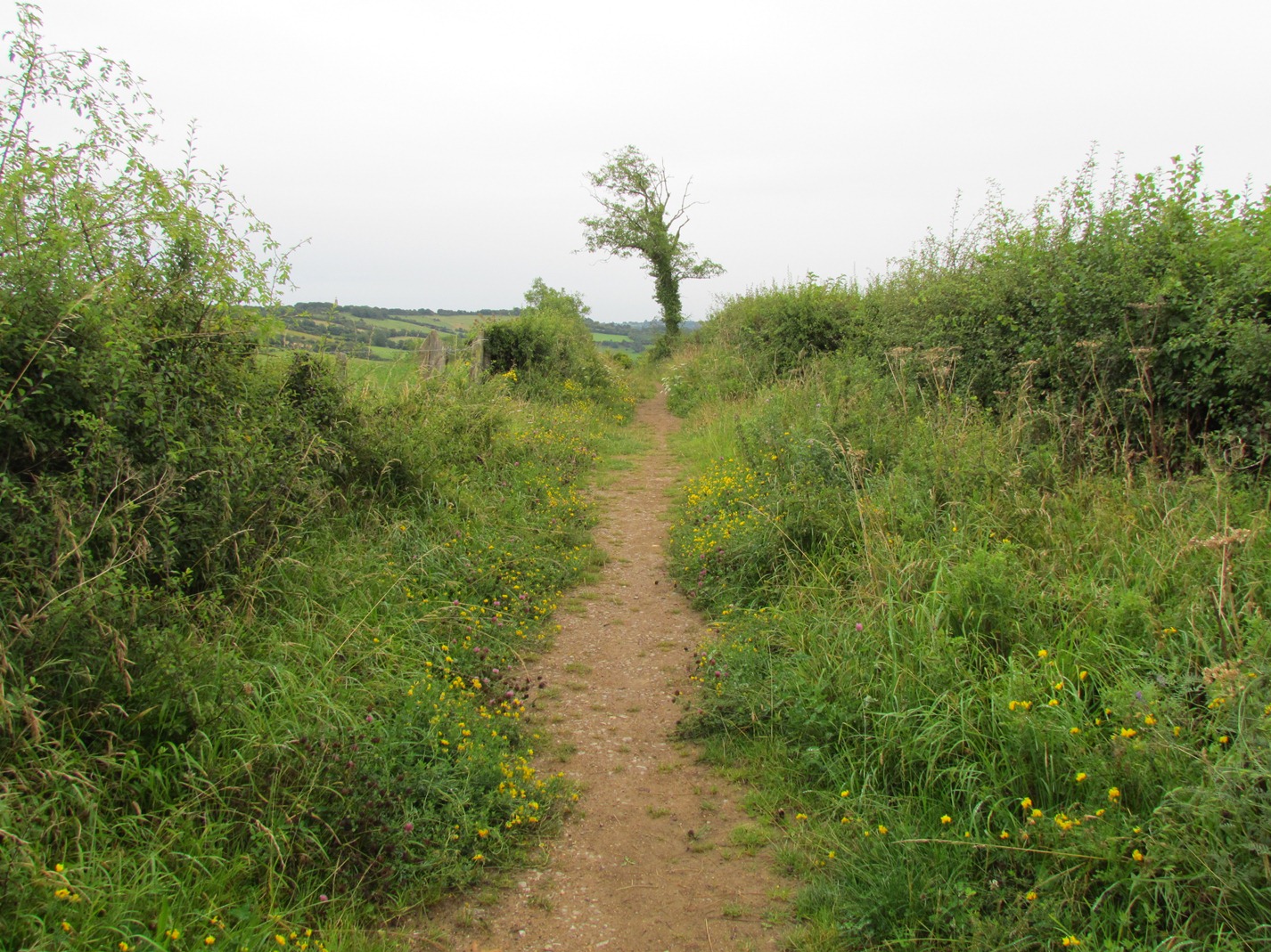
The path to the next stop is not obvious so please follow the directions carefully and use the photos to guide you. Follow the footpath across the field that is marked as ‘fort’ on the map. It is flat to the middle of the field and then goes gently downhill.
Pass through the gate and go down the slope. Dogs should be put on a lead here as there are often sheep in the next fields.
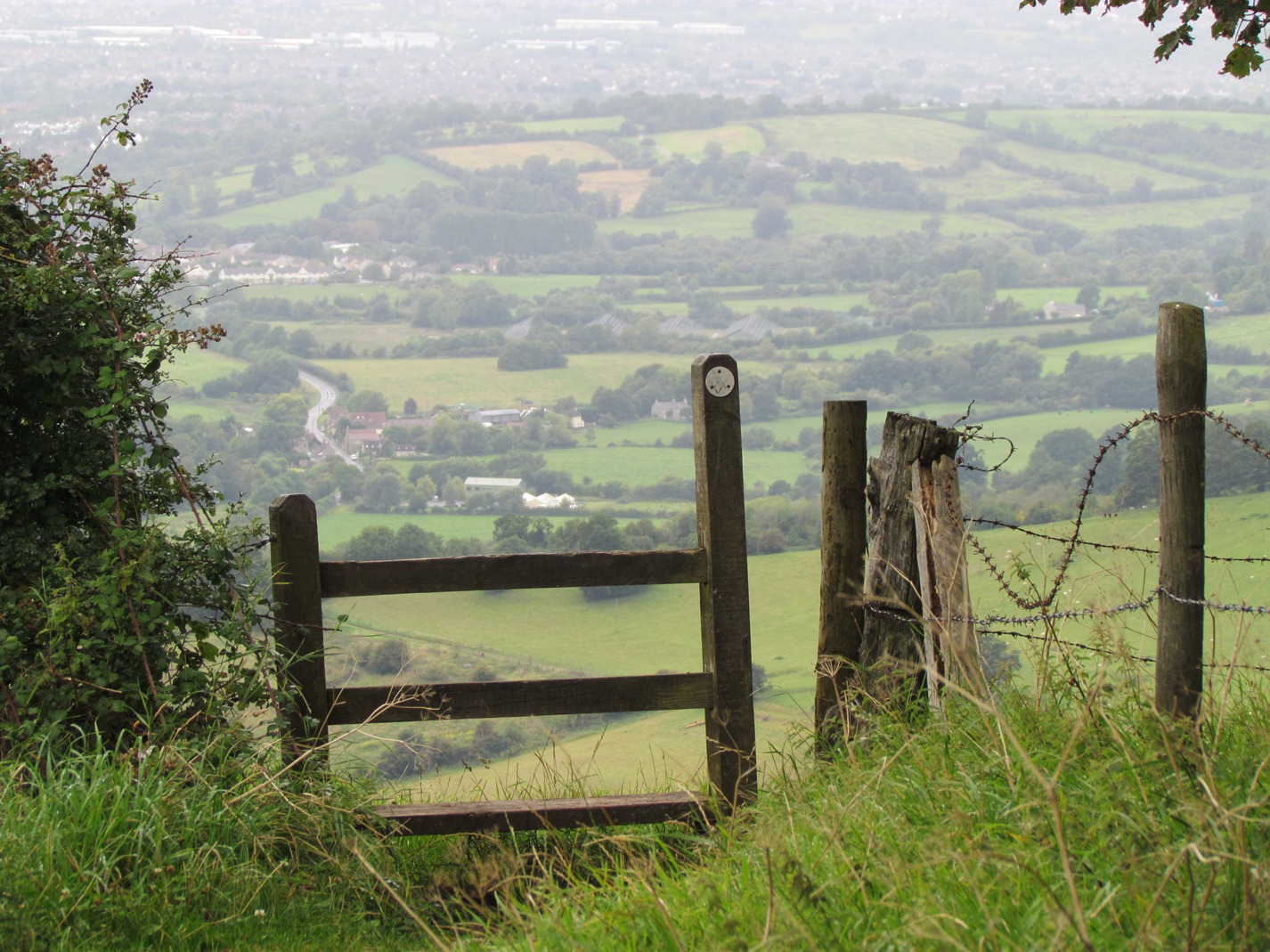
Take a moment to enjoy the magnificent view. At this point the Cotswold Way footpath turns right and follows the shoulder of the hill towards the Roman Camp. Do not take this path but instead follow the footpath sign that points straight ahead.
Make your way downhill across uneven ground. The footpath through this field is not clear but there is a wooden post part way down the hill that you should aim for.
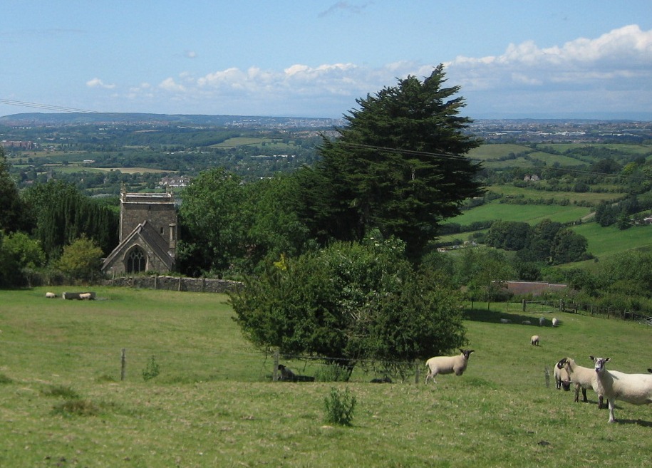
After the wooden post divert slightly from the designated path - bear diagonally to the right alongside a line of trees on the left. The square tower of North Stoke church i s directly below across the field.
Find the last tree in the row – a large willow – which has a large depression in the land on the lower side. Stop by the depression below the willow tree.
15 The lion of the Cotswolds
At this willow tree, which locals say is the highest in the area, we are on a spring line on the scarp (that means steep) slope of the Cotswold Hills escarpment. This spring marks a boundary in the rock beneath the surface between limestone and Fullers Earth, which is a type of clay. The spring water was used to clean woollen cloth. And the wool industry is yet another story of successful economic activity in this area.
Sheep have grazed on the Cotswold hills for more than 2,000 years. The Cotswold breed, with distinctive curly fleece, was known as the ‘Lion of the Cotswolds’.
Sheep farming was a particularly lucrative business during the medieval period. At that time, England was a relatively under-populated country. There was plenty of rolling hill-pasture to sustain vast flocks of sheep. The value of sheep was in their fleece, which could be woven into wool and then made into cloth.
Most of the wool was exported to Europe – particularly to Flanders and Lombardy. Thousands upon thousands of pack-horses laden with woolbales wound their way down from the High Cotswold hills to the River Thames.
The continental weavers paid well for the wool and Cotswold merchants grew rich. They built splendid houses and churches. Perhaps the church across the field was built with sheep money.
From the willow tree continue diagonally down the field to a gate. Turn left down the track.
Do take time to go into North Stoke church which is usually unlocked. Be careful when descending the steps from the church because they can be slippery. In wet or frosty weather it would be best to go back to the church car park and take the stony track downhill instead of the church steps.
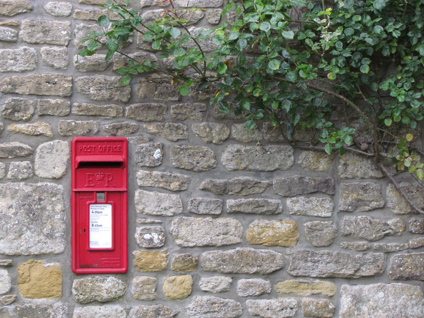
Follow the track past a small pond down into the village. Stop at the first junction by the postbox and Chestnut Barn.
16 Thank you for the music
As you’ve seen, sheep farming is still a flourishing part of the local economy, as it has been for 500 years or more. But village businesses are not always what you would expect.
From Chestnut Barn, which used to be part of Manor House Farm, musician Bill Occleshaw runs a worldwide theatre music business, creating orchestras. For instance, he has created orchestras for musicals such as Chicago, not just in London but also in many other cities, including Tokyo. What brought Bill to base this business in a small Cotswold village like North Stoke?
Bill: By accident, really! We were looking for somewhere else to move from Bristol and fancied the barn. We have these converted barns and you find that you can run a business from here without having to have an office in Covent Garden and fight the traffic wardens every day. And also it’s just so good to sit in the garden on the phone and talk to people who are sweating it out somewhere in a city. It’s wonderful!
It started and expanded here by accident, really, but it has been terrific. The advent of computersn has really helped us and the space. What is nice is that if I go to London or other parts further north in the country – when you drive home late at night and you get up the next morning, you’re in the countryside and you’re not stuck in a hotel. It’s just a great way of living and you can just relax and do your job easily. And if you want to go down to the bottom of the garden and talk to the sheep in the field next door, you’d probably get a sensible answer from them.
Dick: What about your neighbours here: are they farm workers or do they have interesting jobs like yourself?
Bill: There are a few teachers. There’s a couple of doctors and a couple of surgeons. There’s one guy that was a farmer but is now a property developer. Across the road there’s a young girl that runs a furniture import business from the Far East. We have a Secretary that works for three of the Lords in the House of Lords and comes home every weekend.
Dick: Who would have thought that in a village like this of mellow yellow limestone that you’d have all these different people!
Follow the lane as it winds through North Stoke village. After some way it starts to descend quite steeply. Take care because there can be traffic. After the shady bend with trees on either side, there is an opening on the right hand side, where you can see down to the bottom of the valley.
17 Waste and wildlife
Here we come to another imprint of humans on this landscape. From here you can see Saltford sewage treatment works. It treats 28,000 litres of sewage each day from more than 100,000 people in and around Bath.
The works were established 100 years ago as a government utility. It was then privatised in the 1980s, sold to the US company, Enron, in the 1990s, and then taken over by a Malaysian company in 2002! Over recent years, the water company has invested around £2.5 million on hi-tech equipment at this site.
The chemical procedure removes phosphorous from treated waste water. High levels of phosphorous in water can encourage the growth of algal blooms, which remove oxygen from water and have a detrimental impact on wildlife. With this equipment, the treated water released into the River Avon is of a much higher quality. In turn, this has allowed wildlife to develop and thrive. Look out for kingfisher and little grebe. If you’re really lucky, you may spot an otter swimming past the water outfalls from the plant. This just goes to show that some industries can actually have a positive influence on the environment.
Just before our next stop, you will walk through a meadow. When the sewage plant was being upgraded in 2004, a 600 metre temporary aluminium road was laid across the fields and a temporary metal bridge across the river. This allowed lorries and heavy equipment to go directly from the A431 to the sewage works rather than through the narrow streets of Saltford. By 2006, the bridge and temporary road were removed and the ground repaired. And now it is as if the field had been undisturbed for centuries. See if you can see any signs at all of the road and bridge. Again, it just goes to show that human intrusion into the natural landscape can be reversed. It is a credit to all the designers, engineers and landscapers involved in the project.
Continue down the lane. At the junction with the A431, turn right and walk 100 metres along the pavement until you see a footpath across the road on the left. Take care when you cross the road. Go over the stile and follow the footpath, with the river on your right. Cross a small metal bridge and over a stile into a meadow. In this field, remember to look out for any signs of the road and bridge that diverted construction traffic to the sewage works across the river. Continue across the meadow to the buildings of Kelston Mills. Stop in the centre of the hamlet.
18 Ollis and Frankham
This is the hamlet of Kelston Mills. A hamlet is defined as a settlement without a service centre, like a church, shop, garage or pub.
Like Saltford Mill that we saw earlier, Kelston Mill was a brass mill but now there are only ruins left. Note the six, three-storey terraced houses straight ahead. These are known as Brass Mill Cottages, Brass Mill Lane. The houses were built in the 1760s to house workers for the mill. In the 1851 census, seven families were registered as living in Brass Mill Houses and all of them were either present or former brass workers.
Two of the households had the surname Ollis and another was Frankham. These were both Dutch names. You might wonder what Dutch people were doing here is Saltford. Well, in 1704, the Bristolbased industrialist Abraham Darby went to The Netherlands to study – or perhaps spy – on the industrial techniques of coal fired furnaces and the production of large brass pots. He also recruited a number of skilled workers who came over to Bristol to work in his mills. Some also brought their families. These surnames are found in the records of workers not just here at Kelston, but in other mills in the Avon valley.
Interestingly, these Dutch workers were Catholic by faith. During the same period, many French and Flemish Protestants had moved to Britain to escape religious oppression. So the industrial revolution – famously driven by the Protestant work ethic – was also helped by skilled Catholics.
Follow the footpath immediately in front of the terraced houses and admire the welltended gardens. Go through the wooden swing gate and follow the footpath to the right down to the riverside. Turn left at the metal swing gate and continue along the river bank. Stop when you are opposite the sailing club.
19 Down by the riverside
The land around Kelston Mills has been converted into a riverside marina and offices. Looking across the river, you can see several other river-connected enterprises.
The Jolly Sailor public house was originally built as a mill. When the River Avon was canalised in 1820, it became a lock-side pub. Inside the pub you can see poker holes burned into the mantelpiece by canal bargees as part of their rites of passage.
Opposite is Bristol Boat Limited, operating from Sheppard’s boatyards to sell and repair rivercraft.
From 1894, Saltford Rowing Regatta was held on the river upstream of Saltford and it was quite the thing to catch the train or bus out from Bristol and Bath to enjoy the spectacle. To cater for the visitors, Sheppard’s rowing boat hire shed and tearoom was built in 1906. Unfortunately, the shed and tea room burned down in the 1970s and the regatta has vanished into history.
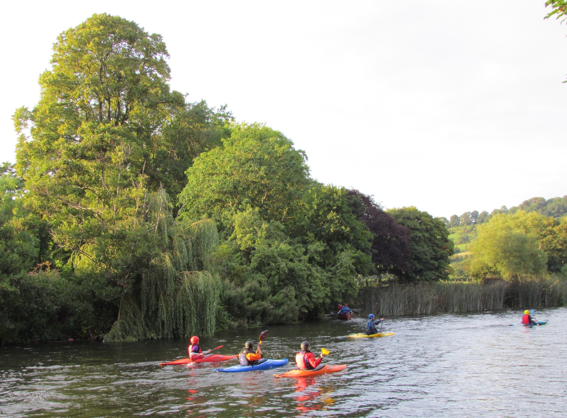
Meanwhile, Saltford Sailing Club just across the water is currently thriving, with events every Sunday. And at twilight time, the local canoe clubs come here to explore the river and the canoe flume over the weir at Saltford lock.
Continue along the river bank footpath. When you reach the old railway bridge, climb up the embankment and turn right onto the bridge. Do take time to look at the view from the bridge, from where you can see most of the walk that you have just completed. Cross the bridge and continue along the cycle track for another 100 metres. Turn left down the embankment to the Bird In Hand pub. Stop in the car park.
20 Thirsty work
Almost finished now! Here we are in the car park of the Bird in Hand pub. It was originally two cottages, called Holbrook Cottages.
In 1869 they were knocked together and turned into a pub to service the ‘navigators’, who were men employed to dig out a cutting and build a bridge and embankment for the Midland Railway. The construction of the different routeways in this valley brought in people and generated economic activity.
Now the navigators are long gone and the Bird in Hand is a very modern pub.
In order to flourish, pubs like these have to attract customers by a range of events, which this pub certainly does. There are quizzes, festivals, fisherman’s breakfasts and deals – for instance, the bacon buttie and a pot of tea for £3.50. Can you beat that?!
A diversion into the Bird in Hand for the famous bacon butties, lunch or just a drink, is highly recommended after you have read to the final stop. Otherwise, turn left at the front of the pub to return to The Shallows.
21 Seven thousand years of making a living
Here we are back where we started on the riverside in the village of Saltford. This walk has told the story of how people have lived and worked in this area for the last 7,000 years. They have been involved in a wide variety of enterprises – from prehistoric tool working to metal manufacturing; from livestock farming to organic food production; and from contemporary offices to leisure and tourism.
These people have made use of the physical landscape and natural resources. We saw how the river has been used to drive water mills and nurture the leisure boating industry, how the steep valley sides were suited to grazing sheep and cattle, and how the plateau was ideal for horse racing and airstrip. We have also seen how people have moved progressively downhill to live, from the very tops of hills in pre-historic times, to the terraces above the river flood plain in modern times.
Another important feature of this walk has been seeing how buildings – large and small – as well as land and fields have continually changed their uses over time as individuals and organisations have seen new opportunities for development. I hope you’ve learned something new on this walk and enjoyed it.
A circular walk from Saltford in the southern Cotswolds near Bristol and Bath
Over the last 7,000 years a tremendous range of economic activities have been carried out on the southern slopes of the Cotswolds.
From prehistoric flint knapping to 18th century brass hammering. From curly-haired sheep to organic dairy herds. From horse racing to leisure boating.
From local hostelries to holiday cottages. From micro-businesses to multi-national corporations.
This walk follows a fascinating story of enterprise. As you are walking, discover how people constantly created new opportunities to exploit the landscape, in order to earn a living.
Follow the walk by clicking on the map pins or downloading the guides below
Sheep have grazed on the Cotswold hills for more than 2,000 years. The Cotswold breed, with distinctive curly fleece, was known as the ‘Lion of the Cotswolds’.