1 Welcome to Babbacombe

This short stretch of coastline has been designated as a Global Geopark recognised by UNESCO.

On this walk, you’ll find out about the tremendous diversity in the geology that has led to this status. You’ll learn how to identify different types of rocks and learn about the processes that formed the landscape that you see.

You’ll also discover how humans have used and exploited the particular characteristics of this section of coast for economic activity and for leisure purposes.

You are also going to find out about the processes that continue to shape this landscape and ponder some questions about how we respond to them.

This walk was created by Pat Wilson.

Pat: “I moved to South Devon a few years ago from the Home Counties and love exploring the coastline. I’m a physical geographer so I’m particularly interested in the geological formations and coastal processes along this fascinating stretch of coastline. I hope to share some of these with you on this walk.”


Anstey's Cove
Pat Wilson © RGS-IBG Discovering Britain
Directions

From the middle of the recreation ground walk to the Anstey’s Cove car park.

2 A valley without a river

Standing with the car park behind you, look across the field. This is the Ilsham Valley. As you walked across it you would have noticed it has a wide, flat floor but quite steep, almost cliff-like valley sides. If you look to both left and right there are wooded slopes with only one or two houses on this steep land.

This valley was formed by movements of the earth which brought a rock called limestone to the surface. The valley has been formed along a crack in the rock, known as a fault line.

Limestone is permeable, which means that water can pass through cracks or joints within the rock. That’s why there is no large stream or river in the valley – which you might think there should be given the size of the valley. Instead there is a network of underground rivers and caves.

Nearby is Kents Cavern, one of the most famous limestone cave systems in Europe. It is well worth a visit as one of the things you can see there are the remains of these underground rivers.

As you cross the car park look out for the massive whitish cliffs through the trees in front of you - they are also made of limestone which underlies this valley.


Ilsham Valley
Pat Wilson © RGS-IBG Discovering Britain
Directions

Leave the car park and cross the lane passing from left to right. Go down the lane that leads down the slope straight ahead. It is very steep and there are steps if you find these easier for the descent. At the bottom turn right, go past the small cafe to the end of the concrete promenade. Go down the steps onto the pebbled beach; if the tide is too high then remain at the top of the steps.

Note: It is very steep down to and up from Anstey’s Cove. If you are not able to manage,stay by the car park for Stops 3, 4 and 5 then follow Directions 5.

3 Black and white

This beach is called Anstey’s Cove. Look down at what’s underneath your feet. You should notice there are two distinct sorts of pebbles: dark greenish/black ones and white/pinky ones. Pick up one of each, roughly of the same size. You should immediately notice that the darker pebble is heavier than the lighter pebble.

First let’s look closely at the darker pebble. It’s heavier than the lighter one because it contains iron. You should also be able to see sparkly crystals. This is dolerite, a rock which formed when hot liquid (known as magma) from inside the earth made its way to the earth’s crust where it cooled down into solid rock. Later in the walk we shall be able to see another example of this process happening.

Now look at the lighter pebble. You might be able to see some small circles that are a similar size to a coin. These are the fossilised remains of a coral reef. This rock is Devonian limestone, which was formed when this area was underneath a warm tropical sea about 380 million years ago.

Now go over to the base of the cliff and look more closely at the rocks there. They are quite different to the two types of pebbles that we have just looked at. They are black, in thin layers and quite crumbly. You can see how the sea has been able to wear them away and create the small beach you are standing on. These are black shales, which were formed in deep ocean basins.

These three rock types – dolerite, Devonian limestone and black shales – are responsible for shaping not only Anstey’s Cove but the coastline that we shall see throughout our walk.


Black shale cliffs in Anstey's Cove
Jenny Lunn © RGS-IBG Discovering Britain
Directions

Go back up the steps onto the promenade. Stop near the café.

4 Smuggling, swimming and a cup of tea

In the late eighteenth century, a man called Donn surveyed this area. The map that he produced in 1795 showed ‘Anjus Cove’ with nearby Torquay as an insignificant village.

A map published just over 30 years later in 1827 shows this place as ‘Anstie Cove’. On both maps it is a remote cove so was ideal for smuggling, which was rampant at the time.

But all this changed in the Victorian era and the emergence of seaside resorts such as Torquay. This cove became one of the attractions that people could come to visit.

In the 1890s, the entrepreneurial Thomas family set up a tea shop on the beach. Ladies could get away from crowded Torquay and take their carriage here. They could think they were in the wilds but still get a cup of tea! There was a notice at the top of the hill:

     Picnics supplied with hot water and tea
     At a nice little house down by the sea
     Fresh crabs and lobsters every day
     Salmon, peel sometime red mullet and grey
     The neatest of pleasure boats to let out on hire
     Fishing tackle as good as you can desire
     Bathing machines for ladies are kept
     With games and towels all quite correct
     Thomas is the man that supplies everything
     And also teaches young men to swim

There is an old photograph of Thomas standing at the door of his café (see next page) and it shows the poem above in Latin – just for the amusement of his rich clientele.

In 1929 Jonathan Thomas and the local landowner sold the Cove to the Council for £7,000. The cove is still a popular stop to visit but the activities have changed. There’s still a café but bathing machines have been replaced by kayak hire!

And if you thought smuggling was a thing of the past, think again. Here in Anstey’s Cove in October 1988 sixty policemen and customs officers swooped on smugglers who had landed a cool five million pounds worth of cannabis here at the dead of night!


Anstey's Cove with cafe and bathing machines (1896)
Copyright The Francis Frith Collection ® www.francisfrith.com
Directions

Continue along the promenade to the far end where there are some metal railings. Stop here and look round the corner to Redgate Beach.

5 Rock removal

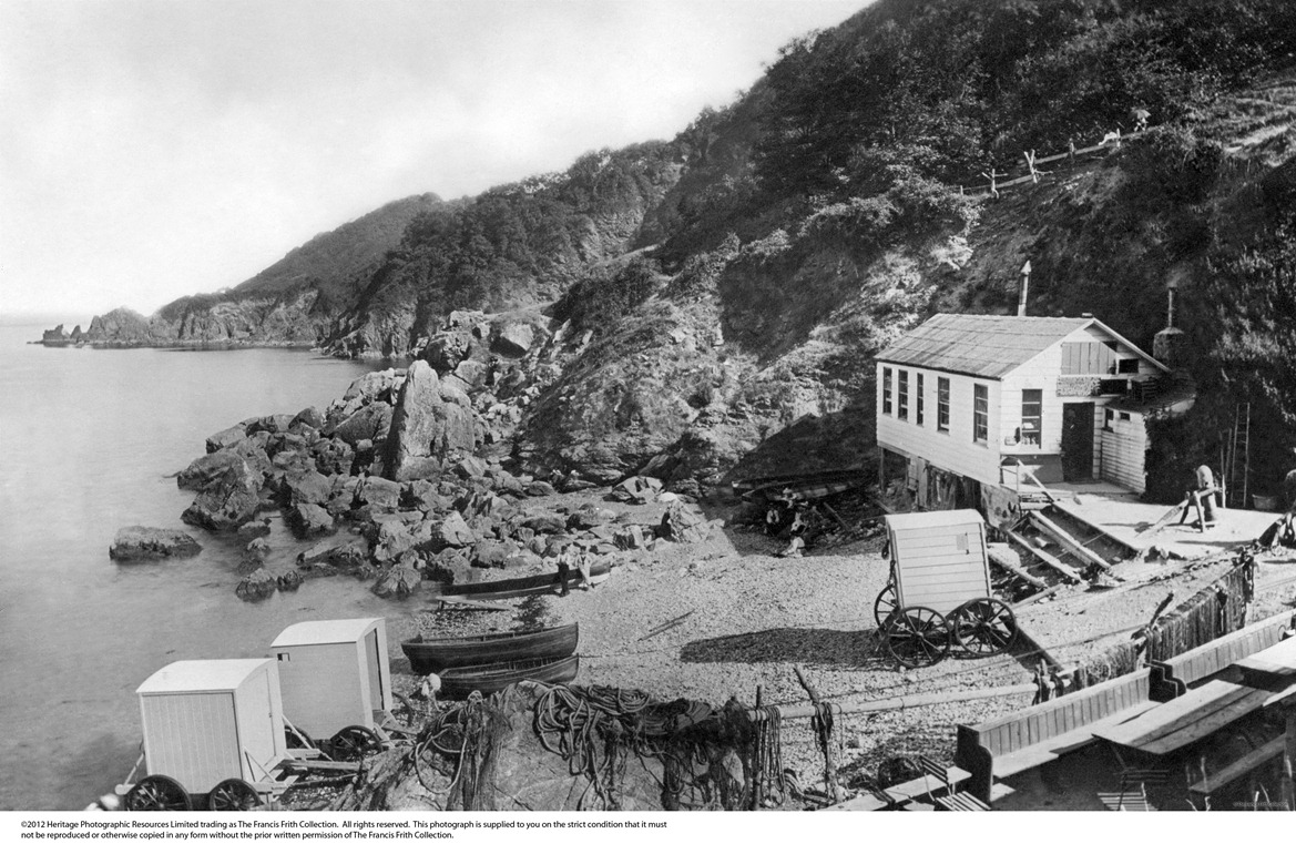
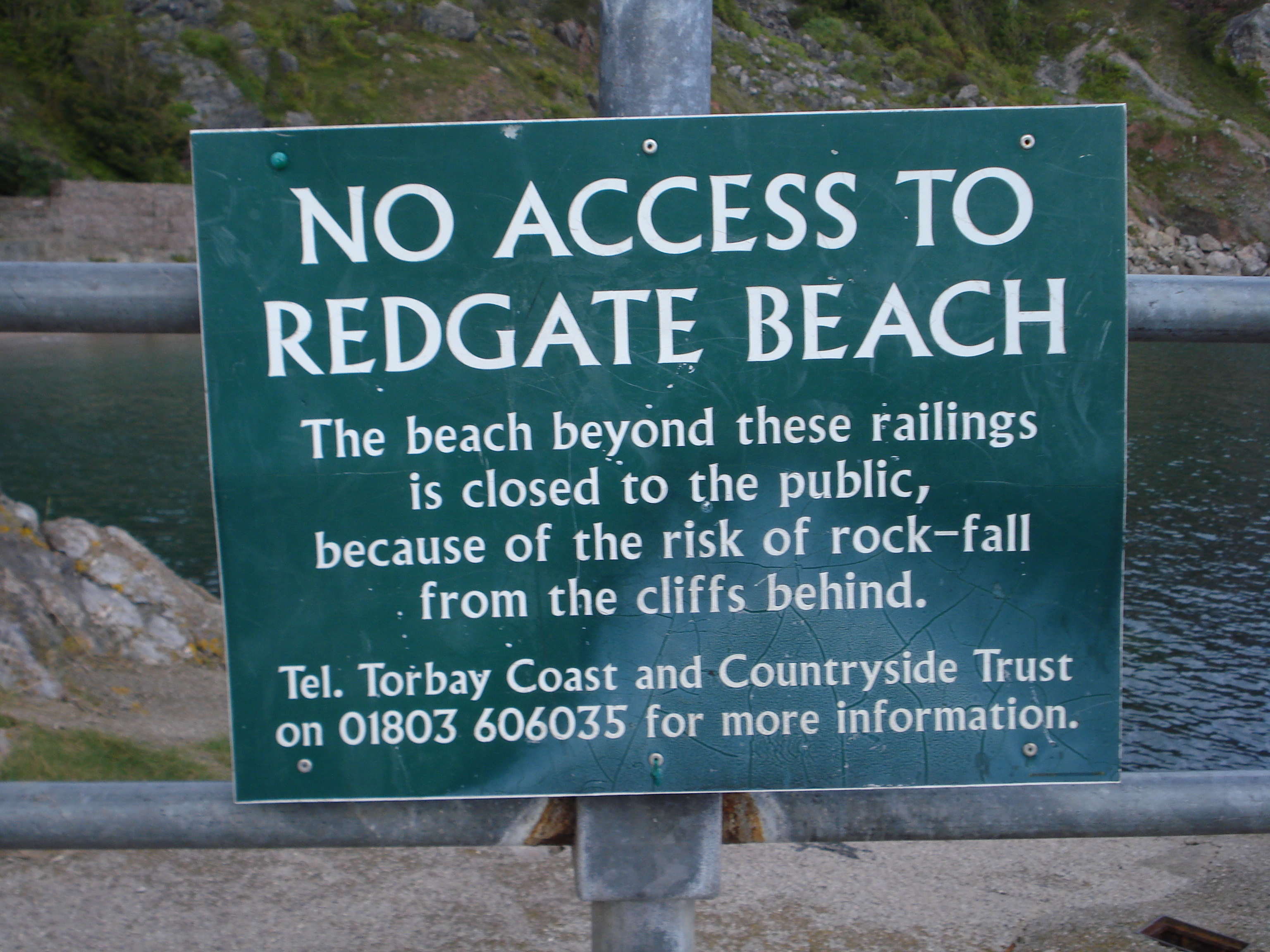
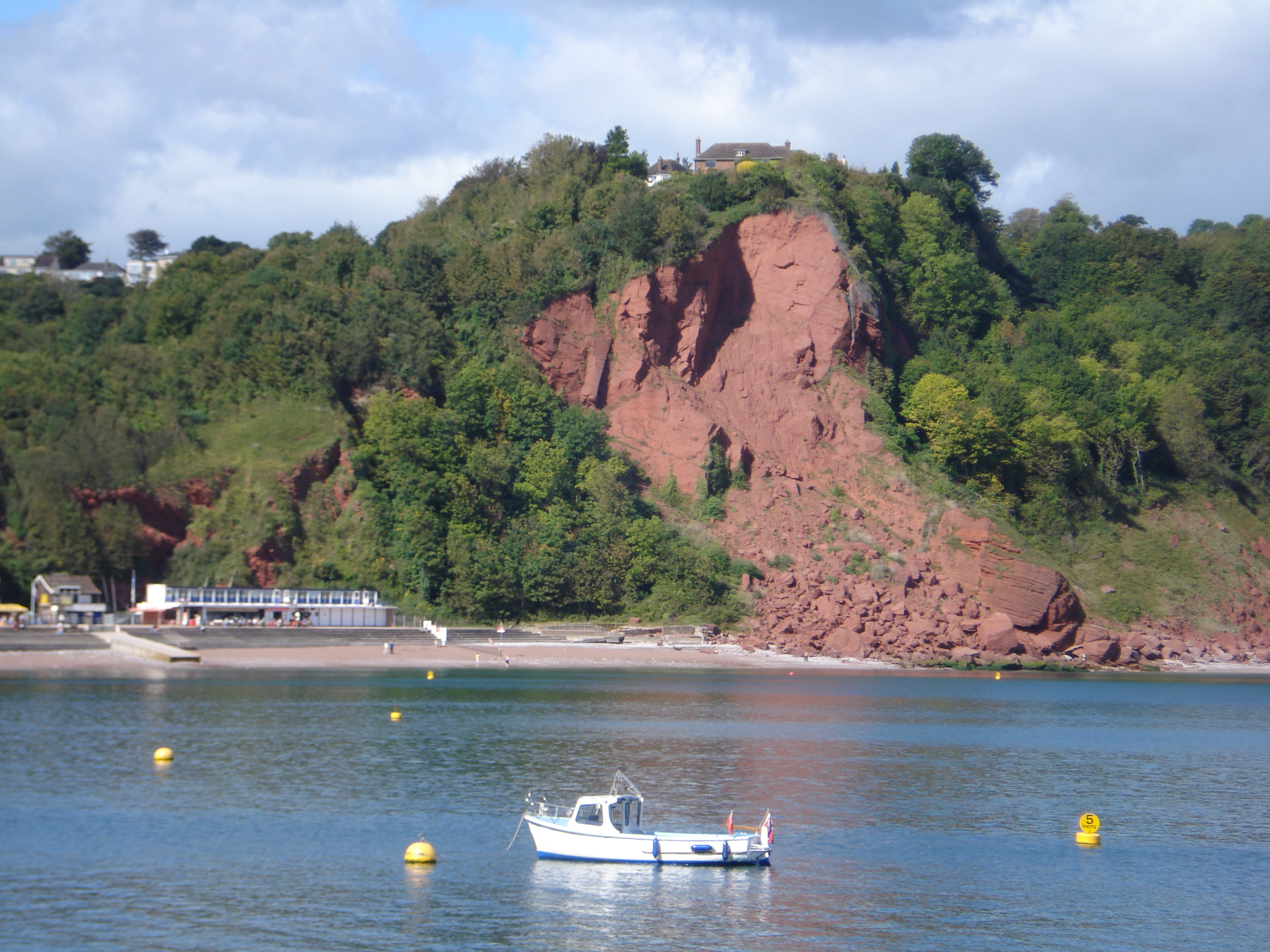
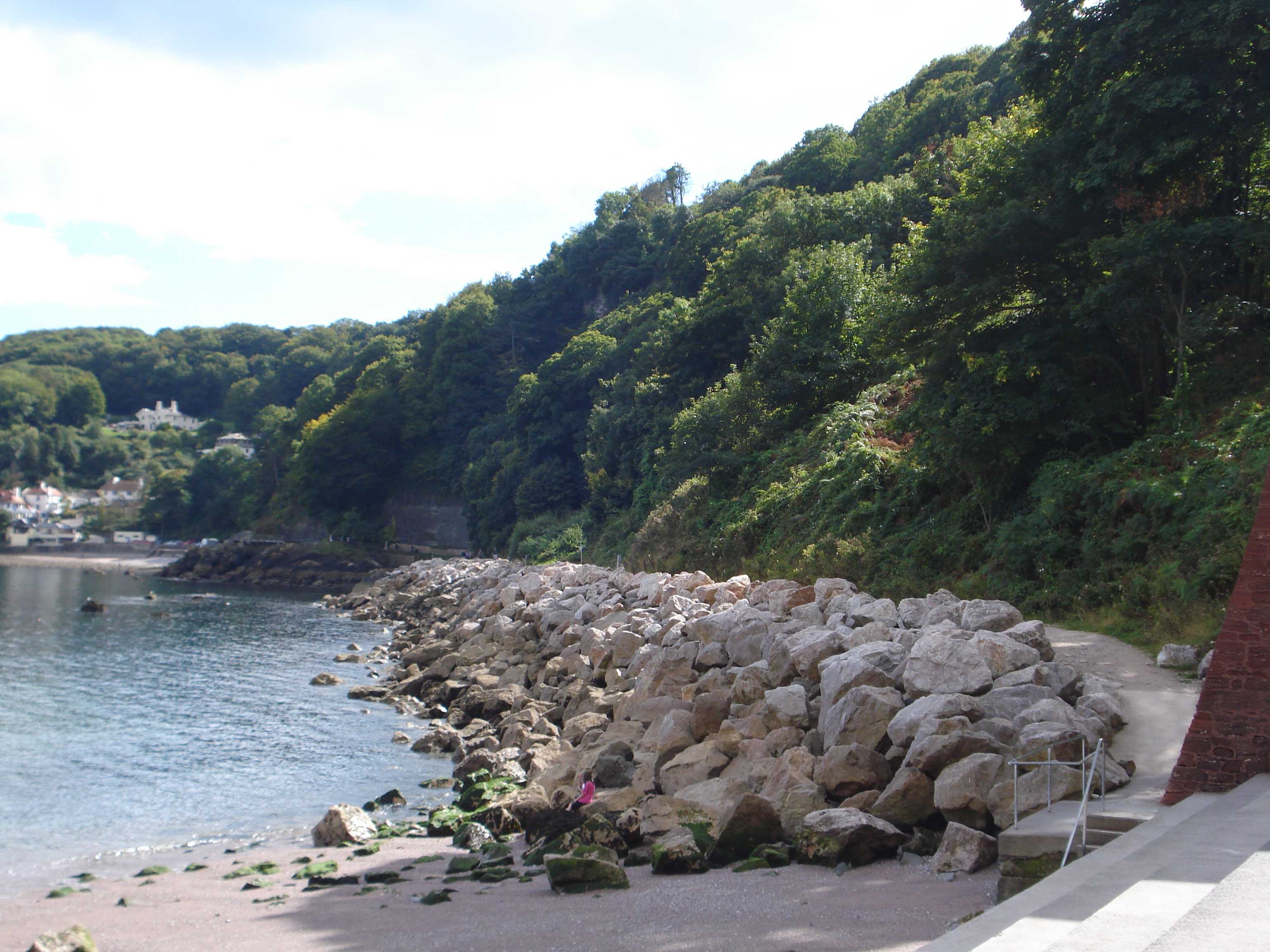
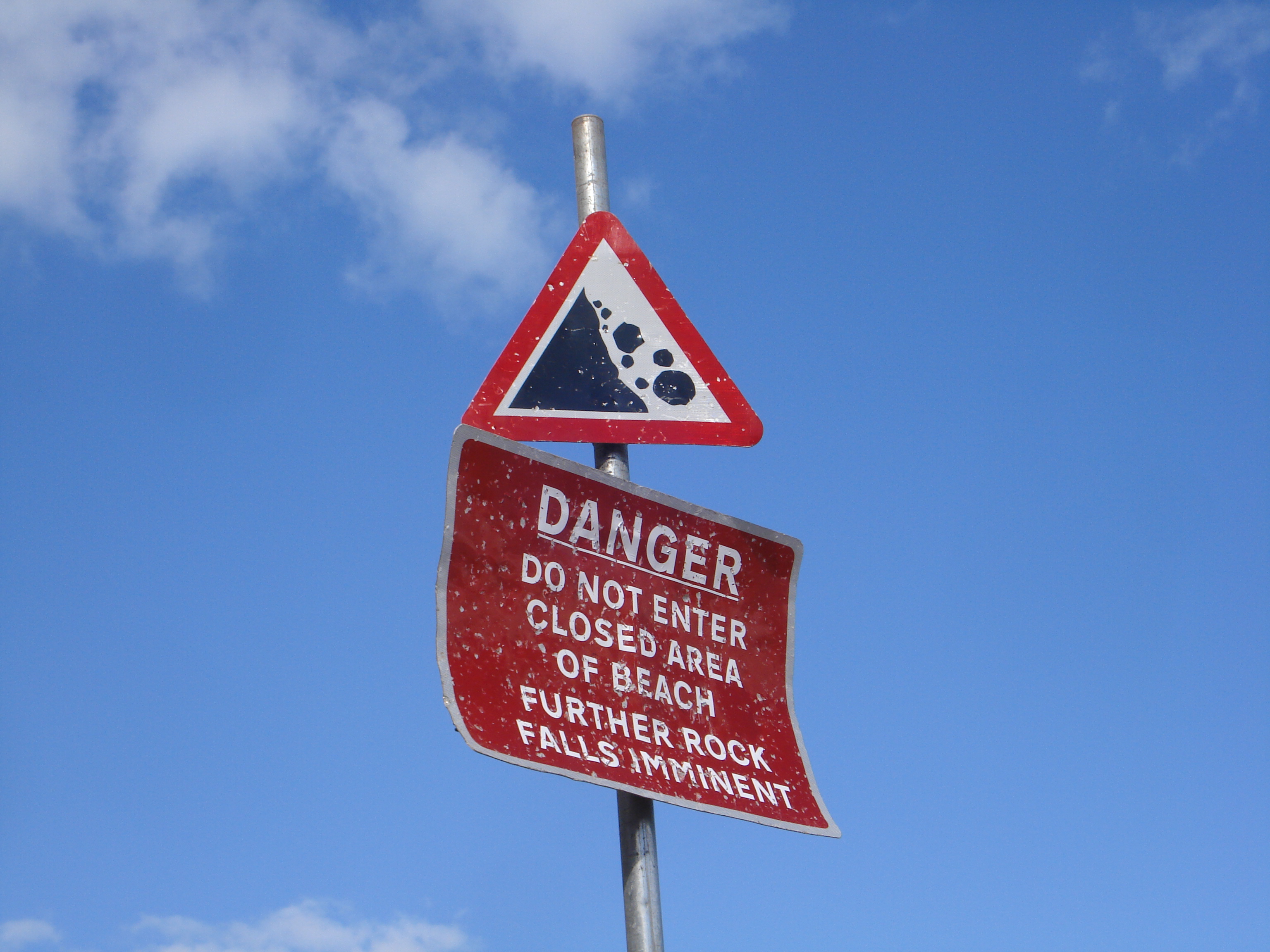
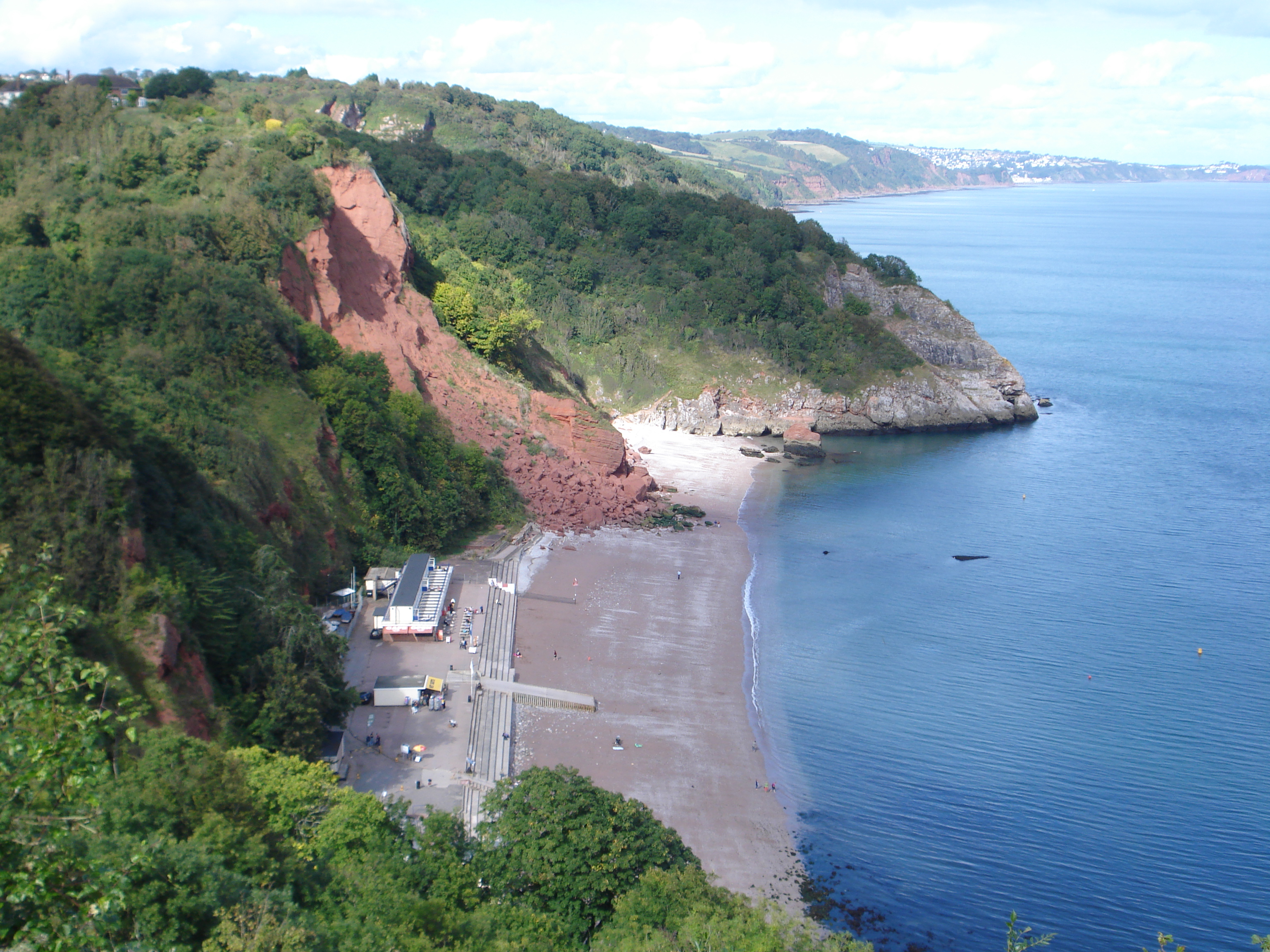
There was once a walkway which led to the next beach but it has been removed and the beach officially closed in 1998.

Its closure is still an emotive local issue. You might see people on the beach but they shouldn’t be there. Later we will see the beach and its cliffs from the other side and find out the reasons for its closure.

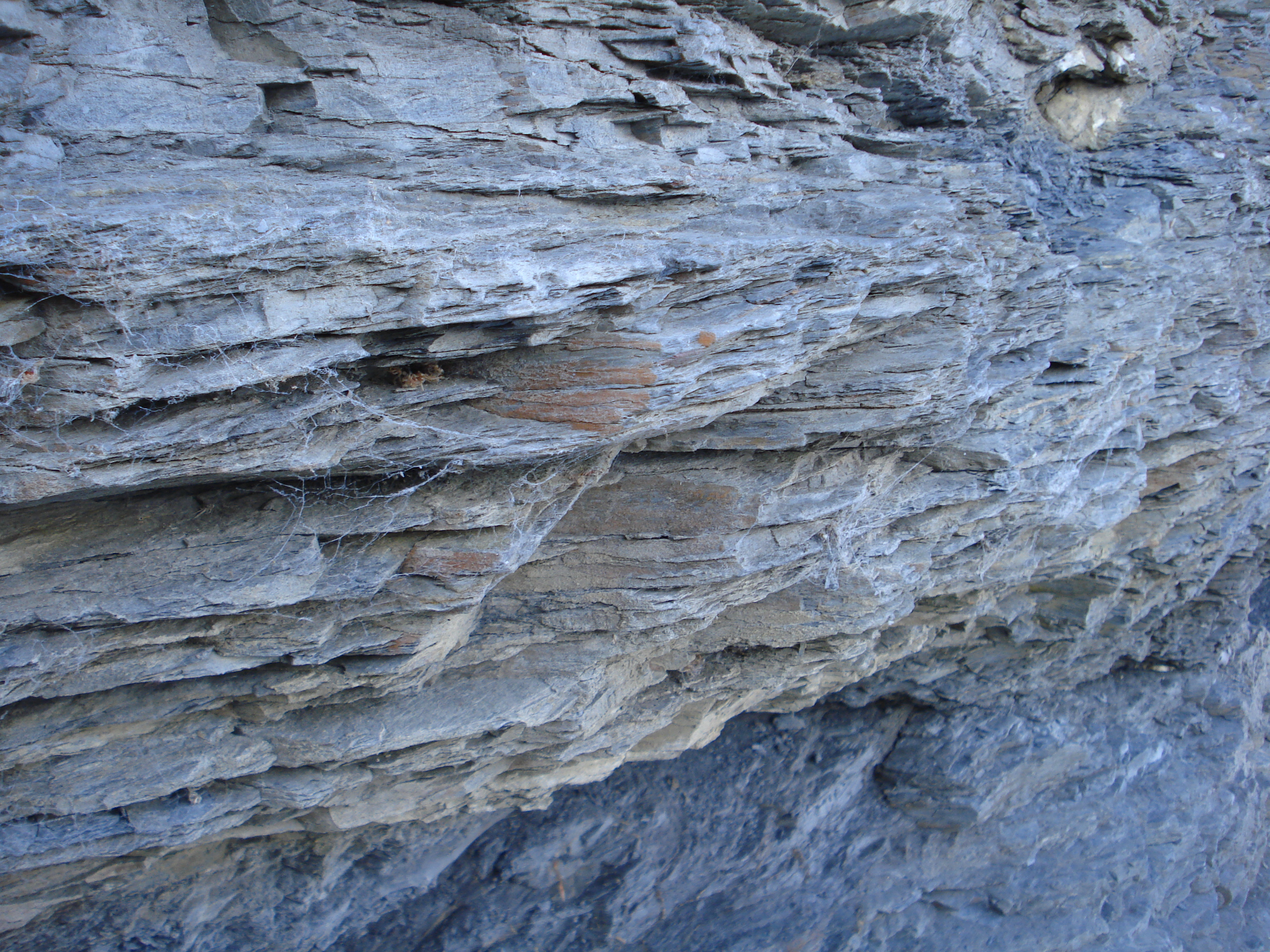
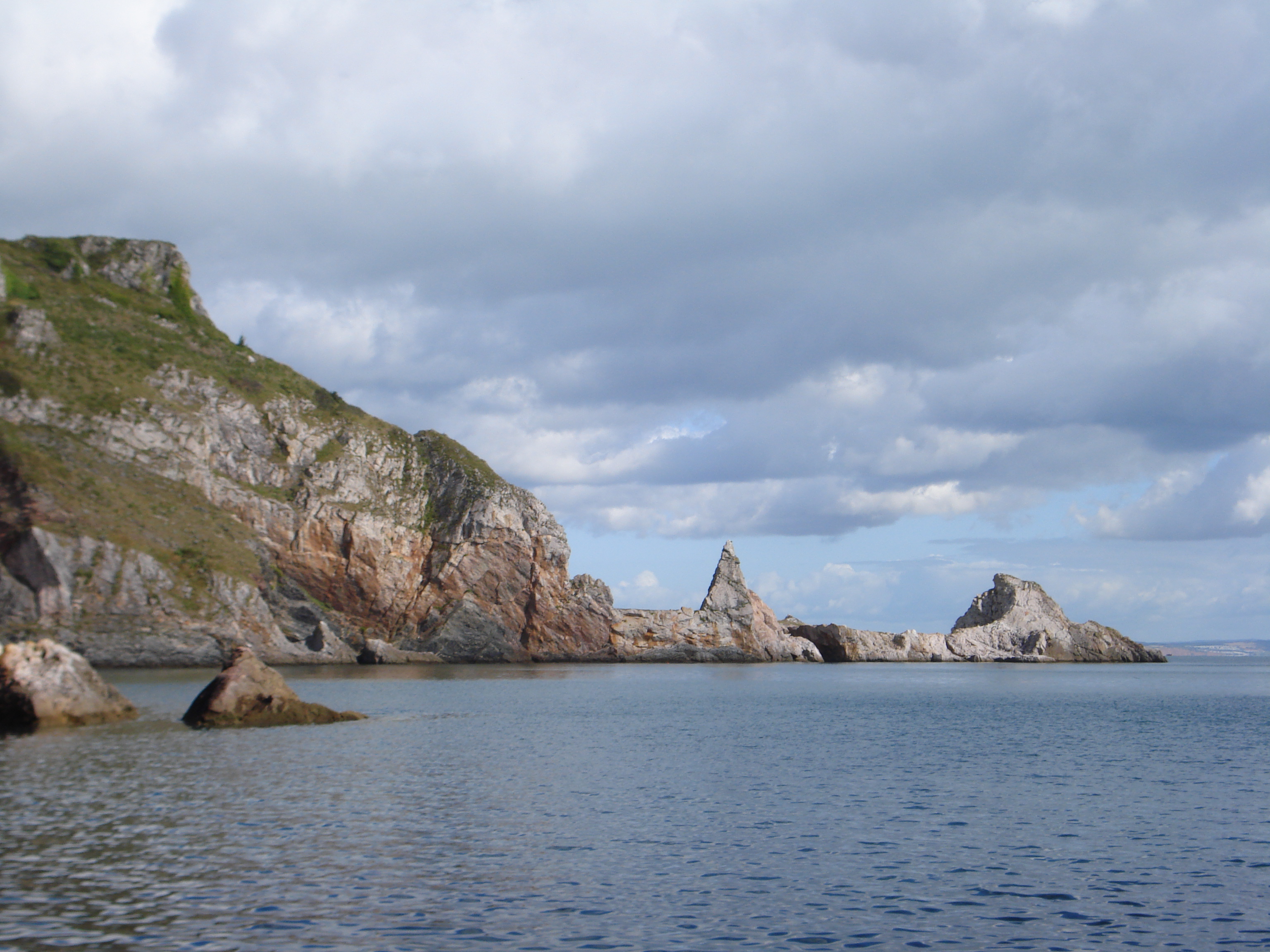
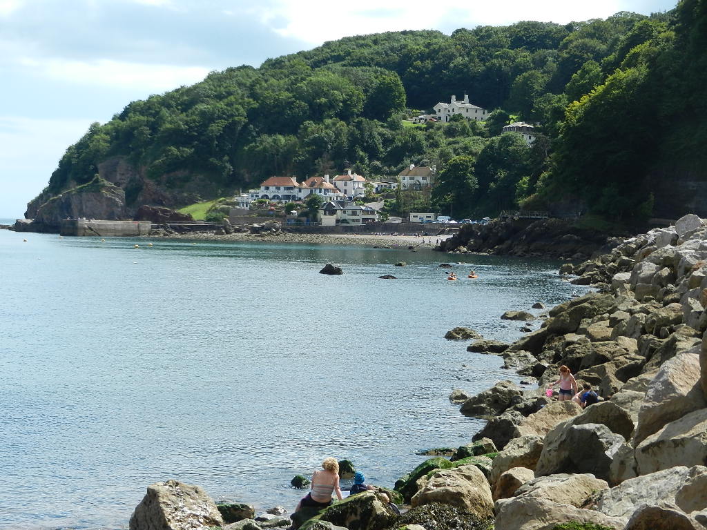
Now look across the bay to the high pinkywhite cliffs which are made of the Devonian limestone that we learned about earlier. Look carefully at the layers of rocks and try to follow some of the lines.

You can see that the lines are not in parallel but go in all kinds of directions. Some have been upended and others have been folded over. These are all indications of the dramatic earth movements which not only raised these rocks out of the ocean but also created massive mountain ranges of which these rocks are the last remnants.

Now look at the almost-flat top of the cliff. If you follow the line of the cliff to the sea it passes over two large pointed rocks almost at sea level. Limestone was quarried here in the 1800s and those two pointed rocks mark the end of Long Quarry. They give you some idea of just how much limestone has been removed.

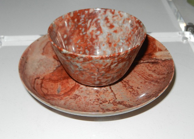
The limestone here is of very high quality so it was good for building. Thousands of tons were removed from here, put on to boats and shipped round to Torquay where they were used to build both prestigious and ordinary buildings.

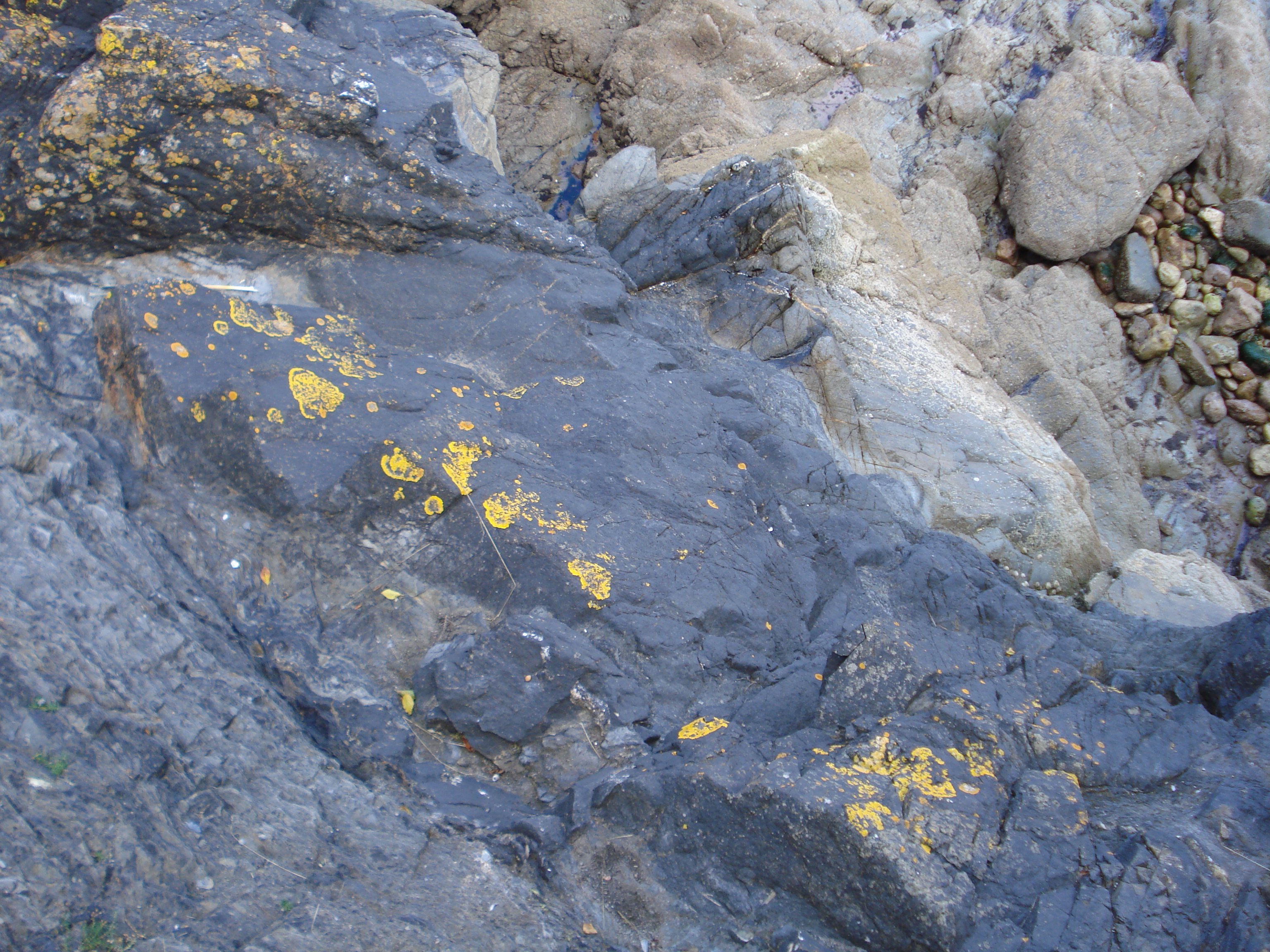
If you’re in Torquay do take time to look at the buildings and structures made of limestone such as the sea wall along the promenade. You should be able to see lots of fossils.

Quarrying is really devastating to the landscape and has left a large part of the coast here as an industrial wasteland.

Also, during the quarrying operation large amounts of rock debris were tipped into the sea and the currents moved it gradually along the coast dumping it half a mile away on Oddicombe Beach, turning it white. We will see this later in the walk.

Quarrying has now ended and although it has left a scar on the landscape it has provided a new form of economic activity. Today adventure tourism has taken over providing serious rock climbing pitches on the walls.

Torquay is also popular for Stag and Hen weekends so groups come here to do the new extreme sport of coasteering which involves a combination of swimming, wading, climbing and scrambling around the intertidal zone.


Beach closure sign
Jenny Lunn © RGS-IBG Discovering Britain
Directions

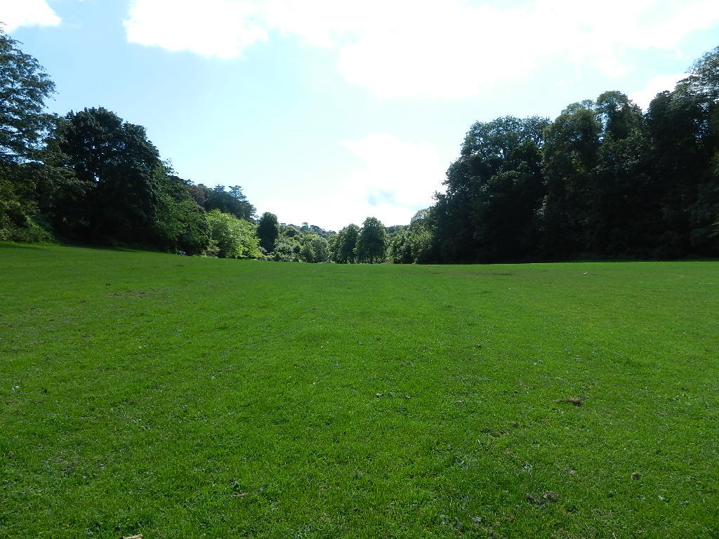
From Anstey’s Cove, retrace your steps up the steep lane back towards the car park. When you reach the road at the top turn right. After about 100 metres look for a footpath on the right signposted “Babbacombe and St Marychurch over the Downs” and “Coast Path Walls Hill”. Go up the steps and follow the path uphill through the woods.

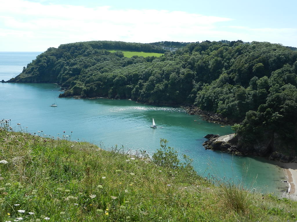
After about 300 metres you emerge on to an open grassy area. Stay on the right hand side with a fence and hedge on your right. Follow the fence round until you reach the barred gate and path down to Redgate Beach. Follow the fence a little further round the next corner and stop at the end (near a bench) where there is a good view down to the beach.

6 Danger from above and below

From this viewpoint we get a wonderful view down to the railings at the end of Anstey’s Cove promenade where we were at our last stop.

Enclosing Anstey’s Cove and Redgate Beach below are two rocky headlands. Opposite is the wooded headland of Black Head which is composed of dolerite, the dark rock that we found on the beach. On this side we are standing on the white limestone cliffs that we saw from down below.

Now look down at the concrete promenade on Redgate Beach. Follow the line of the promenade to the rocks at the far end. You should be able to see a gap in the rocks.

This is a fault line; it’s the same one that we heard about at the beginning of the walk that formed the Ilsham Valley. In fact, if you follow the line upwards you can pick out the grass playing field behind the car park where we stopped earlier.

Now if you look at the top of the cliffs at the back of Redgate Beach you should be able to see deep vertical cracks, known as ‘fissures’. These cracks are where rain can penetrate, dissolve, widen and weaken the rocks.

Look down again to Redgate Beach and you can see attempts to protect the base of these cliffs with concrete barriers. The base of these cliffs is not limestone but the black shales that we saw earlier on the beach by the café. They are soft and crumbly so can be easily eroded by the sea where it meets the bottom of the cliffs.

So the black shales underneath are worn away leaving the white limestone above hanging over thin air. From time to time these can fall down, as you can see in the middle section of the cliffs. The fissures in the upper cliff and the undercutting of the lower cliff make this beach dangerous.

The Council (who owns the land) decided to close the beach in 1998. Locals who have been using the beach for over a hundred years were not happy. What do you think? Is it Health and Safety gone mad or common sense to reduce the risk of someone getting hurt? Would you be happy walking under that large block half way up the cliff after very wet weather? Some questions to ponder.


Rock fissure above Redgate Beach
Pat Wilson © RGS-IBG Discovering Britain
Directions

Continue following the fence along the cliff top around the edge of the open grassy area. Near the shelter is a bench facing out to sea. Stop by this corner of the fence. From here you can just see over the fence and cliff edge to the two pointed rocks of the limestone quarry that we saw from Anstey’s Cove.

7 A flat plain and a steep cliff

We have just walked around the edge of part of a flattish area known as Walls Hill. There are several of these flattish areas of cliff tops in this area, generally called ‘plains’.

Tens of thousands of years ago, the sea was at a much higher level than it is today. You have to imagine that this flat area was just under the level of the waves at the shore.

The sea eroded the rocks and created a flat area which we call a ‘wave cut platform’. You can seen several new ones in the process of formation around the coastline in this area.

We saw at the last stop some cliffs in danger of collapsing due to erosion of the rock underneath undercutting the rock above. Here we have another case of cliffs in danger of collapsing but for a different reason.

In 1959 there was a landslip and a large gash appeared near where we are now standing. When landslips like this take place, the remaining rocks adjust to the removal of material.

Often when this happens, cracks can appear parallel called dilatation joints. When these joints appeared, the area was deemed dangerous. Old photographs show this cliff top being prepared for blasting – they removed the remaining cliff to try and make it safer just beyond the fence where you are standing.


Long Quarry Point 
Jenny Lunn © RGS-IBG Discovering Britain
Directions

Continue following the fence along the cliff top. After passing the shelter the path goes through a boundary hedge where there is another “Coast Path” marker post and emerges into another open grassy area. Keep to the path on the right. Stop at the second bench which has a wonderful view along the next section of coast.

8 A special place

This is Walls Hill and humans have been coming here for at least 2,500 years. The uneven surface here is the remains of the mounds and ditches of an Iron Age fort where people sheltered in troubled times.

Today people still come to Walls Hill but for a different reason. This is a very important area in ecological terms and is now a Site of Special Scientific Interest (SSSI).

As you walked along you might have noticed that the soil is very thin and the hard limestone rock is often at the surface on the path. The type of vegetation that generally grows on limestone is known as calcerous grassland but here a unique type has developed called ‘squill, spurge fescue’ grassland.

There is only about 22 hectares of it and every effort is being made to conserve and preserve it. The SSSI brings both botanists and ecologists to observe the 35 rare and special plant species that thrive here such as White Rock Rose, Small Hare’s Ear, Goldilocks Aster and Early Meadow Grass.

These plants are also an ideal habitat for butterflies such as the Marbled White, the Common and Small Blue, the latter needing the specialised Kidney Vetch which also grows here. So as you walk along, keep your eyes open for them especially if it is a warm summer day.

Before you continue, do take time to look at the lovely view of the red cliffs stretching northwestwards towards Teignmouth and Exmouth. We shall find out more about this later.


Common Kidney Vetch
Wikimedia Commons
Directions

Continue along the grassy path on the right hand side of the open area. After a short distance is a wooden post with the Acorn symbol for the Coast Path. Follow this path into the woodland, where there is also a signpost indicating Coast Path Babbacombe. Follow the steps as they zig-zag down through the wood. Take care as they can be very slippery in wet
weather. At the bottom turn right along the lane. After about 50 metres the lane bends round to the left and there is a signed public footpath on the right. Follow this path downwards. Just before the archway follow the path down to the right. Shortly after it takes a left turn down some steps and between walls. Then follow the steps down to the right and you emerge at the Cary Arms. Stop by the old lamppost.

9 Knock-down price, fall-down cliff

Below us is Babbacombe Beach. Look across the water to the red cliff face on the opposite side of the bay beside Oddicombe Beach. These red rocks are quite different to the white and black rocks that we have seen so far on our walk.

The red rock is a type of sandstone that is soft and crumbly which means it can easily be weathered by the wind or eroded by water. We will have a chance to get a closer look at it later in the walk but from here we can see what can happen with this soft and crumbly rock.

In February 2010, the house you can see on top of the cliff was bought at a knockdown price of £154,500 (others nearby fetched around £675,000). This was because it had structural damage due to geological faults below it.

Six days later 5,000 tonnes of rock took half the garden onto the beach below. It now sits 150 feet from the edge of a 300 foot cliff.

Considerable concern was expressed at the time that there might be dog walkers or joggers buried but no one was found. The beach was closed for a while after further rock falls.

Today the area of the beach below the fall is cordoned off. This closure also stopped access to the important Petit Tor Quarry which is the area of white/grey rock that you can see to the right of the red rockfall. We will find out more about the quarry later in the walk.

Again it raises questions about what precautions should be taken to protect people on the beach. Should they be allowed to be as near to the rock fall as they are at the moment? Can the Council afford to close another popular beach? In the summer of 2012 a young woman was killed by a similar rock fall along the coast in Dorset. Think about the issues as you walk towards Oddicombe Beach and explore the rock fall close up.


Oddicombe Beach rockfall
Jenny Lunn © RGS-IBG Discovering Britain
Directions

Turn right down the steep road and follow it past the Cary Arms. At the bottom of the hill turn right and follow the walkway. Stop at the end of the harbour wall.

10 From fishing boats to luxury yachts

The steep lane that you have just seen was used as access from the Downs above to ‘Babicomb Bay’ as it was called on the 1795 map. The beach had been used for centuries as a base for the fishing boats of the people of the small villages situated on the higher land behind the cliffs.

Queen Victoria visited this bay several times as one of her ladies-in-waiting lived in a cottage where the beach car park is today. She wrote in her 1846 Journal:“It is a beautiful spot, which before we had only passed at a distance. Red rocks and wooded hills like Italy, and reminding one of a ballet or play where nymphs appear, such rocks and grottoes, with deepest sea on which there was no ripple.”

The same property where Victoria had visited gained notoriety in 1884 when a later owner was murdered there by a man called John Lee. Lee was sentenced to death for his crime but despite three attempts the gallows didn’t manage to kill him so he was given a life sentence and later released. So for many years this house where he committed his crime became a sort of ghoulish attraction for visitors who came especially to Babbacombe Beach to see it.

Meanwhile the harbour wall we are standing on was built in 1889 for the benefit and protection of the fishermen and boatmen. At its opening, large numbers of people crowded on.

Old photographs also show the small Cary Arms which had played host to the Prince of Wales in 1874. He was just one of the celebrities that visited Babbacombe in the late 1800s.

Times have certainly changed since then. Today the Cary Arms is a large establishment describing itself as ‘a boutique bolthole by the sea’! The fishing boats are long gone; they are replaced by moorings for yachts, assorted sea sports and scuba diving, while fine dining, jazz nights and spa treatments are on offer inside.

The demands of the modern, well-heeled tourist are changing the face of this part of the coast although you can still see children playing on the beach and catching crabs off the harbour wall as children have done here for generations.


Babbacombe Beach
Pat Wilson © RGS-IBG Discovering Britain
Directions

From the harbour wall, retrace your steps along the walkway below the Cary Arms. Go past the car park and café and continue along the promenade to the wooden walkway. The walkway has three short sections. After the second bend – when you are on the third section of the walkway – stop about halfway along.

11 A hot rock sandwich

As we’ve come along from Babbacombe Beach, we’ve been walking along the base of some cliffs and these cliffs are made from the flaky black shale that we saw earlier.

Now look over the walkway to the rocks on the sea side.

Immediately beneath you are the flaky black shales but then it suddenly gives way to a smooth black rock. This is the dolerite that we came across on the beach at Anstey’s Cove in those little pebbles. Further towards the water you see the shales again. It’s like a shale sandwich with a dolerite filling.

As we learned earlier, the dolerite is formed from magma which is hot liquid from inside the earth. Here it has forced its way (or ‘intruded’) into the layers of shale to form this ‘hot’ sandwich. In doing so it has slightly ‘baked’ the shale and made it harder and therefore more resistant to erosion.

This feature is known locally as Half Tide Rock and it illustrates, at a very small scale, how different rock types can quite suddenly change the shape of the coastline. Back above Anstey’s Cove at Walls Hill we saw the effect of a much larger intrusion of dolerite which formed Black Head.


Half-Tide Rocks
Jenny Lunn © RGS-IBG Discovering Britain
Directions

At the end of the wooden walkway follow the path as it goes around a small cove at the base of a black shale cliff. The path then goes up some steps into the woodland. After a short
distance is a junction – straight ahead are wooden steps upwards and down to the right is a flight of steps to sea level. Stop at this junction.

12 Upside down cliffs

Look up towards the top of the cliffs (depending on the time of year and the amount of vegetation here you might have to move a little to the right or left to get a good view). You should be able to see quite a prominent flat area or ‘shelf’ and the top section beyond that is set right back.

You can see that the cliffs are almost vertical here and you should also be able to get glimpses of a whitish rock on the top part. This is the other rock type that we saw earlier – Devonian Limestone.

You are looking at some of the highest cliffs in Britain – which are some 300 feet at their highest point on Babbacombe Downs above. At this lower level we are standing on the black shale section of the cliffs. These rocks also hide a secret which some landscape detective work managed to discover.

Both the black shale and white limestone contain lots of fossils but when geologists carried out work to establish when they were formed, the evidence didn’t seem to add up. What geologists found was that the fossils in the black shales where we are standing at the bottom of the cliff were much younger than those in the white limestone at the top of the cliff.

Normally you would expect to find younger rock at the top. So what on earth has happened here? The cliffs are upside down! They concluded that the massive earth movements that raised these rocks from the ocean up into mountains must have also folded them over in such a way that they were inverted. Today it is possible to detect the same type of situation in high mountains like the Alps.


Black shale cliffs with limestone above
Pat Wilson © RGS-IBG Discovering Britain
Directions

Go down the steep steps towards the sea. At the bottom turn left. Stop after about 25 metres where there is a small waterfall on the left side.

13 Waterfalls

As we’ve walked along this path from the bottom of the steps you should have noticed water coming from the cliffs and running across the path.

As we discovered at the last stop, these cliffs are composed of white limestone above and black shale below. At the start of the walk in the Ilsham Valley we found out that limestone is permeable and allows water to pass through it. In contrast, shale is impermeable meaning that water cannot pass through it.

So rain water that falls on the top of the cliff passes straight through the limestone. When it reaches the shale layer it cannot pass through so comes out along the junction of the two rocks as springs. So all the water we can see here and along this path has come from springs high up on the cliffs. In the wet summer of 2012 when I researched this walk it was positively gushing out!

So this means that the cliffs are not only being worn away by the waves at sea level but also where the spring water emerges half way up them.

As you walk on, notice the massive ‘rock armour’ – the enormous angular rocks at the side of the path – protecting the black shale rocks at the base of the cliffs from further erosion.


Rock armour at Oddicombe Beach
Jenny Lunn © RGS-IBG Discovering Britain
Directions

Continue along the path towards the next beach. Walk along the promenade or the beach to the fence and danger signs at the far end in front of the cliff fall.

14 Red and white

This is Oddicombe Beach and it has always been popular for generations of local families. Do you remember Long Quarry Point that we saw earlier? There we found out about the rock debris that was created by the quarrying activity and dumped into the sea. Over time, currents carried it gradually along the coast and it was dumped here at Oddicombe Beach.

This created a white beach backed by red cliffs which was quite an unusual sight because normally the colour of a beach matches the rocks of the cliff behind.

The reason for this anomaly is a fault. In fact there are two very large fault lines in the Earth’s crust here – with your back to the sea there is one to the right and the other following the railway track to the left. As we discovered earlier, fault lines are cracks in the Earth’s crust. At one time there was movement along these fault lines and a section of the much younger Permian red sandstone slipped into this position.

We discovered earlier that fault lines are a point of weakness in rocks too. The faults make these cliffs very unstable and prone to falls. Here you can see the rock fall that we saw from a distance earlier where the garden of the house at the top of the cliff had disappeared. But this rock fall is nothing new. If you look at old photographs it looks very similar to today so landslips have been happening here for hundreds of years.

As with the cove that we saw earlier, the Council took over ownership of the beach in the 1930s. And that, of course, makes them responsible for health and safety. Look at the cliff behind the café and you can see rock bolts have been put in place to try and secure the cliffs and prevent further landslips. After the 2010 rock fall, a Torbay Council spokesperson said: ‘there is nothing we can do to save it so it’s being left to natural erosion’. What do you think: should further precautions be taken or should it just be left for nature to take its course?


Warning sign on Oddicombe Beach
Jenny Lunn © RGS-IBG Discovering Britain
Directions

Stay in the same place but look beyond the red rock fall to the next headland of grey/white rock, known as Petit Tor Point.

15 Devon marble

The grey/white rocky headland that you can see beyond the red rock fall is Petit Tor Point Quarry. Earlier we saw where limestone was quarried. But this is quite a different quarry.

Although the rock here is also a sort of limestone, it has very different characteristics from the Devonian limestone that we saw at Anstey’s Cove. This is a rock known as a ‘breccia’ which is composed of angular fragments of Devonian limestone but slightly coloured pink. It is usually full of fossils too. This rock was once buried deep in the Earth’s crust so it is very hard. When it is polished it looks like marble.

From the early 1800s, this rock was quarried from here. And the Victorians loved it! They used it for vases, plates, ornaments and tables; they also built it into the ornamental parts of their churches.

The Woodley Company in nearby St Marychurch manufactured items made of Devon marble. If you visit the old company works (which is now the Corinthian Sailing Club) you can see Victoria’s Royal Insignia above the door. It was an important industry in Devon but fashions changed in the twentieth century and the industry closed. In the summer of 2012 the Torquay Museum held a wonderful exhibition of some of the best examples of Petit Tor Marble artefacts.

As you walk back along the beach, look out for pinky-coloured pebbles of Petit Tor marble as well as many of the other rocks we have seen on our walk.


Cup and saucer made of 'Devon marble'
Pat Wilson © RGS-IBG Discovering Britain
Directions

The new Cliff Railway Visitors Centre on the Promenade is well worth a short visit before moving on. When you are ready go to the centre of the promenade by the toilets and from there take the road up the hill. Just before the bridge over the road stop at the entrance to the Cliff Railway (lower station).

16 A unique railway

Around the turn of the century the enterprising Thomas family, who set up the cafe at Anstey’s Cove that we saw earlier, also set up a café at Oddicombe Beach together with boats for hire and a dozen or so bathing machines.

The beach grew in popularity as more and more people took family holidays in Torquay and liked to visit the surroundings. But it was difficult to access so in 1913 the Council bent to local pressure and approved a plan to build a cliff railway. Sadly the First World War and the post-war economic situation meant that it was not actually opened until 1926.

At first it was a private enterprise run by the Torquay Tramway Company but it was bought by the Council in 1934 for £18,000 after the collapse of the Company. From then on it had a chequered history. It closed for over ten years in the 1940s then opened in 1951 after £10,000 worth of repairs.

More recently, between 2005 and 2007, there was a major refurbishment using money from the sale of the Town Hall in St Marychurch and it is now up to modern health and safety standards. 

It is one of sixteen funicular railways in the UK and the only one of this particular type still running. In keeping with our changing times, it also has its own Visitors Centre on the beach, organises themed events such as ‘Murder Mystery Family Fun Days’, live music on the beach and Santa’s Post Box at Christmas. You can even get married on it as it has a civil marriage licence!

If the train is open we highly recommend a ride, not only for the view but also for a close up of the vertical limestone cliffs, particularly in winter when the leaves are off the trees.


Babbacombe Cliff Railway
Jenny Lunn © RGS-IBG Discovering Britain
Directions

You can take the train to the top of the cliff if it is running (there is a small charge) or continue up the steep zig-zag road. Outside the door of the top station a Coast Path sign points to the right. This is where we leave the Coast Path. Go left up the sloping path, past the Cliff Railway Café and under the arch. Turn left along the road, keeping on the pavement on the left hand side. After about 30 metres, note a fountain with the figure of a woman which we will learn more about later. Follow the footpath along the top of Babbacombe Downs, which is a grassy area with flower beds. When you reach a raised viewing platform go up the steps on to the platform and look out to sea.

Note: The walk can be shortened from here. From the arch at the top of the path above the cliff railway, turn right and then left along Babbacombe Downs Road. At the end is Babbacombe Road. There are bus stops a short distance to the left or right and regular services will take you into Torquay or towards Teignmouth.

17 A wonderful view

Think back to earlier when we were on Walls Hill – the area of grassland that was preserved as a SSSI and can’t be built on.

This area was once also like that but now you can see how the downs have been transformed from open grasslands into formal lawns, flower beds and promenading paths. There is also a range of accommodation and restaurants to suit most tastes and a small theatre.

If there is good visibility this viewpoint gives a wonderful coastal panorama of Lyme Bay. Nearest to us is a sweep of red cliffs like those we saw at Oddicombe Beach. They extend past Teignmouth and Exmouth.

After that are the light coloured cliffs of the famous Jurassic Coast and then the chalk cliffs near Weymouth and the Isle of Portland. Look at the direction finder to see where to spot Portland which is over 40 miles away! Also notice how straight most of the coast appears to be as far as you can see. You might wonder why.

Pat: “As a young physical geographer getting to grips with understanding the underlying structure of Britain, I came across a strange idea known as the Tees-Exe line. From the mouth of the River Exe at Exmouth you can draw an imaginary line on a map to the mouth of the River Tees in Yorkshire. To the north-west of the line lie all the oldest, most resistant rocks in Britain; to the south-east of the line are the youngest and least resistant.”

“What you can see from here is this dividing line. Beyond the River Exe is the first of the younger, less resistant rocks. These softer rocks erode quicker and at a more even pace, which is why much of that coastline is so straight in contrast to this section of coastline.”


View of Oddicombe Beach and the coast beyond
Jenny Lunn © RGS-IBG Discovering Britain
Directions

From the viewing platform, go down the steps and turn left. Follow the cliff top path to the far end. Cross in front of the theatre and around its right side to the corner of Babbacombe
Downs Road. Bear left down Beach Road. After about 25 metres is a gateway on the right into a grey stone house called Babbacombe Cliff. Stop by the blue plaque on the wall.

18 A grand villa

Through the gates is a grey Victorian house with an archway. It is called Babbacombe Cliff and was built in the mid 1800s in its own secluded wooded coombe with wonderful sea views. Now it is overlooked by modern properties and you could walk past without really noticing it.

The original villa was bought by the wealthy Mount-Temples in 1874. They extended it, lavishly decorated it and furnished it with all the latest fashions. This including William Morris wall tiles and Pre- Raphaelite paintings by Rosetti and Burne-Jones. They also installed a portcullis in the archway!

The Victorian celebrities of the day came to stay at such secluded properties and none was more famous than Oscar Wilde, whose wife was a distant relative of Lady Mount- Temple. She leased the villa to Wilde and his family in the 1890s. Whilst here he had a love affair (which eventually proved his downfall) and also wrote his play A Woman of No Importance.

Lady Mount-Temple lived here until her death in 1901. She was noted for her ‘good works’, particularly her love of animals hence the ornamental fountain that we saw up on Babbacombe Downs Road which depicts her feeding a bird.

After her death the house was sold and after the First World War became the upmarket 34-bedroom Babbacombe Cliff Hotel. Its fortunes waned as the well-heeled started to go further afield for their holidays and in 1999 it was sold and converted into luxury holiday apartments. No doubt the Wilde connection makes a good selling point!

As you continue, look out for the pair of old iron gates which are the last remaining evidence of the Babbacombe Cliff Hotel.


Babbacombe Cliff
Jenny Lunn © RGS-IBG Discovering Britain
Directions

Head back up Beach Road but turn immediately left up the slope behind the wall where the blue plaque is. Go up the steps and turn left along the road. The old cottages on either side of the road here are all that remains of old Babbacombe village.

Take the first left called Walls Hill Road which is signposted to a car park and the cricket club. Cross Walls Hill car park and go round the barrier on to the footpath across rough grass.
After a short distance the rough grass gives way to cut grass.

If cricket is not being played walk straight across to the benches at the other side. If a game is in progress you will need to skirt round the edge of the pitch.

19 An unusual cricket pitch

This is the ground of Babbacombe Cricket Club, which moved here in 1917. It’s a bit of a strange place for a cricket pitch because it’s not flat!

Pat: “I’ve watched them playing here and there is certainly a skill in fielding. It’s difficult to get the ball to stay at the other side of the boundary so it’s very hard to make a six!”

An old photograph from 1965 also shows this ground being used for a sports regatta with running lanes laid out and the caption describes it as a ‘fine natural stadium’. But think back to the Ilsham Valley where we started the walk. This is another example of a ‘dry valley’ – an area where the rock underneath is limestone. Water drains straight through and leaves no evidence of a stream.

These are usually called ‘combes’ – hence the local names Babbacombe and Oddicombe. Combes can be found all over southern England especially where there are softer limestones under the surface.


Babbacombe cricket ground
Pat Wilson © RGS-IBG Discovering Britain
Directions

Remain at the cricket ground for the next stop.

20 A changing landscape

We’re now at the end of the walk. I hope you’ve enjoyed discovering more about the geology of this section of the South Devon coast. In a very short distance we have seen a tremendous diversity of rocks – dark green dolerite and white limestone; black shale and red breccias.

We’ve learned about their different properties – some hard and others soft; some permeable and others impermeable. The action of wind, rain, waves and tides working on these properties have shaped the landforms that you see today.

We’ve looked at rocks up close and also learned how they were part of larger scale geological movements of the earth. We’ve also seen how humans have exploited these diverse rocks and their characteristics from the quarrying of limestone for building and ‘Devon marble’ for decoration, to the use of secluded coves for smuggling.

In addition, we’ve seen 150 years of tourism from the Thomas family’s café and the Victorians with their bathing machines to the modern-day seaside of upmarket hotels and new leisure activities.

We’ve also seen how the shape of a coastline not only happens over millennia but also very rapidly. The processes of erosion and deposition are constantly changing the landscape. The cliff collapses and closed beaches have raised questions about whether we should protect our land and property or let nature take its course.

Next time you’re at the coast look a little closer at the cliffs and beaches and ask some questions about the rocks and landforms that you see.


Some of the rock types found on this walk
Pat Wilson © RGS-IBG Discovering Britain
Directions

From the benches beside the cricket pitch follow the footpath past the wooden sign indicating Walls Hill SSSI. Head straight across the open grassy area, which is the site of the Iron Age hill fort that we heard about earlier. At the far side is a gap in the hedge through to the next section of Walls Hill.

To return to the start on foot, head diagonally across the open grassy area to the far corner by the cliff. This is the way we came up from Anstey’s Cove car park at the beginning of the walk. Follow the Coast Path signs through the woods and back to Anstey’s Cove Road Car Park and cross the recreation ground back to llsham Road

To continue your journey by bus, bear right across the open grassy area to another wooden Walls Hill SSSI sign. Follow the path down to Babbacombe Road where there are bus stops
on either side. Regular services will take you into Torquay or towards Teignmouth.

Coves and cliffs

Petit Tor Point © Jenny Lunn RGS-IBG Discovering Britain

Babbacombe walk

A walk along the picturesque South West Coast Path in the English Riviera

Babbacombe's dramatic coastline of steep cliffs and hidden coves is a wonderful place to go walking. This walk uncovers the stories of an ever-changing landscape.

Explore the wide variety of rocks you can find along this stretch of Devon coast. Discover evidence of dramatic earth movements and the powerful forces of nature. Find out why a red cliff collapsed into the sea while white cliffs were blasted apart with dynamite. 

Discover how people have used the rocks, from mining and bathing to smuggling and coasteering

You can enjoy some stunning views and a ride on a restored cliff railway. The walk route also raises important questions about how we intervene with our coastlines. 

Follow the walk by clicking on the map pins or
downloading the guides below


Location: Babbacombe, Devon
Start point: Recreation ground by Anstey’s Cove car park, TQ1 2JE
Finish point: Babbacombe Cricket Club, Walls Hill Road, TQ1 3LZ
Keep an eye out for: A trip on Babbacombe Cliff railway offers spectacular coastal views

Babbacombe walk credits

Thanks to - 

Pat Wilson for creating the walk, and the audio commentary

Jenny Lunn for editing the walk materials and providing photos

Caroline Millar and Rory Walsh for editing the walk resources

Francis Frith and Torquay Museum for permission to include archive images 

Florence Lee for additional assistance

Other images reproduced under Creative Commons Licences

...a beautiful spot...Red rocks and wooded hills like Italy, and reminding one of a ballet or play where nymphs appear, such rocks and grottoes, with deepest sea on which there was no ripple.”
Queen Victoria, in her journal of 1846