Hello! I’m Dick Bateman, a retired teacher. I’ve lived in Saltford village for 30 years and love exploring it on foot. I never tire of this place and am always discovering something new.
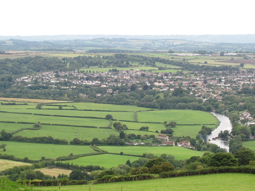
This is the Avon Valley, a busy but beautiful area on the southern edge of the Cotswolds Area of Outstanding Natural Beauty. The valley has a key position between the two cities of Bristol and Bath and this walk explores the routeways created to link the two cities and support various industries and economic activities in the area.
Half way between the two cities of Bath and Bristol is Saltford village, and here we can find four different routeways located within a stone’s throw of one another. There is a former stagecoach road, The Great Road, now the present A4, one of Britain’s busiest A roads. In the eighteenth century, the River Avon was converted into a canal but narrow boat barges are now used for holidays rather than for carrying coal. And there are two railway lines – Brunel’s Great Western Railway is still the main Bristol-London route and the now-defunct Midland line, which was converted into Britain’s first Sustrans cycle track in the 1980s.
On this walk you will find out about how each routeway fits into the landscape, hear some of the stories about the physical and political challenges to their construction, and discover how the routeways have been variously used for industry, transportation, leisure. The walk is a couple of miles long and it loops in a figure of eight, starting and finishing at The Shallows car park, which is just by the river bank. The route is mostly flat, with just a few steps and slopes, and so should be suitable for most people. I hope you enjoy the walk!
From The Shallows car park, go to the river bank for Stop 2.
2 What’s in a name?
Though people have lived in this area for thousands of years, the village was probably first built in the period 1200 to 1500 years before the present day. The place name ‘Saltford’ is Anglo-Saxon, although there are at least three possible meanings for the name, which people argue about.
It could mean ‘Salt Ford’, because in those days there were no weirs on the River Avon and water here could have been salty, whereas, the tidal salt water did not reach the riverside village of Freshford, on the Avon to the east of Bath.
The Domesday Book entry for this place was ‘Sanford’ and that could have come from ‘Sand-ford’ because the banks are sandy. Equally interesting are early references to ‘Saehl ford’, meaning ford of the willows. That is also plausible – indeed, you will see many picturesque willows along the bank here.
Each of these three possible name origins includes ‘ford’, which means a shallow place in a stream or river that can be crossed on foot by people or horses. When you’re looking across the river towards the Cotswolds, this spot with the Brass Mill to the right and the Bird in Hand to the left, is that fordable section of river and is now known – appropriately – as The Shallows.
Walk along The Shallows with the river on your left. Shortly after Saltford Brass Mill and a cottage is a footpath on the left hand side. Follow this footpath into the grounds of The Riverside Inn. If this path is too overgrown or waterlogged, you can continue along the lane and enter the pub grounds through the vehicle entrance and car park. Stand outside the pub overlooking the weir.
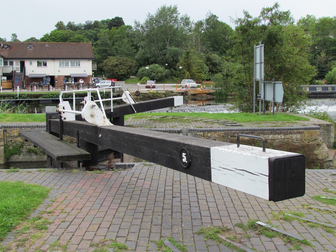
3 Improving navigation
Here we are at the Riverside pub looking at Kelston Lock. The River Avon is the first of the routeways that we shall be looking at on this walk.
In the days before the Industrial Revolution, anyone wishing to move goods across the country had to entrust their merchandise to jolting carts or pack animals on deplorable roads. The Bath Corporation were keen on various schemes to make the Avon navigable as far as Bath because road transport from Bristol was difficult and expensive “by reason of rockie and mountaynous waies”.
But there was a lot of opposition to these plans. There were too many powerful people with vested interests in maintaining the status quo. Here on the Avon, mill owners didn’t want the river made navigable in case it reduced the flow to their waterwheels. So, although an act was passed in 1712 to make the Avon navigable as far as Bath, nothing happened.
Eventually, the various voices of opposition were overcome and a consortium set about the task in 1724. Building the Avon Navigation was actually quick because no horse towing path was needed – all the boats were hauled by men. In December 1727, the first cargoes arrived in Bath.
But the improved waterway still wasn’t popular with everyone. Here we are at Kelston Lock, but in 1738 Saltford Lock – the next lock downstream – was blown up by Somerset coal miners who feared that the new waterway would mean that cheaper Midlands or Welsh coal could be brought in and thus threaten their livelihoods. The navigable river was upgraded further in 1820 to connect with the Kennet and Avon Canal, achieving the long-held ambition of a waterway linking Bristol with London.
Leave the Riverside Inn through the car park. Turn left onto the lane and follow it under the railway bridge. Take care here as vehicles can come round the blind corner at speed. At the main A4 Bath Road, turn right along the pavement. After a short distance is an entrance to a railway storage yard. Stand here for Stop 4.
4 The Great Road
This is the former Saltford Station. A group called Saltford Environmental Group are trying to re-open the station, but more of this at the next stop.
This is the A4, a road that runs all the way from Trafalgar Square in London to Avonmouth via Maidenhead, Reading, Newbury, Chippenham, Bath and Bristol. It used to be called The Great Road. This routeway has gone through many transformations through the ages – from Roman roads to basic wagon tracks connecting market towns in the Middle Ages.
It was not until the seventeenth century that a distinct route between London and Bristol started to resemble today’s road. During the seventeenth century, that’s when the A4 was known as The Great Road to Bristol. But when Queen Anne started patronising the spa city of Bath, the road became more commonly known as Bath Road. This stretch of road in Saltford still bears that name.
As Bath became more popular with the wealthy and famous, Turnpike Trusts were set up under the terms of the Turnpike Acts to pay for maintenance to the road.
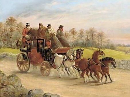
With improvements being made to the road system, the business of moving mail became easier and thus more profitable. Journey times from Bristol to London fell from 2 days in 1752 to 38 hours in 1782 and only 18 hours by 1836. Royal Mail coaches in 1836 were able to do the trip in 12–13 hours.
In the early part of the nineteenth century coaching was at its height. In 1830, there were six stagecoaches each day carrying passengers to and from London along the Bath Road. This had risen to ten per day by 1836.
But the coaching services were to be shortlived with the rise of the railways. The Great Western Railway, which we shall see at our next stop, followed a very similar route with stations in many of the same towns as the road passed through. By 1843, the coaching service had finished altogether.
In the twentieth century, the A4 lost its status as the primary road between London and Bristol. The M4 motorway was constructed between 1965 and 1971. Journey time from London to Bristol by car is now about 2 hours – quite different from the days of the mail coaches!
A Bristol to London mail coach with a hunt beyond, by JC Maggs WikiGallery (Creative Commons License)
Directions
Continue up the hill. Just before the top of the hill where the road bends to the left is a footpath on the right hand side. This is a good point at which to stop and look at the view of the valley including the river and railway. Follow the footpath to the bridge over the railway for Stop 5.
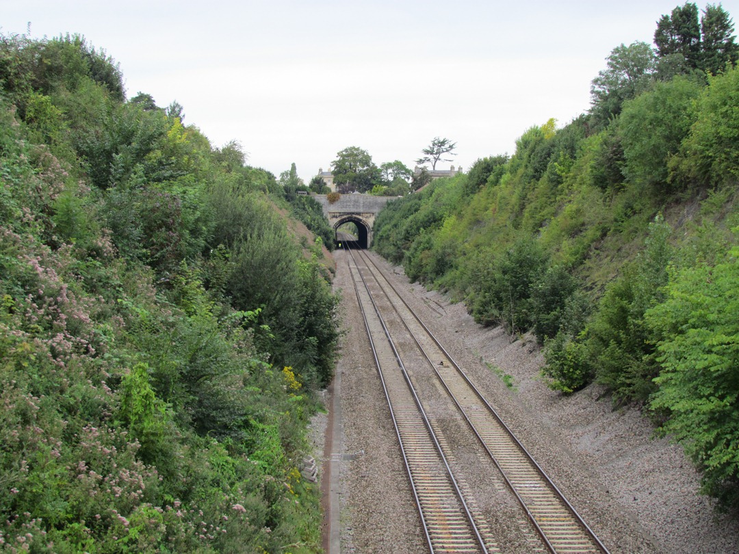
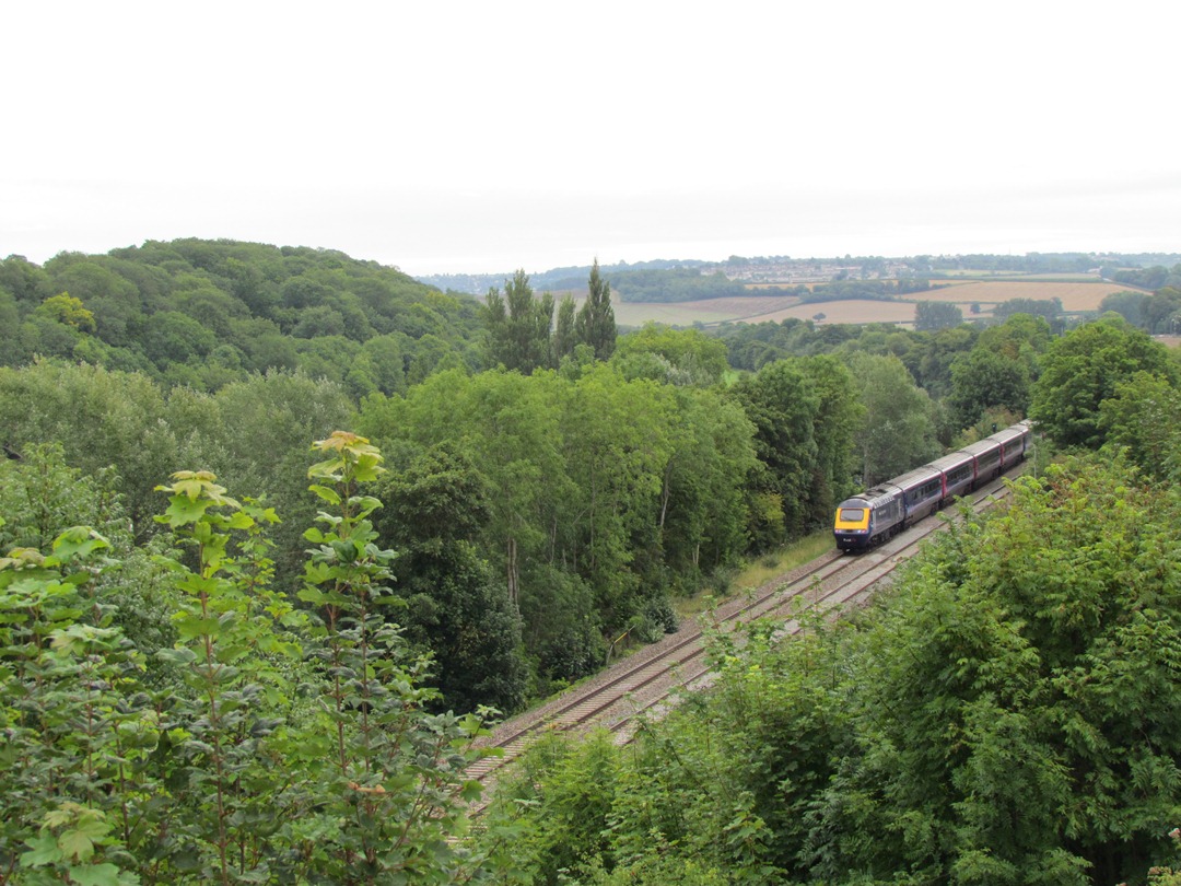
5 The Great Western Railway
As we heard at our previous stop, the Great Road was superseded by the Great Western Railway. By 1830, a railway was under construction linking London with the port of Liverpool. Merchants in Bristol were afraid that they would lose their status as the second port in the country and the primary one for trade with America. So Bristol wanted its own railway line. In 1833, Isambard Kingdom Brunel was appointed to be Chief Engineer for the Great Western Railway. It was to be built to unprecedented standards of excellence in order to out-perform the lines being constructed in the north-west.
Many stretches of the route between London and Bristol posed engineering challenges to Brunel, who – when he took the job – had no previous knowledge of railways. But he was an engineering genius and managed to design and construct track, buildings, locomotives, bridges, cuttings and embankments to overcome every problem in his way.
On this stretch, the line parallels the River Avon. To maintain a low gradient, it runs over the flood plain on an embankment and in cuttings through the valley sides. The rock in this cutting – blue and white Lias limestone – is laminated by mudstone (in other words, clay). This is a combination that is unstable, causing frequent landslips. It is a hazard that faced Brunel 170 years ago and is still present. Preventative work in the cutting has cost Network Rail – we reckon – over £10 million pounds over the last ten years.
On 30 June 1841, the first train carried the Great Western Railway’s directors and Brunel from London to Bristol in just four hours. Just over one hundred years later, the Great Western Railway became the Western Region of British Rail.
This is still the West Country’s main railway line. These days, high speed trains make the journey from London Paddington to Bristol Temple Meads in as little as one hour and 42 minutes. But they don’t stop in Saltford. The station – where we stood at our previous stop – closed in 1971. But locals – such as Chris Warren who we have with us – are campaigning to reopen the station.
Chris: Saltford Environmental Group was formed in January 2011 and by July 2011 we were ready to have our first public meeting to gauge public opinion about whether the villagers would like their station back. It was an overwhelming success – we had 140 people turn up – and we were all singing from the same hymn sheet. So the current situation is we have political support at Bath and North Somerset Council and we are about to launch a doorstep petition just to get a body of opinion which we can then present to various people who will ultimately make the decisions. But as a lobby group, we’ve had incredible success in a very short space of time and I’m very hopeful that we can achieve our ultimate aim of, within five years, having our station back.
Cross to the other side of the bridge and turn left with the metal fence of the railway cutting on your left. After a short distance, the path forks – take the right fork between houses. Where the path forks again with steps upwards to the left and a path straight on, go straight on. After a short way the path goes down steps to reach the Shallows car park.
Turn left onto the lane past the public toilets. On the opposite side from the toilets is a gateway leading to a permissive footpath. Follow this footpath and up the steps onto the embankment of the old railway and turn right.
Note: After wet weather this footpapth path can get very muddy. For a dry alternative, continue along the lane to the Bird in Hand pub. Turn right down the lane and just below the pub car park is access up onto the embankment of the old railway. Turn right along the track.
Keep to one side as the track is often busy with speeding cyclists. Cross the bridge over the river. Stop after about 200 yards at the information board and bench.
6 An industrial line
Just a few hundred metres from the Great Western Railway is another railway line. This line was part of the Midland Railway, which was primarily an industrial route, built in 1844, to link Bristol’s industrial centre with local collieries in Kingswood to the immediate east and north of Bristol. Twenty years later, this spur line was built from Mangotsfield – on the already existing line – through Saltford to Bath.
This is the site of the old Kelston Station. Interestingly, the landowner – Inigo Jones – allowed the railway to go through his land on condition that he could contact the railway company and get the train to stop to allow his wife and daughter to go to Bath. They agreed and that’s what used to happen!
Like the A4 road and the Great Western Railway, this line also followed the easiest route through this area along the lowlands of the River Avon valley. The nearby Bird in Hand pub opened in 1869 to service ‘navigators’ – the navvies – the men employed to dig out a cutting and build a bridge and embankment for this railway.
In the twentieth century, this was part of the London, Midland and Scottish line (LMS), which used to link Birmingham and Bristol with Bath.
This line linked with the Somerset and Dorset line (or the ‘Slow and Dirty’ as it was fondly known). This stretch was closed to passengers in 1966 and finally to freight in 1971. But that was not the end of the story, as we shall hear at our next stop.
You can stay at the information board or continue walking for Stop 7.
7 Second incarnation
As you can see, after the railway line closed, it had a second incarnation – as a cycle track. In 1977, the Cycle Bristol Action Group (Cyclebag) was formed. They were a group of cyclists and environmentalists, led by John Grimshaw, who were concerned about the over-dependence on cars and the lack of specific provision for cyclists in most British cities, in contrast to some other European countries.
In 1979, the group obtained planning permission to create a 2 metre wide dust track on the abandoned line between Bath and Bitton. Then, with the help of the county council, the group leased more of the line. And between 1979 and 1986, they constructed a cycle track on the full 13 mile length.
By 1983, Cyclebag had evolved into the charity Sustrans, still led by John Grimshaw. The Bristol and Bath Railway Path was the first cycle route created by Sustrans. Since then, Sustrans has created many more cycle routes across Britain, often making use of disused railway lines like this one. Individual routes were gradually joined up to make over 10,000 miles of designated cycle routes – the National Cycle Network.
Today, the path is a 3 metre wide tarmaced surface from Bristol to Bath and an attractive leisure and commuting route. Meanwhile Sustrans has become the UK’s leading sustainable transport charity – and it all started here.
Continue along the track a short way until the first gap in the bushes on the right hand side where there is a wooden seat. Go through the metal gate and follow the path down the field. Go through another metal gate to the riverside. Go to the side of Kelston Lock opposite the Riverside Inn for Stop 8.
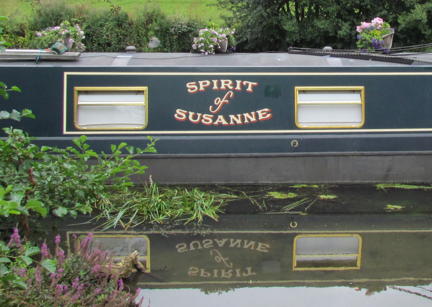
8 Pleasure boating
Just as the rail line we saw was transformed from a commercial routeway to a leisure routeway, so too has the main function of the river altered from one of trade and industry to one of pleasure and recreation.
Saltford Marina, across the river, is one of several examples along this stretch of the river of this changed usage. The marina is a family-run business with 85 moorings on the river front and within the marina. There are residents who live on boats all year round and commute into Bristol and Bath, as well as holiday boats and day trippers.
From the lock, follow the riverside footpath with the river on your left. Pause partway along this path for Stop 9.
9 From towpath to trail
We have already seen how the railway line and river have changed in their primary uses from commercial routeways to leisure routeways. There’s a third change of use here on the riverbank too.
As we heard earlier, when the river was made navigable in the eighteenth century, boats were hauled by men. They walked along towpaths on the bank dragging ropes attached to the barges and boats.
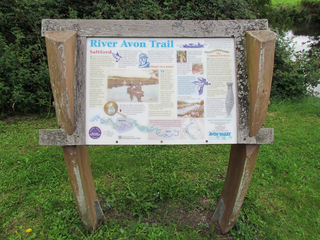
Now this former working routeway, where men sweated and toiled, is a designated footpath – the River Avon Trail. The trail runs 23 miles from Pulteney Bridge in Bath – upstream along this valley – through Bristol and to Pill in North Somerset. At this point the trail is on the south bank, opposite to where we are now.
Continue following the river bank footpath. Look out for kingfishers along this stretch of river. Go under the railway bridge then turn right to climb up the embankment. Turn right onto the cycle path and go onto the bridge. Stay on the right hand side of the bridge looking at the view for Stop 10.
10 Ancient routeways
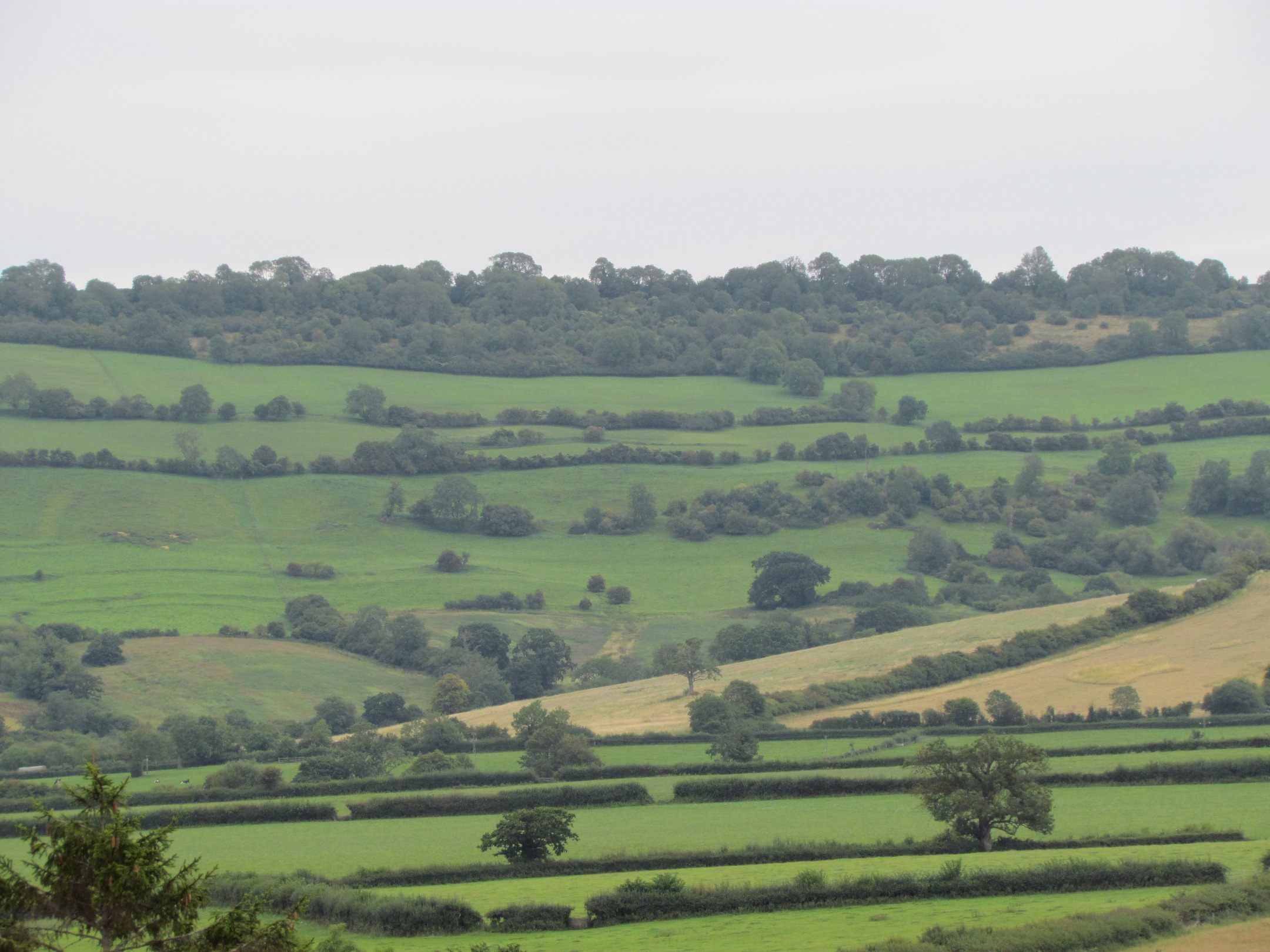
From here on the bridge, look up the hillside to the hedgerow line leading to the saddle between Kelston Round Hill on your right and the flat top of Lansdown straight ahead where Bath racecourse is. That hedgerow follows the line of a Roman Road. This ancient routeway is believed to have linked the Roman city of Bath with the port of Abonae, which is now Sea Mills near the confluence of the River Avon with the River Severn.
Like the modern routeways that we have looked at, this ancient routeway also follows the line of the Avon valley, but the major difference is that it is positioned on the rim of the valley rather than in the bottom of the valley.
Up on that hillside, there is not only evidence of human presence in the Roman period, but also of the earlier Stone, Bronze and Iron ages. There are several reasons why these ancient peoples preferred to be on higher ground. First of all, most of the country at that time was covered in thick forest. On higher ground, trees were sparser and people could move about more easily. Second, hills and ridgeways provided defensive sites.
Over subsequent centuries, people gradually moved downhill. All across the country, you will see that today, there are many more villages and towns on the river terraces just above the valley bottoms – like Saltford – than on the valley sides or the hilltops.
Immediately after the bridge, you can turn left down the steps and follow the footpath the way you came back to The Shallows for Stop 11.
Alternatively, you can carry on a short way further along the track to the Bird in Hand pub on the left hand side for Stop 11. You might like to finish your walk with some refreshment. The ‘bacon buttie and a cup of tea’ deal is highly recommended (not available Sundays).
11 More than just A to B
Routeways are essentially ways to get from A to B. They are linear paths. But here in Saltford, rather than travelling along routeways, we have looked at a cross section of routeways in one location. Here in the valley bottom are four different routeways – a river, road and two railway lines. We have seen how the physical landscape strongly influenced how the routes were positioned, but also posed some challenges for construction.
We have learnt how the routeways were vital for industry and commerce, in particular linking this area with the capital, London, and with the port of Bristol. Many industries thrived in this area because of these routeways. We have also seen how the functions of routeways have changed over time – the main road superseded by a motorway, a disused railway line turned into a cycle track, the river used for pleasure rather than for commerce, and a towpath turned into a walking trail.
We hope you’ve enjoyed this walk. Perhaps next time you cross over a railway bridge, walk alongside a river or drive along a main road, you can think about the reasons for its position, the challenges of its construction, the people and traffic that have used it, and its future.
A short walk along the banks of the River Avon in Somerset
You may think of routeways just as means of getting from A to B, but every route has its own story.
The Avon Valley links the cities of Bath and Bristol. Halfway along, in Saltford village, you can find four different routeways located within a stone’s throw of one another.
There is one of Britain’s busiest A roads. There is the River Avon, converted into a canal. And there are two railway lines – Brunel’s Great Western Railway and the now-defunct Midland line, which was converted into Britain’s first Sustrans cycle track in the 1980s.
This walk explores how each routeway fits into the landscape. As you are walking, uncover the physical and political challenges to their construction and discover how the routeways have been used for industry, transport and pleasure.
Follow the walk by clicking on the map pins or downloading the guides below