1 Welcome to Walmer and Deal

The East Kent coast from the village of Old Walmer to the town of Deal has faced attack from various forces for centuries, from Julius Caesar’s legions to Second World War bombs. But it’s not only foreign invaders who have tried to breach this part of Kent. The coastline here is under constant assault from the forces of the sea.

Eroded by the waves and attacked by storms, this landscape is constantly changing. From a natural spit that brought prosperity to the town to recent coastal defences designed to defend it, this walk explores how Walmer and Deal defend their shores.

Along the way we will see the remains of a medieval village, castles built by Henry VIII, a dramatic shingle beach with views to the White Cliffs of Dover and a canning factory that kept the British Army on its feet.

We will hear stories of secret weapons designed to hinder Hitler’s planned invasion, find out how the local sailors made a living from a deadly shifting sandbank and walk through narrow Georgian streets where smugglers hid their contraband brandy and tobacco.


Boats on Walmer beach
© Caroline Millar
Directions

From Walmer railway station go down Station Drive then turn left into Station Road. Turn left into Neville Gardens before turning left into the footpath on the left at the first curve in the road. After about 7 metres leave the path, entering the church graveyard using the wooden gate on the left. Cross the graveyard, keeping the church on the left, before exiting on Church Street. Turn to your left to view the church and the stone remains of the medieval Walmer Court.

2 Master of the manor

Standing here by The Church of the Blessed Mary we can still see the village’s medieval origins. The church was built in 1120 as the chapel for a large manor house called Walmer Court. Look over the churchyard wall and you can see the stone and flint remains of its walls. Today this twelfth century building is little more than a ruin but it would once have been the centre of village life.

Walmer Court was also an impressive symbol of the power of its Norman lord, Hugh de Auberville. After the Norman Conquest in 1066 most English villages were organised around a manorial system. The king granted land to families like the de Aubervilles in return for military service to the crown.

Lords of the manor like Hugh de Auberville owned the land they were granted, which gave them total power over the villagers’ daily lives. Under this feudal system villagers were required to provide their overlord with rent or labour service.

Walmer’s busy agricultural community soon developed into a thriving village. Like many settlements near the coast, however, the fate of Upper Walmer was inextricably linked to the sea. The village overlooked a coastline that constantly evolved and developed over the centuries.

Over time, the sea washes material laterally along the coast according to the prevailing wind and waves in a process called deposition. This can result in a spit, or bank, forming along the existing coastline. From Walmer a spit grew northwards to Deal and extended towards Pegwell Bay. This spit provided Deal with new land to grow and develop. So from the midseventeenth century Deal superseded Walmer as a trading settlement.

Walmer was left as a quiet rural village. As you continue, notice how the leafy streets, green verges and older houses feel very different in character to the newer parts of the town where we started the walk.

Here a village atmosphere still remains. Today the peaceful church is also known as Old St Mary’s as it was superseded by a larger village church in the nineteenth century.


The Blessed St Mary’s Church 
© Caroline Millar
Directions

Turn right down Church Street passing the pretty Green Lane on the left. Turn right into Dover Road and continue up the hill. Pass The Thompson’s Bell pub. Stop at the back of number 381 Dover Road by a shoulder-high brick wall. Try to find three pipe outlets sunk in the wall.

3 A flaming cocktail

The Thompson’s Bell pub we just passed and a couple of nearby street names, such as The Maltings, are the only clues we have to the existence of the Walmer Brewery. There is evidence of the
brewery from at least the nineteenth century but there may have been a brewery here as far back as the Tudor period. Thompsons’ malting house, brewing house, bottling plant and stables covered a large part of Walmer village and created much local employment.

The brewery’s elevated position also meant that the buildings could function as a lookout point during the Second World War. From this site the flash of German guns could be seen firing from the
French coast, just 25 miles away. A warning bell gave the brewery workers time to take cover from long-range enemy fire.

Notice that Dover Road goes downhill from this point. During the Second World War, this slope was used to test a secret weapon called the flame defile trap. You can find the remains of it in this
wall, though they are not easy to see.

Try to spot three pipe outlets in the brick just below shoulder level. To operate the flame defile trap, petrol was pumped through these pipes and ran downhill to be ignited by a Molotov cocktail. The resulting stream of burning liquid could destroy any enemy vehicles attempting to make their way up the road from the beaches at Deal and Lower Walmer. Luckily this weapon was never actually used as enemy forces never reached this part of British soil.


Remains of the flame defile device
© John Guy
Directions

Turn downhill and retrace your steps until you reach Grams Road on the right. Carefully cross over into Grams Road; take care on the short stretch without a pavement. When you reach Liverpool Road, cross over and enter a small car park. Walk up the steep steps on the right which will bring you onto the flat grassy area of Hawkshill Down. Walk following the line of the hedge to a small memorial on your right in the corner of the field. When you reach the war memorial, take a seat on the bench and enjoy the stunning views of the English Channel.

4 Gotha hum

After walking downhill from Walmer village we have now climbed back uphill to an elevated area with wonderful views. From here we can look back to Walmer village or look out across the English
Channel. On a clear day you will see the white cliffs of the French coast just 25 miles from here.

Look ahead at the small monument surrounded by a fence. This memorial is to sixteen airmen whose squadrons flew from here during the First World War. In 1917 this flat elevated grassland was chosen as the location for a new Royal Naval Air Service aerodrome. Planes and pilots were stationed here to protect Allied ships in the English Channel from German torpedo planes based on the Belgian coast.

Hawkshill aerodrome became more vital during the ‘First Blitz’ when German Gotha bombers spread terror over southeast England. Twenty-seven raids killed 835 people and injured another 1,972.

This new form of terror was signalled by the distinctive “Gotha Hum” of the German planes’ twin engines. Hawkshill was part of the air defence network that the government urgently set up in response.

Planes from Hawkshill intercepted the German Gotha aircraft returning from bombing raids on London and Kent. Aviators included the Canadian, Harold Spencer Kerby, who flew a Sopwith Pup
biplane.

But using this aerodrome was fraught with problems. Climbing to 12,000 feet, aviators faced complications caused by frozen compasses and a lack of oxygen. Meanwhile warm air from the land meeting with cold water from the North Sea often formed coastal fog. This was a problem for returning pilots, who navigated by using distinctive local landmarks such as the White Cliffs of Dover, Sandwich Bay and the railway lines.

The Germans faced their own problems. Despite a top speed of 83mph, the Gotha IV bombers often struggled to reach England in the face of strong prevailing winds from the southwest. Eventually they used a radio-equipped Rumpler CIV plane to collect weather observations from the Kent coast before each raid.

During the Second World War, Hawkshill’s primitive grass take-off and landing strips were no longer sufficient for the RAF’s more powerful aircraft. But Hawkshill still played a vital role in the war as the location for a secret OBOE navigation station, which transmitted radio signals to help aircraft locate themselves over occupied Europe.


Sopwith Pup N6442 at Hawkshill Down (1917)
© Mike Davis, Cross and Cockade International (CCI)
Directions

Follow the footpath past the memorial along a narrow path. Ignore the footpath downhill to the left and continue ahead along a hedged path. Emerge into an open field and walk straight across it towards some houses. At the field edge go straight ahead following a yellow sign along a sunken tarmac footpath. On reaching a large tree, ignore the first path leading downhill. Instead head uphill on the path leading into Church Cliff. Continue past a latitude and longitude plaque on the wall of a house on your left. Turn left into Upper Street then walk downhill into a small lane called South Road which will give you access to the beach. Pass a row of cottages on your left before stopping by The Zetland Arms pub.

5 Attack from the sea

Facing the sea, look to the right and you will be able to spot the famous White Cliffs of Dover. On a clear day you may notice similar cliffs on the French coast. These remind us that Britain and the continent were once joined to one another. 

Britain’s link to the continent was severed when a vast prehistoric river cut through the land bridge to Europe 450,000 years ago. This river turned Britain into an island and helped form the Straits of Dover.

We are now in Kingsdown at the end of the North Downs, a geographical feature which stretches from Farnham in Surrey to the Kent coast.

The North Downs and South Downs were created from a thick band of chalk deposited over 60 million years ago. Tectonic activity pushed up and folded over the chalk to create a huge elongated
dome. Over the millennia, much of the soft chalk has been shaped by the wind and rain to form the undulating slopes of the North and South Downs.

These soft coastal chalk cliffs are being constantly eroded by the power of the sea. The waves attack the cliff by wearing away at its base, creating a ‘notch’ in the cliff face.

Gradually the overhanging rock above the notch collapses, causing the cliff to retreat inland. This constant process of erosion exposes fresh chalk which gives this icon of Britain its distinctive appearance.

Even in calm weather you can probably appreciate the power of the waves here as they hit the shore. The shingle beach and promenade are also threatened by sea erosion.

Notice the variety of defensive structures that have been placed along this part of the coast – concrete walls, wooden groynes and the gravel beach. These help to mitigate the power of the waves but are themselves under constant attack.

There is a continuing battle to maintain the efficiency of these defences. People in this part of Kingsdown face the threat of their houses being damaged by inundation or erosion. This leads to the constant problem facing local authorities and the Environment Agency as to what resources should be deployed to defend particular areas of our coast.


Smashed defences on Kingsdown beach
© Helen Williams
Directions

With the pub on your left, follow the stone path and walk along the promenade. Go through the iron bollards and continue along Wellington Parade. Take time to enjoy the sea views on this long stretch of the walk. Stop when you reach one of the wooden benches in front of the cannon at Walmer Castle.

6 Henry's defences

The wide gravel beach in front of Walmer Castle is made up of eroded material which has been transported along the coast from the White Cliffs. Between 1741 and 1884 this process caused the
land here to expand seawards by 115 metres.

This deposition of material also allowed the development of some rare plant life. On this section of the shore the high level of salt in the earth allows only saline tolerant plants to flourish. Look out for the purple-pink sea pea, which looks a lot like the sweet pea found in gardens. See too if you can spot wild carrot. Long-stalked and shaped like an umbrella, its delicate white flowers in bloom are known as Queen Anne’s Lace. Sea kale, a relative of the cabbage, is abundant here and edible either raw or cooked. Invasive trees which are not native to Britain have also established themselves on the beach, such as the Holm oak.

The landscape here between Walmer and the marshland to the north of Deal has long proved attractive to other potential invaders too. This low, level stretch of shore is an ideal landing place for an invading army.

King Henry VIII recognised this weakness and in 1539 commanded the building of the three castles on the Downs – Walmer, Sandown and Deal.

They were constructed as artillery forts, specifically designed to mount gunpowder weapons like cannon. These castles had an advantage over invading ships that had to fire their weapons in a
shifting and often stormy sea. Look carefully at Walmer Castle and notice its thick walls designed to slow down an enemy invasion and wide flat platforms for mounting the cannon.

As military technology developed over the centuries the fort became obsolete and Walmer Castle became the residence of the Warden of the Cinque Ports, a post held by people such as Prime Minister William Pitt and Lord Wellington.

During the First World War the poet Rupert Brooke recuperated here and wrote his famous poem ‘The Soldier’ while training at the Royal Marines Barracks in nearby Deal. Today the Castle is an important part of the area’s heritage tourism industry.


Walmer Castle (1890s)
Courtesy of www.oldukphotos.com


Directions

Continue along the beach-side path. Where the path splits off toward the sea, stop by the privet hedge for a good view of the modern housing estate set back from the road.

7 To the manor born

This 1960s housing estate with its flat roofs, balconies and uniform design looks a bit out of place here. Architecturally, these box shaped apartments are unlike any other residential housing on Walmer seafront. But if you look closely you can see that the estate sits inside a green, landscaped area of mature gardens.

Notice the attractive stone balustrade and gatehouse (with its roof balcony). These seem out of keeping with this modern estate but give us a clue to the past use of this area. In 1901, a luxurious manor house called Walmer Place was built here on 16 acres of land with glorious sea views.

Like many of England’s large houses it was demolished in the 1960s when the land was sold and redeveloped. Today the Lord Warden Estate attracts many people who have moved to the coast from inland urban areas of Britain seeking a pleasant seaside location to spend their retirement.

Notice that the estate is in a low-lying area which could make it vulnerable to flooding. The land in front of the buildings though is formed of a substantial shingle beach. The shingle protects the estate as it reduces the energy of the waves. This natural coastal defence made the site suitable for redevelopment.


Lord Warden Estate
© Caroline Millar
Directions

Continue along the beach-side path. Stop at the low grey square monument on the left at Walmer Green, just in front of number 12 The Beach.

8 Veni, vidi, vici

This stone plaque showing the head of Julius Caesar marks the probable landing place of not one but two invasions of this coast.

From 58 BC the Romans campaigned to expand their empire by fighting the Gallic Wars with tribes in present-day Germany and France. Commander of the Roman forces was Julius Caesar.
While fighting the Gallic tribes, Caesar turned his attention to an invasion of Britain. He and the Romans were attracted by Britain’s potential for slaves, arable crops and minerals.

The Romans, however, had very little detailed geographical knowledge of the area so Caesar sent his tribune (second in command), Gaius Volusenus, on a five-day reconnaissance mission along
the Kent coast to prepare the way for an attack. Dover was identified as an ideal landing spot and Caesar set sail with two legions of soldiers.

The expedition did not go entirely as planned. The Roman ships met a strong offshore storm and as they came into sight from the Kent coast thousands of Britons lined the White Cliffs. These combined obstacles pushed Caesar on to Walmer. It was here that he first set foot in Britain, on the 26th August 55 BC. After an awkward landing the local Britons were defeated. Nature proved the deadlier enemy; the storms wrecked much of Caesar’s fleet and he was forced to return across the Channel.

Caesar came back to Walmer the following year. Better prepared, he was more successful and enforced a series of treaties with the British tribes. It would take almost a century, however, for the Romans to turn invasion into conquest. In 43 AD forces ruled by Emperor Claudius landed at nearby Richborough, by which time the Romans had a far better geographical understanding of this part of Britain.


Artist impression of Caesar's invasion of Britain (1843)
Wikimedia Commons (CCL)
Directions

Continue along the path until you reach a grey tiled building that resembles a church. This is the RNLI Lifeboat Station.

9 Flat and fatal

Despite many conflicts between Britain and France, closer still is a deadly natural enemy - the Goodwin Sands.

Four miles offshore and some nine miles long, this shallow bank of sand is submerged at high tide. William Shakespeare mentions it in his play The Merchant of Venice written in the 1590s: “the Goodwins I think they call the place – a very dangerous flat and fatal, where the carcasses of many tall ships lie buried as they say”.

The waters between the Goodwin Sands and the shore is known locally as the Downs. They have long provided a safe anchorage for ships. In adverse weather though, ships taking shelter from
storms have been driven onto the shifting sands. During the Great Storm of 1703, one of the worst natural disasters to hit England, five Royal Navy warships were wrecked on the Sands with much loss of life.

An estimated 2,000 vessels have been wrecked here over the centuries. These waters were so dangerous that three lifeboats were located along the coast at Kingsdown, Walmer and Deal.
Initially propelled by oars they have been replaced by two inshore boats kept here at Walmer.

The prevailing winds tend to be from the southwest and the northeast which can cause problems for both professional and amateur sailors. This is still a busy lifeboat station today rescuing sailors,
tourists and even a BBC film crew caught out attempting to recreate the tradition of playing a cricket match out on the Sands at low tide.


SS Mahratta wrecked on Goodwin Sands (1909)
Wikimedia Commons (CCL)
Directions

Continue along the seaside path. On the way you will pass a memorial bandstand built after 11 Royal Marines were killed in the IRA bombing of Deal Barracks. Walk across the grass to reach The Strand. Turn right and pass North Barracks Road and Cheriton Road on your left. Stop outside a long, three-storey brick building with a clock tower.

10 Life within walls

In the eighteenth century the increased threat of invasion from France led to additional soldiers being stationed in Kent. This impressive building was once a barracks for the Royal Marines. To build it a large part of the town was substantially remodelled, resulting in an unusual street layout still apparent today.

For many years it was a common practice to house soldiers with local townspeople. This was unpopular with the locals as it interfered with their smuggling activities!

So a series of purpose-built barracks were created to help ease the tension with the locals, allow better control over soldiers’ training and cut down the risk of desertion. Deal Barracks became an important location during the First World War, notable for training the Royal Naval Infantry Division. These were naval personnel that fought on land alongside the infantry.

During the Second World War the barracks were bombed by the Italian Air Force and later the Nazis on one of their ‘Baedeker raids’. These were bombing missions that targeted places of historical and cultural value that featured in a German tourist guidebook.

From the 1930s the barracks housed the Royal Marine Music School which trained the famous bands of the Royal Marines. They closed in 1996 when the bands moved to Portsmouth. This was an economic blow to the area as many local people were employed servicing the barracks complex. The site has now been redeveloped as housing while retaining many of the original features of the historic buildings.


Walmer Marine Barracks (c.1910)
Courtesy of www.oldukphotos.com
Directions

Continue along The Strand until you see the back of Deal Castle. Turn right into Marine Road and head towards the seafront. Turn left and stop by the moat on the promenade.

11 We shall fight them on the beaches

Deal Castle is the best-preserved of the three Castles of the Downs built by Henry VIII in 1539. They were among the first castles designed as artillery forts for gunpowder.

Each of the three Downs castles was strategically placed so that its artillery was close enough in range to support the neighbouring castle. A series of bulwarks, long demolished, were built between the castles using local materials. These provided additional defences against an enemy landing.

Here at Deal, cannon were sited on the flat roof to fire against attackers from sea and land. Attackers who survived the firepower of the cannon then had to brave the soldiers’ musket fire while crossing the moat.

Though they were built to defend the coast against continental attack in the sixteenth century, their greatest threat came in 1940 with the potential of Nazi invasion. Operation Sea Lion, Hitler’s plan to invade Britain, included a parachute landing to seize this part of the coast before capturing the nearby port of Dover. To ward off such a landing Deal Castle was fitted with new defences.

An emergency battery of 6-inch naval guns was established in front of Deal Castle. Mines, antitank scaffolding, barbed wire and even pipes to dispense burning petrol were positioned along the
beach. These performed similar functions to medieval moats and murder holes.

A rangefinder on the castle roof allowed the guns to fire accurately to a distance of eight miles. This accuracy required a higher degree of technology than was available to Henry‘s gunners. Accurate maps, compass bearings, temperature readings, gauges to measure the rise and fall of the tides were all combined with information from the rangefinder to create the best possible firing solution.

Thankfully the invasion did not happen. The RAF shot down a large number of German aircraft, including a Dornier recently recovered from the Goodwin Sands. The RAF along with the Royal
Navy denied the Luftwaffe air superiority over the invasion beaches of South East England. This ensured the safety of Britain’s shores.


Deal Castle
© Lieven Smits, Wikimedia Commons (CCL)
Directions

Continue ahead in the direction of the pier towards the fishing boats drawn up on the beach. Stop oppostite the Prince of Wales Terrace.

12 The Deal boatmen

The small boats, lobster pots and fishing paraphernalia perched on the steep shingled beach are another physical link to Deal’s past. Since medieval times, skilled boatmen have made a living off this coast by fishing. Herring, cod, mackerel, sprat, prawns and lobsters are among the catch in these fertile waters.

Today this small part of the beach and a stretch near the lifeboat station are the only two designated areas for local fisherman. See if you can spot the capstans (winches) on the beach. These allow the fishermen to pull their boats up above the reach of the waves.

In the past these waters provided other opportunities. The Downs anchorage between Goodwin Sands and the shore could accommodate up to 400 vessels. These ships needed fresh water and provisions such as bread, beer, fruit and vegetables. These were supplied from land by a group of locals who became known as the Deal Boatmen. Rough weather also offered opportunities for
salvaging wrecked ships or lost anchors. This work was known as ‘hovelling’.

During the eighteenth and early-nineteenth centuries the Boatmen’s knowledge of the local currents led to their employment as pilots for ships going through the Goodwin Sands. They also surveyed the constantly shifting sandbank, a task now carried out biannually by the Hydrographic Office.


Fishing boat on Deal beach
© Bob Jones, Geograph (CCL)
Directions

Continue along the promenade for a short distance. Stop just past Ranelagh Road and look at the row of tall white townhouses along Prince of Wales Terrace. Note the new splash
wall which directs wave energy away from the beach and the promenade. Look for the tall building across the road with the cross and large ball on the roof.

13 As time goes by

Looking at this row of Victorian houses today it is hard to believe that this was the site of a substantial naval yard. From 1703 to 1863 a yard based here maintained and serviced the Royal Navy fleet while it was anchored offshore.

Sailing ships needed a constant supply of items such as rope, sails, rigging and anchors which received inevitable damage in the stormy seas of the English Channel. The yard itself included a blacksmith, rope makers, sail makers, a brewery and a bakery for making crew biscuits.

The high point of the yard’s importance came during the Napoleonic Wars with France. To aid the Navy, local seamen and fishermen were recruited as Sea Fencibles. They used their knowledge and skills to patrol the local coastline. Deal’s role in the defence of the realm during the Napoleonic Wars was so important that rapid communication with the Admiralty was an urgent requirement.

In 1796 a signal system was developed to transmit urgent messages to the Admiralty from various naval bases in England. Deal was the first base to have it installed. The system used a series
of telegraph towers to pass coded messages to London in just sixty seconds.

The end of the Wars in 1815 saw a decline, though the Navy still used the yard to supply the needs of its reduced fleet. The yard’s fate was sealed by the development of steam travel in the 1840s. Steam ships were not so dependent on the vagaries of the wind and eventually rendered sailing ships (and the yard) obsolete.

Following the yard’s closure the area was redeveloped for housing. This was laid out on a square grid street pattern, fronted by a seaside terrace of grand homes and a large hotel. Today the only remaining relic of the former naval base is the timeball that you can see opposite.

When the telegraph signal system closed in 1816, the tower was left redundant. For a while it was used as a watchtower in an attempt to combat smuggling. The building eventually found a new use in 1855 as a timeball station.

An electric signal from Greenwich dropped the ball every day at 1pm. This gave ships anchored in the Downs the exact time, allowing them to accurately establish their longitude. Today the building is a local museum.


Deal Timeball Tower Museum
© Cameraman, Geograph (CCL)
Directions

Continue along Prince of Wales Terrace before turning left into South Street and immediately into the remains of Beach Street where you can get a feel for the narrow, twisting streets and passageways of old Deal. Continue along around the roundabout before crossing the road carefully to stop at the entrance to Deal’s modern pier.

14 The last pier

Deal Pier has two claims to fame. It is the only fully intact pier in Kent and it was the last seaside pier built in Britain. However, like the town it has suffered from changing fortunes.

While Deal’s naval base shrank after the Napoleonic Wars, a simultaneous crackdown on smuggling took away another pillar of the town’s economy. The town needed a new source of income.
Nearby towns like Margate, Broadstairs and Ramsgate had developed a tourist industry.

Passenger boat services from London lured holidaymakers from the capital’s smog and dirt to the fresh air and purifying seawater of the Kent coast. Deal decided to take advantage of this trend too and built a pier in 1838.

Made of wood and never completed, strong waves destroyed this pier within 20 years and cast its remains up onto the beach.

A second pier was built in 1863 with a tramline and steamer landing. It survived until 1940 when a mined Dutch ship smashed into it. The Prime Minister Winston Churchill ordered the pier remnants to be destroyed so that Deal Castle’s emergency wartime guns had a clear field of fire from the coast.

But Deal still wanted a pier and in 1957 the current one was completed. It remains the only pleasure pier in Britain built after the Second World War. A walk along Deal Pier offers spectacular views along the English Channel.


Deal Pier
© Caroline Milar
Directions

Walk along the promenade until you reach The Royal Hotel.

15 A commanding location

The Royal Hotel has provided travellers and tourists with sustenance and rest since it was established around 1720 as The Three Kings. Among its customers was Admiral Horatio

Nelson, who planned a series of raids on the French coast from here. As second in command of the Channel Fleet, Nelson was in charge of disrupting any French invasion of the British coast. Nelson’s victory at the Battle of Trafalgar in 1805 finally removed that threat.

The hotel survived the depression in Deal at the end of the Napoleonic Wars due to its location. The building was ideally positioned as one of the main departure points for sailing ships along the Kent coast. The development of Deal Pier also provided a boost, bringing a new wave of holidaymakers who travelled to Deal and other resorts by steamship.

Today the hotel makes an impressive spectacle in its enviable seafront position. But this part of Deal once looked quite different. We will find out the reasons for this at the next stop.


Admiral Horatio Nelson (1799)
Wikimedia Commons (CCL)
Directions

Continue along the promenade and stop opposite the three-storey redbrick Adelaide House on the corner of Griffin Street.

16 Strolling the prom

The promenade we have been walking on since Deal Castle is one of the town’s Victorian features developed to attract tourists. Construction of the pier allowed steamships to disembark their passengers in comfort right on the seafront. These tourists could make use of the hotels and boarding houses along the beach, such as the Royal Hotel.

After the arrival of the railways in 1847, even more tourists and day-trippers could access Deal for a holiday or a day out. The town council hoped that tourism would bring in fresh income after the
area’s declining military use.

So the council bought up sections of the beach for redevelopment, displacing the Deal Boatmen to the two small areas we saw earlier. The promenade was once the site of many homes and boarding houses. These were all demolished to cater for the new holidaymakers. However like many seaside areas, this part of the Kent coast lost visitors to foreign package holidays in the 1960s and 70s.

Notice again the shingle beach. It plays an important part in defending the promenade by absorbing the destructive energy of the approaching waves. This process also interrupts and slows down the process of longshore drift, where sand and gravel is moved northward along the coastline.

The natural shingle cannot act alone to defend the town from the power of the sea. At the time of creating this walk the Environment Agency was spending some £10 million on a series of works to reduce the risk of flooding in Deal to a 1 in 300 risk for the next 10 years. These works include dumping over 125,000 cubic metres of sand and shingle along the beach. This will protect almost
1,500 houses and 150 commercial properties located in this low-lying part of the town.


Deal Promenade (1910s)
Courtesy of www.oldukphotos.com
Directions

Continue along the promenade until you reach Hengist Road. Turn left and stop by a housing development on the right called The Cannery.

17 Canned meat

We have discovered already that Deal’s location by the coastal anchorage of the Downs made it a suitable naval supply base. Deal is also close to the fertile fields of East Kent, which meant the town could easily supply the Navy with food.

Fresh vegetables and meat played an important part in providing sailors with Vitamin C to protect against scurvy. For longer sea journeys, salt beef and hard tack biscuits provided sailors with their main food source.

The invention of the tin can in 1813 provided a ready means of preserving rations for longer periods at sea and on land. The name of this housing development is a clue to its past use. If you look at the unusual shape of the roofs and the generous courtyard, it is not surprising to learn that it was once a canning factory.

During the First World War the infamous Maconochie Stew was canned here. This stew contained the men’s meat and vegetable ration combined in one tin. It could be eaten hot or cold, though anecdotes of scooping cold stew straight from the can sound less than appealing! Cans of the stew were transported to the secret port at nearby Richborough to supply the two million British soldiers based on the Western Front in Flanders.

With their strong link to Deal’s maritime history the buildings have been retained and redeveloped as new homes suitable for the twenty-first century.


Maconochie army ration tin
© Great War Observer, Flickr CCL)
Directions

Turn left into Sandown Road and continue until you reach Alfred Square on the right. From here turn left into the High Street before taking the next right into Water Street and then left into Robert Street. Stop at the corner of Robert Street and Clarence Place.

18 Hellfire corner

Today this is a quiet street but seventy years ago this was the scene of a tragic event. During the Second World War, this was a dangerous area to live in.

The Germans had placed batteries of heavy guns on the French coast to support Operation Sea Lion and to attack vital shipping routes in the Channel. These enemy guns had the power to fire heavy artillery as far as 55 miles. In fact shell fragments from these guns have been found as far inland as Chatham and Maidstone.

Projecting shells across the Channel involved firing at a set of grid coordinates on a map. Geographical factors such as prevailing winds, air pressure and humidity could affect the accuracy of this long-range shelling.

This area of the Kent coast became known as ‘Hellfire Corner‘. Devastation was extensive, with 65 deaths, 200 injuries and 5,000 damaged buildings.

One of the most tragic events occurred in January 1944 when 12 people died in a civilian shelter here in Robert Street. It was hit by German shellfire from the French coast. The victims were all women and children. A group of men occupying the neighbouring shelter to smoke cigarettes miraculously survived.


German cross-Channel gun, Northern France (1945)
Wikimedia Commons (CCL)
Directions

Continue along Robert Street. At the end turn left into Duke Street then cross the High Street. Bear left into New Street then cross over Middle Street. Stop at the entrance to the narrow lane of Golden Street.

19 Free traders

Golden Street is a reminder of Deal’s darker past. The town’s location near to the Continent offered many opportunities for smuggling. Brandy, lace and silk were brought through these streets into the town from ships anchored in the Downs.

These contraband goods were brought up from the beach by gangs of smugglers. They were then transported down the narrow streets and alleys in this part of the town. Cellars, basements and attics concealed these goods from the revenue authorities.

The smugglers, or ‘Free Traders’ as they were known, could then sell items on to Kent and London shopkeepers without paying tax to the government. It was not a one-way trade. During the Napoleonic Wars, gold coins were smuggled through the same streets to help finance Napoleon’s campaigns. These coins were transported in small rowing boats built by local people.

The boats were designed to be carried over the Goodwin Sands or rowed into the wind to evade the customs men. The crews could reach the Continent in just five hours. Such was the extent of the smuggling trade that the Prime Minister, William Pitt, ordered Deal boats to be burned.

But it was a temporary solution; the economic recession that followed the Napoleonic Wars led to an upsurge in smuggling. One estimate suggests that 200 men in Deal alone made a living from the ‘Free Trade’.


Golden Street
© John Salmon, Geograph (CCL)
Directions

Go back into Middle Street. Turn left and stop at the corner of Coppin Street.

20 Save Our Street

The street plan in this area of Deal is based on the town’s changing geography. The development of the four-mile Deal Spit brought much prosperity to this part of the town while the naval base led to a population explosion.

At first, wooden shacks and buildings appeared on the shore. Later, houses were built on three parallel streets that followed the contours of the spit – Beach Street, Middle Street and the High Street.

Here in Middle Street you can still see the original street pattern. Branching off it is a series of narrow streets where food, drink, lodgings and entertainment were offered to the sailors. Famous
explorers such as Captain James Cook and John Rae would have trod them after exploring the most distant and dangerous parts of the world.

Following the Second World War, the local council wanted to redevelop this bomb-damaged and economically-deprived area. There was a proposal to demolish Middle Street, replacing it with a
tower block and wider streets suitable for cars. Local protests caused the scheme to be dropped and in 1968 Deal was declared Kent’s first Conservation Area.

Along Middle Street look on the front walls of the houses for fire insurance marks. There are good examples between numbers 122 and 127. Fire in these narrow streets, where timber houses held flammable materials such as brandy, was a major risk. Fire marks showed the local brigade which buildings were protected by insurance. If you were not insured then the fire crew were under no obligation to put the fire out.

Look out too for number 103 Middle Street where the boatyard plaque recalls the golden era of boatbuilding in the eighteenth and nineteenth centuries. Specialised sailing luggers and rowing
galleys were built here then carried through these narrow streets to be launched on the beach.


Middle Street houses
© Caroline Milar

Directions

Continue along Middle Street then turn right into Oak Street. At the end carefully cross the road and stop outside the old Town Hall.

21 A New Deal

Deal High Street and its attractive Town Hall still retain the feel of an earlier age. Explore this part of Deal today and you will encounter artisan bakers, artists, vintage shops and organic greengrocers. In fact Deal won The Daily Telegraph’s ‘High Street of the Year 2013’ award.

Thanks to its laidback seaside feel and transport links to London, Deal has become popular with young professionals and families buying up the quaint fishermen’s cottages and Georgian townhouses.

Deal, Kingsdown and Walmer have experienced many changes in fortune over the centuries. Their location in a sheltered anchorage by the Downs offered both threat and opportunity. Deal in particular grew by taking advantage of the economic possibilities of the Royal Navy’s presence. After the Napoleonic Wars, new opportunities emerged in the developing coastal leisure industry.

Throughout the walk we have seen how this landscape has been forced to adapt in order to survive, at times literally in the face of foreign invaders and natural disasters. Coastal erosion, military invasion, declining industries and package holidays have all shaped this part of Kent’s coastline.

A recent wave of tourism has helped fuel the growth of boutique accommodation, gourmet restaurants and distinctive local shops. Meanwhile traditional seaside amusements such as the pier
and ice cream parlour remain as Deal experiences another chapter in its long and varied history.


Deal High Street (c.1905)
Courtesy of www.oldukphotos.com
Directions

You may like to explore Deal town further or return to the beach. To return to Walmer you can take a train from Deal railway station. Continue along the High Street then turn right into Queen Street to follow signs for the station.

Invasion coast

Boats on Walmer beach © Caroline Millar

Walmer and Deal walk

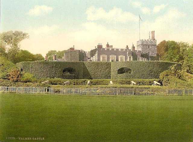
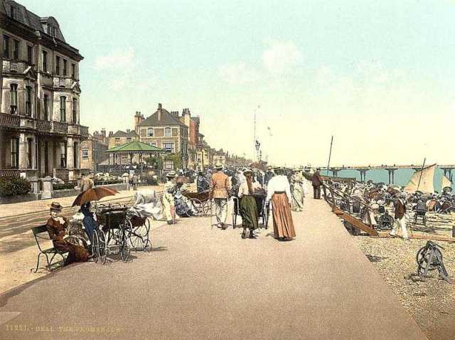
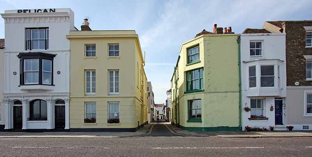
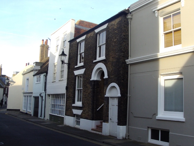
A walk from Walmer along the England Coast Path

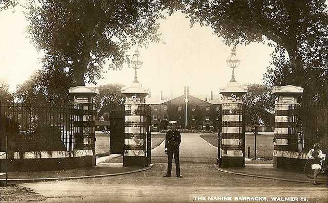
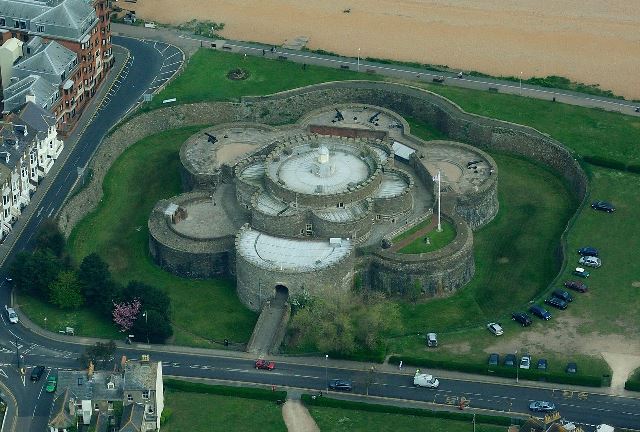
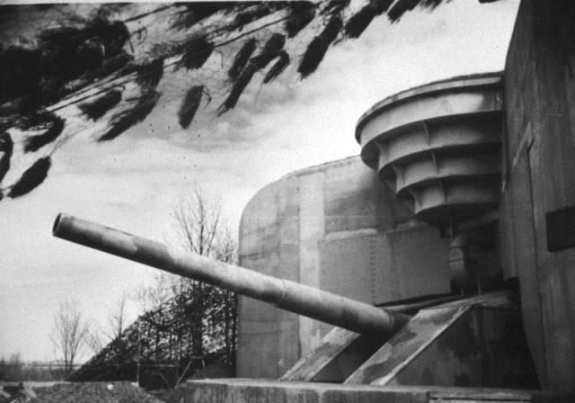
The East Kent coast between Walmer, Kingsdown and Deal has faced attack for centuries. Its flat shores and closeness to Europe have attracted many overseas invaders - from Julius Caesar’s Roman legions to Napoleon’s warships, First World War bombers and Hitler’s planned landings in 1940.  

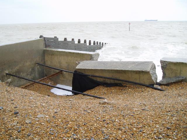
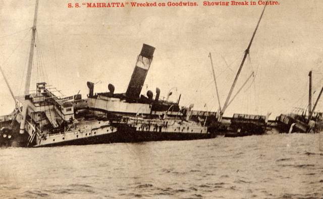
But humans are not the only threat to this part of Britain’s coast. Walmer and Deal face constant attack from the powerful forces of the North Sea.

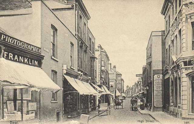
Waves and storms erode the soft chalk cliffs, creating a constantly shifting landscape. This walk explores the changing coastline between a medieval village and a modern seaside town. 

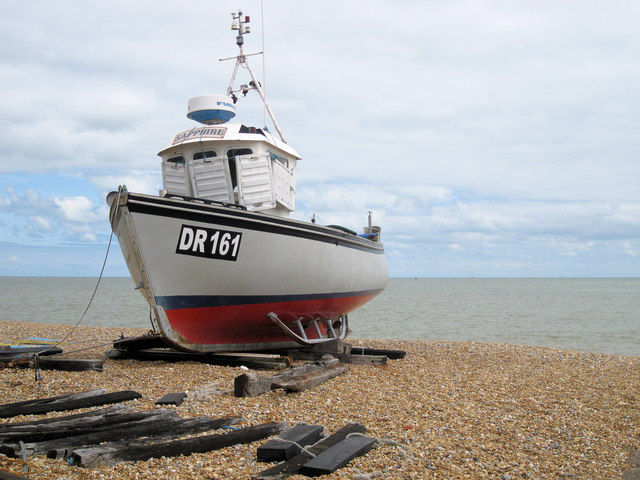
Find out how local fishermen made a living from a deadly sandbank. See castles built by Henry VIII and hear stories of secret Second World War weapons.

Follow the walk by clicking on the map pins
or downloading the guides below

Location: Walmer and Deal, Kent
Start point: Walmer railway station, Station Road, CT14 7RN
Finish point: Deal Town Hall, High Street, CT14 6TR

Walmer and Deal walk credits

Thanks to - 

Raymond Molony FRGS for creating the walk, providing photos and the audio commentary

Caroline Millar, Rory Walsh and Jenny Lunn for editing the walk resources

Gordon Leith, curator of Research and Information Services, Royal Air Force Museum for detailed information on the Sopwith Pup

For their valuable assistance - Dr Ann Coats (Naval Dockyards Society), Helen WilliamsJohn GuyAlan Buckman (East Kent History)Robin Green (The Deal Society)Kirsty Holroyd (Walmer Parish Council), David Magee (The Fort Dunree Museum), Sarah Humphris and Barbara Molony

Grant Sibley, Harold Wyld, Dover Museum, the RNLI, Cross and Cockade International, The Shuttleworth Collection, The National Railway Museum / Science and Society Picture Library and oldukphotos.com for kind permission to include images from their collections

Other photos reproduced under Creative Commons Licenses

"Deale looks like a good thriveing place...all this Country about seemes to be a very fruitfull soyle and full of woods..." Celia Fiennes