1 Welcome to Sandwich

Sandwich is one of England’s best-preserved medieval towns, packed with ancient narrow streets lined with colourful timber buildings. Centuries ago Sandwich was a prosperous port beside a major shipping channel. That all changed in the sixteenth century when the port declined. Sandwich was left almost frozen in time.

This walk explores how the changing landscape affected the town and its people. We will discover Sandwich’s medieval importance for trade and defence. We will hear why the town welcomed monarchs and migrants, martyrs and pilgrims - perhaps even an elephant!

The route is about two miles long starting and finishing at the bridge on The Quay. There are a few slopes and some very narrow pavements. A short section is across open land which can be muddy, so wear suitable shoes. We hope you enjoy the walk!


The Quay, Sandwich
Rory Walsh © RGS-IBG Discovering Britain 
Directions

Begin the walk halfway across the Town Bridge on the side facing the Bell Hotel and riverside buildings. Look across the river to the car park and quayside.

2 A sandy place

From this bridge we can begin to understand Sandwich’s layout. The river below is the Stour. The buildings to the right mark the edge of the town, built on an area of high ground known as the Thanet Beds.

Look at a map of Kent you will see an area called the Isle of Thanet. As the name suggests Thanet was once an island. It was separated from mainland Kent by a strait called the Wantsum Channel. Once 600 metres wide, it was a major shipping route connecting the English Channel with the Thames Estuary.

Sandwich was located on a sand bank south of the Isle of Thanet, where the River Stour flowed into the Wantsum Channel. This location probably gave the town its name - ‘Sandwich’ derives from the Saxon for ‘sandy place’. In the tenth century the town relocated to higher ground, where it still stands today.

The direction of the prevailing winds along the Wantsum Channel made Sandwich a natural harbour for ships. A port developed here, known as the Sandwich Haven. Sandwich was ideally placed to trade with the rest of England and the Continent. By the eleventh century the town was England’s fourth-largest port.

 
Detail from a map of Roman Kent showing the Wantsum Channel around Thanet
Wikimedia Commons
Directions

Cross over the bridge towards the Bell Hotel. Turn left then carefully cross over the road. Follow the pavement beside the quayside buildings. Stop when you reach a stone archway next to a white building.

3 Fishy tales

Sandwich was once a walled town with access through a series of gates like this one, the Fisher Gate. Fisher Gate was the main entrance from Sandwich quay into the town itself.

There has been a fortified gatehouse on this site since 1380, though the current one dates from 1581 when it was enlarged. The town’s merchants passed through the Fisher Gate to conduct business on the quayside. The medieval quay would have been a busy place lined with ships and bustling with people.

Tradesmen like coopers would have used this gate on a daily basis. Coopers were skilled craftsmen who made barrels, a vital trade in a medieval port. Barrels were the best way of transporting goods by sea, including wine, beer, spices and salted fish.

Pack horses carried sacks of Kentish wool through here to be shipped to Flanders. Imports arrived through the Fisher Gate too. Wine from France, fruit from across Europe, timber from the Baltic were unloaded at The Quay and carried into the town through here.

To protect the town’s trade the Fisher Gate had a portcullis which could be lowered to seal off the street behind. We can still see the groove in the archway. Next to the Fisher Gate is a building called The Keep. A chain crossed the river here, allowing the town’s authorities to collect taxes from ships entering and leaving the port.

 
Fisher Gate plaque
Rory Walsh © RGS-IBG Discovering Britain 
Directions

From the Fisher Gate continue along The Quay. Cross over the road then turn left before the entrance to the Secret Garden. Head towards the river and stop by the beacon with a large coat of arms on it.

4 A privileged port

This beacon was built to celebrate the Millennium. It also marks the former entrance to Sandwich port. During the town’s medieval heyday the River Stour was much wider and covered part of this grassy area.

Notice the coat of arms on the beacon. The red and blue shield is the emblem of the Cinque Ports. Formed around 1050, the Cinque Ports were all on England’s south coast. The original five (‘cinque’ is the French for ‘five’) were Hastings, Romney, Hythe, Dover - and Sandwich.

The Cinque Ports played a special role in medieval England. England did not have a Navy until the reign of Henry the VII. Before then the Cinque Ports provided the king with men and ships for fifteen days a year and during times of war.

In return these ports had special royal privileges including tax exemptions, salvage rights, and their own law courts. Later we will pass the Guildhall, where the Cinque Port court sessions were held. Look out for other examples of the Cinque Ports emblem around the town.

The Cinque Port towns became very wealthy. This wealth meant that they became strategic targets, however, and they were frequently attacked by French raiders. These attacks escalated between the 1330s and the 1450s, the ‘Hundred Years War’ between England and France.

Look across the grassy area for a ditch beside the stone wall. This was part of Sandwich’s defences. We will find out more about them at the next stop.


Sandwich Millennium Beacon
Rory Walsh © RGS-IBG Discovering Britain 
Directions

From the beacon head away from the river and cross the grassy area towards the stone wall. When you reach the wall turn left. Follow the path, keeping the wall and fence on your right. At the playground the path bears right and climbs uphill lined with railings. Continue on this path until you reach a bench and noticeboard. You should be overlooking a ditch and tennis courts. Stop at the bench.

5 Walls and wars

The Wantsum Channel made Sandwich accessible but vulnerable. Attacking forces could sail right into Sandwich Haven and plunder the town. From the thirteenth century Sandwich was attacked several times by the French.

King Richard II was so worried that in 1385 he ordered extra walls to be built around Sandwich. Stone was costly to transport so most of the walls were earth ramparts topped by wooden fences. The raised earthworks survive today and visitors can still follow long stretches of them.

We are now at the remains of The Bulwark. This was a large two-storey building completed in 1451 to protect Sandwich harbour.Notice how high up we are compared to the quayside. This site allowed men inside to spot potential enemies sailing up the river. They could fire arrows and cannon at the approaching raiders, while the chain across the river provided extra security.

Despite these defences attacks still occurred. In 1457 a violent raid breached The Bulwark and a 4,000 strong French force sacked the town. Many buildings were destroyed and the mayor was killed. To this day the Mayor of Sandwich wears a black robe.

All that remains of The Bulwark is this raised bank and a few stone sections at the bottom of the ditch. Today the ditch and other surviving defences protect the town from flooding rather than the French.

 
Remains of The Bulwark
Rory Walsh © RGS-IBG Discovering Britain 
Directions

Continue along the path of The Bulwark up to the road bridge. This was the site of Sandown Gate, another of the town’s medieval entrances. Recent research indicates that a royal castle may have existed nearby in the medieval period opposite the Mill Bank. Turn right into Sandown Road and continue until you reach a church on the left. Cross the road and go into the church grounds beside the Knightrider Street sign.

6 Towering presence

This is Sandwich’s parish church, St Clement’s. It dates from the twelfth century and was built in stone imported from Caen in France. The impressive Norman tower was a lookout point in the town’s defences and ships used it navigate the harbour.

Sandwich had three medieval parish churches - another clue to the town’s prosperity. From the tenth century Sandwich belonged to the monks of Christ Church, Canterbury. As major employers and landowners, they collected a large amount of taxes from tenants, fishermen and visiting ships.

Another reason churches flourished in Sandwich was a constant stream of pilgrims travelling through the town. In 1170 Thomas Becket, the Archbishop of Canterbury, landed in Sandwich after meeting King Henry II in France. Becket then journeyed to Canterbury Cathedral where he was murdered.

After his death Becket was canonised as a saint. A shrine was created in Canterbury Cathedral at the spot where he was killed. Pilgrims from throughout Europe arrived in Sandwich to follow in Becket’s footsteps and journey to his shrine.


St Thomas Becket faces King Henry II in a dispute (manuscript c.1307-27)
Wikimedia Commons
Directions

Keep the church on your left and follow the path through a set of metal gates. Follow the road ahead then turn right into Fisher Street. At the end note the slope down to the back of the Fisher Gate. Also note the Old Custom House to the right.

Turn left into Upper Strand Street. Pass Pondicherry Alley, a narrow passage that runs down to The Quay. At the end turn right and then immediately left past The Admiral Owen pub. Continue on the left hand side of Strand Street. Stop outside a building with a sign for Sandwich Weavers.

7 Weaving strands

We are now in one of the oldest parts of Sandwich. Here in Strand Street we can still see evidence of the original Saxon street plan. Many streets in this part of the town are narrow passages barely ten feet across. They would have bustled with people, pack animals, and barrels being trundled to and from the quaysides.

Notice how on some buildings the upper stories jut out over the pavements. The Sandwich Weavers is a fine example. These jettied designs allowed traders to maximise their floor space in a restricted site.

This building is named after Dutch migrants who settled here in the sixteenth century, though the building itself is much older. When Sandwich was at the height of its prosperity, this building was part of The Bull Inn. Merchants, sailors and townspeople who met here would have been able to glimpse ships in the Stour.

In the thirteenth century The Bull Inn was at the edge of the river. The clue is in the street name. ‘Strand’ was an Old English word for ‘bank’ or ‘shore’. The buildings we can see today on the other side of the street appeared after the River Stour shrank and the land was redeveloped.


Sandwich Weavers sign
Rory Walsh © RGS-IBG Discovering Britain 
Directions

Continue along Strand Street and cross over narrow Potter Street. As the road curves to the left, stop outside the large timber-framed building opposite the boatyard.

8 Timber!

Strand Street is thought to be the longest unbroken stretch of timber-framed buildings in England. This towering building is actually two houses - Harfleet House and Dragon Hall - often known collectively as ‘The Pilgrims’

Harfleet House was probably built for a thirteenth century merchant. Over time its wealthy owners modified it to three storeys. In 1660 it belonged to major wool merchant, William Harfleet. The building has had many uses since including bank, antique shop, hotel, tea room and pub.

Wooden-framed buildings like ‘The Pilgrims’ were made from a mix of materials. The outside frames were built with Wealden timbers but internal walls and floors were often made from hardwood imported from the Baltic.

External walls were made from local mud, wattle, and even dung. These buildings were strong but susceptible to thieves, who could force a way through the wall panels. This method became enshrined in law as ‘breaking and entering’, a phrase still widely used today for burglary.

Before we move on, notice the street sign across the road – Breezy Corner. Linger here and you might feel a rush of ‘Sandwich wind’, caused by the town’s location on high ground near the coast.


Dragon Hall
Rory Walsh © RGS-IBG Discovering Britain 
Directions

Continue along Strand Street to the end of Harnet Street. Carefully cross over then turn left to continue along the right hand side of Harnet Street. Turn right into Guildcount Lane. When you reach the end turn left into Bowling Street. Look across the road at the large house with window shutters on the corner of Vicarage Lane.

9 Strangers in town

At the Sandwich Weavers building we heard about Dutch migrants who settled in the town. We have now arrived in the area where this community flourished.

In the sixteenth century the Netherlands were ruled by Spanish Catholics. Many Dutch Protestants fled their homeland to escape religious persecution and in 1560 Queen Elizabeth I granted a licence for a group of them to live in Sandwich. Around 25 families moved into this part of the town. They were known locally as ‘the Strangers’ (from ‘étrangers’, the French for ‘foreigners’).

The Dutch Protestants arrived at just the right time. By the 1560s Sandwich’s economy had begun to struggle. Changes to the coastline meant that the port had begun to shrink. The Dutch migrants introduced the town to new ways of making a living.

Dutch weavers used local wool to make broadcloth, a luxury item with significant value. The Dutch were also experts at land drainage and market gardening. They introduced new crops to the area, such as celery and carrots, on the sandy soils to the east of the town.

Sandwich still had some trade with the Continent, so the Dutch were able to use their contacts and expertise to trade. Sandwich’s economy has given a boost and some of ‘the Strangers’ became wealthy themselves.

A good illustration is the building on the corner, Richborough House. It was built in 1590 for one of the Dutch settlers. Notice the brick pattern above the door and the end wall covered in expensive stone, both signs that this was a wealthy person’s home.

By 1590 the Dutch made up nearly half of the local population. Many houses in the town were modified with features like gable walls and ornate brickwork. See how many examples you can spot.


Richborough House doorway tiles
Rory Walsh © RGS-IBG Discovering Britain 
Directions

Continue along Bowling Street. At the end carefully cross the road and turn right into Delf Street. Continue up to Horse Pond Sluice, a small L-shaped area of water outside a grey house.

10 Water, water, everywhere…

Horse Pond Sluice is named after this small metal sluice by the doorway of the house. Sluices are gates used to control water levels, especially in streams and canals. The sluice here helps the flow of a waterway called the Delf.

The Delf flows into Sandwich from a series of springs in the Lydden Valley behind the town of Deal. Some sections are underground now but there are stretches, such as here, that are still open at street level.

The name ‘Delf’ sounds Dutch but it is actually from Old English for ‘ditch’ or ‘dig’. The Delf is not a natural stream. Locals diverted it in the twelfth century to supply the town with clean water. Despite strict laws to maintain it, however, the results were mixed. 

Animals got into the water and the stream was used to dispose of all kinds of waste. Beyond Horse Pond Sluice blacksmiths, butchers and tanners used the Delf for their work. As a result waterborne diseases were a constant problem in Sandwich. Even so the Delf was used for drinking water until the end of the nineteenth century.


The Delf at Horse Pond Sluice
Rory Walsh © RGS-IBG Discovering Britain 
Directions

Continue along Delf Street then turn right into Church Street (signposted Church Street St Marys). Take time to admire some of the houses. At the end of the road is a church on the right hand side. Stop when you have a good view of the church.

11 Earthquake!

We have now arrived at St Mary’s, Sandwich’s oldest church. It is thought to date from the eleventh century but was rebuilt several times after damage by French raids.

Notice that St Mary’s doesn’t have a tower. This is because in 1580 “a great and terrible earthquake struck Sandwich which did shake and cleave St Mary’s Church”.

The earthquake weakened the building and in 1667 the tower collapsed. Beyond Sandwich, the Dover Straits Earthquake of 1580 shook the whole Kent coast and even parts of Europe. There was a landslip at the White Cliffs of Dover and buildings were damaged in Lille and Ghent. In the English Channel 165 ships sank with much loss of life.

In Sandwich, St Mary’s resounded with a loud crack. Damage to the rest of the town though was surprisingly light. Sandwich’s many wooden buildings were more flexible and therefore more earthquake resilient than the few stone ones.

Though large earthquakes are unusual in Britain, the area around Sandwich has been struck more than once. An earthquake in May 1382 sank up to 30 ships in the English Channel. Earthquakes hit the Dover Straits again in 1776 and 1950.

In May 2015 an earthquake struck Sandwich again. Nearby Folkestone was the centre of two smaller earthquakes in 2007 and 2009. The tectonic activity in East Kent is another example of how Sandwich has been shaped by physical forces over the centuries.


St Mary’s Church
Rory Walsh © RGS-IBG Discovering Britain 
Directions

Pass the church - take care as there is no pavement on the right hand side of the road. Carefully cross over Strand Street and head towards the car park using the paths marked for pedestrians. Stop by the wooden gate overlooking the river.

12 Royal river

Today the River Stour is popular with pleasure boaters. Look among the boats here for the Sandwich River Bus, a ferry that runs between Sandwich and Richborough Roman Fort. There has been a ferry on the Stour for almost a thousand years, since King Canute granted the monks of Christ Church a charter to operate one in 1023.

The ferry and the river have many royal connections. These river banks were once lined with quays. Monarchs from Henry II to Elizabeth I used them to travel between England and the Continent. Henry V, for example, set sail from Sandwich in 1415 for the Battle of Agincourt. His army included local archers and ships supplied by the Cinque Ports. Heavy goods, including horses, were loaded by a riverside crane.

It is possible that a more unusual animal may have travelled through Sandwich. In 1255 the French king, Louis IX, sent King Henry III a present – a ten year old African elephant. It was the first elephant to arrive in England since Roman times.

Henry ordered the High Sherriff of Kent to bring the elephant from France to London by water. The Wantsum Channel was the main shipping route, so the elephant probably travelled through Sandwich port. The Sheriff submitted a bill of £6 and 87 pence for transport charges. Expensive indeed when a Knight at Arms could live on £15 a year.


King Louis IX's elephant by Matthew Paris, Chronica Majora (1235–1259)
Wikimedia Commons
Directions

Stay beside the River Stour and look along the river towards the bridge where the walk began.

13 Deposition and drainage

This view along the river shows how much the Stour has shrunk since Sandwich’s medieval prime. In the 1400s almost 100 local ships were based here and the river welcomed many visiting vessels. So what happened to them and why is today’s river so small?

The fate of Sandwich is linked to its geography. Sandwich was founded on a sandbank, where the River Stour flowed into the Wantsum Channel. This location created but then destroyed the port. It happened when the two changes in the landscape combined.

The first change was natural. The prevailing winds and tides that carried ships into Sandwich also moved sediment along the Kent coast from south to north. This sediment was deposited across the mouth of the Wantsum Channel, gradually blocking access to Sandwich Haven. The same process ultimately stopped the Isle of Thanet being an island.

The second change was caused by people. Beside the Wantsum Channel were extensive salt marshes. The monks drained these marshes to use the land for farming. This considerably reduced the Wantsum Channel’s width, making it harder for ships to reach Sandwich port.

By the end of the sixteenth century Sandwich port and its trade had shrunk dramatically. The last recorded use of the Wantsum Channel was in 1672 when a ship from London delivered a set of bells for St Clement’s Church.


Map of the silted up Wantsum Channel (1786)
By kind permission of Angela Searles at A Catholic Land
Directions

Turn away from the river and head towards the former brewery buildings to the left of the car park. Go through the gates marked ‘pedestrian access only’ and follow the path through the trees. After a short distance there is a playing field on the right. Look over the playing field.

14 Salt and water

Looking across the field, notice how flat this land is. This is one of the areas reclaimed salt marshes we heard about at the last stop. Besides creating farmland, draining the marshes released a useful by product.

In the era before refrigerators, salt was a very important way to preserve food. In Sandwich fish were a staple of the local diet and they could perish very quickly if left unsalted.

Salt marshes also play an important role in flood protection. They absorb sea water and protect land during high tide or storms. The playing fields here can soak up water when the River Stour floods or after heavy rain. This to preserve this natural flood barrier, notice there is little housing here.

Flooding is still a risk, however, in Sandwich. The Environment Agency estimates that 488 homes could be affected by flooding. Flood defences costing £21.7 million have been built along the banks of the Stour, including higher walls and spillways.

Changes in the natural environment still affect Sandwich, just as they have for thousands of years.


Mobile flood barriers, Sandwich quay
© Fluvial Innovations
Directions

Remain facing the playing fields and look towards the complex of pale modern buildings on the horizon.

15 Secrets and discoveries

This landscape hides several interesting secrets and discoveries.The pale modern buildings on the horizon are part of Discovery Park, which opened in 1957 as a research and development facility for the pharmaceutical company Pfizer. Many new drugs were developed here to treat various illnesses and diseases.

Before Discovery Park was built this low-lying area was a secret military base. In 1916 a military port called Richborough was created here, named after a nearby Roman fortress. The port supplied the British Army with food and ammunition during the First World War. It was also where roll on / roll off ferries were first developed.

In 1939 part of the disused port - the Kitchener Camp - accommodated 5,000 Jewish men escaping from Nazi-occupied Europe. Sandwich welcomed their arrival. Many found work rebuilding the military camp during the Second World War. Kimbers Golden Crust Bakery on Harnet Street even started to sell real coffee to cater for these new European customers.

To the left of Discovery Park, the dense group of trees is part of the Gazen Salts Nature Reserve. This area of protected land has become a haven for wildlife, including orange tip butterflies, tufted ducks, teals, cuckoos, woodpeckers, warblers, kingfishers and endangered water voles.


Richborough Train Ferry
© Sandwich Guildhall Archive
Directions

Continue along the path as it sweeps to the left. Pass the entrance gate of the Gazen Salts Nature Reserve on the right. A fence will appear on your right and a stream on your left. Stop when you reach a concrete bunker on your left.

16 A place of punishment

We are now outside Sandwich’s medieval walls. The path we are on led to the Canterbury Gate, the town’s main entrance from the west. Being outside the town walls meant this area was used for less desirable activities.

The land on the other side of the fence is Gallows Field, where the town gallows were located. Robbers were hanged and their bodies displayed to deter other criminals from entering the town. Women accused of crimes were ducked in stagnant water.

Note the ditch beside the path. The water here is the Guestling, a stream that flows from the Delf we saw earlier. The medieval monks created the Guestling to drain their land. After the French raid of 1457 many of these drainage channels were deepened to create extra defence features.

Across the ditch is a concrete bunker. This is a Type 22 pillbox built during the Second World War as part of the south coast defences against Nazi invasion in 1940. The ditch and the pillbox show how Sandwich was on England’s frontline for over 500 years.


Gallows Field
Rory Walsh © RGS-IBG Discovering Britain 
Directions

Continue along the path until you reach a road. Cross the road carefully and enter the lane to the left of Guestling Cottage. Pass the houses on the left and continue onto a raised path lined with trees. Pass through a pair of metal gate posts. A stream and cricket pavilion will appear on the right. Stop at one of the benches by the path and look at the flat land beyond the stream.

17 Bows and bats

We are now on top of the old town walls again. This pleasant stretch is called The Butts. The unusual name comes from an activity that used to take place on the drained marshland now occupied by Sandwich Town Cricket Club.

During much of Sandwich’s medieval prosperity England was at war with France. English monarchs demanded that their subjects should always be ready for war service. Henry III for example issued an edict in 1252 that required all “citizens, burgesses, free tenants, villeins and others from 15 to 60 years of age” to have ready weapons.

The most effective English weapon in this era was the longbow. From the age of ten every able-bodied man had to learn how to use one. Archers developed their skills by hitting targets – or ‘butts’ – set at ranges of up to 200 metres.

In medieval times the flat land here was where locals and the king’s men practiced. It is thought that Henry V’s archers trained here before the Battle of Agincourt.

The preferred wood for making longbows was yew. This very strong wood was so popular that English supplies ran out. By around 1350 stocks had to be imported from Spain and Italy through Sandwich port.


Battle of Agincourt (early 15th century minature)
Wikimedia Commons
Directions

Continue along the path of The Butts. Pass a small bridge on the right and a supermarket car park on the left. At the end of the path turn left. The start of the road (called Moat Sole) was the site of the Woodnesborough Gate, another of Sandwich’s medieval entrances. Follow Moat Sole as it sweeps round to the left. Stop almost immediately opposite a large stone building with a porch by the road.

18 Pilgrims’ progress

This grand stone building is St Thomas’ Hospital. It is not a hospital in the modern medical sense – instead it accommodated medieval pilgrims. It is named after Thomas Becket.

As we have already heard, Sandwich became a popular stop for pilgrims travelling to Becket’s shrine in Canterbury. There has been a St Thomas’ Hospital in Sandwich since the fourteenth century, though the buildings we can see were completed in 1878. The date on the porch refers to its earlier location.

There were three ‘hospitals’ in medieval Sandwich; St Thomas’, St Bartholomew’s and St John’s. Pilgrims added considerably to Sandwich’s wealth by spending money here and paying taxes on their accommodation and travel.

Pilgrimage was a serious matter. Pious devotees travelled throughout Europe to go on spiritual as well as physical journeys. For many working people it was also their only chance to leave their lord’s manor for an extended period.

We can get an idea who went on pilgrimages from Geoffrey Chaucer’s epic poem The Canterbury Tales. Written in the 1370s it follows a group of pilgrims travelling to Canterbury from London. Besides clergy the group includes a knight, a merchant, a yeoman, a sailor, a widow, and a miller.

The Prologue contains an outline of their journey:

     Palmeres for to seken straunge strondes
     To ferne halwes, kowthe in sondry londes;
     And specially from every shires ende
    Of Engelond, to Caunterbury they wende,
     The hooly blisful martir for to seke
     That hem hath holpen, whan that they were seeke.

Or:

     Wandering travellers tread new shores, strange strands
     Seek out far shrines, renowned in many lands,
     And specially from every shire’s end
     Of England to Canterbury they wend
     the holy blessed martyr there to seek,
     Who has brought health to them when they were sick.


The company of pilgrims in Chaucer's Canterbury Tales 
Wikimedia Commons
Directions

Continue along Moat Sole until you reach a mini roundabout. Use the supermarket crossing point to the left to cross the road. Continue along Moat Sole and stop outside the Red Cow pub.

19 Thirsty work

As the name of The Red Cow suggests, this part of Sandwich has a farming history. Until the 1970s the car park across the road was the site of the town’s cattle market. The street around the car park is still called Cattle Market today.

Many regulars at the Red Cow were animal drovers and farmers. Cattle and sheep were reared on the marshy fields outside the town walls before being herded into the market. Farmers had to breed animals that could live on marshy land. North Kent sheep in particular were well adapted to living on these salty soils.

Sandwich livestock supplied the town plus the nearby naval base at Deal. From the sixteenth to the nineteenth century sailors and Royal Marines at sea were given one pound of salted meat as part of their daily rations. Fresh meat was loaded onto naval vessels while they were at anchor off the coast.

At the Red Cow, the drovers and farmers would quench their thirst. Beer was also safer to drink than the easily polluted water that flowed along the Delf and other streams around the town.


Red Cow Inn logo
Rory Walsh © RGS-IBG Discovering Britain 
Directions

Continue along Moat Sole. When you reach the car park on the right, turn into the road to the left. Continue a short distance and stop outside the pale building set back from the road.

20 A place of shelter

The distinctive Sandwich United Reformed Church was built in 1706. Do go inside if it is open. Holding up the ceiling are a pair of ship masts. They come from ships that transported another of Sandwich’s migrant communities - French Huguenots.

Like the Dutch weavers, the Huguenots were Protestants who arrived in Sandwich to escape religious persecution. From the late sixteenth century an estimated 40,000 Huguenots settled in England. They were the first group of people to be called refugees – the word comes from the French ‘refugier’ which means ‘to take shelter’.

In Sandwich the Huguenots found shelter with the Non-Conformist community. Non Conformists are Protestants who worship independently from the Church of England. When Sandwich’s Non-Conformists began building their church the Huguenot settlers donated the masts in gratitude.

Before we move on, notice the large building across the road. This is the back of the Guildhall. Built from 1579 the Guildhall was the Cinque Ports courthouse. It is now home to the town museum and is well worth a visit.


Sandwich United Reform Church
Rory Walsh © RGS-IBG Discovering Britain 
Directions

Feel free to enter the church if it is open. When you are ready, leave the church and carefully cross the road. Keep the Guildhall on your right and follow the pavement into a market square. Continue across the square and onto the right hand side of New Street. Stop beside a small white house with a square plaque above the door.

21 The great migration

We have already heard about people who arrived in Sandwich from abroad. People also left the town for foreign lands. By the 1600s Sandwich had declined as a port but it was still used by smaller ships. Sandwich’s reduced size helped it become a departure point of the ‘Great Migration’.

The ‘Great Migration’ was a period of religious turmoil from the 1600s. English Puritans left the country to start new lives overseas. Some 40,000 Puritans settled in America. As Sandwich was by then a small port it was an easier place for people to evade the authorities.

In Massachusetts there is a town named Sandwich, founded by Puritan migrants. Puritans were not the only people to leave Sandwich for a new life. This small house once belonged to the writer and political activist Thomas Paine.

In 1759 Paine set up a tailor’s shop here that specialised in making corsets. The business was not a success so he emigrated in pursuit of a better living, first to France and then America. Paine’s writing career there inspired the American Independence movement and he created the phrase ‘United States of America’.


Portrait of Thomas Paine (c.1876)
Wikimedia Commons
Directions

Cross over the road and continue along Austin’s Lane. The next stop is the church ahead. When you are ready, bear left and go into the church grounds. Stop with a view of the tower.

22 Protection and plague

We are now at the third of Sandwich’s medieval churches. St Peter’s played an important role in the town. Its central location meant that it sounded the curfew bell at eight o’clock each night. When the curfew sounded all fires had to be extinguished - vital when most of the buildings were made of flammable timber.

St Peter’s also offered protection during the Plague. The Plague or ‘Black Death’ was one of the worst pandemics in history. It started in China then swept across Europe in 1348, though outbreaks continued for over 300 years. The disease was spread by fleas which lived on rats. Since rats often hid on ships, plague spread rapidly in port towns.

Sandwich was hit by several outbreaks. In 1564 infected people were quarantined inside St Peter’s to stop the disease spreading.

St Peter’s later became the community church of the town’s Dutch settlers. Look carefully at the tower. The top is made from darker bricks than the rest. When the original tower collapsed in 1661 the Dutch rebuilt it. They added the unusual dome on top and the Dutch gable wall on the chapel.

The curfew bell tradition continues to this day. From Monday to Saturday the bell rings at 8pm for 10 minutes.


St Peter’s Church tower
Rory Walsh © RGS-IBG Discovering Britain 
Directions

With the church on your left, go through the gap in the wall onto St Peter’s Street. Turn right and head toward the white building on the right hand side with the noticeboard on the end wall. This is where the town jail used to be.

Go into the narrow passage across the street called Holy Ghost Alley. This was originally a shortcut that allowed people to carry water from the Delf Stream. Walk through the alley to emerge on the High Street. Turn left and continue a short distance until you are outside a dark building on the left hand side called Pellicane House.

Note: the alley may be too narrow for pushchairs and wheelchairs. For an alternative route turn right from the church and continue along St Peter’s Street. Turn left into Short Street then left at the end to enter the High Street.

23 Ups and downs

We are now in Sandwich’s High Street. Notice the buildings here are much larger compared to the streets by the river. This higher ground away from the crowded quays allowed people to develop larger properties.

Many were highly modified in the seventeenth and eighteenth centuries. With its flint walls, Pellicane House is a good example. Look for other buildings nearby that have been updated, including Georgian fronts added by rich owners.

By the sixteenth century the High Street had replaced The Quay as the town’s business centre. The shift illustrates Sandwich’s decline after its medieval prosperity. When the Wantsum Channel and Sandwich Haven silted up, large ships could no longer travel to the quayside. Trade shifted to Dover and Deal.

Furthermore, from 1536 Henry VIII dissolved the monasteries. The monks who owned Sandwich had to surrender their land and property to the king. Henry also suppressed religious hospitals and Thomas Becket’s shrine was destroyed on his orders.

Without its valuable port and pilgrims Sandwich became isolated. The medieval town was left behind. Sandwich hasn’t grown dramatically since. Today the population is 4,500, compared to around 2,000 in the late medieval port. By comparison, industrialised towns and cities doubled in size in decades rather than centuries.


Pellicane House
Rory Walsh © RGS-IBG Discovering Britain 
Directions

Continue along the High Street. Stop beside The Admiral Owen pub and look at the arch ahead next to The Crispin Inn.

24 A haven again

This arch is The Barbican or Davis Gate, built in the fourteenth century as part of the town’s defences. From 1759 until 1977 it was used to collect tolls from travellers crossing the bridge. There is still a board inside listing the toll charges.

These tolls became a major source of income, especially from the late Victorian era when Sandwich’s preserved medieval streets became a visitor attraction. The amount of toll money collected funded the rebuilding of the bridge in 1892. Today tourism is still one of the main elements of the local economy.

Increased visitor numbers also helped protect Sandwich. The Barbican, the town walls, the churches and many of the houses we have seen are now listed buildings. In fact the whole medieval town is a conservation area.

Another reason visitor numbers increased from the Victorian era was a new leisure activity: golf. Sandwich is home to three world-class golf courses, including Royal St George’s which opened in 1887. Sandwich has hosted The Open Championship 15 times.

Interestingly the golf courses developed thanks to the processes that shrank the port. The courses are on coastal land created by centuries of sediment deposition. This is yet another example of Sandwich using its changing physical geography for economic gain.


The Barbican
Rory Walsh © RGS-IBG Discovering Britain 
Directions

Carefully cross over the end of the High Street towards the Bell Hotel. Then cross over The Quay and bear left towards the town bridge where you started the walk. As before, stop halfway across the bridge.

Note: it is possible to access the bridge through The Barbican. Please take care though as the pavements inside are very narrow and traffic from the High Street goes through the arch. Use the traffic lights to go through safely. As you do, look inside for the toll charge board and a plaque commemorating Richborough Transit Camp.

25 Monks, monarchs and migrants

We end back at the bridge overlooking The Quay. From here we can see how Sandwich has adapted to changing circumstances.

The river is no longer full of working ships but a place for leisure boating. The quayside buildings have changed from warehouses to pubs and restaurants. The Barbican has changed use from a defensive structure to a tourist attraction.

Throughout our Sandwich’s story, geography has always affected the town. Sandwich’s location created a sheltered harbour beside a major shipping route that reached its economic peak during the early medieval period. However, coastal deposition and draining salt marshes changed the landscape. The harbour was cut off from major trade and the economy went into decline, despite skilled migrants from Europe.

These physical and economic changes left the town almost frozen in time. Sandwich has capitalised on this since through tourism. The processes that destroyed the port also helped to create new land uses, from golf courses to nature reserves.

Geography is never static though and even now Sandwich faces new challenges. Like the medieval monks, monarchs and migrants, today’s residents face both the threats and possibilities posed by Sandwich’s fascinating and changing landscape.


Sandwich Riverbus sign
Rory Walsh © RGS-IBG Discovering Britain 
Directions

You may like to explore the town further or follow the town walls. To go to Sandwich railway station, make your way back along the High Street. Continue onto The Chain then bear right into Galliard Street. At the end turn left onto New Street. The station is on the left.

Saved haven

Strand Street, Sandwich © Rory Walsh RGS-IBG Discovering Britain

Sandwich walk

A circular walk around historic Sandwich

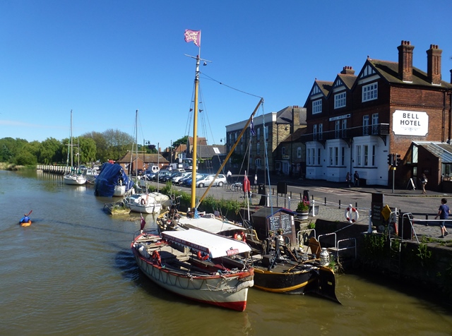
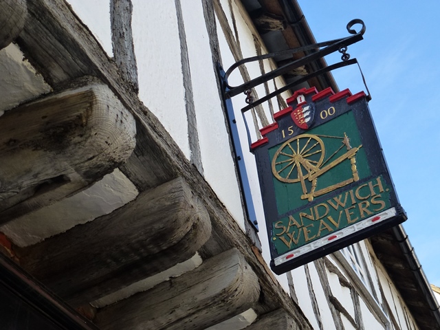
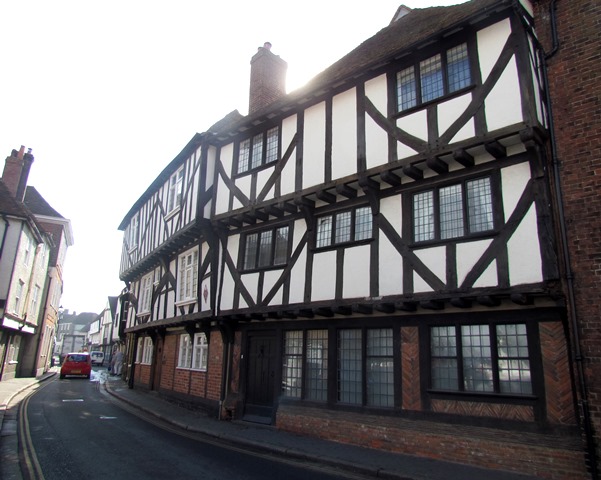
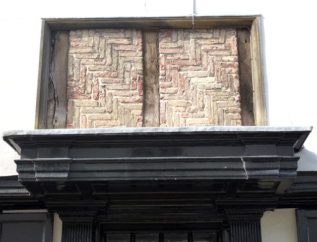
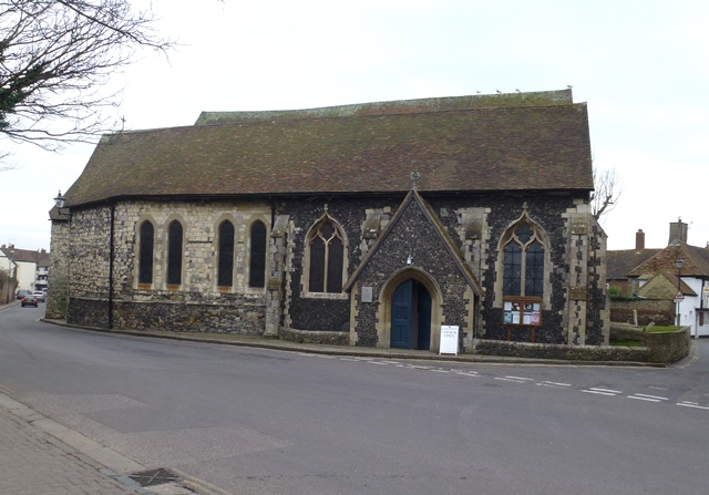
Sandwich is one of England’s most picturesque towns. The narrow winding streets are lined with colourful timber-framed buildings and surrounded by world-class golf courses. Yet behind these charming sights the town has survived sieges, earthquakes, pandemics - and more.

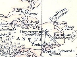
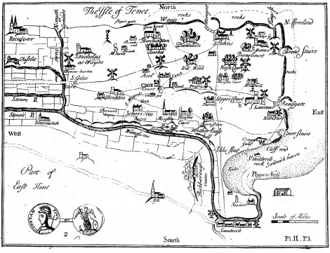
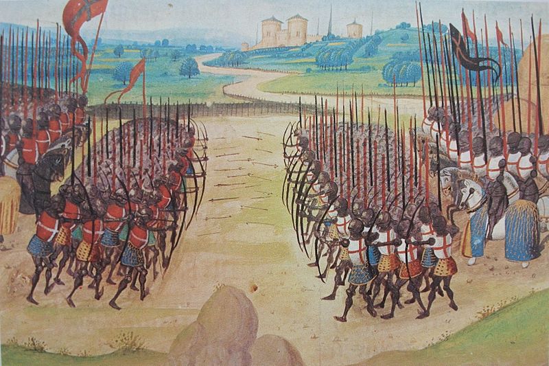
In the medieval period Sandwich was a major port that welcomed pilgrims, launched armies, and hosted royalty. By the sixteenth century however the town was left behind, almost frozen in time. 

This walk explores why - and follows the town’s changing fortunes to see how Sandwich has adapted over the centuries.

Follow the walk by clicking on the map pins
or downloading the guides below

Location: Sandwich, Kent
Start and finish point: Sandwich Town Bridge, Ramsgate Road, CT13 9EA
Keep an eye out for: The town's medieval layout includes some very narrow pavements!

Sandwich walk credits

Thanks to - 

Raymond Molony FRGS for creating the walk and providing the audio commentary

Rory Walsh for editing the walk materials and providing photos 

Caroline Millar for editing the audio files

The Sandwich Society for their input and generosity 

Dr Helen Clarke and Arthur Percival MBE for advice and guidance 

Anne and Aidan Hyland Lawes (RIP) for introducing Raymond to the world of the Fine Rolls of Henry III 

Dr David Crook OBE for help with tracking a medieval elephant 

For their valuable assistance - Dr Frank Andrews (Sandwich Local History Society), Sue Fielder (Open Sandwich Design), Ray Harlow  (Sandwich Guildhall Archive)Kat Hubschmann (The Wiener Library)Simon Phelps (Fluvial Innovations), Karen Potter (Gazen Salts Nature Reserve), Dr Clare Ungerson, David FlinthamMike Osborne, Angela Searles and Barbara Molony

Sandwich made headlines in May 2015 when it was hit by an earthquake - major quakes have shaken the town several times since 1382