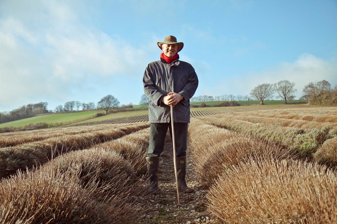
Hello and welcome to the Darent Valley. I’m William Alexander and I was born and grew up on Castle Farm, a couple of miles north of here. In 1892 my ancestors relocated from Scotland, arriving in the valley by train. They were accompanied throughout the journey by a herd of 17 dairy cows!
During the late 19th century cheap and plentiful wheat was being imported into England, particularly from the USA, driving down the wheat price to levels that forced many farmers to give up renting their farms because of financial despair.
As a result landowners struggled to find replacement tenants prepared to farm on their estates. Many a hardy Scottish farmer, often a younger son, like my great-grandfather who would not inherit the family acres, spotted an opportunity to move south, enjoy the kinder weather, benefit from the better soils and all this at reasonable rents.
Instead of growing wheat these Scots brought their herds of cows, then fed them on the cheap wheat and barley. They could easily sell all the milk they could produce into the London markets on their doorstep. My ancestors, like many of these Scottish farmers, prospered, grew and over the decades changed their farms to respond to the latest technology and new opportunities.
Turn right immediately outside the railway station and go down the flight of steps. Turn right at the road and walk downhill. Stop at the first field gateway on the right immediately after passing beneath the railway bridge.
2 This green and pleasant land
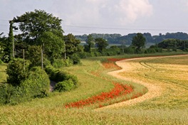
From this gateway you can enjoy your first view across the rolling English countryside. Perhaps I’m biased, but I consider that the Darent Valley represents one of the best examples of where Green Belt planning policy has protected the landscape encircling London from inappropriate urban spread and development. With arable fields (those regularly ploughed) and grass hills stretching from your feet into the distance, it is hard to believe that you are standing only 19 miles from Westminster Bridge.
This entire valley is part of the Kent AONB (Area of Outstanding Natural Beauty) that extends northwards from the White Cliffs of Dover in a sweeping arc along the North Downs.
This is one of about 50 designated AONBs in Britain. These are precious landscapes whose distinctive character and natural beauty are so outstanding that it is in the nation’s interest to safeguard them.
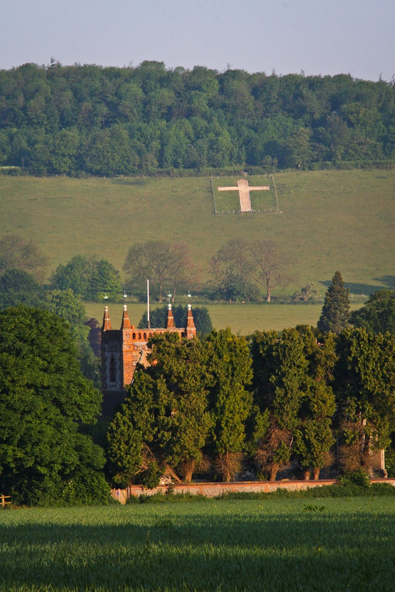
Shoreham village is largely out of view from here, tucked amongst the trees of the river valley, but you should be able to pick out the church tower and the cross cut into the white chalk of the hillside.
Kent is famously known as ‘The Garden of England’ because of the great diversity of crops grown across the county. Its fertile soil, agreeable climate and location close to the capital are all factors contributing to why Kent is so closely associated with horticulture.
I have planned your walk route along the Darent Valley to enable you to see a range of farming activities as well as other interesting places along the way. At the various stopping points I will explain how the geography and geology of this landscape influences what is grown here and help you to interpret the farming that you see.
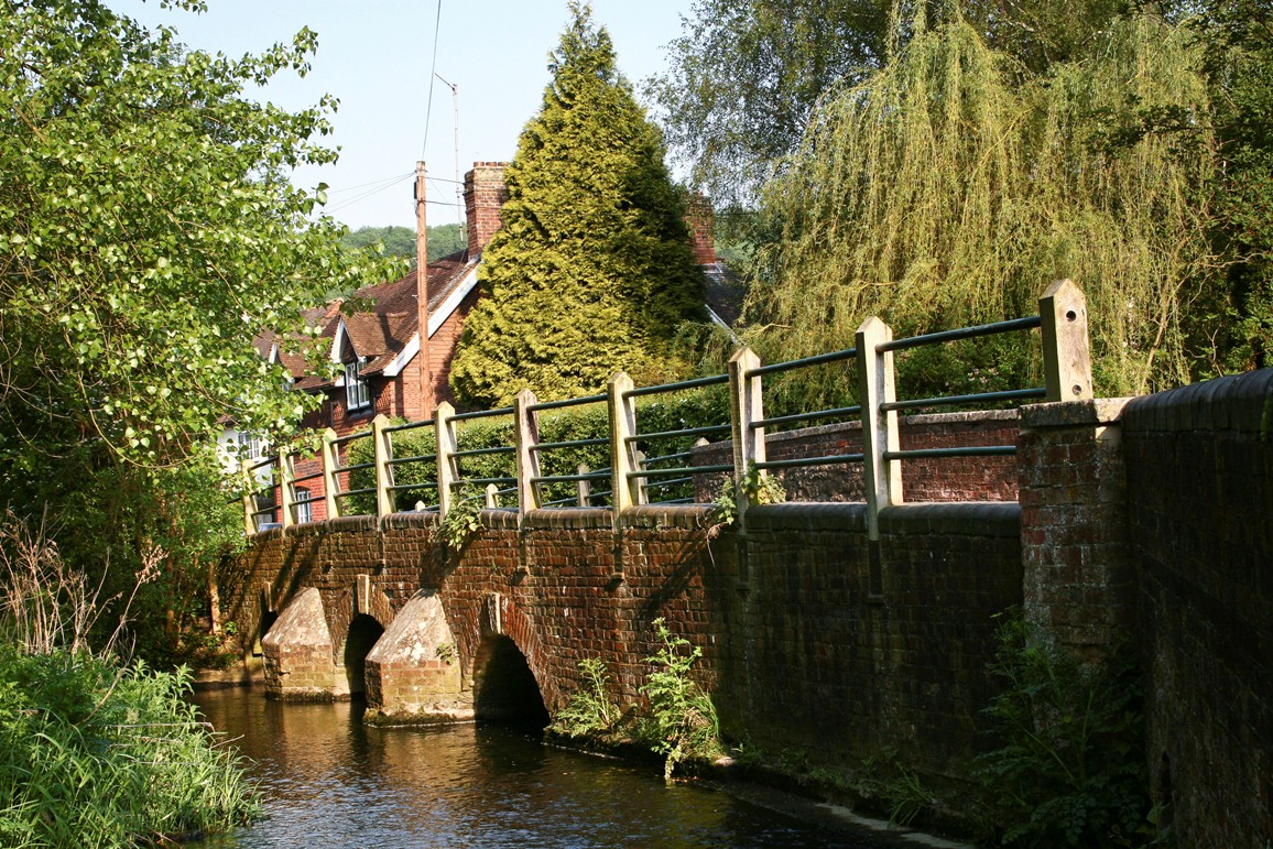
Walk down the road. Just before the first house on the right, turn right onto the field track (signposted as footpath). After 50 metres turn left into the churchyard through the kissing gate in the flint wall (N.B. a kissing gate is a hinged gate with a small enclosure through which people but not animals can pass). An avenue of clipped yews leads you past St Peter & St Paul’s Church with its splendid fifteenth century porch. Walk on through the lych-gate to rejoin the road opposite The George pub. Keep walking until you reach the bridge over the river. Just before the bridge bear right into Darent Way. Stop at the stone war memorial by the riverside.
3 From source to sea
The small settlement of Shoreham grew here at the narrowest section of the valley where it was feasible to ford the river. Although no longer in use there is still some evidence of the ford on the downstream side of the bridge. The bridge, built of brick and flint, is formed of three low arches and dates from the nineteenth century, although there was probably an earlier medieval bridge here.
At only 21 miles, the Darent is a comparatively short river. The source springs from the sandy geological beds known as the Greensand Ridge in the Westerham hills. The river begins life as a small brook running eastwards into lakes near Sevenoaks before emerging to flow northwards along this valley. Supplemented by several smaller side streams it increases in size until flowing into the River Thames just beyond Dartford 12 miles to the north of here. The Darent’s water is very pure and is protected as an important chalk stream. It provides a rare habitat for a range of plant and animal wildlife including brown trout and crayfish.
The Darent river is one of the major suppliers of the capital’s water. This valley is what’s known as a groundwater catchment area. Groundwater (as opposed to surface water like lakes and reservoirs) is water held under the ground within the rocks and soil. It is pumped out (a process known as abstraction) and used to supply London’s drinking water.
In the 1980s, after years of over abstraction, the Darent was identified as suffering from one the lowest flows of any river in the country. This was only too evident when sections dried up completely during some summer months, damaging the river ecosystem.
Over the last 20 years the Darent Action Plan has been successfully implemented. The amount of water abstracted from the Darent has been radically restricted and engineering now makes it possible to add to river flows in periods of drought. Environmental habitats have been enhanced along the entire length of the river so effectively that in 2011 the Environment Agency announced the Darent as one the UK’s ‘10 most improved rivers’ - good news for wildlife, residents and walkers alike.
Walk about 20 metres downstream. Stop outside the gates of a large white house called Water House.
4 Painter of paradise
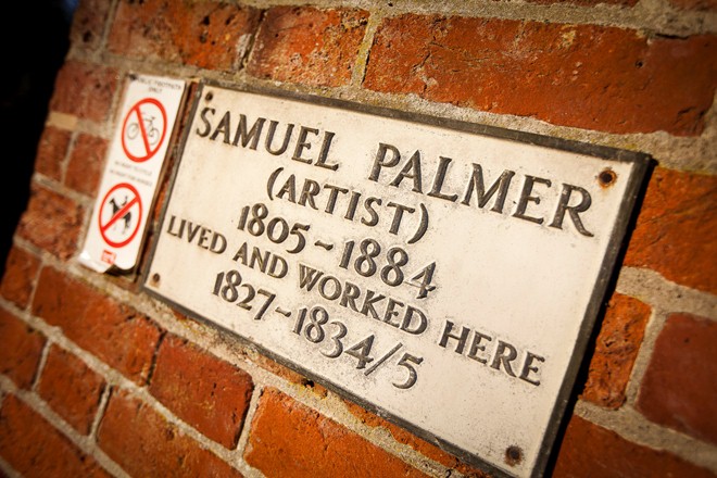
One of Britain’s finest artists, Samuel Palmer, lived here at Water House between 1828 and 1835. Palmer was often seen strolling around Shoreham’s hills and woods by day and night to paint and get inspiration. It was here that he created what are now considered some of his greatest and most poetic pastoral scenes including ‘The Magic Apple Tree’, ‘The Sleeping Shepherd’ and ‘The Shearers’.
Impatient with modern life Palmer turned to the past for inspiration claiming ‘The past was for poets, the present for pigs.’ The quiet village of Shoreham suited him ideally. He viewed it as his ‘earthly paradise’.
However Palmer’s bucolic scenes were in defiance of what was really happening in the countryside where farming was becoming increasingly mechanised and poor farm labourers were rising up in protest. After living at Water House for seven years, Palmer became disenchanted with the reality of rural life and left his ‘earthly paradise’ behind.
But Palmer was right about one thing: this is a very picturesque spot. As you walk through the village you will notice that Shoreham has escaped most of the adverse effects of heavy road traffic, lying as it does just off the route of the main A225. The absence of pavements, street lighting and yellow lines reinforce the rural character of the village.
Return to the bridge, cross the river and walk up Church Street. Do take a moment to appreciate some of the splendid architecture of Shoreham’s houses – timber-frame construction, weatherboarding, sash windows and beautiful brickwork. Also look out for the historic ostler window on the wall outside The Kings Head pub.
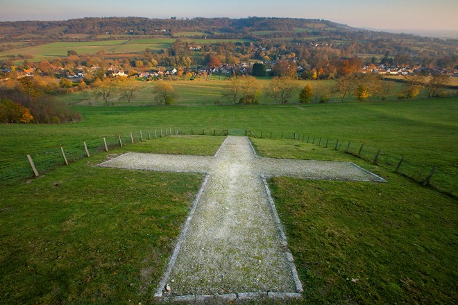
At the T-junction turn right into the High Street. After 100 metres turn left onto an unsurfaced lane signed ‘The Landway’. Follow the footpath up past the playing field and beneath mature beech trees. Continue to follow it upwards between two hedges. Stop when you emerge at a stile into a sloping field. Look right to take in a good view of the chalk cross on the hill.
Note: For a level route that avoids the climb continue along the High Street through the village for about 500 metres. Where the road bends to the left turn right into Mill Lane and resume at Stop 8.
5 Geology underfoot
You’ve probably noticed that you’ve gone from relatively flat ground to walking up a challenging hill.
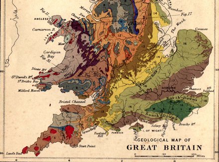
You’re now climbing up a steep slope on the North Downs, a geographical feature stretching from Farnham in Surrey all the way to the White Cliffs of Dover. The Downs were created from a thick band of chalk deposited over 60 million years ago. Tectonic activity pushed up and folded over the chalk to create a huge, rounded, elongated dome.
Over the millennia, much of the soft chalk was eroded by the wind and rain to form the undulating slopes of the North and South Downs. In fact the whole of Southern England lies on a mighty seam of chalk, which was formed from the shells of millions of tiny sea creatures that lived and died in the warm, shallow seas once covering most of Britain.
The Shoreham chalk cross you can see is one of many artistic chalk cuttings found in Southern England. During the First World War a Shoreham resident, Mr Cheesman, lost both his serving sons in action, Richard and Cecil. So with the help of the then vicar of the local church he proposed the idea of a cross cut into the chalk on the hill to remember them and others who died.
Continue up through the field towards a gate in the trees. Here you may need a breather, so stop and turn to look back over the village in the valley below. When you are ready, go through the kissing gate and up the final steep climb until you reach a wide track, known locally as the Terrace. Stop at the sign for Meenfield Wood.
6 A productive woodland
We’re now on the terrace next to Meenfield Wood. Although we think of woods as part of the natural landscape, this woodland and many others are actually man-made. These trees were planted as a long-term crop.
Plantations such as Meenfield were originally established all around Kent on soils that proved difficult to cultivate for agriculture. When possible these plantations, predominantly of sweet chestnut were located conveniently close to where the timber would ultimately be used - as fencing timber for agriculture and tall poles for hop gardens.
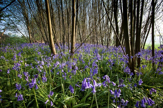
Traditional management is still practised in these particular woods. The chestnut trees are harvested every 15 to 20 years by cutting off the multiple stems close to the ground where they grow from the base. This ancient technique, known as coppicing, allows increased levels of sunlight to reach the woodland floor so warming the soils and triggering bluebells to burst forth and create a dramatic blue carpet of flowers in Spring.
The cut stools quickly sprout new shoots which grow fast and straight to produce another crop of stems. English oak trees are grown in the same woodlands where competition for light with the chestnut trees makes them grow straight with very few large branches. Because there are fewer branches then fewer knots are found in the final timber making it stronger and more suitable for uses such as house building. These standard (or single stemmed) oak trees are harvested every 150 to 200 years.
The Kent Downs AONB has woodland covering 20% of its land area making it one of Britain’s most wooded AONBs. Forestry is the second largest land-use after agriculture. Woodlands are a vital component of the natural beauty of the Darent Valley, providing a green mantle to the upper slopes and ridges. They emphasise the undulating nature of the ‘dip and scarp’ slopes whilst framing the lower agricultural fields and village settlements.
Walk along the terrace track with the trees on your left and the valley on your right. Stop when you reach the chalk cross. You may wish to take advantage of the benches here.
7 Reading the valley
Please sit down and enjoy the view! From this vantage position above the cross you have a sweeping panoramic view of the Darent Valley.
Sevenoaks town can be made out in the distance on the hill to your right and Shoreham village with its distinctive church tower can now be studied from above. Just out of sight round to the left are Castle Farm and Eynsford village where our walk will soon be heading.
As you heard earlier, over the millennia geological processes have created this landscape with its valleys and hills. Further natural weathering of the underlying geological rocks have together created many different soils which have in turn determined how this land has been used over past centuries. To better understand today’s land use, it is helpful to consider three sections across the valley.
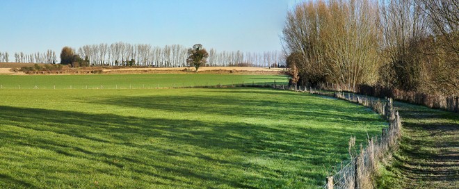
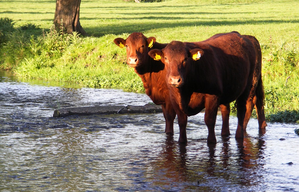
1. Valley bottom The land on either side of the river is called the flood plain because it can be submerged by overflowing winter river water. This dictates what can be grown in these fields. Realistically grass is the only crop that will tolerate such regular immersion and arable crops cannot safely be grown here. This is why flood plains are usually grazed by livestock, providing an economic solution to keeping these water meadows productive.
Fifty years ago small herds of dairy cows grazed these meadows. Today milk production is rare in this valley, now being concentrated in the west and north of England where rainfall and thus grass yields are higher. Locally cows have been replaced with sheep or beef cattle as the grass eaters.
Slightly further away from the river, a couple of metres higher, the next fields up would have flooded in previous millennia but no longer do. These fields often contain deep alluvial soils - a fine grained fertile soil deposited by the river on to its banks, heavy in nutrients, that today provide an excellent soil on which higher value crops can be grown such as hops, fruit or perhaps vegetables.
2. Valley sides On sloping ground erosion mixes chalk and clay particles together with decaying plant material to create ‘light soils’ that are easy to plough and cultivate although less fertile than the rich alluvial fields we just mentioned. In the Darent valley chalk-rich soils predominate which are suitable for growing a range of arable cereal crops including the familiar wheat, barley and oats.
Across the valley (slightly to your left) you should be able to pick out several steeper fields between the main road and the woodland on the hilltops.
In my grandfather’s day these fields were cultivated to grow arable crops using horses or small tractors as part of the war effort’s ‘Dig for Victory’ drive to grow as much food as possible to feed the nation.
Today many modern tractors and combine harvesters can be too large for safe use on such steep inclines and with such thin soils the yields are often poor.
So these ‘marginal’ fields have been abandoned for growing arable crops and allowed to revert to native chalk grass. These areas are now managed specifically to provide habitats for the benefit of chalk downland species including rare orchids, butterflies and reptiles. From here they might look untended, but these important areas need to be managed by grazing or mowing to prevent scrub establishing. Scrub can quickly grow into bushes, bushes into trees and then into woodland. Woody species ultimately shade out the grass and lovely downland flowers, meaning that a rare ecosystem is lost.
3. Hilltops Topping both sides of the valley you will see woodlands. Trees grow successfully on the heavier clay soils found along these ridges. Succeeding generations of farmers have judged these soils as having too low a yield potential for general cropping. Consequently they have not been cleared or ploughed for agriculture but remain in productive woodland.
Before moving away from this particular vantage point, take a moment to look to the left of the churchyard and down to a large house with a triangular shaped roof. Just below this you may be able to spot a vineyard, evident from its regular rows of vines. The chalk soils combined with changing climatic conditions make some locations in Kent and Sussex very comparable to the Champagne region of France so I hope you will find yourself raising a toast with English champagne in the years to come.
Continue along the Terrace as it slopes downhill. Just after the second barrier, turn right down to a stile that leads into a field. Follow the footpath down alongside the hedge to another stile. Continue downhill until you meet the road. Stop to look at the flint house with the sloping roof at the corner of Mill Lane.
8 Finding the flint
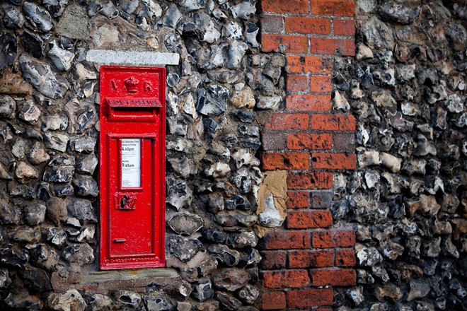
The brick and flint building on the corner of Mill Lane and the High Street exhibits a distinctive and unusual curved corner and a long cat slide roof. This cottage is also an excellent example of flint stones used as a local building material.
White flints are formed as nodules within the chalk and assume an endless variety of bizarre shapes, varying in colour internally from lustrous blues to darkest black.
You often find flints in barns, garden walls and churches, as well as many domestic dwellings wherever chalk is the dominant underlying geology.
Often flint nodules were used ‘as picked’, straight from the fields to create rustic but solid walls in lesser rural buildings. However skilled craftsmen would ‘knap’ or cut the flints into more regular shapes to create higher quality architectural work, better exhibiting the flint’s intrinsic beauty, often in combination with bricks to strengthen the corners. You can look more closely at one historic example of a major flint building towards the end of this walk in Eynsford: the Norman castle that dates back to the eleventh century.
Being very hard and sharp, flints also offered our ancestors other practical and valuable uses not least for making tools and creating fire. Archaeological digs suggest that as long ago as 4,500 years black flints were being mined and fashioned into axes, saws, knives, scrapers and arrowheads.
Our route continues down Mill Lane back to the river. This lane was once a hive of industrial activity centred on the paper mill at the bottom of the lane.
The mill was powered by a waterwheel and used timber from local woodlands as a source of pulp. You can see the old Mill surrounded by trees, now converted to a private dwelling, sitting on a small man-made island.
At the bottom of Mill Lane turn left to pick up the Darent Valley footpath and continue left along the riverbank for approx 200 metres. Stop 9 can be read anywhere along the river path.
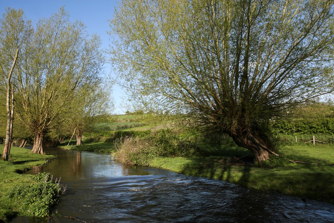
9 Riverside ramble
Walking along the river path passing alders and willow trees you soon leave Shoreham village behind. Next to the river are several willow trees which grow and thrive in locations where the roots are close to water. Every 10 to 15 years all the tree branches are cut off approximately 8 feet above the ground - an ancient practice known as pollarding.
At this height, cattle cannot reach up to eat the replacement shoots which, during the following spring, begin to grow as new branches that will ultimately become the next crop.
These pollarded branches are cut down and mainly used for firewood. The regular harvesting of timber under this management system results in ever increasing tree girths giving these trees their distinctive shape and form.
As I mentioned earlier arable crops requiring annual ploughing cannot reliably be grown in these fields within the valley flood plain because of the risk of flooding.
This land is better suited to growing grass continuously, known as permanent pasture, which needs to be grazed with livestock. Looking across the river between the tree branches you may spot a flock of sheep or a herd of cattle grazing these water meadows.
As you walk along this section you have great views out across the wider valley.
It is easy to imagine Samuel Palmer wandering along this path, perhaps by moonlight, wearing his greatcoat with the oversized pockets for carrying his paints and brushes.
Stop after about 200 metres when you reach a gate into a field on the left.
10 Landscape mosaic
To your left the view is of a traditional lowland English landscape farmed within a mosaic of fields and bordered by hedges or wooded copses.
These slopes are gentle in gradient with well draining soils that are ideally suited to cultivation by machinery.
Generally farmers will choose to grow cereal crops like wheat, barley and oats and perhaps an oilseed crop because they perform well on these soils rather than potatoes or vegetables which yield better if grown on deeper, more fertile soils with fewer stones or flints.
In order to care for the soil and maintain good yields farmers need to rotate their crops which means that from year to year any individual field may be growing a different annual crop.
Those closest to this footpath are often growing grass specifically for cutting in June or July to make hay to feed animals through the winter but rotations can mean that you will find them sown to wheat, barley, oats, oilseed rape or even linseed. In the distance the angle of the slope becomes steeper in places resulting in some very steep fields that are not easily ploughed so these are growing permanent grass that is in turn grazed by beef cattle.
So how can you identify which crop is growing? Admittedly, for much of the year many fields just look ‘green’!
Obviously if there are cattle or sheep grazing (or if there is evidence of past grazing such as fences or dung) it’s almost certain to be grass.
Next look carefully to determine if the green field has its plants growing in distinct rows; if it does then it is probably a cereal crop. Also if you spot ‘tramlines’ – regular unsown strips or tracks through the crop - then these provide another good indicator that the field is growing arable crop, not grass!
Typically wheat is sown in September and grows green leaves which cover the ground before lower temperatures halt growth and winter dormancy sets in. Warming soil temperatures in March start growth once again. In May the crop height noticeably increases and by June the ‘ears’ poke out above the leaf canopy. All of these crops will be harvested rapidly using a large combine harvester during July or August.
Identification of the different types of cereal crops can be tricky but it’s easiest around harvest time after the ears have appeared.
Wheat has tight, bare ears containing seeds, which are milled into flour for baking bread, biscuits and pasta, with some used in wheat breakfast cereals. Barley looks different, identified by its distinctive long whiskers. Barley grains are fed to livestock but large tonnages get ‘malted’ as an ingredient to brew beer or distil whisky. Oats have ears formed of multiple drooping branches each bearing individual seeds, which are used to make porridge, muesli and horse feed.
Oilseed rape looks like cabbage during the winter turning unmistakably bright yellow during the April flowering period, later growing tall and strong to form an impenetrable mass of branches bearing pods filled with small round black seeds until harvest in July. Once threshed these seeds are crushed to squeeze out a vegetable oil which goes to make healthy cooking oils or butter substitute spreads. In recent years some of the rape crop has been processed into biofuel as a diesel substitute. The leftover pulp from all these processes is used as a valuable ingredient in animal feeds.
Continue on the footpath for approx 700 metres, crossing through three fields, heading towards the line of tall poplar trees on the horizon. Go through a metal gate between the trees to walk on a slightly elevated track. Stop just before a brown brick house when you have a good view of hop poles and wires down to the right.
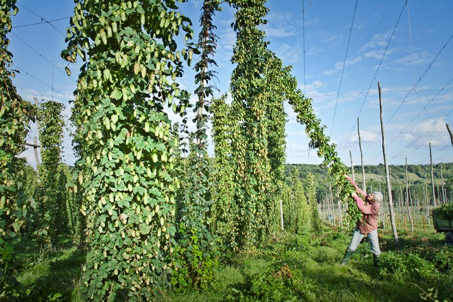
11 Let's go hopping
From the elevated footpath you have a great vantage point from which to look down on the network of wires, supported by chestnut hop poles that forms a hop garden. These hop poles would probably have been locally made from the chestnut trees you saw earlier up at Meenfield Wood.
Hops were first used from early in the sixteenth century as a regular ingredient for brewing beer, bringing preservative benefits as well as imparting flavour characteristics of both bitterness and aroma.
The popularity of beer during the 1800s resulted in hop growing flourishing as a profitable crop with small farms adding hop growing to their activities, hence the frequency of the distinctive round oasthouses on farms throughout Kent.
The industry expanded, notably in Kent and Hereford, because both regions were close to large urban populations providing the labour needed for hop picking every autumn. I have an ancient map confirming that hops have been grown continuously in this very field for some 300 years.
A hardy perennial plant, hops grow every year from the same roots by sending up over fifty shoots in April. Of these six are hand selected and ‘trained’ onto coir strings (made from coconut fibres). The shoots grow by twisting clockwise around the rough string and extend so quickly that they reach the top wire, a height of 16ft by the longest day of the year, 21st June.
Subsequently lateral branches grow out ready to bear the hops, which appear in August and ripen in September. Greenish yellow hop flowers appear singly and in clusters and the whole length is then known as a hop bine.
Once picked the aromatic hop flowers were transported in large hessian sacks called pokes to the oasthouses for drying.
Oasthouses have a conical roof capped with a white wooden cowl. The hops are dried in kilns using coal-fired burners. The updraft of hot air escaped out of the top of the building through the cowl.
Hop drying would continue throughout the night, overseen by a skilled oastman, ready for pressing into special tall sacks called pockets. Before 1960 hops were hand-picked by a small army of over 200 Londoners. Families set up temporary homes in rows of small corrugated iron ‘hopper huts’ on the farm.
Hop-pickers used their annual holidays to get some country air away from the smoky city, with a bonus of earning some extra wages.
Although difficult weather sometimes made the work tough and tiring for the pickers, camaraderie was high and today I still get the occasional visitor to Castle Farm who fondly remembers coming hoppin’ down in Kent.
Hop picking was mechanised on Castle Farm in 1960, with the bines then being cut and carried on a series of trailers to a fixed picking machine next to a modern drying oast.
Market prices for hops are notoriously volatile, sometimes falling below the cost of production. By 1999 prices were so low that I was unable to viably compete with the prices of imported hops so I decided to cease growing hops for brewing.
Nevertheless hops have retained a place on our farm and are still being grown specifically for the decorative market as dried hop bines. Nowadays you’ll often see them hung up in pubs and decorating country kitchens or wedding venues.
Continue past the hop field and houses until you reach a road. Carefully cross the road and take the steps slightly up to the left onto a permissive footpath. Follow the path round to the right (alongside an elm hedge) until you see a sign to The Hop Shop. Cross the bridge into Castle Farm.
12 Cattle and apples
As you walk over the bridge into Castle Farm you will see water meadows upstream on your right and downstream beyond the model windmill.
Cattle can normally be seen grazing these permanent pastures between April and October but in winter these fields can easily flood as rains swell the river and grass growth slows and it can no longer sustain a grazing herd. Conditions quickly become too muddy therefore throughout the winter all our cattle are housed in purpose-built buildings on comfy straw and fed on hay, silage and cereal proteins.
We buy native beef breed calves such as Sussex or Devon or Angus after they have spent six months or more suckling from their mother down on the southern coastal marshes. They contentedly graze and grow on until they are ready for marketing at approximately two years of age and will have experienced excellent welfare standards throughout their life. All our beef carcasses are hung for a minimum of three weeks to develop tenderness and flavour in the meat and are sold through quality high street butchers and restaurants in London and the South East.
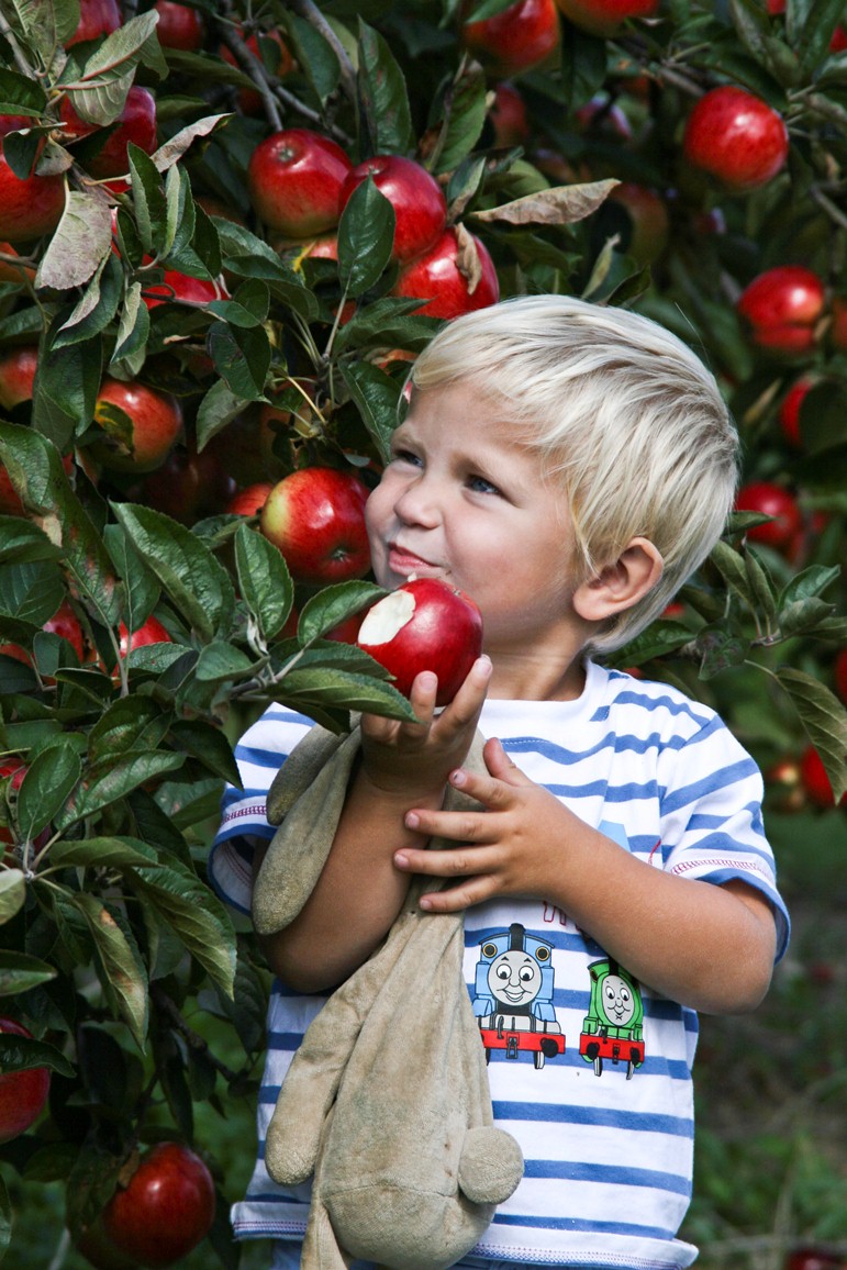
Fruit orchards are a familiar sight in the Garden of England. Historically these horticultural crops were grown in Kent to be close to London markets and a large urban population. Water retentive soils, slopes that keep the trees above any natural cold frost pockets, warm summers and growers’ skills are all factors which have combined to ensure that fruit production remains important in the county. Apples, pears, cherries, plums and cobnuts are just some of the fruity or nutty delights that Kent is known for.
Here at Castle Farm we have a small apple orchard growing ‘Norfolk Royals’, a rare and traditional variety that is a red, juicy, crisp eating apple at its most tasty when eaten immediately after picking. Although this walk route does not pass the orchard, if visiting in September or October you can follow signs to the nearby pick-your-own venue.
Find somewhere comfortable to sit outside the Hop Shop to read Stop 13.
13 Changing with the times
My grandfather grew his business by renting additional acres and when the opportunity arose in 1932 he purchased Castle Farm.
It was a mixed farm with many different but complimentary enterprises including a dairy, wheat, oats, beef cattle, fruit (apples & plums), vegetables (potatoes, swedes and savoy cabbages), as well as hops and clover for hay.
A few years later the outbreak of World War II emphasised the importance of Britain having an efficient agricultural industry.
My grandfather chaired one of the Regional Agricultural Executive Committees (War Ags) that were created to co-ordinate ploughing up grassland and encourage the latest farming techniques, all targeted at increasing food production. Nationally, this concerted effort raised the country’s selfsufficiency from 50 per cent to 75 per cent in a few years.
Modernisation and mechanisation continued after 1945. Tractors rapidly replaced horses as the main source of farm power, leading to falling numbers of agricultural workers as manual work was reduced by engine power.
My father continued the family tradition of being an early adopter of the latest farming techniques with the resulting increases in our crop yields and overall productivity. The business expanded as opportunities to buy or rent neighbouring land appeared and he adjusted the mix of farm enterprises to those that he found performed best.
The pedigree dairy herd and cereal crops were increased while the least profitable enterprises such as potatoes and vegetables were dropped.
I took over the management of Castle Farm in 1976. A decade later, together with my wife Caroline, we set out to diversify the farm’s activities. She can tell you more about these new developments...
Caroline: Firstly we introduced dried hop bines as a new and unique product for decorative use into the floral market whilst continuing to supply hops for brewing. In 1987 we began trading as The Hop Shop and quickly expanded this new venture, soon growing over 70 species of flowers specifically for drying.
In addition to supplying our dried flowers to wholesalers and high street shops we marketed them direct from the farm shop. We started in a converted garage and later transferred into a reconstructed cattle building (moved from a farm in Sussex) to create our current ‘Hop Shop’.
Here we were able to promote our farm produce (honey, beef, and apple juice) as well as foods from other local producers. So we were able to get local links with the artisan food producers around Kent.
From The Hop Shop retrace your route back over the bridge, across the lane and onto the field footpath. Turn right to continue along the path bounded by a fence on your left and the road on your right. Stop on the footpath at the bottom of a lavender field.
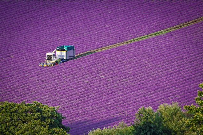
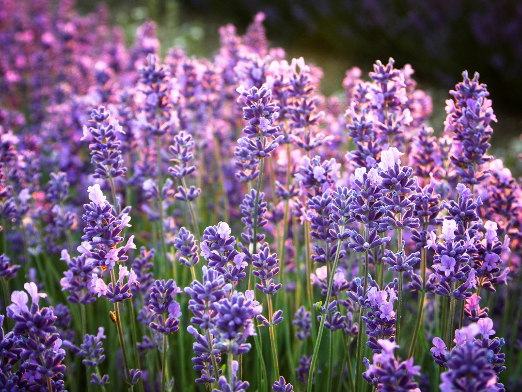
14 Purple haze
This footpath now takes you along the bottom of my youngest lavender field, planted in 2011. Lavender is immediately recognisable by the distinctive hedges, spaced almost 2 metres apart, stretching into the distance.
This particular field has over 30 miles of lavender hedges, which will take 6 years to grow to full size and produce the best oil yields. Growing lavender requires patience. The results are not immediate but once matured and ready the fields then should remain productive for a further 10 years.
All of the 130,000 plants in this field have been planted through strips of black plastic which confers multiple benefits to the crop. Plastic reduces weed competition, conserves soil moisture and enhances plant growth by keeping the soil just that little bit warmer. The chalky soils on these sloping valley sides suit lavender ideally, being alkaline and free draining. These conditions are similar to lavender’s native limestone hills around the Mediterranean.
Although lavender bushes may appear rather grey/brown throughout the winter, in April fresh green leaves unfurl followed by a first mauve haze of flower buds appearing in late June. The colour becomes more intense by the day until, in late July, the sea of purple flowers looks simply stunning. Warm sunny weather helps to build oil content within the plant, which peaks around full flowering. A specialist harvester is used to cut and collect the flowers into large trailers, which are immediately transported to the farm distillery, where steam is used to extract the precious aromatic oil.
Currently Castle Farm grows over 75 acres of lavender, but we are at the centre of a small cooperative of Kentish growers and we distil over 200 acres of cut lavender here every summer. If the air here has a heavy scent in July its because there is more lavender grown in the Darent Valley than anywhere else in the UK!
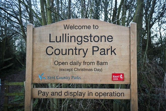
Continue along the footpath att the bottom of the lavender field. Leave the field via the corner stile which brings you to Lullingstone Visitor Centre. Refreshments and toilets are available here.
15 From private estate to country park
We’ve stopped here to point out the estate of Lullingstone Park up to your left. In Norman times this area was a true native forest from which only a few of the original trees remain today. Some veteran oak, beech, ash, hornbeam and sweet chestnut trees all still survive, some thought to be over 500 years old, making it one of the most important sites of ancient woodland in England.
In medieval times the parkland was part of the private estate of Lullingstone Castle and was managed as a deer park, surrounded by tall metal fencing designed to contain the high jumping deer. King Henry VIII was a regular visitor, staying at the castle and hunting in the park.
Kent County Council now manages the 460 acre Country Park. It’s open to the public so you no longer have to be a lord or a king to enjoy strolling through it. There are walks, picnic spots, visitor events and educational activities for children. It’s a good illustration of how ownership and usage of land often changes over the centuries.
When you are ready follow the path back down to the river marked as the Darent Valley Path and continue left, towards Lullingstone Castle. As you walk along the riverbank here, notice that the Darent is wider and straighter with a different character compared to the meandering riverbank we walked along earlier.
This section from the Lullingstone Visitor Centre to the castle has had the river position artificially moved and straightened over the centuries in order to manage water flows and create waterfalls to power various mills. More recently, the river bed was moved away from its natural route flowing along the lowest part of the valley bottom in order to by-pass the area from which gravel was extracted in the 1950s. The excavations were left to fill with water and create the artificial trout lake you may be able to see beyond the opposite bank of the river.
From the Visitor Centre take the the footpath left alongside the river signposted as the Darent Valley Path. Stop when you reach the gatehouse of Lullingstone Castle.
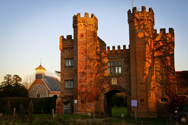
16 Royal robes
Lullingstone Castle is the home of one of England’s oldest family estates. The present Manor House and Gatehouse were built in 1497 and have been lived in by the same family, the Hart-Dykes, ever since.
To the left of the manor house you can see the charming parish church of St Botolph’s. This parish church of Norman origins contains some of the oldest stained glass windows in England.
The main reason for stopping here, however, is to tell you about another agricultural venture.
In the 1930s England’s first silk farm was established here with much of the house taken over to breed hundreds of thousands of silkworms. More than 20 acres of the estate was used to grow mulberry bushes whose leaves are the staple diet of silkworms. All the silk processing took place within the castle.
Silk became a flourishing business and produced silk cloth for the late Queen Mother’s coronation robes in 1937, for the current Queen’s wedding dress in 1947, and for the robes in her subsequent coronation in 1953.
The silk was also used to make parachutes for use in the Second World War. This silk enterprise is yet another example of diversification, again demonstrating how agricultural practices and land use change over time.
In 2005 Tom Hart Dyke added another chapter to the history of Lullingstone by creating in the walled garden, the UK’s first ‘World Garden of Plants’ containing some 8,000 plant species, cultivars and hybrids planted within a huge garden map in their respective countries of origin. Opening times are listed on a sign on the wall of the splendid brick gatehouse.
As you walk on beyond the estate you will pass grass fields on your right which once grew arable crops but are currently used for horse grazing. Horsiculture or ‘the practice of keeping of horses for leisure purposes’ has today become a significant land use, especially close to urban centres of population.
These paddocks are well managed but in other locations the division of land into small plots under fragmented ownership can result in the appearance of unsightly shelters, inappropriate fencing, over or under grazing of land, together with the permanent siting of brightly coloured show-jumps in open fields and other paraphernalia associated with the use of horses for leisure.
As you walk down the lane look out for further examples of farm diversification. Several redundant farm buildings have been converted into new uses. There are stables to accommodate the horses you saw in the paddocks and the long, dark, weatherboarded building once a large grain store has been converted and upgraded to provide several modern, rural office units.
Continue straight along the road, passing Mulberry stables and a converted oast house. Stop when you reach Lullingstone Roman Villa.
17 Enter some Romans
Earlier at the Visitor Centre we talked about the ancient woodland dating back to Norman times in the eleventh century but the history of settlement in this valley goes back much further. This building houses the remains of a Roman Villa which was inhabited from the late first to early fifth century AD.
Lullingstone is one of a string of Roman villas that were built in or near the Darent Valley. There may once have been as many as ten villas in this valley alone.
The Romans chose this area because it was close to both London to the west and Canterbury and coast to the east. You have to imagine that the meandering river Darent was then a much wider, navigable river. Flat-bottomed boats linked Lullingstone to the Thames taking goods up to London by boat which was much quicker (and cheaper) than by road.
Just like we do today the Romans took full advantage of this landscape and used the land in very similar ways. Farming would have been mixed with livestock grazing the water meadow whilst the arable land of the wider valley was sown with crops.
Excavations have revealed plenty of evidence of domesticated cattle, sheep and pigs as well as hens and other fowl. The local woodlands were exploited by the Romans using the wood to build fences, tools and fuel and as areas to graze pigs.
From the Roman Villa continue straight along the road. Stop just as the road rises uphill and a smaller road joins to the left. You should have a good view of the meandering River Darent.
Note: If you wish to shorten the walk here there is an option for a shortcut to Eynsford station. Turn right in front of Lullingstone Roman Villa then cross over the steel framed bridge. Follow the unsurfaced road, which is a public footpath, up to the main A225 road. Here turn left to walk along the grass verge, under the bridge before turning right up to Eynsford station.
18 Wooing wildlife
As you leave the villa behind and continue along the road ahead, to your right there are fine views over the river Darent as it meanders through the flood plain meadows, edged with a few willow and alder trees.
The rich alluvial soils in the field beyond the river are above the floodable zone, only by a few metres, but high enough to be safely cultivated for growing arable crops such as wheat and rape.
A little further on, just before the Darent flows beneath the viaduct, keep your eye out for a small area growing reeds and wild grass on the opposite riverbank. This land has a history of occasionally flooding so it’s been taken out of crop production, separated from the adjacent arable field and managed purely as a wildlife habitat.
Most farmers now undertake practical measures for environmental protection and habitat enhancement like this, making conservation an integral aspect of their business. Traditional options such as tree planting and hedge restoration are often these days only the basis of wider, whole farm stewardship schemes that create and manage a lattice of land areas as wildlife habitats.
You may have noticed six metre wide grass margins around the perimeter of certain fields. These strips provide a habitat that is attractive to wildlife, encouraging populations of insects, butterflies, small mammals and birds. Margins in adjacent fields join up to provide continuous wildlife corridors that I sometimes refer to as wildlife motorways, linking together larger natural habitats and woodlands.
Continue along the lane and stop by the red brick viaduct.
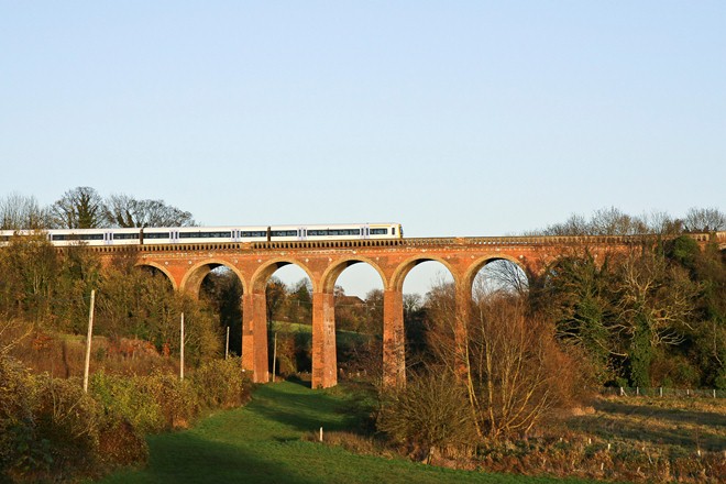
19 Lucky escapes
Your walking route will shortly pass beneath the splendid brick viaduct carrying the Victoria to Sevenoaks railway line which was opened in 1862. This rail link to London enabled farmers to receive deliveries of feed, seeds and horse manures, whilst the grain, milk and vegetable produced could more easily be transported into the London markets.
Individual travellers could also now use fast, direct transport into the city, a benefit that initiated daily commuting and changed Eynsford from a predominantly agricultural community to a dormitory commuter village.
In the 1980s plans were announced to build a section of the M25, London’s orbital motorway, along a route that was uncomfortably close to this beautiful and special landscape. After a lengthy public planning enquiry the road was built but outside the valley itself, to the north closer to London.
Campaigns organised by local residents secured significant amendments to various design and constructional details. These hard fought for changes were effective in reducing some of the inevitable negative consequences of such a motorway - specifically in relation to the visual blight and noise pollution. Ultimately the M25 lowered the unsustainable traffic burden along the main A225 road that runs along in the valley itself.
A less familiar historical episode was the Darent valley’s lucky escape from being developed as a London airport. The proposal suggested that runways be constructed on top of the hill only 500 metres to your left. In 1937 surveys were done, plans were drawn, purchase options were agreed and an additional station platform was even built in readiness for the impending arrival of the construction workers.
This timetabled (but never used) platform still remains today, visible just before the Swanley tunnel on the up-line side (going towards London). Then the Second World War intervened. My father narrates how, after the war he personally removed the wooden runway marker pegs from these fields as the focus had shifted to west London to a place called Heathrow!
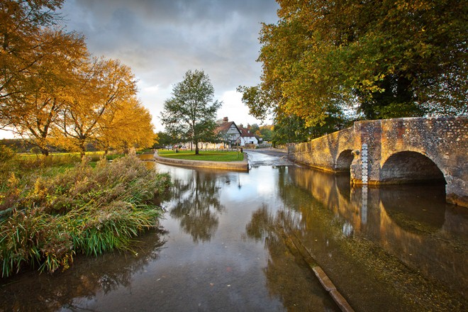
Continue along the lane into Eynsford village. Stop near the bridge and ford.
20 Picture postcard
Eynsford bridge, ford and the Tudor cottage regularly feature on postcards, calendars and biscuit tins. This pretty scene attracts many visitors to the village who, on fine summer days, occupy the grass riverbank as if it were a beach.
The narrow humpback bridge, with its distinctive pedestrian escape niches was built in the sixteenth century and dedicated to Saint Catherine, the patron saint of bridges. If you look carefully on the upstream side you might be able to make out a small protruding stone, once the carved head of Saint Catherine.
We’re coming to the end of our walk now but there is more to explore in Eynsford village. You might like to visit Eynsford Castle which is managed by English Heritage. It was once a strategically important defensive stronghold on the route from London to the coast. The high, featureless curtain walls were built around 1100 with the local flints we saw earlier, unknapped but laid carefully in courses. Excavations suggest that a timber watchtower once stood in the centre of the motte.
The Parish Church of St Martin (just ahead of you) is also worth a visit - it has an illustrious history that stretches back to the twelfth century and earlier.
If you are going to the station, as you walk up the hill you will pass the few surviving trees of what used to be an avenue planted as a mnemonic. Originally the initial letters of consecutive trees spelt out words (e.g. Thorn + Holly + Elm, spelling THE) to form a quotation from Robert Browning: ‘The best is yet to be, the last of life, for which the first was made.’ It’s rather hard to make out now as new trees have grown up in between but it’s a nice piece of village eccentricity!
Well I hope that you have enjoyed your visit to the Darent Valley. We began by exploring Shoreham, immortalised by the visionary artist Samuel Palmer, before climbing to the cross on the hill for birds-eye views up and down the valley.
Here I explained how geographical factors determine why the landscape is used to grow what you see today. We learnt, for instance, that the flood plain area next to the river is best suited to grazing cattle, that the gentle slopes of the valley with their lighter soils are suited to arable crops like wheat, barley and oats, while the heavier clay soils on the hilltops have been left as woodland for timber production.
The main section of this walk was through farmland near to the river, where I related how farming is ever changing, illustrated by my own family experiences. Farming practices have changed hugely in the 120 years since my great grandfather emigrated from Scotland with his herd of 17 Ayrshire cows. Most manual work and horses have been superseded by tractors and mechanisation that has resulted in many fewer people being employed on farms, which have increased in size and generally become more specialised with fewer enterprises.
At Castle Farm I described how my own agricultural business has sought and embraced farm diversification opportunities, specifically by changing the emphasis of our production from hops to lavender, hence the title of this walk.
I very much hope that you are leaving with an improved knowledge about farming and land use as well as a better understanding of how natural landscapes such as the beautiful Darent Valley are actually being managed. Remember that much of what you have learnt today is not only relevant to the Darent Valley but should also help you understand what you see wherever you go in the countryside.
To return to the railway station cross over the river then turn right onto the main A225 road in front of the church. Follow the pavements up to Eynsford station at the top of the hill. You can catch a train back to Shoreham or towards London. Alternatively you can walk back to Shoreham.
Your browser is out of date, and unsupported by this website. Please upgrade to the latest version to use this website.
The rolling hills and deep valleys of the Darent Valley were described by artist, Samuel Palmer, as an ‘earthly paradise’. But this slice of Kent, just a stone’s throw from the capital, is more than just a beauty spot.
- Join local farmer William Alexander to explore a rural landscape of rolling hills, deep valleys and meandering rivers - Find out why crops including apples, hops, wheat and lavender flourish here in the 'Garden of England' - Discover a Norman castle, a Roman villa and a feat of Victorian engineering
Follow the walk by clicking on the map pins or downloading the guides below
"But as in a long sultry walk we choose out shady places now and then, to sit down in, so I think none will agonize so effectually as those who take the mental bath and balsam of a little daily leisure"