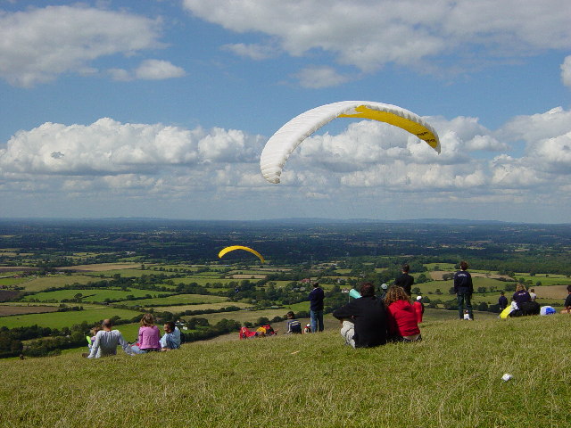
With stunning unbroken vistas all the way to the Surrey Hills in the north and the Isle of Wight to the south, it’s no wonder this is one of the best-loved viewpoints on the South Downs. John Constable famously described it as "the grandest view in the world".
It's certainly a popular spot. From here hang gliders, kite flyers, picnickers and walkers all enjoy the view. But how many of them really understand what they are looking at? On this trail we'll go beyond the view and delve into the highs and lows of the Downs to find out how they formed, what shaped them and how this natural wonder was turned into a tourist trap for Victorian daytrippers.
Before we step away from the traditional view, take a look ahead across the low-lying land to the line of hills on the horizon. These are the North Downs which stretch from Farnham in Surrey to the White Cliffs of Dover in Kent. The North Downs and the South Downs, on which we are standing, are made of the same white and relatively soft rock – chalk. In between is the flatter land of the Weald, made up of layers of clay and sandstone.
Directions
From the car park pass the Devil’s Dyke pub on your left. Go past the bus turning circle and follow the path alongside the road. Go through a gateway on the left and continue down through the trees into the valley. Go through a kissing gate and find a bench with a view of Devil's Dyke below.
2 Bench with view into valley
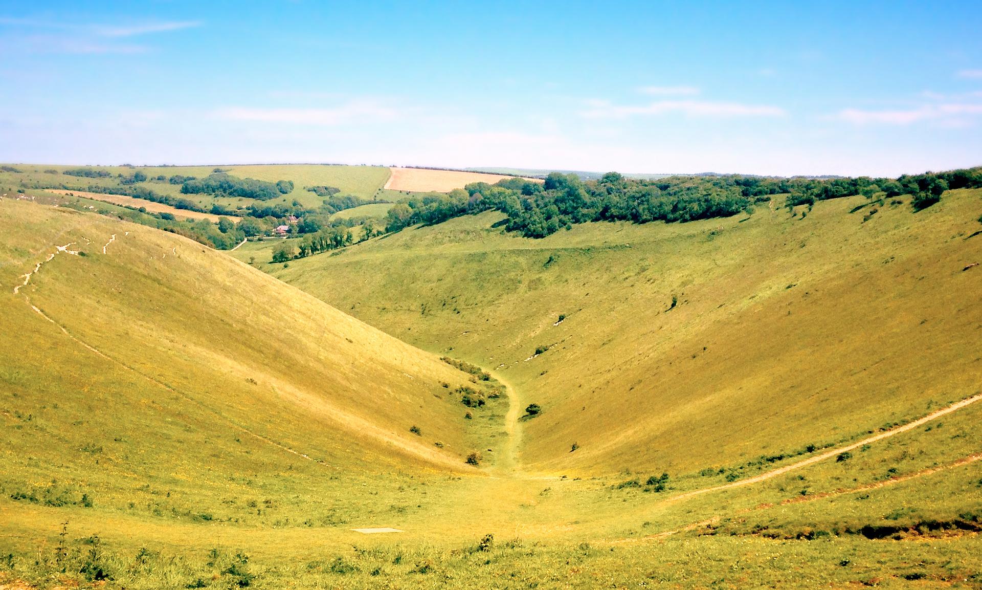
This is the Devil’s Dyke, the longest, deepest and widest dry valley in Britain. It’s a perfect 'V' shape, a graceful gorge carving its way sinuously through the hills with steep, curving slopes on either side. But there’s something missing. You would normally expect a river to have carved out a deep valley like this one, but the Dyke is completely dry. Where is the water?
For the answer, we’ll need to think about what’s under our feet and travel back in time to the last Ice Age.
The North and South Downs of England are made of chalk which is a porous rock (i.e. water can pass through it). In the icy, glacial stages of the Ice Age, which together lasted some 2 million years, southern England was in the grip of tundra conditions, like much of Alaska today.
Further north, vast ice sheets and glaciers covered the landscape, but they did not reach this far south. In tundra areas the soils and rocks beneath froze down to depths of 30 metres and more. This changed the very nature of the chalk. From being a porous rock, chalk became an impermeable rock (one which water cannot pass through).
During the Ice Ages there were brief summer months. The top layers of rock and soil melted, creating a watery sludge that flowed and slid downhill across the frozen ground beneath, carving out valleys.
That is how the Devil's Dyke formed and why you do not see any water flowing in it today. It is a classic 'dry valley'.
You can see from here that the valley floor bends away to the left. This would have been the path of natural flow and least resistance for the summer meltwaters.
Directions
Take the path down through the deepest part of the valley following in the footsteps of the ice. Notice the chalk under your feet and the outcrops of chalk on the hillsides. When the path narrows and bends left, you will reach a gate on your right. head towards it then double back along a grassy track up to your right. Follow it uphill towards a line of trees (with the Dyke on your right). At the summit, cross a stile on the left. Continue across a field towards a group of red tiled buildings (Saddlescombe Farm).
When you reach a roadside parking area opposite Saddlescombe Farm, turn left along the grass verge. Keep the road on your right and continue for a few more yards to reach a public footpath sign on the left. Turn left down the grass bank here and go over a stile. Bear right to join the tarmac path which heads steadily downhill and swings right.
Just before the tarmac path begins to swing left you will reach a fork with a waymark post. Fork left here, to join the narrower stone path (marked with a black arrow) which runs alongside the power lines on the left. A little way along, the path swings right down into a tunnel of trees to reach a stile. Cross this and follow the path under the trees, taking care of the tree roots underfoot. You will emerge to a T-junction with a bridleway. Turn right and follow the path to reach a lake.
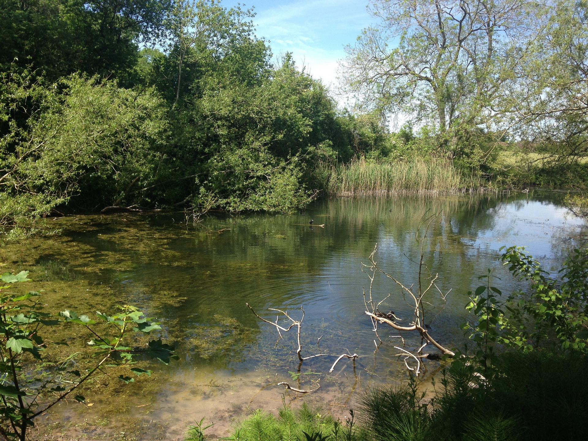
3 Poynings lake
As you walked down through the forest did you notice some muddy ponds in among the trees? And now we’ve reached a sizeable lake. We’ve finally found the water!
At the last stop we heard that the ground was frozen hard during much of the Ice Age and water couldn’t penetrate through the chalk. So instead it carved out the distinctive undulating dry valleys of the South Downs. After each cold phase of the Ice Age, temperatures warmed up allowing the ground to thaw completely. We are currently in one of those warm phases.
Chalk rock is porous, as opposed to impermeable rock which cannot absorb water. So rainwater that falls on the Downs is soaked up by the ground. The water slowly passes down through the chalk until it reaches the layers of impermeable rock at the bottom. Here that rock is Wealden clay.
Where the rock changes from chalk to clay, the water emerges as a series of springs. A characteristic of escarpments like these is a series of so-called ‘spring line villages’ along the base of the slope. The line of trees and villages along of bottom the escarpment indicate where people settled to take advantage of the source of fresh water.
We’ll be strolling through the village of Poynings next. Along with nearby Fulking and Edburton, it is a typical spring village in the foothills of the Downs.
Directions
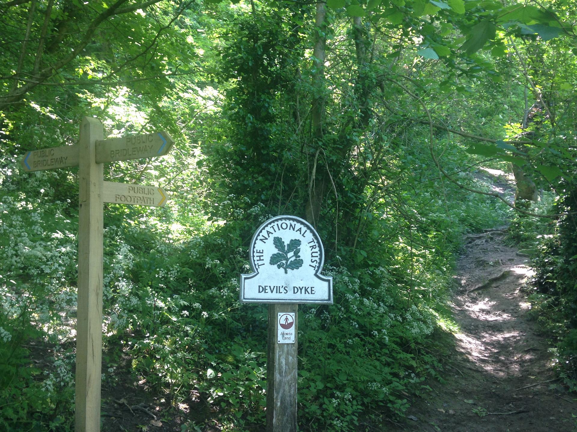
Continue past the lake down to Poynings village. Turn left along the lane, passing The Royal Oak pub and several houses. Immediately after Dyke Lane House, a half-timbered house on the left, turn left onto the signed bridleway along Dyke Lane. Follow the lane between properties and then keep ahead on the narrow stone path through the tunnel of trees.
At the top of the slope you will come to a fork in the path, with a National Trust sign. Keep right here and follow the path steeply uphill via a flight of steps. Take your time as the steps are uneven. At the top of the first flight of steps you will see a kissing gate on the right. Stop here.
4 Top of first flight of steps in the wooded ascent
Stop for a rest and catch your breath for a moment. It’s a steep ascent but you are climbing up a hill that was created during the same ripples in the earth’s core that created the Alps!
Around 65 million years ago the colliding of tectonic plates caused a phase of mountain building that created the Alps and the Pyrenees. These massive pressures in the earth’s crust rippled out towards northern France and southeast England. The chalk rock was gently folded and uplifted into a huge dome shape known as the Weald-Artois anticline.
The rocks in the middle of the dome were stretched and weakened. Over time they were attacked and eroded by rain, frost, wind and gravity. Two separate remnants were left behind on either side – the North and South Downs, which remain today as two distinct chains of hills running across the south of England.
Directions
Continue up more steep steps. As you emerge from the trees the gradient becomes less steep and you will have glorious views of the Downs.
5 Grassy slope with view of Downs
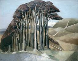
This grassy slope is the perfect spot to sit down, catch your breath and enjoy the stunning landscape of the South Downs. Rudyard Kipling once described them as the "blunt, bow-headed, whaleback downs". In some ways the curving valleys do look like a whale, or perhaps like a sheet billowing in the breeze. Painter Eric Ravilious spoke of them having a "beautifully obvious design". How would you describe them?
Our relationship to a place is always affected by how others have represented it. Painters like Paul Nash and Eric Ravilious were interested both in the capturing the unique form of the Downs but also in evoking its history and sense of timelessness. Many of their paintings show old winding pathways, hill forts and Stone Age remains that all celebrate an ongoing connection to the past.
The physical landscape, its diversity of plant and animal life, and such artistic representations can inform how we think of and see this landscape today, as a place to value and preserve.
Directions
Follow the narrow chalk ridge path. Take care as the slope down to the right is very steep. Some way along you will reach a fork, keep right staying on the main chalk ridge path as it climbs steadily.
Towards the top, the path swings left to reach a kissing gate. Pass through this and walk ahead across the grass to reach the car park and pub where the walk began. With your back to the pub, walk ahead to the derelict brick building.
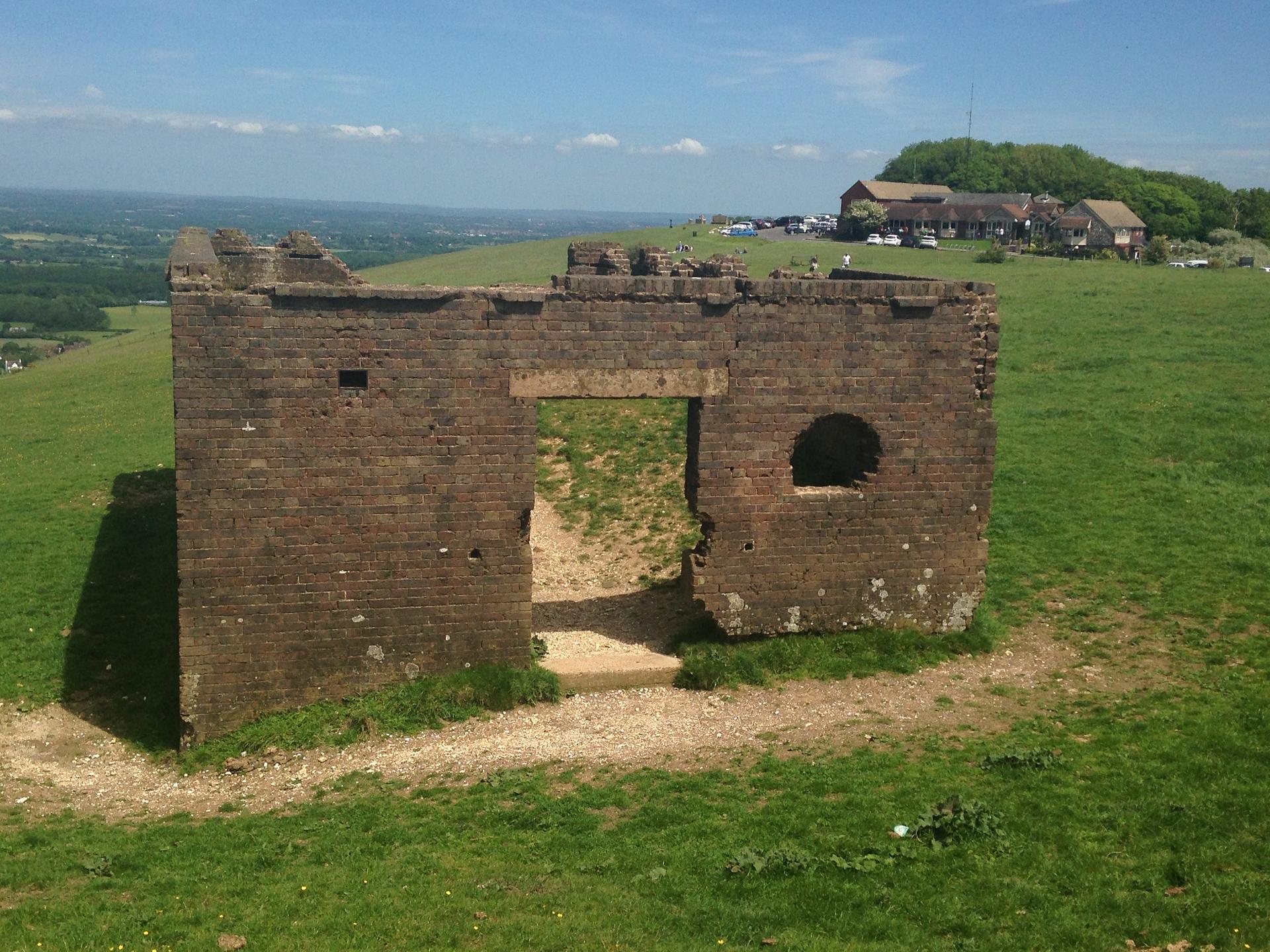
6 Derelict funicular railway building
Look around and see how many people you can spot enjoying the view or eating and drinking at the pub. This viewpoint is what people tend to associate with Devil’s Dyke. With its National Trust signs, paid car parking, restaurant and interpretation boards it’s this view across the Weald that has become the attraction and tourist honey pot.
It was the Victorians who first turned Devil’s Dyke into a beauty. They built a branch railway to transport sightseers to the bottom of the hill, as well as a steep cliff railway from here to Poynings and a cable car across the dyke itself. This derelict brick building is thought to have been the station for the funicular railway though other theories suggest it was built to store bombs during the First World War.
In 1898 The Sussex Daily News reported: "The Dyke has become one of the most popular pleasure resorts in the South of England…on entering the grounds, which have lately been enclosed, a casual visitor cannot fail to notice a marked improvement in the park-like appearance of the estate for trees and shrubs have been planted and a miniature lake with several species of waterfowl is to be found in place of the barren Downs’"
Though still bearing the traces of man’s involvement and reshaping, at least the Downs today have been allowed to revert back almost to their natural state. On a bank holiday, awash with daytrippers from Brighton, it can hardly be thought of as one of our wild places. But by turning your back on the ice cream vans and artisan ciders you can still find the real view – of the deepest, widest and longest dry valley in England, where it’s still possible to be awed by nature.
Your browser is out of date, and unsupported by this website. Please upgrade to the latest version to use this website.
A short walk around Devil's Dyke in the South Downs
Devil’s Dyke is a well-known spot for kite flying, paragliding and picnicking, with not one but three concrete markers (and a talking telescope) to point out landmarks near and far.
But this trail goes beyond the ‘traditional’ view to find the hidden stories of the landscape - from the Ice Age to the ice cream van.
Discover how the South Downs came to be here, what forces formed and shaped them and how the Victorians turned this natural wonder into a theme park.
Follow the trail by clicking on the map pins or downloading the guide below
.png)