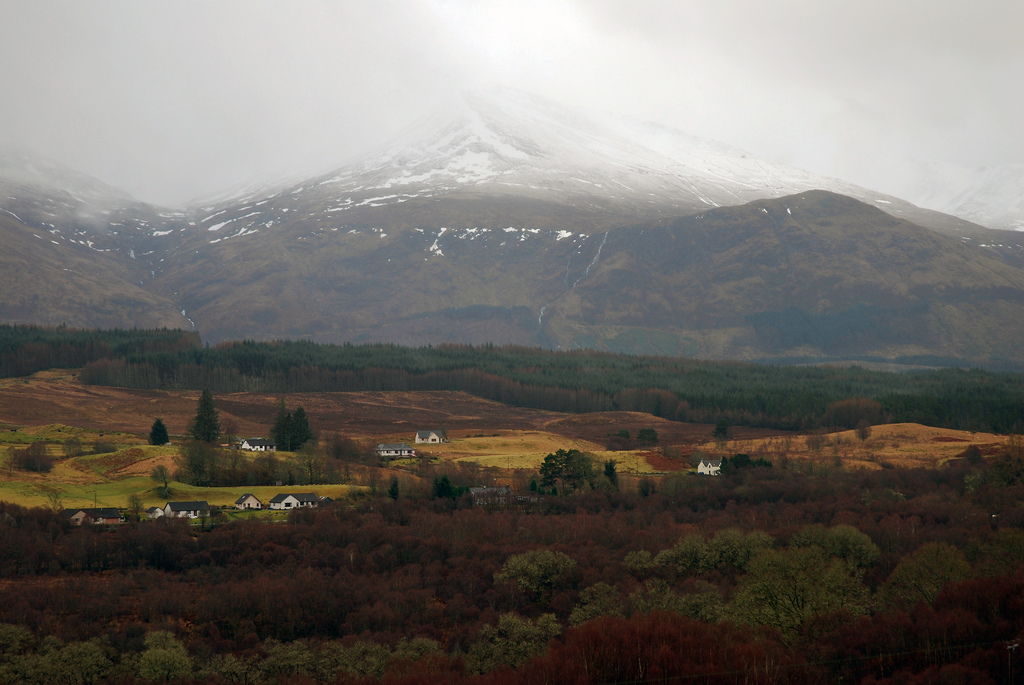
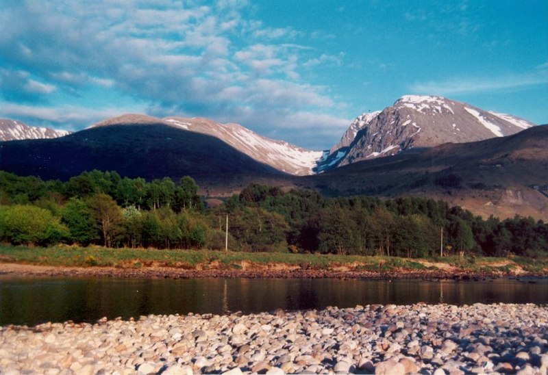
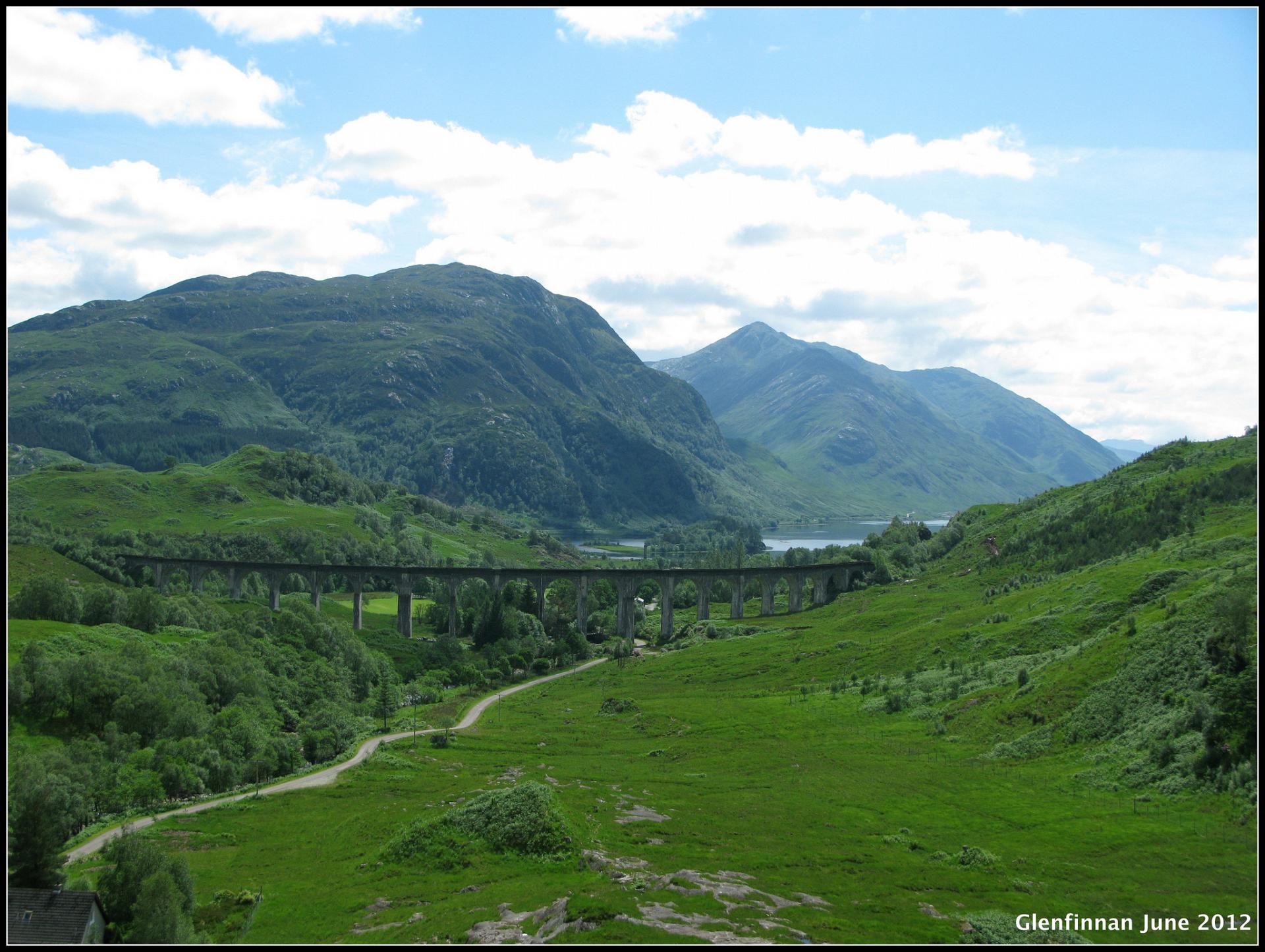
Look across the water and we can’t help but wonder at the mighty edifice towering above us. Ben Nevis is Britain’s highest mountain. At 4,413 feet tall, it easily dwarfs the highest in Wales (Snowdon at 3,560 feet) and England (Scafell Pike at 3,208 feet).
It’s not the only impressive mountain in Scotland. Ben Nevis is one of 227 ‘munros’. Munros are Scottish mountains over 3,000 feet high. It’s become a popular challenge for experienced walkers to visit or ‘bag’ them all. Ben Nevis is undoubtedly one of the toughest. The reason for this is to do with its geographical location.
In Britain, most mountains are found inland and in largely upland areas. This means that even when you are in a valley bottom, you are still starting your walk at a relatively high altitude. The starting point for most walkers who tackle Ben Macdui (Britain’s second-highest peak) is 600 metres above sea level.
If you walk up Ben Nevis, however, the normal starting point is a mere 17 metres above sea level. Some even begin with one foot in the sea so they can truly claim to have conquered ‘all of’ Nevis!
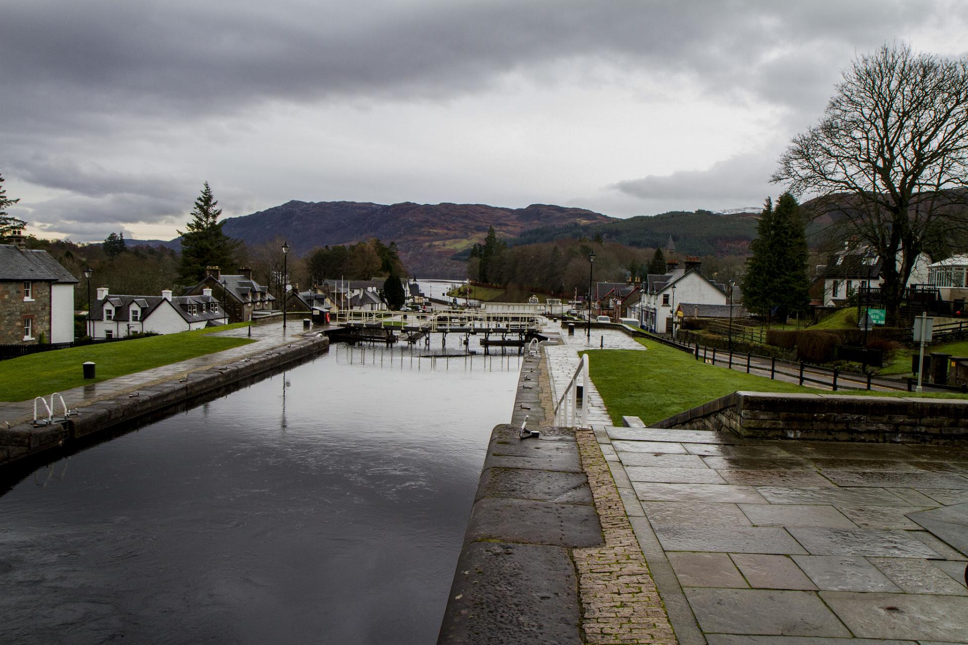
Walk towards one of the canal lock bridges. Stop in the middle and look at the canal.
2 Bridge over Caledonian Canal, Corpach Locks
We are now at one end of the majestic Caledonian Canal, a 60-mile cutting that slices through Scotland and connects the east and west coasts. Before the Caledonian Canal was built, any ships needing to get from one side of Britain to the other, would have to make a 700 mile detour around the top of Scotland, navigating the Outer Hebrides and Orkney Islands.
Exposed to the cold northern winters, with gusts of winds from the Atlantic Ocean battering the ships, the journey was fraught with peril. To avoid this lengthy and dangerous journey, a canal was completed by 1822. It linked Fort William on Scotland’s west coast with Inverness on the east coast, providing a much safer and quicker passage.
The Caledonian Canal also marks the western end of the ‘Great Glen Fault’. You’ve probably heard of the San Andreas fault in California, but did you know we have an equally famous one right here in Britain? Look at a map of the UK any you can’t fail to notice a great scar running across Scotland. It’s probably one of the most obvious topographical features of Britain’s landscape.
Between 400 and 425 million years ago, movements in the Earth’s crust (called tectonic motions) caused two types of rocks to smash into each other. When the two set of rocks collided, pressure built up so much that the older rocks on the north-western side ‘slipped’ relative to the younger rocks on the south-eastern side.
This ‘slipping’ happened within a few million years of the first collision but as pressure built up it happened a second time, approximately 100 million years later. It happened yet again just as the last dinosaurs were dying off 65 million years ago. The result is long ‘fault’ or crack visible from space!
This long fault in the Earth created what’s known as a ‘rift’ valley - the Great Glen. The Great Glen boasts four of Scotland’s great lochs: Linnhe, Lochy, Oich and the famous Loch Ness. The Caledonian Canal took advantage of the Great Glen. Since the lochs already existed here, two thirds of the route was effectively already complete, they just needed to dig canals to link up the lochs.
Continue over the lock bridge and cross over the canal. Follow the canal towpath on your left for approximately 2,000 metres, crossing below the A830 Road to the Isles, and walk up a slope alongside several canal locks. Stop at the top of the slope.
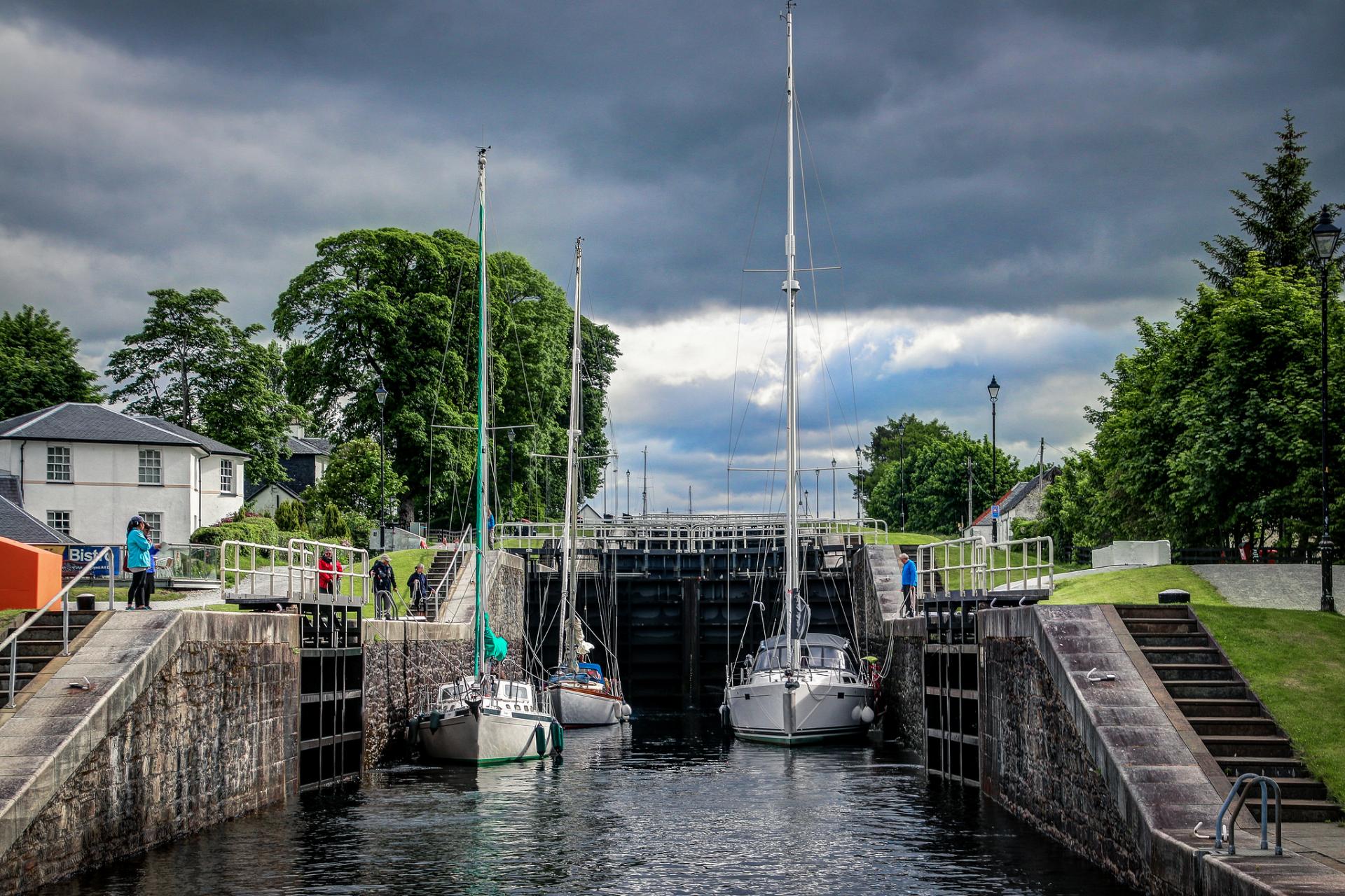
3 Banavie Locks (Neptune’s Staircase)
Although the Caledonian Canal follows the line of the Great Glen fault, it is by no means flat. To deal with the natural contours of the landscape, the engineers built 29 locks over its 60-mile length. Here we are at Banavie Locks, built at the same time as the canal. Today they are affectionately known as ‘Neptune’s Staircase’.
The staircase has eight locks which lift boats a total of 20 metres, making this the longest staircase lock in Britain. It is more economical to have eight locks close together like this, rather than spread out over a longer length. It means that three lockeepers (rather than eight) can work the eight locks together.
But why do boats need to be lifted to such a height? The answer is for safe passage to Loch Lochy. Between here and Loch Lochy, the canal passes over the River Lochy, the River Spean, two roads and a track, as well as coming close to a hydro-electric power station.
By building the canal up at the locks and constructing multiple aqueducts, the canal doesn’t need to interfere with the river. Similarly, newly installed roads and power production infrastructure don’t interfere with the boats using the canal.
The canal can though top up river in times of drought. This means businesses dependent on the river are not affected by changing weather or seasonal conditions.
Using the path between the third and fourth locks, walk east (away from the canal) through some trees. At the first crossroads continue straight then at the second crossroads turn left immediately after a house (you should now be about 140 metres from the canal).
After approximately another 100 metres, take the path to the right. This path is straight for approximately 200 metres before it turns gently to the right. It is then straight for a further 250 metres before it turns sharply to the left, with trees to your left and rough grazing to your right. The path then passes several buildings on your left as it loops slowly then more sharply to the right. Just as the path sharpens up, the River Lochy should be visible behind the houses. Stop here.
4 View of the River Lochy
At the last stop we found out that the canal helps to serve the river. But while the opening and closing of the gate between the canal and river can help manage flow, it cannot control the river’s natural processes. Two of these actions involve sediment being deposited and eroded on the banks of the river. We can see a great example of that here.
Generally speaking, when a river is straight the fastest flow is in the middle, where the water is deepest and there is least friction. When a river meanders, however, the water is pushed to the outside of the bend, making this the fastest and deepest part of the river. On the inside of the bend the water is much slower and shallower.
As the river slows on the inside of the bend, some of the sediment it carries is ‘dropped’ or deposited due to the lack of current. As this continues, the sediment builds up on the inside of the bend, making the river shallower.
The opposite is true of the outside of the bend. As the river is fastest here, it has a greater force and therefore scours out the river bed and bank in a process called erosion. As more and more of the river bank is eroded, the river effectively moves further and further out. in some cases a river can take a new course altogether.
Look beyond the house and you will see that a beach is forming on the inside of the bend. At the same time, the outside of the bend is eroding the soil, so the river is moving ever closer to the house. It’s worth remembering that while this landscape is blessed with water - and these lochs, rivers, canals and streams are a huge appeal for tourism and industry - water also has the power to destroy!
Continue along path, which is relatively straight for approximately 700 metres. The path kinks to the right just prior to Lochy Holiday Park then kinks right again shortly after passing the holiday park prior to reaching Lochaber High School.
Continue along the path, passing the front of the school, until you reach the A830 road you crossed beneath previously. Do not cross the road but turn left and walk along the pavement for approximately 375 metres, crossing the River Lochy and stopping between the roundabout and the petrol station on your left. Stop here.
5 Road to the Isles (BP) petrol station, A82
In addition to the canal and river running through the Great Glen, the main railway line to Fort William and the A82 trunk road also follow the line of the fault. Close to where we are standing, the beautifully scenic ‘Road to the Isles’ spurs off the A82 towards Glenfinnan and Mallaig. It is well worth a drive if you have the time.
Given the junction of these two A-roads, you can understand why a petrol station was sited here. But if we consider the potential environmental impacts, this location may not be as good as it first seems…
Almost all UK petrol stations have underground storage tanks for petrol and diesel. Over time, fuel is spilt by careless drivers, during tanker deliveries, or when tanks or fuel lines split. While small spills can be contained, larger spills will enter the soil and flow towards the nearest river.
With most petrol stations, the nearest river is some distance away. As a result, the amount of fuel entering the river is negligible. Here, however, the petrol station backs directly onto the river. This means spilt oil will drain through the soil and enter the water with a likely negative impact on fish, birds, animals, and people.
While it might not be our first thought, environmental matters like this are often under pressure in such stunning environments. Beautiful landscapes attract tourists who in turn need to eat, drink, and fill up their cars with fuel. Careful planning is needed to manage the impact of these visitors, make the area accessible and protect the environment that attracts people in the first place.
Carefully cross the A82 road heading towards the Ben Nevis Distillery. Stop on the pavement outside.
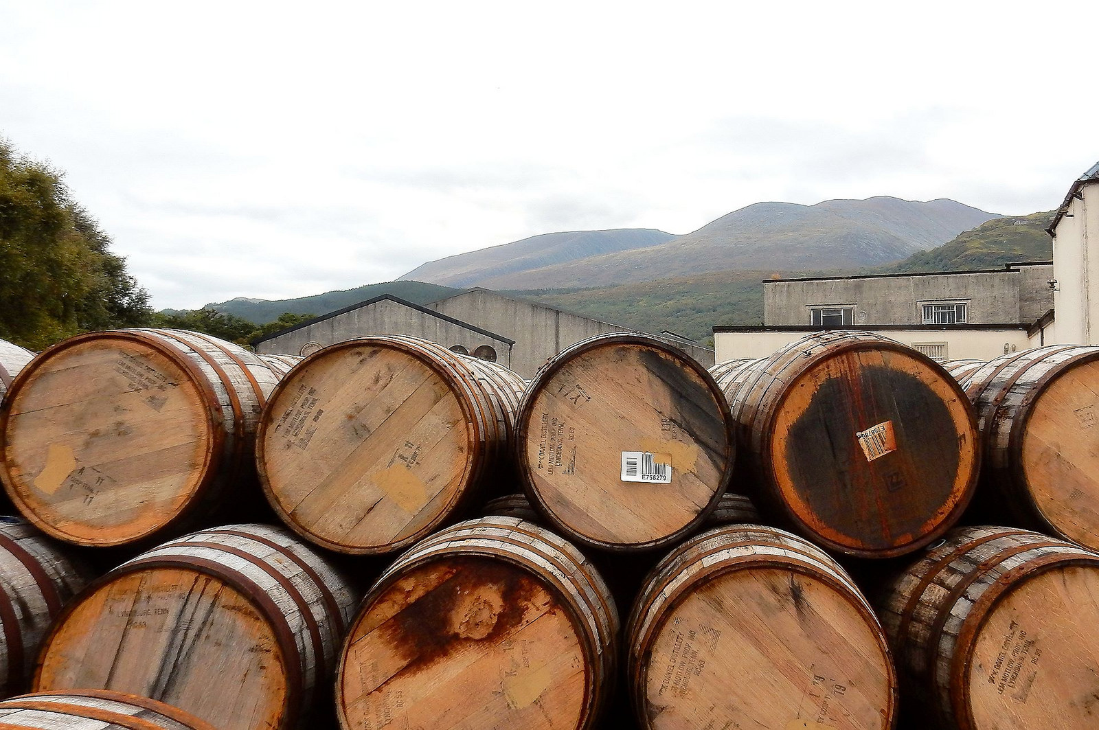
6 Ben Nevis Distillery
The white building in front of us is the Ben Nevis Distillery, one of Scotland’s 120 whisky-making distilleries. Whisky accounts for 85% of Scottish food and drink exports and the industry employs over 10,000 people, often in economically-deprived areas, making it one of Scotland’s most important industries.
The three ingredients for making whisky are water, barley and yeast. At the Ben Nevis distillery, the water used in the distilling process comes from two pools high up on the mountainside. This water flows down gullies on the north face of Nevis, before forming a large stream known as ‘Allt a’Mhuilinn’.
At about 10 metres, a small spur diverts some of the water out of the stream towards the distillery. Here it is added to fermented grain mash and distilled in wooden casks for a minimum of three years. Without the mountain and the stream that flows down it, the distillery wouldn’t be here.
Besides enabling whisky production, the geography here also hinders it! Scottish distilleries need a constant supply of water to operate all year round. Every winter, however, production at the Ben Nevis Distillery is suspended for anything from two to eight weeks.
This is because high up on the mountainside, the water in the two pools freezes and the stream’s flow all but stops. Without the water from the stream, one of the two main ingredients is absent and production is ceased. So you might want to grab yourself a wee dram while you can!
Carefully cross back over the A82 road then turn left and cross the A830 road. With the roundabout to your left, there should be a footpath immediately ahead of you. Follow this tree lined path which follows the bank of the River Lochy for approximately 350 metres, passing a clubhouse on your left. Cross the car park and after a further 35 metres you will notice castle ruins on your right. Walk into the middle of what was Old Inverlochy Castle. Stop here.
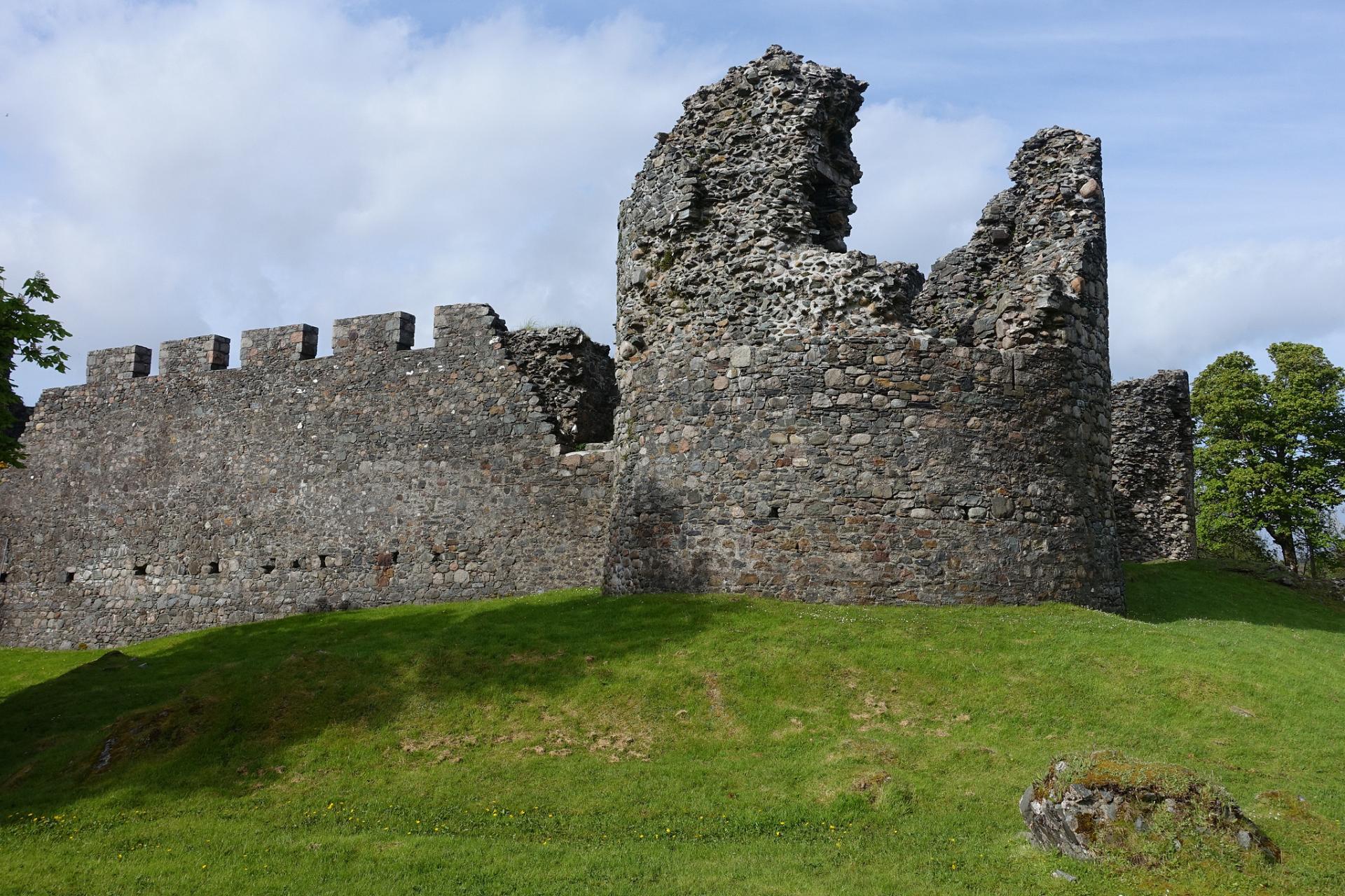
7 Old Inverlochy Castle
Castles, whether ruined or complete, are a key feature of the Scottish landscape and like the whisky distilleries, an important draw for the tourist industry. Although now a ruin, Old Inverlochy Castle occupies an important place in Scottish history.
In 1431 this was the site of the first Battle of Inverlochy, fought between the monarchy (King James I) and Alexander of Islay, the Lord of the Isles, for control over the Highlands. Over 200 hundred years later, in 1645, this was the site of one of the bloodiest battles on Scottish soil during the Civil War between monarchists and parliamentarians.
The castle was built here thanks to the local geography. The moat that surrounded the castle has long gone but Inverlochy’s location at the western end of the Great Glen, and its natural defensive position alongside the River Lochy, gave those defending it superior advantage.
Inverlochy Castle survived until 1654, when it was abandoned in favour of a nearby large timber fort. In 1690 the timber fort was itself replaced by a stone one named ‘Fort William’ after King William III. The town which grew around it was initially named ‘Maryburgh’ after Queen Mary II, though eventually it took the same name as the fort.
This sealed the fate of Old Inverlochy Castle, which fell into ruin. The ruins however have remained relatively undisturbed. Being so close to the river, no transport routes such as roads or railways have been developed here. On the other hand, the site of the stone fort which replaced it now has a main railway line passing through where it once stood!
After exploring the castle, leave the castle the same way you entered it. Turn right and follow the track for 25 metres. At the junction, turn right and follow the track (with the castle on your right) for approximately 130 metres where the track bends to the left and crosses a railway line. Follow the track as it bends left again. The track now runs parallel to the railway line. Follow this track for approximately 100 metres stopping when you are above a very straight watercourse. Stop here.
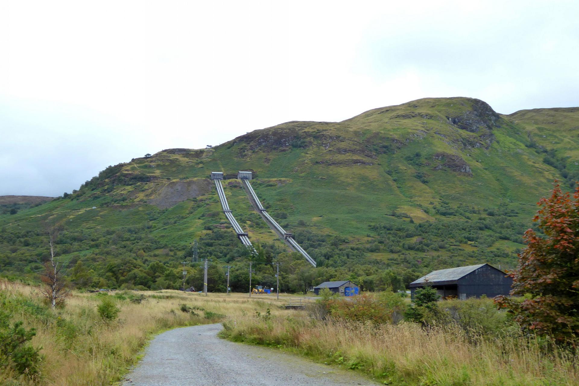
8 Hydro-electric power station watercourse
Do you notice something unusual about this stream? It is very straight and has a uniform width as far as the eye can see. Some maps label it as the ‘River Lochy’, but we saw the River Lochy earlier and it was anything but straight and narrow. This is not the Lochy, although it does join the river downstream from here. So what is it?
Look upstream and cast your eye up the hill. You will notice two very long, straight pipes running down the hillside. Between these two pipes and our watercourse is the Lochaber smelter, used for making aluminium. The two pipes serve two hydro-electric generating power stations, which provide the energy to run the smelter.
Floodwaters from the River Spey (over 27 miles away) are diverted into the Loch Laggan dam via the River Spean. A tunnel 2.5 miles long then takes this water into the River Treig and Loch Treig, goes around the Nevis Mountain Range, and diverts the water down the large pipes we can see on the hillside. Until 1970 the main tunnel was the longest water-carrying tunnel in the world.
At the bottom of the pipes a turbine converts the falling water’s kinetic energy into mechanical energy. Then a generator converts the mechanical energy from the turbine into electrical energy for use in the smelter. About 95% of the power generated is used at the smelter, with the rest sold to the National Grid. And the water? Well, after driving the turbine, it flows beneath the smelter and down the channel in front of us before reaching the sea; nearly 30 miles after its man-made journey began.
We hope you have enjoyed this watery trail around the landscapes of the River Lochy which provides a taster of the mountains, rivers, glens and lochs that make this area the ‘Outdoor Capital of the UK’. This is not, however, just a haven for outdoor enthusiasts. As we have seen, this landscape has provided resources for people to live and work here for centuries.
A combination of wilderness and beauty makes Lochy so popular among locals and tourists. It is not always easy working in such an environment. From the navvies digging out the canal in the nineteenth century to the distillers waiting for streams to thaw to make whisky, we have seen just how important the landscape, and particularly water, is for the people that call Lochy their home. And as water becomes an ever more pressing issue across the globe, we can appreciate just how special this liquid landscape really is.
The quickest way back to the start is to retrace your steps 100 metres then instead of crossing the railway lines follow the ‘Great Glen Way’ straight ahead on the footbridge across the River Lochy. Once across the river, the path meets the B8006 Kilmallie Road. Do not cross the road but turn left and follow this road for approximately 950 metres with the River Lochy on your left.
Turn left down Glenmallie Road, then at the end continue straight to follow the Great Glen Way footpath. Turn right so Loch Linnhe is on your left and keep following this footpath for 1,750 metres until it crosses the end of the Caledonian Canal and you will reach the start point.
Your browser is out of date, and unsupported by this website. Please upgrade to the latest version to use this website.
Locks, lochs, glens and Bens - this walk has it all. Despite being in the shadow of Britain’s tallest mountain, Ben Nevis, our route stays on the low ground to tell the story of a liquid landscape.
Find out how natural and man-made water courses have made this the ‘Outdoor Capital of the UK’ - a magnet for walking, sailing, skiing, swimming, kayaking and other outdoor pursuits.
Also discover another an attraction that holidaymakers rarely consider. Water is this area’s most precious resource, from industry to transport. Here, water is key for work and play - so come with us as we trace its path through this stunning scenery…
Follow the walk by clicking on the map pins or downloading the guide below
Corpach Locks are next to Corpach railway station. If driving, there is a small car park by the locks off the A830.
Keep an eye out for:
Common and grey seals in the lochs
Further information:
Explore more of the Fort William area with VisitScotland and more walks along the Great Glen Way long distance footpath with walkhighlands.
Fort William walk credits
Thank you to -
Chris Speight FRGS, CGeog, RGS-IBG Trustee / Councillor for devising and writing this walk
Caroline Millar for script edits
Jonny Baillie, Andrew Bowden, Herbert Frank, Frogtail images, Richard Law, John M, Duncan McNeil, Sean Munsen and Allen Watkin for images reproduced under Creative Commons Licenses