Welcome to this Discovering Britain walk in Aberdeenshire. It explores Bennachie, a hill much loved by the locals.
Many places in Britain have a landmark that is held in fond regard by local people. It may be something in the physical landscape such as a hill or a spectacular viewpoint; it may be a building such as a skyscraper or seaside pier.
Whether formed over millions of years by the forces of nature or much more recent in origin such landmarks are well-loved and much visited, in some cases becoming iconic of a place.
And so it is with Bennachie, a hill that has an important place in the hearts of local people. The late Lord Aberdeen wrote: ‘To Hell with your Alps, Rockies and Himalaya, Bennachie – the centre-stone of the County of Aberdeen – is the hill for me’.
Most of the books about Bennachie are not descriptive guides but rather love stories, eulogies from nearby residents who simply love looking at and walking on the hill. On this walk we will try to answer the simple question: why does a relatively modest hill – a mere 500 metres high and seemingly insignificant compared with hundreds of grander peaks in this part of Scotland – receive such unique adoration from those who know it?
We’ll find out about the hill’s geology and ecology, about its human history from the prehistoric people who used the hill to more recent exploitation of the natural resources. We’ll also hear folklore and legends associated with the hill, as well as extracts from poems and stories, all of which will help us to answer this question.
This walk has been created by Dick Bateman, a Yorkshireman who has also fallen under the spell of Bennachie on successive visits to his son and his family who live in nearby Inverurie.
With your back to the entrance of the visitor centre, turn right and walk a few steps to a colourful information board beside a signpost for various trails.
2 A hill or a mountain?
This area of Aberdeenshire between the Cairngorm Mountains to the west and the sea to the east is characterised by a gently undulating landscape of fields and woods.
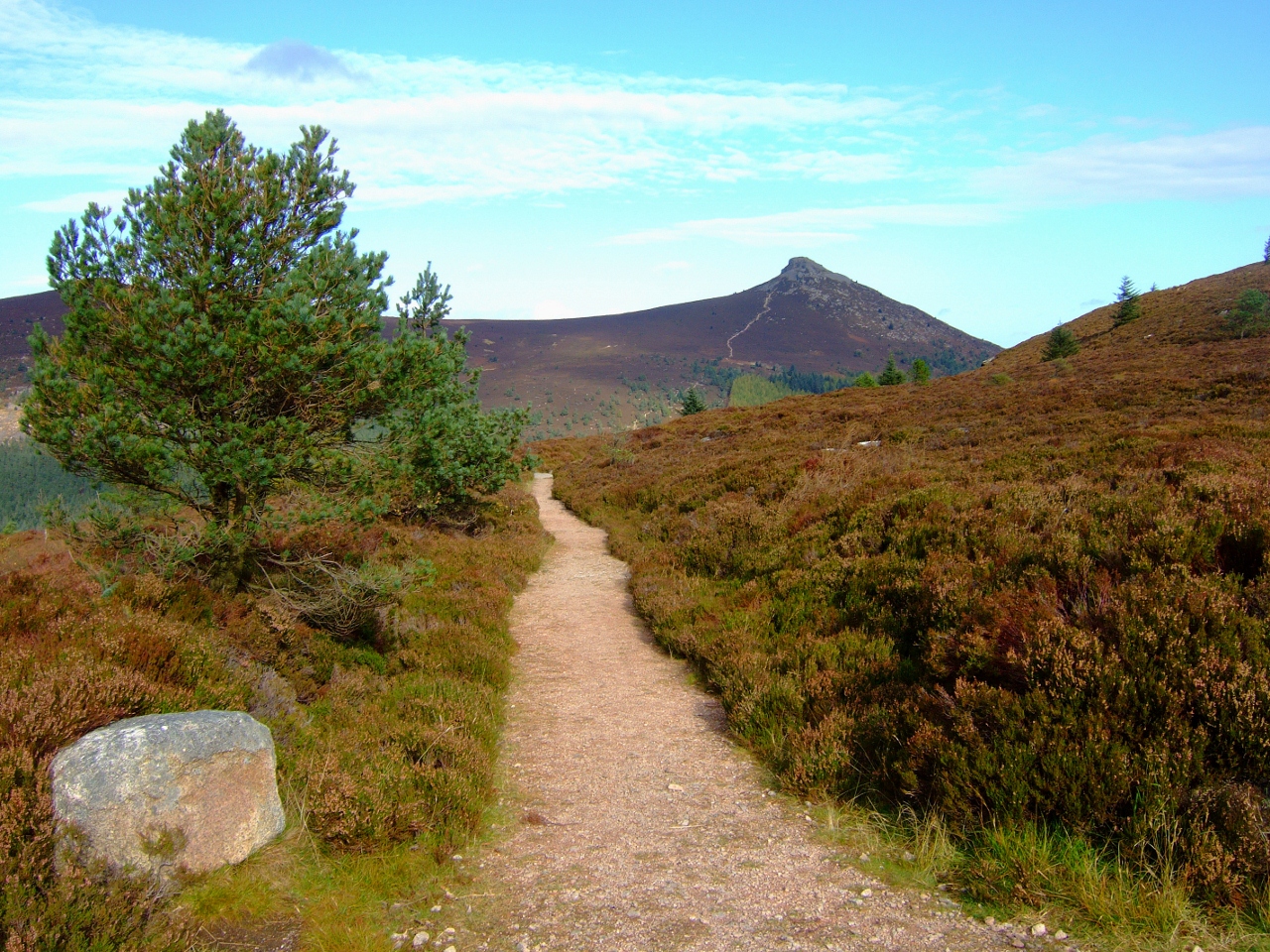
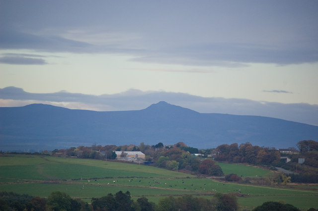
But standing on the skyline – from almost whichever angle you approach – is the distinctive ridge of Bennachie with its plateau top, the rounded summit of Oxen Craig and the distinctive conical peak of Mither Tap.
Bennachie is made of granite. In fact, it is part of a chain of granite outcrops that extends outwards from the Cairngorms into lowland Aberdeenshire. The highest point on Bennachie is Oxen Craig (Oxen Hill) at 528 metres followed by Mither Tap (Mother Top) at 518 metres.
So does this make Bennachie a hill or a mountain? Walkers generally regard hills over 2,000 feet (610 metres) as being mountains so that makes Bennachie a hill.
Even though it’s not very high compared to other peaks in Scotland it is distinctive due to its domination over the surrounding flat landscape.
In this respect it has similarities to several other much-loved hills such as The Wrekin in Shropshire and Glastonbury Tor in Somerset which also stand out in otherwise low-lying areas.
Follow the path signposted the Discovery Trail, Gordon Way Trail and Mither Tap Timeline Trail. After about 100 metres pass a similar signpost and continue straight on. At the next signpost, where the Discovery Trail goes off to the right, keep straight on. Then at the next signpost shortly after, where the Gordon Way Trail and Mither Tap Timeline Trail go off to the right, turn left on the unmarked path. After about 100 metres, just as the path starts to go down a dip, look for a signpost on the right for the Gouk Stone. Follow the grassy path for about 50 metres through the trees until you reach the stone.
3 The Bailies of Bennachie
This is the Gouk Stone. ‘Gouk’ means cuckoo in Doric, the dialect of lowland Aberdeenshire. In fact there are stones known as ‘The Gouk Stane’ at several locations across Scotland but there are various explanations as to how the name came about.
One is that when the Gouk or Cuckoo returns to Bennachie from spending the winter in Africa in March or April each year, this stone is the first place on which it comes to rest.
Look in the wall behind for a stone in the shape of a cracked cuckoo’s egg, which was created by a local sculptor, as well as the inscription ‘the calling of the gouk is the other side of spring’.
Other stories say that this stone was thrown down the hill by a giant – but we’ll hear more about him later. Whatever the origins of the Gouk Stone, this is a favourite spot for the many regular visitors to Bennachie and part of the quirky magic of the place.
You should have already gathered that Bennachie is a special place therefore it should be no surprise to discover that this hill has, what in effect, is a fan club called the Bailies of Bennachie. Harry Leil has been a Bailie for about 20 years.
Harry: “The word ‘bailies’ means guardians, so we’re the guardians of the hill. The Bailies were founded in 1973 and now there are about 3,000 Bailies.”
“There’s a core group who are actively involved in promoting and preserving the hill in various ways. Some people are involved in maintaining the footpaths and rights of way. Some are interested in studying the geology and ecology of the area; others in archaeological work. We do guided walks and produce books. We also collect literature, art and music concerned with the hill and have evenings of storytelling and poetry.”
“I got involved because I just love Bennachie. I’ve been coming here for about 40 years and it doesn’t matter how often you come – winter, summer, spring – every time it’s different. It’s just a magic place.”
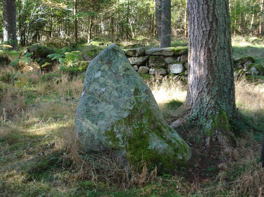
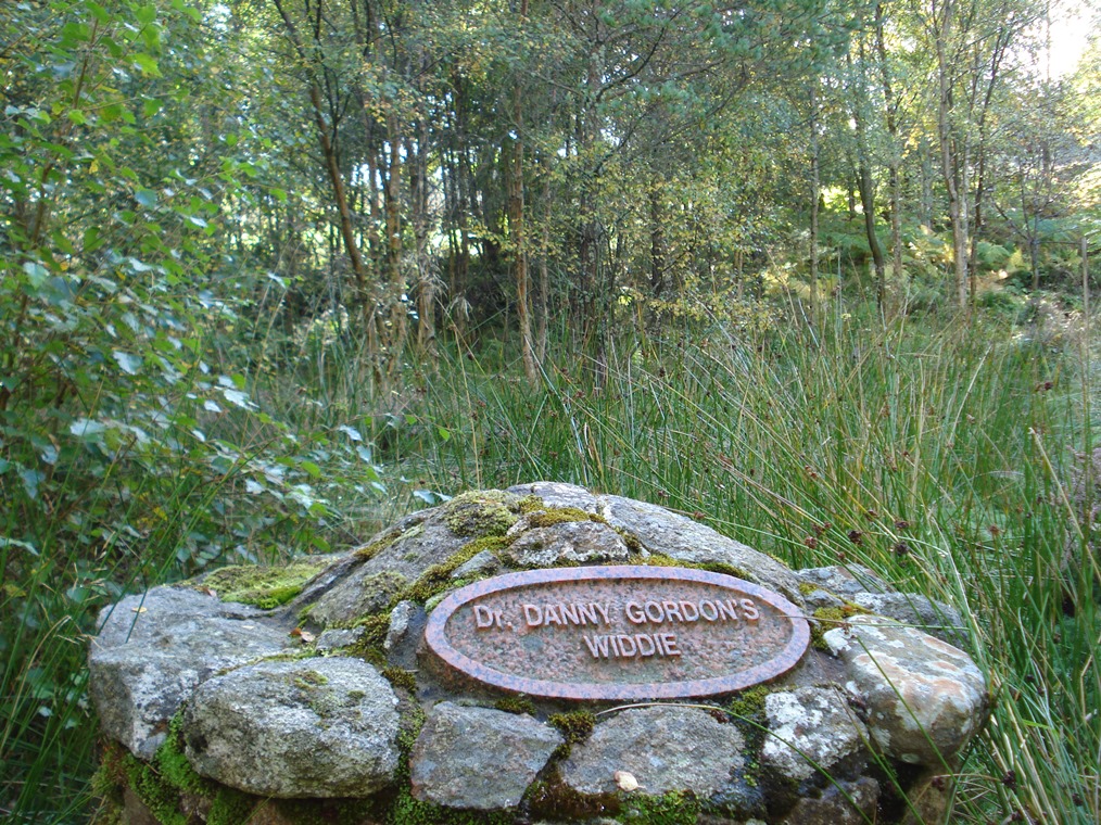
From the Gouk Stone, retrace your steps along the grassy path to the gravel path and turn right. After about 200 metres, look on the left side for a few stone steps down to a little bridge over the stream (Clachie Burn). Go across to the granite cairn marked with a plaque indicating ‘Dr Danny Gordon’s Widdie’.
4 A widdie and a plantin
At the last stop we found out about the Bailies of Bennachie, the group of volunteers that do so much to preserve, maintain, commemorate and promote this hill.
This plantation of native deciduous trees was established in memory of the founder member of The Bailies of Bennachie, Dr Danny Gordon.
Dr Gordon was a well-loved General Practitioner in the nearby town of Ellon and well-known as a raconteur.
One of his stories was about a local minister who was well known for calling on farmers just in time for lunch. The story goes that seated at the table he tried to count the cats round the fire.
‘Are they all yours?’, he asked. ‘Na, Na’, the farmer’s wife retorted, no doubt looking him directly in the eye, ‘A’ the hungry whelps in the countryside come here for their meat!’
Dr Gordon loved trees. When he passed away, his daughter had the idea that rather than give flowers at the funeral, people should plant a tree in their gardens in his memory. However, Mr James Mackay, the Senior Bailie at the time, came up with the suggestion that people could donate money for trees which could be planted together here on the hill. At the time, this particular area had been clear-felled and the Forestry Commission agreed to it becoming a new plantation.
The Bailies planted native species here and charmingly called it ‘Dr Danny Gordon’s Widdie’ (‘widdy’ means woody). Local Master Mason, Slessor Troup, who specialised in restoring ruined castles such as Pitfichie, built the granite cairn.
The Gordon Way Trail that you should have already seen signs for is also named after him. Both the plantation and the trail seem fitting ways to remember a great character who loved this hill.
When you cross back over the little bridge and turn left along the path, look for a similar plantation a short distance further on the left whose granite plaque is labelled ‘Rev Dr James Wood’s Plantin’.
Rev James Wood MBE was a contemporary and friend of Dr Gordon – who called his ecclesiastical friend ‘The Padre of Bennachie’.
When he died, the Rev Wood’s family requested a plantation in the adjacent area and the Forestry Commission agreed. The Wood family supplied the native trees and Slessor Troop built another cairn.
Just as these two characters loved Bennachie so their memory will live on here on the hill for many years to come in the form of these trees. Here’s a poem by Rev Wood entitled ‘Postscript to Creation’:
Go back across the little bridge and turn left along the path, which takes you past the Rev Wood’s plantation about 100 metres further on the left. Continue along the path which is straight for a short distance then makes a sharp right turn up a hill. At the junction of paths at the top turn left following the signpost for the Gordon Way Trail. Follow the path as it winds through trees. Stop at the next junction of paths where there is a signpost.
5 A bald mountain
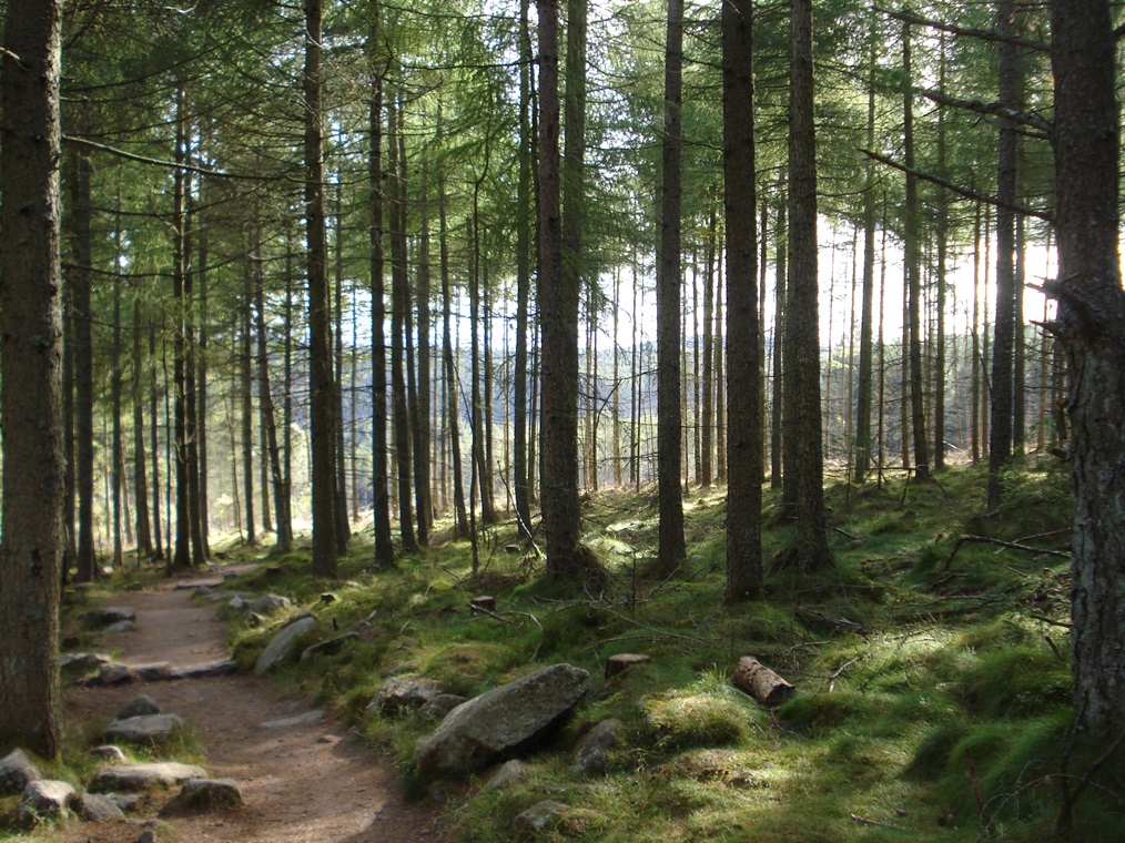
Most of the land around Bennachie is owned by Forestry Commission Scotland, the devolved government department responsible for the protection and expansion of Britain’s forests and woodlands.
Much of the British Isles was once covered by native woodland. Bennachie, up here in the cooler north, would probably have been covered with Scots Pine, birch and alder.
None of this primary forest remains although some of the plants associated with Scots pine woods are still found such as the occasional juniper bush and bilberries (or blaeberries as they are known here).
Through the millennia forests were gradually cut down – for fuel, for building materials and to clear land for pasture. The rate of tree removal was fairly gradual from the Bronze Age through to the Middle Ages but became more rapid with the start of the Industrial Revolution when the population began to grow and new industries required wood.
Fast-forward to the twentieth century and during the First World War declining stocks of timber became a threat to national security. Britain could no longer rely on timber imports yet vast quantities of wood were needed, particularly to line the trenches on the battle front. In response, the Forestry Commission was established in 1919 with the aim of increasing timber reserves.
By this time Bennachie had become relatively treeless – a ‘bald mountain’. In 1938 the Forestry Commission acquired land on the northwest of the hill and started to plant trees such as Sitka spruce, Western hemlock, Douglas fir and a small number of ‘noble’ fir.
A local poet, Flora Garry, wrote about the foresters who came to plant these trees:
His saplins clead the bare knowe heid,
Pine, spruce and fir, the larick tree;
He plants and clears for coming years
For lythe and wealth on Bennachie.
Today the land is still owned and actively managed by Forestry Commission Scotland. Jackie Cumberbirch is a Conservation Ranger for FCS.
Jackie: “Currently about 70 per cent of Bennachie is forested. Originally Bennachie was planted with monocultures – large areas of one type of tree such as Sitka spruce or Lodgepole pine – but these days there is more awareness of the importance of biodiversity.”
“As you’re walking around Bennachie today you’ll see a mixed plantation with a more diverse range of tree species (including Scots pine, larch and birch) and age classes. Spruce and fir allow little light to penetrate and now give the lower slopes of Bennachie their dark green character, whereas patches of pine and larch, planted higher up the hill, tend to be more open.”
“Into the future – and with the impacts of climate change – we’ll probably see even more species coming in. In particular we want to introduce more broadleaf trees including oak.”
Continue straight along the path signposted as the Gordon Way Trail which climbs steadily through the trees. Where the path meets a wider track, turn left then immediately right, again following signs for the Gordon Way Trail. This path crosses an area clear-felled in 2013. Stop at the next signpost which indicates Donview to the left, Mither Tap, Heather Brig and Gordon Way Trail to the right.
6 Planting and felling
Commercial forestry is not only about planting trees; it’s about deliberately nurturing and then harvesting them, as Jackie Cumberbirch from Forestry Commission Scotland explains.
Jackie: “We’re like farmers – the trees are our crop - but the big difference is that forestry is a long-term business.”
“We start by planting trees about a metre apart. As they start growing – between about 20 and 30 years old – we thin them out. By removing some trees, the remainder get fatter.”
“We want trees that are uniform and growing quite straight so that they can make certain types of product. We cut the trees when they are between 50 and 80 years.”
“That’s where I come in my role as Conservation Ranger. When an area is ready for felling I go and check it out. I find out what wildlife is there, which birds are nesting in the trees, and whether there is anything of botanical interest. Then I can advise the foresters the best time of year for the felling in order to do minimal damage.”
“Nowadays the trees are felled using harvesting machines but in the 1960s chainsaws were used and before that gangs of men using cross-cut saws and horses.”
“Our timber is used for a variety of purposes depending on the tree diameter including planks, decking, pallets, chipboard, pulp and firewood.”
“We have a number of sawmills in the local area that do the processing.”
“As you walk around Bennachie you will see large areas that have been ‘clear-felled’ – this means cutting down all the trees in a particular section.”
“We take away the main tree trunks but leave the branches and smaller material. This is known as ‘brash’. It rots down and after about four years the area is ready to replant again.”
“Clear-felling is quite devastating, though, and we are trying to reduce the scale of it.”
“I originally came from Manchester to study forestry at Aberdeen University. Bennachie was one of the first places that I came to visit as a forestry student. Now I’m actively involved in Bennachie through my work for the Forestry Commission and as a Bailie. Bennachie is a really special place not just with woodlands and wildlife but also with the social and cultural history. I even got married on Bennachie!”
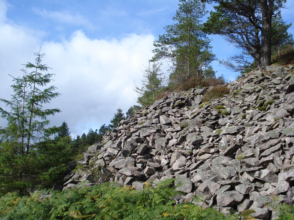
Follow the signpost for the Gordon Way Trail which is the path that forks to the left. It begins fairly level then starts to climb steeply. After about half a mile, the path levels off and there are clear views to the left. Look for a very large pile of loose rocks on the right side of the path. Just behind you can see the face of the old English Quarry.
7 Massive rocks
We’ve already found out that this hill and much of the surrounding area is made from granite. Granite is an ‘igneous’ rock which was formed from solidified magma that came from inside the earth.
Granite is a very dense type of rock. In geological terms it is ‘massive’ – meaning that it lacks internal structures – and this makes it very hard and tough.
For this reason it is very good as a construction material. That’s why Aberdeen has the nickname the ‘Granite City’. But granite from here was used much further afield.
This is the ‘English Quarry’, one of several major quarries as well as smaller ones found on the hill. It was worked by an English company (hence its name) during the early 1800s.
Granite blocks were cut out by hand, without explosives, and then probably taken by horse and cart down Bennachie to Port Elphinstone where they were loaded onto canal barges.
They were transported down the Aberdeenshire Canal to Aberdeen docks and then onto coastal vessels for the final part of their journey down to England.
Granite blocks from this quarry were used to build the Thames Embankment in London and the docks at Sheerness in Kent. Ironically, granite for building is now imported into Aberdeen from as far afield as China!
From the old quarry, continue along the path which is level for a short distance further then starts to climb up stone steps. This takes you through thinning trees and up onto the heather-clad moorland slopes. Continue following the path up the hillside. Stop due east of Bruntwood Tap where the gradient lessens for a breather.
8 A colourful carpet
We’ve now left the forest slopes behind and emerged above the ‘treeline’, which is the edge of the habitat at which trees are capable of growing.
The treeline naturally varies between 200 and 400 metres above sea level in this region.
Here it is partly artificial as the exotic trees below were planted by the Forestry Commission.
The native tree, the Scots pine, does not grow well above this elevation because it is too exposed. Any Scots pine you may see are very stunted.
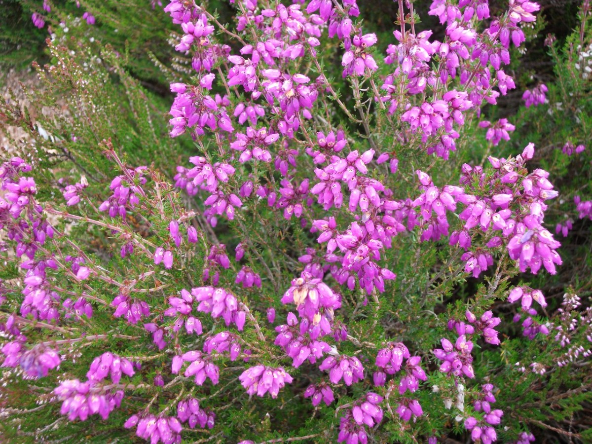
What does thrive on these higher slopes is traditional moorland vegetation. There are different types found up here so look out for subtle changes as you continue walking.
The dominant plant found across the drier parts of the moor is heather particularly Ling heather, whose flowers come out from mid-August into the autumn giving the hill a wonderful purple colour, and Bell heather whose red flowers shine in July.
In wetter areas of the moor, you will find Crossleaved Heath (Erica tetralix), a type of heather with pink flowers that gets its name from the distinctive whorls of four leaves that occur along its stems.
In the parts of the moor that are permanently waterlogged you will find sphagnum moss, cotton grass and two carnivorous plants, Sundew and Butterwort.
On the ground, look out for different kinds of berries – the bluey-purple berries of the deciduous ‘blaeberry’ (bilberry), red berries of evergreen cranberry, and the averons (cloudberries) with white flowers and orange fruit, ‘like enormous raspberries’.
There’s plenty of wildlife to look out for too that thrives in this kind of upland environment. Mountain hares, also known as blue hares (Lepus timidus), feed on grasses up here while different types of grouse enjoy the heather (more about them a little later in the walk).
Two kinds of wading bird are also commonly seen: the common snipe (Gallinago gallinago) with short legs and a long straight bill and the curlew (Numenius arquata) with long legs and a downcurved bill. You may also spot the hen harrier (Circus cyaneus), a bird of prey that flies with wings held in a shallow V, gliding low in search of food.
The heather moorland used to be actively managed by burning (more on that later) but these days it is left to its own devices as a heath moorland and valuable habitat. Off the path the heather is very thick in places.
Continue on the path which rises steadily as it traverses the hillside. Stop when you reach the junction of paths with a signpost that indicates the Gordon Way Trail to the left.
9 Fog and snow
We’ve nearly reached Oxen Craig, the highest point on Bennachie.
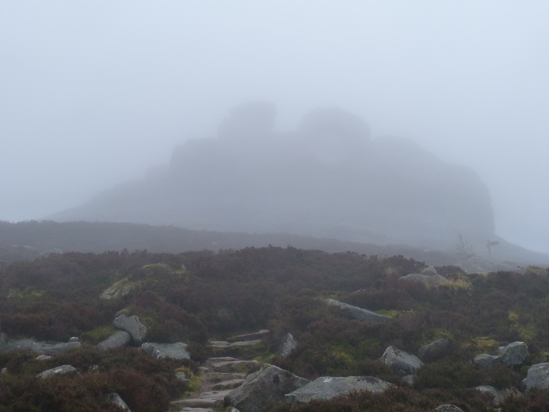
Hopefully the weather will be clear on your visit and you can enjoy wonderful views but, as you can imagine, the weather is not always fair. John Nicol walks up Bennachie regularly.
John: “We can get a tremendous range of weather conditions here on Bennachie.”
“At the Bennachie Centre it can be quite nice but as you come up the hill you can find strong winds and temperature decreases, as well as mist and fog – or as we say in this part of Scotland it can get ‘gai dreich’.”
“We have snow cover off and on from October right through until March or April. In recent winters snow cover has been less but in 2013 we had snow cover on the hill right through until March when I met some people up here who were cross-country skiing.”
Unfortunately, two planes have crashed up here in bad weather and a memorial cairn with a plaque remembers those who died.
The first crash occurred on 3 September 1939, the day that the Second World War started. A Westland Wallace Mark II, a two-seater biplane operating as a target tug, crashed on the slopes of Bruntwood Tap in thick cloud while on a flight from RAF Wigtown to RAF Evanton via RAF Dyce. Unfortunately both the pilot and gunner were killed. As they were on military manoeuvres at the time, it is believed that they were the first British casualties of the Second World War.
Then on 12 February 1952 a Gloster Meteor F.8, a single-seater jet fighter operating out of RAF Leuchars crashed into Oxen Craig in a snowstorm, killing the pilot.
Perhaps the way that Bennachie extends eastwards into the Aberdeenshire lowlands plus the cloud that often caps its summits contributed to these accidents. Fortunately, despite the increase in air traffic operating out of Dyce airport in Aberdeen there have been no more crashes on Bennachie.
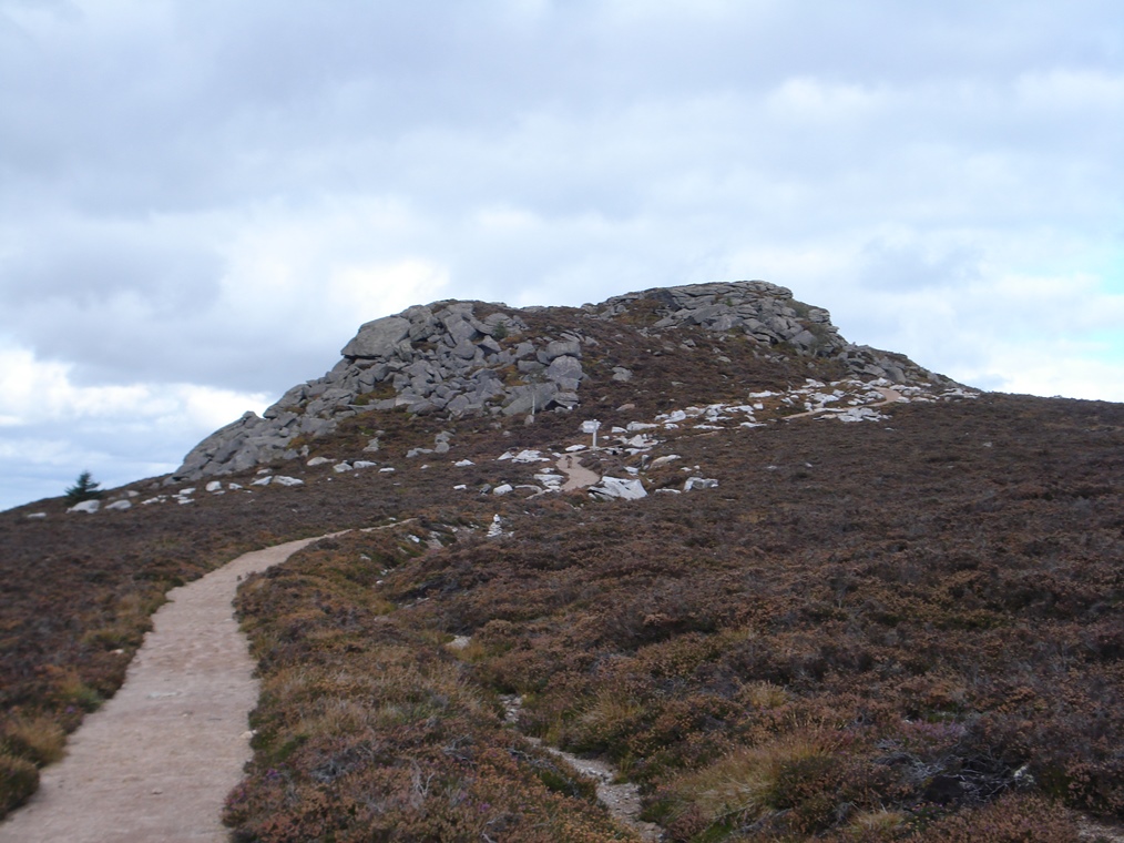
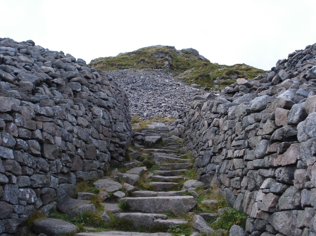
At this point we leave the Gordon Way Trail. Continue uphill along the unnamed path. At the next signpost turn left which is indicated Back o’ Bennachie Car Park. This path leads up to the summit of Oxen Craig. As you climb onto the bare rock, ignore the signpost which points downhill and continue up the gentle granite surfaces past the cairn shelter and beyond it to the trig point and viewpoint indicator.
10 Resistant rock
We’ve now reached the summit of Oxen Craig, the highest point on Bennachie. Do take time to look at the view (if the weather is clear!) and use the indicator to spot landmarks both near and far.
At the beginning of the walk we found out that Oxen Craig is a granite tor. So how and why did this rocky outcrop form here?
The origins of granite go back about 300 million years to a time when molten material called ‘magma’ from inside the earth rose up towards the surface in a massive dome which gradually cooled and solidified into granite rock.
Over millions of years this giant rock dome was gradually worn away by the forces of nature – ice, frost, water and wind – which exploited vertical and horizontal cracks in the rock to steadily break it up.
Only the hardest and most resistant rocks stood firm against the relentless forces of weathering and erosion. These were left standing prominently and are known as ‘residuals’.
Over the last million or so years, this landscape was moulded by a series of glaciations which created the landscape that you see today.
Throughout the Ice Ages those hardest rocks once again proved resistant to the forces of ice, frost and water so by the time the ice sheets and glaciers melted, a series of rocky outcrops were left.
Since then they have been subjected to natural weathering processes. This makes the granite look as though it is formed of horizontal layers.
These bastions of granite are known as ‘tors’ – it’s the same word used in other granite landscapes such as Dartmoor – but in this area they are also known as ‘tops’ or ‘taps’. Oxen Craig where we are now is one; so is Mither Tap almost due east. All together there are ‘Seven Taps of Bennachie’ scattered across the plateau.
Retrace your steps from the summit of Oxen Craig back down the track to the first junction of paths. Go straight on the path which is signposted Mither Tap Quarry Trail. At the next signpost where a small path descends steeply to the left, continue straight on. Stop at the next junction of paths which indicates Mither Tap Quarry Trail to the right.
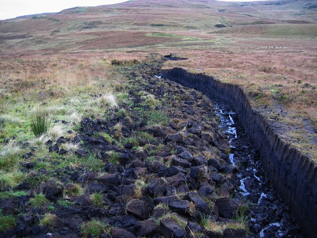
11 Traditional fuel
Earlier we found out about the plants and grasses that grow on the wetter parts of the moorland. In such bogs, the ground is usually permanently saturated. This is caused by a high level of rainfall and a low level of evapotranspiration (which means how moisture evaporates from soils and plants into the air).
These wet conditions reduce the rate of decomposition of plant matter – oxygen simply can’t get through and the dead plants eventually turn to peat. This happens at a very slow rate, estimated at 1 millimetre per year.
For many centuries, peat has been cut out of the ground, dried then used as a fuel. The decayed plant matter is rich in carbon so it burns well. Peat was traditionally used in parts of Scotland and Ireland where trees are scarce for domestic cooking and heating.
This part of Bennachie is known as Moss Grieve and is believed to have been a place of peat cutting. Peat ‘turfs’ would have been cut with a special peat spade with a narrow blade. It was known as a ‘tusker’, a name thought to derive from the Old Norse word ‘torf-sceir’, a turf cutter.
There has been no peat cutting here on Bennachie for well over 50 years now probably due to a combination of lack of demand and poor accessibility. Modernisation brought gas and electricity into houses while the peat up here was difficult to transport away due to the lack of tracks.
Turn left along the unnamed path. At the next signpost turn right, which again is unnamed. At the next signpost, turn left on another unnamed path to the summit of Craigshannoch to enjoy the view. When you are ready, trace your steps down from the summit and turn left along the unnamed path. At the signpost, turn left and follow the path along level ground. Where the surfaced path turns a sharp right downhill, continue straight to the stone cairn.
12 A tall tale
From this cairn look straight along the ridge and you will see two small tors about 200 metres apart. On the Ordnance Survey map you will see that this is called ‘Little John’s Length’.
So who was Little John? Actually he was not so little – he was a giant – and he made his bed on this ridge between the tors.
Many iconic hills have myths and legends associated with them. For example, The Wrekin in Shropshire was created when an angry Welsh giant dumped a shovelful of earth, while the huge stones on the summit of Mount Snowdon cover the corpse of Rhitta, a fearsome giant killed by King Arthur.
Meanwhile Jock o’ Bennachie who lived here was a very friendly giant. The late Algy Watson, one of the founding members of the Bailies of Bennachie, told the story:
This is kent as Little John’s Length reputed tae hae been the bed o a freenly giant, Jock o Bennachie. There he wid lie the lang simmer day dreamin o his luv, the Lady Anne.
In the ballad o the ‘Rival Giants’ ye can read aboot foo Jock o Noth, his great freen, won the luv o Lady Anne an trysted her awa tae Tap o Noth some dizen miles tae the wast.
Fan Jock o Bennachie haurd the news his birse wis up an he hurled a muckle rock at Jock o Noth wha saw it comin an stuck oot his fit an stoppit the rock far ye can still see it on the Noth hillside, his great fitmark on the wast side an the five great fingermarks o Jock o Bennachie on the ither side.
Retrace your steps from the cairn back to the surfaced path and turn left down the hill. At the junction of paths at the bottom, turn left which is signposted for Rowan Tree Car Park. Pass through some trees and after about 50 metres look on the left for an information board beside a small pool of water.
13 A battle and a broken heart
Another Bennachie legend concerns a local man called Hosie. There are several versions of the story but it all happened in 1411.
Hosie was on his way to marry his fiancée when news came that an army of Highlanders were advancing.
He was persuaded to postpone his wedding and fight in the Battle of Harlaw which took place on the sloping land to the west of Inverurie where the Earl of Marr and his men fought the Highlanders in a bloody fight.
Unfortunately Hosie was captured by the Highlanders and imprisoned in a Hebridean dungeon for several years.
Eventually he escaped and went to find his fiancée. But she had assumed he had died and had married someone else!
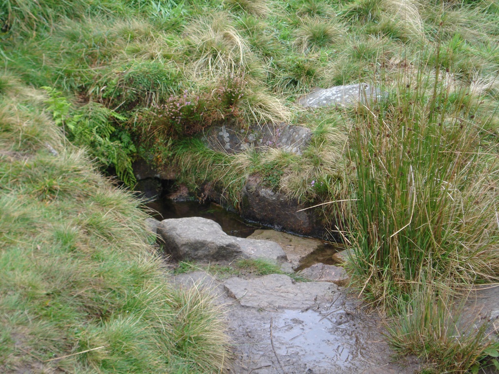
Hosie was heartbroken and, with nothing to live for, died and was buried on the hill overlooked by Mither Tap.
This well near where he was buried was called Hosie’s Well and it is believed that the water in the well is ‘nothing but Hosie’s tears’.
Retrace your steps back along the path. At the junction go straight ahead on the path signposted Mither Tap and Maiden Causeway. This path takes you upwards towards the peak of Mither Tap. Stop for a rest where the stone steps begin and look back over the heatherclad hillside.
14 Beautiful birds
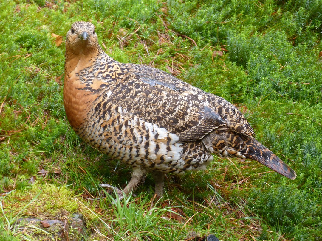
Earlier we heard about the vegetation found up here on the open moorland, of which the purple Ling heather is the most dominant. This is the ideal habitat for grouse, a type of game bird. The grouse here are mainly red grouse which have a reddish-brown plumage and a bright red flash above their eyes.
Red grouse need heather of various ages to thrive: young shoots and leaves to provide food for young grouse, older twigs and leaves to provide food for adults, and old heather to provide cover and shelter.
This was once actively managed as a grouse moor with the heather burned in rotational strips to give this variety and maintain a healthy population of grouse for shooting. Look on the Ordnance Survey map and you will see that an area near here is marked as ‘Grouse Butts’. A ‘butt’ is a low barrier, usually made of sods or peat, but sometimes of timber or stone, behind which people hide in order to shoot at game birds.
As you may know, grouse shooting has long been a popular country sport in Scotland. The season traditionally starts on 12 August – known as the ‘Glorious Twelfth’ – when the purple heather is at its best. Here’s a description of a grouse shoot by Frank Davidson from ‘The Book of Bennachie’:
“To the ‘Tap’ and the moss lying between it and the ‘Owsen Crag’, there on the 12th the grouse lie canty and snug, their privacy is invaded by the black labradors. Their masters’ pause and relish the breeze fresh from the Atlantic or the North Pole bringing with it the tang of heather honey.”
“Handsome Syd, no mean labrador, distinguished by his seal head and otter tail, soon signals a covey is at hand and the guns take their toll.”
“No Cheepers here – all well grown birds in beautiful plumage, including the patriarch himself with his red wattle above his eye...”
Although grouse shooting makes an important contribution to the Scottish economy, it no longer takes place here on Bennachie as game shooting and recreational walking are incompatible. Since this area is no longer actively managed as a grouse moor and no burning takes place, the grouse population has markedly declined.
However you may still see red grouse up here and occasionally other kinds of grouse. The black grouse, whose males are completely black apart from a distinctive red wattle over the eye and a white stripe along each wing in flight, are seen where the moor adjoins the woodland.
Capercaillie, whose males can grow big as a turkey, are found in woodland but are becoming increasingly rare, although a female hen was seen around the Visitor Centre in 2012 and 2013. The ptarmigan, a high mountain grouse which is a mixture of grey, brown and black in summer and totally white except for its tail and eye-patch in winter, has also occasionally been seen here.
Continue up the path and stone steps towards Mither Tap until you reach a level area with a signpost. Stop by the information board.
15 Picts versus Romans
The Romans arrived in Britain in 43 AD. By about 80 AD they had subdued many of the native tribes of Britons in England, Wales and southern Scotland. But those to the north of the Forth and Clyde were proving harder to tame. The Romans referred to the people of this area as Caledonians or Picts, ‘The Painted People’.
The stones on this hillside are the remains of a Pictish Fort. As you can see, it was a great choice for a defensive site – from the top is a 360 degree vista, there are steep slopes and in the middle there was a well. The information panel shows an artist’s impression of what it may have looked like.
The governor of Britain, Julius Agricola, decided to take on the Caledonians. Agricola advanced to the River Tay and a legionary fortress was built at Inchtuthil, north of Perth. In 83 AD, 5,000 professional soldiers from the formidable Ninth Legion faced down 30,000 Caledonians in a pitched battle at ‘Mons Graupius’.
Tacitus, the Roman historian and son-inlaw of Agricola, described the fateful battle between the Caledonians and Romans:
“...men and horses were carried along in confusion together, while chariots, destitute of guidance, and terrified horses without drivers, dashed as panic urged them... the earth reeked with blood.”
The location of Mons Graupius has been much contested by historians but among the possible sites is Bennachie.
Go through the stone walls and follow the steps up to the summit of Mither Tap where there is a trig point and viewpoint indicator.
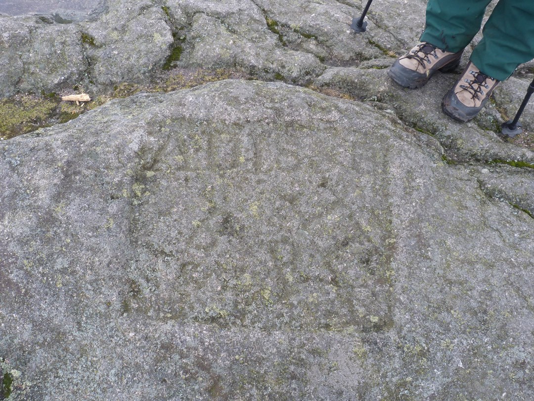
16 The Thieves’ Mark
Here on the summit of Mither Tap look between the trig point and the viewpoint indicator for a carving in the bedrock. You might be able to just make out AD 1858 BPLE. The letters stand for three estates: Balquhain, Pittodrie and Logie Elphinstone.
Although the hill was common land, in the 1850s eight local landowners (or ‘lairds’) decided to claim the hill from the people. They had seen potential profits to be made – from peat-cutting rights, game shooting and rents from ‘squatters’.
The parties squabbled amongst themselves but by 1858 were more or less agreed. In 1859 the estates were awarded possession of the ‘Commonty’ of Bennachie by the Court of Sessions. Along the walk you may have seen some of the boundary stones which marked out which laird owned which part.
In later years, people felt that this acquisition of the land was a shameful act. It became known as ‘The Rape of Bennachie’ and this marker stone became known as The Thieves’ Mark.
Now most of the land of Bennachie is owned by the Forestry Commission, who bought it back from private ownership for the people.
Retrace your steps back down from the summit to the information board and signpost. Take the path indicated for Bennachie Visitor Centre Car Park. It is a very steep descent down stone steps, which can be slippery in wet weather, so take your time and stop regularly to rest. Stop part way down the steps for a rest – look out for a horizontal stone which makes a handy bench.
17 A well-worn path
I’m sure you can guess what kind of stone these steps are made from – yes, granite! Granite quarried from Bennachie was not only shipped down to England as we discovered earlier but also used locally.
Here on the footpath the stones not only make for an easier ascent or descent but also help to prevent path erosion. Many pairs of walking boots (and paws) would compact the bare soil, break down its structure and make it liable to wash away in heavy rain.
As the Forestry Commission own the land around Bennachie, the responsibility for maintaining the footpaths and trails lies with them but the Bailies with Bennachie provide quite a bit of assistance for smaller maintenance jobs.
This includes cutting vegetation, repairing some structures and clearing out water bars.
Within the Bailies is group of people known as Hill Wardens who each have a responsibility for a particular section of the hill. They walk their assigned area regularly and report back about any maintenance issues. The Forestry Commission and Bailies together decide what has to be done.
Continue down the stone steps which end after the steepest section. Follow the path as it drops below through heather moorland and into the trees. Notice the different sections of woodland including some mature Christmas-tree-shaped firs called ‘Noble Fir’. Follow 3 successive signposts for Bennachie Visitor Centre Car Park which send you right, left and straight on respectively. Look for a stone ruin on the right side which has an information board and a post numbered 2.
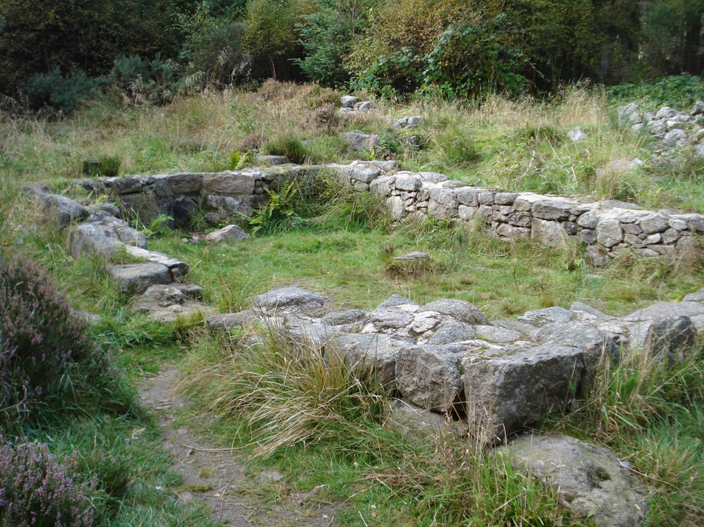
18 The Colony
Here are the remains of a stone cottage, one of several scattered across the area that made up the Bennachie Colony. The Colony was a crofting community which settled and farmed the land from 1825 until 1878.
The families had moved to Bennachie as it was a ‘Commonty’, common land where people could settle and make a living from the difficult terrain without paying rent to any landlord.
We know something about these families and their trades from historical records.
For example, the Essons were stone dykers who built walls, the Lindsays were itinerant fish sellers (‘cadgers’), the Littlejohns were thatchers and the Coopers were agricultural labourers.
Earlier we heard about the eight landowners who were awarded possession of the Commonty in 1859. The Colony went to the landowner, Leslie of Balquhain, who started to charge rent. The residents discovered that they no longer owned or even had a right to stay in the houses that they had built or to cultivate their fields.
Leslie evicted many tenants and the Colony slowly disintegrated. Most of the Colonists were gone by the 1870s with the notable exception of stone dyker, George Esson, who lived on the hill until his death in 1939.
The first anecdotes of the Colonists were told in a book of 1890 where they were portrayed as a shady set of characters with dubious morals and backward ways. At the time local people probably thought that the Colonists ought to pay rent just as they did. However, as more research has been done about the Colony, their reputation has gradually shifted to one of admiration and respect.
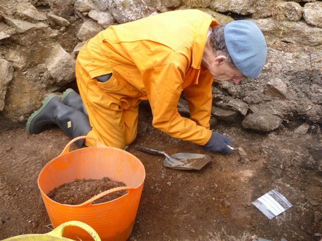
Aoife Gould is a community archaeologist working as part of the Bennachie Landscapes project alongside the University of Aberdeen and the Bailies of Bennachie.
Aoife: “We combine archaeological excavations and surveys on the hill with archival research of the historical records; neither method on its own could paint the full picture of the Colony.”
“We’re finding out that the Colonists weren’t quite as uneducated, poor or backwards as may have been indicated at the time. For example, in two of the houses we’ve found evidence of inkwells and slate pencils so at the very least they were writing. We also know from the historical records that most of the children who were born and grew up in the Colony were attending local schools. Yet McConnachie’s book of 1890 talks of them being of low-intellect and low-intelligence and not really able to understand their political situation. I think that’s maybe doing them a bit of a disservice actually.”
“We were also expecting that the artefacts we found would be the most common and rude kind because poverty was supposed to have predominated in this settlement. But we have found pottery, often quite highly decorated and probably imported from the south of England, as well as beads and ornaments which speak of having a bit of a pride in your appearance and your home.”
“When you compare these finds to the picture that was painted of these uneducated, backward people scraping a living on this hill, it’s a bit incongruous.”
From the cottage ruin continue along the path. At the next junction of paths turn left which is signposted Bennachie Visitor Centre Car Park. Stop at the next junction of paths where the Gordon Way Trail meets the Colony Trail and Mither Tap Timeline Trail.
19 The next generation
It is 40 years since the Bailies of Bennachie were founded but passion for this beloved hill is not fading. There is a new generation of enthusiasts and volunteers emerging.
Colin Shepherd is the Coordinator for the Bennachie Landscapes project which is engaging with local communities.
Colin: “We want people living in the communities around Bennachie to find out more about the natural history and human heritage of the hill. In the long-term, the idea is to equip local people with the knowledge and skills they require to do their own work into the history and heritage of their local area.”
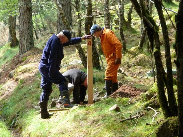
“We work with schools on a weekly basis and get children engaged in fieldwork around Bennachie. They are involved in shovel-pitting, excavation, field walking and then washing their finds, analysis and cataloguing. They also look at cartographic and documentary evidence. All of this helps them to understand how the past relates to the present.”
“Obviously these activities meet the requirements of the teaching curriculum but they’re also about showing the children the practical application of their classroom learning and getting them to engage with their local landscape.”
Turn left following the signs for Bennachie Centre Car Park. This leads back to the centre along the path used at the start of the walk.
20 A popular spot
We have now arrived back at the Bennachie Visitor Centre where we started the walk. Jan Lythgoe is one of the wardens of the centre.
Jan: “The Centre was opened in 1995 by Prince Charles. We get about 45,000 visitors to the Centre every year and over 100,000 visitors to Bennachie. Some are regular visitors while others are first-timers or tourists. Many people come to walk but we also get horse riders, cyclists, joggers and orienteers. There’s something for everybody.”
Alison Sutherland is the Aberdeenshire Council Ranger for Garioch and is also involved in welcoming people to Bennachie.
Alison: “A major part of my job is marketing and promotion. I do a lot of talks to local groups such as Rotary Clubs, local heritage societies and local women’s rural institutes to promote Bennachie and the Bennachie Centre, as well as what I do as a ranger. I promote the Core Paths in and around Aberdeenshire as well as the long-distance path on Bennachie, The Gordon Way, and do a guided walk along it once a year.”
“I do quite a lot of work in terms of promoting walks for health. People who are in rehabilitation or recovering from illness come here to do the low-level walk and enjoy the beautiful countryside that we’ve got here around Bennachie. And another major part of my job is working with school groups who come to visit Bennachie and also training teachers about learning in the outdoors.”
Jan: “I think everybody loves Bennachie – it’s certainly built into the psyche of everyone in the area and is such a prominent landmark which can be seen for miles. I’m not originally from here but I think it is a fabulous place to work.”
We hope you have enjoyed this walk and, whether you have been to Bennachie before or if this was your first visit, we are sure that this hill will have worked its magic on your heart as it does with most of ‘them that spie her’.
This is definitely a special place. It has a fantastic geological history and the rugged granite tors have withstood millions of years of natural landscape change to stand proud today at the pinnacles of Bennachie.
The hill also has a wonderful natural history, the dense plantations standing in contrast to the open heather moorland and both home to a variety of species of plants, flowers, mammals and birds.
The human history of this hill dates back to prehistoric times when Iron Age people built a defensive fort on the slopes and proudly asserted their Caledonian identity against the Romans. In more recent centuries, a community of settlers used their skills to make a living from this landscape, while others quarried stone, harvested timber, cut peat and shot grouse.
Meanwhile the folklore of this hill stands somewhere between fact and fiction including Jock o’ Bennachie and heartbroken Hosie. For hundreds, maybe thousands of years, this hill has cast a spell on those who have lived within its shadow. It has inspired poetry and prose, music and song, painting and sculpture.
Thousands of people who feel a strong connection to this hill have become Bailies of Bennachie, dedicating their time and skills to conservation, maintenance, archaeology, research and writing. Together with the Forestry Commission, the Bailies of Bennachie are ensuring that both devotees and new visitors can enjoy the hill.
Charles Murray’s poem, ‘Bennachie’, is a eulogy of the hill and this verse captures his preference for Bennachie in comparison to some of its illustrious neighbours.
There’s Tap O’Noth, The Buck, Ben Newe, Lonach, Benrinnes, Lochnagar,
Mount Keen an’ mony a Cairn I trow that’s smored in mist ayont Braemar
Bauld Ben Muich Dhui towers until Ben Nevis looms the laird o’ a’
But Bennachie – Faith yon’s the hill Rugs at the heart when ye’re awa’.
This is the end of the walk. Do go in the visitor centre if it is open to look at the displays. There is also a small shop selling guidebooks, maps, souvenirs, snacks and hot drinks.
Your browser is out of date, and unsupported by this website. Please upgrade to the latest version to use this website.
Bennachie is not particularly high, especially compared to the nearby Cairngorms, but it literally stands out from its surroundings. It has become an icon of Aberdeenshire, much-loved by local people and imbued with folklore.
This walk explores Bennachie's landscapes, from its forested lower slopes to its granite tors. Look out for plants and flowers, discover who has lived on the hill through the centuries and find out how the hill’s natural resources have been used for peat, timber and stone.
Also uncover some of the hill's legends and stories and enjoy some of the region's Doric poetry.
This walk has been created in collaboration with the Bailies of Bennachie, Forestry Commission Scotland, Aberdeenshire Council Ranger Service and the Bennachie Landscapes project.
Follow the walk by clicking on the map pins or downloading the guides below
Dick Bateman for creating the walk, providing the audio commentary and photos
James Mackay and John Nicol for advice, script edits and accompanying Dick around Bennachie
Jackie Cumberbirch (Conservation Ranger, Forestry Commission Scotland), Aoife Gould (University of Aberdeen), Harry Leil (Bailies of Bennachie field coordinator), Jan Lythgoe (Warden at the Bennachie Centre), Colin Shepherd (Coordinator of the Bennachie Landscapes) and Alison Sutherland (Aberdeenshire Council Ranger) for sharing knowledge, photos and their enthusiasm
Bailies of Bennachie and Forestry Commission Scotland for kind permission to use images from their collections
Alison Stewart, a bonnie wee wifie o’Fyvie-o for reading poems in Doric
Jenny Lunn and Caroline Millar for editing the walk materials
Vhairi Bateman for rejuventaing the tired walkers with a splendid home-made lasagne on the day before she gave birth!
Tony Bateman for assistance checking the route
Dougal for testing the walk’s suitability for fellow canines

 Crown Copyright.jpg)

