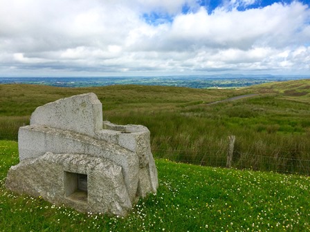
Near the picnic tables in the car park see if you can find a sculpture called the ‘Source of the River Lagan’, it looks like an ancient stone tomb. Step in for a closer look - on one side you’ll spot Leganany Dolmen (a prehistoric tomb a few miles from Slieve Croob), on the other side is the harvest festival of Lughnasa.
People gathered at the top of Slieve Croob for the Lughnasa harvest celebration, which took place in August. Locals sometimes called it Cairn Sunday, because of the tradition of carrying a stone up the hill to lay on the burial cairn where according to local folklore twelve kings are buried. Lughnasa is also known as Blaeberry Sunday, as walkers picked bilberries on their way to the summit.
Directions
Leaving the car park, pass through the green gate and onto the tarmac road. You’ll follow this road until just before the summit. The surface is even, but may be muddy and wet.
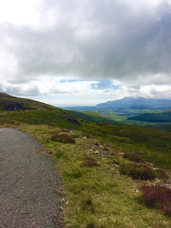
2 Views toward Lough Neagh and the Sperrins
As you climb the road, open farmland on your left marks the beginning of the Lagan Valley - named after the river which rises further up the mountain. You’ll get to see, or maybe even hear, the source of the Lagan when we get closer to the summit.
The river zigzags downhill here in a narrow channel, gathering volume from other springs and rainwater flowing off the slope. Along its fifty two mile course, the Lagan slows and meanders on the lower ground. Typically, where there are bridges, there are also villages and towns. The Lagan drew industry to its banks, including linen mills. Water from the river was used in linen production, and linen-makers used small islands to stretch out the cloth for bleaching.
Heavy industry polluted the waters along the river's course, and also in Belfast, where shipbuilding dominated the landscape. The settlement of Belfast began at the mouth of river, and trade across the Irish Sea and beyond helped shape the city’s industry and its fortunes.
As you climb looking towards the horizon on your left, see if you can pick out the waters of Lough Neagh. It’s the largest freshwater lake in the UK and Ireland with a seventy seven mile shoreline! The local legend of giant Finn McCool throwing a piece of earth at a rival is one story of how the lough was formed (his weapon supposedly became the Isle of Man)! In reality, volcanic activity along moving fault lines created the lough basin around 65 million years ago.
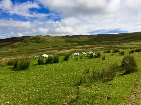
Beyond the lough, you’ll see the peaks of the Sperrin mountain range, bordering counties Tyrone and Derry. Inevitably, grazing sheep will surround you. Take in the gorse, bracken, thorn bushes and flashes of purple heather. Surprisingly, you’ll notice hardly any trees. Over the years, farming and grazing animals have had a damaging effect. Look out for ‘lazy beds’ - parallel lines that farmers dug for planting potatoes.
Directions
Continue to climb towards the big bend in the road.
3 Source of the River Lagan
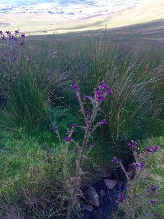
As the grasslands either side of the trail get boggier, you’ll find one obvious clue that tells you the source of the River Lagan is nearby. Besides the moss, moor grass and rushes, look out for the white tufts of bog cotton, like candy floss stuck to the grass.
The source of the river lies to the right of the track as you climb. The stream crosses the path just before the large bend in the road - a grit bin beside the path will alert you that the source is nearby.
A few steps from the main path, you’ll hear your feet squelching in the oozing source of the river. The springs that rise in this boggy ground feed the Lagan, where rainfall running off the hillside also adds to the volume of water.
Directions
Follow the sharper bends in the road towards the communications transmitters, as the views open up.
4 Views towards Belfast, Ards peninsula and Strangford Lough
From here the views open up over the capital city and Belfast Lough, an inlet of the Irish Sea and site of Belfast harbour and shipyard. Can you pick out two yellow cranes? The Northern Irish call these cranes Samson and Goliath. These iconic symbols of the city mark Harland & Wolff shipyard, the centre of the shipbuilding industry in Northern Ireland, where the ill-fated Titanic was built.
Near the summit, just as the view widens, but still on the tarmac path, you’ll find an information panel. This will help you identify landmarks in the view. Looking north-east, you can take in the entire Ards peninsula and Strangford Lough. In good visibility, if you’re eagle-eyed, you can pick out the stone structure known as Scrabo Tower.
Strangford Lough is the largest inlet in the British Isles, and is an inland sea edged by the Ards peninsula. (MAP)The changing tides bring interesting animals and plants and the lough is designated an Area of Outstanding Natural Beauty.
On clear days, look beyond the peninsula to the Irish Sea, towards Scotland and the Isle of Man. As you near the summit, you’ll discover stunning views from the other side of the path over the High Mournes and the Irish Sea shoreline of Dundrum and Murlough bays.
The land here was formed around 400 million years ago. Several Ice Ages created Slieve Croob and the nearby Mournes Mountains. Sheets of ice, first from Scotland and then Donegal, pushed across the landscape, carving out these valleys and forming the mountains and hills around you. The intensely green hills you see between Slieve Croob and the Mournes are drumlins. These oval, egg-shaped hills were formed under the moving ice sheets. The sharper end of the drumlins point in the direction of ice flow. They’re now criss-crossed by hedges and stone walls, dividing farmland into fields.
Directions
You must leave the tarmac road as you approach the summit, for the very short climb over uneven grass through three stiles to the cairn. The grass can be wet and slippery.
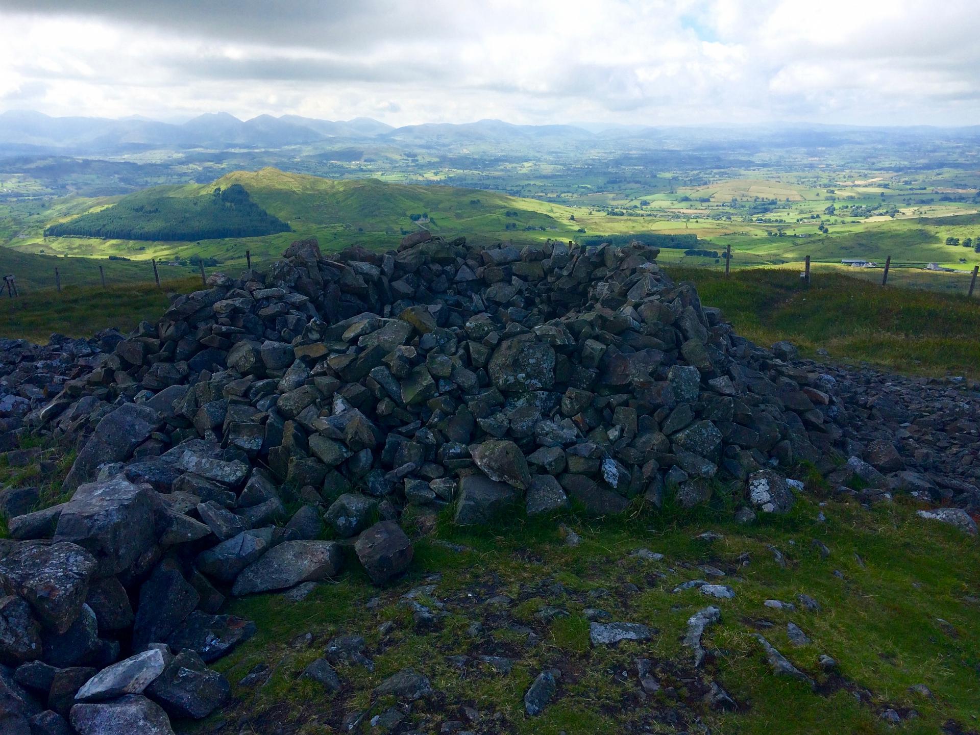
5 The summit
The summit of Slieve Croob is a perfect example of what can happen to land when it becomes too easily accessible! You’ll struggle to avoid eye contact with the various communication masts and transmitters. As you take photographs of the spectacular view from the summit, remember that it’s masts like these that keep your mobile phone in service! Happily you can turn your back on technology and enjoy the panoramic views.
You’ll also see the stones of a ‘cairn’ or ancient burial site just beside the triangulation pillar at the summit. Possibly dating from the Bronze Age, when peaks where used as sites for rituals, the cairn is supposedly the burial place of twelve kings. There’s a local custom of carrying stones to the top of the hill to help to bury the dead so if you’ve a stone in your pocket, why not add it to the pile.
The source of a river, an ancient burial cairn and a panoramic view over Northern Ireland are your reward for climbing this high peak.
Directions
To return to the start point, retrace your steps over the grass and three stiles, and rejoin the tarmac road that returns you to the car park.
Your browser is out of date, and unsupported by this website. Please upgrade to the latest version to use this website.
Slieve Croob ('slieve' is Irish for mountain, 'croob' means hoof) is the highest peak in the Dromara Hills, at the foothills of the famous Mourne Mountains.
In one 360 degree turn at the top of this hill, you can see the six counties of Northern Ireland (Antrim, Armagh, Down, Fermanagh, Londonderry and Tyrone).
Bring a camera and binoculars - the view is all-encompassing and breathtaking.
Follow the trail by clicking on the map pins or downloading the guide below
Dree Hill Cark Park, 59 Dree Hill, Dromara BT25 2EF
Getting there:
Leave Dromara on the B7 Rathfriland Road. Turn left in the hamlet of Finnis onto the Dree Hill Road (crossing a small bridge over the River Lagan). Follow the Dree Hill Road as it climbs fairly steeply. You’ll find the car park on your left, edged with a stone wall
Keep an eye out for:
The grassland turning boggy as you approach the summit. It marks the source of the River Lagan, which rises here and runs to the Irish Sea in Belfast.
Slieve Croob trail credits
Thanks to:
Sue Moore for writing and photographing this trail. Sue is a Freelance writer based in Northern Ireland.