The Pennines are often referred to as the ‘backbone of England’. It’s a chain of hills stretching for about 250 miles from the Scottish border to the Peak District in Derbyshire.
Chains of hills or mountains are usually dividing points. They’re physical boundaries and administrative borders as well as psychological divides. Although the Pennines form a natural barrier between east and west, throughout history people have needed or wanted to cross from one side to the other.
This walk investigates two millennia of routeways constructed over and under the Pennines in Saddleworth. Saddleworth is the collective name for an area which includes several villages nestled in the valleys on the west side of the South Pennines.
Saddleworth’s landscape is criss-crossed by routeways used by people to travel on foot, on horseback, by wheels and by water. This walk looks at routeways from three geographical perspectives. First the position of different routeways in the physical landscape, and how the lie of the land and the underlying geology influenced their position, orientation and construction. Second the reasons that the routeways were created including military, economic and social motivations. Third how modern paths, roads and routes and other evidence in the modern landscape such as street and place names give clues to the past.
Starting in the village of Delph, the route follows the Castleshaw Valley up to the Standedge Cutting then goes down the parallel Diggle Valley through the village of Diggle to finish at the Brownhill Countryside Centre.
This walk was created by Jenny Lunn, Project Manager for the Discovering Britain series, who grew up in Delph and spent many happy childhood hours roaming these valleys and hills on foot and by bicycle.
Walk along King Street towards the river. When you reach the bridge, bear left down the track to the river bank.
2 A busy river crossing
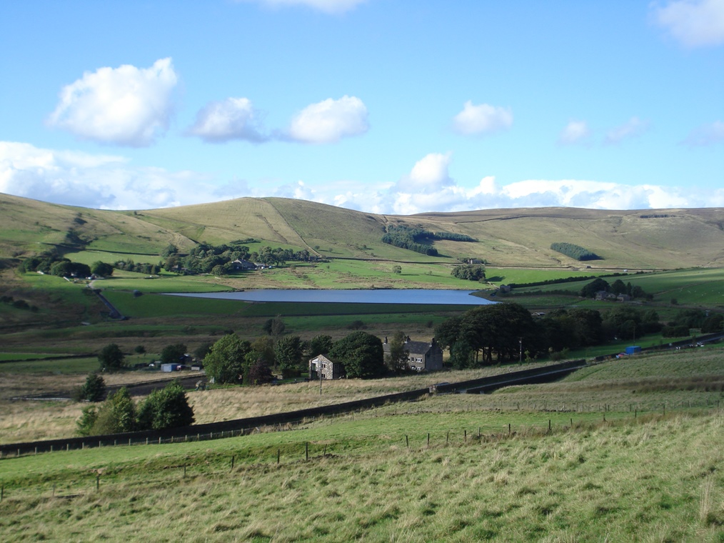
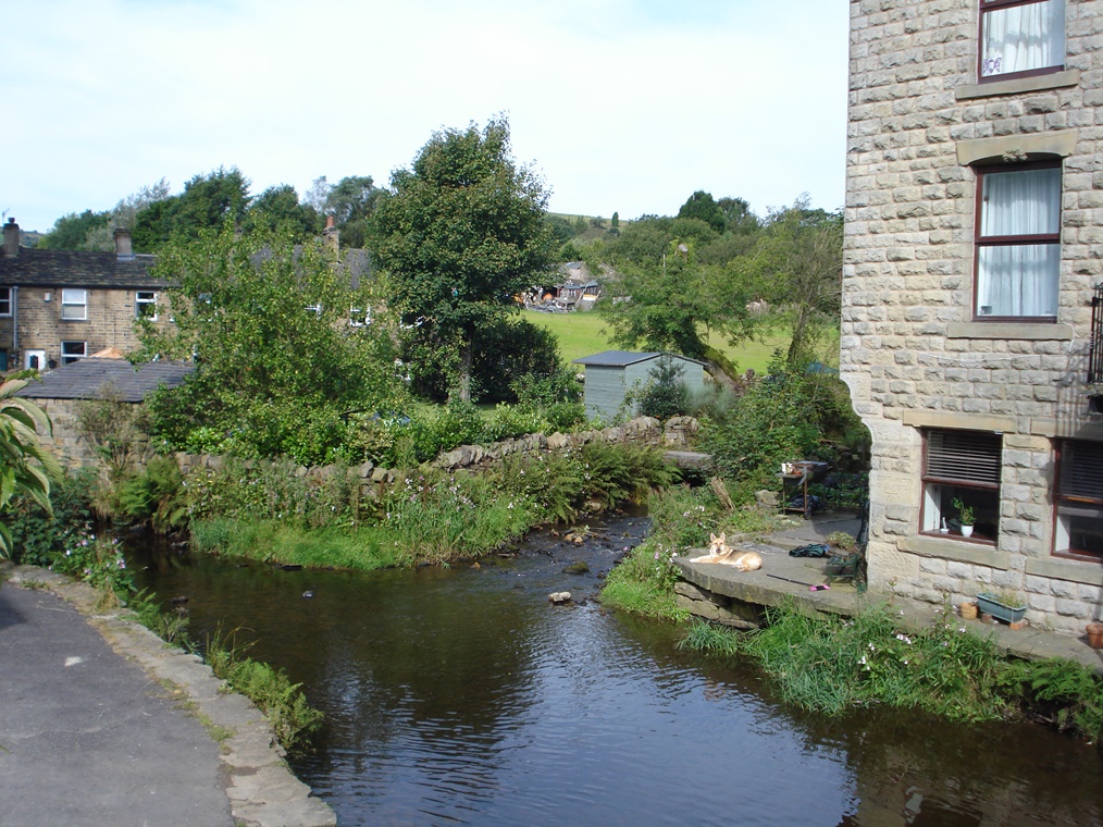
This is the River Tame. Its source is just a few miles upstream beyond the next village of Denshaw. It is joined at this point (directly across from where you are standing) by Hull Brook which originates a mile or so up the Castleshaw Valley.
This was a ford, a shallow place in the river where people or animals could cross safely. For centuries the ford here at Delph was used by both locals and travellers.
The alleyway opposite – running up between the houses – was probably the route of the original road. One house has a high window where a light was shown for travellers.
There are written records from the 1700s showing that locals had constructed a narrow wooden footbridge at their own expense about 80 yards downstream from the ford. However, it was insufficient to take any loads or livestock and several people had endangered their lives by using it.
The ‘Inhabitants of Saddleworth and several other Travellers and Carriers’ submitted a Petition in 1740 for a more substantial bridge that could take the increasing foot and horse traffic.
The estimated cost of a bridge at Delph was £160. It is not clear whether the funds were granted but the next notes from 16 years later say that the existing footbridge at Delph was “very inconvenient and of little use”. It was simply not sufficient for the number of carts and carriages passing every day.
Two years later in 1758 the “Publick Horse Bridge called Saddleworth Bridge at Delf” was noted as being “ruinous” and the inhabitants of Saddleworth were threatened with a £100 fine if they didn’t repair it!
The bridge that you now see probably dates from the second half of the 1700s when the road network was being developed (more about this later).
In the last decade it has been widened and strengthened to cope with everheavier traffic through the village including double-decker buses and delivery lorries.
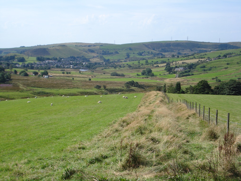
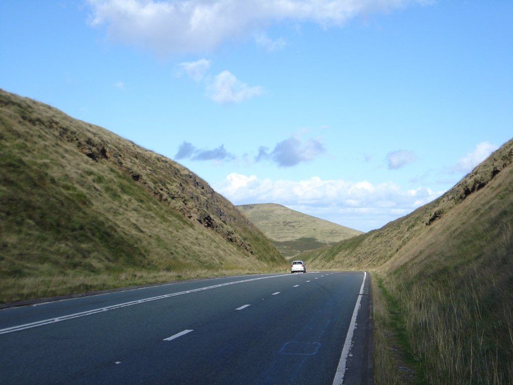
So we start our walk here at this river crossing point at the very bottom of the valley; over the next few miles we’re going to make our way up to the top of the valley to a hilltop crossing point.
The next mile or so of the walk takes us along a road passing houses built in the 1960s but which actually uses the route of much older pathways that we will find out about at the next stop.
Go across the road bridge and up to the White Lion pub where the main road bends round to the left. Go straight on up Delph Lane and note the stone drinking trough on the right which was probably used by animals using the road. The road climbs steeply then levels off and starts to descend gradually. Where the road levels off almost at the lowest point look for a signposted public footpath on the left which passes between a modern house (Number 101) and an old stone house.*
This narrow path goes between houses and gardens. At the next road (Palinwood Road) go straight across to continue along the signposted Public Footpath. This is also narrow and passes between houses and gardens. When you reach the next road (Hull Mill Lane) go over the stile opposite and follow the signposted public footpath into the field. At the first field boundary go through the gateway and continue across the field. At the second field boundary cross the stile and stop on the other side looking across to the other side of the valley.
* Note: The next part of the route can be wet and muddy in places. An alternative route is to continue along Delph Lane. Follow it along the flat section and then as it climbs steeply. At the top is a five-way junction. Take the second left fork which is Waterworks Road, a straight road with stone walls on both sides and signposted to the Castleshaw Centre. Stop part way along the first section looking across the valley for Stops 3 and 4. Continue along the road and rejoin the route by the Castleshaw Centre en route to Stop 5.
3 A network of paths
Look across the valley to the opposite hillside where there are two clusters of buildings. The upper left one is called Grange.
Buildings called Grange usually have a religious connection. The name was used to refer to a manor or farming estate belonging to a monastery and used for food production.
In about 1250, Cistercian monks established a farm here on the grassy slopes of the Castleshaw Valley. The monks belonged to Roche Abbey near Rotherham, about 30 miles away on the other side of the Pennines. They would have needed to cross the hills to get there so there were certainly interregional paths during medieval times.
There was also an extensive and complex network of local routeways in the Middle Ages too. Lords of the manor needed to access their farms to collect rents and leases; farmers needed access to their fields and to common ground; farmers also needed ways to transport their crops to mills or their livestock to markets.
There were also trackways to local quarries where building stone was extracted and paths for the residents of the district to reach their parish church. In many cases, subsequent paths and roads followed these ancient trackways.
Continue along the field path towards a pair of stone houses which are called Causeway Sett. Stop on the path by the lower side of the second house.
4 Packhorse routes
Since the beginning of the walk the route has followed a fairly straight line. From the ford over the river in the centre of the village we went up Delph Lane past modern houses, forked along a narrow footpath between houses, then along a field path.
We have actually been following an old packhorse route. This valley and the wider region is criss-crossed with them. Most packhorse routes in the area date from medieval times but they became more important from the sixteenth century with the growth of the wool trade.
In the days before the Industrial Revolution weaving was a ‘cottage industry’ done on a small scale. Look at the old part of this house which faces the way you have just walked.
Note that the windows on the upper storey are close together in a row. This design is found across the area – you may already have noticed some houses with this feature in the village. These upper windows provided more light for the loom workers.
Across this area was a busy network of middle men and carriers transporting raw wool to the weavers’ cottages and then collecting woven cloth pieces to take on to fulling mills or dyeing mills and then on to market.
They carried the wool on horses and mules, known as packhorses, which used a network of pathways between small settlements like these and the bigger centres.
Place names also give clues to this historic trade. These two houses are known as Causeway Sett. In this region, a ‘causey’ is a paved road slightly raised above the surrounding ground.
The path that you have been following – and will continue along – was in fact paved with the hard gritstone of the local area and bounded with kerbstones.
Look at the map for other clues of this history in the landscape such as Pack Horse Farm up the hillside which is at the end of Old Pack Horse Road.
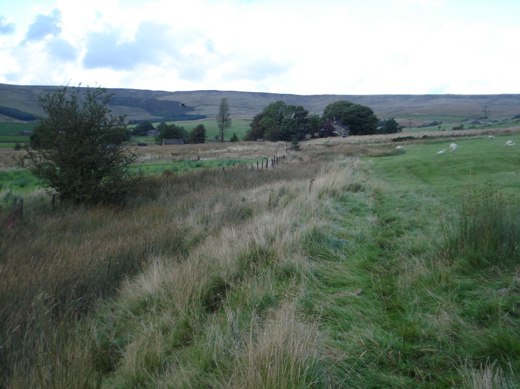
Note also that the weavers’ cottages and farmhouses are all on the lower flanks of the hillside, neither in the marshy ground at the bottom of the valley nor on the steeper slopes. This was the optimal position both for settlements and routeways at the time.
Continue along the footpath below the houses. Beyond the second house is a stile in the corner. Go over the stile and follow the path past the old farm outbuilding then along the lower boundary of this field. Immediately to the left is a marshy ditch and fence. In parts this path can be very wet and muddy. Go over a double stile and follow the footpath across the lower side of the next field towards a group of houses. When you reach the houses go over the stile onto the lane (Millcroft Lane).
Go straight across the lane and through the gate to continue on the marked public footpath on the lower edge of the field. When you reach a kissing gate with a sign for CCTV the path goes through the grounds of the Castleshaw Centre. We suggest avoiding this because there are often school children around the site. Instead turn right and walk up the field to the stone wall. Go over the stile and through the gap in the wall and turn left onto the lane.
Note: This is where the alternative dry route joins the main route.
Follow the lane where it bends to the left signposted Cote Lane. Shortly after the dip look for the signpost for Public Footpath and Roman Fort on the right hand side. Go through the gap in the stone wall and through the gate then head diagonally up the field. There is a wooden post at the mid-point to help guide your direction. From the post continue diagonally upward across the field towards a fenced area. Go through the gate and stop at the first information board.
5 A Roman road
All the way from the village up the Castleshaw valley we have followed an old packhorse route which, as we discovered at the last stop, was well used in the pre-industrial period.
However, running almost parallel, just a few hundred metres away, is a much older routeway – a Roman Road.
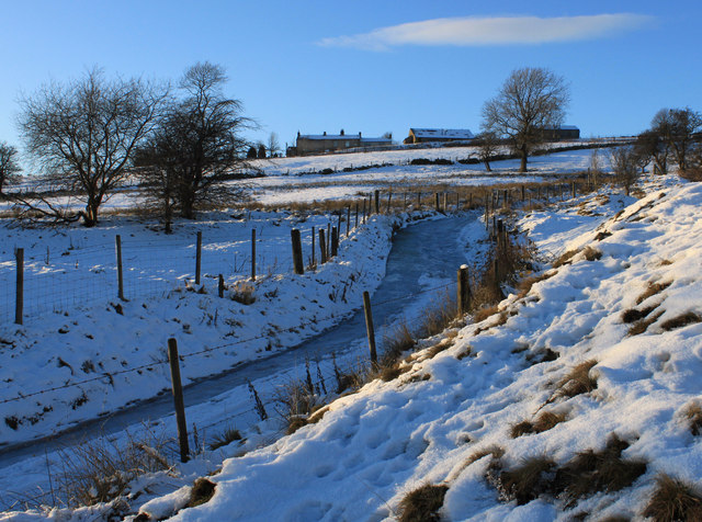
It is difficult to spot, except in winter when snow shows the relief of the ground, so look at the information board which describes where to look to see the evidence.
The Roman Road led up the valley to the fort where you are now standing. It was called Rigodunum and was constructed here in AD79.
While this is a good vantage point for a fort, it’s also an exposed position. It is remote, bleak and bitterly cold in winter. Life for the 500 soldiers posted here can’t have been easy.
Here we are exactly half way between the important Roman cities of Chester (Deva) and York (Eboracum) so this was an important and strategic point on the trans-Pennine route. The road was largely used for military purposes particularly for patrols and supply trains so it was less sophisticated in its construction than if it had been for large scale commercial or civilian traffic.
Also the geology of this area – specifically the very hard gritstones – made it very difficult to construct roads and side ditches in the usual Roman format.
It may be for this reason that stretches of the Roman Road through Saddleworth – particularly here through the Castleshaw valley – were not subsequently used as routeways.
In contrast, the next Roman crossing point of the Pennines at Blackstone Edge further north was maintained as a routeway into the Middle Ages and beyond.
As you know, the Romans liked to build their roads in straight lines and here was no exception. Despite the steep terrain, the road continued from the fort up the hillside. Look at the nearest cottage and see if you can make out the faint line on the hillside leading straight upwards to the ridge. This is also visible on the aerial photograph below.
Do take time to explore the fort site, which was excavated during the 1980s, and look at the various information boards.
You need to leave the fenced fort area by the top corner so head towards the nearest stone cottage. Once you reach the telegraph pole walk alongside the fence to the stile. Go over the stile and turn right onto Bleak Hey Nook Lane. Follow the lane as it winds round and up. After about half a mile is a row of stone cottages which is a hamlet called Bleak Hey Nook. Stop at the T-junction.
6 Turnpike trusts
We discovered earlier that local communities were responsible for maintaining roads and bridges in their parish.
In fact, in the mid 1500s each man was obliged to spend six days per year ‘statute labour’ on repairing roads. A Surveyor of Highways was the official in charge of these works but the system was inefficient: people did not want to do the work and the Surveyor could be persuaded to turn a blind eye.
By the late 1600s responsibility was shifted to parishes which were levied to cover costs of road repair and labour hire.
However, some parishes – such as those in Saddleworth – had to raise funds not just to repair local roads but also to repair inter-regional trade routes that passed through their area but actually benefitted neighbouring areas. Despite the threat of fines there simply wasn’t enough incentive to spend the time or labour on repairing roads.
Thus it’s not surprising to find the historic records full of notes about the roads in Saddleworth being in a poor state of repair.
It would have been fairer if the costs of maintenance fell on the road users or the wider county rather than the local parishes.
This systemic failure was addressed with the establishment of trusts to administer particular roads.
First of all a group of trustees financed the making of a stretch of road. These were usually people with a vested interest in seeing improved roads such as landowners, manufacturers or merchants. In many cases these roads were created on new routes to avoid the problems of older tracks
Once constructed, road users were charged tolls to use sections of the road; these charges were calculated according to the amount of damage that the animals or vehicles may do to the surface.
These were known as ‘turnpike roads’: a ‘turnpike’ was a barrier put across the road to stop passage until a toll had been paid. Then, just as now, people did not like paying tolls to use the roads and there are historic records of toll evasion. Turnpike owners had to put gates onto feeder roads to catch people.
A series of three successive turnpike roads were created over the Pennines here to connect Huddersfield and Manchester and we are going to see evidence of each of them in turn.
From the junction here look up the lane. Just off to the left of the lane is a farm track. Notice where this track continues through a gate and up between stone walls.
This is known as Whimberry Lee Lane and was part of the first turnpike route built in 1760. In about 1800 the surfaced lane that you can see was constructed to make a more gentle gradient up this section.
From the junction turn left up Standedge Foot Road (signposted Pennine Bridleway Standedge 1¼). Immediately bear left up the rough track and under the telegraph wires. Go through the gate straight ahead and walk up Whimberry Lee Lane. After about one-third of a mile go through a gate and rejoin the surfaced lane.
Note: Whimberry Lee Lane can be muddy, particularly nearer the top, so for an alternative drier route follow Standedge Foot Road, the surfaced lane, as it steadily climbs up the hillside for about one-third of a mile to just before Hillview cottage where Whimberry Lee Lane rejoins from the left.
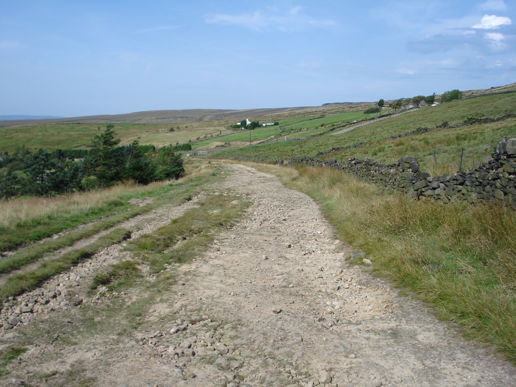
Do take time to look at the view and notice the main road below snaking up the hillside. Continue up the lane past Standedge Foot Barn on the right (probably once a toll house). The lane curves round to the right. Where the hard surface ends and Manor Lane forks down to the right continue straight on (signposted Pennine Bridleway Standedge ¼). Stop where the track becomes rough but wide.
7 Gentler gradients, faster travel
At the last stop we saw Whimberry Lee Lane, part of the first turnpike road opened in the 1760s. That road continued up the steep hillside and went over the top of the hill above you. You may be able to see the line of it.
In the 1790s the turnpike trustees were planning a new road which would avoid the steep climb over the hill and suit faster, wheeled traffic.
A new section was built through Delph including a new bridge across the river. The route then followed much of the first turnpike up the Castleshaw Valley to here.
Then rather than striking up the steep gradient, the road took a more gradual climb up the hillside – the lane you are now on. See how wide it is – this is an indicator of how important this road was as a routeway across the Pennines.
By the 1820s, passenger coaches were running daily from Huddersfield, Halifax and Leeds over the Pennines to Manchester. Goods wagons were also using these routes to travel between commercial centres.
One of the coaches, called the Cornwallis, charged 12s inside and 8s outside for the journey from Manchester to Leeds and made the journey in about four hours.
The advertisement for a post coach called The True Briton (left) boasts of a direct service between Manchester and York taking about 11 hours.
The main road below was the third turnpike road and opened in 1839. You can see that it takes an even gentler gradient than the second turnpike (the road that we are on).
Thus there is a marked contrast over time between the Roman Road and the first turnpike which took a steep and direct route to the top of the hill and the second and third turnpike roads which chose gentler routes.
This shift towards increasing speed and efficiency was going hand-in-hand with the developments of the Industrial Revolution.
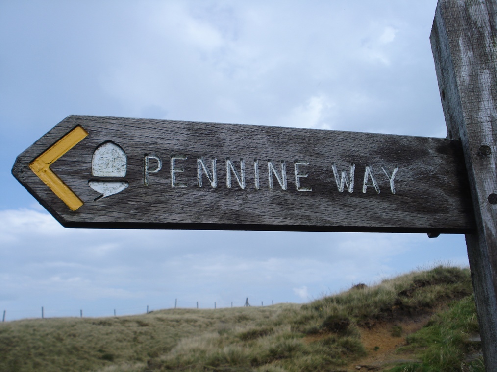
Continue up the wide track. Stop at the highest point where the Pennine Way long distance footpath joins from the left.
8 Leisure routeways
As we have seen with the successive turnpike routes, the increasing demand for trade and communication required finding easier and faster routes to travel across the landscape.
Commercial routeways tend to gravitate towards valley bottoms, shallow gradients and mountain passes.
On the other hand, humans in pursuit of pleasure and recreation seek out just the opposite: longer and more scenic routes along ridge lines, up steep inclines and to peaks.
For a short distance here we will follow the route of the Pennine Way National Trail. In contrast to the routeways that we are looking at on this walk that cross the hills in a southwest—northeast direction, this routeway goes in a southeast—northwest direction along the hilltops. The Pennine Way was Britain’s first long-distance footpath and opened in 1965 after a 30 year campaign. At 251 miles it is a serious undertaking to complete the entire route in one go.
As you continue look for the signposts for other leisure routeways in the area including the Pennine Bridleway National Trail, broadly parallel to the walking route but designed specifically for horse riders and mountain bikers.
There’s also the Oldham Way, a 40 mile circular around the perimeter of the borough of Oldham and the 12 mile Standedge Trail linking both ends of Standedge Tunnel. These are well used by people on foot, bikes and horses all enjoying the Pennine scenery
Continue along the track. After another 250 metres it bends round to the right and down to the road. Cross the road with great care into the car park. At the left side of the information board go up the steps and follow the path. At the path’s highest point, about 250 metres from the car park and before the National Trust sign and gate, go up onto the mound at the left side of the path and look down into the cutting. Be careful as the ground is very steep.
9 Catering for the travellers
As we discovered earlier, the third turnpike road was planned by the turnpike trustees in the 1820s because there was a growing volume of traffic across the Pennines.
This half-mile long cutting considerably reduced the steep gradient at the highest point on the route making the road more suited to fast, wheeled traffic. As a result the number of long-distance stage coach services increased.
To cater for travellers a series of coaching inns (also known as post-houses) emerged. From here you can see two of them. On the Huddersfield side (right) you can see the sign and gable end of The Great Western Inn, established in 1838 and still a pub. On the Manchester side (left) you can see the rooftop and chimneys of the former Floating Light Hotel which operated from the 1840s until closing in 2000, and now a house.
Many of the older pubs in Saddleworth are former coaching inns dating to this turnpike era so do look out for them.
There is other evidence of the turnpike system across the landscape too. For example, some of the toll house buildings remain in Saddleworth as well as some of the mileposts showing distances.
There is also a legacy in street names such as Delph New Road and place names such as Road End.
There were several trans-Pennine turnpike roads in this region but this one – the Wakefield to Austerlands route – was the busiest judging by the amount of income that the trustees derived from the tolls.
In 1840 a Parliamentary Report described it as being in good repair so road travel had certainly come a long way since the bridge and road at Delph were described as ‘ruinous’ in 1740.
The third turnpike eventually became the A62. There are not many major roads across the moors because of the difficult terrain so this remains an important trans-Pennine routeway. However, it is not as busy as it once was and we shall find out next which routeway superseded it.
Remain overlooking the cutting. If it is too cold or windy you may prefer to return to the car park for Stops 10 and 11.
10 Modern routeways
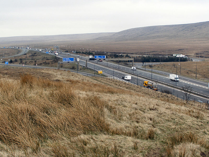
If the wind is blowing in the right direction you might be able to hear traffic on the M62 motorway which is just out of sight beyond the skyline.
Much of the heaviest inter-regional traffic was diverted from the A62 over Standedge when the M62 motorway was built in the 1950s and 1960s.
The motorway runs on an east–west trajectory connecting the important ports of Hull in the east and Liverpool in the west, via the industrial cities of Leeds and Manchester.
The terrain of this cross-country motorway is relatively flat, other than where it passes over the Pennines at Moss Moor just to the northwest of this walk route.
Construction here was difficult because of the moorland terrain, underlying peat bogs and inhospitable weather.
Nearby Windy Hill – at 1,221 feet (372 metres) above sea level – is the highest point of any motorway in the United Kingdom.
While you are here, listen and look for an even more modern routeway: flight paths.
Manchester Airport is 20 miles to the southwest and planes often bank over this area before beginning their approach.
Since chains of hills and mountains are distinct features in the physical landscape, they are often used to mark administrative boundaries.
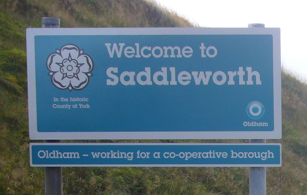
Look down into the cutting and you might be able to see two metal signs at the roadside – one erected by Oldham Council welcoming drivers into Saddleworth and one the opposite way erected by Kirklees Council welcoming them into Kirklees.
However, there’s something interesting about the sign which says ‘Welcome to Saddleworth’. It has the emblem of a white rose, which is the symbol of the county of Yorkshire. In fact, from the earliest records – such as the Domesday Book of 1086 – the land that is now Saddleworth was part of the county of Yorkshire.
In 1974 there were sweeping changes to political boundaries across the country. This included the abolition of the West Riding County Council under which Saddleworth had been administered for almost 100 years.
In the restructuring Saddleworth was moved under the jurisdiction of Oldham Metropolitan Borough Council in the new administrative County of Greater Manchester. The new boundary was logical in some ways as it corresponded with the highest point of the hills. But locals, who had been proud Yorkshire people for almost 900 years, were less impressed with their new association towards the west.
Ever since 1974 people have been actively campaigning to retain and display symbols of the historic county of Yorkshire within Saddleworth. Hence Oldham Council’s welcome sign here at Standedge Cutting says Saddleworth ‘in the historic county of York’ and shows the symbolic white rose.
The boundaries of local government and parliamentary constituencies are often moved for strategic and administrative reasons but the historic counties provide a more long-term and stable historic and cultural geography for the UK.
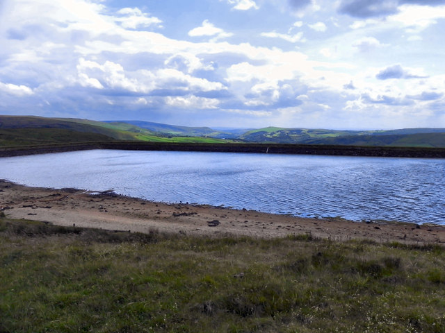
If you have not already done so, retrace your steps back to the car park. Go across the car park to the edge of Brun Clough Reservoir.
12 Capturing water
On this walk we’re looking at different routeways across the hills but one thing that definitely does not cross this boundary is water. The high ground is a ‘watershed’.
All springs, streams and rivers on this side of the Pennines run westwards – locally into the River Tame which joins the Goyt in Stockport to become the Mersey and eventually drains into the Irish Sea at Liverpool.
Springs and streams a few hundred metres away on the other side of the hill drain eastwards into the River Colne which joins the Calder then the Aire and eventually the Ouse and Humber before exiting into the North Sea.
Of course springs, streams and rivers occur naturally but for centuries people have tried to capture water resources for their use.
Many reservoirs were constructed to supply domestic water needs. The ones we saw earlier in the Castleshaw Valley near the Roman Fort were built in the 1890s for the growing population of the nearby mill towns.
However, Brun Clough Reservoir here is older and had a different purpose that will be revealed in due course.
Follow the footpath along the bank of the reservoir with the water on your left and road on your right. At the end go through the gate and follow the footpath down to the left where it joins a track. Follow the track as it winds downhill. Stop at the house
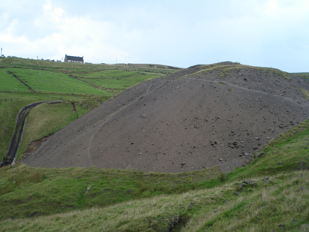
13 Above and below
Look across to the round, brick structure capped with concrete which is beside an area of flat land.
This flat surface stands in contrast to the steep hillside around. In fact it is not part of the natural landscape.
The round structure is one of several shafts dropping down to a tunnel below. When the tunnel was being excavated rock was drawn up to the surface here.
It eventually became quite a large pile of waste material, known as spoil. Later the top of the pile was flattened and it is now a favourite place for sheep to graze.
Beneath this hill are actually four tunnels – a canal tunnel and three railway tunnels. The shaft and the spoil heap relate to the construction of the railway tunnels.
Look on the map to see the lines of the tunnel as well as the spoil heaps and air shafts on both sides of Standedge.
We’ll see the tunnel entrances later in the walk and find out more about their construction and usage.
As you make your way down the path note the steep sides of the spoil heap where grass has not colonised; you can clearly see that this is a giant mound of loose material.
Also look out for the tops of more shafts further down the valley which were used first for extraction and then for ventilation.
Follow the track downhill with the spoil heap on your right. Cross a small stream and stop by the second fingerpost which marks a public footpath bearing off down to the right.
14 Pulling power
The path that we have followed down from the reservoir and will continue following down to the next village is called Boat Lane.
You may wonder why on earth a track high up on a hillside should be called Boat Lane. It relates to the canal tunnel beneath us.
In the early days, narrow boats were not propelled by engines but rather pulled along by horses. The horses walked along towpaths adjacent to the canal with the boat attached by ropes to a harness.
When the tunnel was built through the hill it was just wide and high enough for narrow boats; there was no extra space for a towpath so the barge horses were walked over the hill to meet the boat at the other end of the tunnel. This path, Boat Lane, was the track that they used.
So how did the boat propel its way through the tunnel without the pulling power of the horses and without an engine? We will find the answer later when we reach the tunnel entrance.
Continue following the main track downhill. When you reach a gate go through and turn left onto the lane. Follow the lane as it bends round to the right with the stone cottages of Diggle Edge Farm on the left. Stop where the surfaced lane becomes a rough track (before a gate) and look back at the cottages you have just passed.
15 Connecting hubs
We’re making our way down the valley to see the canal and rail tunnels that run underneath the hill. Before getting there we need to discover why these particular routeways were needed.
By the 1700s the wool trade had grown considerably with a greater volume of goods being transported around. There was a shift from using packhorse routes that connected small scale producers in hillside cottages such as these to using horse-pulled carts on the growing network of turnpike routes that connected the larger scale producers in the valley bottoms.
By the early to mid 1800s the Industrial Revolution gained further momentum. The Saddleworth area, together with West Yorkshire over the hill, was becoming a major centre for the wool trade, particularly weaving and dyeing, while the nearby town of Oldham was emerging as a hub for the cotton trade, particularly spinning. The industrial cities of Leeds on the Yorkshire side and Manchester on the Lancashire side were important markets for the finished woollen and cotton products. It was important to connect these key commercial centres and find a more efficient way to move goods between them.
The first and second turnpike roads that we saw earlier were a time-consuming and costly way of transporting an ever-increasing quantity of goods across the moors. The solution was to go straight through the moors and we’ll find out more about the tunnels at the next few stops.
Continue following the track downhill with fields either side. See if you can spot any more ventilation shafts and spoil heaps. Eventually you reach the hamlet of Diglea and The Diggle Hotel. This is a highly recommended place to stop for refreshments and also has community toilets. When you are ready leave the front of the pub and turn right over the railway bridge. Stop on the right hand side of the bridge.
16 Another new routeway
From the bridge you can see the entrance to the Standedge railway tunnels, the fifth longest rail tunnels in Britain.
The Huddersfield Narrow Canal (which we’ll see at the next stop) had been open for just 34 years when it was bought by the Huddersfield and Manchester Railway Company for £150,885.
The company was planning a line to connect the two industrial centres either side of the Pennines.
The railway company didn’t fear competition from the canal as they would be offering a much faster way of transporting goods and people but they did want to use the canal to build their parallel tunnel.
Short connecting passages were bored between the canal and railway tunnel then excavated rock loaded onto barges for removal. The canal tunnel is several feet below the level of the railway tunnels so it also acted as a drain.
The new railway line opened in 1849 with two more tunnels added to increase capacity in the 1860s and 1890s.
Just the other side of the bridge was Diggle station which opened in 1849. In its heyday the station had platforms serving all four lines. It was closed to passenger traffic in 1968 and little evidence remains today.
Today only one of the rail tunnels is used – by local trains between Huddersfield and Manchester and by long-distance trains running from York and Leeds to Manchester and Liverpool. Appropriately the train operating company is called First TransPennine Express. The other tunnels which you can just see to the right can be accessed by emergency vehicles.
This is a well-used rail route and there have been proposals to reinstate the other tunnels to increase capacity, as well as a recent campaign to re-establish Diggle station. This would be of great benefit to the residents of Saddleworth.
The railway has also become a leisure routeway with the informal title of the ‘Rail Ale Trail’ because of a number of acclaimed pubs along the route particularly on the station platforms themselves at Dewsbury, Huddersfield and Stalybridge.
Continue across the railway bridge and bear left which is Station Road and becomes Sam Road at the corner. Go past the bus stop. Where the road bends round to the right go left into the car park. Go through the car park and down the path at the far end from where you can see the canal towpath. Stop by the tunnel entrance on the left.
17 One of the seven wonders
This is the entrance to the Standedge canal tunnel. It was originally near the railway tunnel mouths that we saw at the last stop.
However, when the third rail tunnel was built in the 1890s the canal tunnel had to be extended by about 200 metres to be out of the way. Hence the date above the tunnel mouth here is 1893 which was the date of the extension.
The nearby information board has a useful diagram showing the relative position of the canal and rail tunnels.
We have already discovered that the vision for this canal was to connect the two major hubs of the textile industry – wool in Yorkshire and cotton in Lancashire.
The Huddersfield Narrow Canal providing a link between the Ashton Canal and the Huddersfield Broad Canal was proposed to Parliament in 1793 and work began a year later. It took 17 years to complete, the main delay caused by the complication of constructing this tunnel.
The tunnel was quite an accomplishment and a record-breaker – it is the longest, deepest and highest canal tunnel in Britain at just over 3 miles (5 kilometres) long, 194 metres (636 feet) underground at the deepest point, and 196 metres (643 feet) above sea level. It is considered one of the ‘Seven Wonders of the Waterways’.
The tunnel broke other records too: it was the most expensive canal tunnel built in Britain at that time costing £160,000 (about £40 million in today’s terms).
The tunnel opened in 1811 with a crowd of 10,000 people gathered here at the Diggle end. Boats loaded with 500 passengers – including Canal Company managers and a brass band – set off on the first passage through.
Here you can see how narrow the tunnel opening is – just enough to take a narrow boat. In order to save money it was not built wider with a towpath.
We discovered up on Boat Lane that the barge horses were walked over the hill to meet the boat at the other end of the tunnel. So how was the boat propelled through the tunnel in the days before engines?
The metal gate on the tunnel entrance gives a clue. Can you see some legs and feet sticking out from the top of the boat?
Men lay on top of the boat on their backs with their legs facing outwards to the side of the tunnel and ‘walked’ along the walls and roof. This was known as ‘legging’.
Professional ‘leggers’ were paid 1 shilling 6 pence for working a boat through the tunnel which took 1 hour 20 minutes for an empty boat and about 3 hours with a full load.
Traffic through the narrow tunnel was obviously one-way although there are four passing places. Between 1811 and 1840 the tunnel was used on average by 40 boats a day.
Walk away from the tunnel entrance along the towpath. You can walk on either side of the canal and there are regular crossing points. After a short distance is a path on the right down to Warth Mill where the excellent Woolyknit Café is located.
Near the first lock (32W) is a landscaped grassy area with benches and play equipment. This was another spoil heap of rocks from the tunnels that was excavated and later landscaped. By Lock 31W is Grandpa Greene’s which is recommended for its homemade ice cream.
Cross over or under bridge number 66 at Ward Lane and continue along either side of the towpath. Stop by Lock 29W and Bridge 69 where there is a bench on an elevated viewpoint.
18 Fighting the competition
As we’ve already discovered, the Standedge tunnel is the highest in Britain at 645 feet. On the western side coming from Ashton-under-Lyne the waterway rises through 334 feet using 32 locks; on the eastern side it descends to Huddersfield by 436 feet using 42 locks.
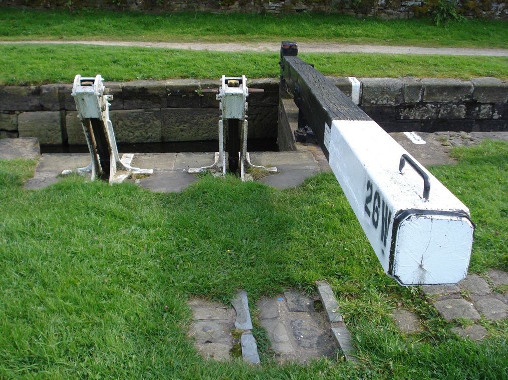
Although boring a tunnel through the Pennines was by far the greatest engineering challenge in constructing the canal, creating these 74 locks on a canal just under 20 miles long was also a major undertaking. In this section between the tunnel mouth and Wool Road at our next stop there are nine locks which are known as the Diggle Flight.
They were constructed under the direction of the canal engineer Thomas Telford and have an unusual – and it is thought unique – design. There are single gates at either end of each lock (head and tail gates) with pairs of inclined paddle gear. Note that the beams do not stick out onto the towpath but onto the opposite side. The locks were worked entirely from that side and this design enabled a more speedy passage by horse-drawn narrowboats.
Since water can only flow downwards through locks, every time a lock was used a lockful of water moved away from the highest point. An adequate supply of water was needed to keep the canal operational so a series of reservoirs were built. Brun Clough Reservoir that we saw near Standedge Cutting was one of ten that gathered rainwater from the hillsides of the Pennines to meet the needs of the canal.
Unfortunately, despite all the cost and effort, the canal was not very profitable.
The nearby Rochdale Canal, which opened in 1804, also offered a routeway across the Pennines linking the Bridgewater Canal in Manchester with the Calder and Hebble Navigation at Sowerby Bridge.
This 32 mile long waterway was a ‘broad’ canal rather than a ‘narrow’ canal meaning that its locks were twice the size.
So while the Rochdale Canal could process two boats at once, here on the Huddersfield Narrow Canal, boats had to wait their turn in the basins by each lock.
Furthermore, Standedge tunnel, having been constructed without a towpath, proved to be a bottleneck while the Rochdale Canal had no unpleasant, time-consuming summit tunnel.
But both canals suffered competition from the railways from the 1840s onwards. Traffic on the canal was maintained until the turn of the century but declined sharply during the First World War.
The last working boat passed through in 1921 and the canal was officially closed in 1944 after which it soon fell into disrepair.
Continue along either side of the canal towpath. Immediately after Lock 24W the canal goes under Bridge 70. If you want refreshments you can leave the towpath here and divert to the Navigation Inn just 100 metres up Wool Road. Otherwise continue under the modern road bridge (Number 71). Immediately afterwards is a warehouse with an overhanging roof on the opposite side of the canal. Stop here.
19 Rebirth
As we found out earlier, constructing the Standedge tunnel caused major delays in the canal project. Boats could travel from Ashton to this point – Wool Road – by 1799 so during the 12 years until the tunnel was completed, goods were offloaded from boats here at Wool Road Basin.
The main warehouse was located on this side of the canal where a small car park now is. Water inlets went inside the sheds so that the boats could be unloaded under cover. That was also the reason for the overhanging roof on the shed opposite.
Goods were then taken by turnpike road over the hill to Marsden where the eastern part of the canal to Huddersfield was also complete. A Mr William Davenport offered this service in 1799 at 6 shillings and 6 pence a ton. The canal not only carried products relating to the textile trade such as wool, cotton and dye, but also other cargo including coal, stone, bricks, timber, limestone, pig iron, corn and horse manure.
At the last stop we discovered that the canal closed in 1944 and fell into disrepair but that was not the end of the story, as you have seen on this walk. The Huddersfield Canal Society was formed in 1974 with the objective of restoring the canal. One of the projects has been the restoration of the Transhipment Shed opposite: structural restoration was carried out by Saddleworth Historical Society between 1977 and 1983, then in 1993 the Huddersfield Canal Society took over the final restoration of the building to its present state.
The canal and tunnel re-opened in 2001 for occasional narrowboat traffic and tours, and celebrated the bicentenary in 2011. Ironically the original canal took 17 years and the equivalent of £40 million; the restoration took 20 years and £45 million! So we end our story of routeways across the Pennines with one of them brought back to life and being transformed from an industrial routeway to a leisure routeway.
Continue along the canal towpath. By the car park the path leaves the side of the canal for about 30 metres but soon rejoins it. Immediately after going under Bridge 73 stop beside the large stone building on the left side which is the Brownhill Countryside Centre.
20 Layers in the landscape
This walk has told the story of humans creating routeways across an intimidating physical barrier of hills.
You have seen for yourself the formidable landscape of marshy valley bottoms, steep valley sides and barren moorland plateaux.
Human determination and advanced engineering has overcome the challenges of this terrain to connect people and settlements on both sides of the Pennines.
Straight, functional Roman roads linking cities stood in contrast to the network of local paths linking farms, hamlets and churches found in medieval times.
Packhorse trails connected weavers’ cottages while wheeled traffic used a succession of turnpike roads.
Narrow boats were legged through a recordbreaking canal tunnel while barge horses were walked over the hill above.
While coaching roads over the hill were upgraded, railway tunnels were built through the hill. The twentieth century brought more modern routeways of a motorway and air corridor.
Many of these routeways were particularly important in terms of trade and commerce, connecting the great industrial centres of northern England.
Today many routeways are also used for leisure by walkers and cyclists, horse riders and boaters.
What is particularly fascinating is to see the layers of routeways across the landscape.
Today’s public footpaths trace old packhorse routes; farm tracks follow medieval paths; main roads use the route of old turnpikes.
In the villages there are pubs that were once post houses, houses that were once toll booths and signposts to guide travellers.
By peeling back the layers we can uncover the story of the area.
Boundaries – in this case the physical barrier of hills and the administrative boundaries of a county border – are often found towards the edge of a map. This walk has offered a different perspective by putting the boundary at the centre and finding out why people have needed to cross it over the centuries and how they have done it.
This is the end of the walk. There are toilets at the Brownhill Countryside Centre adjacent to The Limekiln Café.
To return to the start of the walk in Delph village you can catch a bus from the stop on top of Bridge 73 (Dobcross New Road) or walk along the Delph Donkey which is a footpath following the route of an old branch line. For the latter, continue along the towpath. Just beneath the viaduct turn right across the canal. Walk up the track and then turn right up the lane. After going underneath the bridge turn right to access the Delph Donkey. Turn left and follow the path for 1 ½ miles. At the old Delph Station (now a private house) is Delph crossroads. Go diagonally across and up The Sound through the trees and follow the road into the village.
Alternatively, continue into Uppermill village where there are several cafes and pubs as well as a museum with Tourist Information centre and other attractions. Continue along the canal towpath under the viaduct. Leave the towpath at the first bridge and turn left down Moorgate to High Street. From Uppermill you can catch buses to Oldham, Ashton, Manchester or Huddersfield. 1 ½ miles further is Greenfield Station from where you can catch trains (one per hour) to Manchester or Huddersfield.
Your browser is out of date, and unsupported by this website. Please upgrade to the latest version to use this website.
The Pennines form a natural barrier between Northwest and Northeast England but people have always needed to cross them – from ancient times to the present day.
This walk explores some of the routes over and under the South Pennines in Saddleworth, between Oldham and Huddersfield. The landscape is full of fords and bridges, tunnels and cuttings, tracks and towpaths, locks and viaducts, coaching inns and toll houses.
Follow in the footsteps of Roman soldiers, medieval monks and loaded pack horses. Trace the development of the road network and find out how a record-breaking canal and railway tunnels were constructed through the steep hills.
Peel back the layers and discover two thousand years of history.
Follow the walk by clicking on the map pins or downloading the guides below