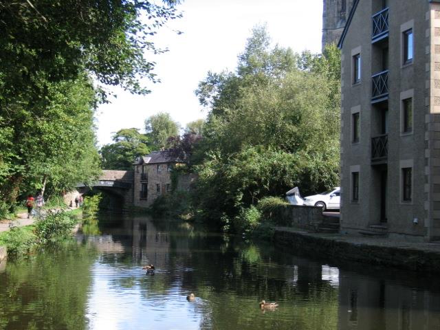
Lancaster’s material wealth owes much to two waterways - the River Lune and the Lancaster Canal. Both helped to carry a range of products which contributed to the city’s economy, from sugar and cotton to furniture and floor coverings.
Some of the profits from Lancaster’s trading and manufacturing were invested in grand public buildings and fine architecture. Many rich traders also embraced philanthropy and sought to improve the lives of local people by providing opportunities for education, training and employment.
Determined community development brought with it a legal system, care for the poor and eventually public subscription. Today’s caring and vibrant community stems from this history of shared wealth.
This walk has been created by three Lancaster residents. John Roff is passionate about canals and rivers, in particular their contribution to Lancaster’s economy, health and leisure opportunities. Sheila Jones and Gordon Clark are members of Lancaster Civic Society who greatly value the city’s heritage.
Throughout the walk they explore the different kinds of wealth that people of Lancaster have developed from the city’s waterways.
With the pub behind you turn left into Damside Street. Carefully cross the road and stop at the memorial which is set into the pavement near the river bank.
2 Slave traders
This sculpture called ‘Captured Africans’ was created by artist Kevin DaltonJohnson and unveiled in 2005. It gives us a clue as to the source of Lancaster’s first flush of financial wealth.
Between 1750 and 1780 Lancaster was ranked as the fourth-largest port in England behind London, Liverpool and Bristol. This was the age of the slave trade.
Many sea journeys started right here on the banks of the River Lune with ships heading across the Atlantic to the West Indies to trade with the owners of plantations where slaves were employed.
Lancaster was also involved in the ‘slave triangle’. Manufactured goods were transported to West Africa; the ships then filled up with African slaves who were taken across to the West Indies and America; and on the third leg of the journey sugar, cotton, rum, mahogany and other goods were transported back to Britain.
Lancaster’s merchants focused their slave trading in West African countries such as The Gambia and Sierra Leone. These countries featured river trading and small-scale slaving transactions that suited the smaller shallow draft vessels trading out of the River Lune. Lancaster’s merchants transported far fewer slaves than those of Liverpool or Bristol but, even so, by the time the slave trade in the British Empire was abolished in 1807 they had transported over 29,000 Africans to the West Indies and America.
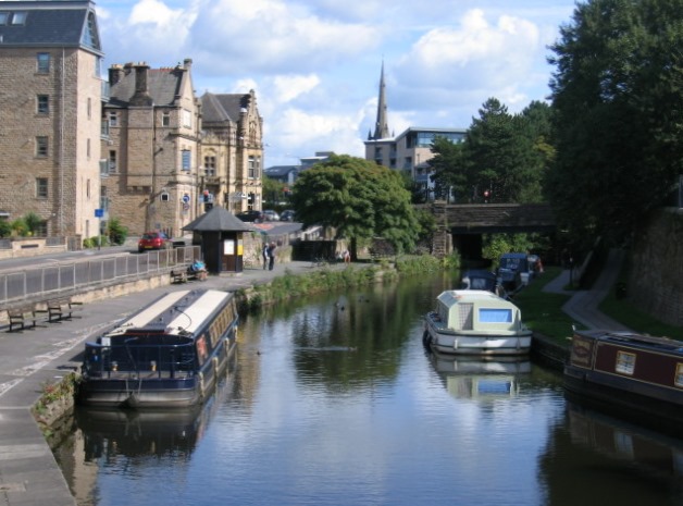
Continue along Damside Street for about another 50 metres. Pass under the low bridge by the river. This is St George’s Quay. Turn left and stop after about 100 metres by the black metal gates in the wall.
3 Seamanship
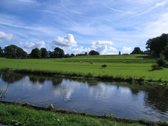
This is St George’s Quay and you can see that the River Lune here is tidal. At low tide the far bank and the river bed are mud. When the tide is high much of the grass on the far bank is covered. During really high tides (called spring tides) this pavement used to be submerged.
After years of inconvenient flooding this defensive wall on the landward side was completed in 2003. Its construction shows how water can destroy as well as provide means of wealth!
The rise and fall of the tide can be as much as seven metres and it is a twisty eight-mile journey from here to the open sea.
Imagine the challenge and skill needed by eighteenth-century mariners: the strong current of the incoming tide pushing the ship at an additional six miles per hour; the loops of the river changing the direction of the wind in the sails. It must always have been a difficult end to an eight-week voyage across the Atlantic from the sugar plantations of the Caribbean.
As trade increased St George’s Quay was expanded to New Quay further down the river. More trade also meant bigger ships could access Lancaster but that posed a problem. The River Lune was not deep enough for them.
In 1749 Lancaster traders who imported goods from the West Indies and the town’s merchants pushed for the foundation of a Port Commission. This Commission improved the channel up the Lune, built the stone quay and permitted a toll on goods.
However, the problems continued so in 1780 land was bought at Glasson which lies downstream nearer the sea. The Port Commission opened a new dock there in 1787 which was capable of holding 25 merchant ships. Their working office is still there today.
Continue along the quayside with the river on your right for about 200 metres until you reach the second set of steps that go over the flood defence wall. Stop in front of the Custom House and Maritime Museum which has four distinctive columns.
4 Custom furniture
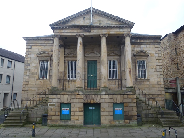
For centuries, the import and export of goods has been subject to tax. Until 1732 the administration of ‘customs’ for Lancaster was organised by the Port of Chester. By the mid 1700s Lancaster had become a significant port and this Custom House was built. Its stature and elegance show the esteem in which trade was held.
When it was completed in 1764 it originally had an upper floor for merchants and a lower floor for seamen - and no way between!
The building was designed by Richard Gillow. Richard together with his brother, Robert, and their father (also named Robert) were businessmen who made their money from the trade that the river brought.
The Gillow furniture company, later Waring and Gillow, made fine furniture particularly using mahogany imported from Jamaica. The pieces they made were sold not only throughout Britain but over the world. The company manufactured furniture in Lancaster until the 1960s and remains a company the city is very proud of. We will find out more about it later in the walk.
The Customs House has now been developed into a thriving and lively museum and is well worth a visit. You can find out about Lancaster’s port, fishing and life around Morecambe Bay. You can also sit in a full-sized packet boat from the canal.
Cross over the road in front of the Maritime Museum and turn left. Walk back along St George’s Quay for about 200 metres past old converted warehouses. Stop at the direction sign that reads ‘Public Footpath Castle and Priory 300 Yards’.
5 Making money
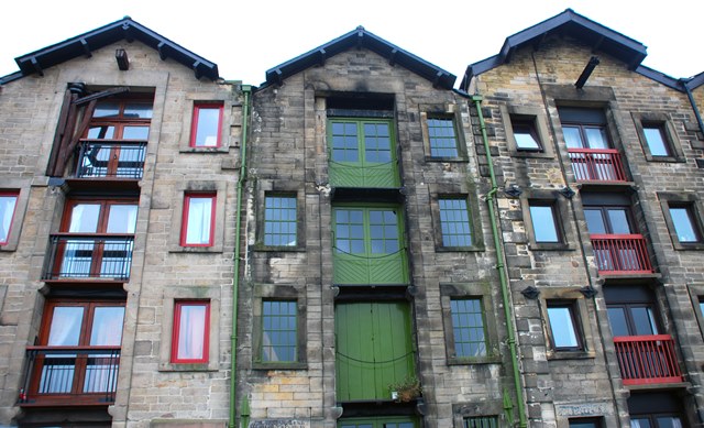
The former warehouses we’ve walked past would once have stored all manner of goods, both imported materials awaiting onward transfer to factories and mills and outgoing cargoes awaiting their shipment.
Outgoing cargoes from Lancaster bound for the West Indies might have included fine clothing, beef and furniture for the planters, to knitted caps, salted fish and work implements for their slaves.
Sugar production in the islands required copper distilling apparatus called ‘stills’ while plantation houses needed candles for light. Lancaster imported goods like hemp, flax, hides, tallow, tar, timber and linen from Russia and the Baltic.
Native exports included pewter, brass, wrought iron and perry (a kind of pear cider). Overall the most lucrative imports for the local economy were tropical woods and sugar.
A short way up the river was Lawson’s Quay which dates from 1680. It became a mecca for sugar. Lawson also built a bridge over the mill stream there to get the sugar dealt with as speedily as possible.
The Sugar House (now a night club) was across the road and the imported goods were dragged there. By 1766 there were two sugar mills, responding to a fast-growing demand for refined sugar amongst the UK population.
Most of the ships that sailed from Lancaster in the eighteenth century were also built here so shipbuilding was another important industry fot the city. For example, in 1863 the Lune Shipbuilding Company was established; they built 14 iron-hulled vessels for the White Star Line.
The warehouses have been converted into riverside flats and offices. Though they no longer hold goods transported on the River Lune they are still a source of wealth as desirable sites of regeneration.
We are now going to climb up the hill to the Priory and the Castle. As we pass a track to the Roman bath house you might like to imagine the Roman fort that once stood on the top of this hill.
This site was clearly a useful military post for holding ground against invasion by Scots or tribes from Ireland. We think it was rebuilt six times over four centuries. After the Romans left the fort was abandoned. History suggests that Lancaster was a self-sufficient market town for many centuries until the first ship was built on the Quay in 1713. Then everything changed.
Take the path to the right and go up the steps. Follow the path over the cycle route (formerly a railway line). Go up some more steps signposted Roman Bath House, Castle and Priory, Tourist Information. Continue up the steep path (Vicarage Lane) and stop when you reach the main door to the Priory on your left.
For a step-free route: You can access the Vicarage Fields cycle path from the Millennium Bridge in front of you. Turn right onto the bridge then turn right again onto the cycle path. Continue for 500 metres along Long Marsh Lane and then turn left up the (steep) Vicarage Lane.
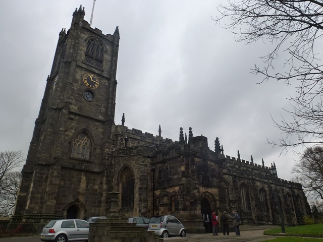
6 A commanding site
Here at the top of the hill by the Priory you should be able to sense the importance of this piece of land. It is a pity successive building has buried all but scant Roman remains.
Look between the Priory and Lancaster Castle to get a good view of the city itself and appreciate its layout. Notice how Castle Hill is mirrored by a rise to the east of the town where you can see the graceful Ashton Memorial. We will find out more about that later.
There is evidence of Christian worship here in Roman times and there may have been a church building here since AD 630. The Priory itself was founded in the eleventh century. After the Norman Conquest Roger of Poitou built an earthwork fort where the castle is now and also made the Priory an outpost of one in Normandy. This arrangement meant income was sent to France. Perhaps this was Lancaster’s first export.
Everyone still calls the church Lancaster Priory although there has not in fact been a prior here since 1430. The monastery part was disbanded by Henry VIII in 1539. The church is well worth a visit: inside you can see the beautifully carved medieval choir stalls and monuments to the early wealth creators of Lancaster embedded all around its walls.
Just on the edge of this hill looking out to sea is the site that the old grammar school moved to in the late-fifteenth century. The first written reference to a schoolmaster is from 1235. Lancaster Royal Grammar School has enjoyed a continuous existence since that date, making it one of the oldest schools in the country. Nowadays there is also a girls’ grammar school and four other high schools. Lancaster has benefitted from a wealth of educational provision throughout history and we will find out more about this later in the walk.
Walk directly away from the church door down the path for about 50 metres. Stop by the churchyard gates.
7 Punishment and parades
A place that is growing in wealth and sophistication needs an adequate system of justice and law enforcement. Lancaster Castle is a symbol of that need – it served as a prison for over 800 years from 1196 to 2012.
In centuries past, those accused of a crime were tried by criminal courts called Assizes. These were courts that handled serious cases and were presided over by visiting judges. From 1362 the Assizes for all of Lancashire were held in Lancaster. This elegant building is the Shire Hall which was built onto the castle in the early 1800s as a law court.
Prisoners were led into the Shire Hall from inside the Castle and if found guilty they were sent outside to be dropped through a trap door. Can you spot the place just to your left where the curved wall meets the straight one? The gibbet for public hangings was erected there and a plot to the right was for the burial of those who were hanged (except those whose bodies were acquired by surgeons for research). The last public execution was in 1865.
The Assizes lasted a fortnight and were held bi-annually. But there was much more to them than the sessions of the court. The Assizes were quite a social occasion when townspeople mixed with country elites. There were concerts and other events in the Assembly Room. A walkway was laid out – called Ladies Walk – for gentlewomen to parade and be seen. It was the setting for ‘the dissemination of new ideas of fashion, manners and dress’. The town benefitted both commercially and socially. Twice a year you would be sure to be in Lancaster for ‘the Season’!
Walk round the curved end of Lancaster Castle, leaving the entrance to the Shire Hall on your left. Continue with the Castle on your left and stop when you reach the imposing John O’Gaunt Gate.
8 A desirable location
This is John O’Gaunt Gate which was built in the fifteenth century and is the most impressive external feature of Lancaster Castle.
The oldest surviving part of the castle is the twelfth-century keep. Scottish raiders ruined much of Lancaster in the fourteenth century but the castle was spared. Three centuries later, during the Civil War, Parliament ordered that the castle be demolished but in 1663 the restored King Charles II agreed to have it repaired.
Through its many builds and rebuilds the castle is evidence that Lancaster has been considered a desirable location since Roman times. Since the castle closed as a prison in 2012 many are hoping that it may be transformed into an exciting leisure and tourist venue.
This part of Lancaster would once have been dense with cottages. With the gate behind you and looking down and left you can see a short row still standing.
However, the elegance of this position close to but above the town has guaranteed that wealthy homes have come to dominate the area. Though we can only see the back of them from here the Georgian homes to the right are undeniably beautiful. They were built for Lancaster’s traders who could become wealthy very quickly. One successful trading voyage could make the trader and ship owner a great deal of money.
At the end of the row of fine houses is The Storey Institute. This was an educational establishment founded by Thomas Storey, one of the city’s great industrialists that we’ll hear more of later.
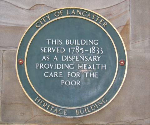
With the John O’Gaunt Gate behind you, walk downhill and diagonally to your left. Stop when the cobbled path joins the road by the former Dispensary. A plaque identifies the building.
9 Provision for the poor
This elegant building with a fine doorway is the old dispensary. Look out for the plaque on the wall. The dispensary was established in the late 1700s largely in response to a typhus epidemic which infected 500 people. It was supported by donations and provided free medical care to poor people. This is another of Lancaster’s wealths.
The growth of care for the poor and of provision for the wider community came first by philanthropy and then by a growingly confident public subscription. We will see further examples of both as we continue the walk.
To the right of the building you can just make out a sign for ‘Shrigley and Hunt’ painted near the roof line. This was a firm of renowned stained glass manufacturers.
Shrigley and Hunt grew out of a Lancaster painting, carving and gilding firm. You can see an ‘advertisement window’ of theirs depicting John O’Gaunt in Lancaster Museum which we will pass later.
On the short distance to the next stop, notice warehouses of the same style as we saw on the Quay.
Cross the road and walk diagonally down the steep narrow Castle Hill about 100 metres to the Covell Cross. Stop beside the cross in the cobbled area in front of the Museum of Childhood.
10 Crossing point
This is Covell Cross and the handsome house in this square is the oldest dwelling in Lancaster. It was built in the 1630s by Thomas Covell. Thomas Covell held many positions in his day but is chiefly remembered for his 48 years as the Keeper of the Castle.
In 1825 the town Corporation bought his former home to serve as lodging for judges who came to attend the Assizes. It is known today as the Judges’ Lodgings and has been converted into a museum with a grand collection of toys and fine examples of the Gillow furniture of which Lancastrians are so proud.
Over three generations Gillow developed from artisan craftsmen to large-scale manufacturers employing a large workforce. Their speciality was cabinet-making and upholstery. They had prestigious showrooms both here in Lancaster and in London. Gillow adapted the latest London designs to suit their customers’ taste as well as creating some ingenious designs of their own. In 1817 Mr Gillow at Lancaster is described as ‘the first Upholsterer in the Kingdom’.
As we discovered earlier Gillow became import-export merchants from the 1740s. Intriguingly their furniture accounted for a small proportion of their exports because it took up too much space on board ship compared to the profits to be made out of it. Thus Gillow furniture was used as storage space for smaller, more profitable British-manufactured goods such as jewellery, brass and iron wares, textiles, shoes and felt hats.
A biographer wrote: ‘The success of the Gillow family firm was due to sound business management and the manufacture of good quality practical furniture made from the best wood, by competent workmen, at the cheapest prices’. We hope you might still observe those values in our businesses today.
Walk directly away from the Judges’ Lodging and use the pedestrian-controlled crossing to go over China Street. Walk about 75 metres down Church Street to the junction with New Road and stop at the NatWest Bank.
11 Boom and bust
Church Street is the city’s oldest street and we have stopped here to find out about another essential component for commerce and managing financial wealth – a sound banking system.
Never mind the banking crisis of recent times, Lancaster had two private banks that failed. The first was located on this site.
Worswick’s Bank experienced difficulties in the early-nineteenth century. Besides being bankers, the Worswick family appear to have been gold and silver smiths in New Street. By 1822 the bank’s position looked increasingly precarious so savers moved their money to a second private bank but by 1826 they had both gone bust.
Some £400,000 of Lancaster money was lost at Worswick’s, plus £120,000 in the other bank. The combined effect of these two failures stunned the local population and personal savings disappeared. The Port Commissioners of Lancaster lost a considerable amount of tonnage dues and had to borrow Trade Tax money to continue.
But they were not alone. In the early years of the nineteenth century England suffered a succession of financial crises; the most devastating, in 1825, ruined 60 banks.
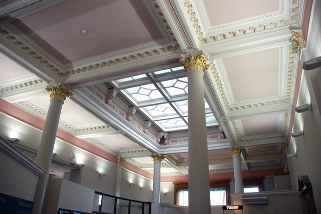
In an effort to increase stability the government changed the law to permit the formation of larger shareholder-owned banks known as ‘joint stock banks’. The first sizeable example of the new banks was the Lancaster Joint Stock Banking Company, established here in 1826. Within a decade there were almost 100 such banks in towns and cities across England and Wales. The building here was created in 1870. Elaborate on the outside and originally furnished by Gillow’s, of course, it retains a magnificent banking hall that makes you feel prosperous just to be in there.
From outside the bank look across the other side of the road to the ornate building on the left.
12 Retail competition
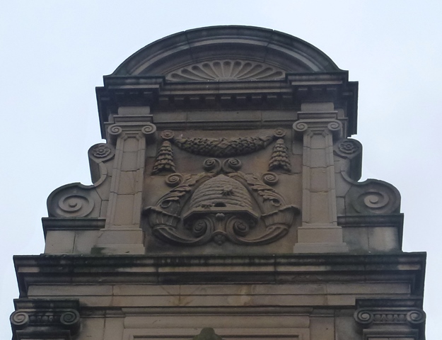
Opposite the bank is the main shop of the former Lancaster and Skerton Equitable Industrial Co-operative Society Limited, which was built in 1901. Many British towns at this time had their own co-operative society.
Look high up on the corner you should be able to make out the beehive symbol that Lancaster’s Co-op Society adopted. The architects here were the Lancaster firm Austin and Paley which designed many of the city’s most notable buildings. We will find out more about them shortly.
The building’s stone-carved frieze, through its skilful work, tells of pride and achievement. For some local businesses, however, the Coop was a threat.
The Co-op developed corporate buying power and provided its members with a cashback dividend, or ‘divi’ – an early form of store loyalty card. It seems that shopping areas always have to respond to changing economic circumstances.
Walk back up Church Street for about 25 metres and turn left into Sun Street. Stop after about 100 metres when the Music Room is on the right behind a small stone-flagged square.
13 Building heritage
This elaborate building is the Music Room. It was built in about 1730 by a rich local family, the Martons. Father and son were both Lancaster MPs, an occupation only considered by those with some wealth behind them.
The Music Room was built in the garden of their town house at 76 Church Street. It was a place for the family to entertain and be entertained – a public sign that the household had significant wealth.
The rest of Sun Street and its buildings were subsequently created in 1797 on the long, narrow detached garden of the Marton’s house.
On the corner we passed The Sun Inn. This was a popular meeting place in the eighteenth century for various organisations including the Port Commission, Freemasons, Lancaster Agricultural Society and the Musical Society.
One of England’s greatest Victorian architectural practices was also based here in Sun Street for a time. It was founded in 1835 by Edmund Sharpe just at the start of the Victorian Gothic Revival period.
Edmund Sharpe was a remarkable multi-talented architect, engineer, businessman and politician. He took Edward Paley on as a pupil who went on to develop the practice with Hubert Austin, perhaps the greatest practitioner of the partners.
This company became the Austin and Paley that we heard about at the previous stop. The firm established a national reputation, especially for its many fine churches ranging from great urban masterpieces to delightful country gems.
The practice was extraordinarily prolific with commissions for almost every imaginable building type including country houses, railways, schools, factories, an asylum, commercial premises and nearly 100 churches.
Some 90 per cent of their commissions though were within a 60-mile radius of here. They have left a powerful reminder of Lancaster’s wealth and heritage in many of the city’s corners and streets.
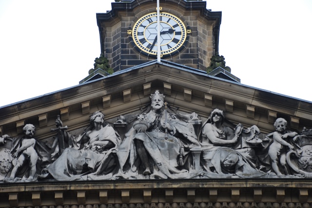
At the head of Sun Street walk through the narrow passageway on the left. Turn left down Market Street and after about 75 metres go into Market Square. Stop in front of the City Museum, the building with the clock tower.
14 Essential goods
With the exception of the Roman period, Lancaster was a fairly self-contained town until local merchants began to develop trade with the West Indies. This is the Market Square which has been the bustling commercial heart of the town since medieval times.
The right to hold a market here was granted by Charter of Edward III in 1337. This market space was vital for subsistence farmers to buy, sell and exchange to improve their resources. In addition, the Charter granted residents connected in any way with buying and selling the right to form an association. This became the Merchants’ Guild, a forerunner of Lancaster’s Chamber of Commerce.
The largest building here in the Market Square was completed in 1783. You can see it is built in a simple Classical style, not over-ambitious in scale for so important an eighteenth-century town as Lancaster. On the ground floor was a covered corn market and above were the chambers for the Lancaster Corporation. So it was Lancaster’s first Town Hall.
This and nearby buildings around the square used to house municipal offices; today they house the Museum and Library. Market Square and Market Street are still used for trade however: open air markets are held here on Wednesdays and Saturdays.
Continue down Market Street for about 100 metres until you reach a crossroads. Turn right into Penny Street and after about 30 metres turn left into the narrow Ffrances Passage. Walk along Ffrances Passage and Gage Street until you get to the traffic lights. Cross Great John Street and enter Dalton Square. Stop beside the Queen Victoria Memorial in the centre of the square.
15 Splendid confidence
Dalton Square exudes wealth and confidence. The square itself was originally a money-making venture. Prominent local John Dalton wanted to develop his family’s land to increase his wealth. So in 1784 he sold off plots of his land for building, including the space here, but he imposed certain rules about the size and look of the houses to be built.
The Daltons were a notable Catholic family. On the north corner of the square you can see Palatine Hall completed in 1799 as the first purpose-built church for Catholics since the Reformation. On the next corner in Sulyard Street was Lancaster’s first Methodist church, built soon after. Paley and Austin were the architects.
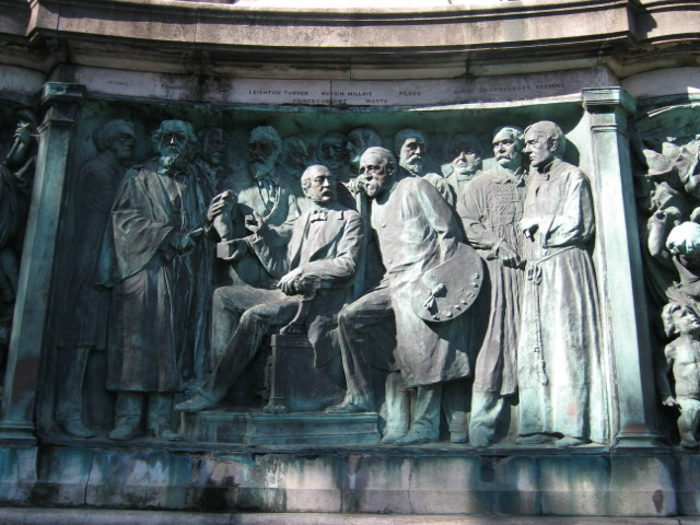
In the centre is the Queen Victoria Memorial. It was completed in 1907 six years after her death and was a gift of Lord Ashton. We will learn more about him shortly.
The memorial records great figures of the Victorian era and celebrates its high ideals. The Queen is guarded by four lions. At each corner is a frieze symbolising the ideals of Truth, Wisdom, Justice and Freedom.
On each side are images of eminent Victorians, some of them local people from politics, literature and science, as well as James Williamson, the donor’s father. Walk round it and see if you can spot some heroes!
Walk to the end of the square in the direction Queen Victoria is looking. Go up the steps and stop to look across the road at the Town Hall.
16 A Lord and his business
Here on the steps of the current Town Hall it’s time to discover more about the wealth of Lord Ashton. He was born James Williamson, the same name as his father, and he masterminded the growth of his father’s business, developing the Lune Mills factory on the site of a recently-bankrupted shipyard.
The Williamson factory produced coated fabrics, floorcloth and, eventually on a big scale, linoleum. For the latter, cork was shipped direct from Spain and Portugal in vessels owned by Williamson and his associate James Helme. The cork arrived in Lancaster from Heysham by a rail link which Williamson had pushed to be built.
In 1894 the Williamson factory was described as ‘the present undertaking constitutes the largest manufactory of its class in the world; and further, we may say, without any fear of contradiction, that the mammoth works on the banks of the Lune, at Lancaster, are the most extensive in the universe, that are owned and controlled solely by one individual’. That’s quite a claim!
After James Williamson resigned as Liberal MP for Lancaster in 1895 he became Lord Ashton. Lord Ashton was very wealthy but he was also a notable benefactor. Besides the Queen Victoria Memorial he built the Town Hall, a hospital wing, buildings at the grammar school, Williamson Park where much of our sandstone was quarried, and the Ashton Memorial.
Locally the Ashton Memorial is called ‘The Structure’ and it presides over much of Lancaster from its exalted position. Labelled ‘the grandest monument in England’ we don’t know for certain whether it was built in memory of Lord Ashton’s second wife, as local tradition has it, or to his family in general. Sadly, from the opening of the Town Hall, a few weeks after the opening of the Ashton Memorial, he became a recluse for the remaining 21 years of his life. Lord Ashton died in 1930, the sixth-wealthiest Briton of the twentieth century according to a newspaper report.
Cross the road at the traffic lights and turn left. Walk to the left of the Town Hall up Nelson Street past the Baptist Church. Enter the car park on the right. Keep the road and wall on your left and walk alongside the wall for about 100 metres until you reach the canal. Stop as you turn right onto the towpath of the Lancaster Canal, below the Cathedral.
17 Growing significance
We have now reached the second waterway that has played a significant role in the development of the city. The digging of the Lancaster Canal in the 1780s by a large and transient workforce brought great confidence for further development. We are going to walk along the canal towpath and find out more about the role it played.
You will also notice that we are overlooked by a large church. This is St Peter’s Cathedral which became the seat of Catholic worship in Lancaster in 1859. It replaced Palatine Hall which we saw earlier and was elevated to cathedral status in 1924. The site also includes a school and social centre for the Catholic community.
Local firms were prominent in the building’s design and furnishings. Edward Paley was the architect, Shrigley and Hunt provided much of the stained glass, and there are unique panels of Lancaster linoleum decorating the walls behind the altar.
Preston is the administrative centre of Lancashire but Lancaster is still considered to be the county town. Lancaster was very proud to be given city status in May 1937, symbolic for this march ‘from water to wealth’.
Continue along the towpath with the canal to your left. Go under the bridge then follow the towpath round and up to street level and cross over the canal. Walk down the cobbled ramp and continue along the towpath past the White Cross pub. Continue about 125 metres and stop at the green gateway on your left. Look into the White Cross complex.
18 Not to be beaten
We are now standing on the fringe of another industrial empire that went on to give rise to the great wealth of education opportunities in the city. Lancaster’s first steam-powered cotton mill was opened here at White Cross around 1802. The mill needed a lot of coal and the canal was the perfect way to transport it.
After cotton manufacture declined the Storey brothers bought and re-equipped the mill for oilcloth manufacture. Oilcloth was cotton or linen covered with an oilbased coating, making it semi-waterproof.
One of the three Storey boys and Lord Ashton’s father (James Williamson) had been early apprentices together. But that did not stop Storeys and Williamsons waging a bitter price war on goods in the 1880s, enhanced by the political rivalry of their two owners. Aside from his business empire Thomas Storey was four times Mayor of Lancaster.
The rivalry between Storeys and Williamsons was terminated by an agreement which included certain restrictions on advertising and specified that Williamsons would concentrate on floorcloth production and Storeys on wall coverings. Storeys finally finished all production in 2006; Williamsons seven years earlier. A century ago well over one-third of Lancaster’s working men were employed by these two firms.
It is appropriate though that these former factory buildings now house Lancaster’s adult education college. Like Lord Ashton, Thomas Storey was another great philanthropist. He was deeply committed to improving educational opportunities within the town, wanting to give younger generations a better chance than that of their fathers. His family financed the rebuilding of the Mechanics Institute (renamed the Storey Institute) which you might have seen near the Castle. For a while it was a technical and science school. Storey’s country estate three miles away became the site of Lancaster University in 1964. In fact the city boasts two universities - St Martin’s College became part of the University of Cumbria in 2007.
Continue along the towpath for about 200 metres under the busy Penny Street Bridge. Stop at the footbridge over the canal just before The Water Witch pub.
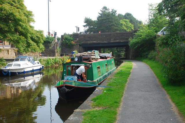
19 Black and white
The Lancaster Canal from Preston to Tewitfield opened in 1792 and later extended to Kendal. Canal boats that travelled north carried coal from south Lancashire to power steam-driven cotton mills, works and homes. This efficient means of transport saw the price of coal drop by three-quarters.
Southbound boats transported limestone which was used at all points on the way for agriculture and for cement. These two cargoes led to the nickname ‘The Black and White Canal’.
Lancaster Canal was an important artery for transporting goods for 150 years; in fact coal was being delivered to Storeys by canal until 1947.
The history of passenger boats on the canal is perhaps more remarkable than freight. Packet boats were non-stop services for passengers and perishable cargoes. Later, to compete with the railways, the ‘fly-boat’ was introduced and became so important to the canal that it was given unlimited right of way. All other vessels had to get out of its path. If they failed a specially fixed blade at the front of the fly-boat would cut through the tow ropes of any boat which was holding it up.
The Water Witch pub here is named after one of the fly-boats that plied between Kendal and Preston. Each boat was pulled by two horses which were changed every four miles. There were eventually three boats each way every day. They took just 3 ½ hours to get from here to Preston – an average of about 10 miles per hour. The fly-boat was not only twice as fast as other canal boats but also luxurious for its time; drinks could be bought on board and heating was provided in winter. We shall find out what happened to this passenger service a little later.
Continue along the towpath past The Water Witch pub for about 250 metres until you reach the next bridge over the canal (Basin Bridge). Stop in the middle of the bridge.
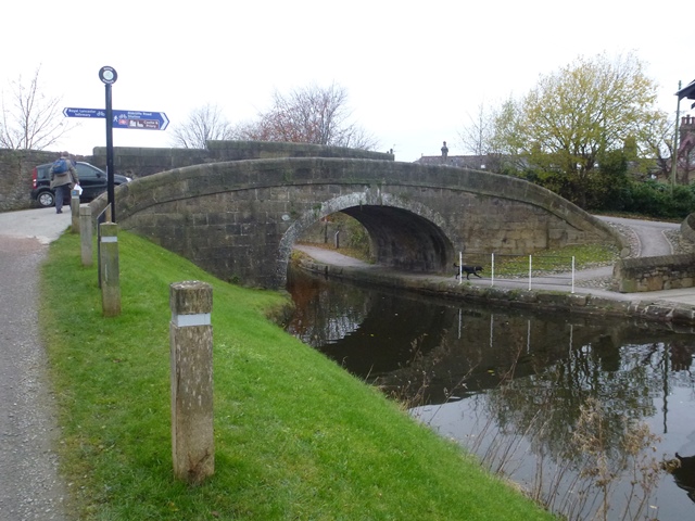
20 Designed for speed
Here at the high point of Basin Bridge you’ll see that the towpath crosses over the canal. Notice how it turns back in the direction it has come and then round and under the bridge. This meant that, as the towpath switched to the other side of the canal, the horse pulling the boat didn’t need to stop to have the rope changed.
Speed was of the essence as that was where the profits were made. You can probably spot groove marks channelled into the stone by the ropes and metal staples that were introduced to preserve the bridge.
Basin Bridge features on an 1845 map of the canal. The bridge was designed by James Rennie, the canal’s chief civil engineer.
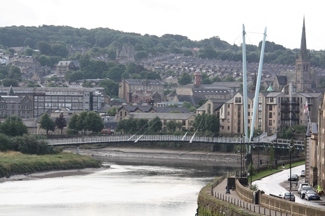
James Rennie was also responsible for the impressive Lune Aqueduct upon which the canal crosses the River Lune about two miles north from here. The Canal and River Trust names it as the finest and largest masonry aqueduct in the country. It carries the canal 202 metres across the river at a height of 16 metres.
English Heritage and local partners helped the Canal and River Trust to restore the aqueduct in 2012. You can explore it by following the canal towpath or the River Lune Millennium Path (or from its car park on the A683 leaving Lancaster). You can also discover the newly-created nature reserve while you are there.
Note: There is an option to shorten the walk here. Carry straight on over the bridge to the road and turn right past B&Q. Turn left into Queen Street, and bear left when it reaches King Street. At Waterstone’s bookshop turn left for the railway station (600 metres) or continue along China Street to Covell Cross for the top entrance of Parksafe car park (600 metres), and down the hill for the bus station (700 metres).
Directions 20 Proceed down the cobbled towpath to the right and under the bridge. Stop by the canal after about 20 metres opposite the crane.
21 A wealth of work
We have already discovered how the canal carried cargoes of coal and limestone. But the mills and factories were not the only businesses to benefit from the canal. The canal had an impact on the wider economy too and created wealth in a variety of ways.
The navigators (or ‘navvies’) who built the canal were paid 11 pence for a 10-hour day. Of course the canal’s construction created mass employment but on-going maintenance of its infrastructure including channels, locks, basins and bridges created longer-term jobs. Investment in the Canal Company was profitable in itself, collecting tolls on freight and fares from passengers.
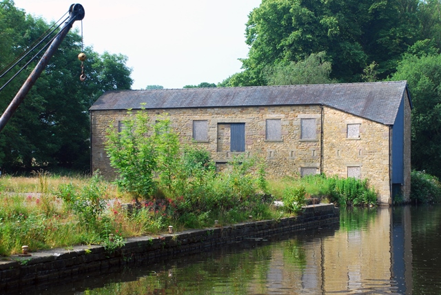
We heard earlier that ocean-going boats were built on the River Lune. Canal boats were built here on the canal. Across on the other bank is the restored and unusually-shaped Boat House. Its skewed front was designed to facilitate boat launching. Packet boats were also repaired there, their lightweight iron hulls being hauled out of the water by pulleys on the second floor.
Continue along the towpath, noting the railway as you go under the bridge. Stop just before the next footbridge. Make the most of the seat and enjoy the view.
22 Today’s canal
Looking back from here you can see a railway bridge, part of the West Coast Main Line. In 1840 the Lancaster and Preston Junction Railway opened; the station was located close to where we stopped at The Water Witch pub.
Although it was a rival to the fly-boats, initially the comfort of canal travel, reputedly good food served on board and a set down / pick up point close to the town of Garstang all gave the canal a competitive edge over the railway for passenger transport.
When the competition got hotter the boat fares were reduced. But in 1846 the Lancaster and Carlisle Railway opened, running its services from Lancaster Castle station. The fly-boat service stopped dramatically: the same day.
These days the ride from Lancaster to Preston takes just 17 minutes by train – much quicker than the 3 ½ hours by canal boat! Lancaster also has direct services to London, Manchester, Birmingham, Edinburgh and Glasgow. These links to major cities play a major role in Lancaster’s wealth today. Connectivity is especially important for the universities and some of the city’s businesses.
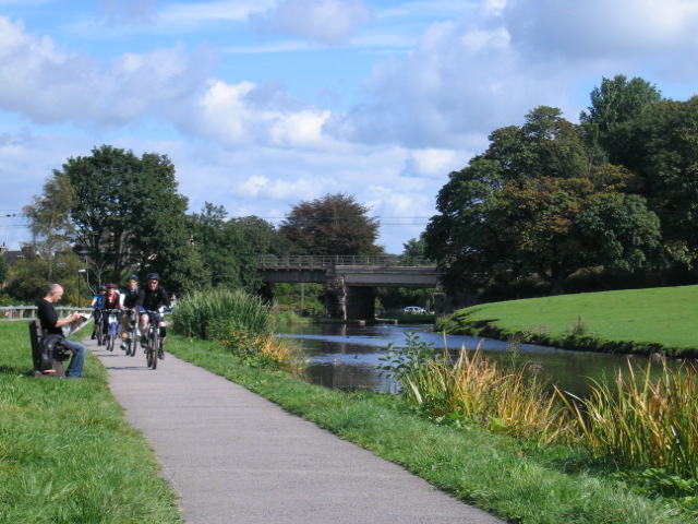
Although the railway displaced passenger and freight traffic from the canal, you can see that the canal today is by no means redundant. The towpath is heavily used by walkers criss-crossing the town, and by cyclists and fishermen, while leisure boaters and canoeists enjoy the water. The canal offers residents and visitors health and leisure benefits. Wildlife also abounds. It is part of our accumulated wealth.
What about those ridges in the field across the canal? Evidence suggests they are remnants of an open-field system, a reminder of the days before Lancaster was a trading, manufacturing and commercial hub.
At the footbridge turn right on to the road and walk back the way you came with the canal now on your right. Turn first left into Cromwell Road and at the end go through the wooden gate into the nature reserve. Stop by the information board at the entrance.
23 Community action
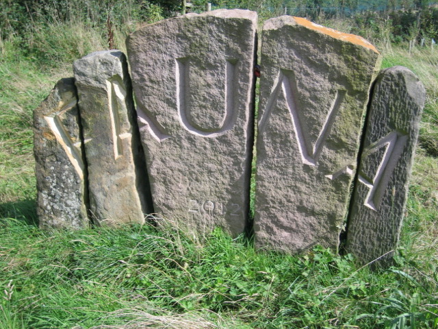
We are about to walk through Fauna (Fairfield Association Local Nature Reserve). This is an example of wealth by public subscription rather than by investment or philanthropy.
The Fairfield Association formed in 1996. They adopted and protected this 16-acre site of naturally wet fields really close to the centre of Lancaster to create a safe habitat for birds and small mammals.
With the help of the RSPB there are reed beds and ponds to encourage wetland birds and the area attracts oystercatchers, snipe, lapwings and water rail.
If you are lucky you may see hares, small birds and meadow flowers. Make sure you spot the White Park cattle with their distinctive long horns. These are a rare breed, well-suited to grazing the area.
And after Fauna comes Flora. The Association has raised more finance and bought the neighbouring 34 acres to develop it in a similar way. The work of this local residents’ group is a fine example of Lancaster’s wealth embodied in its people. Community is important – a great wealth we treasure together.
As you walk through the reserve you will reach a point with a spectacular view of the Ashton Memorial, the Castle and Priory. Each of these represents some of the major influences that have looked over the city. This footpath is another such mark. You will also see the allotments, again a part of our community heritage wealth – with a ten year waiting list!
Follow the track for just over 500 metres until you get to the large FAUNA stone sculpture. Just after that turn right at the green bins and walk straight ahead on the footpath until you come to the tarmac road (Sunnyside Lane). Follow that for 200 metres as it bears left and then right into Ashfield Avenue.
At the end of Ashfield Avenue, cross straight over the road, then turn left then immediately right into Westbourne Place. After just 20 metres take the footpath on the left by the telegraph pole. Go down to Westfield War Memorial Village. After the swing gate, turn left then right. Stop by the bench and look at the statue in the centre of the small roundabout.
24 Water by the cupful
Westfield War Memorial Village is another example of the richness of Lancaster’s community. This small village was built to house soldiers who had been disabled in the First World War.
The Westfield Committee to create the village was appointed at Lancaster Town Hall in 1918, with a strong backing of public support.
The village was laid out by the famous architect and landscape designer Thomas Mawson who had opened an office in Lancaster in 1906.
The aim of the scheme was to erect a memorial, build cottages for married ex-servicemen and found a hostel for the unmarried men. The first priority was given to local veterans of The King’s Own (Royal Lancaster Regiment) followed by those of Lancaster District.
Besides housing there were to be workshops and social amenities. It also claimed the village would not just meet difficulties of ‘social reconstruction’ but provide a small-scale ideal of town planning.
After constant objections from the Ministry of Labour, village construction was funded by donations.
Look around and you will find lots of evidence of the Storey family making this possible. The first house built has the name of Herbert Storey inscribed on it, look for Storey Avenue and at the plaque on the memorial in the centre of the village.
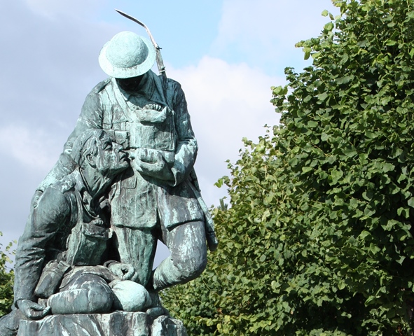
The memorial features a soldier giving water to a wounded comrade, illustrating Lancaster’s recognition of the efforts and sacrifices made by local men serving in The King’s Own. Like other things you may have discovered on this walk, this village and the means it came to be constructed speak of a true wealth. It is one of the city’s understated gems.
From the bench turn left along Storey Avenue and stop by the main gates into the Village by the busy West Road.
25 A truly wealthy city
We have now come to the end of our walk. Beginning with the waters of the River Lune and progressing with the waters of the Lancaster Canal we have followed the wealth engendered by the growth of trade, industry and enterprise.
We have seen how Lancaster’s first wealth came from its port from which ships set sail for the slave stations of West Africa and the plantations of the West Indies bringing back tropical goods including the mahogany that allowed Gillow’s to develop a fine furnituremaking business.
We have seen how legal and banking systems underpinned this society and the development of trade and industry. Walking along the canal we discovered how the production of oilcloth, linoleum and wall coverings made the Williamson and Storey families very wealthy. We also saw evidence of how they returned some of that wealth to the city through buildings and institutions.
As we walked through the nature reserve and the memorial village we have seen how the philanthropy of rich individuals gave way to public subscription and community activity.
Lancaster is a city where financial wealth has provided for education and the riches that brings, and the embedded wealth of a community that cares for and empowers its citizens.
We hope you have enjoyed this walk around our wonderful city.
There is plenty more to explore including the Maritime Museum, the Priory and the City Museum in the city centre. There’s the Ashton Memorial in Williamson Park with its associated Butterfly House and a little further afield why not walk to see the spectacular Lune Aqueduct or Glasson Dock 6 miles the other way along the Lune Estuary path.
To return to the town centre – Leave the village by its main gates and turn right up West Road. Take the pedestrian bridge straight ahead across the railway lines and carry on up the road past the Castle (100 metres).
To return to the railway station – Leave the village by its main gates and turn right up West Road. Follow West Road as it turns right and the station entrance is 50 metres on the left.
To return to the Parksafe car park or bus station - Leave the village by its main gates and turn right up West Road.
Option a) Walk over the bridge and up to the Castle and straight ahead to the John O’Gaunt Gate. With the Gate behind you, walk downhill and diagonally to your left via Castle Hill and Bridge Lane. The entrance to the Parksafe car park is on your left 30 metres after the Covell Cross. For the bus station, follow China Street and Bridge Lane. They curve down to the entrance to the bus station which will be ahead of you at the next set of traffic lights.
Option b) For a more level route, follow the cycle path to the left just before the railway station pedestrian bridge. It leads back to the Three Mariners, the car park and the bus station.
Your browser is out of date, and unsupported by this website. Please upgrade to the latest version to use this website.
Lancaster is the historic centre of Lancashire. Throughout its history, the city has been shaped by two waterways - the River Lune and the Lancaster Canal.
Traders made fortunes importing goods through the Lune while the canal carried raw materials that fuelled the Industrial Revolution. You can still see Lancaster’s water-borne affluence in grand civic buildings, open spaces and elaborate houses.
But true wealth is not just monetary. This walk tells the story of how Lancaster’s people used waterways to make a living but then invested the profits to create real community wealth - health and education institutions, homes for people and wildlife.
Find out how Lancaster's waterways helped to shape a caring and vibrant city.
Follow the walk by clicking on the map pins or downloading the guides below
Westfield War Memorial Village Gates, West Road, LA1 5PE
Keep an eye out for:
How many people can you recognise on the Queen Victoria memorial?
Lancaster walk credits
Thanks to -
John Roff,Sheila Jones and Gordon Clark - aided by Mike Jackson FRGS - for devising this walk and providing photos
Jenny Lunn, Caroline Millar, Rory Walsh and Gary Gray for editing the walk materials
Lancaster Maritime Museum, The King’s Own Royal Regiment Museum Lancaster and The Landmark Trust for kind permission to include images from their collections
Chas Jacobs for kind permission to include his painting 'Down By the Quay'
Sue Willson for testing the walk and for discerning feedback
Other images reprodiced under Creative Commons Licenses