The Pennines are often described as the ‘backbone of England’. These mountains and hills form an almost continuous chain stretching from the Peak District in Derbyshire to the Cheviot Hills on the England-Scotland border.
This area of the North Pennines was designated as an Area of Outstanding Natural Beauty in 1988 for its moorland landscape. Then its impressive geological landscape was officially recognised in 2003 when the area became the country’s first European Geopark.
But this walk focuses on the area’s climate and weather. The hills generally receive more rain and snowfall than the surrounding areas and also experience stronger winds and colder temperatures.
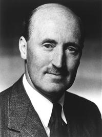
The English climatologist and geographer, Gordon Valentine Manley, started collecting meteorological data here in 1932. He wrote: “I was attracted by the Northern Pennines, in particular around Crossfell, as the most extensive area of bleak uncompromising upland that England possesses”. On this walk we will find out more about Manley’s life and work and the climate and weather phenomena of these hills that he observed.
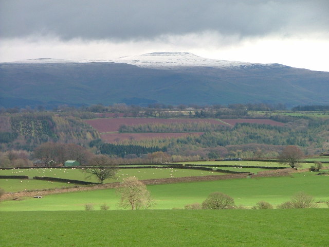
The walk is circular and is about 10 miles long. It starts in the small village of Knock then climbs on footpaths, including part of the Pennine Way, to the summit of Knock Fell. The route then traverses open moorland to the summit of Great Dun Fell. The descent back to Knock is on a tarmac road.
The route is steep and challenging, both on the ascent and descent, so it is recommended for more experienced walkers. Although the route follows marked footpaths, the cloud can descend quickly, even in summer, and limit visibility so always carry a map and compass. It can be very exposed and windy on top of the fells so take appropriate warm and waterproof clothing. Although Manley described this landscape as bleak, we hope you enjoy the walk!
Walk along the road through Knock in the direction of Dufton. At the end of the village the road makes a sharp turn to the right, signposted ‘Dufton’. Stop at this junction.
2 On the polar track
Gordon Valentine Manley was born in 1902 on the Isle of Man, but grew up in Blackburn, Lancashire. He began taking meteorological readings in the countryside around his home from the age of 12.
Later, during his studies at Cambridge University, he had a particular liking for geography.
There he also met Frank Debenham, who had been the geologist on the British Antarctic Expedition of 1910-13, under the command of Captain Robert Falcon Scott. Manley later acknowledged his debt to Debenham for “putting him on the polar track”.
In 1927 Manley became a Fellow of the Royal Geographical Society and a year later he was appointed to establish geography as a degree subject at the University of Durham, where he remained until 1939.
His subsequent research clearly demonstrates a love for hills, mountains and snow, both in Britain and in the Polar Regions, as we shall discover.
Do not follow the road towards Dufton. Instead go left following the footpath sign through Town End Farm. Follow the track for about 250 metres until you reach a fork. Keep right and immediately afterwards is a stile on the right signposted ‘Public footpath, Dufton via back of Pike’. Stop here.
3 Two loves
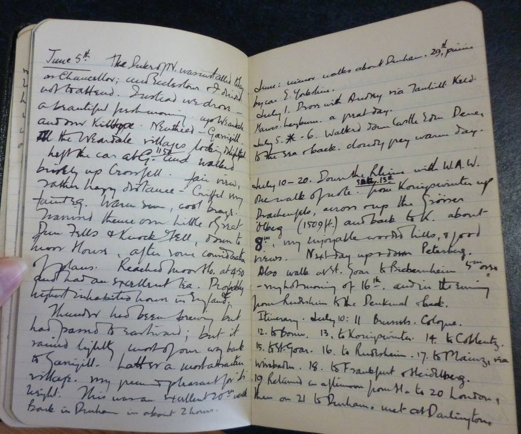
Manley was an avid walker and particularly enjoyed long walks at high altitude. He documented many of his walks in notebooks from his teenage years until at least 1952. While living in Durham, he regularly walked up the hills which now surround us, and, when snow cover would allow, also skied. Weather featured prominently in his walking notes, as this extract from 5th June 1929 shows.
“Left the car at G [Garrigill] and walked briskly up Cross Fell. Fair view, rather hazy distance – Criffel [a hill in southern Galloway, Scotland] very faintly. Warm sun, cool breeze.
Thence on Little & Great Dun Fells & Knock Fell, down to Moor House, after some consideration of plans. Reached Moor Ho. at 4.50 and had an excellent tea. Probably highest inhabited house in England. Thunder had been brewing but had passed to eastward; but it rained lightly west of our way back to Garrigill.
Latter a most attractive village, very green and pleasant for its height. This was an excellent 20th walk. Back in Durham in about 2 hours.”
A year after this walk Manley married Audrey Fairfax Robinson who shared his love of hill walking. The couple’s holidays were often spent walking in Britain and Europe. Manley talked as he walked and has been described as a great conversationalist.
We hope that the weather is fair during your walk to allow you to enjoy the stunning views. If the weather is clear you should be able to see the radar station at the summit of Great Dun Fell to the north, which is our destination.
Diary entry for 5th June 1929 Gordon Manley Papers, University of Cambridge
Directions
The distance to the next stop is about 1 kilometre and will take about 15 minutes. Go over the stile and follow the path. Keep right (over a stile) when the path forks. Continue over a number of stiles and a bridge over Swindale Beck, following Knock Gill (stream) on your right. Stop when you reach a ford and a footpath junction with the Pennine Way (over another stile).
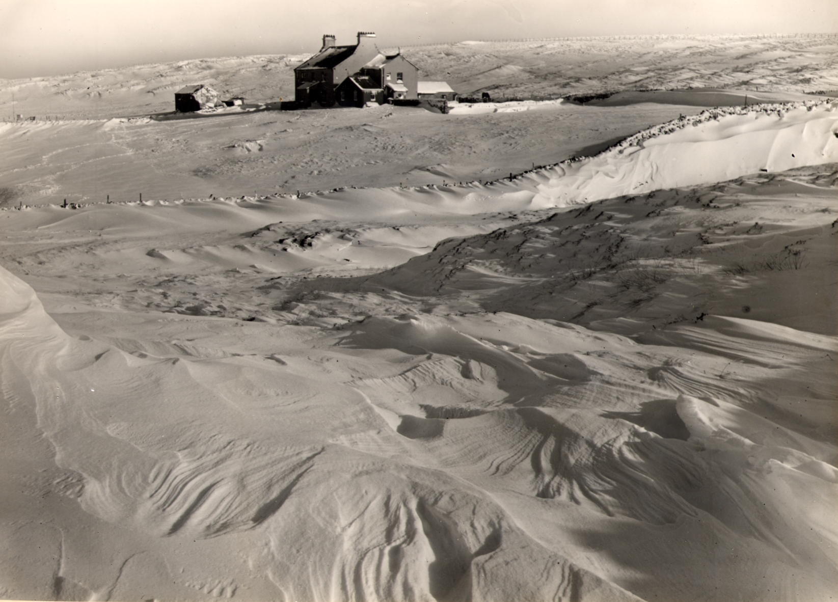
4 The most remote house in England
Manley began taking observations in this area in January 1932. He set up a climatological station at Moor House, a gamekeeper’s cottage about three miles east of the summit of Great Dun Fell (it is marked on the route map).
The cottage was five miles from the nearest neighbours and located at 1,840 feet above sea level. Manley believed that it was the most remote house in England.
Although Moor House was remote, it was inhabited by the Armstrong family. Life was not easy for them. Manley’s notes tell of the Armstrong’s daughter who went to school every day at Garrigill (Tynehead), which was 5 ½ miles away, on her pony. In the winter of 1931 she was unable to go for about eight weeks due to the snow. He also writes of a blizzard at Christmas 1940 when a snow drift reached more than half way up the stairs inside the cottage!
The Armstrongs helped Manley with his meteorological measurements. When he was not there, they changed the instrument recording charts, read the rain gauge and made observational notes. Between 1932 and 1947 they wrote to him regularly, sending the recording charts from the station and commenting on recent weather conditions. Manley himself visited the station on a monthly basis for much of the period.
In a letter of 7th November 1940 Mrs Armstrong wrote: “We have snow on Cross fell and the Dun fells. Today it has been a lovely day quite warm in the sun... The Helm wind was on a fortnight ago. We do so hope we do not get such a severe storm as last winter, things are bad enough without the weather being at its worst, so far we have been very lucky.”
This letter mentions the region’s most famed atmospheric phenomenon – the Helm Wind – which we will hear more about in due course.
Turn left onto the Pennine Way and follow the path uphill for about 750 metres. Stop when you reach a 90 degree left turn over a small stream called Small Burn.
5 A German spy?
Although the high Pennine moors were far away from the battlefronts of the Second World War and less vulnerable to air attacks, the people of the Eden Valley were still affected by the war.
Penrith was on an important line of communication and in 1940 a number of bombs were dropped on the nearby villages of Stainmore and Musgrave by a German bomber returning from an air raid on Liverpool.
In a letter of 1940, Mrs Armstrong wrote: “We had 10 bombs dropped at High Force [England’s highest waterfall approximately 5 miles from Moor House] about 3 weeks ago no damage done only windows broken mostly fell in fields. We had the same plane over us but it turned & went back the way it came, we feel sure he had missed the House owing to mist.”
Later in the same letter it emerges that Manley’s weather observations were being viewed as suspicious: “Mrs Hetherington at Garrigill enquired of me how you were a short while ago she seemed to be very upset as rumours were afloat again that you had been taken as a German spy, it sounded so very ridiculous I simply laughed and told her to do the same the next time she heard such rubbish mentioned, all the same I was very annoyed at people being such fools to set such falsehoods afloat...”
A paper on the Helm Wind that Manley presented to the Royal Meteorological Society in 1940 was even withheld from publication for reasons of national security.
Continue along the Pennine Way for about 500 metres until you reach a stile and a large wooden footbridge over Swindale Beck (stream). Stop here, enjoy the views.
6 Britain’s only named wind
The Armstrong’s letter that we heard earlier referred to the Helm Wind. Did you know that this is Britain’s only named wind? It has attracted scientific, lay and media attention over the years and was even featured on the BBC series Wild Weather in 2010.
The Helm Wind is an example of a ‘Foehn’ type wind, one that is typically dry and that acts down slope in the lee or downwind side of a mountain range.
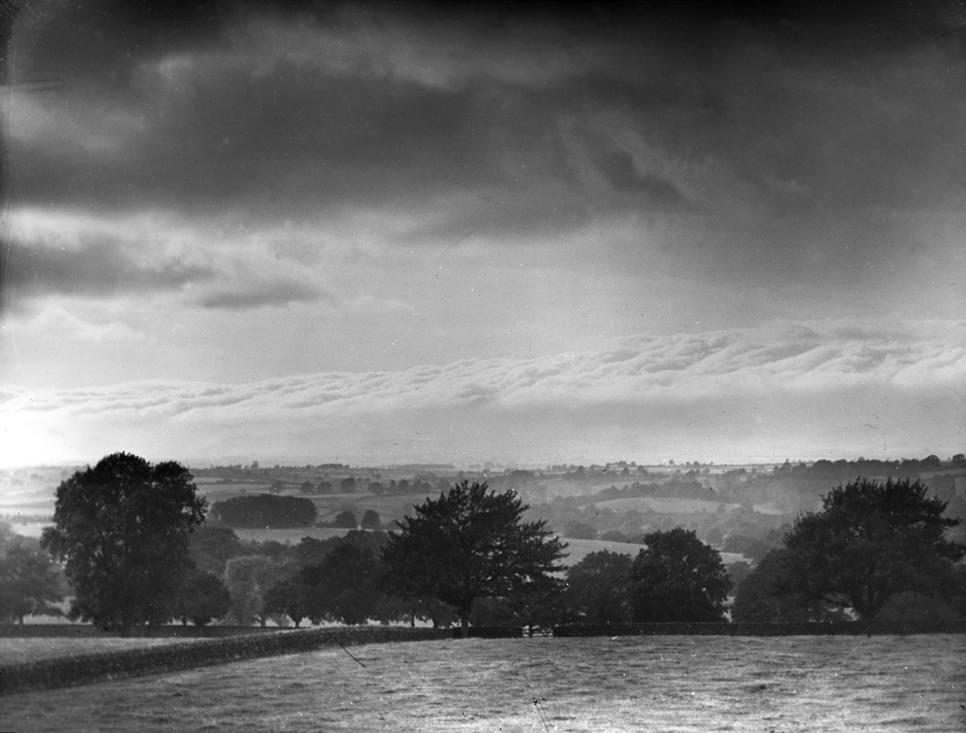
During an occurrence of the Helm Wind, a heavy bank of cloud (the ‘Helm’ or ‘Helm Cloud’) rests along the Crossfell Range.
Meanwhile, three or four miles from the foot of the fells, a cigar-shaped, fierce, rolling cloud (known as the ‘Helm Bar’) forms. A strong, cold wind blows down the steep slope until it reaches the ‘Bar’ and suddenly ceases. Clear sky usually separates the two cloud banks.
The Helm is a true ‘local’ wind, because it is a product of the particular landscape and climatic conditions found here at Crossfell.
The name Helm probably comes from an Anglo-Saxon word for helmet because of the distinctive cloud formation that covers the summit whilst the wind blows. The Helm Wind is both feared and celebrated by locals. If you think you can see this cloud forming now, it may be wise to descend!
Helm cloud bar in process of breaking up By kind permission of Durham University
Directions
Cross the footbridge and follow the footpath up the hillside ahead to the information board which tells you more about Moor House-Upper Teesdale National Nature Reserve. Continue uphill, following the Pennine Way for about 750 metres, which is marked by yellow arrows to help you stay on the path. Stop when you reach a double cairn (pile of stones).
7 Ricocheting like Brussels sprouts
Manley’s own investigations revealed the Helm Wind to have been documented in literature since before 1700. Here is an example from a local newspaper in 1831:
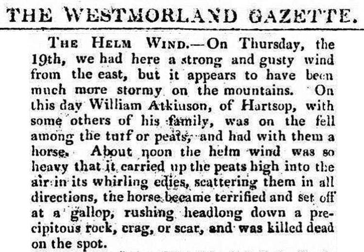
"On Thursday, the 19th, we had here a strong and gusty wind from the east, but it appears to have been much more stormy on the mountains. On this day William Atkinson, of Hartsop, with some others of his family, was on the fell among the turf of peats, and had with them a horse.
About noon the helm wind so so heavy that it carried up the peats high into the air in its whirling eddies, scattering them in all directions, the horse became terrified and set off at a gallop, rushing headllong down a precipitous rock, crag, or scar, and was killed dead on the spot."
It appears that the effects of the Helm Wind have changed little over the years. In a series of interviews with locals over 200 years later, people told stories of farm machinery being blown out of farmyards and sheep flying around like pieces of wool.
One resident who went out into his garden during the Helm quickly retreated indoors because Brussels sprouts were being blown off their stalks and ricocheting around the garden like green machine gun bullets!
Continue for about 500 metres along the Pennine Way. Stop when you are alongside Knock Hush (a fairly straight section of stream in a deep gully).
8 Hushing
This gully and stream may look natural but it is actually manmade. Look carefully on the Ordnance Survey map and you will see that it is called Knock Hush.
‘Hushing’ was a method of mining. A flood or torrent of water was used to wash away the surface vegetation and soil and to reveal mineral veins. This technique was widespread in the lead mines across northern England from Elizabethan times onwards and ‘hush gullies’ like this one are visible in many places.
A number of the mines in this area kept weather observations, which used by Manley used subsequently in his studies of past climate conditions.
Mines were vulnerable to flooding during periods of heavy rainfall, and those working high on the moors often developed a general interest in the weather as they would have been frequently affected by the changeable conditions.
Staff at Ardle Head and Cashwell Mines submitted observations of the Helm Wind to the Royal Meteorological Society investigation of the wind in 1889.
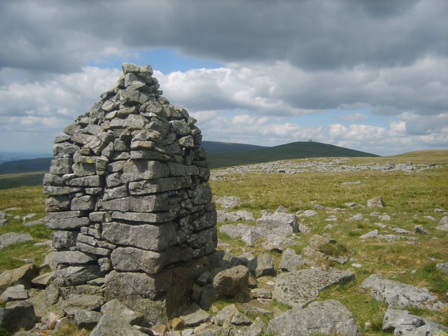
Continue following the Pennine Way upwards for another kilometre. Stop when you reach Knock Old Man (a large cairn with a square base).
9 Solemn, dangerous or exhilarating?
This stone cairn is known as Knock Old Man. The chances are that now you have reached the top, you can feel the wind. However it is probably a normal wind; you would certainly know about it if it was the Helm Wind.
The ‘History of Cumberland’ published between 1794 and 1797 carried a detailed description of the Helm Wind clouds:
“This helm or cloud exhibits an awful and solemn appearance, tinged with white by the sun’s rays that strike the upper parts, and spreading like a gloom below, over the inferior parts of the mountain, like the shadows of night.”
In 1830, the Reverend William Walton provided a few remarks on the Helm Wind to the Royal Society: “It is accompanied by a loud noise, like the roaring of distant thunder: and is carefully avoided by travellers in that district [Cumberland], as being fraught with considerable danger.”
A few years later, at a meeting of the British Association for the Advancement of Science, the Reverend J Watson presented a paper on the Helm Wind. He said: “Its effect on the spirits is exhilarating, and it gives a buoyancy to the body. The country subject to it is very healthy, but it does great injury to vegetation, by beating grain, grass, and leaves of trees, till quite black.”
He correctly assumed the primary cause of the wind: as it blew from the east coast and rose upwards among the hills the air cooled. From the summit, it rushed down with great force into a lower and warmer region.
Painting of ‘An Open Helm’ by R W Crosby (1885) Reproduced with kind permission of the National Meteorological Archive
Directions
Continue following the Pennine Way for about 500 metres. Stop when you reach the summit cairn of Knock Fell. If the weather is clear you can enjoy views across to the Lake District in the west.
10 Investigating the wind
We have already heard some early descriptions of the Helm Wind From the 1830s published accounts of the Helm Wind appeared with greater frequency in historical and geographical guides for the counties of Cumberland and Westmorland.
In 1884, Reverend Joseph Brunskill read a paper on ‘The Helm Wind’ at a meeting of the Royal Meteorological Society. Like those before him, he also drew attention to the noise: a distinctive roar giving warning of the imminent winds.
Following this, the Society put a letter in the local Penrith newspapers asking for people’s records and observations of the Helm Wind. From the responses, 93 instances of the Helm were identified in the period 1871 to 1884. In a later survey, 23 observations were submitted of five Helms occurring between November 1885 and April 1888.
William Marriott, Assistant Secretary of the Royal Meteorological Society, also visited the area making “numerous inquiries at each of the villages as to the appearance of the Helm Cloud, the Helm Bar, the peculiarities of the wind, and its effects, &c.” He heard many stories about the wind and the havoc it caused.
He wrote: “We were frequently told that haystacks were sometimes overturned, men on horseback blown out of the saddle, and other damage done by the wind.”
Although there was no shortage of personal accounts, Marriott found it difficult to put them all together to form an accurate picture of the phenomenon of the Helm Wind. He did, however, make an attempt at drawing a diagram of the processes involved in the wind’s formation.
Diagram of the Helm Wind Quarterly Journal of the Royal Meteorological Society (1886)
Directions
Continue along the Pennine Way for about 1 kilometre slightly downhill, across patchy moorland vegetation. There is a flagstone walkway to follow in places. If the weather is clear you are walking in almost a direct line towards the radar station. Stop when you reach a tarmac road and signpost.
11 A wind of exceptional violence
During his first year of observations at Great Dun Fell, Manley found occurrences of the Helm Wind were tantalisingly few.
Several occurred when he was elsewhere or unable to travel across the Pennines from Durham. However, he presented a paper on his observations of the Helm at the Royal Meteorological Society in August 1940.
Throughout his career Manley not only reported his findings to learned societies and in academic journals but also through the mass media. Here is an extract from a radio interview he gave in February 1939.
“There are many places in the world which are known on account of their characteristic local winds. By ‘local winds’ we may understand, winds of considerable strength which are confined to a small area of country, outside which they’re not felt [...] We have, however, a single example in Britain of a more violent local phenomenon, the ‘Helm Wind’ of Cumberland and Westmorland...
Given the right sort of east or north-east current, the wind rushes over and down the ‘step’ with exceptional violence. Villages and farms at the foot of the hill – places like Knock and Milburn, Dufton and Blencarn, Hilton, Murton, Skirwith, Ousby and Melmerby, find themselves in a “roaring north-easter”, blowing straight down from the fellside in a quite unforgettable way...
To walk up the fellside against it is an unforgettable experience, and, while I don’t object to wind, I don’t recommend going up in a ‘helm’ for pleasure. One stoops against it with everything buttoned up as tight as it can be, and slogs wearily up the hill with this steady roaring torrent of air pressing against one, sometimes at fifty or sixty miles per hour, even on a “fine day”...
It is very tiring, and if there is snow about it causes severe drifting. Further, east winds being what they are, it is bitterly cold. On the morning of the First of May, on the summit, it blew a gale from North-East with a temperature of only twenty-nine degrees at my hut.”
That’s minus 2 degrees centigrade!
Helm cloud settled down on the Pennines By kind permission of Durham University
Directions
Continue to follow the Pennine Way along the road and then along a path, keeping to the right. Stop when you reach the radar station at the summit of Great Dun Fell.
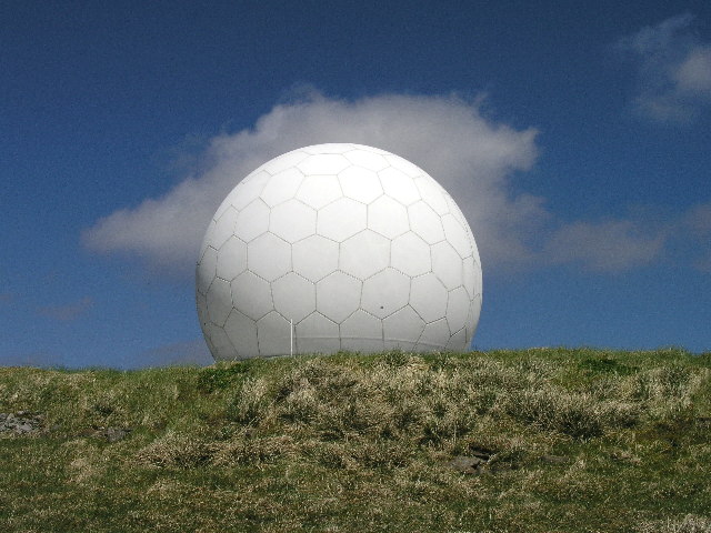
12 A monstrous miscellany of paraphernalia
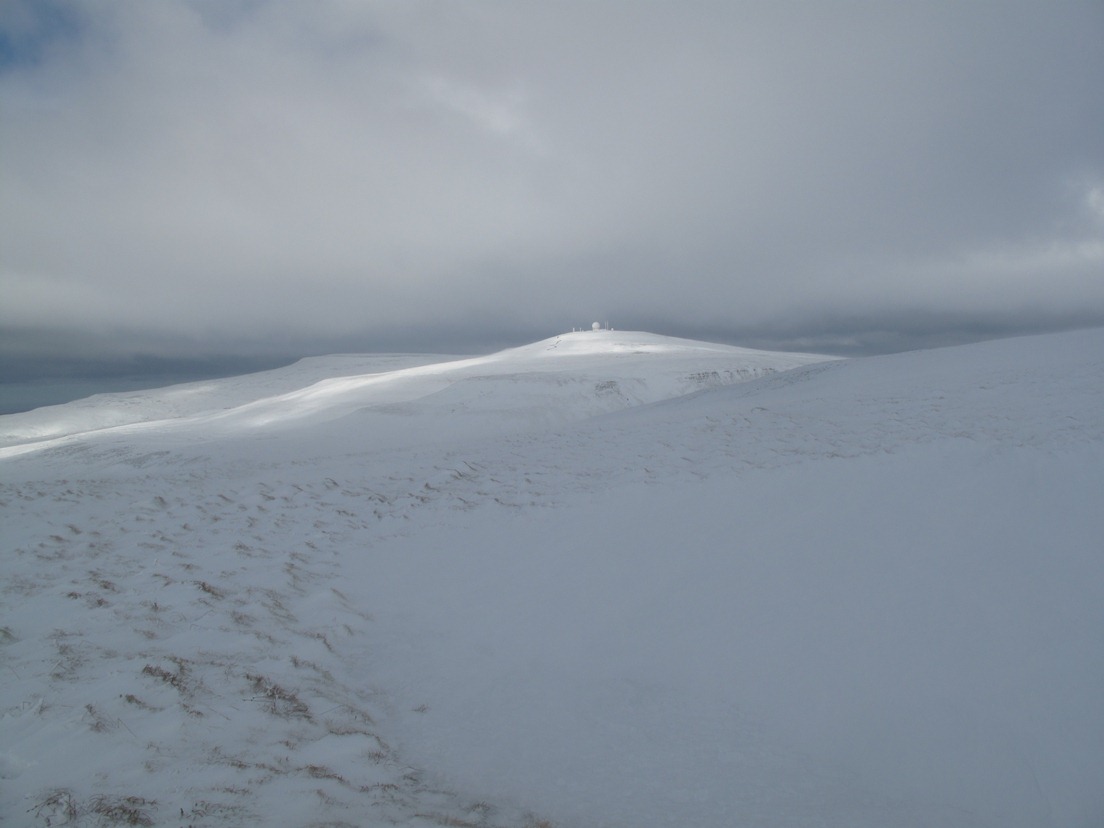
We are now at the summit of Great Dun Fell. This is the second highest peak in the Pennines at 2,785 feet (or 849 metres) above sea level.
The highest peak, Cross Fell, is just 2 miles further north and you should be able to see it in the distance (weather permitting!). The views are mainly of wild moorland and other Pennine fells. On a clear day you will also see the Lakeland Fells to the south west.
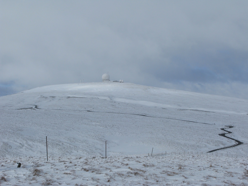
The radar station at the summit of Great Dun Fell is a key part of the national air traffic control system for northern England and southern Scotland. It was constructed in 1948 and the Civil Aviation Authority continued Gordon Manley’s tradition of taking weather observations.
The ‘golf ball’ radome was added in the mid 1980s. The radome is a weatherproof enclosure that protects the radar antenna and conceals the antenna electronic equipment from public view. The Centre for Atmospheric Science at the University of Manchester also uses the station for research into the behaviour of clouds.
In the past other major research projects have used the station, for example investigating cloud aerosol interaction and cloud processing of aerosol.
The masts and equipment at the summit are vital for air traffic control and telecommunications, as well as weather observations, but their presence is not always appreciated. Alfred Wainwright, the famous walker and compiler of guide books wrote in his Pennine Way Companion of 1968:
“The summit of Great Dun Fell is unique. Happily there is no other so defaced, so debased. A monstrous miscellany of paraphernalia, most conspicuous being four tall masts, disgraces it. Additionally there are wind and sunshine recorders, other grotesque contraptions and several squat buildings of no charm whatsoever. All these, aided and abetted by rusty tins thrown out by the resident staff (nice chaps, actually) make this quite the ugliest of all summits. A cairn and a few sheep are all one expects, or wants to see, on a mountain top.”
Walk around the radar station and follow the road back on yourself. About 155 metres south-south-west of the summit and 14 metres below it is a small hollow which was the site of Manley’s hut. Stop when you have found this hollow.
13 Troublesome instruments
As we heard earlier, Manley began his weather observations in this area in 1932 from a station at Moor House three miles east from here.
However, in 1937 he received a research grant and was able to establish a weather recording station close to the summit of Great Dun Fell. This is the former site of Manley’s weather station.
The wooden hut, which measured just 8 feet by 6 feet by 6 feet, was erected in a small hollow created by previous mining operations, where it would hopefully not blow over. It was also at the highest point of the escarpment where the Helm Wind was supposed to be most frequent.
The hut was equipped with two thermographs to measure temperature continuously, thermometers for temperature measurements on the days Manley visited the station, a barograph to measure pressure (similar to a barometer), and a portable cup anemometer to measure wind speed and direction.
In his years of measuring at Moor House, the extreme weather had interfered with the running of the station’s instruments. A letter from the Armstrongs noted that “The pen has been misbehaving itself again, I am saying the pen but it is the clock which stops, some days it is very bad to keep going.” Here too at the summit, Manley faced difficulties in keeping the instruments operational under the severe winter conditions at altitude.
Despite the difficulties, meteorological observations were kept for a period of three years from 1937 to 1939, including a continuous record of temperature. This was the first series of mountain observations to become available in England and remains the longest unbroken mountain record.
Manley’s hut at noon on 5th January 1939 By kind permission of Durham University
Directions
Follow the road downhill for about 750 metres along the road. Stop when you reach the junction with the Pennine Way.
14 Occasional small misadventures
Manley chose Great Dun Fell for his weather station for a mixture of reasons including “ease of access, remoteness and freedom from disturbance by passers-by”.
The ease of access was because there was a road most of the way up the mountain. This was an old mining road.
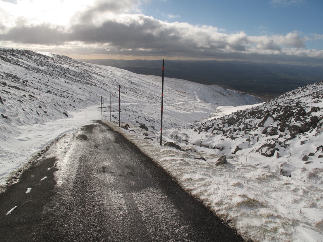
When the radar station was built, the old mine road was extended to the summit and surfaced. It is actually the highest road in Britain and, as Wainwight wrote, “the only one with a mountain top as its objective” as it does not continue past the summit.
Manley himself made around a hundred visits to the hut, generally driving over the Pennines to and from Durham. As we heard in the diary extract, he usually parked at Garrigill and walked the 6 miles to the hut, but from his notebooks we know that he sometimes walked up from Knock following the route we have taken today.
Manley often used skis for the final stage of his journey to the summit. It was sometimes quite an effort to reach the hut so it’s not surprising that Manley sometimes stayed overnight. The hut was equipped for camping and had cooking equipment and tools for clearing snow. He noted that it was also “admirably weatherproof”.
You might think that it would be frightening to be here alone on a winter’s night but Manley wrote: “Occasional small misadventures in the darkness, mist, wind and snow of a December night were offset by the many pleasures.”
Begin your descent of Great Dun Fell following the road. Although this is a quiet private road, do watch out for vehicles. After about 750 metres there is a road which forks up to the right. The hillside up to the right is marked as ‘Green Castle’ on the OS map. Stop at this road junction.
15 Daily diary
After his observations at Great Dun Fell were complete, Manley began to work more and more on collecting, analysing and interpreting other people’s weather observations and climate records.
The most prominent early observer of the weather in this area was James Losh, a lawyer from Newcastle, who kept a daily weather diary between 1803 and 1833. He kept instrumental data and also noted the first appearance of wild and garden flowers in their seasons.
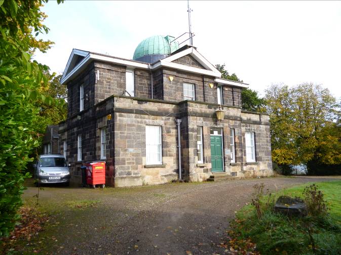
The Durham University Observatory also provided Manley with an important record from 1841. When Manley became Curator of the Observatory in 1931 he began work on standardising its long record of temperature, making historical measurements made with different instruments comparable with the measurements he was now recording on a daily basis.
Manley’s search for early climate records took him to many of the country’s archives and libraries from Exeter to Inverness and he acknowledged a debt to the generous assistance of archivists.
Continue following the road downhill for about 2 kilometres enjoying the views of the Eden Valley and Knock Pike (if the weather is clear). Stop where the road bends 90 degrees to the right and a footpath continues straight ahead (the area is marked as Knock Quarries (disused) on the OS map).
16 Ten months buried in snow and eleven in clouds
Have you noticed the poles alongside the road? Do you know what they are for? They are ‘snow poles’, designed to indicate the road's location when it is covered by snow.
The Crossfell area had a long history of snow observations, of which Manley was aware. George Smith wrote in 1747 that “there are some who affirm that it [snow cover] has continued sometimes for seven whole years together”.
Manley also drew on the writings of guidebook writer Hutchinson who referred to Crossfell in 1794 as “a mountain that is generally ten months buried in snow and eleven in clouds” one that “cannot fail exciting the attention and curiosity of a traveller.”
Manley’s observations at Moor House and Great Dun Fell also coincided with a number of unusually cold and snowy winters in Britain, particularly 1939, 1940 and 1947. The snow was not only heavy up here on the fells but also further afield. Manley’s mother wrote to him in 1940 from Blackburn:
“We have certainly had an exceptional time. It began to snow on Saturday aft and when Auntie Emma arrived home about 6p.m. it was becoming thick – it was blowing so much that there was no straight level – Fanny remarked when E. arrived, “Well it is a good thing you won’t need to go out again until Monday morning”.
On Sunday morning Emma dug snow out of the vestibule, & then dug a sort of trench down to the gate, so that milk &c might be brought to us. I dug a trench to the coal house & got a lot of coal in. Most of the yard was at least a yard deep – next morning I had to dig the trench again but not so deep as if I hadn’t dug it on Sunday...”
Manley’s interest in the weather had clearly rubbed off on his mum! She also sent something with the letter which he needed for the winter weather: “Now my dear, here are your socks, I hope they fit comfortably. If Audrey finds that they might be improved in some way, I shall be grateful for her advice. It is no use knitting another pair like these unless they are the right size.”
From the 1940s, Manley published numerous papers on the subject of snow and ice in Britain. He was a member of the Association for the Study of Snow and Ice (founded 1936 and later the British Glaciological Society). Amateur observers sent in postcards with records of snow and sleet fall and Manley collected and analysed them. Nearby Garrigill was the location of one of the first of these reports.
Keep following the road downhill for a short distance. Look out for the sheepfold (pens for holding sheep) to the right of the road just before a cattle grid. Stop at the cattle grid.
17 Not quite the worst summer!
In recognition of his achievements in meteorology, Manley was elected President of the Royal Meteorological Society in 1945, a distinction he is said to have particularly prized.
Under his presidency he founded ‘Weather’, a monthly magazine aimed at making current developments in meteorology available to a wider public.
Manley published several articles in Weather and since his death, a number of pieces about him; his work and archives have appeared in the magazine. Manley also wrote for the Manchester Guardian. His first article, published in December 1945, was entitled ‘The wettest place’ and was about Seathwaite in the Lake District.
Another of his articles, published in August 1954, was rather optimistically-titled ‘The summer of 1954: not quite the worst’! Over an 18 year period, Manley wrote about half a dozen articles a year for the paper.
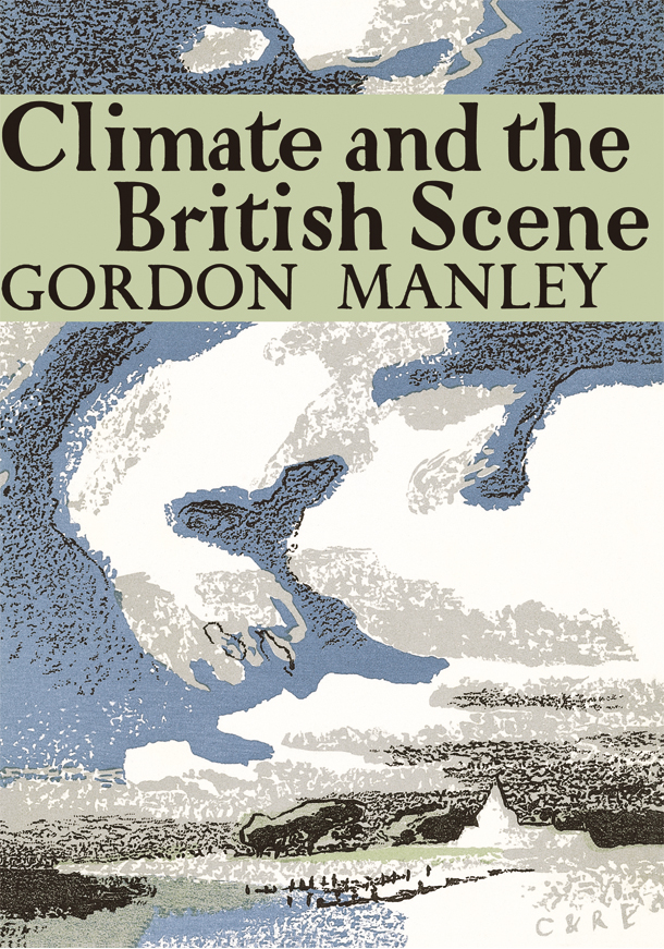
Meanwhile Manley’s book, ‘Climate and the British Scene’, published in 1952 is seen as one of his greatest contributions to British climatology. It was written in a popular, non-academic style and examines the role of the British climate in shaping the landscape and its people. By 1972 it had been reprinted five times.
Continue following the road downhill for about 1 ¼ km. Stop where the private road becomes a public road (where a gravel pit is marked on the map).
18 The gold standard
Through his study of early weather observers and their data, Manley gained a remarkable knowledge of early instruments and their use.
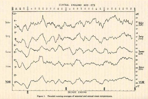
His greatest achievement was the successful synthesis of a vast number of temperature records into a single series of monthly averages for various sites in central England.
Manley first published his ‘Central England Temperature’ series in 1953 (covering the period 1698 to 1952), and updated and extended it in 1974 to cover 1659 to 1973.
The series has been maintained since Manley’s death, although there have been changes in the weather stations used, as some have closed or changed. Corrections have to be applied to more recent observations to take account of urbanisation, but the ‘CET’ series remains one of the longest and most widely used of its kind in the world as a statistically-useful indicator of changes of mean temperature.
Manley left Durham in 1939 and spent the next ten years at Cambridge University. In 1948 he moved to Bedford College (now Royal Holloway, University of London) as its first Professor of Geography, a time described by a friend as his happiest.
In 1964 Manley moved to a new position as Head of the Department of Environmental Sciences at the new University of Lancaster. He retired four years later and returned to Cambridge but remained actively engaged in research and writing.
Manley’s last visit to Moor House was in 1978. The area had been designated as a National Nature Reserve in 1952 and Moor House became a field centre run by the Nature Conservancy Council.
They continued to measure and monitor weather and climate. He spent three days at the field centre and began work on standardising his own Moor House observations with those taken by the Nature Conservancy Council.
Continue following the road downhill for about 2 kilometres passing the Knock Christian Centre on the left. When you reach a T-junction, turn left towards Knock village. Stop in the village.
19 A lasting legacy
As we make our way back to the start, we can reflect on the legacy of Gordon Manley, who passed away in 1980 at the age of 78.
He chose one of the wettest, coldest and desolate parts of the North Pennines for his early weather observations. He said: “Of the higher and wetter western moors south of Crossfell it may be said that nowadays they probably constitute the wildest and least visited tract in England.”
Although he only conducted weather observations at Great Dun Fell between 1932 and 1939, the practice was continued by the Civil Aviation Authority and the National Air Traffic Service, and later by the Centre for Atmospheric Science at the University of Manchester and the Nature Conservancy Council.
Manley was a pioneer in collecting and compiling early weather records and using them to analyse climatic change over time. His work on temperature records in particular remains widely used. Although Manley was a scientist and an academic, he was very keen on making the science of weather and climate accessible to the general public through his newspaper and magazine articles, books and radio appearances.
Manley was also one in a long line of people who have observed and been fascinated by the unique Helm Wind of the Crossfell area. Its special clouds, unique noise and violent wind have long been noted. Manley compiled previous accounts and stationed himself at the best point of Great Dun Fell to experience it.
The little hut at the top of Great Dun Fell may not be where you would want to spend the night but Manley’s expertise, dedication and enthusiasm to observing weather phenomenon from here changed the subject of meteorology for ever.
The spectacular scenery of the North Pennines experiences some of the most extreme weather in England.
This walk follows the Pennine Way to the summit of Great Dun Fell, the second-highest hill in the Pennines. It tells the story of the Gordon Manley, the geographer who pioneered the collection of meteorological data.
Visit the site of one of his weather stations on the summit. Discover what he measured and why he kept returning to this unique landscape. Find out about Manley’s legacy in climate science and meteorological research.
This memorable walk also includes stories of sheep, socks, snow and spies, plus remarkable accounts of Britain’s only named wind.
Follow the walk by clicking on the map pins or downloading the guides below
There is a steep climb to and from the top of Great Dun Fell (848 metres)
Conditions:
Weather can change quickly here so always take a map and warm waterproof clothing
Keep an eye out for:
Views across to the Lake District
Great Dun Fell walk credits
Thank you to -
Lucy Veale and Georgina Endfield for creating the walk, providing photos (and bringing chocolate and homemade flapjack for the team during the test walks)
Gary Priestnall, Simon Naylor and Sam Meek for developing and testing the walk
Jenny Lunn and Caroline Millar for editing the walk materials
John Kettley for narrating the audio guide with Matt Jones and Heather Moorhouse providing additional voices
Cambridge University, Durham University, Frances Lincoln Ltd, Harper Collins Publishers, Meteorological Office Archive, The British Newspaper Archive, The Centre for Ecology and Hydrology at Lancaster University, The Northern Echo and The Royal Meteorological Society for access to their archival collections and kind permission to reproduce archive images
The Royal Meteorological Society as partners on the wider project. Specific thanks go to Catherine Souch (RGS-IBG) and Paul Hardaker (formerly at the RMetS)
The Arts and Humanities Research Council (AHRC) for funding the wider project “Weather Walks, Weather Talks: Exploring Popular Climate Histories and Futures”