
Britain is experiencing a greater number of intense storms with high rainfall, a trend likely to increase because of climate change.
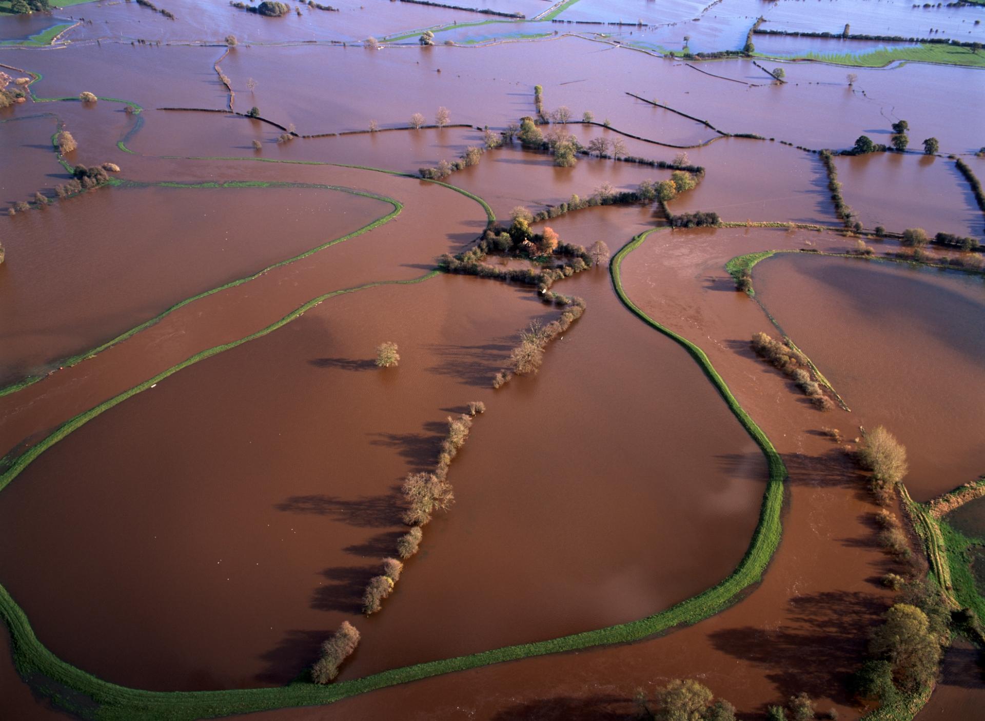
Extreme flooding, such as here on the River Dee, can happen at any time of year but is most likely in the autumn and winter. This is when we receive more of our rain, and as soils are already wet they are less able to absorb more water.
Intense storms at this time can be devastating. During early 2014, England experienced the wettest January since records began. It caused a national disaster, devastating parts of the country with wide scale flooding.
The hills and mountains in the west and north often receive more than 3000mm of rain a year, reaching 4000mm in the highlands of West Scotland. In contrast, East Anglia is one of the UK’s driest areas with less than 700mm of rainfall a year.
Climate change
Most scientists agree that climate change is real and will only get worse during the 21st century. It will probably most affect those areas in the world that already receive huge seasonal rainfall, like the Himalayas. Even in Britain, a recent government report estimated that the risk of flooding from peak river flows, sea level rise and tidal surges will more than double by 2080 and might even increase by up to 20 times. The cost of flooding damage will also rise, from the current £1.1 billion a year to up to around £27 billion.
Flood risk
The risk of flooding is not just a matter of rainfall and climate change. It is also influenced by where people build houses and businesses, the size and shape of the river network, and the mix of land use. For example, flood risk is increased by large areas of non-porous surfaces, like roof tiles and roads. Water rapidly runs off these into drains and sewers, which can then quickly overflow.