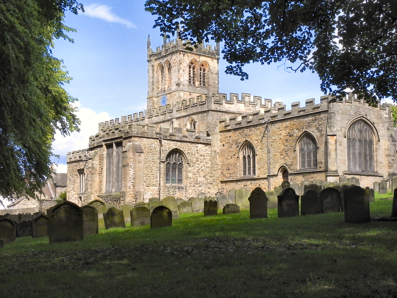
Our walk starts here at the beautiful 12th century St Mary’s Parish Church in Newgate and for a very good reason.
Enter the church and walk down the nave to the north transept, where you will find the massive and imposing font.
Take a close look. You’ll notice it is dark grey in colour, highly polished and has flecks of white fossil pieces. This is Teesdale or Egglestone marble, hewn from a quarry near Egglestone Abbey, which we will see later in the walk.
This font is octagonal in shape and around the edge you will see eight carved shields. On four of the shields and also on the base is what is thought to be the guild mark of Thomas Pounder, who may have been a wool merchant. The remaining four shields on the font bear the letters A E M T, which may be the initials of the mason or other donors.
Although the font is in three sections, it would have required both strong and highly-skilled men to hew, shape, carve and transport it a mile and a half from the quarry at along the banks of the Tees uphill to the church.
John Leland, an historian in the 16th century, wrote “Hard under the clif by Egleston is found on eche side of the Tese very fair marble, wont to be taken up booth by marbelers of Barnardes (Castelle) and of Egelston, and partly wrought by them, and partely sold onwrought to other”. We will visit the site of the quarry later on the walk.
This sturdy font is one of the finest of a group of contemporary fonts in the North and is a powerful reminder of Teesdale’s vanished marble industry which flourished here in the fifteenth and sixteenth centuries.
Directions
From outside the door of the church, pass into the graveyard. In the far bottom corner, follow the green public footpath sign down the hill into a wide grassy area. Turn left under a barrier, with a footpath sign for “Teesdale Way-Abbey Bridge” and then cross to the river bank on your right, where there are picnic tables.
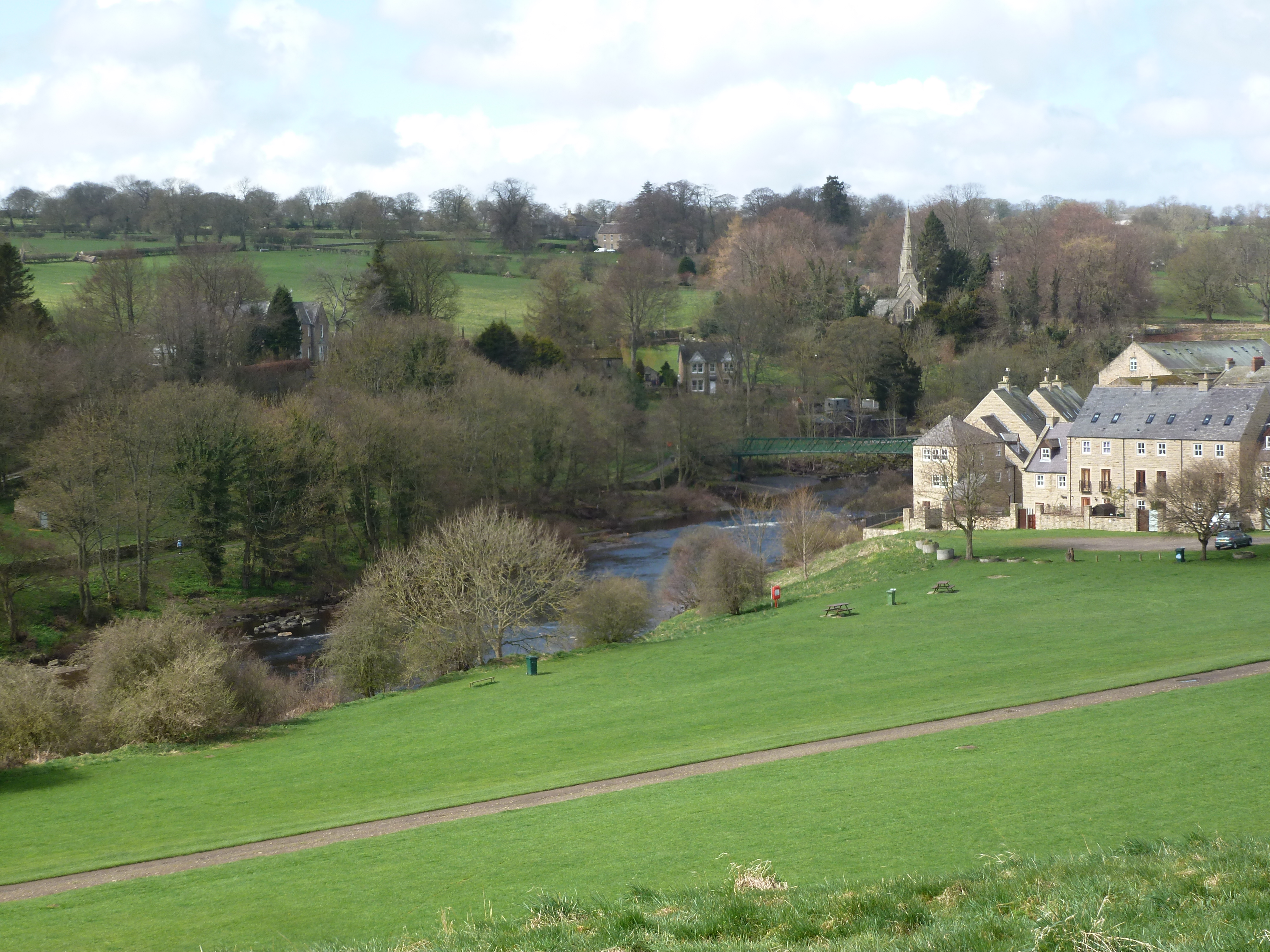
2 The Demesnes
On a roll - the terrible Tees
This large, grassed area of land is known as the Demesnes. It is a lovely spot, with the upper section now turned over to a wildflower meadow and the lower section running alongside the river.
Take a look at the river flowing beneath you, we’ll be walking alongside it for most of the route. The mighty River Tees rises on the slopes of Cross Fell, the highest point in the North Pennines and runs for 85 miles to empty into the North Sea near Middlesbrough. Its flow is controlled by a reservoir and dam at Cow Green, constructed (amidst considerable controversy and protest) between 1969 and 1971.
Whilst it may now look somewhat placid, at times the Tees is one of the fastest-flowing rivers in Britain and the level can rise dramatically. Before the dam was built, the river was renowned for its ‘roll’ or wave, up to 6 feet high, caused by a combination of snow melt and/or high rainfall and westerly winds, resulting in widespread flooding.
In 1771, the County Bridge was damaged and 8 houses were demolished and, in 1881, Thorngate Bridge was swept away, killing two people. Daniel Defoe, author of Robinson Crusoe, writing of a tour of Britain in 1724-27, referred to it as ‘a terrible river, so rapid’. As recently as 1942, seven soldiers of the South Staffs regiment were drowned whilst building a pontoon bridge across the river.
Another dark side of the Tees relates to Peg Powler, an evil spirit with green skin, long hair and sharp teeth, said to live in the river. She grabs the ankles of those who wander too close to the water’s edge, especially naughty children and drowns them. So watch out!
Directions
Return to the obvious cart-track across the Demesnes and follow it as far as a small group of buildings, which is our next stop.
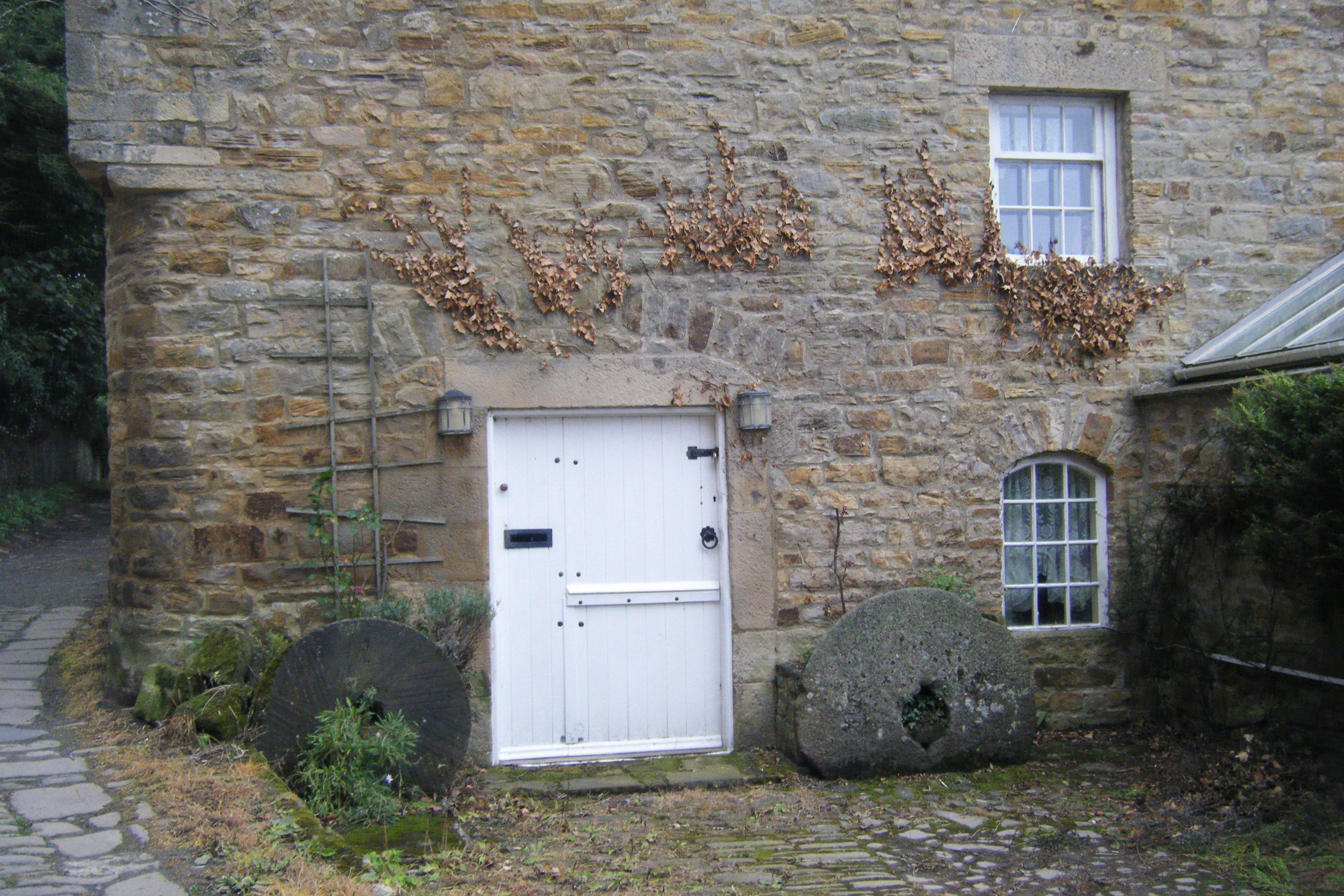
3 Mains Corn Mill
A miller’s tale
Take a look at the stone house next to the river. Does the river’s edge seem an unusual location to build a house? The house is actually a converted corn mill (the grinding stone is said to be still inside and intact) and was the town’s very first water mill (13th century).
The mill was sited here to take advantage of a natural, diagonal rock formation or weir in the river. Look over the wall to see its shape still visible in the river.
The weir directed water to the bank of the river, where a sluice gate regulated the flow and provided a steady stream of water to power the mill. When the mill was restored in 1824, the mill wheel was moved behind the outer wall, to protect it from the severe floods that were then common on the River Tees.
As we pass the old miller’s house, look out for the two millstones on either side of the front door. You can also still see the paved cart track, with its central cobbles for grip and outer flagstones for the smooth running of cart-wheels. As you pass the next house, look up to see the first floor window which would have been a loading door for winching up sacks of grain. Imagine the sounds of carts rumbling over these stones, the clipping of horses’ hooves and the shouts of men heaving sheaves of corn and bags of flour.
Directions
Continue along the track in the same direction, between the buildings and take the narrow pathway after the last house, just to the right of the gate, into the fields. Proceed parallel to the river, with a fence on your right, until you reach a telegraph pole, about 50 metres before a dry-stone wall and ruined building ahead. Pause here.
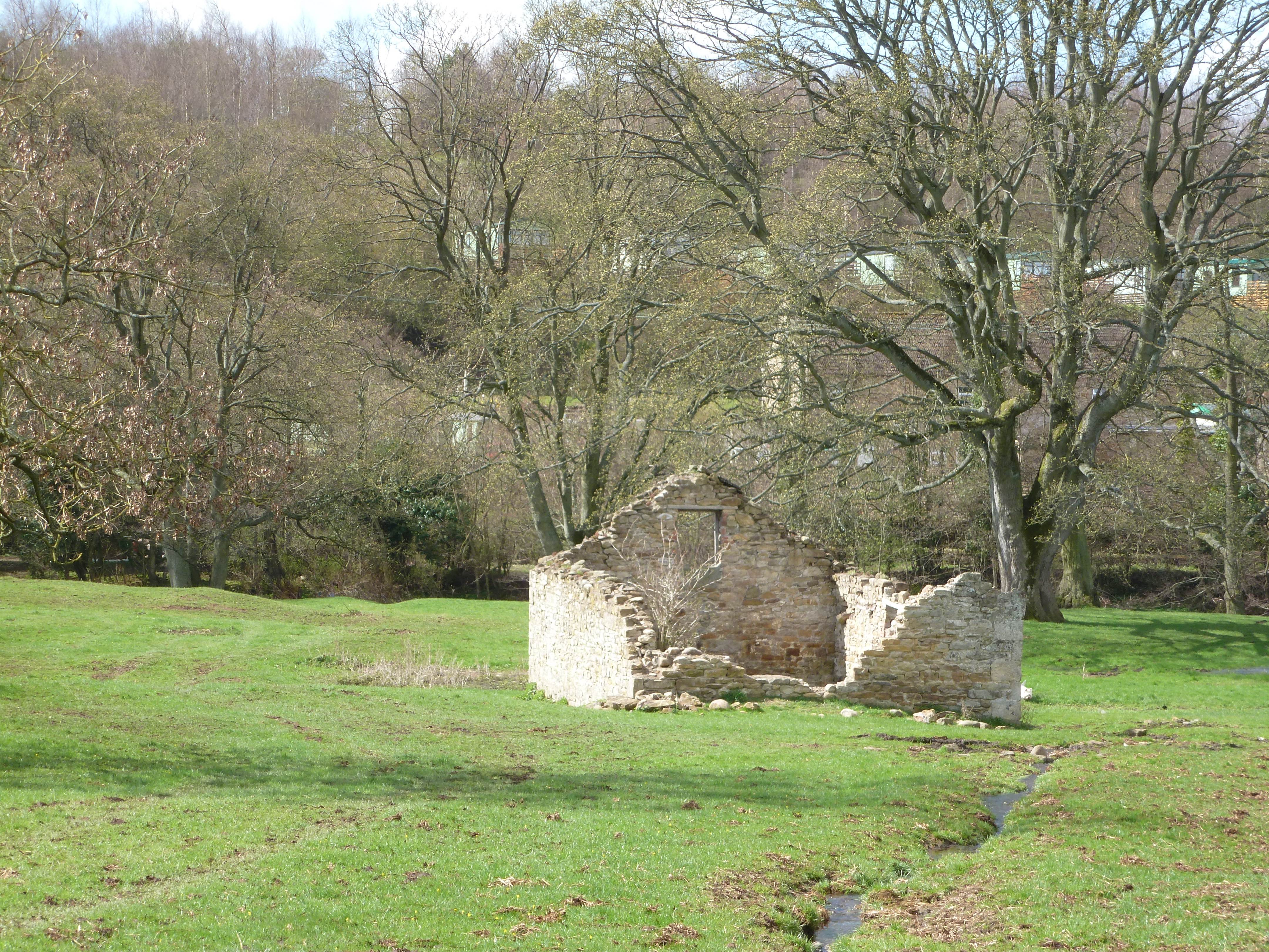
4 Flax mill
Face the flax
This stone ruin ahead and to your left looks like the remains of an ordinary field barn. In fact, this building was once a flax mill. Flax, a plant with a pale blue flower, was grown mainly for its fibres, used to make linen and for its seeds, used to make linseed oil. This mill, known as Low Mill, however, probably produced fibres that were used to make rope, twine and thread for sewing shoes and gloves.
Its significance for us, however, is that (like the corn mill we just saw) its reason for being here was the power provided by the river. If you look through the trees to your right, you will a group of stones which have created a natural, v-shaped weir in the middle of the river, which diverted the water to both sides. There was once another flax mill on the south side of the river, which shared the weir but no evidence of it remains today.
On our side of the river bank and just ahead you you can see a pile of flat stones. These are all that remain of a shelter built for the operator of the sluice gate. There are also the foundations of the mill-race. The dam was held in place by metal structures on the bank and in the river, pieces of which are visible if you look carefully.
In its heyday, the mill would have been a busy and noisy scene and the creaking of the mill wheel as it ground the flax would have been heard for some distance around.
Directions
Continue through the gateway in the dry-stone wall and walk to the left of the mill building. Beyond the mill building, continue diagonally right along the path, which stays away from the river bank until the sewage works, then goes through a gate between the works’ wall and the riverbank. On emerging into a field, find a gap in the tree line on your right, close to the river.
5 River clearing
A tropical paradise - origins of the River Tees
This is a lovely stretch of the river and it’s worth spending a few minutes here to ponder the origins of the Terrible Tees. It may be hard to believe, but 325 million years ago, during the Carboniferous Period, you would have been standing in a warm, shallow sea, alive with bright corals and shellfish.
The North Pennines then lay almost astride the equator and Teesdale basked in a tropical climate. In fact, at different times, the whole area alternated between swampy deltas and deeper seas.
When the water was shallower, sandstones and shale were laid down. When it was deeper, sea creatures such as corals, sea lilies and brachiopods flourished and their remains settled on the sea floor, eventually becoming the layers of grey limestone.
Teesdale is like a layer-cake of these different rocks, sandwiched on top of each other.
Later, during the Ice Ages mighty glaciers, up to a kilometre thick, covered the area, scouring out valleys, depositing boulder clays, rocks and gravel and flattening hill tops, until our present landscape emerged some 10-15,000 years ago.
Today, the river supports a wide variety of plants and animals. If you look carefully, you might see a grey heron standing as still as a statue, stalking its prey; black-headed gulls heading back up to the reservoirs or swallows swooping to catch flies.
Directions
Continue along the path through a field gateway and go straight ahead across the next field, keeping the river close on your right side. Just before reaching the gate at the end of this field, stop at the fence on your right, at an obvious clearing between the trees. As an alternative, if you feel like a refreshment stop, continue through the field gate ahead and turn immediately sharp right down the river bank, where you will find a bench in a tranquil spot with a lovely view.
6 Abbey paper mill
Another miller’s tale
Ignore the dramatic ruins on the skyline for now (we’ll come to those later) and instead look across to the opposite bank of the river and left to see a group of stone buildings. In front of these buildings you should be able to see a wall with two window openings. You may also be able to see some slabs of rock slanting down into the river just beyond. The wall is all that remains of the Egglestone Abbey Mill. This was a paper mill producing hand-made white paper as early as 1717.
For a century and a half paper manufacture was an important industry in County Durham. From the fifteenth century onwards, when paper became cheaper to make than parchment (made from sheep skins), religious institutions and seats of learning, such as Egglestone Abbey and Durham Cathedral, created a demand for white paper. Later, the emerging coal and shipping industries, especially in Sunderland and Gateshead, increasingly needed paper for stationery, wrapping and packaging.
Egglestone Abbey Mill would probably have used linen or other cloth rags as its raw material and harnessed the water from the river to drive the mill wheel. Paper was made by beating the raw fibres into a pulp, screening the solution through a wire mesh, then pressing the resulting wet mat of fibre between layers of damp cloth to remove the water then drying the sheets in the open air.
The landscape artist J M W Turner famously visited the area in 1779 and later painted the Abbey Mill. By 1830 the mill could no longer compete with larger, mechanised paper mills which were sited nearer to markets and the mill was converted to grind corn. It was severely damaged by the flood of 1881 and never repaired. Another example of a once-thriving industry lost from Teesdale.
Directions
Go through the gate and continue ahead, staying close to the riverbank – do not take the track slanting left up to the road. Just before a kissing-gate, there is an old access track down to the right. From the fence here, you should be able to see down to the river. If not, because the trees are in full leaf, try going just through the kissing-gate and have a look from there.
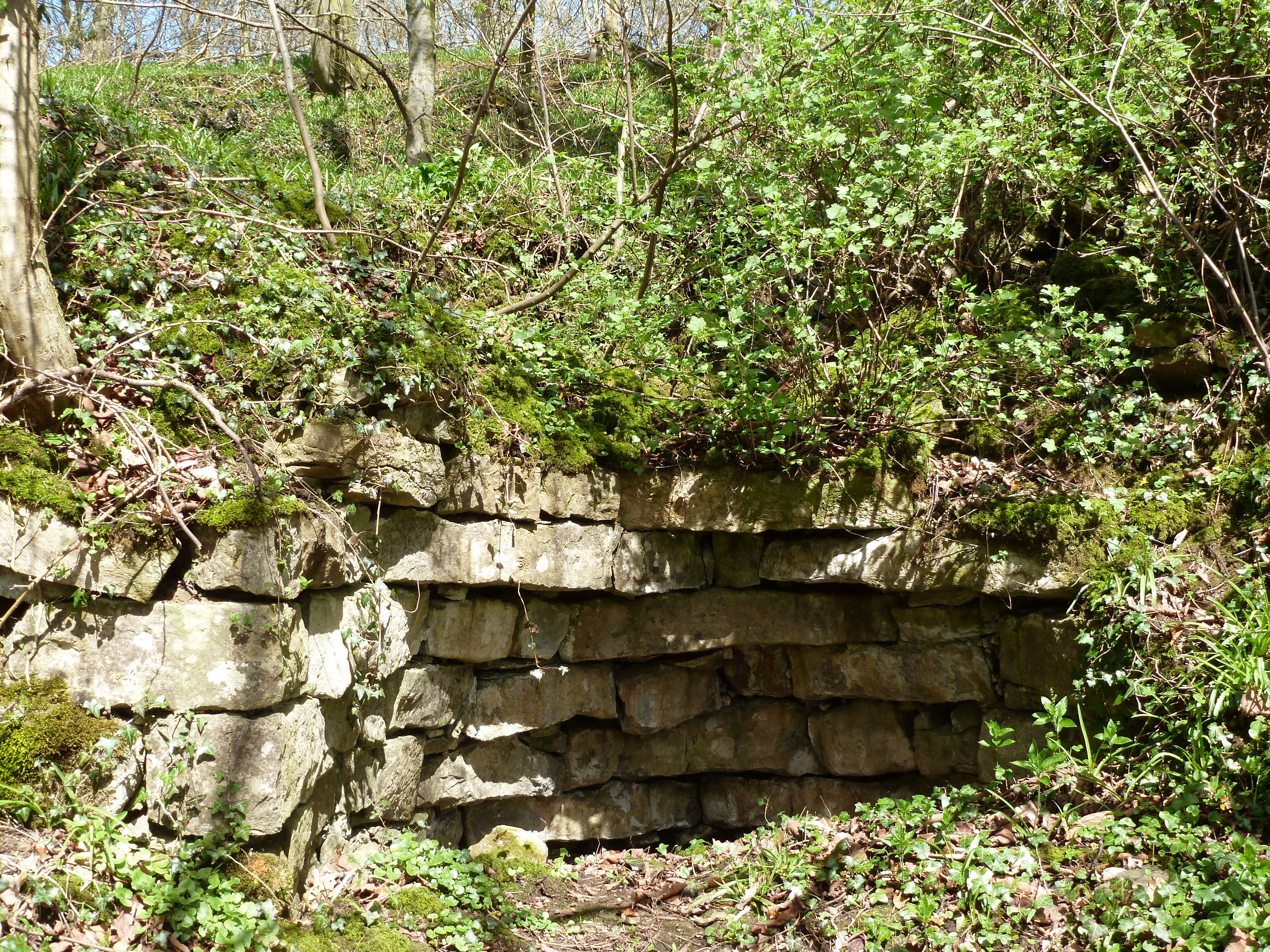
7 Mains House Quarry
A marbeler’s delight
Look down and see if you can spot some large flat blocks of stone on the opposite bank of the river. This is the site of a marble quarry of which historian John Leland once wrote “...About a quarter mile beneath Eggleston is a faire quarrie of blak marble spotted with white, in the very ripe (on the very edge) of Tees. This is almost certainly where the stone for the font in St Mary’s Parish Church was cut.
If you look carefully at the river bank directly below you, you will see more massive blocks of stone. There was another quarry sited on the opposite bank known as Mains House Quarry, which dates back to at least 1307. Abbey and Mains House quarries were two of the four quarries that were the source of Egglestone marble.
Egglestone marble is not a true marble, which has been metamorphosed or changed under intense heat or pressure, but is a sedimentary marble, in which the pores and tension cracks in the stone have been filled with natural calcite cement. This made it possible to achieve a beautiful, polished finish to the dressed stone.
Its other merits were that it could be extracted in large blocks, had an attractive greyish/brown colour and, when freshly quarried, was particularly suitable for carving. No wonder it was used extensively for monumental purposes throughout the North East of England!
Directions
Continue as before, through the woods. This stretch is uneven underfoot and may be slippery after rain. The path climbs up to a squeeze-stile in a wall and out onto a bridge. Turn right across the bridge, watching out for passing vehicles and stop in one of the niches.
8 Abbey Bridge
A gorgeous sight
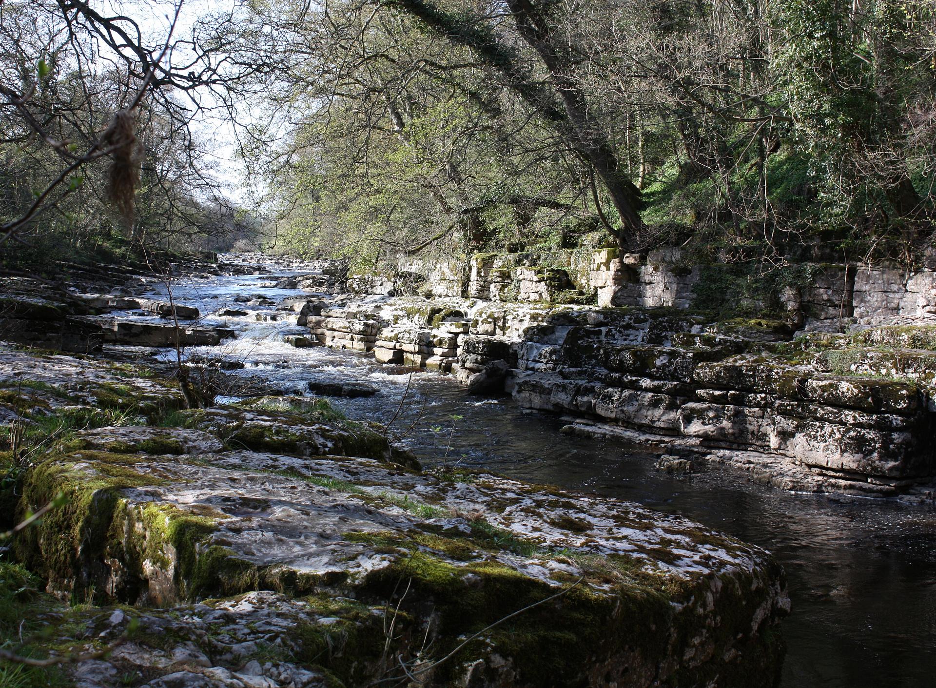
This is the delightful Abbey Bridge standing high above the river. Take a look over both sides and enjoy the dramatic views. The steep, rocky and wooded banks form a natural gorge, through which the river rushes and tumbles over a series of rapids.
It was built in 1773, when John Bacon Sawrey Morritt, an antiquarian and member of Parliament, required better access to his estate at nearby Rokeby.
The author Sir Walter Scott stayed with Morritt in 1809 and again in the autumn of 1812, as a result of which he wrote his celebrated poem Rokeby, in which he describes the river here as ‘..condemn’d to mine a channelled way/O’er solid sheets of marble grey’ which, of course, was Egglestone marble. Scott wrote the poem in the hope that the proceeds would help to pay for the building of his new cottage at Abbotsford in his native Scotland. Although the poem sold 10,000 copies in the first three months, it was not a great success and his hope proved to be in vain.
Abbey Bridge operated as a toll bridge until 1956. A toll booth and toll-collector’s cottage stood at the opposite end of the bridge, together with a tearoom. All that remain are two rounded parapet-ends planted with flowers. You can imagine the busy scene, with horse-drawn carts rattling across the bridge and queuing to pay their tolls, people stopping to admire the view and travellers enjoying tea and cakes in the tearoom.
Directions
Cross the bridge and turn right at traffic lights along a minor road towards the Abbey, bearing left uphill to reach the entrance to the Abbey itself. Go through the gate to find an information board in front of the main ruins.
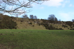
9 Egglestone Abbey
A place for quiet contemplation
Notice that Egglestone Abbey occupies an impressive position, high above the River Tees, near the point at which Thorsgill Beck flows under a single arch bridge into the river. The site was probably chosen because it was sheltered and secluded and also because of the quarry below, from which stone could be extracted, either for construction or to generate an income.
The abbey was dissolved by Henry VIII in 1540 and the monks were pensioned off. It was sold in 1548 and some of the stone was used to build a manor house, but less than twenty years later it was described as being“in utter ruine and desolation”. By the 19th century, it had labourers’ cottages and around 1900 the north transept was demolished to provide stone for paving the stable yard at nearby Rokeby Hall. Today it is maintained by English Heritage and is refreshingly free of ticket booths and gift shops. With the sound of the river crashing over rocks below and nobody about but the sheep, it’s a pretty, atmospheric spot.
Now see if you can find the massive tomb chest. It is carved, more elaborately than most such chests, from Egglestone marble, almost certainly taken from the Abbey quarry below. The sides have a number of recesses, each bearing either a shield or a bracket that would originally have supported a separately-carved figure. Alongside the tomb chest are the lid and a slab bearing an inscription to Thomas Rokeby. There would, no doubt, have been a great many more pieces here originally, but they have sadly been lost over the centuries.
Feel free to wander round the ruins and climb up the steps of the Novices Room for a commanding view of the surrounding area.
Directions
Retrace your steps to go back across the bridge and, at the end of the bridge, take the path immediately to the right, signposted “Teesdale Way – Whorlton 2¾ miles”, to enter a stretch of the ancient Teesbank Woods, a local wildlife site. In spring and early summer, the woods are carpeted with wood anemones, wild garlic and primroses. The path rises uphill a little and then drops back down to the river, near some rapids. After about 500 metres, at a fork in the path, take the right-hand path, following a sign to “Limekiln only 50 metres”. Stop when you reach a partially-collapsed, stone structure on your left.
10 Lime kiln
Toiling over a hot kiln
This pile of stones are part of what was once a lime kiln, a furnace built to extract lime from limestone. A map of 1860 shows four such kilns, together with four small limestone quarries, along just a short stretch of the river here. Hard to believe today, but this would once have been a noisy, smoky, and dirty place, alive with the sights, sounds and smells of industry.
This may seem an odd place to find lime kilns, but there was a plentiful supply of limestone and wood for fuel; water from the river to slake the quicklime and a sheltered position on a rising bank to help the fire to draw.
Lime kilns have been used since Roman times to make lime by burning limestone at temperatures above 900C. The ‘quicklime’ or ‘burnt lime’ produced was mixed with water to produce hydrated lime, which formed the basis of plaster, mortar and concrete. Good quality lime was also used in lime-wash to waterproof walls and lighten interiors; for bleaching paper; for preparing hides for tanning or as a disinfectant.
The lime from this kiln may have been used in the building of the hall at nearby Rokeby Park or perhaps to supply the Abbey paper mill or tanning houses in Barnard Castle. It is more likely, however, that it was used primarily to improve or ‘sweeten’ the surrounding land, which tends to be rather acidic and of poor quality. The soil loses lime naturally through leaching and the cutting of hay and other crops, becoming less fertile over time, so needs regular nourishment to maintain fertility.
Directions
Retrace your steps for about 50 metres to bring you back to the fork in the path. Take the left-hand branch, signposted “Teesdale Way”, leading uphill. Go through the gate out of the wood, turning right along the path and through a wooden kissing-gate into the next field. Keep to the right-hand edge of the field. Go through another wooden gate in a fence and bear diagonally left to go over a stile in a stone wall, with a white-topped “Teesdale Way” marker-post. Follow the same line, aiming for another white-topped marker-post, just left of a solitary ash tree in the middle of the field. Pause here to take in the view.
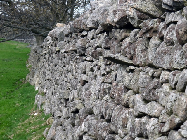
11 Dry stone walls
A pastoral scene
You’ll notice that the landscape here is very different from the earlier part of the walk. You are now quite high above the river and have extensive views over a wide area of lower Teesdale.
Take a look around at the the pastures and arable fields which are divided by dry-stone walls. These are a common feature throughout Teesdale. Dry-stone walling is an ancient craft, dating back probably to the Iron Age and it requires considerable skill. The walls are constructed without mortar to bind them and depend for stability on the interlocking of the “through” stones.
Some walls use rounded boulders, which would have been smoothed by the action of glaciers and rivers and cleared from the fields for agriculture. Mostly, however, these walls are built from stone that would have been taken from small quarries (still visible at the bottom of the stream down to your right) and then cut and shaped to fit the wall.
Originally, these walls might have enclosed small, medieval farms, although many were the product of the Enclosure Acts of the 18th and 19th centuries. These acts controversially forced the enclosure of common lands and transferred them to the ownership of wealthy landowners, often causing conflict and bloodshed.
Here, the primary purpose of the walls is to contain sheep and cattle and prevent them from straying. They were probably built by the farmers themselves, although there are examples higher up the dale that were reputedly built by French prisoners from the Napoleonic Wars. Quite a punishment given the vagaries of the weather and the steeply-sloping fells up there!
These days, skilled wallers are scarce and much in demand, as dry-stone walls are increasingly valued as part of our heritage.
Directions
Walk straight ahead to a wooden hand-gate in the wall ahead, which again has a white-topped marker-post, then stay along the top of the field, with a wall on your left. At the next dry-stone wall, go through a gate and, after a few metres, turn right through a wooden kissing-gate in the fence, with a sign to “The Meeting of the Waters”. Descend the stepped, winding path down to another kissing-gate through a dry-stone wall and into a field. Carry on straight ahead towards another dry-stone wall, where you will find a sign for “The Meeting of the Waters viewpoint”.
12 Meeting of the Waters
Hacking and hewing by the river
Look across to the opposite side of the river and you will see the picturesque spot known as the ‘Meeting of the Waters’, where the River Greta flows into the Tees. The beauty of this place has inspired many poets and artists down the years and it has been painted by both J M W Turner and John Sell Cotman.
Immediately below you and to your right, at the very edge of the river, is the site of Westfield Quarry, another source of Egglestone marble. From here it could be extracted in slabs large enough to make tomb chests.
Quarrying was hard work. It involved hammering wedges into natural joints and bedding planes, or into slots hewn into the rock. Crowbars enabled the resultant slabs to be levered out and trimmed using mallets, chisels and axes. Keep an eye out for the stepped flanks and wedged slots in the rock along the river’s edge, where the huge slabs were removed.
Directly across the river, a smaller area of quarrying occurred at Watersmeet Quarry, which was also owned by the Abbot of Egglestone. The marble extracted here is differentiated from the other sites by dark-coloured shell fragments and is known as Greta or Watersmeet marble.
Monuments made from Egglestone marble are found in Newcastle Cathedral and York Minster, but also as far afield as Kendal in Cumbria and Lincoln, Newark, and Worksop in the Midlands. Over 350 pieces remain in existence. In Durham Cathedral, the monk’s laver or wash-basin, in the cloister garth; the tomb chest of Bishop Thomas Langley and the slabs covering the shrines of The Venerable Bede and St Cuthbert are all fashioned from Egglestone Marble.
The use of Egglestone marble, however, went into irreversible decline in the latter part of the fifteenth century, under pressure from imported Midlands alabaster tombs and London brasses that quickly became a new fashion favoured by the elite.
Directions
Re-trace your steps back to the main footpath. Resume your way, along the edge of the wood. At the top of a short incline, some 50 metres before the next kissing-gate, keep your eyes peeled to find a break in the trees, which should allow a clear view over to the other side of the valley. Stop and look across the river.
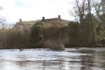
13 View of Mortham Tower
A modest family home
On the south bank of the river, can you see what looks like a rather squat church with a castellated tower? This is Mortham Tower, a fortified manor house, which was built by Thomas Rokeby in the time of Henry VII (1485-1509). Prior to this the old seat of the Rokeby family had been destroyed by raiding Scots in 1343 and the two villages of Rokeby and Mortham, which occupied opposite sides of the Greta, had likewise been destroyed in 1346.
In 1610 the estate was purchased by a local merchant named William Robinson and later the house was substantially altered in the 18th century by Sir Thomas Robinson, the architect and then owner of nearby Rokeby Park. Mortham Tower is one of the most southerly of the fortified tower houses, which are frequently found in the northern counties. These were traditionally called border peels or pele towers and were built as protection against marauding Scots, although Mortham Tower was arguably more ornamental than defensive.
According to John G Lockhart, a Scottish writer and biographer of Sir Walter Scott, writing in 1837-8, the house was haunted by a ghost named Mortham Dobie, a lady said to have been murdered in the woods and who ‘...appeared dressed as a fine lady with a piece of silk trailing behind her, without a head indeed though no tradition states how she lost so material a member, but with many of its advantages for she had long hair on her shoulders and eyes nose and mouth on her breast ...’
To the right, you may be able to see the outline of Rokeby Park itself (although in summer only the top of a chimney and a section of the roofline may be visible amongst the trees). This is an impressive mansion, inspired by the designs of the sixteenth century Venetian architect Andrea Palladio, whose symmetrical style, based on the formal, classical temple architecture of the Ancient Greeks and Romans, was briefly popular in Britain in the mid-18th century.
Directions
Proceed and go through a wooden gate in a fence, keeping to the right-hand edge of the field. Continue through two more fields, with wooden hand-gates, until a gap in a stone wall leads down some steps to a wooden footbridge, crossing a small stream.
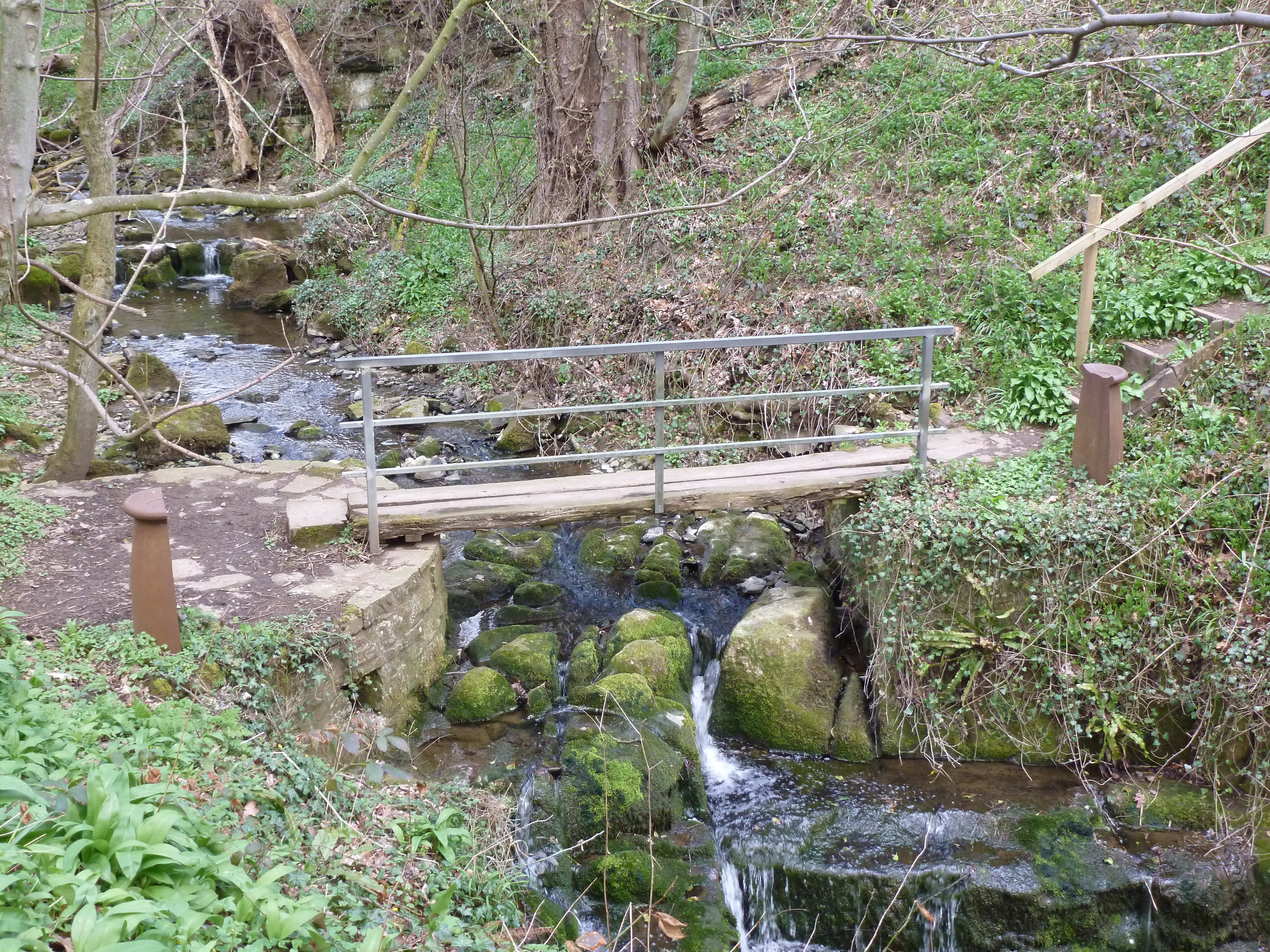
14 Sledwich Gill
A parish boundary with a difference
This pretty stream running down the valley is known locally as Sledwich Gill. The word Gill or Ghyll is used for a stream or narrow valley, mainly in the North of England, but also in other parts of the United Kingdom. It derives from the Old Norse gil meaning steep-sided valley. As you will see, the gill has carved a surprisingly deep course through the hard limestone bed. The gully was probably formed by glacial meltwater, towards the end of the last ice age, around 15,000 years ago.
The gill marks the boundary between the parishes of Whorlton and Westwick. At either end of the footbridge you will see some unusual boundary markers shaped like half a chimney pot. They were commissioned in 1996 by Durham County Council, to coincide with Visual Arts year and the North of England being chosen as the UK Region of Visual Arts. The markers were made by artist Richard Wentworth and are part of a series of similar markers for all the parish boundaries on the Teesdale Way between Mickleton and Gainford. Thus, the artistry of the stone-masons carving Egglestone marble for the Abbey and elsewhere, all those hundreds of years ago, is now echoed by a modern artist adding a stylish flourish to the banks of the Tees.
Directions
Over the footbridge, climb the steps up the steep bank opposite, through a wooden gate and then along the field edge. Go through a wooden hand-gate and across two fields. In the next field, the path bears diagonally left and curves around the top of an open bank of oak trees. Through an iron gate at a small plantation, the path leads straight ahead (ignore the footpath marker to the left) and across fields through wooden hand-gates. Houses come into view and you pass alongside gardens, with a precipitous drop on your right down to the river far below, until you emerge onto a road. Turn right and immediately turn right again down some steps to reach a bridge at the bottom.
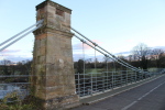
15 Whorlton Bridge
Bridge the gap – An historic structure
Walk on to this elegant bridge and enjoy the river for a moment. It’s a peaceful spot to watch the swirls and eddies of the water as its winds its way across the rocks. Arriving here on 7 July 1831 however, you would have met with a busy and festive scene. A throng of local people, workers and visiting dignitaries progressed across the newly-opened wonder of the Whorlton suspension bridge, accompanied by a ‘band of music’. At last, there was a road crossing from the Durham to the (then) Yorkshire side of the river and travellers would no longer have to risk the dangerous ford or the small boat-ferry further downstream.
This elegant bridge was built by John Green of Newcastle-upon-Tyne, as part of the Staindrop to Greta Bridge turnpike (toll) road. Work had first started in 1829, but the stonework was washed away in a great flood on13 October that year, caused by the worst storm in living memory. A suspension bridge seemed to be the best solution, as it would not require stone piers to be built in the river and would not, therefore, be vulnerable to floods.
Until 1914 this was operating as a toll bridge. You can still see the old toll house on the north side and a large sign gives details of the former tolls.
This is the oldest suspension bridge in the country still relying on its original wrought-iron chain work. It spans 173 feet (53m) and the deck is 30 feet (9m) above the water. Later, during World War II, Winston Churchill stood on this bridge inspecting troops, as they practised on an assault course from the steep cliffs on the northern river bank.
Directions
Retrace your steps from the bridge and walk up the steeply-climbing road, until you reach a sharp, left-hand bend. Stop before the bend and look over the stone wall on your right.
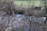
16 Whorlton Lido
Swallows and Amazons, Tees-style
Directly across the river you can see a large, open expanse of grass, with a small wooden shed at the river’s edge. This was the site of Whorlton Lido, which had been an attraction since 1905 and was used by locals and visitors alike as a place for fun and recreation. It is a beautiful stretch of the river, with a series of waterfalls. There are also several natural plunge-pools, which provided safe swimming for both adults and children. Many people will undoubtedly have taken their first tentative strokes in these pools, although a hardy disposition would have been required on all but the hottest of summer days!
The shed sold ice creams and drinks to cool off the many visitors, who would come here for a day out from as far away as Middlesbrough, Stockton and even Sunderland. There was also a nine-hole putting green, children’s corner and picnic area to keep all the family amused.
From the 1970s, it even had its own miniature, 15-inch gauge railway, which was very popular, especially with children. On a sunny Teesdale day, there could be nowhere better to relax or let off steam than Whorlton Lido.
Directions
Continue uphill to the end of the metal barrier and turn right at the footpath signpost marked “Teesdale Way”. The path soon descends through a wood to stepping stones across Whorlton Beck. Once across the beck, follow the banks of the river and up some stone-steps to a ruined house.
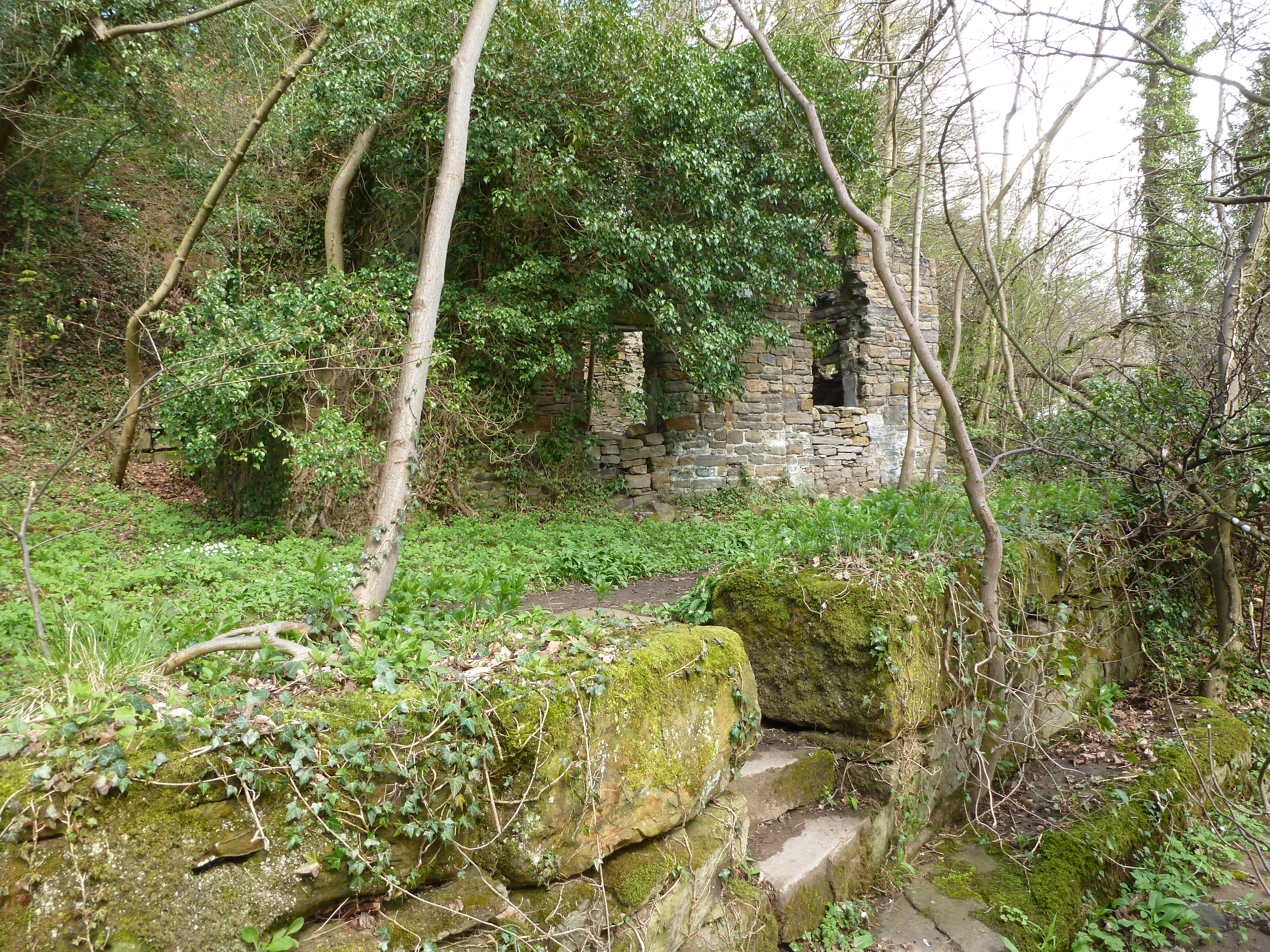
17 Ferryman's house
Who pays the ferryman?
This ruined stoned house now grown over with ivy was once the house of a boatman, who operated a ferry across the river to the other side.
This has been a local crossing-point of the Tees for many centuries, most likely because of the natural geology and the location of the village. Before the ferry, which started in 1691, the only way across the river was by means of a ford, a little further downstream.
A ford is a shallow place with good footing where a river or stream may be crossed by wading or in a vehicle. This ford, however, was dangerous, particularly at times of high water and could be a formidable obstacle for local residents frequenting the Boot and Shoe Inn, which then stood at the water’s edge at Wycliffe, on the other side of the river. There were many accidental drownings on dark nights, so perhaps not the best option if you had taken a few too many drinks!
A few metres along you’ll see some stone steps in front of a walled garden. This was probably the ferry landing point. The garden has some benches with a lovely view of the river, if you feel like a rest.
Directions
Carry on beside the river for another 30 metres or so, where you will see a lifebuoy fixed to a post, marking the spot where it is believed the old ford crossed the river diagonally. Turn sharp left onto a stony, woodland track. At the top of the incline, by some large stones set into the track, ignore a footpath marker to the right and go straight on. At a junction, again ignore the public footpath signpost to the right and continue ahead and over the bridge across Whorlton Beck. Turn left at the road and you will see the village green directly ahead, with a public house on your right.
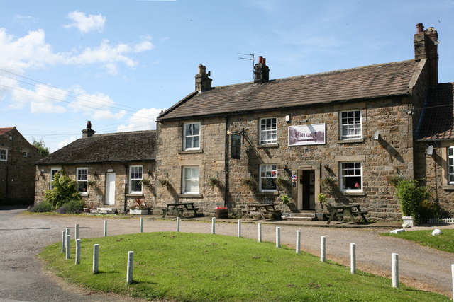
18 Whorlton village green
Room at the inn
Our walk ends outside a typical Teesdale inn, overlooking the picturesque green of the ancient village of Whorlton.
The village was originally named Queornington or Querington, probably derived from the Old English word ‘cweorn’. This means a stone hand-mill for grinding corn or possibly a stream where such stones may be found. Either way, there are no such examples of hand-mills remaining and no-one knows quite how the name came to be changed to Whorlton.
In 1831, when the bridge was built, the village population peaked at 311 people. Today, the village has many attractive and interesting buildings, for example the school, which was built in 1848 and was enlarged in 1870 to accommodate 100 children, many travelling from across the river.
By 1894, the population had declined to 245, but the village still had two publicans, a butcher, tailor, joiner, mason, farm bailiff, blacksmith and overseer, bricklayer, shopkeeper, schoolmaster, vicar and eight farmers. It was a bustling community! Nestling in the south-east corner of the green is the second Parish Church of St Mary’s Barnard Castle (this time with Whorlton). The church was consecrated in 1853 (at a cost of £600) on the site of an earlier chapel-of-ease that may have dated back to Norman times. Outside the door of the church is a stone font, which mysteriously broke apart in 1644, diverting baptisms to Barnard Castle, until the plague that broke out there a year later forced everyone back to the village!
Next door to the church is Whorlton Hall, built by the locally-important Headlam family. It is reputed to be haunted by ghosts and one, the ‘laundry ghost’, has occasionally been found doing some knitting at night, which is perhaps a comforting note on which to end our exploration of this part of Teesdale. Time now to repair to the pub for refreshments.
Directions
To return to Barnard Castle, the options are to walk back along the Teesdale Way on the south side of the river (a further 4.5 miles); return by bus (the number 70 runs infrequently on Mondays – Fridays only) or telephone for a taxi from the pub.
Your browser is out of date, and unsupported by this website. Please upgrade to the latest version to use this website.
Barnard Castle is a bustling market town in Teesdale, rural County Durham. The town boasts a ruined 12th century royal castle, the amazing 19th century Bowes Museum, and a fine cobbled market place.
But we turn our backs on all this and take you on a journey of discovery. This walk explores how the River Tees dominates this landscape, with a major impact on people’s lives (and deaths).
Along the way, we’ll hear about tropical seas, glaciers and terrible floods. But also hard-working millers and stone-masons, and famous artists and writers inspired by the varied and dramatic scenery. And a couple of ghosts and a river sprite, just for good measure!
Follow the walk by clicking on the map pins or downloading the guides below
Long stay car park in Newgate, 50 metres from walk start
Start point:
St Mary's Church, Newgate DL12 8QN
Getting back :
Walk back along the Teesdale Way on the south side of the river (a further 4.5 miles); return by bus (the number 70 runs on Mondays – Fridays only) or telephone for a taxi from the pub.
Keep an eye out for:
Grey herons still as a statue, black headed gulls and swallows swooping for flies
Barnard Castle walk credits
Thanks to:
The volunteers from Heart of Teesdale Landscape Partnershipfor creating this walk
Peter Singer for researching and writing the walk
David Leishman for helping with the research, valued suggestions and testing the route
Honia Devlin for working with and supporting the volunteers
Caroline Millar (RGS-IBG) for editing the walk materials


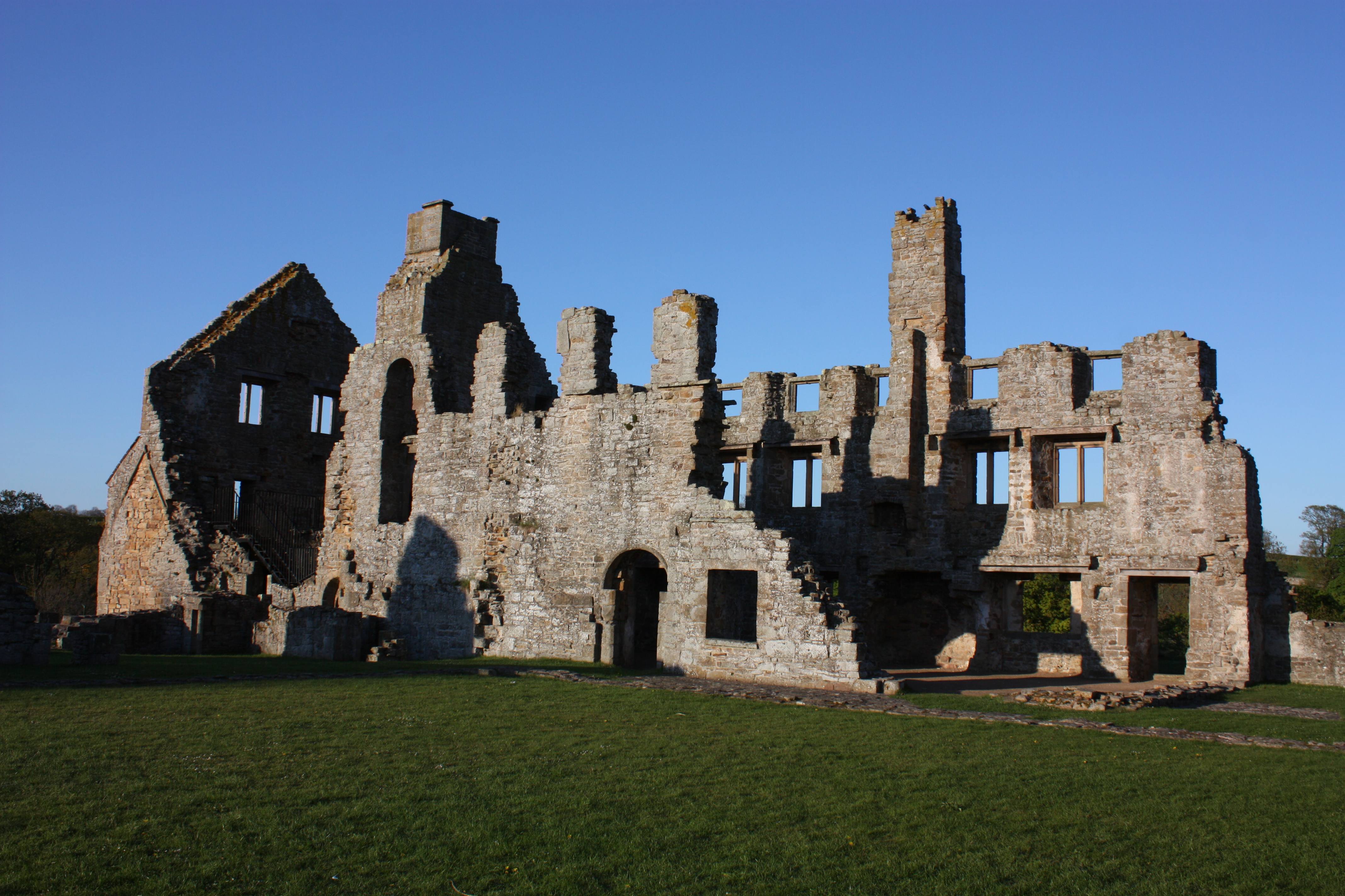


.jpg)


.jpg "Whorlton Castle © Wikipedia CC")
