Take a look at the pretty stone house next to the river. Does it seem an odd location being so close to the riverbank?
Notice the mill stones either side of the front door. These are a clue to the building’s original use. Though today this is a private house, it was built as a corn mill. The building is so close to the river as it used the tumbling Tees’ waterpower to grind corn into flour.
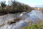
Now take a look over the stone wall at the river below. See if you can spot some rocks in the middle of the river forming a diagonal shape.
The mill was sited here to take advantage of this natural rock formation found in the river. These rocks directed water from the middle out towards the bank, where a sluice gate regulated the water’s flow and provided a steady stream of power for the mill.
As you pass the house, look down at the paved cart track. The smaller central cobbles and larger outer flagstones helped the smooth running of cartwheels. As you pass the next house, look up to see the unusual first floor window, once used a loading door for winching up the sacks of grain.
Directions
Continue along the track in the same direction, between the buildings and take the narrow pathway after the last house, just to the right of the gate, into the fields. Proceed parallel to the river, with a fence on your right, until you reach a telegraph pole about 50 metres before a dry-stone wall. A ruined building will be ahead. Pause here.
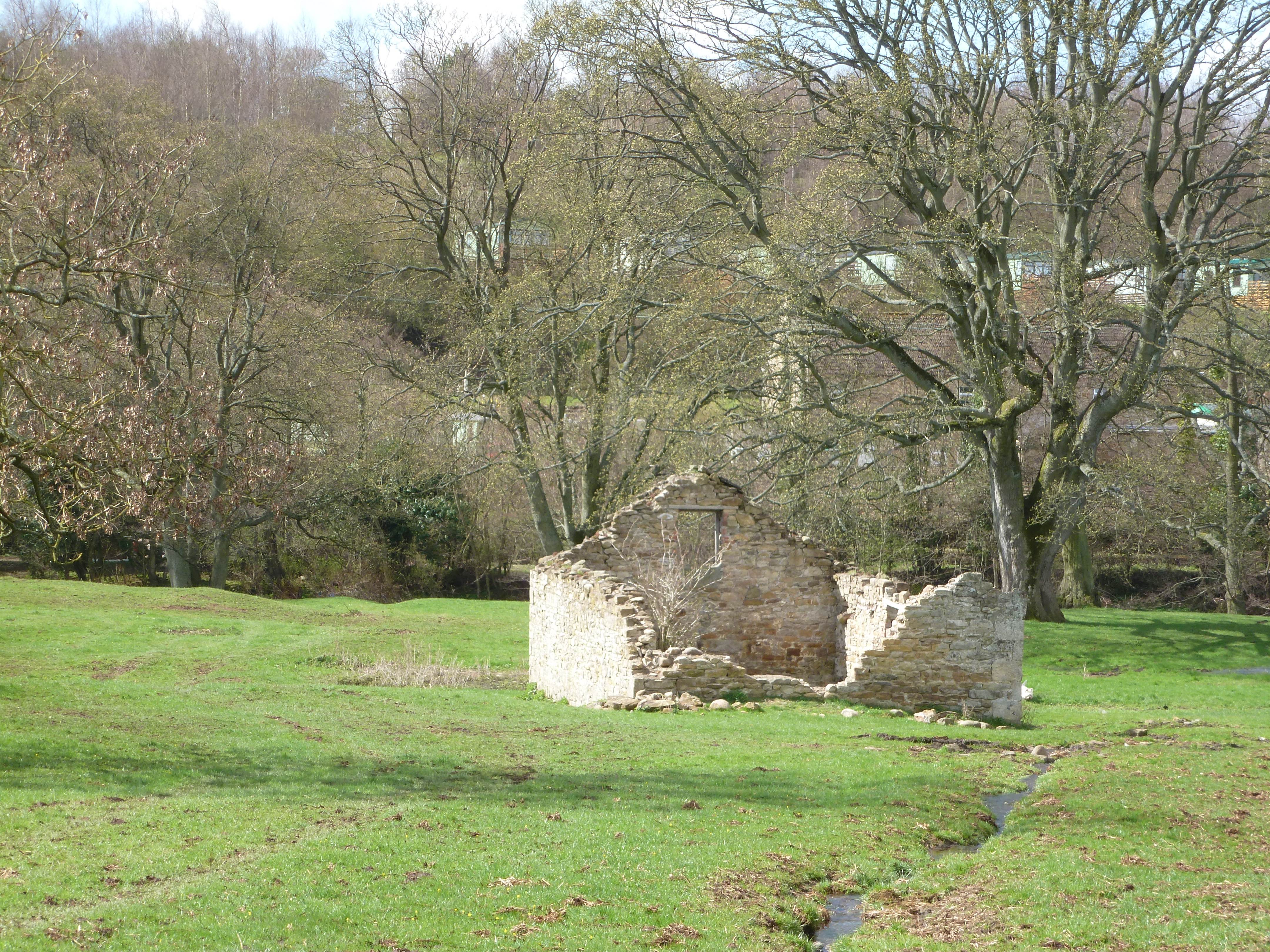
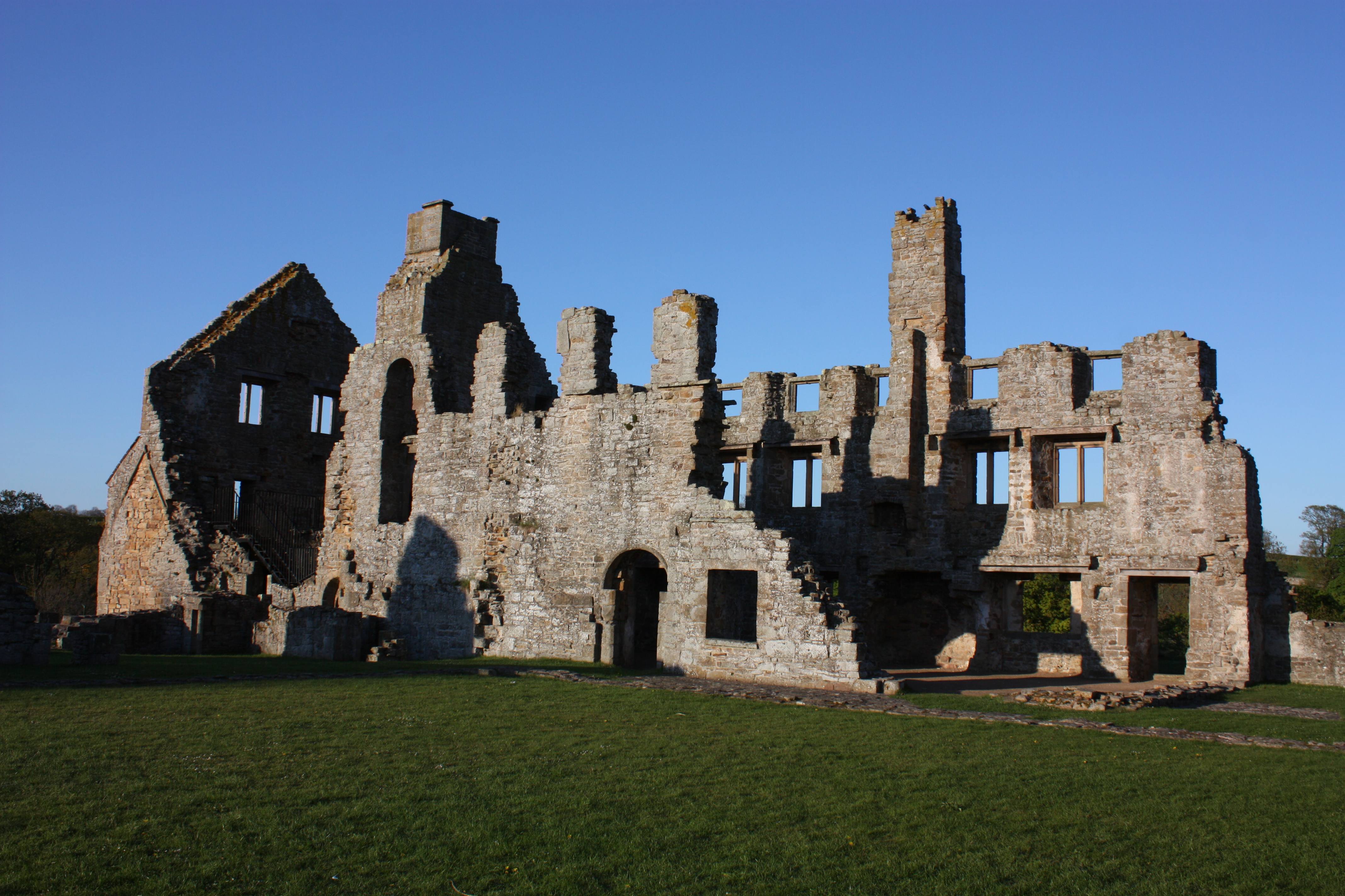
2 Ruins of stone building
The stone ruin ahead looks like the remains of an ordinary field barn - but it isn’t. It’s another clue to how people have used the natural resource of the Tees. This building was once a flax mill. Flax, a plant with pale blue flowers, was grown mainly for its fibres, and spun to make linen. This mill, known as Low Mill, however, probably produced fibres to make rope, twine and thread for sewing shoes and gloves.
Notice its riverside location. Like the corn mill, its reason for being here was the power provided by the river. If you look through the trees to your right, you will again find a group of stones in the middle of the river. Much like at our last stop, these stones create a natural v-shaped weir which diverted water to both banks. There was once another flax mill on the opposite side of the river, which shared the weir but no evidence of it remains today.
On our side of the river bank just ahead of you, can you make out a pile of flat stones? These are the remains of a shelter built for the operator of the sluice gate which controlled the flow of water to the mill.
Linen is still made from flax but has become something of a high end product compared to the quicker and cheaper to make cottons that most of us wear and sleep on today. Today most linen is mass manufactured in China and Eastern Europe though small quantities of high quality linen are still produced in Ireland where the damp climate keeps the flax supple for processing.
Directions
Continue through the gateway in the dry-stone wall and proceed to the left of the mill building. Beyond the mill, continue diagonally right along the path, which stays away from the river bank until the sewage works, then go through a gate between the works’ wall and the riverbank. Continue along the path through a field gateway and go straight ahead across the next field, keeping the river close on your right hand side. Continue through the field gate ahead and turn immediately sharp right down the riverbank, where you will find a bench in a tranquil spot with a lovely view.
3 Bench by edge of Tees
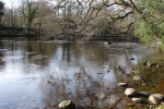
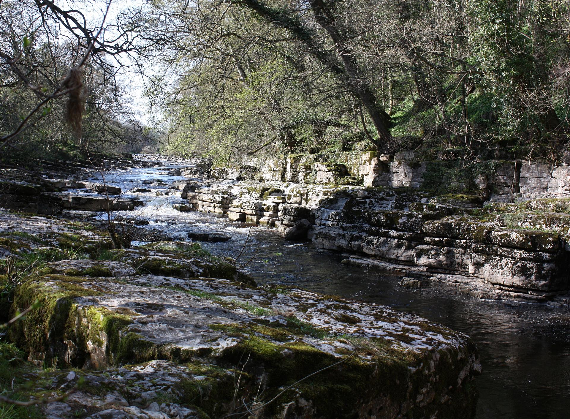
This is a good spot to get closer to the Tees and understand how geology shaped the fortunes of the town and its people. At the river's edge, see if you can spot some large, flat grey rocks that lead into the water. Here and at other places along the riverbank they look almost man-made, like smooth steps have been cut into the rock.
This grey rock is limestone. Limestone was formed around 330 million years ago when the North Pennines lay almost across the Equator. It may be hard to believe, but Teesdale once basked in a tropical climate. If you’d been here then you’d be standing in a warm, shallow sea alive with bright corals and shellfish.
In fact, at different times, this whole area alternated between swampy deltas and deeper seas. When the water was shallower, sandstones and shale were laid down on the sea bed. When the sea was deeper and warmer, creatures like corals, sea lilies and brachiopods flourished. Limestone formed when their skeletons settled on the sea floor and eventually compressed into layers.
Over time the fast flowing river has worn down the limestone to these flat rocks.
Now look across to the opposite bank of the river. To the left are a group of stone buildings. The wall (with two window openings) is all that remains of another of Teesside’s lost industries – it was once a paper mill.
Paper manufacturing was an important industry in County Durham for around 150 years when from the fifteenth century onwards, paper became cheaper to produce than parchment made from sheep skins. Religious institutions and seats of learning, such as Egglestone Abbey and Durham Cathedral, created a great demand for it. Later, the coal and shipping industries (especially in Sunderland and Gateshead), needed paper for stationery, wrapping and packaging.
By 1830 the mill could no longer compete with larger, mechanised paper mills and it was converted to grind corn. Severely damaged by a flood, it was never repaired and another example of Teesdale’s once-thriving industries was lost.
Directions
Go through the gate and continue ahead, staying close to the riverbank – do not take the track slanting left up to the road. Just before a kissing-gate, there is an old access track down to the right. From the fence here you should be able to see down to the river. If not, because the trees are in full leaf, try going just through the kissing-gate and have a look from there.
4 View of quarry remains
Look down and see if you can spot some large dark grey blocks of stone on the opposite bank of the river. This jumble of rocks is all that’s left of another industry which owed its origins to the river – a marble quarry.
Known as Egglestone marble, it was another important industry to Teesdale. Egglestone marble had many merits over other building materials: it could be extracted in large blocks, had an attractive colour and was suitable for carving. John Leland on his tour of Britain in the sixteenth century wrote ‘About a quarter mile beneath Eggleston is a faire quarrie of black marble spotted with white, in the very ripe (edge) of the Tees.’
Egglestone marble was used extensively throughout north east England in monuments, tombs, chests and fonts. That was until imported alabaster tombs from the Midlands and brasses from London took over as the fashionable choice of the elite - then demand for this local marble declined.
Directions
Continue as before, through the woods. The path climbs up to a squeeze-stile in a wall and out onto a bridge. Cross the bridge and turn right at traffic lights along a minor road towards the Abbey, bearing left uphill to reach the entrance to the Abbey itself. Wander round the ruins or climb to the top of the Novices Room for views of the river and valley.
5 Egglestone Abbey
Off the tourist track and mercifully free of ticket booths and gift shops, Egglestone Abbey is a pretty spot to finish our trail. If you climb the steps (over the Novices Room) you’ll get a sense of why the monks chose this as their location. We’re in a sheltered and secluded part of the valley and yet high above the River Tees.
From the quarry below, the monks could extract stone both for their own buildings and as a lucrative income. Stone could be transported along the river to places like Barnard Castle and Durham where it was fashioned into monuments, tombs and religious decorations.
As we have seen, the monks weren’t the only ones to use the river. Thanks to the rocks that were formed over 330 million years ago, local industries like stone and marble quarrying developed. Lime-kilns were also built along the riverbanks using the bountiful wood and water to produce a soil sweetening product called ‘quicklime’ which improved the surrounding arable fields.
As you enjoy a serene stroll back to Barnard Castle along the opposite river bank, try to imagine a time when the river was not quite so peaceful, when instead it meant power and fuelled industries and livelihoods rather than just our imaginations.
Directions
Leave the abbey and return to the road to walk back downhill. At a junction, go left and follow the road to pass Bow Bridge. A squeeze stile in the hedge on the right marks the start of the path along the south bank of the Tees. On the approach to a caravan park the path crosses fields and veers slightly away from the river. Turn right along a surfaced track, down to the caravan park and take the second drive on the left, which eventually leads to the continuation of the riverside path. Turn right over the footbridge back into Barnard Castle.
Your browser is out of date, and unsupported by this website. Please upgrade to the latest version to use this website.
From its isolated source in the North Pennines, the River Tees flows for 85 miles into the North Sea between Hartlepool and Redcar.
Today the section of the river from Barnard Castle to Egglestone Abbey is a popular stretch for walking, fishing and canoeing. But look closely and you can discover an unknown side to it.
This stretch was once a source of industry that powered the people and fortunes of this area. Discover the hidden histories along the banks of the Tees and find out how people have used and exploited the river over time.
Follow the trail by clicking on the map pins or downloading the guide below