1 A great waterway

At 215 miles, the Thames is the longest river entirely in England and the second longest in the United Kingdom. The river’s catchment area is over 8,000 square miles and around 40 smaller rivers flow into it. It’s no wonder the Thames has been a very significant waterway throughout its history.

A good place to start exploring the Thames is its name. This may come from the Sanskrit word ‘tamas’ (dark) as the water is often cloudy. Another possible origin is the Roman words ‘tam’ and ‘isis’ meaning ‘wide water’.

The river’s physical origin meanwhile is Thames Head in Gloucestershire. From there it flows through eight counties, including Greater London, until it enters the North Sea near Southend in Essex.

For 160 miles - from the source to Teddington Lock (four miles downstream from here) - the Thames is non-tidal. The remaining 55 miles are tidal - the water level rises and falls twice daily by around seven metres.

The Thames was formed over 30 million years ago but this walk concentrates on the last 3,000 years, when the river developed its current route and people first settled along its banks. Since then the Thames has been a source of food and drink, a boundary and a gateway, a trade route and a leisure resource.


The Thames at Hampton
© Rory Walsh

Directions

With the information board behind you turn right (keeping the river on your right). Follow the Thames Path signpost down to the river bank. Take care as the path is uneven and can be muddy. Continue along the path past Moseley Lock and weir. Stop just before a metal barrier and look across the river to the opposite bank.

2 Island life

Look across the water at the dense line of trees. They are not on the opposite river bank but on an island. There are over 80 natural islands in the Thames. They range from large marshlands in the Essex estuary to small tree-covered islets.

This one, Ash Island, is just over 200 metres long and 100 metres wide. Look on the map to appreciate its layout. Ash Island is privately-owned. Houseboats have been moored on it for at least half a century. Access is by boat or a footbridge at Molesey Lock.

Immediately upstream is the larger Tagg’s Island. Tagg’s Island became wholly residential in the 1960s and today has 62 bungalows and houseboats. Before then the site had many uses over the decades, including a boatyard, an opulent hotel, and an invalid car factory.

All kinds of people choose to live on Thames islands for a range of reasons. Each island has a strong sense of community and living on them is quite different from life on the mainland.

Besides islands, people live on the Thames at bankside moorings, in former industrial docks, and in marinas. A waterborne Thames home can cost anything from £20,000 to £1million.

Across Britain, about 15,000 people are thought to live afloat on canals, rivers, estuaries and harbours. Some cruise continuously while others are permanently moored. Many people do both.

Does a houseboat appeal to you? Or would you rather live in one of the riverside flats opposite?


Ash Island
© Rory Walsh

Directions

Retrace your steps back along the path (with the river now on your left) and stop beside Moseley Lock.

3 Controlling the flow

This is Molesey Lock, one of 45 locks along the Thames. On the way to it we passed the accompanying weir. Locks and weirs are used to control a river’s flow and gradient.

On its journey from source to sea, the River Thames drops 110 metres in elevation. A river’s natural course includes some steeper and some gentler sections, with rapids in places and lazy meanders in others.

Like many metropolitan rivers however, the course of the Thames has been altered and managed over time. The major reason is that for centuries the Thames was a trade route. Before the advent of railways, barges carried goods up and down the river.

Navigating vessels in fast-flowing water was difficult, while those carrying heavy loads could run aground in shallower sections. So weirs were installed to control the water level, making the river deep and safe enough for vessels.

The role of locks meanwhile is to raise and lower vessels at weirs where the water level changes. Molesey Lock opened in 1815 and was rebuilt in 1906. A lock was built here because waters upstream were often too shallow for barges carrying coal, bricks and timber.

At locks like Molesey the level is adjusted in a ‘pound’ between two sets of gates. A boat enters the lock through one gate which is then closed behind it. The second gate partly opens so that the water in the pound reaches the same level as the next stretch of the river. The boat can then continue safely on its journey.

At 82 metres Molesey is the second-longest lock on the Thames. It is run by a lock-keeper who operates the gates and maintains the water flow. Small vessels, like canoes and rowing boats, can bypass the lock by going over a set of rollers on the other side of the lock-keeper’s cottage.

Besides maintaining the water level, locks in the Thames have helped to manage the tides. The tidal section of the river begins four miles downstream from here at the next lock, Teddington. Before Teddington Lock was installed though the Thames was tidal as far as Staines, about 16 miles further upstream.


Boat at Molesey Lock
© Rory Walsh 

Directions

Continue along the riverside path. Stop before the bridge next to the sign for Martin’s Boat Hire.

4 Saucy hats and silken rugs

During the Victorian era railways began to replace canal boats and barges as the main method to transport goods. As a result many rivers and canals became popular for leisure uses. Just past Molesey Lock we can see examples on both banks.

On this side, J Martin & Son is one of several places where you can hire rowing boats. The Thames has been popular with leisure boaters for many years. In fact during the Victorian and Edwardian eras Molesey Lock was the busiest on the river, with queues of boats waiting to go through it.

Jerome K Jerome’s book Three Men In A Boat (1889) tells the story of three friends taking a Thames boating holiday. It includes a colourful account of Molesey Lock:

Sometimes, you could not see any water at all, but only a brilliant tangle of bright blazers, and gay caps, and saucy hats, and many-coloured parasols, and silken rugs, and cloaks, and streaming ribbons, and dainty whites [...] Altogether, what with the caps and jackets of the men, the pretty coloured dresses of the women, the excited dogs, the moving boats, the white sails, the pleasant landscape, and the sparkling water, it is one of the gayest sights I know of near this dull old London town.”

While some people enjoy wielding oars, others prefer cruising along the river in motor boats. On the opposite bank is the Thames Motor Yacht Club. Established in 1930 it is one of the oldest motor boat clubs on the river.

Many of the early members were Navy servicemen and in 1940 boats from the club took part in the evacuation of British troops from Dunkirk. Today the Thames Motor Yacht Club has around 300 members, including generations of families.


Detail from 'Up River by the Underground', London Underground poster (1913)
Wikimedia Commons (CCL)

Directions

Continue along the riverside path and turn left onto the nearest side of the bridge (facing upstream). Stop when you are about halfway across and look back towards Molesey Lock.

5 An historic crossing

Hampton Court Bridge is one of over 200 bridges across the River Thames. There are also six ferries, 27 tunnels beneath it, and a cable car! Many of these modern crossings are on the site of earlier fords and wooden bridges.

The Hampton Court Bridge we can see is the fourth one built on this site. The current bridge opened in 1933. Sir Edwyn Lutyens was one of the architects and it is now Grade II listed. The structure was carefully designed to reflect nearby Hampton Court Palace.

Before bridges and tunnels were built, the main way to cross the Thames was by ferry. Besides helping passengers across the river, some ferries transported goods from one riverbank to the other. Ferries also transported horses.

In the centuries before engines were developed, horses towed boats along – hence riverside paths being called towpaths. Where the towpath swapped sides, ferries carried the horse and its driver across the water. We will find out why towpaths swap sides later in the walk.

The next crossing upstream from Hampton Court Bridge is the Hampton Ferry. It was established so fishermen could cross over to the seasonally-marshy and reed-laden Moulsey Hurst. The Hampton Ferry has been operating since 1514. This makes it one of the ten oldest companies in the UK and among the 150 oldest companies in Europe!


Hampton Court Bridge
© Nigel Cox, Geograph (CCL)

Directions

Continue over the bridge. At the end use the traffic lights to cross the road. Stop by the ornate gates that lead into Hampton Court Palace. Look through the gates for a view of the palace entrance courtyard.

6 A royal trophy

In the Tudor and Stuart periods the Thames was the centrepiece of royal life. Successive kings and queens loved the river and enjoyed spending time in their riverside palaces; Greenwich, Whitehall, Kew, Richmond, and Hampton Court.

Hampton Court Palace was built around 1514 for Cardinal Wolsey, initially a friend of King Henry VIII. When the two men fell out Henry ‘persuaded’ Wolsey to ‘give’ him the palace. Henry and his successor, Queen Elizabeth I, both enjoyed staying at here. Sir Walter Raleigh, one of Elizabeth’s courtiers, wrote “There are two things scarce matched in the Universe – the sun in heaven and the Thames on earth!”

Much of the palace we can see today dates from the Stuart kings of the seventeenth century. King William III and Queen Mary had great formal gardens laid out to maintain a view of the Thames. Famous architects, including Sir Christopher Wren, were employed to embellish the buildings. We will see into the gardens and the palace further along the riverside path.

The river itself was a royal thoroughfare from the Tudor era until the mid-nineteenth century. Monarchs travelled between their riverside palaces in elaborate barges. Henry VIII and Elizabeth I were even carried along the Thames by barge after death on the way to their state funerals.

The Thames is still used for royal transport and ceremonies. A notable occasion this century was the pageant held in June 2012 as part of Queen Elizabeth II’s Diamond Jubilee celebrations. The pageant was inspired by the large royal flotillas that used to journey along the river.

During the event some 670 boats of all shapes and sizes travelled between Wandsworth and Tower Bridge. The royal family travelled in a specially-built barge named Gloriana, designed to recall the royal barges used by previous monarchs.

The following month, Gloriana set off at dawn from Hampton Court Palace to carry the Olympic flame during the final day of the London 2012 Olympic Games torch relay. In the build-up to the Games’ opening ceremony Gloriana carried the Olympic flame along sections of the Thames, right up to the Olympic Park in Stratford.


Hampton Court Palace
© Rory Walsh

Directions

With the gates behind you turn left towards the bridge. Continue a short way to a bus stop then immediately turn left to re-join the riverside path beside Hampton Court Palace. Pass the sign for the Landing Stage then stop by the Banqueting House, a square building that edges the path. Find a pale stone in the bottom corner of the wall marked ‘Flood 1894’.

7 Floods and droughts

This marker on the wall of the Banqueting House indicates where the water level rose to during a flood in 1894. It is natural for a river to flood periodically and throughout the centuries the Thames has burst its banks many times. In a flood of 1816 people reportedly rowed through the Great Hall of the Palace of Westminster and the floor was covered in fish!

The non-tidal Thames is at risk from flooding after heavy rain, when the volume of water in the river rises. Meanwhile, the tidal Thames is prone to flooding when high tides and strong winds coincide. When this happens sea water is pushed up the funnel of the estuary and towards the city.

Over time a range of flood prevention measures have been put in place to protect the Thames. The most well-known are the Embankment through central London, which was built in the Victorian era, and the Thames Barrier near Greenwich, constructed in the early 1980s.

Elsewhere stretches of floodplain - low-lying land either side of the river - soak up excess water. Each town along the Thames also has its own local flood alleviation schemes to divert water or protect land and property.

Planners try to prepare for ‘once in 100 years’ flood events but severe flooding on the Thames has become more regular in the twenty-first century. In 2000 the river rose to one of the highest levels in living memory. 2003 and 2007 were also bad years and the floods of January/ February 2014 also brought widespread destruction. Later we will see areas that were badly affected.

While extreme flood events have become more frequent, so have droughts. In 2006 British swimmer and environmental campaigner Lewis Pugh became the first person to swim the full length of the Thames from Gloucestershire to Southend-on-Sea.

He did it to draw attention to severe drought in England, which saw record temperatures indicate a degree of global warming. Drought meant that the official headwater of the Thames had stopped flowing, so Pugh had to run the first 26 miles. The remaining 202-mile swim took him 21 days to complete.


Hampton Court Palace flood marker
© Rory Walsh

Directions

Continue past the palace grounds. Take time to look through the elaborate railings into the gardens. Beyond the palace the riverside path forks. The higher left fork is a shared path for pedestrians and cyclists. For the rest of the walk we recommend taking the lower right fork closer to the riverbank. Take care as the path can be uneven in places. Stop when you can see Dittons Skiff and Punting Club on the opposite bank.

8 Worth a punt

We heard earlier about people who enjoy rowing on the Thames for pleasure. Rowing is also a serious sport. The Thames is the historic heart of UK competitive rowing, with over 200 rowing clubs along the river.

Many host races and long distance events, including the famous Boat Race between Oxford and Cambridge universities (started 1829) and Henley Royal Regatta (established 1839). Across the river here is Dittons Skiff and Punting Club. Founded in 1923, ‘Dittons’ is one of six skiffing clubs on the Thames.

Skiffing is a kind of racing particular to the Thames. Skiffs are traditional wooden rowing boats used for racing and leisure. Over the years ‘Dittons’ club members have competed at the Olympic Games and set Guinness World Records, including the first crew to row the length of the Thames.

Beginning each April boat clubs of all types take part in regattas - races where boats run side by side. ‘Dittons’ hosts the annual Hampton Court and Dittons Regatta. Outside the regatta season, the club runs Bridge to Bridge skiff races from Hampton Court to Kingston.

Besides rowers on the Thames, also look for kayakers and canoeists. The Royal Canoe Club at Teddington, founded in 1866, is said to be the world’s oldest. Canoeists use sheltered water in non-tidal sections of the river for training and racing. Sea kayakers use the tidal stretches for touring. Meanwhile playboaters and slalom paddlers use the white water created at weirs.


A pair of racing skiffs
© Motmit, Wikimedia (CCL)

Directions

Continue along the riverside path. Notice the varied chalets and bungalows on the opposite side of the river. Soon the river forks around an island. Stop when the end of the island comes into view.

9 Pieces of ait

We began the walk near two islands and here we can see another. Look at a map and we’ll see that Thames Ditton Island, Ash Island and Tagg’s Island all have a similar shape – they are all long and narrow.

Such islands in the Thames and its tributaries are called ‘aits’ (also spelled ‘eyots’), and pronounced ‘eight’. Aits form when the river transports and deposits fine sediment downstream. Over time the sediment may build up enough to break the surface of the water. Some of these islands are eroded away again but others become permanent features and develop vegetation.

In the early 1600s Thames Ditton Island (then known as Colly’s Eite) was little more than a muddy hump. By Victorian times, when leisure boating had taken off, boats from Kingston moored on it so people could enjoy a riverside picnic.

In the early twentieth century a trend developed for building bungalows on the islands, which were often used for weekend getaways. By 1930 the whole perimeter of Thames Ditton Island was covered in wooden holiday chalets. Owners would moor their boats at the bottom of their gardens.

In 1939 a footbridge to the island opened it up as a place for permanent occupation. Although Thames Ditton Island is just 320 metres long there are now 47 homes on it. Nearly all of them are on stilts in an attempt to prevent flood damage.

Recent floods, however, have inundated the island - most recently in 2014 when the ait was covered in several feet of water.


Thames Ditton Island (1923)
By kind permission of Thames Ditton Island

Directions

Continue along the riverside path. Stop when you reach a gate and set of small bollards across the path. There is a signpost for Barge Walk and a notice for anglers.

10 Water life

These angling notices are a reminder of another way that people have used the Thames. Today anglers catch fish for leisure, returning their catches into the water. Historically, though, Thames fish were a part of peoples’ diet.

Until around 1800 the Thames supported a large fishing industry. Eels, lobsters and salmon were caught and sold in great numbers. Eels became a cheap and nutritious staple food, especially in East London.

With the Industrial Revolution, London’s population rapidly increased. The Thames was used for various industrial processes - and as a way to dispose of waste. The river became highly polluted, terrible effects upon people and wildlife.

Fish suffered especially. Water quality declined so much that a report in the 1950s stated that there was no fish life at all between Kew and Gravesend. From 1960 a determined effort was made to help fish return to the Thames.

A series of measures were set up to protect water life. Anglers cannot use the Thames in spawning season, which is when fish swim upstream to breed. Weirs have been fitted with ‘fish ladders’, channels designed to help fish go over them to spawn.

From being biologically dead only a few decades ago, the Thames is now home to 120 fish species, including bass, flounder and salmon. Their increased numbers support other wildlife. Birds such as herons and cormorants have thrived, while otters have been sighted between Lechlade and Oxford.

The river’s floodplains of woodland, water meadows and grassland are home to many other species. Former industrial sites have become wildlife havens too. We will see an example at the next stop.


Cormorant watching the river
© Rory Walsh

Directions

Continue along the path as it bends round to the left. After the path becomes lined with a hedge, look on the opposite bank for Thames Marina (a white building with a petrol pump outside). A little further along the bank is a large yellow-brick building set back from the river. Stop when you have a good view of it.

11 Cleaning up

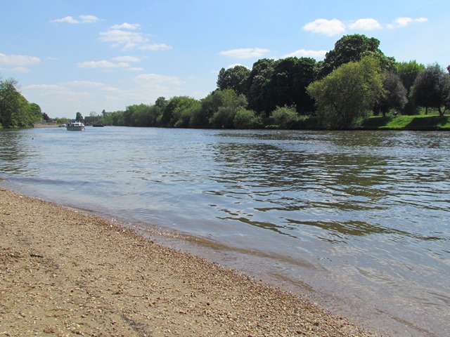
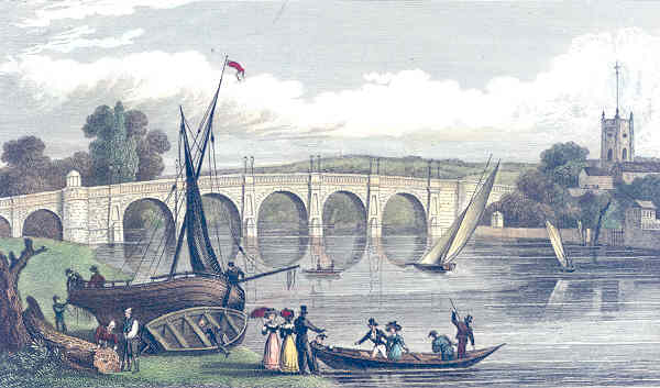
By 1805 London’s population had grown to one million. The Thames was the main source of drinking water but despite this there was no system for keeping the river clean. Sewage, industrial effluent, human waste and even dead animals filled the water.

It was little surprise that in 1832 there was an outbreak of cholera. The state of the Thames became a well-publicised scandal. In 1849 another cholera outbreak killed an estimated 2,000 people a week.

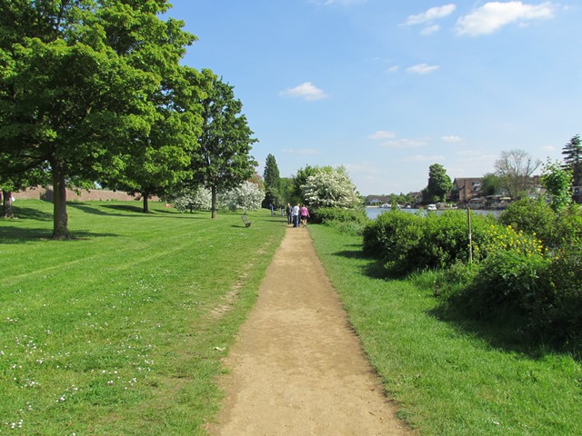
To stem the disease the Government introduced the Metropolis Water Act of 1852. This Act banned extracting water for household use from the tidal Thames beyond Teddington. In the same year engineer James Simpson built the Seething Wells water works we can see here on the opposite riverbank.

Most water works of the time pumped water straight out of the Thames for human consumption. At Seething Wells, however, water was filtered. Water was stored in large reservoirs for six hours then refined through sand, shells and gravel. The process cleaned up the water and ultimately helped to fight cholera.

For many years cholera was thought to be an airborne disease. But a London doctor, John Snow, was convinced it was waterborne instead and began to investigate. Snow compared the cholera contraction rates near to several London water works. Cholera cases were 14 times lower at Seething Wells. When Snow published his findings in 1855 they helped to transform perceptions of the disease.

As London’s population and water demand grew, Seething Wells expanded too. The Chelsea Water Company joined the original Lambeth Water Company at the site and by the 1880s there were at least 20 filters, 16 engines and 600 miles of pipework. Seething Wells supplied 7,500,000 gallons a day - 30 gallons per person - across south London.

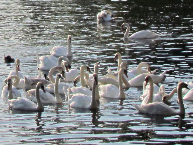
The works remained significant until the 1970s. Since then some of the buildings have become student halls for Kingston University. The reservoirs meanwhile are an important wildlife refuge. The large expanses of open water and network of underground pipes support many species, including rare bats and over 75 bird species.

Though the pumping station is no longer operational, this stretch of the Thames is still a source of drinking water. Hampton is on the Thames Water Ring Main, a 50 mile-long tunnel which circles London. Constructed in the 1990s it provides a fast and efficient way to transfer drinking water supplies across the capital.

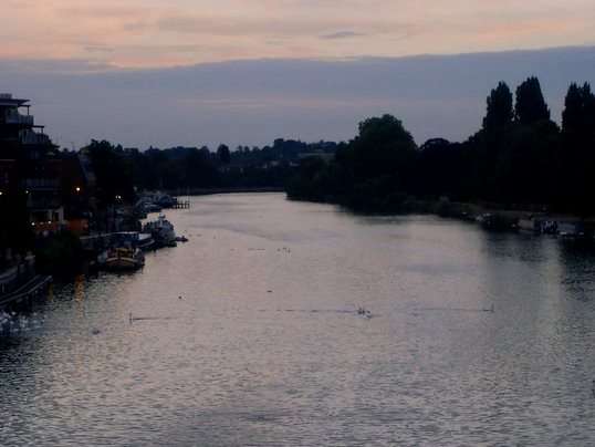
The water may look murky but the Thames is now the cleanest metropolitan river in the world. A sign of its advance from the Victorian era came in 2007 when a blind taste test saw Thames tap water rated above 20 bottled brands.


The Silent Highwayman (1858)
Wikimedia Commons (CCL)

Directions

Continue along the riverside path, now lined with trees on both sides. Look out on the opposite bank of the river for the walls of the filtering reservoir. When you are past the water works look for a group of boats tied together. They include a barge with a broken boat in the back and narrowboat with a British Waterways sign on the side.

12 Managing the river

As we have seen, a lot of people use the river for different purposes and have land, property and infrastructure along its banks. But who actually owns the river? Who is responsible for managing it? Local councils or the Government? Land owners or river users?

In the Middle Ages the Crown had general jurisdiction over all of the Thames. Then in 1751 the Thames Navigation Commission was formed to manage the non-tidal river above Staines. The City of London claimed responsibility for the tidal river.

The City and the Crown disputed ownership of the tidal river until 1857, when the Thames Conservancy was formed. In 1866 the functions of the Thames Navigation Commission were transferred to the Thames Conservancy, which became responsible for the whole river.

In 1909 control divided again. Management of the tidal river (now below Teddington after the lock was built there) transferred to the Port of London Authority. The non-tidal part passed through various hands.

In 1974 the Thames Conservancy became part of the new Thames Water Authority. When Thames Water was privatised, its river management functions transferred to the National Rivers Authority, which eventually became part of the Environment Agency.

Although there are designated bodies for managing the two parts of the river, a lot of individuals and collectives play a role in how the Thames is accessed and used. Later on we will discover how this can lead to disputes.


British Waterways barge
© Rory Walsh

Directions

Follow the path and a row of narrowboats will appear on the opposite bank. Continue until you can see Harts Boatyard, a pale building with balconies outside.

13 Staying afloat

Much of this stretch of the river has shifted use from a working waterway to a place of leisure. In 2001 the Environment Agency started the ‘Thames Ahead’ initiative to rejuvenate the river’s economy. Working with the marine trade and local authorities, the results saw increases in boat registrations and business investment.

One example of a thriving riverside business is Harts Boatyard opposite. Established in 1853 it is the oldest boatyard in Surrey. The yard undertakes boat repairs and engineering work while the sales section offers vessels from canal boats and racing dinghies to floating offices and pied-à-terre houseboats.

The boatyard has recently been refurbished complete with state-of-the-art floating pontoons for the popular canal boat market. They also advertise residential moorings aimed at foreign investors.

A boat moored here offers reasonably-priced living accommodation close to central London and Heathrow Airport. Owners’ boats are fully serviced and maintained while they are abroad and made ready for use at very short notice on their return.

The boatyard has also diversified with a pub and restaurant. These serve the boating community and local residents, who can hire a boat from a selection of electric and motor launches.


Harts Boatyard
© Rory Walsh

Directions

Look to the left of Harts Boatyard for the Thames Sailing Club. There should be a banner outside and several boats with tall masts.

14 River racers

We have already discovered how the Thames is used for motor cruising, rowing and skiffing. Another popular activity is sailing. Sailing is practiced at many clubs along the length of the Thames using different types of boats, such as Lasers, GP14s and Wayfarers.

On the opposite bank is the Thames Sailing Club. Founded in 1870 it is the oldest river sailing club in the UK. The club is also home to a unique type of sailing boat – the Thames A-Rater. They are used for racing on this particular stretch of the non-tidal river.

A-Raters have a 27-foot long body, a flat hull and a 45-foot mast. These very tall masts are designed to collect as much wind as possible, including above the level of the riverside trees and buildings. Some A-Raters are over a hundred years old but even now these Edwardian gentlemen’s yachts are the fastest boats on the river, offering exciting sailing for their three-person crews.

Each June, A-Raters from the Thames Sailing Club are towed along the river to take part in ‘Bourne End Week’. This is a regatta based at the Upper Thames Sailing Club in Bourne End, Buckinghamshire.

On the last day of the regatta the two clubs compete for the Queen’s Cup, the most prestigious race in their calendar. This cup was originally presented by Queen Victoria herself in 1893.


Thames A-Raters
© Melanie Hardman, Flickr (CCL)

Directions

Continue along the riverside path as the two tracks merge beside Raven’s Ait. Take care for cyclists on the path from this point. Stop opposite the largest building on Raven’s Ait and look at the island.

15 A place of debate

Raven’s Ait is another historic Thames island. In 1217 the Treaty of Kingston may have been signed here. The treaty effectively ended the First Barons’ War between England and France when Prince Louis (later King Louis VIII) of France renounced his claim to the English throne.

The island could have been chosen as it had long been a meeting place for negotiations and debate. Since then, Raven’s Ait has become a topic for debate in itself.

Raven’s Ait is only accessible by boat so it has had several watery uses. From 1858 to 1911 it was the first home of Kingston Rowing Club. It was then leased by The Navy League, the charity responsible for the Sea Cadet Corps and the Girls’ Nautical Training Corps.

During the 1980s the Inner London Education Centre set up training and water sport facilities on the island. After Kingston Council bought the site in 1989 it became a conference and wedding venue. Twenty years later that company went bankrupt and the island was occupied by squatters.

The group said the island was common land for public use. Under the campaign ‘Reclaim Your Raven’s Ait’, they wanted to establish the island as a self-sufficient eco-friendly centre for community and environmental groups.

Following a legal battle the council evicted them. The company that owns Harts Boatyard then obtained the lease and eventually re-opened Raven’s Ait as a “unique island venue”. At the centre is the refurbished Main House with a ballroom, suites and over 30 rooms for all types of business meetings and ceremonies.

In 2013 the lease was sold to a Middle East-based businessman, reputedly for £1.9 million. The island’s varied history provides an example of the river’s politics - including issues of privacy, accessibility and ownership.


Raven's Ait sign
© Rory Walsh

Directions

Continue along the path as it curves to the left. Stop when you reach a bench that faces a church with a square tower on the opposite bank.

16 At great length

Stop here for a pause and take in the riverside path. This stretch that we have been following has very few obstacles or diversions. But this was not always the case.

Earlier we heard about the Thames Navigation Commission, which was formed to manage the non-tidal river above Staines. Part of their job was to make navigation easier for cargo boats. This included improving the towpath.

The task was difficult thanks to many natural obstacles along the way. Furthermore, many riverside landowners refused permission for the towpath to enter their land. The Thames Commissioners did not have compulsory purchase powers, so the towpath had to switch from one riverbank to the other.

This created the need for the ferries that we heard about earlier. One of these ferries still operates between Shepperton and Weybridge. We followed the towpath across the river when we crossed Hampton Court Bridge.

The Thames Commissioners’ efforts to create the working towpath led the route we have been using today. Since 1996 this long-distance footpath has been designated The Thames Path National Trail.

The Thames Path follows the river for 184 miles, from the source to the Thames Barrier. It is the only one of the 15 National Trails that runs entirely alongside a river. It is also the longest riverside walk in Europe. There are even challenges and charity events to complete its entire length.

The Thames Path has been made accessible to suit all ages and abilities. Countless numbers of people use it on a daily basis. For some the Thames Path is on their daily commute, for others it is a place for walking the dog or a leisurely stroll or cycle.


The Thames Path
© Rory Walsh

Directions

Continue along the Thames Path as it becomes tarmac paved. Pass the Riverside Café on the opposite bank then a group of large houses on the left. Stop at the next riverside bench. Depending on the time of day there may be large white paddle steamers moored by the pier on the opposite bank. If they are not moored there they will be travelling on the river.

17 Cruising along

We have already discovered that leisure use of the Thames for leisure developed during the Victorian period. The increasing railway network meant that more people could have a day out in riverside towns, such as Reading, Oxford and Windsor.

To serve these visitors a range of firms emerged offering River Thames cruises. One such company is Turks. This family-owned company can be traced to 1710 when it was established by Richard Turk - although records of Turk-built boats extend back to the twelfth century.

Turks began by building passenger wherries and fishing punts. As their reputation spread, they expanded into making boats for English and foreign royalty. They also exported pleasure craft - especially touring canoes and skiffs - all over the world, often winning prizes at international exhibitions.

Pleasure cruises are still available up and down the Thames. In central London, for example, you may have seen fleets of river cruisers between Westminster and Greenwich. Turks paddle cruisers are a regular and colourful sight on the water between Hampton, Kingston and Richmond.


Turks steamer New Southern Belle
© Rory Walsh

Directions

Continue along the path. Stop by the riverside decking outside a small boatyard. Look along the river towards the bridge and see if you can spot any swans on the water.

18 Swanning up and down

The Kingston stretch of the Thames is home to a large number of swans. They can often be seen drifting serenely along the river here.

Did you know that all the swans in Britain are shared by three owners? The first is the monarch, a tradition dating back to the twelfth century when swans were a royal delicacy. Under a fifteenth century Royal Charter, two City of London Livery Companies – the Vintners’ Company and the Dyers’ Company – have a share in the Sovereign’s ownership.

In the third week of July an ancient practice takes place on the Thames called ‘swan upping’. This used to be when swans were caught for food. Nowadays it is a kind of census. It happens upstream from here between Sunbury and Oxford.

During the ceremony Swan Uppers row the river in skiffs. When they find a family of swans the Uppers give the cry “All-Up” and surround the birds with their boats. Then they catch the swans and take them ashore.

Swans caught by the Queen’s Swan Uppers have a ring placed around their leg that is linked to the database of the British Trust for Ornithology. Swans caught by the Dyers and Vintners are identified by a further ring on the other leg.

Today, only swans with cygnets are caught and ringed. This gives a yearly snapshot of how well Thames swans are breeding.


Swans at Kingston
© Rory Walsh

Directions

Continue along the riverside using the path or the tarmac road. If you use the road, take care for occasional traffic. Stop when you are across the river from a modern red and white housing block. Look for a quay to the left of the block spanned by a footbridge.

19 Quayside keys

Here we can see one of the many modern apartment blocks springing up beside the Thames. The Charter Quay development was completed in 2001. It features five townhouses, 239 apartments, river moorings, restaurants, bars, shops, a piazza, a waterfowl conservation area and the Rose Theatre.

Thames-side developments like these have become very desirable. An apartment at Charter Quay with a river view can cost more than £800,000 – almost double the average local price.

Some of the river’s most expensive residences are in former working buildings, such as converted Docklands warehouses. Elsewhere specially-built houses line the river, including ones we passed earlier before Thames Marina.

Though already expensive such houses can have an added cost. Building beside a river increases the risk of flooding and property damage. When floodplains are reduced, excess water cannot drain away. Even so, heightened flood risk doesn’t seem to diminish the value of riverside land and property.

Before we continue, look for a gap in the buildings opposite. You should be able to see another waterway emerging from Kingston town centre. This is the Hogsmill River, one of the Thames’ many tributaries. The Hogsmill rises six miles away in Ewell and joins the Thames here at Charter Quay.


Charter Quay
© Rory Walsh

Directions

Continue along the tree-lined path. Stop just before it slopes uphill and look towards the bridge.

20 A royal border

Records suggest that there has been a bridge at Kingston since the twelfth century. Until Putney Bridge opened in 1729, Kingston was the only Thames crossing between London Bridge and Staines.

The current bridge opened in 1828 though it has been widened several times since. Kingston’s development stems from its location as a Thames crossing. In Saxon times the river here was shallow and marshy and there was probably a ford.

The ford would have created an ideal trade and meeting place, especially as the Thames at Kingston was a boundary between two ancient kingdoms - Wessex and Mercia. The town’s name comes from the Old English words ‘cyninges’ and’ tun’ meaning ‘king’s estate or enclosure’.

It is thought that seven Saxon kings were crowned in Kingston, from Edward the Elder (circa 900) to Ethelred the Unready (circa 975). In the town centre is the Coronation Stone. Local lore suggests that the Saxon kings were crowned while sitting on it. You can find out more by visiting our Kingston viewpoint


Kingston Bridge (1831)
Wikimedia Commons (CCL)

Directions

Bear left and follow the path uphill to the end of the bridge. Then turn right and make your way across the right hand side of it. Stop in one of the alcoves on the bridge and look back along the river.

21 Ebb and flow

Kingston Bridge is a fitting place to finish. The bridge is another example of the way that people have used and shaped the river. Throughout this walk we've seen how people have adapted the natural landscape, from building bridges and water works to living on islands and boats.

The bridge is also a good place to look back along the Thames and appreciate many of the features we have explored. From this high position we can sense of the river’s width - which led to its use as a barrier, a trade routeway, and a food and water source.

Look along the banks and we can see many examples of the leisure activities that now take place by the Thames. The Kingston side is lined with houses, restaurants and bars. The tree-lined Hampton bank is popular with joggers, anglers and cyclists. On the water itself we may spot many types of vessels, from canoes and cruisers to sailing yachts and motor boats.

Towards the horizon, the river meanders around the grounds of Hampton Court Palace, a reminder that people from many classes and backgrounds have lived and worked by the river. All along the towpath various individuals and groups have helped to manage, preserve and restore the Thames.

Our route also revealed a little about the wildlife that co-exists alongside the people, from fish stocks that came back from the dead to birds and bats thriving by the riverbanks.

Whether you are familiar with this section of the Thames or a first time visitor to this pleasant stretch, we hope that you have enjoyed exploring it and discovering some of the stories behind the river’s ebb and flow over the centuries.

If so you may like to try some of the other walks that explore sections of this great river - including in Oxford, Marlow, the South Bank, Deptford, Greenwich, North Woolwich and Leigh-on-Sea.


Dusk from Kingston Bridge
© Rory Walsh

Directions

From the bridge you may like to explore the riverside and town at Kingston. You can visit the Coronation Stone and historic market square. To return to Hampton Court you can take a bus from Kingston town centre, retrace your way along the towpath or enjoy one of the many boat cruises to Hampton Court Palace.

Ebb and flow

The Thames from Kingston Bridge © Rory Walsh RGS-IBG Discovering Britain

River Thames walk

A tranquil walk along the Thames from Molesey to Kingston 

Rivers are a vital resource for life on Earth. Most of the world’s biggest cities are located by large rivers and these waterways are so important that they are respected, venerated, even worshipped.

This walk follows the non-tidal Thames to explore the river's physical features – its flow and floods, islands and meanders - and its roles as a place to live, work and play.

Explore how the Thames has shaped people’s lives and led to their deaths. Discover how it became a source of food and drink, and a site of trade and sport.

Also find out how the Thames is managed with many physical and political battles to keep the water flowing.

Follow the walk by clicking on the map pins
or downloading the guides below

Location : Thames Path, Greater London
Start point: Hampton Court Bridge (southern end), KT8 9BH
Finish point: Kingston Bridge, KT1 4BJ
Keep an eye out for: Boat racing during summer months

River Thames walk credits

Thanks to - 

Dr Toby Butler, History lecturer at The University of East London, for inspiring this walk with his audio trail ‘Drifting’ - available here

Rory Walsh for editing the text, providings photos and the audio commentary

Jenny Lunn and Caroline Millar for editing the walk materials

Britain From Above, Andy Spector at Thames Ditton Island and Simon Tyrell from The Friends of Seething Wells for kind permission to include images from their collections

Roger and Jenni Haile and Paula Gilder of Molesey Local History Society for useful advice and suggestions

Other photos reproduced under Creative Commons Licenses

“There are two things scarce matched in the Universe – the sun in heaven and the Thames on earth!” - Sir Walter Raleigh