1 Welcome to North Woolwich

For many years this area of East London was a vast open marsh officially in Kent. But after London’s economy and population grew in the nineteenth century, the ‘Great Marsh’ became one of London’s busiest and most important districts.

The area became known as North Woolwich to distinguish it from the main town of Woolwich on the opposite (south) bank of the River Thames. 

North Woolwich was an industrial and manufacturing hub, home to some of the country’s most notable companies.
At the heart of North Woolwich was a new set of docks built to handle London’s ever-growing volume of commercial shipping.

But it wasn’t to last. Industrial decline from the 1960s led to the gradual closure of heavy industry, manufacturing and finally the docks - with devastating knock-on effects for local communities.

From the 1980s, however, a series of government regeneration programmes were introduced to attract investment, jobs and people to former industrial and dockland sites in East London, including North Woolwich.

This walk tells the story of the economic boom, decline and revival that has shaped this area. We will discover how the area’s location and geography affected its fortunes. In particular we will look at industry, regeneration and transport – and how each has left an imprint on the landscape.

King George V DLR station is a good starting point as it encapsulates all three themes of this walk: it is named after King George V Dock, the construction of the Docklands Light Railway was part of the regeneration process, and it has provided a vital transport link connecting local communities with the wider London Transport network.

This walk was suggested by Dr Toby Butler, history lecturer at the University of East London and inspired by Phil Cohen and Mark Hunter, who worked on an oral history based version of this trail as part of the Ports of Call project. www.portsofcall.org.uk


Ships in Royal Albert Dock (1955)
© Ben Brooksbank, Geograph (CCL)
Directions

With your back to the DLR station entrance go along the road ahead (Pier Road). At the crossroads with Albert Road use the pedestrian crossing on the left and continue straight along Pier Road keeping to the left pavement. After a short distance the road bears right. On the corner is a set of steps. Stop here and look across the road at the red-brick building opposite. (For a good view go up the steps onto the platform.)

2 The end of the line

This was once North Woolwich’s railway station. The Italianate architecture shows that it was a rather grand and impressive building. The railway came here in 1847 and the name of the station, North Woolwich, was soon applied to the whole area.

This station was the southern terminus of the Eastern Counties and Thames Junction Railway that came from nearby Stratford. This railway carried wealthy passengers to steam boats. From the platform you can see the now rather dilapidated pier by the river.

As well as passengers, the railway carried freight to and from factories that lined the banks of the Thames. Some of these factories were world famous. At the end of Pier Road was WT Henley Cable Works which opened in 1859. This company made waterproof submarine telegraph cables. The cables allowed telegrams to be sent around the world. Thousands of miles of cables were laid under the sea to join up the British Empire and beyond. Cable ships docked a stone’s throw from here to load their cargo. 

In 1979 the railway was refurbished and a new North Woolwich station was built just around the corner. The old building was given to a Trust and turned into a railway museum. After King George V DLR station opened, the railway line and the new station closed completely. Sadly the museum closed too in 2008. The station is now Grade II listed and the interior has been nicely restored; one idea is that it could become a station once again for a small heritage steam railway.

Much of the old railway line will become part of London’s newest transport scheme, Crossrail, the £15 billion project creating an east-west railway line. This will be on a branch off the main line that serves Canary Wharf and Woolwich. There won’t be a station here though. The line will cross the Thames through a new tunnel that will run pretty much beneath your feet.


Former North Woolwich station
Rory Walsh © RGS-IBG Discovering Britain

Directions

With the steps behind you use the traffic island to carefully cross the road towards the station. Take care as the traffic can be fast. With the station on your right continue for about 100 metres to a red-brick circular building. It is on a central island between two roadways used by ferry traffic. Take great care crossing the roads here as traffic can arrive suddenly.

3 Walking under water

This round red-brick tower is one of the entrances to the Woolwich foot tunnel. The tunnel under the river is just over 500 metres long and allows pedestrians to cross the Thames for free without having to board a train or ferry. Look across the river and see if you can spot its sister tower on the other side.

There’s a similar foot tunnel a little further upstream connecting Greenwich with the Isle of Dogs. The two tunnels were constructed thanks to the efforts of a local politician, Will Crooks. He worked in the docks and campaigned to improve living conditions for working-class people. He later became the MP for Woolwich.

The tunnels meant that thousands of workers could cross the river at any time of day. The Greenwich foot tunnel opened in 1902 and the Woolwich one here opened in 1912. They may not be modern transport connections like the DLR or Crossrail but they are nonetheless very useful. They are classed as a public highway and therefore kept open 24 hours a day by law. Today an estimated 1½ million people use the two tunnels each year.

We highly recommend a walk through the tunnel to appreciate this vital transport connection, plus get a sense of the river’s width. You can return on the free ferry for some great views of the river.


Inside Woolwich foot tunnel
Rory Walsh © RGS-IBG Discovering Britain

Directions

To cross the river using the foot tunnel use the steps or lift inside the tower to go down to the tunnel. It will take about 12 minutes to walk the full length. Use the steps or lift at the other end to go back up to street level. You can return using the tunnel or free ferry.

To cross the river using the Woolwich ferry (either direction) from the foot tunnel carefully cross the access road by the waiting area for vehicles. Take the pedestrian path and keep the traffic on your right. You may need to wait at the barrier before being allowed on board. The crossing takes about 5 minutes each way.

If you do not want to experience the tunnel and ferry continue past the foot tunnel tower and follow the pavement between the two sections of Pier Road. At the end use the pedestrian crossing to cross the ferry waiting lanes on the left. Go up the ramp and stop at the top for a good view of the ferry.

4 Free for all

The ferries that you can see crossing the river are part of a long history of river services here at Woolwich. A medieval ferry operated nearby and we will see its possible location a little later.

In 1810 the Army built a ferry to carry troops and equipment from their barracks at the Royal Arsenal on the south side of the river. The following year an Act of Parliament established a commercial ferry company but this was eventually dissolved in 1844. Then came the railway company ferry connecting North Woolwich station with Woolwich.

By the 1880s this service was inadequate. Thousands of people needed to cross the river every day to get to work in the rapidly expanding Royal Docks. When the Woolwich Free Ferry opened in 1889 the streets were lined with flags and bunting while 25,000 people enjoyed trips across the river in the first weekend.

Over one hundred years later the ferry is still running. Around 2½ million people and one million vehicles use the service every year. It is particularly well-used by drivers as it is where London’s inner ring road – the North Circular and South Circular – connect.

In the absence of a road tunnel or bridge, traffic must queue for the ferry or face a long diversion to other river crossing points. The ferry is relatively slow and the traffic can create congestion and pollution. There have been many plans for a local bridge over the years but none has yet come to fruition.

On the other hand drivers who use the ferry can take a break for a few minutes and watch the Thames slide majestically by on their journey to the opposite bank.

The other side of the Thames is also where the River Bus to London runs from Woolwich Arsenal Pier. These regular boat services up and down the river have become an integral part of the London Transport network and are well-used by some commuters. It takes just half an hour to reach Canary Wharf and one hour to reach Westminster.


Woolwich Ferry Ernest Bevin
Rory Walsh © RGS-IBG Discovering Britain

Directions

If you have come back across the river on the ferry follow the access road then carefully cross over Pier Road. Turn right and head back towards the foot tunnel. If you remained on the ramp go back down from the viewpoint, then carefully cross over Pier Road towards the foot tunnel.

From the foot tunnel entrance retrace your steps back to the old station building. Follow the road round to the left then carefully cross over at the entrance to a park. Pass the sports courts and take the first path on the right. At the end turn left then continue up to the walkway with the river on your right. Stop part way along the walkway.

5 Pleasant gardens

We are soon going to visit the docks and find out about various local industries. The docks employed many thousands of people, who spent most of their lives working in manual jobs that were often backbreaking and dirty.

This park is a reminder that there was still some time for leisure too. It was established by William Holland, a showman and owner of the Pavilion Hotel, and opened in 1851 as the Royal Pavilion Pleasure Gardens. ‘Pleasure gardens’ were public spaces that hosted entertainment shows including hot air balloons, acrobats and firework displays. Many also had concerts and fairgrounds.

Pleasure gardens became very fashionable in eighteenth and nineteenth century London, especially beside the River Thames. An 1859 advert in The Times describes how the Royal Pavilion Pleasure Gardens were “open every day and night, wet or dry, for a succession of extraordinary grand galas and fetes, on a scale of splendour never before attempted at any place of al fresco amusements.”

Attractions included a rose garden, a bowling green, a maze and open air music and theatre shows. Though popular, the expense of these entertainments meant that the gardens started making a loss. By 1890 they were sold to the council who redeveloped the site as the Royal Victoria Gardens.

During the Second World War the docks and companies based at North Woolwich became a bomb target. The gardens were badly damaged and today the only Victorian remains are the central walkway and the riverside path.


Royal Victoria Gardens
Rory Walsh © RGS-IBG Discovering Britain

Directions

Continue along the walkway to the far end of the park. Go through the gate and follow the signs for the Thames Path which will take you around a slipway. Continue along the next section of riverside walkway. Stop at the top of the next slipway which is at the end of Bargehouse Road.

6 Water ways

This ramp down to the river is a slipway, a launch for boats. This slipway is thought to be the site of one of Woolwich’s earliest ferry crossings. Historical records show a ferry operated here in 1308. The name of the street at the top of the ramp – Bargehouse Road – is another clue. It is named after the ferryman’s house that stood nearby.

Ferries ran between Woolwich and here until the free ferry opened in 1889. Travel on this part of the Thames dates back even further. When the docks were excavated Bronze Age and Roman artefacts were found, including a Roman urn, a millstone and a 27-foot long canoe.

The river downstream of here is known as Gallion’s Reach, after a fourteenth-century landowner named Galyon. In the eighteenth century prison ships docked here and transported convicts to Australia. You may notice maps and signs that feature varied spellings of ‘Gallions’ and ‘Galleons’.

This stretch of river was the site of a terrible disaster. In the twilight of 3 September 1878 a coal ship called the Bywell Castle collided with the SS Princess Alice, a paddle steamer that took families on pleasure trips to the seaside. At least 550 people died, including 158 children. The accident remains the worst boating disaster on a British waterway.


Bargehouse Road slipway
Rory Walsh © RGS-IBG Discovering Britain

Directions

With the slipway directly behind you go up the slope. Go through the metal gate in the fence to the right to enter a modern housing estate. With the housing blocks on your left go towards the river and continue along the path. Stop past the first block of houses.

If the gate is locked continue up the slope and along Bargehouse Road. Turn right at the end and follow the path up to a large roundabout. Turn right into Fishguard Way. Follow the road round to the right into the estate. Continue ahead through two sets of bollards until you reach the riverside path.

7 Reclaiming the marsh

For centuries, this low-lying area by the river east of central London was open marshland. By 1700 it was known as Plaistow Marsh and was still very rural. That all changed from the 1840s.

A building act of 1844 banned ‘harmful trades’ in London, so new factories had to be built outside the city. Meanwhile, the River Thames was a convenient way to transport raw materials and a place to dump waste. Sites such as Plaistow Marsh were ideal for development.

This particular stretch of the river bank became the site of a shipyard. The company Harland and Wolff was founded in Belfast in 1861 and made some of the world’s most famous vessels, including RMS Titanic, HMS Belfast and the SS Canberra ocean liner. They established a shipyard here in 1924.

Vessels of various types, including cruise liners and Navy destroyers, were repaired here in giant warehouses. So were pieces of marine equipment such as buoys and piers. Harland and Wolff also built narrow boats for the Army canal at Woolwich Arsenal and the Grand Union Canal Carrying Company.

The Harland and Wolff shipyard gates can be found in Lyle Park in nearby Silvertown. This stretch of riverside is now a quiet residential area and it’s difficult to imagine what a noisy and busy place it once was.


Map of Victoria Dock by Plaistow marsh (1872)
Wikimedia Commons (CCL)

Directions

Continue along the riverside path past the second block of houses. Then stop beside the riverside wall.

8 Regeneration stories

Harland and Wolff’s ship repair yard here closed in 1971. It was one of many companies that shut as the docks in London declined. We will find why this happened a little later in the walk.

The effect on the local area was devastating, leading to high levels of unemployment and social deprivation. In addition to the social impact, the derelict docks and industrial sites became an eyesore.

From the 1980s regeneration plans were put in place to revitalise the former docks by attracting new industries and different types of jobs.

Development schemes brought new landmarks to East London including the high rise offices at Canary Wharf, the ExCeL exhibition and convention centre, and the Millennium Dome (now the O2 Arena).

Regeneration was not only about flagship commercial premises though. New public transport routes and housing were created. The modern blocks here are good example. We are now in Galleons Point, built on the site of the Harland and Wolff shipyard.

Regeneration is an on-going and long-term process. It takes time to develop new infrastructure, attract investment and create jobs. To date North Woolwich has been quite successful in attracting new residents with housing developments such as this one.

A less successful attempt at regeneration can be seen across the river. Look on the opposite bank of the Thames to the distinctive tower blocks of an area known as Thamesmead. This 1,000 acre housing development stands on the site of the Woolwich Royal Arsenal artillery works. When it was first built in 1968 Thamesmead struggled with design problems, notably a lack of shops and public transport.

Billed as ‘a town for the twenty first century’ Thamesmead became famous when its brutalist tower blocks featured in Stanley Kubrick’s film ‘A Clockwork Orange’. Today many of Thamesmead’s problems have been addressed and the new Crossrail link will make the area more attractive to commuters.


Gallions Point housing
Rory Walsh © RGS-IBG Discovering Britain

Directions

Continue along the riverside path past the Galleons Point estate. Stop when you reach the corner where the Thames Path turns left away from the river.

9 Reaching across

Earlier we saw how much the Woolwich Ferry is used by vehicles. This is because there are numerous bridges over the Thames in central London but far fewer river crossings in the outer parts of the city. The nearest vehicle crossings to the Woolwich Ferry are the Blackwall Tunnel (about two miles upstream) and the Dartford Crossing of the M25 - some ten miles downstream.

All of these East London crossing points suffer from congestion. Since the 1930s there have been suggestions for a new bridge over the river here. The most recent proposal, submitted in 2004, was the Thames Gateway Bridge to cross the river from Thamesmead to Beckton, just downstream from where we are now.

The £500 million plans were for six traffic lanes, a cycle lane, a walkway and railway line. Local residents and environmental groups raised concerns over increased traffic, air and noise pollution, and wildlife damage. There were also concerns over costs and that the bridge would bypass North Woolwich instead of regenerating it.

As a result the scheme was rejected and in November 2008 the Mayor of London, Boris Johnson, scrapped the project. Yet this wasn’t the end of the story.

A year later a contract was awarded to investigate the viability of an East London crossing. Boris Johnson announced proposals for a road tunnel under the river between North Greenwich and West Silvertown to relieve congestion at Blackwall Tunnel. It could run roughly where the Emirates Air Line cable car crosses the river.

Plans for a Gallions Reach crossing have been scaled back, though a bridge or tunnel are still possible options. The Woolwich Ferry could move to Gallions Reach where the roads can be better redesigned to take local traffic.

What do you think about plans for a crossing here? Such infrastructure is always a long-term project, often held back more by politics and planning than the actual physical and engineering challenges. Time will tell what solution is found.


QE2 Bridge, Dartford Crossing
© Kenneth Yarham, Geograph (CCL)

Directions

Follow the path with the blocks of Gallions Point on your left. The Thames Path continues over the entrance lock to the Royal Docks. Stop by the small redbrick building which is the former lock keeper’s cottage. If you prefer, you can stop on the lock itself. NOTE: the lock is lined with chains but if you do stop over it be very careful, especially with children.

10 Gateway to the world

For centuries London’s original docks were on the river banks close to the heart of the city. As shipping levels grew, however, there was a severe lack of secure places to load and unload cargo. At times ships had to wait weeks to unload, which led to piracy and theft.

To massively increase the space for servicing shipping, a series of artificial docks were dug beside the river. The docks were surrounded by high walls and had their own special police force to protect the cargo. Yet as ships grew larger, deeper river channels and bigger berths were needed. Navigating the bends in the Thames also became difficult, particularly around the Isle of Dogs.

So between 1855 and 1921 a series of three connected docks were dug out of Plaistow Marsh. They had railways running up to the quayside and were big enough to accommodate larger ships. Named after kings and queens – Royal Victoria Dock, Royal Albert Dock and King George V Dock – they became known collectively as the Royal Docks or ‘the Royals’.

This lock is now their main entrance. While the River Thames is tidal, the docks have a constant water level. This lock allowed ships to pass between the docks and the river. At the next stop we’ll see the full extent of the dock area and find out about their activities.


A ship enters the Royal Docks (1955)
© Ben Brooksbank, Geograph (CCL)

Directions

If you stood on the lock return to the path. Continue along the gravel path with more Gallions Point blocks on the left. At the end go up the steps to the road bridge. Carefully cross over the road – the traffic can be very busy here so you are advised to turn left and use the traffic island. Once you are on the other side of the bridge stop halfway across it and look out at the expanses of water.

11 Royal dynasty

The 'Royals' were once the world’s largest enclosed docks. From this elevated position on the bridge we can get a sense of their size. They are two miles long and for most of their history they were packed full of vessels from all over the world. 

The oldest of the Docks, Royal Victoria opened in 1855. It is furthest away from us, on the horizon beyond City Airport. To our right is the Royal Albert Dock which joined up with the Victoria Dock in 1880. Next to it (on our left) is King George V Dock, which opened in 1921.

The Royal Docks were a huge success. Within five years of opening Royal Victoria Dock carried 850,000 tons of shipping a year – double the amount of the central London docks. The Royal Docks dealt with a huge array of cargo, particularly food, timber and passengers.

Lining the 12 miles of quayside were giant refrigerated warehouses to store meat and fruit while large granaries processed cereals and grains. Much of this infrastructure has gone but some industry remains. Look to the left of the docks for the twin chimneys of the Tate and Lyle sugar refinery. The largest sugar refinery in the world, nearly all the cane sugar in the European Union is processed here - along with the famous golden syrup.

Thousands of people were employed in the docks, often on a day-by-day basis. Many of the dock workers were highly skilled. Jobs included crane drivers, stevedores who loaded and unloaded vessels, lightermen who carried goods to and fro on small barges, and deal porters who carried heavy timber. They were strong, acrobatic and needed a head for heights.

Men would gather each morning at the docksides and were selected for work by foremen, a process called 'going on the stones'. Of course all the dock workers and their families needed places to live. The docks brought massive growth in the local population. Much of the housing in North Woolwich and the nearby areas of Beckton, Canning Town and Silvertown was built for dock workers.


The opening of King George V Dock (1921)
© PLA / Museum of London

Directions

Continue along the road and on to the Sir Steve Redgrave Bridge. The bridge bends to the left and is lined with curved street lamps. Stop when you reach the bus stop and look towards the airport runway between the docks.

12 Taking off

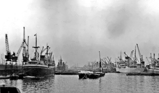
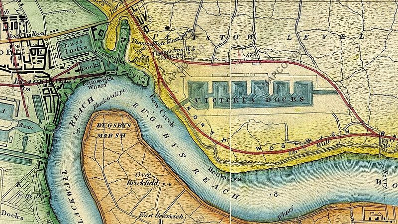
The Royal Docks remained London’s major docks until the 1960s. They began to decline due containerisation. Before containers, each ship was loaded and unloaded by large teams of men. Containers of a standard size could be handled by cranes, which made loading ships much faster - and cheaper with far fewer workers. 

Meanwhile dockside rail transport was eclipsed by cheap lorry haulage. As other docks were better able to deal with the huge container shipping, in 1981 the Royal Docks closed.

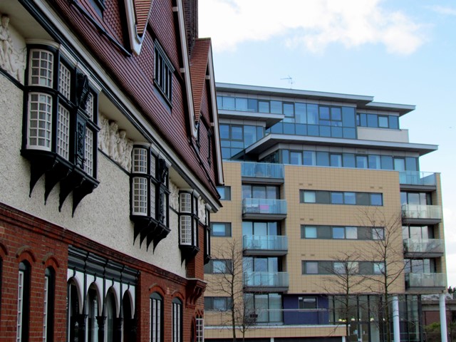
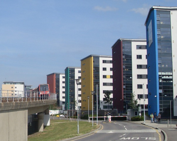
In the same year the government formed the London Docklands Development Corporation (LDDC) to regenerate 8½ miles of riverside and docks in East London, including the Royal Docks. The LDDC was given the dock land and powers to relax planning controls for market led development.

One of the first and most controversial projects that they supported was London City Airport. The airport’s development was fiercely resisted by many residents who came up with their own ‘people’s plan’ for the Royal Docks. Opponents argued that this was not an appropriate place for an airport and that the land should be used for housing, childcare, shopping facilities and recreation.

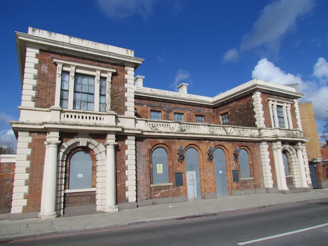
Despite opposition the airport opened in 1987. The runway was built on the space between King George V Dock and Royal Albert Dock. This had once been an area for loading, unloading and storing goods. The airport terminal and car park were built on parts of King George V Dock quayside.

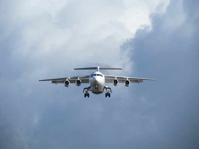
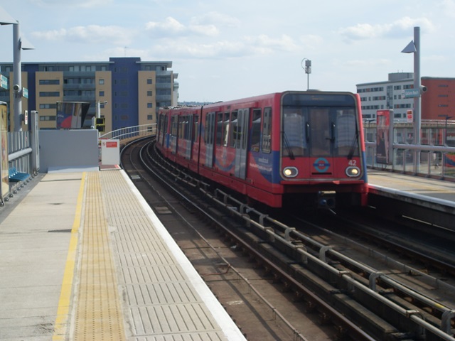
London City Airport is a STOL (Short Take Off and Landing) runway, which means it is only suitable for smaller aircraft. Large jets, helicopters and private flights are not allowed to use it. The airport has its own DLR station, so passengers can step off a plane and in no time be on a train directly to Canary Wharf or the City. 

In 2012 it welcomed a record three million passengers and there are plans to double capacity to six million in ten years. Most of the flights serve business people in Europe, many of whom return the same day. Destinations include Berlin and Frankfurt, Milan and Rome, Zurich and Geneva, Paris and Luxembourg. There are also some important domestic routes such as Edinburgh, Aberdeen, the Isle of Man and Channel Islands.

The airport means that North Woolwich is a gateway to the world once more. As you can hear, however, the sound of the planes can be deafening and there are still mixed feelings about its impact on local communities.


Plane landing at London City Airport
Rory Walsh © RGS-IBG Discovering Britain

Directions

Continue along Sir Steve Redgrave Bridge. Stop when you are level with Royal Albert Dock on the other side of the airport runway.

13 Making a splash

Although the three Royal Docks are no longer used for commercial vessels they still welcome leisure craft. The impounded spaces of water are ideal for many types of sport and recreaction.

In Royal Victoria Docks there is a Watersports Centre where you can try windsurfing, wakeboarding or stand-up paddleboarding. Royal Albert Dock is home to the London Regatta Centre. The straight section of open water provides an Olympic-sized 2,000 metre rowing course, one of only three in Britain. See if you can spot distance markers along the dock edge.

George V Dock is reserved for power water sports and here you can try jet-skiing and water-skiing. Open water swimming events and triathlons are sometimes held in the docks too. Just the other side of this bridge in Albert Basin is Gallions Point Marina, which provides moorings, various boat services and yachting courses

The ExCeL hosts the annual London Boat Show, with a display of pleasure craft immediately outside in Royal Victoria Dock. The docks are also home to the SS Robin, a Victorian cargo steamer being restored and due to open as a floating museum near the Emirates Air Line.

During the London 2012 Olympic and Paralympic Games, the Royal Docks were the second largest sporting venue after the Olympic Park, with the ExCeL hosting a number of competitions. Meanwhile cruise ships moored in Royal Albert Dock provided accommodation to around 900 Olympic workers. 


Gallions Point Marina
Rory Walsh © RGS-IBG Discovering Britain

Directions

Continue to the end of the bridge then turn sharp left to follow the path towards the docks. Turn left at the dockside then go under the bridge. Gallions Point Marina will appear on your right. Follow the dockside path as it bears left behind a modern housing block. Stop at the building with tall chimneys that is set behind the modern dockside blocks.

14 Old and new

So far we have heard a lot about former dock infrastructure and regeneration developments. We are now near a rare survivor from the prosperous years of the Royal Docks.

The ornate Gallions Hotel was completed in 1883. The building was a stopping point for wealthy passengers, who travelled on ocean liners from the Royal Albert Dock. Though dwarfed by modern apartment blocks it is still a grand structure. Take time to look at the domed tower and the moulded figures on the second floor walls.

The hotel was luxurious, with separate floors for First and Second Class passengers. There were underground stables, a foot tunnel to the docks and the hotel even had its own railway station. The front doors opened onto railway platforms, allowing guests to board trains to and from central London.

In the 1940s the hotel became a pub but it shut in 1972 as the docks fell into decline. Well into the 1990s ‘The Gallions’ was left isolated on the Albert Basin, surrounded by wasteland. It survives today because, like North Woolwich station, it is a Grade II listed building.

When the £100 million redevelopment of Albert Basin began in the 1990s, the building was carefully renovated and new buildings completed around it. Today the Gallions Hotel includes a restaurant, gym and café – making it an ideal place to stop for a break.


Gallions Hotel and modern riverside development
Rory Walsh © RGS-IBG Discovering Britain

Directions

Take time to look at the details of the Gallions Hotel. You may like to stop here for refreshments from the restaurant, gym café or the nearby shops. When you are ready, pass the playground behind the hotel and continue along the road lined with trees. At the junction with the main road (Atlantis Avenue), turn left towards the large roundabout. Look across the road at the DLR station.

15 Back on track

We began the walk at a Docklands Light Railway station and here we can see another section of the network. The DLR’s little red trains are now an integral part of London. They were created though to address a problem of isolation.

The decline of the docks (and the workers' trains and buses being axed) left some communities rather cut off. When the LDDC was set up one of the first issues they identified in the Docklands was a chronic lack of public transport. Regenerated sites can’t attract people without infrastructure.

Like London City Airport, the DLR opened in 1987. It made use of disused dock railways and derelict land. Originally 11 trains ran between Tower Gateway, the Isle of Dogs and Stratford. The network has expanded since, especially to the east. The DLR reached North Woolwich and the Royal Docks in 2005 and, as we discovered, replaced the mainline rail service.

There are now 13 DLR stations around the former docks with plans to expand the DLR even further east to Dagenham in Essex. The Docklands Light Railway carries about 80 million people each year. It has helped areas like this to attract new residents who can use the trains to travel to Canary Wharf and the City or connect with the London Underground. 


DLR train at Gallions Point
Rory Walsh © RGS-IBG Discovering Britain

Directions

Continue to the large roundabout so the DLR line passes overhead. Use the traffic lights to cross over the road. The end of Sir Steve Redgrave Bridge will be on the left. Now follow the dockside path so that the airport runway is over the water on your left. Pass five modern tower blocks on your right. Stop when you reach buildings on the right shaped like cylinders. They are in pairs and brightly coloured.

16 A knowledge dock

This is the Docklands campus of the University of East London (UEL), which opened in 2000. There used to be warehouses on this site, along with the Royal Docks police training school. For training purposes the school had a small museum of objects that were used to smuggle goods through the docks!

Today UEL is one of the most diverse and modern universities in Britain with 28,000 students from over 120 countries. As well as students and academic staff, the campus has created a range of service jobs and has become a major local employer. The Docklands campus includes housing for 1,200 students in the brightly-coloured apartment blocks that we have just passed. In term time the dockside library is open 24 hours a day.

Establishing a campus here was a key part of the early regeneration plans and it has been another way of attracting new economic and social activity to the area. The new buildings of the university campus also reflect the heritage of the Royal Docks.

Take a look at the rounded buildings here on the waterside. They are shaped like ship funnels to recall the vessels that once lined up here on the dockside. Their names also provide echoes of the past. For example, look for signs to the Knowledge Dock and Sports Dock.


University of East London campus buildings
Rory Walsh © RGS-IBG Discovering Britain

Directions

Continue along the dock-side path past the cylindrical buildings. This is a good spot for watching planes taking off and landing at the airport. When you reach the North Building of the university (set back from the path) go across the square into the university campus. Follow the underpass to the right of the North Building to reach Cyprus DLR station. Stop by the station entrance.

17 Royal restoration

Cyprus DLR is named after the Cyprus housing estate built for workers at the Royal Albert Dock. Today the station serves their residents and the university. Like King George V station, Cyprus symbolises the story of North Woolwich’s changing fortunes.

On this walk we have explored how North Woolwich has been made, unmade and remade by the riverside industries and the Royal Docks. Changes in shipping and volumes of trade transformed empty Plaistow Marsh into the largest enclosed area of water in the world. North Woolwich was a place of heavy industry and manufacturing, ship building and railways, docks and warehouses.

Another set of changes in shipping and volumes of trade led to the area’s economic decline. As we have seen however recent developments have brought about a remarkable transformation in the economy, society and the physical landscape.

North Woolwich is now a place where European business people jet in, where knowledge is created and where the large water spaces are used for leisure and recreation.

Sometimes the process of change hasn’t always been good, or easy. We have seen that there are real tensions between the planning needs of the local community and market-led development.

Interwoven with the story has been transport and connectivity. This area’s outlying location helped and hindered its fortunes as it was chosen as the site for the docks then left isolated after the docks closed.

Now there is increasing need for more transport as London’s commercial centre of gravity moves east. Examples include Crossrail, the DLR extension and the Thames crossing. Meanwhile a new container port, London Gateway, has opened downstream catering for massive cargo ships.

There are many more sites ready for development and long-term plans are in place to attract further investment. Recently the Royal Docks were granted Enterprise Zone status, which gives tax breaks and relaxes planning regulations to further attract capital and developers.

Plans that have been announced for the Royal Docks include a floating residential village, plans for a China Centre business district next to the UEL campus and the regeneration of Silvertown Quays.

Time will tell how these proposals progress. One thing is certain – North Woolwich is changing, fast. These changes are every bit as dramatic as turning the marshland into dockland. Come back soon and see how the area has changed again!


DLR and UEL buildings
Rory Walsh © RGS-IBG Discovering Britain

Directions

To return to King George V DLR station you can walk back along the university dock-side and over the Sir Steve Redgrave Bridge. Alternatively take the DLR from Cyprus and change at Canning Town to transfer to the Woolwich Arsenal branch.

From Cyprus DLR station you may like to visit the ExCel, Emirates Air Line cable car, the O2, Museum of London Docklands or historic Greenwich (including the Cutty Sark, the Royal Naval College and the National Maritime Museum).

Trains and boats and planes

University of East London campus © Rory Walsh RGS-IBG Discovering Britain

Trains and boats and planes

Map of Victoria Dock (1872), Wikimedia (CCL)

North Woolwich walk

A walk around the rapidly changing Royal Docks 

For centuries the part of East London now known as North Woolwich was a remote riverside marsh in Kent. Then from the 1840s it became a gateway to the world.

Three new docks transformed the area into the industrial heart of the world’s largest port. But this success was not to last. 

When the docks closed in 1981 North Woolwich fell into decline. So a series of projects were established to revive it, complete with new buildings and transport.

This walks follows North Woolwich's boom, decline and revival. Discover why sites built for industry are now used for leisure. Travel on routes over and under the Thames, see houses built on shipyards and watch planes land on water. 

Follow the walk by clicking on the map pins
or downloading the guides below

Location: North Woolwich, east London
Start point: King George V DLR station, Pier Road E16 2LH
Finish point: Cyprus DLR station, Strait Road E6 5PH
Find out more:

Try the original Ports of Call oral history walk

North Woolwich walk credits

Thanks to - 

Dr Toby Butler, History lecturer at The University of East London, for suggesting this walk, helpful comments and providing the audio commentary

Phil Cohen and Mark Hunter for researching the original ‘Deep Water’ audio walk for the Ports of Call oral history project

Eastside Community Heritage for kind permission to include audio clips from their archive

Jenny Lunn and Caroline Millar for editing the walk materials

Rory Walsh for providing photographs

Nikki Braunton at the Museum of London, Britain From Above and John Alsop for kind permission to include images from their collections

Other photos reproduced under Creative Commons Licenses

Within five years of opening, Royal Victoria Dock carried 850,000 tons of shipping a year