Today the City of London is known for its banks and financial institutions. Among all the office blocks and skyscrapers though are some extraordinary reminders of London’s ancient past. This past was very much shaped by the area’s environment and weather.
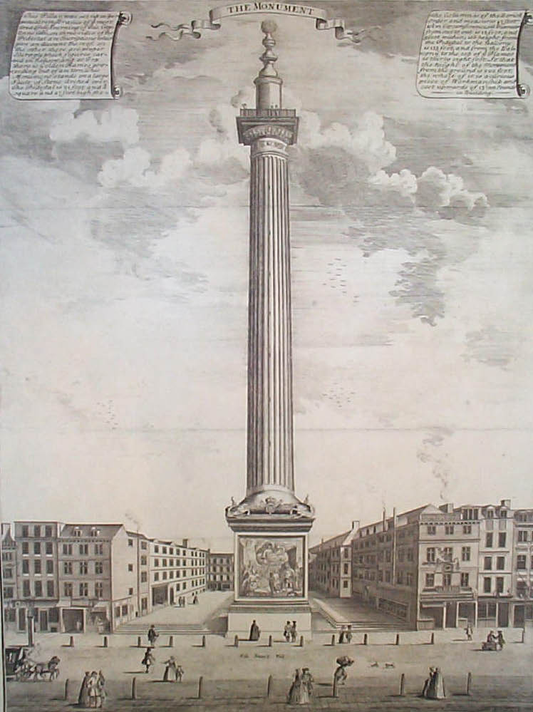
The Monument to the Great Fire of London was completed in 1677, just over a decade after the inferno swept through the city. A little later we will explore the specific weather conditions that lead to the devastating fire. For now, let’s look at The Monument itself.
Designed by two architects, Sir Christopher Wren and Dr Robert Hooke, The Monument is 202 feet high and stands 202 feet away from where the fire started. For a small fee, we could climb the spiral staircase inside it up to a viewing platform.
Above that is a copper flaming urn, symbolising the fire. From a distance the whole structure looks like a candle. What is truly wonderful about The Monument, however, is that it is not only a historical memorial. It was actually intended to double as a scientific instrument. This was very much Robert Hooke’s doing.
Underneath The Monument is a tiny laboratory with a hole in the ceiling. The hole was designed to hold a lens, which lined up with another lens inside the hollow urn at the very top. A trapdoor could be opened to reveal the starry heavens above - turning The Monument into a giant telescope!
Also, each of the 311 steps inside The Monument is exactly six inches high. The plan was to use them to measure atmospheric pressure at different heights up and down the column.
Sadly these ingenious plans never came to fruition. Even in 1677, vibrations from constant traffic heading to and from London Bridge made conditions inside The Monument impossible for scientific study.
The Monument is just the first example we’ll see of Londoners’ attempts at understanding the weather. As we continue, many building we’ll pass have unusual weather vanes. When it’s safe to do so, keep looking up!
Pictures: Engraving of the Monument by Sutton Nicholls (1753), Wikimedia Commons (CCL)
Inside the Monument, Views (1891), Wikimedia Commons (CCL)
Directions
With The Monument on your left, go down Fish Street Hill towards Lower Thames Street. Use the pedestrian crossing to stop outside the Church of St Magnus The Martyr, just on the other side of the road. Visitors are welcome inside the church, except during services, as longs they are quiet and respectful.
2 The Church of St Magnus the Martyr
Here is a building that has truly stood the tests of time and weather. Enter through the gate and stand in the space underneath the church tower.
This was once the northern entrance and exit to Old London Bridge. The bridge stood for over 600 years - through fires, floods, hurricanes and freezes - from 1209 to 1831. Old London Bridge had 19 arches while above the water some 200 buildings spanned its length, including houses, shops and even a church.
Have a small wander around the grounds here and you will find some of the bridge’s huge stone bricks. Also look for a large piece of wood - part of a Roman wharf, found on Fish Street Hill and dating from 75 AD! But the real treat is inside the church.
Enter through the doors under the tower then pass through a second set of doors into the main part of the building. Just inside to the left is a long glass case containing a full reproduction of the Old London Bridge. The model was completed in 1987 by David T Aggett, a liveryman of the Worshipful Company of Plumbers.
Depicting the bridge around the year 1400, it is utterly spectacular and sumptuously detailed. Take time to enjoy the details. Along the bridge, between the high buildings, are around 900 tiny people. Look very closely for a time-traveller - a modern policeman gazing at the scene around him.
Pictures: Old London Bridge in an engraving by Claus Visscher (1616), Wikimedia Commons (CCL)
When you are ready, exit the church then turn right along Lower Thames Street. Pass by two office blocks on your right. The next building, with a statue above the doors, is Old Billingsgate Fish Market.
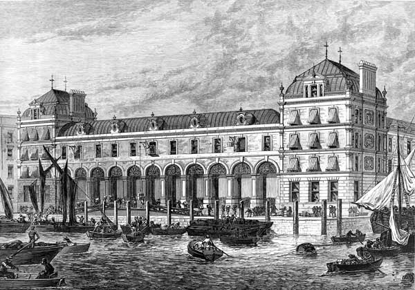
3 Old Billingsgate Fish Market
From 1876 to 1982 this building was home to London’s most famous fish market. It was designed by Horace Jones, the architect behind Tower Bridge and Leadenhall Market (both of which appear on our route). The building is now a conference and events centre.
But why a fish market on a walk about weather? Throughout history there have been tales of fish and other aquatic animals falling from the heavens like rain.
Six months before the Great Fire of 1666, fish apparently fell from the clouds in Kent. Several were taken to London to be examined. A similar incident occurred over 300 years later. In June 1981, Newham residents Mr and Mrs Langdon were watching television during what they took for very heavy rain. The next morning they discovered fish all over their back yard, window ledges and roof.
As a result, Mr Langdon featured on the front page of The Newham Reporter. When the fish were taken to the Natural History Museum, they were found to be smelt and flounder from the River Thames.
There are accounts of other watery creatures falling from the sky. In 1984, jellyfish landed on the streets of Bath. Frogs allegedly fell over South Croydon in 1998. In 2004, the BBC reported a fish fall in Wales. Science is still unable to explain these phenomena or even prove that it definitely exists.
Tangentially related is the strange British expression ‘raining cats and dogs’. One theory for the phrase’s origin is a poem about London’s weather, Jonathan Swift’s ‘Description Of A City Shower’ (1710):
"Drowned puppies, stinking sprats, all drenched in mud Dead cats and turnip tops come tumbling down the flood"
Other possible origins are the Old English ‘catadupe’ meaning ‘waterfall’ or the Latin ‘catadoxa’ meaning ‘unexpected’.
Pictures: Billingsgate Fish Market in Illustrated London News (1876), Wikimedia Commons (CCL)
Walk past the building and, if the black gate is open, turn right along Old Billingsgate Walk and head towards the river. Stop at the riverside wall and take in the view of The Shard.
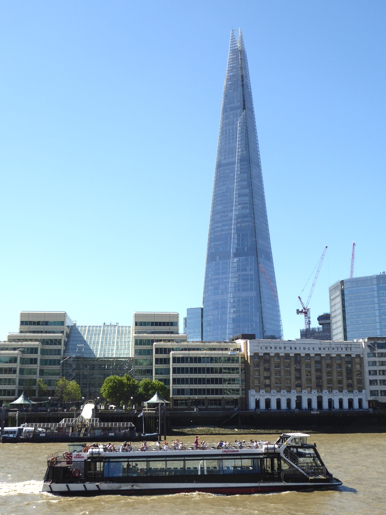
4 View of The Shard
Across the river stands one of the landmarks of modern London. Designed by Renzo Piano, the Shard opened in 2012. The tower is 96 storeys high but the highest point we can reach is the viewing platforms on the 72nd floor. The glass storeys above it are designed to radiate heat from the building, making it more energy efficient.
Not long before the Shard opened, construction workers found a fox on the 72nd floor! It’s still unknown how it got up there. Today a cuddly toy version (wearing a builder’s hat) can be purchased from the gift shop.
At 310 metres high, it’s not surprising that the Shard attracts the odd lightning strike or two. After a large thunderstorm over London on 22 May 2014, the tower took a direct hit. Images of The Shard being zapped by a lightning bolt made headline news the next day.
Lightning caused London’s single biggest weather-related disaster of recent times. On 21 August 1939 thirty parents and schoolchildren were walking home through Valentines Park in east London during a torrential shower. Taking refuge under a corrugated iron shelter proved fatal when it was struck at 4.50pm by lightning. Seven people were killed - five adults and two children - and 22 injured. Many were thrown metres out of the shelter.
Eighteen years earlier, a more mysterious form of lightning was spotted on the other side of London. On 26 June 1921, a severe late-night thunderstorm woke up residents in St John’s Wood. At around 2am a number of locals witnessed a strange, pear-shaped mass of light hovering beneath the clouds for two minutes.
Several calls were made to the UK Met Office, which then asked in national newspapers for more witnesses. They received 115 replies. The event was written up in the Metrological Magazine and the August 1921 issues of Nature magazine.
The event was a very rare atmospheric phenomenon – ball lightning. Ball lightning appears as glowing orbs hovering, moving slowly or streaking across the sky.
Measuring anything between a few centimetres and several metres across, these balls of electrical energy sometimes pass harmlessly through buildings. But at other times they destroy anything in their path.
For a long time, ball lighting was dismissed as pure fantasy. Then in the 1960s it was reproduced in laboratories and in 2014 caught on video by Chinese scientists. Latest theories are that it is caused by radiation getting trapped inside a plasma bubble. Not surprisingly, ball lightning is now believed to be the culprit behind many UFO sightings.
A 1901 illustration of ball lightning, Wikimedia Commons (CCL)
Directions
When you are ready, turn away from the river and head back to Lower Thames Street. Use the pedestrian crossing and then walk up the road called St Mary At Hill. At the top turn left onto Eastcheap. Stand on the pavement wherever is comfortably out the way of passing pedestrians
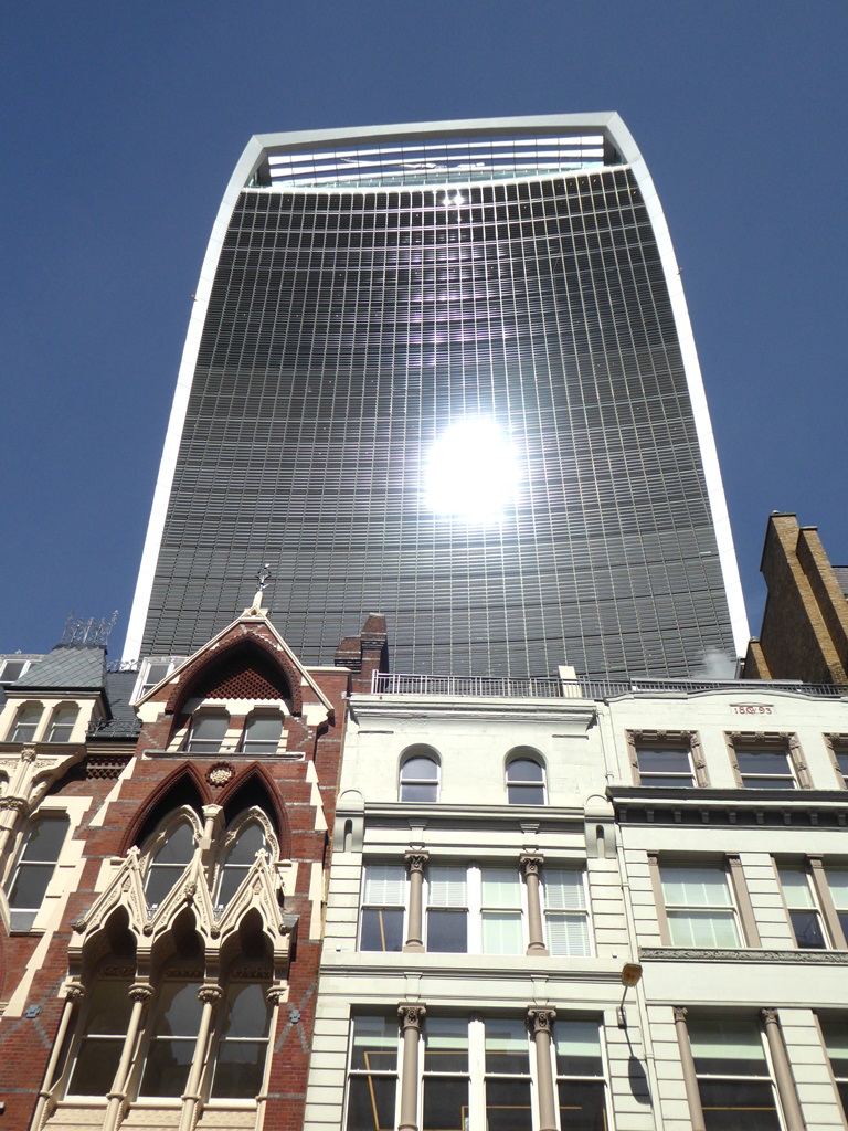
5 View of 20 Fenchurch Street (The ‘Walkie Talkie’)
Across the road looms the vast edifice of the building officially named 20 Fenchurch Street. Due to its strange shape, Londoners know it as ‘The Walkie Talkie’. The sides of this huge tower bulge outwards, creating more space at the top for premium-rent offices.
In a great example of good weather and bad planning, September 2013 saw the sun shining brightly on the side of the building that faces this street. The tower’s curvaceous front reflected the sun’s hot rays and bounced them downwards, melting parts of a Jaguar car and paint on door frames, and burning carpets in shopfronts.
Newspapers reporting the incident coined several other nicknames for the building, including 'The Walkie Scorchie' and 'The Fryscraper'! The offending glass now has sun shades affixed all the way down, at great extra cost for the building’s owners.
Amazingly, the tower’s architect, Rafael Vinoly, had previous form in designing giant magnifying glasses. The Vdara Hotel in Las Vegas is known for melting pool-side furniture and giving its guests sunburn!
More seriously, the London Fire Brigade is used to being called out to blazes started by our life-giving star. In 2015, three house fires were started by the sun’s reflections - off a mirror, a doorknob and an empty jar of Nutella.
With the Walkie Talkie on your left, bear right along Eastcheap as it becomes Great Tower Street. Turn right again down the delightfully cobbled (and named) Idol Lane. A short way down on the left is a church with a difference. Go into the gardens and find a circular water fountain surrounded by benches. Stop here.
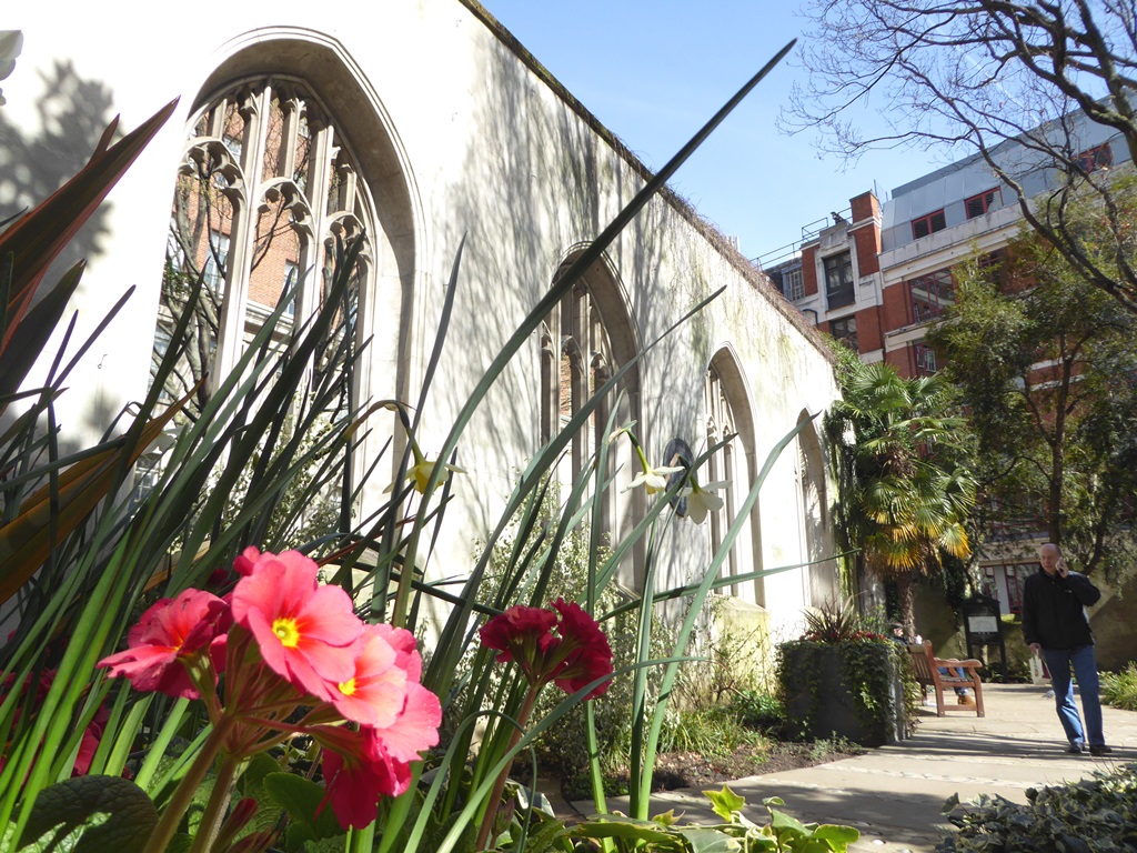
6 The Church of St Dunstan in the East
This bombed-out church is now an enchanting garden. Although traffic can be heard whizzing by, it remains tranquil and somewhat other-worldly.
Originally built around the year 1100, it was patched up and rebuilt after the Great Fire of 1666. The church stood complete until the Second World War, when it was bombed during the Blitz in 1940. The site reopened as a public garden in 1967.
Towering above the garden is the church’s beautiful spire. Legend has it that this was not the work of Sir Christopher Wren, but his daughter Jane. The story goes that the builders were dubious such a spindly structure would hold its own weight, so as the scaffolding was removed Jane lay below to show her faith that it would survive.
And survived it has, through centuries of weather and two colossal hurricanes. Both known as the Great Storm in their day, the most recent was in October 1987. Famously dismissed beforehand by BBC Weatherman Michael Fish, it resulted in 18 deaths, the felling of 15 million trees and £2billion of damage.
But that was nothing compared to the carnage wrought by the Great Storm of November 1703, just two years after the spire was built. Storm conditions lasted a week, killing 8,000 to 12,000 people, mostly sailors out at sea.
Some 400 windmills were destroyed, some catching fire from the friction of their sails spinning so fast in the wind. A very unfortunate cow was reportedly blown into the branches of a tree.
In London 2,000 chimneys were torn down and the roof ripped off Westminster Abbey. Afterwards, the writer Daniel Defoe reported seeing up to 700 boats of all sizes piled on top of each other in heaps in the Thames. Clergymen put it down to God’s wrath. Queen Anne called for a day of fasting. Christopher Wren said he was “sure” St Dunstan was still standing.
Besides two Great Storms, London has even seen tornados. It is claimed that the UK has more tornados per square mile than any other country in the world. Fear not; 95% of them register as just T0 or T1, the lowest scores on the official Tornado Intensity Scale.
In 2006 North London was hit by a T4 tornado with winds up to 136mph. Six people were injured and it caused £10million of damage. But that was nothing compared to the T8 that descended on 17 October 1091.
Only two people died but whirling winds of 240mph levelled 600 houses and ripped the wooden London Bridge from its supporting columns. Reportedly, six 25-foot beams were also torn from the roof of St Mary Le Bow church and rammed 21 feet into the ground!
Engraving of ships at sea caught in the Great Storm of 1703 (Wikimedia Commons)
Directions
Return to the gate and go back into Idol Lane. Turn right and retrace your steps back to Great Tower Street. Turn right and continue ahead towards a church with a spire visible at the end of the street. Cross over Byward Street at the traffic lights and stop outside the church.
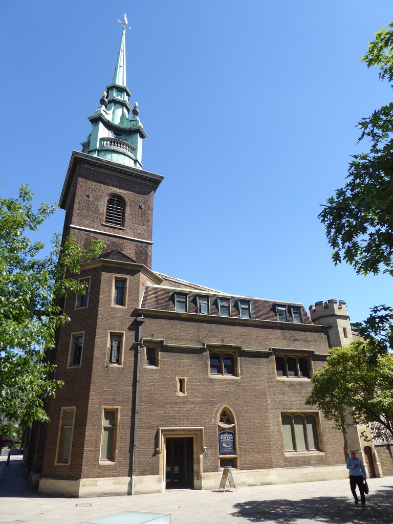
7 All Hallows by the Tower (All Hallows Barking)
With parts dating back to 675 AD, this is the oldest church in the City of London. Just looking at it reveals several incarnations as it was rebuilt over the centuries.
The crypt is well worth a visit for its Roman relics, including a piece of original Roman pavement and a wonderful model of Roman London (then known as Londinium).
The church also marks the most easterly point reached by the Great Fire of London. By 1666 London’s narrow streets were crammed with wooden buildings. Most had jettied upper floors leaning out towards each other. A long and hot summer saw temperatures regularly hit 30ºC, baking London’s wooden houses dry.
Just after midnight on 2 September (a Sunday), the ovens at Thomas Farriner’s Kings Bakery caught fire after not being cleaned properly. They went on to burn down 13,000 houses, 87 churches and the previous St Paul’s Cathedral.
A strong wind blew the fire westwards through a city stuffed with flammable materials, including oil and gunpowder left over from the recent Civil War. The riverfront, financial centre, and Fleet Street all fell to the flames.
On Tuesday (4 September) the fire moved eastwards. The wooden porch of All Hallows was destroyed. But the flames never got any further due to the widespread demolition of houses in the hope the fire would burn itself out in its place.
The next day (5 September), the wind dropped. The flames could no longer leap across streets, allowing for the same remedy to be applied west of the fire. That day, the diarist Samuel Pepys climbed the tower of All Hallows to survey the devastation. He wrote that it was "the saddest sight of desolation I ever saw".
A refugee camp stood outside the City walls for eight years while people waited for their homes to be rebuilt. Many of them died in perishingly cold winters. Amazingly, Thomas Farriner kept his job as a baker.
Painting of the Great Fire of London / A map showing the area devasted by the fire Wikimedia Commons (CCL)
Directions
Pass along the right hand side of the church, towards the Tower of London. Turn right onto the lane heading down to the river. Although it looks closed to traffic, be mindful of the occasional vehicle.
Head towards Tower Millennium Pier but then bear right. With the river on your left continue along the wall until you reach the last lamppost. From here, take in the uninterrupted views of the river.
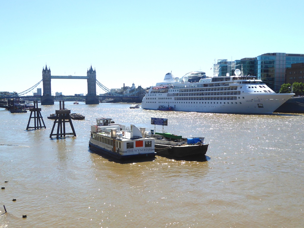
8 View of the River Thames
London owes its existence to the River Thames. For many centuries this river was the main trading route into England. At London it was still deep enough to accommodate large seafaring vessels while narrow enough to build a wooden bridge.
Look across the water. The Thames used to be much wider, shallower and slow moving compared to today. At the next stop we’ll find out why that all changed.
The 19 narrow arches of the Old London Bridge slowed the river down even more. These conditions combined with a ‘mini Ice Age’, which saw temperatures in Northern Europe 1º cooler than average. As a result, the Thames froze over 23 times between 1309 and 1814.
Thames Watermen, unable to ferry people across the river, charged people to go onto the ice instead. Markets sprung up on the frozen river, selling trinkets, souvenirs, roast beef, confectionary, ales and later, coffee, hot chocolate and gin.
The frozen river became the venue for ‘Frost Fairs’. Puppet shows, drinking, dancing and gambling were joined by spectacles such as cock fighting and horse racing. In 1814 an elephant walked across the ice. Amazingly, it survived.
Of course there were deaths due to thawing ice but the fun was considered worth the danger. Marking the 200th anniversary of the last Frost Fair, the BBC described it as "a cross between a Christmas market, a circus and an illegal rave".
Title page of a book on the 1608 Frost Fair / Engraving of the 1683 Frost Fair Wikimedia Commons (CCL)
Directions
With the river on your right, join the crowds thronging around the entrance to the Tower of London. Walk back uphill towards the road, bearing right towards a wall opposite the Ticket Office. Built into the wall are a series of benches and some information panels. Beside these, a series of broad steps descend towards the Tower itself. Find the panels and look down at the Tower.
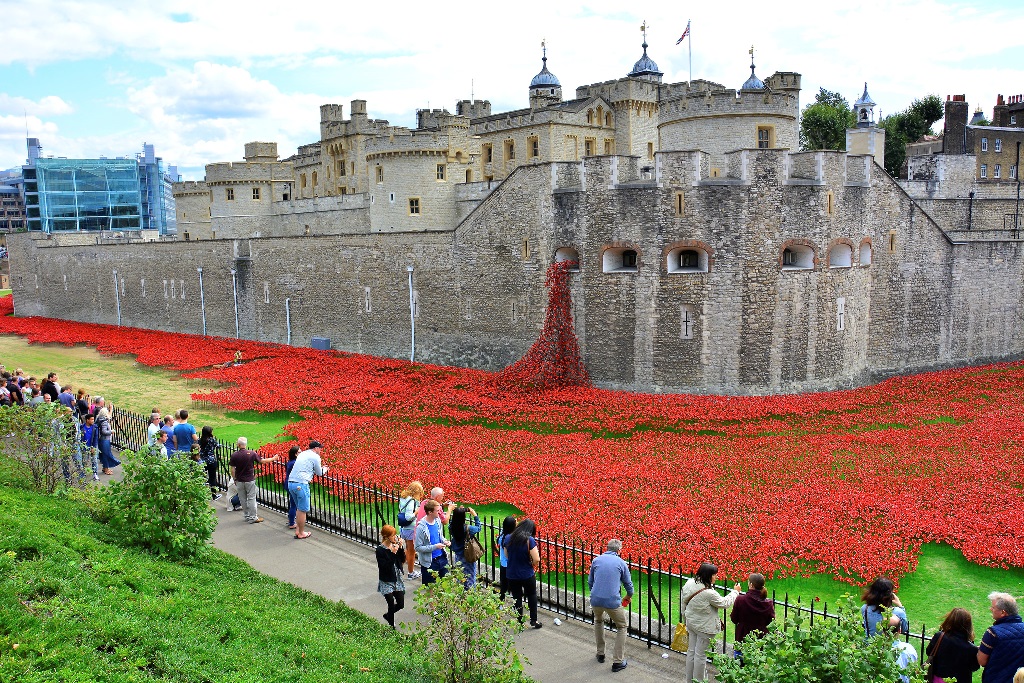
9 Overlooking the Tower of London
The Tower of London has withstood almost a 1,000 years of weather. The White Tower, the tallest part of the castle in the middle, was completed in 1078 during the reign of William I. The rest was built over the following centuries by monarchs who lived there.
As well as a royal palace, The Tower has been used as a prison, an observatory, home to the Royal Mint and the forerunner to London Zoo! Surrounding the walls is what is now affectionately known as Tower Ditch. This was where the moat used to be.
Every winter an ice rink springs up here but it’s most famous recently for ‘Blood Swept Lands and Seas of Red’. This was the vast display of ceramic poppies that filled the whole area in 2014 for the 100th anniversary of the First World War.
But what happened to the moat? And why hasn’t it been refilled?
The moat was originally fed by the River Thames. For centuries the Thames was the dumping ground for London’s rubbish, including sewage, animal remains from slaughterhouses and increasingly, factory waste. As the Industrial Revolution wore on, the Thames evolved into a giant sewer - and the Tower moat with it.
Latrines in the Tower also emptied into the moat, which didn’t help. In 1841, The Surgeon General said the moat was "impregnated with putrid animal and excrementitious matter … emitting a most prejudicial smell”. Four years later, the Constable of The Tower - the retired Duke of Wellington - ordered the moat to be separated from the river and drained.
That didn’t help the Thames, however. 1858 was another particularly hot summer. And low tide left piles of sewage along the riverbanks up to six foot deep. The City Press newspaper described the Thames: “It stinks - and whoso once inhales the stink can never forget it and can count himself lucky if he lives to remember it”.
A pleasure cruise for Queen Victoria and Prince Albert was abandoned after five minutes. The Government, reeling from the stench in the newly-built Houses of Parliament, rushed through a bill to solve what the press called ‘the Great Stink’.
Sir Joseph Bazalgette was commissioned to rebuild and extend London’s sewage system. This ended the problem. It also meant that the narrowed river, much deeper and faster flowing, never froze over again.
Talk of refilling the Tower’s moat has surfaced many times since, most recently during preparations for the 2012 London Olympic Games. With estimated costs of between £13-18millon, the idea was sadly abandoned.
A Punch cartoon on the polluted River Thames (21 July 1855), Wikimedia Commons (CCL)
Directions
With the Tower on your right go back uphill to the road. Use the pedestrian crossing to go into Trinity Square Gardens on the opposite side. Bear right through the gardens and follow the path behind the large Merchant Navy Memorial.
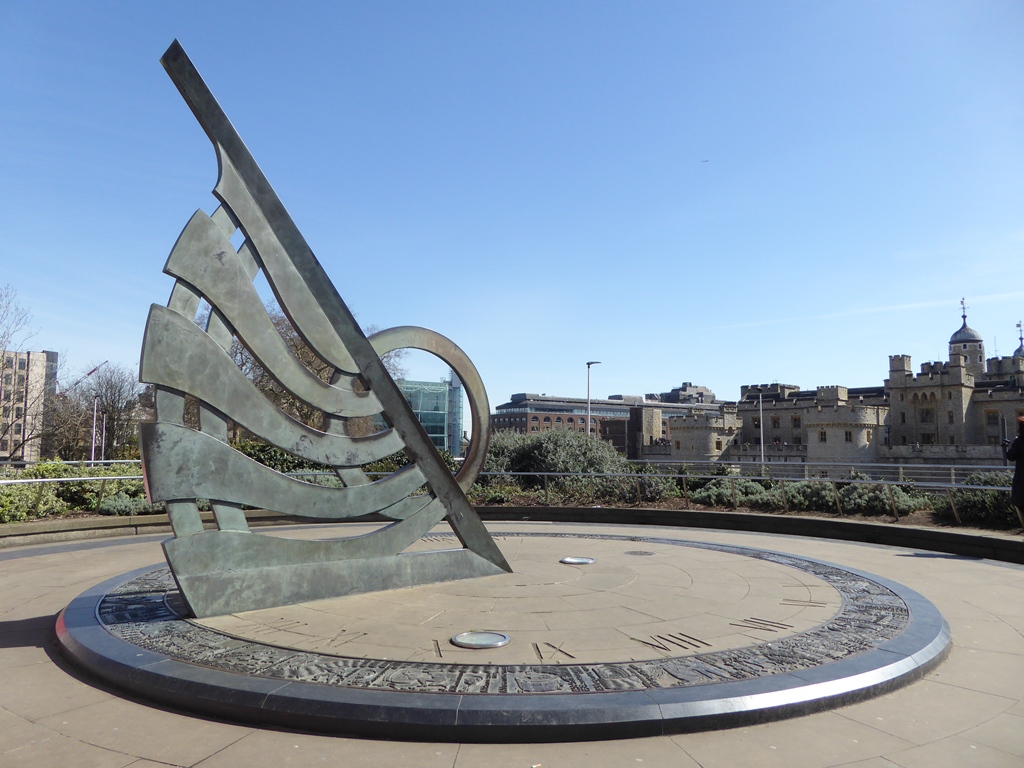
Exit the gardens beside Tower Hill Underground station and then turn right towards a large metal sundial. The sundial itself can only be reached by a flight of steps. Do go up them if you can, otherwise look at the sundial from outside the station.
10 Tower Hill sundial
Sundials have existed since Biblical times. They depend of course on weather that London isn’t necessarily known for. Yet the city’s reputation is unfair. As we’ve already seen, London has had a lot of sunshine.
For many years London’s hottest summer was 1976, which saw highs of 26º for 25 days, and 32º for 15 days. In 2018, the average temperature in July was 22.5º - beating the 1976 record of 21.6º. By the end of August, 2018 had become the hottest summer in British history.
For the hottest year in world history, that would be 2016, closely followed by 2017, 2015, and 2014. There is possibly a pattern here…
Sitting outside Tower Hill station, this wonderful sundial was designed by John Chitty and Edwin Russell. Unveiled in 1992, around the edge is a panorama of London’s history - with the river Thames flowing through each tableaux.
Look out for pictures depicting events related to our walk, including the Great Fire. Can you also find a surprise visit from a modern politician at a medieval revolt?
If you went onto the sundial itself, go back down the steps. With Tower Hill station on your right, bear left around the back of Trinity Square Gardens. Pass a square building on the right and stand on the corner with Savage Gardens (no connection with the ‘90s band!).
11 Trinity Square
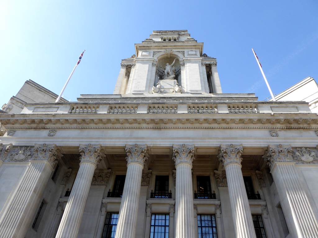
Dominating Trinity Square is the grand facade of the former Port of London Authority Building. Notice its giant tridents flanking the entrance and an imposing statue of Father Thames near the top. Completely rebuilt inside, the building is now a hotel.
Now look to the right at the mansion-like building next to it, complete with a wonderful ship weathervane on its roof. This is the head office of Trinity House, an organisation that promotes the welfare and safety of people working in the maritime industries.
Trinity House is also the General Lighthouse Authority for England and Wales. It oversees 60 lighthouses and 10 lightvessels - unmanned ships that perform the same function as lighthouses, but further out to sea. These provide weather information to Trinity House, which then sends it to the BBC for the Shipping Forecast.
Forecasts are given for each of Britain’s coastal zones, named after physical features like sandbanks, islands and rivers. Intended to help sailors and fishermen chart their course, this Radio 4 late night broadcast has an audience well into the 100,000s - far more than the number of people actually out at sea.
The precise, clipped and atonal delivery of the forecast has been compared to poetry and ritualistic prayer. People use it as an aid to falling asleep, drifting off to a litany of ethereal sounding words and places - Dogger, Fisher, Viking, German Bight... The forecast has become part of our wider culture. There are choral and rock versions and it featured in the Opening Ceremony of the London 2012 Olympic Games.
One of the zones, Finnistere, was recently renamed Fitzroy after Vice Admiral Robert Fitzroy. Keen to reduce the number of deaths at sea, he invented the first weather forecast - and actually coined the term. Fitzroy was also the captain of The Beagle, the ship Charles Darwin travelled on to the Galapagos Islands.
Darwin was one of many travellers who have experienced a very unusual weather phenomenon - St Elmo’s Fire. This luminous shimmering light, usually blue or violet, surrounds the points or edges of a vessel. It was first recorded around the masts of sailing ships but has since been spotted on aircraft taking off from Heathrow Airport.
St Elmo’s Fire occurs when there are high levels of static electricity in the atmosphere, often during thunderstorms or near to recent volcanic activity. The ‘fire’ is luminous plasma caused by the electrical field meeting a sharp object – such as a mast or wing.
Although traditionally seen as a bad omen, there is nothing dangerous about this strange sight.
Engraving of St Elmo's Fire on a ship's masts, Wikimedia Commons (CCL)
Directions
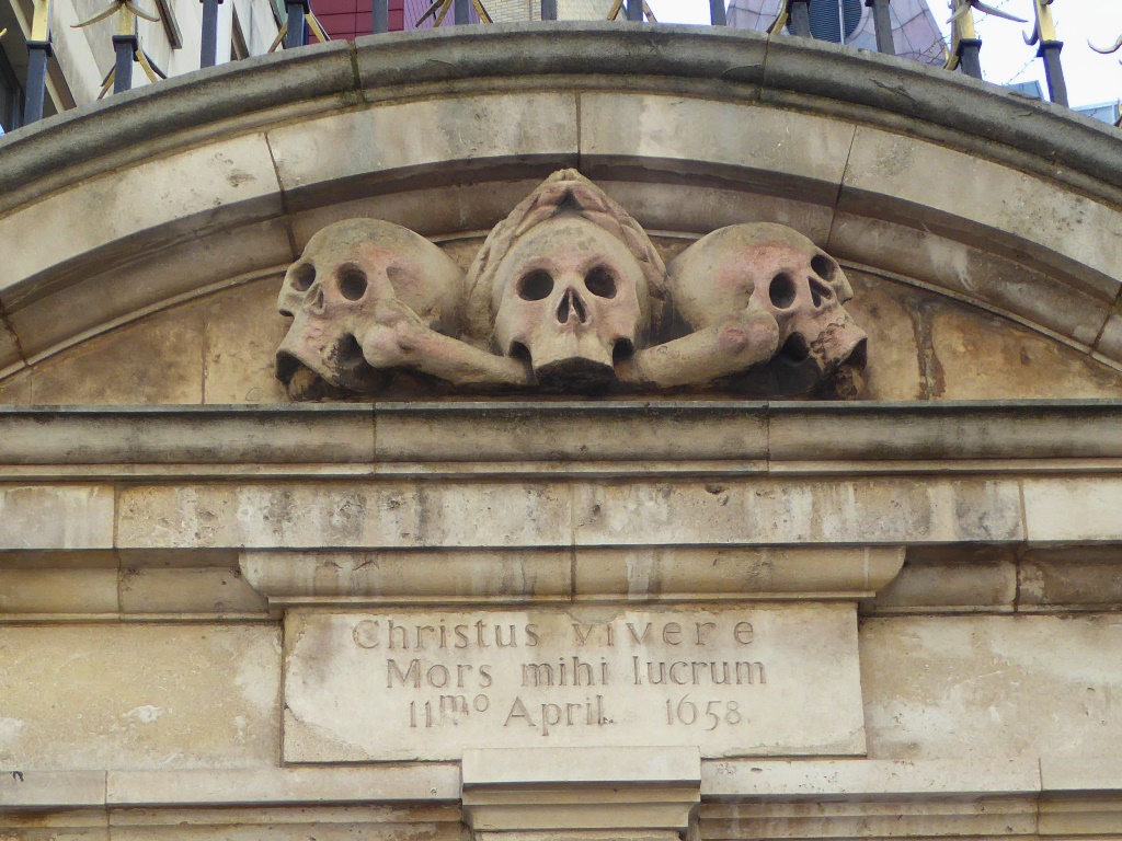
With Trinity House on your right, go along Savage Gardens. Turn left along Pepys Street and continue to the very end. Across the junction is a church with three skulls above the entrance gate.
12 St Olave Hart Street
Pause for a moment at for a footnote to Great Fire of 1666. The church opposite, St Olave’s, was famously dubbed by Charles Dickens as “The Church of St Ghastly Grim” for its skulls and forbidding appearance.
Two centuries earlier it was associated with another writer. The church stands just across the road from where Samuel Pepys lived and right next door to where his office used to be. As Chief Secretary to the Admiralty, Pepys had a covered staircase installed linking his office to the church. This allowed him to attend services without getting rained on.
St Olave’s narrowly escaped the Great Fire. At the height of the inferno, Pepys saved his wine collection and a valuable Parmesan cheese from the blaze by burying them in his garden. They would have lain underground very close to this spot! Pepys and his wife Elisabeth are both buried at St Olave's.
Portrait of Samuel Pepys by John Hayls, Wikimedia Commons (CCL)
Directions
Facing the church gate, turn right and continue to the end of Seething Lane (one of many wonderful street names in this area!). Turn left onto Hart Street. At the end turn right onto Mark Lane, then right again into London Street. Head towards Fenchurch Street station and stop outside.
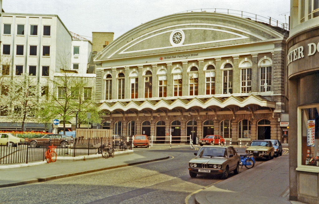
13 London Fenchurch Street railway station
Fenchurch Street is London’s only mainline railway station not to have its own Underground link. When it opened in 1841, both mainline rail and the Underground lines operated with steam trains. These trains contributed to London’s weather by helping to create fog.
London is famous for its fogs and smogs. Charles Dickens wrote in his novel Our Mutual Friend (1865) that in the countryside, "fog was grey, whereas in London it was, at the boundary line, dark yellow, and a little within it brown, then browner, and browner, until at the heart of the City... it was rusty black"
Concerns about the city’s air quality go as far back as the thirteenth century. Fog droplets condensed around soot particles from coal fires. Over time pollution from workhouses, factories, power stations, steam trains, and cars all added to the problem.
Matters came to head on 5 December 1952 after dense smog had lingered for five days. Streetlights remained on as people felt their way along walls. Cars were abandoned and bus conductors walked in front of the vehicles to prevent accidents, until all surface transport was shut down.
Smog even found its way indoors, resulting in movies and theatrical productions being cancelled as audiences struggled to see!
Amazingly, London was so used to these events that there was no panic. It was only afterwards that the scale of the disaster became clear - 4,000 people were killed in those five days, 8,000 people in the weeks after. Eventually, The Clean Air Act of 1956 encouraged the use of gas fires in place of coal and moved power stations out of London.
Although smog is no longer such a regular occurrence, London’s air quality is still horrific. The city regularly breaks EU safety limits. In 2015, Oxford Street exceeded the yearly limit in just five days. Three years later, London had passed the yearly limit by the end of January. This is still a problem the city desperately grapples with.
With your back to the station, retrace your steps back along London Street. At the end carefully cross the road and turn right onto Mark Lane, then left onto Fenchurch Street itself. Use the crossing outside the Walkie Talkie building on the left to turn right onto Lime Street.
Follow the first left, Lime Street Passage, which is an entrance into Leadenhall Market. Follow the street as it curves right then stop when you are at the centre of the market’s covered arcade.
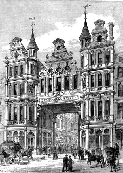
14 Leadenhall Market
Leadenhall Market is the grandest Victorian scheme to protect London’s commerce from bad weather. A meat and poultry market for around 700 years, the present Leadenhall buildings date from 1881. Created by Horace Jones (who designed Tower Bridge and Billingsgate Fish Market we saw earlier), the site is now home to restaurants, pubs and boutiques.
The fashion for covered arcades and markets in London began with Piccadilly’s Burlington Arcade, built in 1819. The story goes, however, that the roof was actually fitted to prevent people from lobbing rocks and refuse at the home of George Cavendish, an unpopular aristocrat who lived next door!
Despite London’s reputation for rain, in recent years the city has received less soakings than Miami, New York, Sydney, Rio de Janeiro and Mexico City! The average rainfall for London is 22.9 inches (583 millimetres) per year. Compared to New York (49.9 inches per year) and New Orleans (62.7 inches), London is positively arid!
Of course, London’s rain is scattered over 106.5 days of the year, often falling as drizzle, rather than the short bouts of torrential rain experienced elsewhere.
Pictures: Leadenhall Market's main entrance (1881), Illustrated London News, Wikimedia Commons (CCL)
From entering Leadenhall via Lime Street Passage, turn left. Walk through the longest part of the roofed market and continue out onto Gracechurch Street. Turn right and use the pedestrian crossing. Then turn left onto Cornhill. Pass the large door of St Peter’s Church an stop outside the neighbouring ornate terracotta office building. Look up!
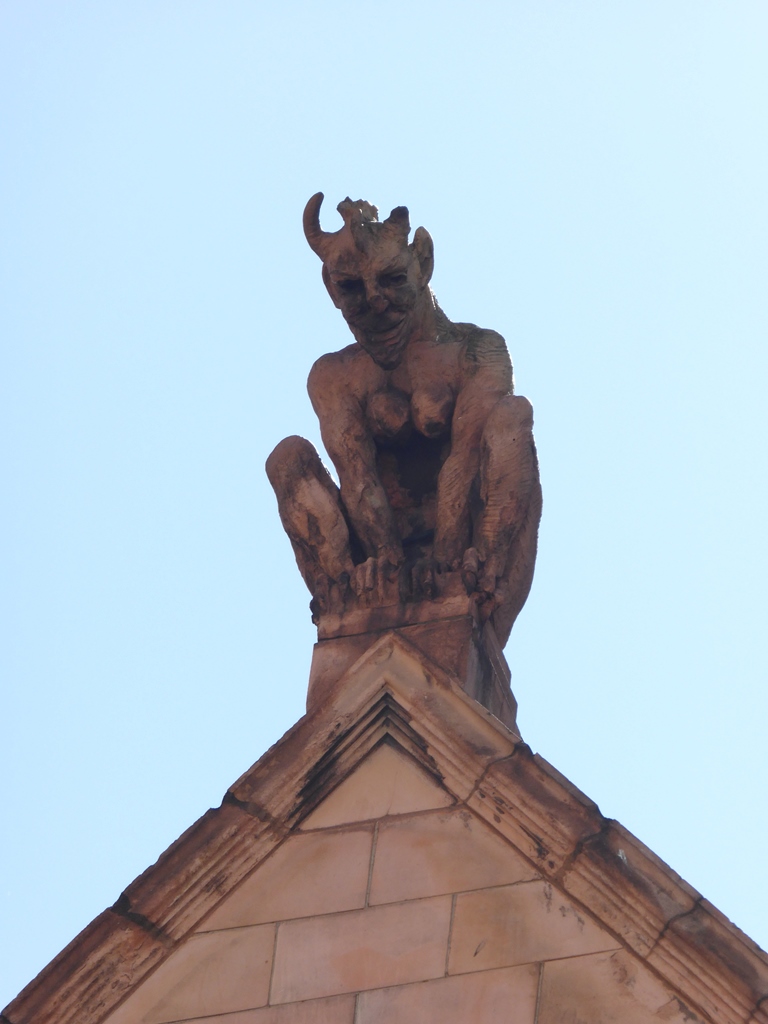
15 The Cornhill Devils, 54 and 55 Cornhill
Gaze up to see three fearsome faces leering down at us. These are the Cornhill Devils. One sits at the top of the roof, there’s another directly below, while a third crouches upon a windowsill on our left, snarling down at St Peter’s Church.
Legend has it that the original plans for this terracotta building encroached upon the church’s land by one foot. The enraged vicar forced the architect, Earnest Runtz, to redesign it. Runtz apparently added these decorative devils as an act of revenge – it’s said that one bears the vicar’s face!
Since the building was finished in 1893 the devils have weathered well, despite all the conditions London has thrown at them. They are perched at one of the highest spots in the City. While St Paul’s Cathedral tops Ludgate Hill, St Peter’s Church tops Cornhill.
Hill top living has many advantages, including reduced risk from flooding. London has experienced many floods over the centuries. During a flood in 1816 people reportedly rowed through the Great Hall of the Palace of Westminster, while the floor was covered in fish!
Floods on 7 January 1928 saw the Palace flooded again. The Tower of London’s moat refilled for the first time in 80 years, the Embankment collapsed beside the Tate Gallery and Blackwall and Rotherhithe tunnels were left submerged. Tragically, 14 people were killed.
The cause was the weather out at sea. For 55 miles the River Thames is tidal. The water level rises and falls twice a day by about seven metres. When high tides coincide with strong winds, sea water is pushed inland and the river’s level rises until it floods.
Since the Victorian era a range of flood protection measures have been put in place to protect London. The best-known are the Embankment and the Thames Barrier, built near Greenwich in the early 1980s. Yet while central London has remained protected, flooding seems to be increasing at the river’s non-tidal outskirts.
In 2000 the Thames rose to one of the highest levels in living memory. 2003 and 2007 were also bad years while floods in January and February 2014 brought widespread destruction in Surrey, Buckinghamshire and Oxfordshire. The following year, an Environment Agency report estimated that 300,000 London homes are at risk of flooding from the Thames.
Continue along Cornhill until you see another church. Take the immediate left turn into St Michaels’ Alley. A short way along on the left is the Old Jamaica Winehouse. Stop outside it and look for a square blue plaque on the wall.
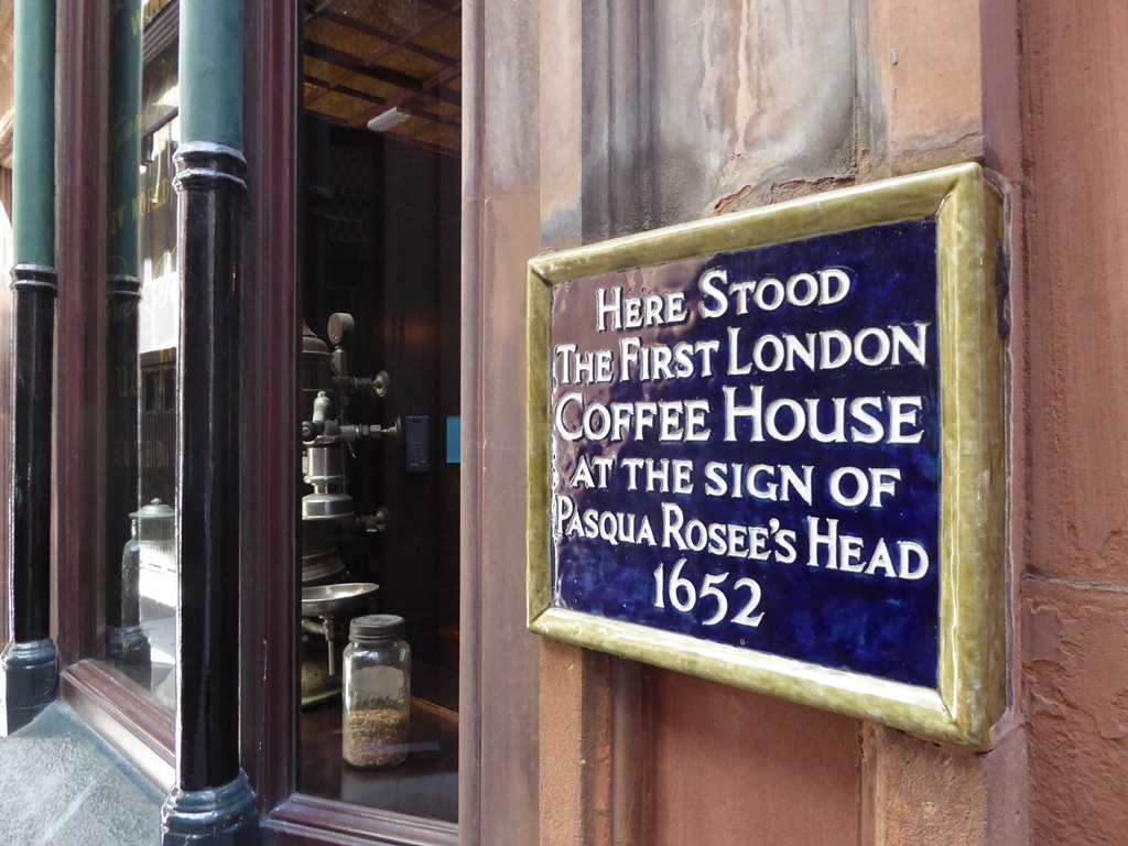
16 The Jamaica Wine House, St Michael's Alley
This Victorian pub, with its gloriously worn down doorstep, sits on the site of London’s very first coffee house. Pasqua Rosee set up shop here in 1652, and many other coffee shops quickly sprung up nearby.
Unlike the ale houses and taverns of the day, anyone of any class could enter and mingle in the coffee houses - so long as they were male. Coffee houses became very popular with sailors, ship captains, and merchants looking to travel overseas. They were soon the best places to hear the latest shipping news and to conduct trade deals.
Before Vice Admiral Robert Fitzroy invented the weather forecast, seafaring was extremely dangerous. Besides facing pirates and hostile foreign navies, untold thousands of ships around the world were lost to storms. In 2016, Historic England estimated that approximately 40,000 shipwrecks still lie undiscovered around the British coast.
Vast sums of money rested on voyages reaching their destinations. Merchants turned to insurers to safeguard their fortunes. If their ships and the goods they carried were lost, their businesses would not be swept under too. One of the world’s biggest insurers, Lloyds of London, started life this way in Lloyd’s Coffee House, which opened in 1688.
London’s modern financial district owes its existence to these seventeenth century coffee houses. Many of the City’s investment banks and insurance markets began (and thrived) in them, by making bets against the weather.
Enmgraving showing a 17th century London coffee house, Wikimedia Commons
Directions
Retrace your steps onto Cornhill and turn left. Pass the Royal Exchange on the opposite side of the road and cross over when you reach Bank junction. Step up onto the raised area by the equestrian statue of the Duke of Wellington. If a bench is free, take a seat.
17 Duke of Wellington statue, Bank junction
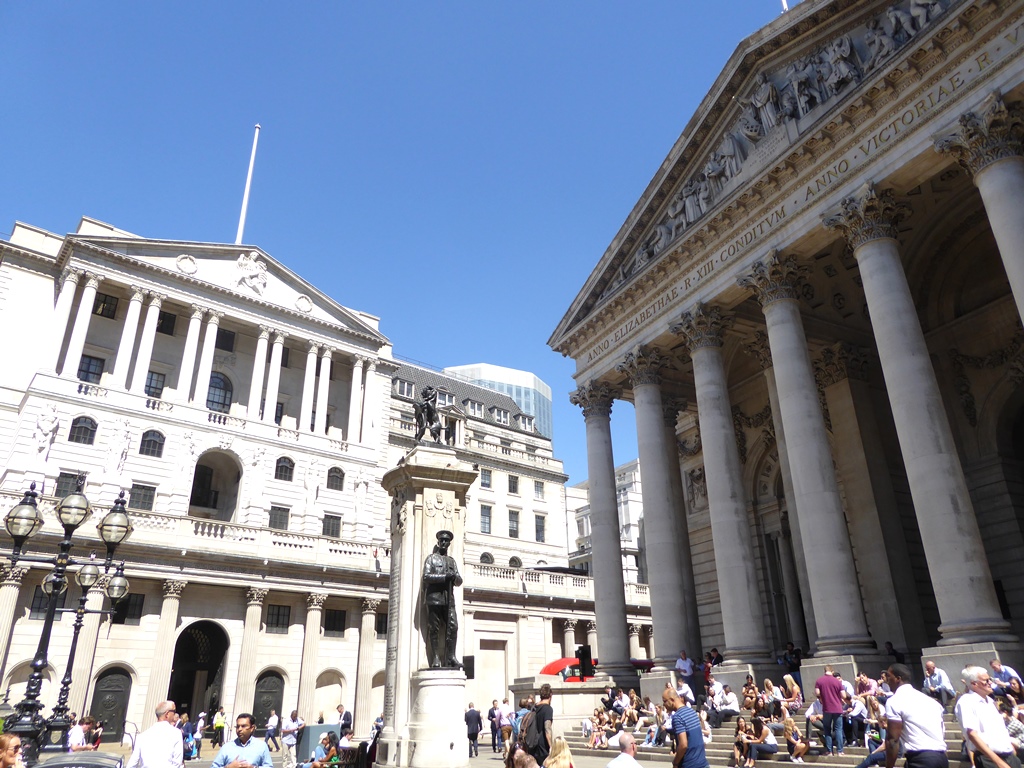
Imposing buildings dominate this road junction. Directly behind Wellington’s statue is the Royal Exchange, an extraordinarily fancy shopping arcade. If it is open, pop through the doors for a glimpse of life as one of the super-rich!
The original market was created by the merchant Thomas Gresham and opened in 1571 by Queen Elizabeth I. Look at the roof for another unusual weathervane - a grasshopper. This was the Gresham family emblem.
To the left of the Royal Exchange is the epic facade of the Bank of England. Founded in 1694 by William Patterson, this walled fortress contains over £100 billion of gold, from this country and others worldwide. From here, the Governor oversees the UK’s monetary policy and sets interest rates.
The country’s economic climate has always been affected by the actual weather. Sunny spells are often hailed for creating a ‘feelgood factor’ that encourages spending and tourism. But during cold and wet periods many businesses suffer, as people are unwilling or unable to go outdoors. Recent harsh winters, including the ‘Big Freezes’ of 2010, 2016 and 2018 led to reports of lost earnings and trade.
For the Bank of England, knowing which way the wind was blowing used to be literal. Sailing ships relied upon an easterly wind to navigate their way up the Thames. With the wind in their sails, these fleets generated more trade - which meant the Bank had to circulate more money. So a weathervane on the Bank's roof is attached to a compass in the court room, which let managers know if the wind was blowing from the east.
The weather still shapes the Bank’s actions today. In April 2018 the effects of a harsh winter and cold spring were cited for the Bank not raising interest rates. Rates were raised at the start of August, following a heatwave that had raised fears of crop shortages, extra costs for the NHS, and a decline in workers’ productivity due to lack of sleep.
With our weather as unpredictable as ever, only one thing is certain. The wind, sun and rain have all played a crucial role in London’s story. The weather has shaped the city and the lives of its people through the centuries, right up to today. From falling fish to buildings acting like magnifying glasses, from the Great Storm to the Great Stink, we hope you have enjoyed our weather report.
Entrances to Bank Underground station are on Cornhill and Threadneedle Street, where you can access the Northern Line, Central Lines and Docklands Light Railway. Meanwhile, there are multiple bus stops for many bus routes on the roads leading up to the junction.
To return to the Monument on foot, carefully cross over the end of Cornhill and turn sharp left to join Lombard Street. Continue along this road as it becomes King William Street. At the end is an entrance to Monument Underground station. Go into the station and through the ticket hall to reach the Monument itself again.
Your browser is out of date, and unsupported by this website. Please upgrade to the latest version to use this website.
Frost Fair on the Thames with Old London bridge in the distance, Wikimedia Commons (CCL)
London Weather walk
A weather-themed walk around the City of London
Londoners have always been obsessed with the weather. Given how much it has shaped the development of the city, it’s easy to see why.
This walk visits several London landmarks, a modern skyscraper, an enchanting garden and several historic churches. Each has a link to weather-related events, such as the Great Storm, the Great Fire, great freezes, and the Great Stink!
Other places on the route illustrate the devastating impact of pollution in certain conditions, and some of the weirdest weather events ever to happen here.
Follow the walk by clicking on the map pins or downloading the guides below
The Monument to The Great Fire of London, Fish Street Hill, EC3R 8AH
Finish point:
Duke of Wellington statue, Bank junction, EC2R 8AH
Be prepared:
Most of the route is step-free but the sundial at Tower Hill station can only be reached via a flight of steps. Parts of the route cross very busy roads.
Keep an eye out for:
Many weather vanes, including ships, cockerels and a grasshopper
Directions to the start:
The Monument stands just outside Monument Underground station, on the corner of Monument Street and Fish Street Hill. If coming from the station, go through the barriers and head out through the main exit on your left. Stepping outside, The Monument itself is the large column to your right.
London Weather walk credits
Thanks to -
Jess Brownrigg for creating this walk
Rory Walsh for editing the text and providing photos
Georgie Endfield for researching archive images
Ben Brooksbank, David Iliff and Martin Pettitt for images reproduced under Creative Commons Licenses
 Also, each of the 311 steps inside The Monument is exactly six inches high. The plan was to use them to measure atmospheric pressure at different heights up and down the column.
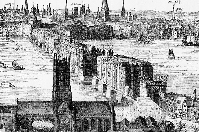


 This bombed-out church is now an enchanting garden. Although traffic can be heard whizzing by, it remains tranquil and somewhat other-worldly.


%20wikimedia.jpg) Thames Watermen, unable to ferry people across the river, charged people to go onto the ice instead. Markets sprung up on the frozen river, selling trinkets, souvenirs, roast beef, confectionary, ales and later, coffee, hot chocolate and gin.
Thames Watermen, unable to ferry people across the river, charged people to go onto the ice instead. Markets sprung up on the frozen river, selling trinkets, souvenirs, roast beef, confectionary, ales and later, coffee, hot chocolate and gin.