1 A story of regeneration

Today people can walk along the Thames Path on the south side of the river for many miles but that hasn’t always been the case.

This riverside area has only opened up for leisure uses over the last few decades.

This walk looks at this regeneration of the South Bank since the Second World War.

Regeneration means the development of urban land to improve upon what was there before, either by refurbishing existing buildings or demolishing them and building something new.

Regeneration is not haphazard, it is planned. It is used as a strategy to improve an area’s physical environment, to boost the economy and improve the social and cultural dynamics of a place.

This walk looks at buildings and architecture but also at the stories behind regeneration, particularly the politics and the social impacts.

The walk was created by Erica Pani from Queen Mary University of London.

Erica: I created this walk when I was an undergraduate as part of the coursework for my human geography course. I’ve always loved the South Bank. It’s a wonderful place to stroll with so many things to see, interesting buildings, great cafés and restaurants. And it’s a great place for A skyline of cranes in every direction people-watching. I hope that you enjoy the walk!


The Royal Festival Hall
Rory Walsh © RGS-IBG Discovering Britain 
Directions

Remain in the plaza on Belvedere Road at the rear entrance to the Royal Festival Hall.

2 The ups and downs of the South Bank

This stretch of the South Bank, today in the London Boroughs of Southwark and Lambeth, has a long and varied history.

Although our walk looks at the development of the South Bank in the last 60 years, appreciating its longer history is vital for understanding the cultural, social, political and economic landscape that we see today.

In Roman times, goods that came from Porchester, Sussex and Kent (to the south) crossed the river here. It was also an area well known for its provision of ‘social entertainments’.

It was a similar story in many centuries that followed. The South Bank was both an important strategic location as well as being ‘infamous’ for its shady inns, taverns, slums and disreputable ‘underclass’.

The boom period for the South Bank was the nineteenth century when London was a hub of world trade and commerce.

At the numerous wharfs and docks along the banks, ships were unloaded of goods from the far reaches of the British Empire.

There was also a large population in the area that provided a readily-available supply of labour.

But it was also a poor population, living in slums that were overcrowded and disease-ridden.

During the Second World War this area around Waterloo Station suffered from extensive bombing that destroyed homes, businesses and factories. Vast areas were left completely derelict.

Architect and town planner, Patrick Abercombie, said:

“It is one of the great anomalies of the Capital that while the river, from Westminster eastwards, is lined on the north side with magnificent buildings and possesses a spacious and attractive embankment road, the corresponding south bank... should present a depressing semi derelict appearance, lacking any sense of that dignity and order appropriate to its location at the centre of London and fronting onto the great waterway.”

In more contemporary words, the South Bank was ‘not fit for purpose’. Its condition was not befitting of post-war London and something needed to be done. We will find out what was done throughout the rest of this walk.


The South Bank (c.1937)
By kind permission of Lambeth Archives
Directions

Facing the Royal Festival Hall go up the steps to the left of the building. Pass the statue of Nelson Mandela and follow the walkway around to the front terrace of the Hall. Stop on the terrace overlooking the river.

3 A tonic to the nation

After the Second World War the South Bank was a derelict and depressing place. Here, as across the country, there was a sense of post-war gloom as austerity measures and rationing continued.

The Labour Government of the time was keen to provide a ‘tonic to the nation’ that would signal the country’s physical and social reconstruction and renewal.

This ‘tonic’ was the Festival of Britain, a national exhibition held in 1951 on the centenary of the Great Exhibition. The Festival was a showcase for Britain’s future, a future guided by modern planners, architects and
engineers.

They would create modern cities, new transport links, better housing, improved education, social equity and cultural districts. Architects wanted new principles of urban design to feature in the post-war rebuilding of London and the creation of the new towns. These included multiple levels of buildings, elevated walkways and the avoidance of a street grid. Where once there had been working class houses and warehouses, a new landscape emerged.

Over its five month lifespan, 10 million people paid to see the various Festival exhibitions. We are now by the main exhibition site, the Royal Festival Hall.

The Royal Festival Hall is the only one of the Festival buildings still standing. The rest were torn down in 1953 by the subsequent Conservative government who felt that they were too ‘socialist’ in style!


Crowds at the Festival of Britain (1951)
By kind permission of Lambeth Archives
Directions

Continue along the terrace at the front of the Royal Festival Hall. Stop between the Royal Festival Hall and the Queen Elizabeth Hall.

4 A cultural quarter

After the success of the Festival of Britain, further developments took place on the site. New arts venues were added: the Queen Elizabeth Hall, the Purcell Room, the Hayward Gallery and the Saison Poetry Library. Together with the Royal Festival Hall these buildings make up a multi-purpose arts complex now known as the Southbank Centre.

Other arts organisations were also established on the riverside. For example, the National Film Theatre (now known as the BFI) was completed in 1958 and the Royal National Theatre was completed in 1976. We will pass them both shortly.

The development of the South Bank was a catalyst for further regeneration on the south side of the river over subsequent decades. What is important to note for now is that these developments set the tone for others.

Today the South Bank and Bankside – comprising a stretch of over two miles – is a hub for culture, entertainment and leisure. It’s a tremendously popular place for Londoners and visitors alike who come to the museums, galleries, concert halls, theatres, restaurants, cafés and bars.

Think about the main purposes of these buildings – music, dance, drama, film, art. The South Bank is booming again. And it’s a very different type of economic boom from the previous one which was centred on the wharves and heavy industries.


The Hayward Gallery (1970)
By kind permission of Lambeth Archives
Directions

Go down the steps from the Queen Elizabeth Hall and onto the river bank level. Stop by the undercroft with graffiti on the walls.

5 Class divides

As you can see, the South Bank cultural district has proved very popular and has expanded far along the river. But we should stop and think a little bit about who this ‘culture’ is for. Who comes here to the concerts, the films, the galleries and the plays?

Some would see the South Bank as largely a middle class environment, a particular type of cultural expression. As in the Victorian era though, there are still large populations living nearby of predominantly working class people.

Also take a look at the graffiti underneath the Queen Elizabeth Hall. At first this might look like a run-down, neglected space. In fact the area is a dedicated skate park and one of the few the legal graffiti areas in London. The concrete ramps and structures are used by skateboarders to practice and perform tricks for crowds of spectators, while the graffiti brings colour and vibrancy to the dark undercroft. The talented performances of the skateboarders and graffiti artists can be seen as another form of cultural expression to the formal exhibitions and plays inside the buildings.

Although we have been looking at the physical environment of buildings, we also need to think about the social environment. There is an argument that regeneration highlights social separation and class divides.

This debate is keenly felt here. In March 2013 proposals were unveiled for Festival Wing - a £120 million redevelopment to improve the Southbank Centre. Under these plans the skate park would make way for shops and restaurants and a new skate park would be built nearby below Hungerford Bridge. However, these proposals met strong opposition. A campaign group against the development attracted 50,000 signatures. Whatever happens to this site, the skate park is not the first space on the South Bank that has caused division between local communities as we shall discover at the next stop.


Skateboarder under the Queen Elizabeth Hall
Erica Pani  © RGS-IBG Discovering Britain 
Directions

Continue along the riverside path. Pass the Royal National Theatre and BFI under Waterloo Bridge. Go past the IBM and ITV buildings then turn right and stop in Gabriel’s Wharf, which is an outdoor area with small shops, stalls and cafes.

6 Power to the people

In the 1800s, this area was a thriving industrial hub. From the early 1900s, however, there was severe industrial decline.

This was followed – as we heard earlier – by heavy bomb damage during the Second World War. By the 1950s and 60s, most of the land here at Gabriel’s Wharf was derelict. By the 1970s the population had fallen from 50,000 to just 5,000.

There were grand plans to redevelop Gabriel’s Wharf into hotels and offices. 

Property developers planned to turn it into high value real estate that would generate them a big profit.

They expected no opposition from the few remaining local residents. But they were very wrong. 

On hearing that the site was to be redeveloped and that they would be displaced, the community joined together in 1977 as the Coin Street Action Group.

The developers had proposed one million square feet of office space with exclusive riverside access.

Instead, the local community drew up a plan for low-rise social housing, public riverside access, shops and a park.

For seven years – between 1977 and 1984 – a conflict raged between the local community, the property developer, the local authorities and the central government.

There were two planning inquiries, one of which was described by The Times as “one of the longest, costliest, most important and confused planning inquiries ever held”.

Against the odds, the local community won! The battle here at Coin Street gave inspiration to other communities in London that were under threat, although few others were successful in stopping the big developers.


Gabriel's Wharf
Rory Walsh  © RGS-IBG Discovering Britain 
Directions

Walk all the way through Gabriel’s Wharf and leave by the exit away from the river. Turn left onto the road (Upper Ground). At the corner with Duchy Street, go into Bernie Spain Gardens.

7 A space for everyone

From here we can see what the battle for Coin Street achieved. On this very short section of the river bank, squeezed between the IBM block and the OXO Tower, there are no large offices or residential buildings; there’s just one block of community housing. Who do you think it is owned by? The local council? A housing association? Or is it private? Nice isn’t it?

Well, each block is owned by one of Coin Street’s fully mutual housing co-operatives to bring affordable housing to local people. We are in a public garden and there is free access to the river front.

This remains a space managed by the local community. Had the community not won, offices would be standing here and there would be restricted access to the river bank. Hundreds of families would have been displaced.

When regeneration occurs, it is important to think of the people who get displaced and the communities that get broken up. If you had lived here and were threatened with eviction, would you have campaigned against it or would you have taken compensation and left?

Erica: Here, in Coin Street, I think the whole city has benefited from the fact that the community was able to get together and fight for this land – not just for themselves but for everyone else too.


Bernie Spain Gardens
Rory Walsh © RGS-IBG Discovering Britain 
Directions

Leave Bernie Spain Gardens and cross over Upper Ground. Make your way through the park area back towards the riverside. Turn right and follow the Thames Path past the OXO Tower and Sea Containers House. Go through Blackfriars station and stop outside the Tate Modern.

8 From industry to art

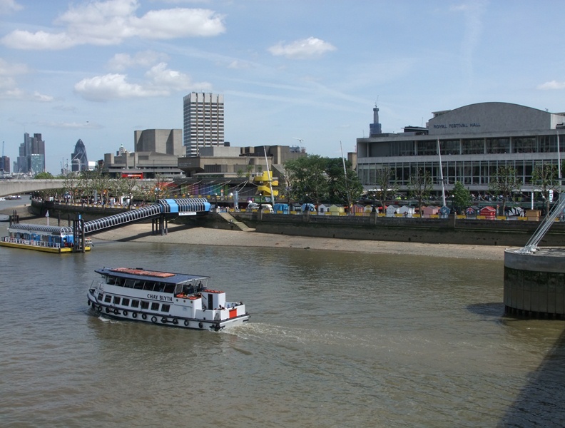
The South Bank complex that we saw earlier was a cultural quarter developed between the 1950s and 70s. We are now in a different borough known as Bankside. It was here that another hub of culture was developed in the 1990s and 2000s.

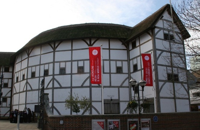
The main features of this new cultural hub are well known – the Tate Modern, Shakespeare’s Globe and the Millennium Bridge. But we should to once again think a bit more about these cultural attractions, the land they are built on and the people who visit them.

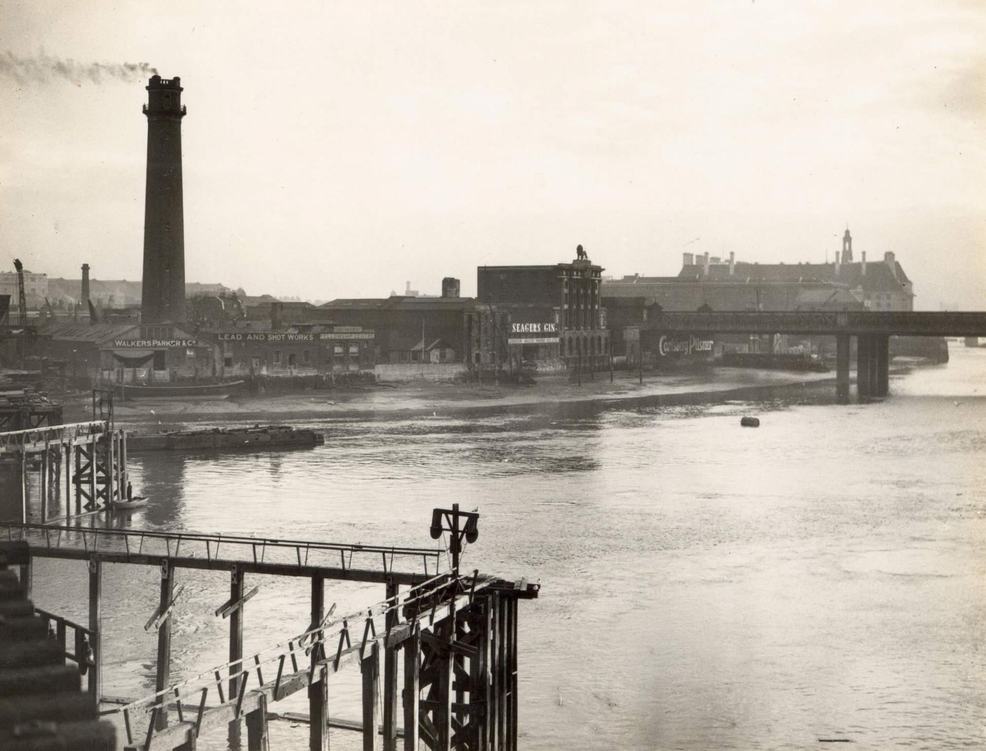
Following the war, the country had a problem with power shortage so a new oil-fired power station was planned for London.

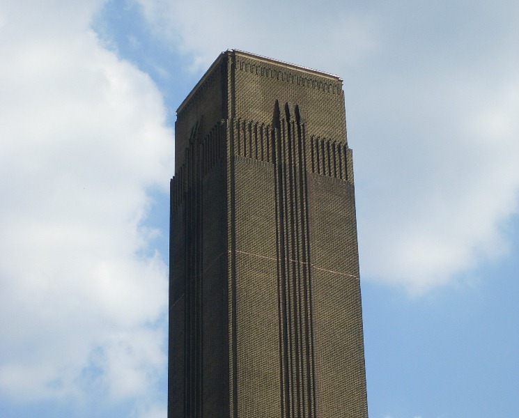
Bankside Power Station was designed by Sir Giles Gilbert Scott, who also designed Battersea Power Station a few miles up the river (as well as Liverpool Cathedral and the red telephone box).

The power station building is enormous - 200 metres long with a chimney 99 metres high (although it had to be lower than the spire of St Paul’s opposite). As you can imagine, there was strong local opposition to construction of such a large building.

The western part of the building was completed first and started generating power in 1952. The whole building was completed in 1963.

However, less than 20 years later, it closed. Rising oil prices in the 1970s made Bankside Power Station uneconomical so it stopped producing power in 1981.

For many years, the power station was at risk of being demolished by developers. By 1993, its fate seemed sealed when contractors knocked a large hole in the side of the building and started removing the interior plant equipment.

Over preceding years, many people had been campaigning for the building to be saved and there were lots of different suggestions for possible new uses. In 1994 it was announced that Bankside Power Station would be home to the new Tate Modern.

The conversion from power station to art gallery took less than five years and cost £134 million. It opened in 2000 and is now one of London’s landmark cultural attractions, with over 5 million visitors every year.

Since it opened, Tate Modern has also created over 4,000 local jobs and generates some £100 million annually in economic benefits to London.

What do you think? Do you like the idea that an old power station is now being used as an art gallery?

Perhaps the old industrial site should have been cleared for more contemporary buildings. Or is it nice to see modern history still apparent in the landscape? On the other hand are art galleries everyone’s cup of tea? Perhaps there could have been a better use for this site? Whether social, economic or cultural, regeneration can always make us think.


Tate Modern
Rory Walsh © RGS-IBG Discovering Britain 
Directions

From the Tate Modern, continue along the Thames Path. Stop outside Shakespeare’s Globe theatre.

9 Rotten tomatoes

In Elizabethan London, this area of Bankside was a place for ‘social entertainments’. These included theatres, drinking houses, bear pits and brothels. Near here, William Shakespeare was part-owner of the Globe Theatre, built in 1599, where many of his plays were performed.

The original Globe Theatre was destroyed by fire in 1613 when a canon was fired from the stage as part of a play and set fire to the roof. The theatre was rebuilt and lasted until 1642 when the Puritans – who were religious reformers – banned stage plays.

The Globe had its third incarnation almost 350 years later. Sam Wanamaker - the American actor, director and producer - visited London in 1949. He had a vision for recreating the Globe and reviving the tradition of Shakespearean plays performed on the South Bank. In 1970 he founded a trust and spent over 20 years fundraising and campaigning for the reconstruction of the theatre as near as possible to its original position.

It wasn’t easy as the local council had a shortage of social housing and wanted the site. It took 17 years of negotiations! By the time Wanamaker died in 1993, the site was secured and construction underway. The
building was completed and opened by the Queen in 1997.

In Shakespeare’s day, the theatre provided entertainment for a range of people. Those who stood in the pit had a lively interaction with the actors – throwing rotten tomatoes and booing at performers they didn’t like! Seats in the upper galleries meanwhile were for more well-off people.

Today, the people who go to the theatre – even in the pit – are largely the middle classes and they probably don’t throw rotten tomatoes at the actors. However, the Globe has a large outreach and education programme to bring Shakespeare alive for wider audiences. Perhaps such projects can help to breach some of the class divides that still exist today.

What do you think? Was it a worthwhile project to spend millions of pounds reconstructing the theatre? Or should housing have been more of a priority?

Perhaps the centuries-old tradition of playhouses on the South Bank is different today than it was in Elizabethan London.

But is it important to see Britain’s history as a living and active part of the landscape? Why is regeneration so difficult?


Shakespeare's Globe 
Erica Pani © RGS-IBG Discovering Britain 
Directions

Continue along the Thames Path, which passes underneath Southwark Bridge. At Cannon Street railway bridge, the path moves away from the river bank along the cobbled Clink Street. Pass The Clink Prison Museum and the Golden Hinde. At Southwark Cathedral turn right into Cathedral Street. When you are underneath the railway bridge, turn right into Borough Market.

10 Middle class market

Borough Market has been on this site since 1756, though there has probably been a market in this area at the end of London Bridge since Roman times. There are certainly written records of a market from the 1200s.

Borough was one of London’s most important food markets in the 1800s because it was so close to the wharves and docks on the Thames.

The present buildings were constructed in the 1850s and have been refurbished over the last 15 years.

A wholesale market operates on weekday mornings from 2 to 8 am, so you are unlikely to see that. The retail market operates only three days a week – Thursdays from 11am to 5pm, Fridays from 12 noon to 6pm and Saturdays from 9am to 5pm. During those times, you will find the market very busy; on other days and outside opening hours there are very few signs of life.

Historically, this market focused on fruit and vegetables but nowadays there are a variety of stalls selling other produce including cheeses, meats and breads. There are also a lot of fast food stalls, which are popular with people who work nearby, as well as tourists. In some ways, the market is the same today as it was over a century ago in that it sells produce from all over the world.

Perhaps what is different though is the type of people who come to shop at the market.

These days, Borough Market is rather a fashionable place. It has a reputation for fine foods, organic produce and artisanal products. With many handmade and high quality items, prices are by no means cheap.

As we found earlier with cultural locations along the South Bank and Bankside, the market is very much a middle class environment.

One problem with regeneration seems to be that the money invested often seeks a return.

This wasn’t the case with Coin Street because it was a development by the community, for the community.

But in so many cases, regeneration draws in the wealthier classes, crowding out those who can’t afford to pay.

Erica: I rather like Borough Market. But I wouldn’t come and do my weekly veg shop here like my mother used to when I was a child and we lived up the road.

Places change, but class divides and wealth-gaps still remain.


Borough Market (c.1860) 
Wikimedia Commons (Creative Comons License)
Directions

Retrace your steps out of the market and down Cathedral Street. Where the road splits at the cathedral, keep right on Montague Close and follow the road round to the right. Before going under the bridge ahead find a good vantage point for looking up at the enormous tower that rises behind the cathedral.

11 Vertical city

From here we can see a landmark piece of regeneration and development on the South Bank. The design was proposed in 2000 but received strong opposition from local authorities and heritage bodies. There was a government inquiry in 2003 but the plans were given the seal of approval. After various financial and legal wranglings, construction began in March 2009.

On completion in April 2012, The Shard became the tallest building in the European Union and the fifth tallest in the world. It stands just below 310 metres high and has 95 floors. The public viewing gallery near the top offers a 44-mile vista across London. No wonder it drew 4,800 visitors on its opening day.

When full, the plans are that The Shard will contain highquality offices, leading brand restaurants, a five-star hotel and exclusive residential apartments. According to the promotional website it is a ‘vertical city’.

Whatever your views on architecture, this new development is certainly spectacular. It is billed as a ‘new icon for London’. Do you think that it will become as iconic as Big Ben, Tower Bridge or the London Eye?

The Shard is just one element in the wider development of the area, which will be known as the London Bridge Quarter. London Bridge railway station and bus terminus has been transformed into a new transport hub. There is also going to be new retail space for shops and restaurants and a landscaped public plaza.

Again we should stop and ask some questions about this new development. Who wanted it to be built and who objected? Who will be the main users of the buildings and surrounding spaces? Who will benefit the most from it? Who will be disadvantaged by it?

The project is financed by private money from the Middle East, largely banks and property developers from Qatar. The highend offices and apartments, hotel and restaurants will no doubt have a matching high price!

This will be an environment of affluence and consumption for a particular type of people. And the profits will go to foreign investors. One thing about foot-loose capital is that it can touchdown anywhere – who knows what benefits or difficulties it might bring?


The Shard under construction (May 2011)
Rory Walsh © RGS-IBG Discovering Britain
Directions

Continue along Montague Close and under London Bridge. Follow the road to the junction with Tooley Street and turn left. After about 100 metres turn left into Hays Lane. Enter the second building on the right, Hay’s Galleria. Stop inside the large open space.

12 Commercialising history

We are now inside Hay’s Galleria. Can you recognise what this building used to be? This was a dock. Ships came in here from around the world and unloaded their goods into the surrounding warehouses for storage.

Now the building has been converted into a leisure and commercial space. This is one example of turning history into culture.

There are a few more examples along the riverside. Just before Borough Market, we passed a replica of the Golden Hinde, the ship that Sir Francis Drake used to sail around the world in the 1570s.

A little further along from Hay’s Galleria is HMS Belfast, a Royal Navy cruiser in service from the 1930s to the 1960s. Both ships have been turned into visitor attractions. History has been turned into a commercial product. This is what we mean by the commodification of culture.

Just before the Golden Hinde we passed The Clink, while below London Bridge station was the original site of the London Dungeon which is now based at another part of the riverside near County Hall.

These are both museums that commemorate ‘less savoury’ aspects of the Thames path – gruesome stories of imprisonment and torture; real artefacts mixed with recreations and interpretations of the punishment meted out when human rights just wasn’t an issue. Visiting these museums is a way of experiencing history. In these two places history rather than culture is being sold as a commodity.


Hays Galleria roof
Rory Walsh © RGS-IBG Discovering Britain 
Directions

When you are ready, leave Hay’s Galleria and turn right along the riverside path. Go past HMS Belfast and stop outside the egg-shaped glass building.

13 Planning and power

This is City Hall, an important stopping point on our walk, not only in terms of pointing out yet more physical regeneration along the riverside, but also in terms of what it represents.

City Hall is the home of the Greater London Authorit (GLA). Based in this building is the Mayor of London and the London Assembly, made up of 25 elected members.

The GLA is responsible for the administration of 610 square miles of Greater London.

It has powers over four strategic areas: transport, policing, economic development, and fire and emergency planning. Power over other areas such as housing and environment is shared with local councils.

What is of particular relevance to our walk is that the GLA co-ordinates land use planning in Greater London. The long terms plans for developing and building in London are all set out one document: The London Plan. Below are the six objectives. After reading them, think about the developments that we have seen so far by the Thames. Have they fulfilled all the objectives?

1. To accommodate London’s growth within its boundaries without encroaching on open spaces
2. To make London a better city for people to live in
3. To make London a more prosperous city with strong and diverse economic growth
4. To promote social inclusion and tackle deprivation and discrimination
5. To improve London’s accessibility
6. To make London a more attractive, well-designed and green city


City Hall
Rory Walsh © RGS-IBG Discovering Britain 
Directions

Continue along the Thames Path, which goes underneath Tower Bridge. Stop on the cobbled street of Shad Thames, with brick warehouses on either side and small bridges overhead.

14 The world's largest tea warehouse

Step back in time to the 1870s and we would have been in the centre of one of London’s busiest riverside wharves. Here goods were unloaded from ships arriving from all over the world, particularly the British Empire.

This was the largest warehouse complex on the Thames and reputedly the largest tea warehouse in the world! The iron bridges above us were used for moving goods between warehouses.

At its peak, this space would have employed thousands of dock workers like shipwrights, lightermen, riggers and lumpers – all handling untold wealth from every corner of the globe.

By the 1960s, containerisation had completely changed the nature of shipping. Places such as Butler’s Wharf were completely unsuited to modern ships and the way that they carried goods. So in 1972 – exactly 99 years after it opened – Butler’s Wharf was closed and left derelict.

But some people have an eye for a bargain. In the early 1970s, many of the buildings were bought by property speculators with a view to redevelopment. Their opportunity came in the 1980s when the Conservative government introduced a new form of ‘entrepreneurial urban policy’.

The London Docklands Development Corporation was established to revitalise and regenerate some of London’s derelict wharves and docks, including Butler’s Wharf. Here it was transformed from a derelict industrial warehouse into luxury apartments, top-brand restaurants and boutique shops.

The one- and two-bedroom apartments were designed to attract people in professional and managerial jobs who worked in the City and Canary Wharf (which was another of the Development Corporation’s projects).

This was known as ‘gentrification’. This gentrification was not a slow, organic process. Rather, the gentrification that happened at Butler’s Wharf was fast and deliberate. It was ‘engineered’ by a Government keen to encourage private money back to the inner city.

Butler’s Wharf remains a rather exclusive development today. SE1 is not just a postcode but a synonym for affluence.

If you pass one of the estate agents, look in the windows at some of the prices for apartments here.


Shad Thames
Rory Walsh © RGS-IBG Discovering Britain 
Directions

Continue along Shad Thames between the warehouse buildings. When you reach the Design Museum, turn left onto the riverside then right to continue on the Thames Path. Cross St Saviour’s Dock then turn right at the arch and follow the walkway. Turn right onto Mill Street and stop at the top of Mill Street where it meets Jamaica Road.

15 The invisible Berlin Wall

Just a few streets away from Butler’s Wharf we’ve reached Jamaica Road but we might as well be a world away rather than a few hundred metres.

We’re still in the SE1 postcode but this is a much less affluent area. There is extensive social housing here, especially in the area south of Jamaica Road.

The professional people living in Butler’s Wharf have more in common with those living in similar developments at Battery Park in Manhattan than they have with their immediate neighbours in Jamaica Road.

One well-known urban geographer and planner, Peter Hall, has suggested that there is “a kind of invisible Berlin Wall” separating the two places.

What is important to note is that the difference is not only physical, seen in the type and quality of buildings, but also social. This is a classic example of the complete social separation that can occur following gentrification.

On the one hand are luxury apartments situated where the working classes once toiled, awardwinning restaurants whose diners have included the Blairs and the Clintons, and cultural centres such as the Design Museum. On the other hand is a neighbourhood where 3 out of every 5 residents live in social housing and 43 per cent of the working age population is economically inactive.

Erica: When I first created this walk as an undergraduate, I asked a local man working as a porter in a Butler’s Wharf office what he thought. His reply was really interesting. He said that the area had been left derelict for so long that some of the locals were pleased to see it put to some use, and at least he now had a job. When I asked if he came here for pleasure, he laughed and said, “No love, I can’t afford it – and if I could I wouldn’t want to go home hungry from designer-sized portions!”


Flats on Jamaica Road
Rory Walsh © RGS-IBG Discovering Britain 
Directions

Stay beside Jamaica Road.

16 The story of the South Bank

This walk has told the story of London’s South Bank and Bankside over the last 60 years. Sites made derelict through industrial decline and wartime bombing have been transformed. Some were completely cleared and brand new buildings erected, like the Southbank Centre in the 1950s and the London Bridge Quarter still under development.

In other places, old buildings were renovated and given a new function - such as the power station transformed into an art gallery and the tea warehouse turned into luxury apartments. In the case of the Globe Theatre, a long gone historical building was meticulously researched and reconstructed.

The physical buildings are a fascinating topic in themselves but equally interesting is the human story behind regeneration. During this walk we have explored two things.

First, we’ve found out about the politics of regeneration. Different groups decide about changes in land use – government, private sector or local communities. Different types of people fund building projects – central government, property tycoons and overseas investors. Developers and investors have power and influence towards planning decisions but sometimes local communities stand up against them.

Second, we’ve learnt about the social impact of regeneration. We’ve seen how many regenerated spaces – such as exclusive apartments, expensive restaurants and upmarket shops – attract different people to an area, often with an effect on those who already live and work there.

As a result some people think regeneration can reinforce social and class divides. This is a contentious issue with no easy answer. What do you think?


The ever-evolving South Bank
Rory Walsh © RGS-IBG Discovering Britain 
Directions

To return to Tower Bridge or London Bridge turn right along Jamaica Road. Alternatively, for the nearest Underground station (Bermondsey) turn left along Jamaica Road.

Transforming the riverside

Royal Festival Hall and the South Bank © Rory Walsh RGS-IBG Discovering Britain

London South Bank walk

A walk along the regenerated River Thames

A power station transformed into an art gallery. A tea warehouse converted into luxury apartments. Derelict industrial sites and depressed neighbourhoods replaced with iconic buildings and new cultural quarters.

These are just some examples of the dramatic changes on the south side of the River Thames in central London. 

But this tide of post-war regeneration is not just about new buildings. Behind the scenes there is also a web of political decisions and power struggles. And they do not benefit everyone.

This walk reveals some of the stories behind the riverside's regeneration.  

Follow the walk by clicking on the map pins
or downloading the guides below

Location: South Bank and Bankside, central London
Start point: Royal Festival Hall, SE1 8XX
Finish point: Junction of Jamaica Road and Mill Street, SE1 2DE
Keep an eye out for:

As much as possible - the riverside is a great place to watch the world go by

Tourist information:

Visit London

London South Bank walk credits

Thanks to - 

Erica Pani for creating this walk and providing photos

Queen Mary University of London for permission to adapt the original walk created as part of a degree programme

Jenny Lunn, Caroline Millar and Rory Walsh for editing the walk materials

Nick Stanworth, Alex Ricketts, Florence Lee and Sarah Johns for assistance with the walk materials

Lambeth Archives for kind permission to reproduce images from their collection

Laura Shawyer, Lucinda Morrison and Ariella Jackman for  useful feedback

Other photos reproduced under Creative Commons Licenses

The plaster walls of Shakespeare's Globe contain goat hair while the roof - made from 6,000 bundles of Norfolk reeds - is the only thatched roof in London