1 Welcome to Harmondsworth

Welcome to Harmondsworth. This small Middlesex village can trace its history back to the Domesday Book. It also lies on the northwest edge of a vast twentieth-century development: London’s Heathrow airport.

Heathrow is one of the world’s largest airports and you may well have flown from there. In fact, until it was overtaken recently by Dubai it handled more international passengers than any other airport.

However, very few travellers explore anything outside the airport boundary - other than the long-stay car parks and hotels. Most people probably assume that the surrounding area is noisy, congested and polluted. If those are your views then this walk might surprise you. Planning regulations have helped to preserve and restore some natural places as well as historic villages. We will visit some of these on this walk.

We will also find out how the airport first came about, how it operates today, and the never-ending political debate about the need for further expansion. We will explore what it is like to live so close to a major airport and how it affects people’s health and well-being. We hope that this walk will help you to evaluate all sides of the argument in one of the big challenges facing our country today.

The circular route is just over 5 miles long. It follows footpaths and quiet streets but there are two busy roads to cross so take extra care here, especially if you are with children.


Harmondsworth Village Green
© RGS-IBG Discovering Britain
Directions

Walk between the Five Bells Pub and St Mary’s Church up to a large gate. You should be able to see a large barn on the other side. If you are here on a Sunday when the gate is open, go up to the barn. Otherwise look at it from the gate.

2 The Cathedral of Middlesex

This is the Harmondsworth Great Barn, a structure that dates back to 1426. It was used to store cereal crops and was in agricultural use until as recently as 1978. From the outside it might look big but fairly ordinary but inside it has a magnificent oak structure. The poet Sir John Betjeman described it as the ‘Cathedral of Middlesex’.

English Heritage ranks the barn with the Houses of Parliament and Westminster Abbey for its exceptional architectural and historic interest. It is protected as a Grade I listed building and, until recently, was also a Scheduled Ancient Monument. We have recognised the need to protect ancient monuments since 1882, and powers to ‘list’ important buildings first appeared in the Town and Country Planning Act of 1947.

Twenty years later the Civic Amenities Act introduced the concept of Conservation Areas to preserve or enhance areas of special architectural or historic interest. Harmondsworth village became one of the first in the London Borough of Hillingdon and this has undoubtedly helped it retain much of its character.

Harmondsworth is one of three historic villages less than a mile from each other that lie in the shadow of Heathrow. They all share an uneasy relationship with the airport. While they benefit from trade and employment opportunities, they also suffer the constant threat of airport expansion. Villagers fear having their lives blighted even more by noise and pollution or even losing their homes. We’ll find out more details about the airport expansion proposals throughout the walk.

 
Harmondsworth Great Barn
© RGS-IBG Discovering Britain
Directions

If you have come on a Sunday when the barn is open, it is well worth a visit. When you are ready, go back towards the village green and enter the churchyard on the left. Go to the right of the church and stop in the graveyard.

3 The price of peace

Villagers in Harmondsworth have been worshipping at St Mary’s Church for hundreds of years and parts of the building date back to the twelfth century. However, the relative tranquillity that they have enjoyed has been threatened on and off ever since Heathrow airport was established.

It certainly came under serious threat in 2003 when the government of the time decided that London needed more airport capacity. They decided that two new runways should be built in the southeast of England: one at Stansted airport and one here at Heathrow.

The new runway was to be just 200 metres beyond the church with the airport boundary running along the edge of the graveyard. The village would survive but it would be surrounded on two sides by the airport fence. Meanwhile, the neighbouring village of Sipson would be demolished.

The airport’s owner offered financial schemes to protect the values of some properties but could do nothing to counter the fear and uncertainty felt by many villagers.

One of the roles of government is to make difficult decisions about major infrastructure developments such as roads, railways, power stations and wind farms. These benefit the nation as a whole but invariably affect the lives of people who live nearby and so are fraught with difficulties.


St Mary's Church graveyard
© RGS-IBG Discovering Britain
Directions

Follow the path through the churchyard and leave through the gate. Follow the footpath across the field for about 200 metres. Stop by a lake where a path joins from the left.

4 On the centre line

The noise from the M4 motoway does not seem to affect the birds attracted to this lake which was created in a former gravel pit. Imagine, though, the noise here if a new runway was built. We are standing right on the centre line of the third runway proposed in 2003. Stand with the lake behind you and you will be looking east directly along its length.

The new runway was to be shorter than Heathrow’s two existing runways and for use mainly by smaller aircraft flying to Europe. It was to have its own terminal building and be connected to the existing airport by taxiways for aircraft and a rapid transit system for passengers.

With many European flights using the new runway, there would be more capacity on the older ones. Many businesses feel that new flight destinations to China, India and Brazil are vital to maintaining Britain’s competitiveness in the world. Various estimates have been made for how much economic value more flights would bring. All of these estimates are hotly-disputed by those opposed to expansion.

Some people object because aviation emissions contribute to climate change. Others believe that there is already too much noise and pollution around Heathrow and that if any additional capacity is needed it should be built elsewhere.

The Conservative Party campaigned against the expansion plans that had been set out by the previous Labour government. Once in power as part of the Coalition government, they scrapped the Heathrow expansion plans in 2010. However, that did not stop the debate about the ongoing need for airport expansion. In fact, several new expansion plans have been suggested. One of these would wipe out Harmondsworth, Longford and most of this walk!

 
Saxon Lake
© RGS-IBG Discovering Britain
Directions

Continue along the footpath with Saxon Lake on your left until you reach a pedestrian bridge crossing the M4 motorway. Walk onto the bridge and stop on the first span overlooking the carriageway.

5 Motorway madness

How busy is the M4 below us? In 15 seconds try to count how many vehicles go underneath. On an average day over 150,000 vehicles zoom (or crawl in a traffic jam) past here, many of them heading to or from the airport.

About 40 per cent of passengers travel to Heathrow by public transport; the rest come by private car or taxi. The busiest stretch of motorway in the whole of the UK is in fact the nearby stretch of the M25 past Heathrow. It frequently carries over 200,000 vehicles a day.

Planning for sufficient surface access is vital for any airport. When the government proposed a third Heathrow runway it believed that a new rail link to the central London terminus of Waterloo, more London Underground capacity, and more buses and coaches would be sufficient support. Even so, an increase in car journeys was predicted. The government made it clear that it would not widen the M4 so the percentage of airport-related traffic here was predicted to rise to over one-third of all vehicles.

Exhaust gases from the traffic below are another cause for concern because they include some harmful pollutants. You may have noticed Low Emission Zone signs if you drive towards London. This scheme is managed by Transport for London and aims to discourage older trucks and buses which are the biggest culprits. Vehicles which do not comply with the latest standards can only enter the zone if they pay a daily fee of up to £200.


Traffic on the M4
© RGS-IBG Discovering Britain
Directions

Continue across the bridge and go through the gate at the bottom of the ramp.

6 Invisible irritants

Pollution is anything in the environment that can cause harm. These houses close to the motorway certainly suffer from noise pollution but do they also suffer from air pollution?

After the great smog of 1952 caused 40,000 deaths in London, the Clean Air Act was passed. Local authorities were allowed to ban the use of coal for domestic fires. This made a significant difference in London and, as a result, today we enjoy much cleaner air. However two invisible pollutants are now a concern: particulates and nitrogen dioxide.

Particulates are tiny pieces of matter which can be carried deep into the lungs. This might be dust that has been carried hundreds of miles but in urban areas most comes from the exhausts of road traffic.

Older diesel vehicles are a particular problem. The World Health Organisation claims that particulates affect more people than any other pollutant. Chronic exposure adds to the risk of developing cardiovascular and respiratory diseases as well as lung cancer.

Nitrogen dioxide can also irritate the lungs and lower resistance to respiratory infections. Again the largest source is road vehicles, particularly from diesel engines, but aircraft engines are also a contributor. Concentrations drop rapidly a short distance away from a source so people who live or work very close to busy roads are likely to be most affected.

Local authorities are required to monitor air quality and develop improvement plans where it is poor. Hillingdon has a local action plan and has campaigned against the expansion of Heathrow. However there is little it can do on its own about vehicle exhaust along motorways. We will find out more about air quality when we get closer to the airport itself.


Houses by Little Benty
© RGS-IBG Discovering Britain
Directions

With your back to the motorway follow the road leading directly ahead then turn first left into Magnolia Street. After 150 metres turn right at the T-junction and continue for a further 200 metres to another T-junction. Turn left and immediately left again stopping at the kissing gate with a noticeboard by it.

7 Green guardians

We have just walked through a 1960s housing estate and are about to enter the Colne Valley Park. It was formed in 1965 and is the first stretch of countryside to the west of London. This long thin strip covers 27,500 acres and follows the River Colne for 13 miles. It stretches from Rickmansworth in the north to Staines in the south, where the Colne joins the Thames.

We value and protect green spaces in many different ways. These can range from National Parks and Areas of Outstanding Natural Beauty to Nature Reserves, local parks and gardens.

Here a Community Interest Company has been created to conserve and enhance the park and provide opportunities for recreation. Over 40 different organisations are members including local authorities, parish councils, private companies, interest groups and charities.

The most important way we prevent urban growth is by designating land around our towns and cities as Green Belt. National Planning Policy requires local authorities not only to protect the Green Belt but also to actively manage it. This includes providing access for recreation and sport and improving any damaged land.

We are going to walk through Green Belt land as we follow the River Colne for the next mile or so, and we will see some areas where improvement has taken place. This beautiful natural corridor is marred only by the background noise of cars and aircraft.


Bullrushes in Colne Valley Park
© RGS-IBG Discovering Britain
Directions

Go through the gate and follow the footpath for about 500 metres, stopping by the river just before a motorway bridge.

8 Not so high speed

We have now reached the point where the River Colne passes under the M4 motorway. The Green Belt Policy has helped to protect the Colne Valley Park from urbanisation but it still comes under tremendous pressure from other major infrastructure.

The M4 here was opened at about the same time that the park was created. Since then both the M40 and M25 motorways have been built through it. Now another major surface transport artery is planned to cross the park.

What are your views about the proposed high speed rail link (HS2) from London to the North? It is planned to cross the Colne Valley Park by a viaduct north of here over Broadwater Lake.

The government believes that HS2 is needed to relieve the congested West Coast Main Line and bring economic benefits to Birmingham, Manchester and Leeds. However, the proposed route through the Chilterns has attracted a great deal of opposition.

Many different routes for this new rail line were evaluated including one that would have linked with Heathrow. All were rejected as more costly with lower economic benefits and none was said to have significantly better impacts on the environment.

These major infrastructure projects have a long duration, usually spanning decades from proposal and scoping to construction and opening. So only time will tell whether HS2, like Heathrow’s expansion, will actually go ahead.


Motorway bridge over the River Colne
© RGS-IBG Discovering Britain
Directions

Follow the path under the motorway. Pass a path on the left and bear right. When you reach the other side of the lake take the first path to the right. After another 100 metres stop on a wooden bridge.

9 Prospect Park

This bridge leads to Harmondsworth Moor, an area that was once full of gravel pits. Gravel extraction scarred the landscape with large holes that were later used as land fill sites for waste. After that Harmondsworth Moor was abandoned and left derelict. In the meantime, British Airways acquired a site on the edge of the moor which it called Prospect Park. In 1990 the company applied for permission to build a new corporate headquarters there.

Hillingdon Council’s planning policy is to keep activities directly related to the airport within the airport boundary. It would not therefore have supported this development had it not been for the fact that the airline promised to landscape and restore Harmondsworth Moor to its natural state.

Nevertheless this is part of the Metropolitan Green Belt around Greater London so the plans had to be referred to the Department of the Environment and be subject to a Public Inquiry. The planning inspector concluded that the environmental improvements justified the loss of land for the offices. See if you agree.

The 40 acre park opened to the public in June 2000 and has since earned the Green Flag Award, which recognises the best green spaces in the country, and the Wildlife Trust’s Biodiversity Benchmark. There are several miles of high-grade river banks, lakes, ponds, grassland and young woodland. It is home to a wealth of wildlife and several rare species have been spotted including insects such as the stag beetle, river and marshland plants, skylarks and harvest mice.


Skylark
Wikimedia Commons (Creative Commons License)
Directions

Cross the bridge and take the path immediately to your left following close to the River Colne. Follow the riverside path until you reach the next bridge on your left. Cross the bridge into Accommodation Lane and stop by the entrance to Saxon Freight Centre.

10 Hub and spoke

This freight centre is just one small example of the employment opportunities that the airport brings. Heathrow directly employs about 76,500 people. Taking indirect businesses like these into account that rises to 114,000 or 22 per cent of all the jobs in the local area.

Heathrow is known as a hub airport because it has a wide network of flight routes that connect passengers and freight to destinations all over the world. It is this status as a hub that is at the centre of the airport expansion debate.

Heathrow achieves its wide network because many passengers transit here, connecting from one flight to another, not necessarily stopping here in the UK. This helps airlines to serve destinations that would not otherwise be profitable based only on passengers starting or terminating their journeys here.

In fact, about one-third of Heathrow passengers connect from another flight and in 2012 the airport had direct services to 162 destinations. However, that number is falling because the airport is operating at capacity and airlines are dropping less profitable routes. Paris, Frankfurt and Amsterdam airports all have wider networks.

Business organisations feel that it is critical to have flights to more destinations in the fast-growing economies of the world. Airlines say they can only support such services from a hub airport, and there is room for only one hub. At the time of creating this walk the Mayor of London was Boris Johnson. His view was that Heathrow is in the wrong place and that a new hub should be built in
the Thames Estuary. Experts say that would mean Heathrow would have to close, with massive job losses which we can’t afford. There you have the debate in a nutshell!

 
Saxon Freight Centre sign
© RGS-IBG Discovering Britain
Directions

Continue along Accommodation Lane. After about 100 metres where the road turns left keep straight on. After another 100 metres, just before a bridge, go through a wooden gate to your right and join a footpath. Continue until you reach a lake with modern buildings beyond it.

Note: The gate is locked between 6am and 10:30am from Monday to Friday. If you are here during these times then you will have to skip the next stop and follow these directions instead to arrive at Stop 12:

Return to the bridge and cross over, taking the path immediately to your left following the river. After 200 metres by another bridge take the path uphill to your right and stop after 100 metres by a memorial stone.

11 Part time parking

In front of us is Swan Lake which was created from another old gravel works. Beyond it is British Airways’ headquarters, known as Waterside. The building includes some innovative design features. For example, there are many meeting rooms but no private offices and most employees do not have their own dedicated desk.

Informality is encouraged and meetings can be conducted in a covered ‘street’ running down the centre of the building which contains cafés, a supermarket, a bank and even a hairdresser. Employees also benefit from the view of and access to the restored parkland.

However, among the many conditions that were imposed when planning approval was granted for this building was a limit on car parking. There are insufficient spaces in the underground car park for everyone to drive to work so the airline restricts employee parking to only four days out of five.

Car sharing and working from home are encouraged; a free bus service also runs to the Underground station at Hatton Cross. This is also the reason why the gate you entered is locked on weekday mornings. The airline does not want employees parking all day in the public car parks built for visitors to Harmondsworth Moor.


British Airways Waterside, Swan Lake
© RGS-IBG Discovering Britain
Directions

With Swan Lake on your left follow the footpath until you come to a signpost for Pulpit Bridge. Turn right and go through the gate. Cross the road and go through another gate towards a car park. Follow the footpath for about 200 metres to the bridge. Cross over and take the footpath straight ahead uphill. Stop after 100 metres by a memorial stone on the left of the path. There is a bench here to sit down on if you like.

12 Political plotting

This memorial is to the seven-man crew of a Royal Canadian Air Force Halifax Bomber that crashed here in 1943 during the Second World War. It was returning to its base at Leeming in North Yorkshire after a bombing raid to France. Heathrow did not exist then but plans were already being made to create it.

The Air Ministry used a wartime emergency requisition order in 1944 to acquire Fairey Aviation and its grass airfield close to the hamlet of Heathrow. It also acquired surrounding farms and houses. This was ostensibly for a base needed for long range aircraft to support the war with Japan.

Eviction notices were issued and construction work began but the war ended before the airport had been completed. It was transferred to the Ministry of Civil Aviation in 1946 when commercial flights began. BOAC’s first scheduled flight was an Avro Lancaster which flew to Australia on a route operated jointly with Qantas.

Harold Balfour was Under Secretary of State for Air at the time and he subsequently wrote in his autobiography that he had always intended that Heathrow should become a civil airport. He had been able to overcome opposition from his fellow Ministers for Agriculture and Housing to gain Cabinet approval for the military airport. By using War Powers he had also been able to avoid a lengthy public inquiry.

What would the area around Heathrow look like today if Harold Balfour had not been able to avoid the normal planning process?


Canada memorial, Harmondsworth Moor
© RGS-IBG Discovering Britain
Directions

Continue along the footpath keeping left and until you reach a gate before a wide track. Go through the gate and turn left over a bridge. Go through the gate on the left then turn immediately left and then fork right following a signpost to The Keyhole. At the top of the hill stop at The Keyhole which is a feature made of large stone blocks.

13 Terminal trouble

This stone feature is called The Keyhole. Stop for a rest here and you will be sitting on Waterloo Bridge! When the old road bridge across the Thames in central London was demolished in the 1930s most of the stone was stored on Harmondsworth Moor. You may spot more blocks that have been used as part of the landscaping of the park.

Stand on the mound and you should be able to see aircraft operating at Heathrow. You should also be able to spot the control tower and the curved roof of Terminal 5.

Before Terminal 5 opened in 2008 Heathrow had a reputation for being shabby. Punctuality was poor and a number of strikes and weather events had brought the airport to its knees. The scenes of passengers stranded in the airport’s terminals were beamed around the world. Heathrow had become a national disgrace. Despite this need, there was a lot of local opposition to this terminal and the Planning Inquiry lasted almost four years. The government finally gave the go ahead more than eight years after the initial planning application.

The opening of Terminal 5 itself was something of a disaster when problems with the baggage systems caused mass cancellations. These teething problems were soon overcome and the terminal now offers passengers a much-improved experience. A replacement for Terminal 2 is due to open in 2014. As it is a replacement rather than a new building, it was approved much more quickly and without an inquiry.


Heathrow Terminal 5
© RGS-IBG Discovering Britain
Directions

With The Keyhole behind you, make your way to the path and follow it towards the airport. Take the right fork down to the river. Cross the footbridge and turn immediately right. Follow this wide wooded track by the river and stay on it as it bends left by another bridge. At a Public Bridleway sign take the right fork and pass under the road flyover. On the other side bear left then turn right to pass the old road bridge. Continue along the wooded track for 400 metres until you reach another road. Cross over and turn left. Stop by a kissing gate.

14 Safety first

How safe do you feel standing here? We are now very close to Heathrow’s northern runway and inside what is known as a Public Safely Zone. These are areas at the end of runways where planners control new development to restrict the number of people who may be exposed to an aircraft accident on take-off or landing.

Don’t get too worried though! You would have to live here for a year to have a one in 100,000 chance of being killed and you are five times more likely to be killed in a car accident.

Aircraft normally land and take off into the wind. When the airport was first created, it was built with a network of runways pointing in many different directions. Aircraft in those days were more sensitive to wind direction so the most appropriate runway could be used for the conditions at the time.

Modern aircraft are far less sensitive and Heathrow now has just two runways, both of which run east-west. The prevailing wind here is from the west and for about three quarters of the time aircraft arrive from the east, descending over central London, and depart to the west at this end of the airport towards Windsor.

Today aircraft arrive and depart every 90 seconds. Would Harold Balfour have chosen Heathrow as the location for London’s airport if he had known then that it would lead to so many aircraft flying directly over central London?


Crashed Britiah Ariways flight BA38
Wikimedia Commons (Creative Commons License)
Directions

Go through the gate, turn right and cross over the road. Follow the stony track and stop after about 100 metres at the top of the slope.

15 Noise nuisance

Do you find it noisy here? At this point we are directly under the flight path. If this end of the runway is being used for take offs then you will be able to compare the levels of noise from different aircraft types.

Although modern aircraft are far less noisy than they used to be, around a quarter of a million local people live with an average continuous noise level above 57 decibels. The government takes that to be the level
at which people start to become significantly annoyed. Campaigners argue that it begins at lower levels.

To provide some alleviation for those who live under the flight path, a system of runway alternation is used. One runway is normally used for departures and the other for arrivals; at 3pm each day they are switched. This procedure is highly valued by those who live under the flight path because it provides predictable periods of respite from noise.

The most contentious noise issue of all occurs after dark. About 15 flights are allowed to operate each night between 11.30pm and 6am. These are almost all early morning long haul arrivals starting with flights from Hong Kong at around 4.30am. These are particularly unpopular because people complain that they are woken up and unable to get back to sleep.


Aircraft overhead
© RGS-IBG Discovering Britain
Directions

Return to the road, cross back over and turn right. After about 250 metres you will come to a large roundabout. Carefully cross the dual carriageway to the left of the roundabout. Take care with children here as vehicles can be travelling fast. Continue past the roundabout towards Longford. Stop after about 50 metres by a bridge which has a royal crest on it.

16 Feeding fountains

Look on the side of this attractive bridge and you will see the royal crown of William IV and the date 1834. Under it flows the Longford River which is an artificial waterway dug two hundred years earlier on the orders of Charles I. He built it to take water from the River Colne to supply Bushy Park and Hampton Court Palace.

The Duke of Northumberland River is another manmade waterway fed by the River Colne. It was dug even earlier in the reign of King Henry VIII to supply water to the Duke’s mills. Both of these rivers ran across the site of the airport and had to be buried in culverts under the runways.

Terminal 5 could not be built without disturbing these rivers. Diverting them was very complex and was subject to separate planning approval. Just beyond the bridge the rivers come together and flow in open channels side by side skirting the airport. Silts from the original rivers were transferred to the new location together with water voles, plants, fish and freshwater mussels. The banks were also naturalised to provide a habitat for small mammals.

We are now going to walk through the village of Longford. It lies right on the edge of the airport. However, like Harmondsworth, it has a long history and has managed to retain some of its old buildings and character.


Longford and Duke of Northumberland rivers
© RGS-IBG Discovering Britain
Directions

Continue along the road through Longford. Cross over to the White Horse pub. About 100 metres further look for a footpath on your right by a village notice board. Go through the gate and follow the path. Stop when you reach a large green box on the right.

17 Going green

What do you think this large green box is? No, it doesn’t belong to Dr Who! This is just one of many automatic monitors all around London which is continually sampling air quality. This site is known as ‘Green Gates’.

Concentrations of particulates and nitrogen dioxide are both subject to limits under EU regulations. However, these are breached in many parts of London and the government is at risk of legal challenge and fines.

Particulates do not exceed EU limits around the airport but they do in central London. The Low Emissions Zone that we heard about earlier is one attempt to try to curb this.

On the other hand, nitrogen dioxide concentrations do exceed limits at some locations around the airport. Road vehicles are the largest source but aircraft engines are also a significant factor.

We are now very close to the runway so you might expect this monitor to record high concentrations of nitrogen dioxide. In fact, it doesn’t. The level here is below the EU limit but by a road at the other end of the runway, close to where aircraft start their take-off roll, the limit is usually exceeded. Concentrations are even higher in parts of central London where the EU limit is exceeded by two and a half times.

So how can pollution levels be reduced? New aircraft with lower emissions will help around the airport but the situation for London as whole can only really be solved by having fewer or cleaner road vehicles.


Air quality monitor, Green Gates
© RGS-IBG Discovering Britain
Directions

Continue along the path and rejoin the road. Turn right and continue by the road for about 300 metres. Stop by a bus stop opposite a Premier Inn hotel.

18 A particular pump

Look for the water pump just beside the bus stop. Although it is almost three metres high it’s easy to overlook among today’s clutter of street furniture. So what do you think it was used for? It looks like a pump but how could you operate something that big?

The road we have been following through Longford is the Old Bath Road which was originally the responsibility of the Colnbrook Turnpike Trust. The Trust installed the pump in around 1827.

Horse-drawn carriages were the fastest vehicles at that time but it would appear that there was a problem with particulates even then. This pump and others like it along the turnpike were installed to fill up tanks on carts which were then used to water the road to keep down the dust.

Longford village has retained its character largely because of the foresight of the planners who diverted traffic onto the Colnbrook bypass in 1928.

Like Harmondsworth, much of the village is covered by Conservation Area status but unlike Harmondsworth it does suffer from aircraft noise. It is fairly quiet when the southern runway is being used for departures but noisy when the northern runway is being used for take-off.


Water pump, Bath Lane
© RGS-IBG Discovering Britain
Directions

Cross the road and take the footpath to the left of the Premier Inn hotel. When you reach the dual carriageway, cross over. Take great care because vehicles tend to travel fast here. Take the footpath immediately ahead of you away from the road. Stop after about 100 metres by the pale modern building on the left behind a high fence.

19 An unfriendly welcome

Heathrow is the largest passenger port in Britain with around 65 million international passengers arriving or departing each year. After a simple passport check, most people collect their baggage and enter the country quickly, many being met by the smiling faces of family or friends. For a few, though, it is not so straightforward.

The modern buff-coloured building behind the high fence is the Colnbrook Immigration Removal Centre. Controlling immigration is another highly political issue and the Home Office’s Border Force is charged with keeping out those who are not entitled to enter the country.

Around 20,000 people a year seek asylum in the UK, many fleeing war or persecution in their home countries. Most are allowed to live freely in the UK while their cases are reviewed but around 2,000 a year are held in secure centres. This one is one of the high-security facilities in the country where some of the more difficult cases are dealt with. Most of the people held here are waiting to be deported, hence its proximity to the airport.

On a lighter note, the UK has welcomed people from all over the world for centuries. London is a very diverse city and the workforce at Heathrow reflects this with 57 per cent being white British, 14 per cent Indian, and 12 per cent from other European countries.


Colnbrook Immigration Removal Centre
© RGS-IBG Discovering Britain
Directions

Continue along the path past the Immigration Removal Centre and into a park. Pass Harmondsworth Primary School and bear left. When you join a road continue ahead for about 100 metres. Stop by Harmondsworth Hall on the left.

20 A political commission

How quiet is it here? We are back in Harmondsworth and almost at the end of our walk. This is Harmondsworth Hall, an attractive Grade II listed building which operates as a guest house. It advertises itself as being in “an ideal location, situated only seven minutes’ drive from Heathrow Airport, and yet not on the flight path”.

Here is a protected historical building that benefits from its location close to the airport yet it continues to have an uncertain future at the hands of politicians.

As we heard earlier, wartime politics created Heathrow in the first place and, ever since, politics has been involved in proposals to expand existing airports and build new ones. In 1968 Mr Justice Roskill was commissioned to recommend a site for a new four-runway airport. He came up with a shortlist and, of these, he recommended Cublington in Buckinghamshire. Opposition and a change of government lead to a U-turn, and one of the other sites - Maplin Sands on the north bank of the Thames Estuary near Southend-on-Sea - was chosen instead. A Bill was prepared for Parliament just in time for an incoming Labour government to suspend work and then abandon it.

Doesn’t it all sound very familiar? Heathrow is operating at capacity yet the Conservative-Liberal Coalition government scrapped the previous Labour government’s plans for a third runway. Instead they asked Sir Howard Davies to undertake a Commission to examine the need for additional airport capacity. The Commission decided that a new runway is indeed needed and narrowed the options down. Two of these involve a new runway here at Heathrow - one of these options would completely destroy this village. Another option is for a new runway at Gatwick or just possibly a new estuary airport.

Critically, the Commission will not come up with its answer before the next general election! It seems unlikely that there will ever be a political consensus on the matter and it will be a brave – if not suicidal – politician that makes the final decision on airport expansion in London.


Harmondsworth Hall
© RGS-IBG Discovering Britain
Directions

Continue for about 20 metres and stop when you are back at Harmondsworth Village Green.

21 A difficult issue

Here we are back at the Village Green where we started the walk. Have you been surprised by finding such natural scenery of rivers, lakes, parks and meadows so close to an airport?

We have discovered how planning regulations have helped to preserve two of the area’s historic villages despite the everpresent threat from airport expansion. We have also seen an example of regeneration of Green Belt land created by sacrificing a portion of it for office development.

Since its creation, Heathrow has been a political issue and successive governments have struggled with expansion plans. We have explored some of the current arguments for and against airport expansion – be they economic, environmental or geographical.

We stood on a motorway bridge and learned about air pollution. We stood directly under the flight path and heard for ourselves the aircraft noise that affects at least a quarter of a million Londoners. We also stood on the centre line of the proposed third runway which the Heathrow villages battled against – and won. But we’ve also found out how the future remains uncertain as political wrangling and public protest continue.

The airport expansion debate is not likely to go away quickly. The issues we have explored here are just as applicable to other major infrastructure projects which the government is facing including motorway widening, high speed rail, wind farms and nuclear power stations. We hope that you come away from this walk with an appreciation for our planning system. Whatever your personal views or political leanings on infrastructure projects, we have a rigorous planning system that seeks to consider all options and choose the best.


Aircraft warning sign
© RGS-IBG Discovering Britain
Directions

We hope that you have enjoyed the walk. You may like to explore the village and enjoy some refreshments at the Five Bells pub. To return to West Drayton station you can catch a bus from Hatch Lane at the end of Harmondsworth High Street.

Planes, pollution, planning and politics

Plane landing at Heathrow © RGS-IBG Discovering Britain

Heathrow walk

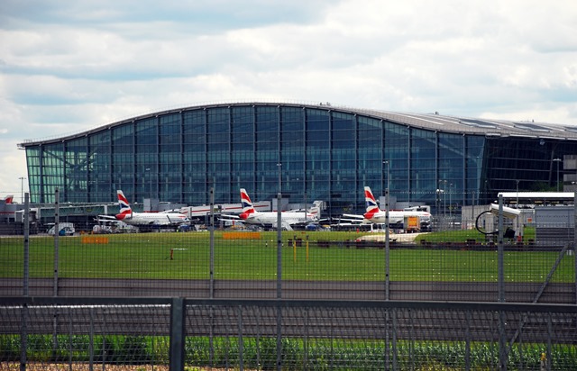
A walk in the shadow of a busy international airport

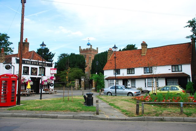
Going for a walk close to London Heathrow may seem strange. Yet the area is full of surprises, including tranquil natural scenery and historic villages. 

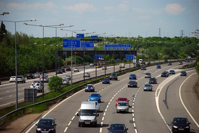
Find out why Heathrow was originally built here and the struggle ever since to manage its growth. Hear arguments for and against airport expansion. 

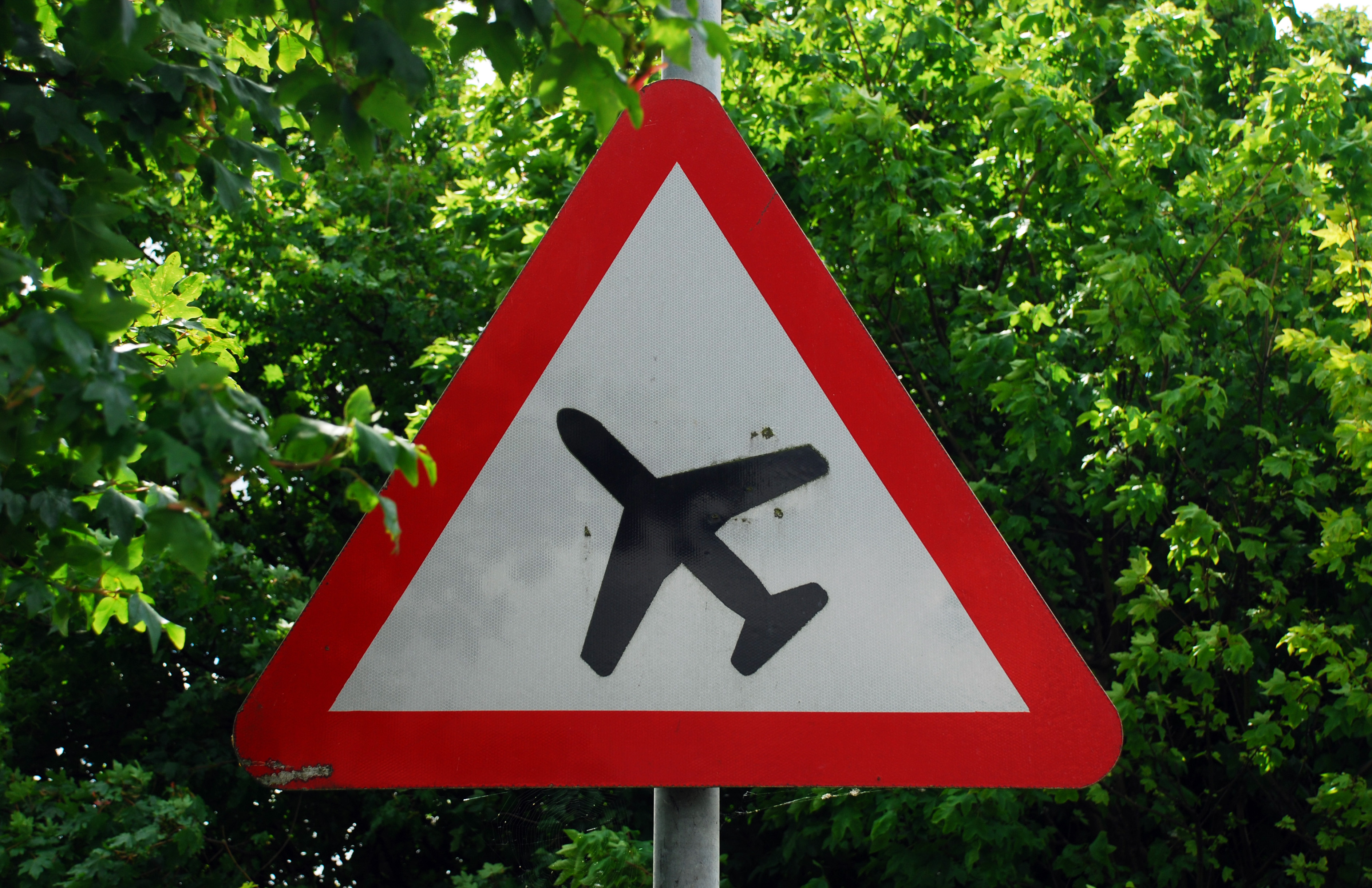
Stand on the line of a proposed new runway. Hear the noise of aircraft and learn how they affect the air you breathe.

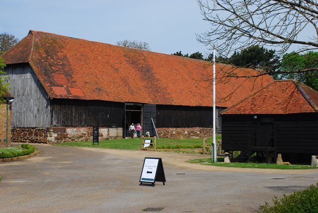
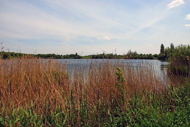
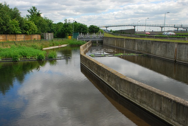
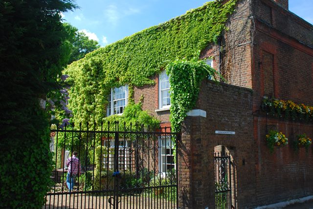
On the other hand enjoy the wildlife on a restored moor, discover how planning regulations have helped to protect buildings and preserve a riverside haven for birds and wildflowers. 

This is a place where people and planes coexist, and where planners and politicians battle over their future.

Follow the walk by clicking on the map pins
or downloading the guides below

Location: Harmondsworth, London Borough of Hillingdon
Start and finish point: Harmondsworth Village Green, West Drayton, Middlesex UB7 0AQ
Keep an eye out for: The remains of the old Waterloo Bridge

Heathrow walk credits

Thanks to - 

The Discovering Britain team for creating the walk

Jenny Lunn and Caroline Millar for editing the walk materials

Alpsdake, Ochi, Clem Rutter, N T Stobbs, Sven Tesche and Robin Webster for photos reproduced under Creative Commons Licences

Heathrow Airport was built on the site of a small countryside hamlet - the name comes from 'Hetherow' or 'Hitherowe', Old English for 'row of houses on a heath'