It might not look it but you are currently on one of the main entry points to the Olympic Park! Almost 70% of the people who came to watch the 2012 Olympic Games entered through this bustling shopping centre, perhaps encouraged to spend at the same time. Westfield Stratford City is a central part of the plans to regenerate this part of East London and to attract new residents and businesses. The vision was that a whole new ‘village’ would be created within this part of London. It was even given the same postcode – E20 – as the area in the BBC TV programme ‘EastEnders’!
The signposts and walkways from the Tube divert you from the older Stratford Centre, formerly the main shopping area and focal point for the people of Stratford, now looking a little tired and neglected.
For some the new Westfield is a welcome development, providing jobs and entertainment and making the place feel alive. Others feel excluded, as the words of local hip hop artist Plan B reveal:
You could get lost in this concrete jungle New builds keep springing up outta nowhere Take the wrong turn down a one-way junction Find yourself in the hood nobody goes there
(Plan B’s single, Ill Manors)
Many argue that the expensive shops are only for tourists, that local businesses are struggling to compete and that most local employment is still low-skilled. The new lighting, public art works and clean pavements of the new centre contrast with the older buildings, boarded-up windows and graffiti that feature in the older streets.
Think what it might have felt like to grow up here, as Plan B did, and to watch the place change so quickly. How do the places already there fit into the vision of a new village?
Directions
From M&S and with the footbridge on your right, follow the shopping street with glass walls. When you reach the Hugo Boss on the right, bear left onto Stratford Walk.
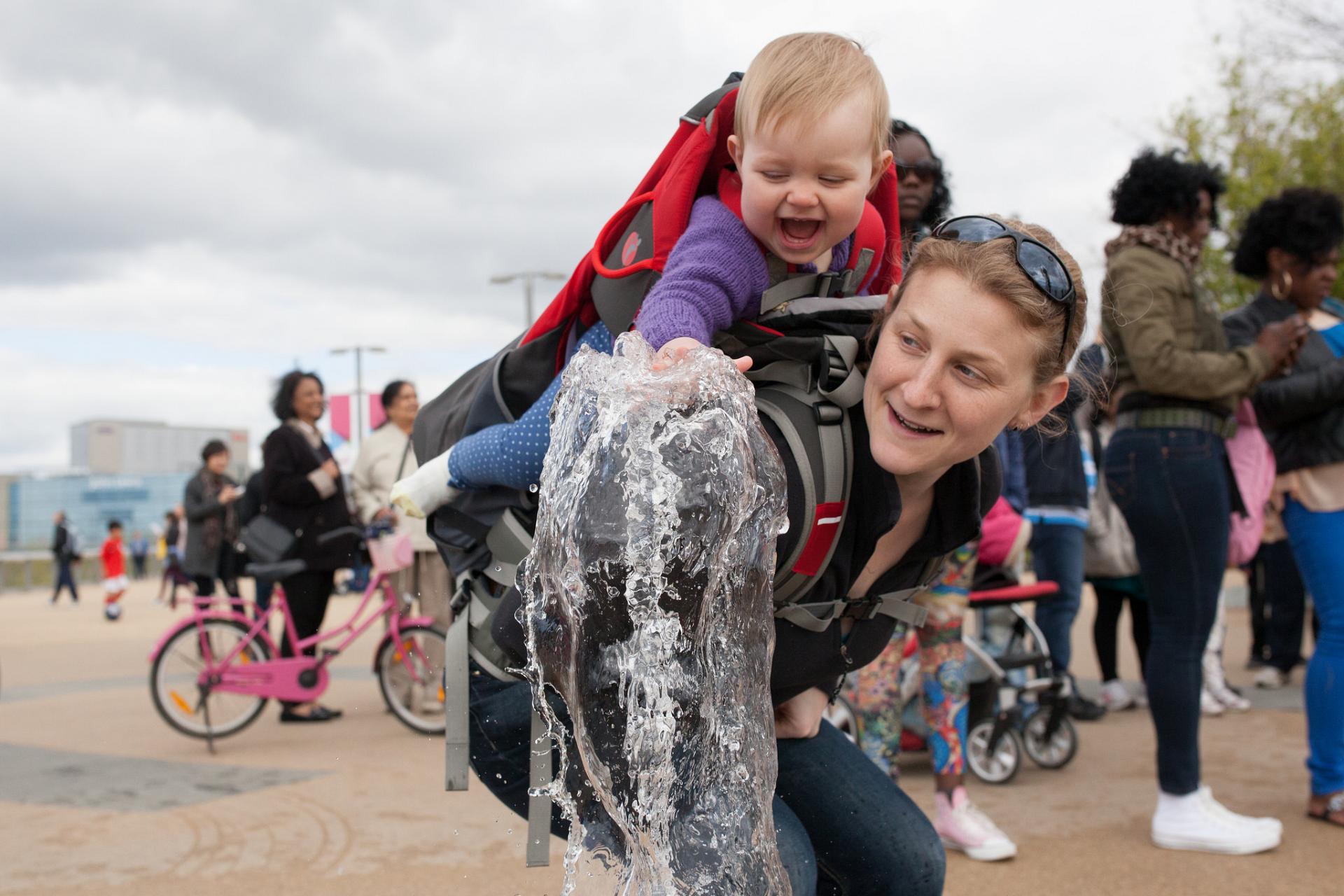
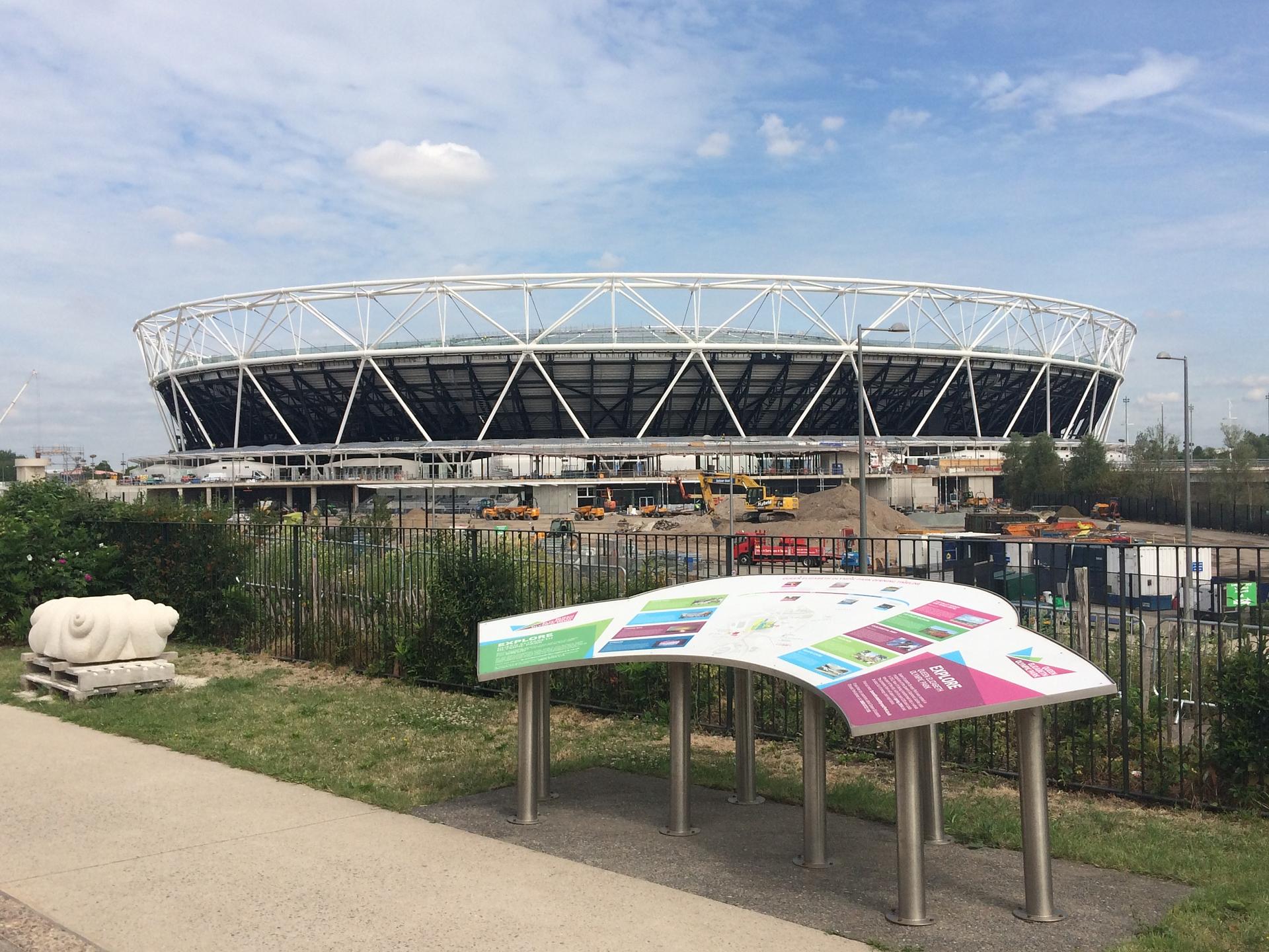
Continue to the end of Stratford Walk and Cross Westfield Avenue at the traffic lights. Join the large walkway directly ahead of you to enter the Olympic Park. You pass an Information Centre on the right and the Aquatics Centre on the left. Cross over the bridge by the Aquatics Centre and walk towards the main stadium (now West Ham Utd's) down to the open plaza with water fountains.
If it is a nice day, the fountains in front of you will be full of children playing. Look around you at the grand stadia and beautiful landscaping (and recall the station and shopping centre you have just travelled through). Despite peoples’ fears, the Olympic Park has not become a ghost town since 2012. It seems to be providing valuable sporting and recreation space in East London. Between July 2013 and Spring 2015 there were more than 4 million visits to the Park.
This part of London had long been a hive of activity, and from the Middle Ages the River Lea was providing power for mills and a key transport route to the docks. By the 19th and early 20th centuries it had become a thriving industrial area, with factories producing silk, porcelain, plastics, chemicals, dyes and matches.
However, by the 1960s and 1970s the London docks were unable to compete with new container ports in other parts of the country, and factories were moving to places with cheaper rents and workforces. This process, known as deindustrialisation, led to the closure of much of the local industry and increased unemployment. The local borough councils struggled to maintain services such as schools, transport and parks, and the area became viewed as a place in decline.
The Government supported the idea of London hosting the Olympics because it saw this as an opportunity for regeneration. Indeed the Olympics have bought an estimated £9 billion of investment to East London, much of which has gone into improving transport and the local environment.
Directions
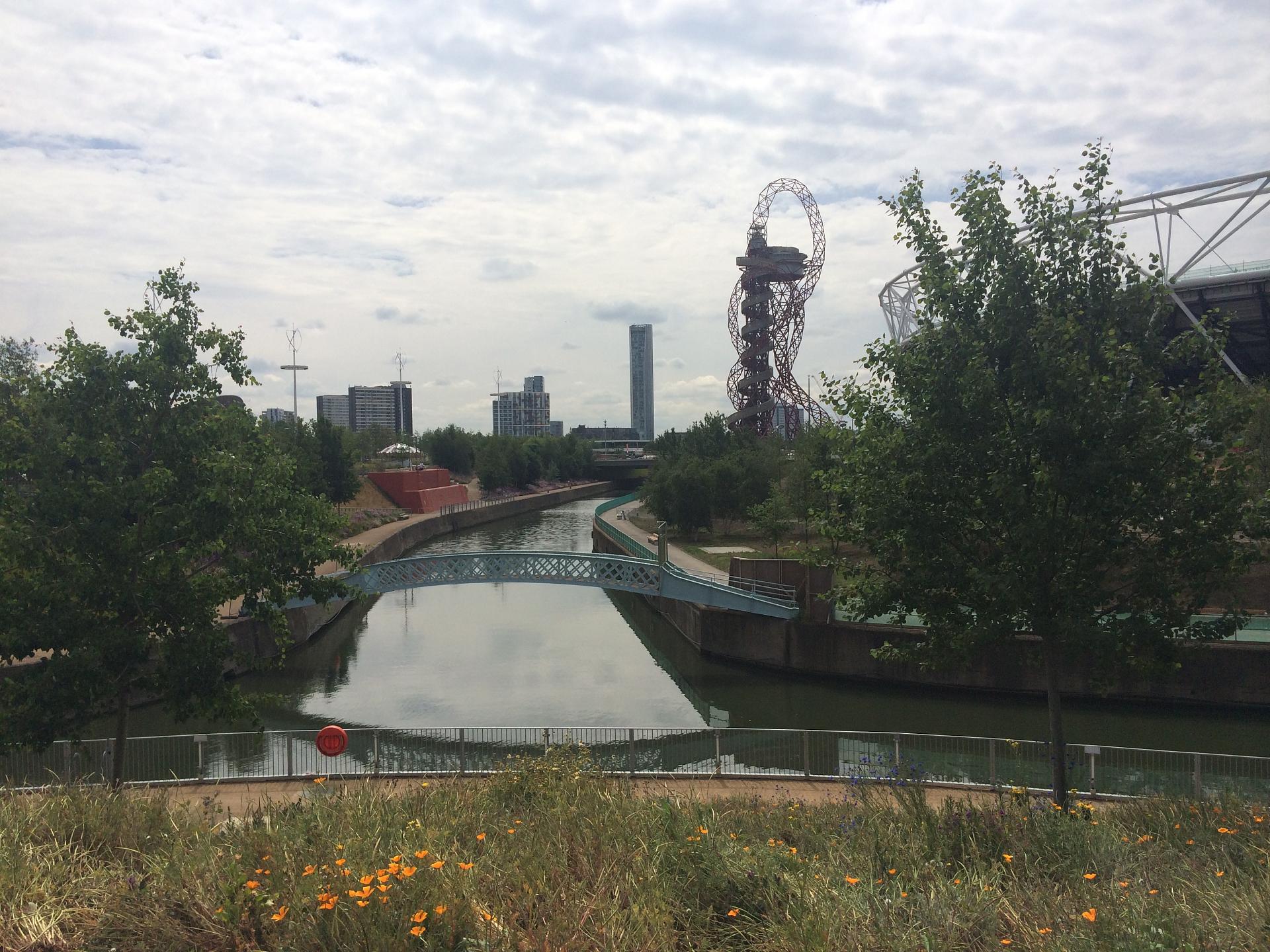
From the fountains head left towards the Arcelor Mittal Tower (the giant red metal tower) and walk towards it as if you were going to pass it on your left-hand side. Just before you reach it take the path on the right that zigzags down to the City Mill River.
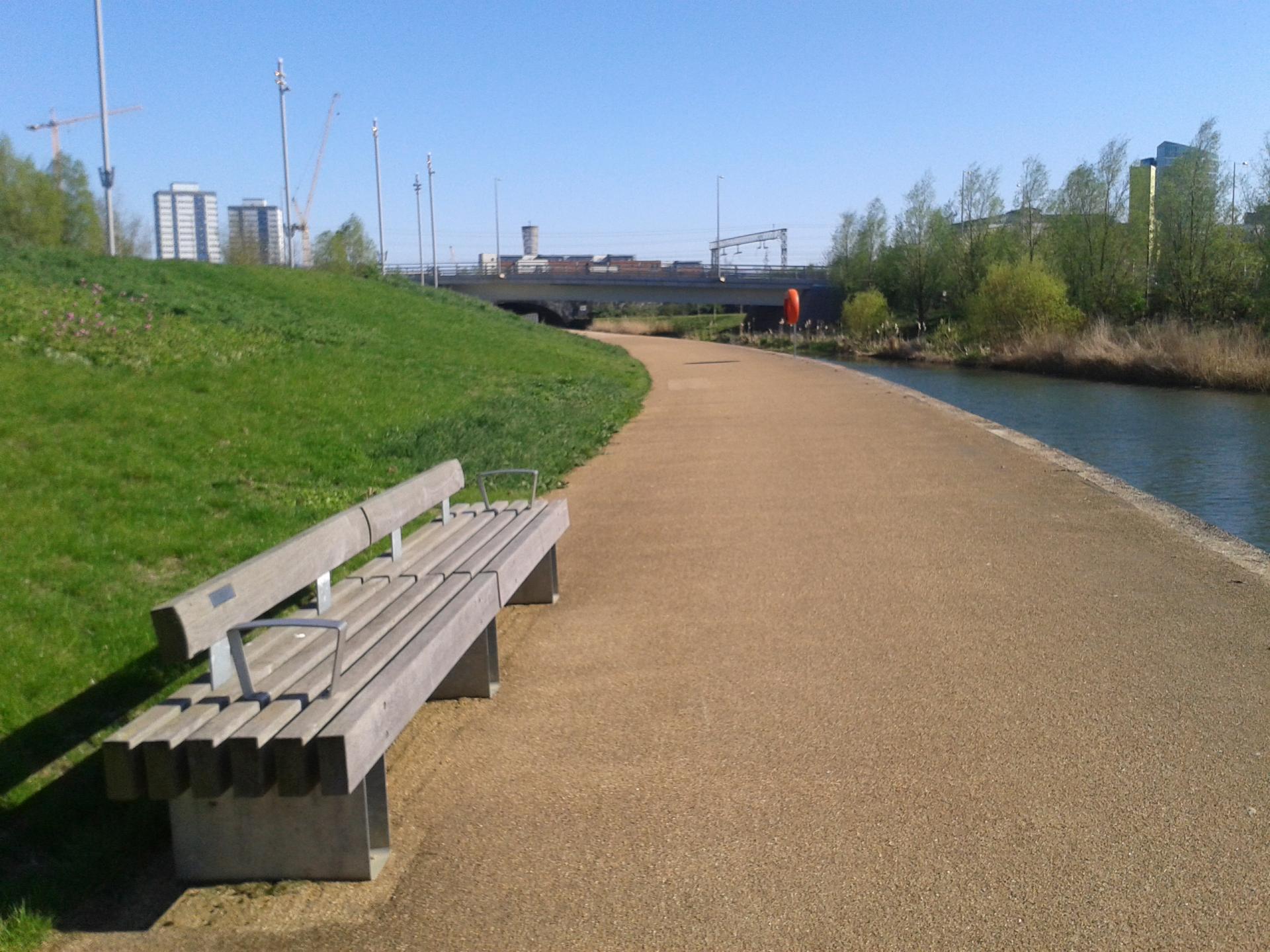
When you reach the water’s edge, turn left, and follow the riverside path under the bridge. Along the bank there are a number of benches. Walk under the bridge and stop at the bench immediately after it. Look at the plaque on it.
3 Bench by City Mill River, Olympic Park
The plaques on the benches may look like memorial plates but they are, in fact, part of an art project called Fantastic Factology. Art is often used in regeneration projects to brighten places up, to attract visitors and to recognise local community interests. The plaque on the second bench reads:
Dry Cleaning was first introduced to the UK in 1876 by Achille Serre who opened his factory on the Olympic Park site in 1896.
The Fantastic Factology project collected facts and memories, like the one above, revealing that the site was a place of innovation and industry in the past. Although the Achille Serre factory closed in the 1960s, many people lived, worked and played here, even until 2005 when London was awarded the Games. The land was not empty. Over 200 businesses had to be moved to make way for the Olympic park, and many of them did not want to go.
The Fantastic Factology art project reminds us there may be different views about redevelopment. The Manor Garden Allotments, for example, were created in 1924 to provide community gardens. In 2006 it was estimated they provided food and enjoyment for over 150 families. In 2007 they were cleared to make way for the Park, and although some smaller, temporary gardens were set up 2km away, a permanent solution has yet to be found and many local people feel angry and disappointed. Not everyone thought that the area was a wasteland crying out for development.
See if you can spot some more of the 50+ plaques on benches across the park – and consider what role they play. Sometimes art can be used to paint a positive picture; sometimes art can help to reveal differences of opinion.
Continue along the path by the river and at the next bridge take the steps or ramp up the bank on your left-hand side and walk onto the middle of the bridge that crosses the river. Take care as this is a road and there can be traffic.
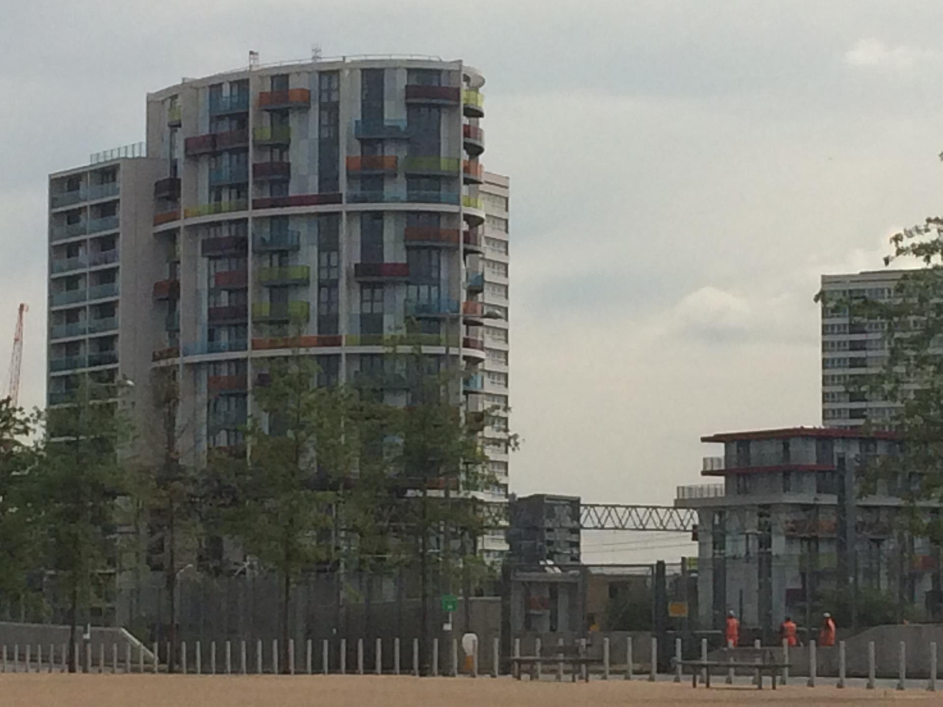
To the South East you will see high-rise new-builds, designed to tie in with the Olympics (e.g. the colourful Icona Point and the tall, silver Stratford Halo Tower). To the South there are 1960s tower blocks (e.g. Aubrey Moore Point - see photo below) and low-rise red brick flats. Finally, to the South West you will be able to see the office and residential apartments of Canary Wharf (you will see these more clearly from the View Tube at the next stop).
Where would you prefer to live? Where do you think you could afford to live?
Since the Olympic boroughs have high numbers of people requiring social housing and salaries tend to be lower than the London average, the Olympic Development Authority was required to provide 9,000 new homes on the site. One third of these were meant to be available for social housing or for rent at ‘affordable’ levels. Outside the Park, developers buying up land were also asked to ensure they provided some housing at affordable rents.
However, as redevelopment got under way after the Games finished, the number of affordable homes being built inside and outside the Park decreased. Some of the ‘affordable housing’ is now out of reach of the people currently living in the area. A local resident expressed the view that:
“This is about regenerating east London, but not for the people who live there now.” (local resident, 2008)
When the Olympic site was being prepared, over 400 properties were subject to compulsory purchase and then demolished, and two Travellers’ sites were cleared. Some felt that compensation was inadequate and many were not rehoused in the same area. Just outside the Park, the Carpenters Estate has made the national news several times because of protests and occupations by people unhappy with the local housing situation.
Directions
Continue over the bridge and follow the road as it bends round to the right. Almost immediately take the footpath, across the zebra crossing, leading up a slope off to the left. This takes you up onto a wide, raised footpath called the Greenway.
You would not know it, but you are currently standing on top of a large sewer! The Greenway is actually built on top of the Northern Outfall Sewer, which takes sewage from Bow to the treatment works further east in Beckton. The sewer is a fascinating piece of 19th century engineering, designed by Joseph Bazalgette after an outbreak of cholera in 1853. Before this, London’s drains mostly emptied into the River Thames, causing pollution and disease. The Northern Outfall Sewer is an earlier example of a major work undertaken to improve the city, rather like the Olympic Park today.
Black and white photograph: Northern outfall sewer in course of construction, London, 1900-1907. Source: Sir George W. Humphreys, Main Drainage of London, (London: London County Council, November, 1930), p. 50. Courtesy of James Joyce, P.E., Technical Director, Odor and Corrosion Technology Consultants, Inc., Houston, Texas.
Turn and look behind you at the distinctive bright green structure you just walked past: this is called the View Tube. The View Tube is constructed from recycled shipping containers and includes a café, a gallery and an education centre. It was developed by a partnership between community groups, the Olympic Delivery Authority and other local organisations. It is a good example of how collaboration between developers, politicians and local communities can create facilities that people enjoy and feel included in.
This is a good place to stop for tea and coffee (Mon-Fri)!
Directions
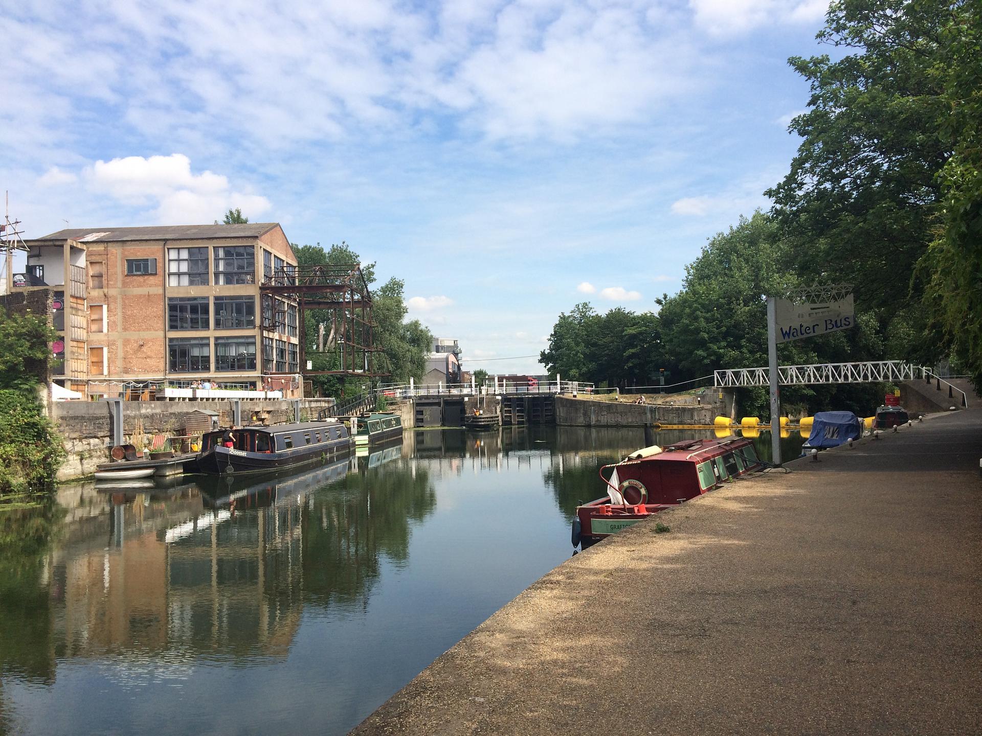
Walk along the Greenway until you are level with the main stadium, then take the footpath off to the left leading downhill to the river. When you reach the towpath turn right and walk under the bridge and towards the lock ahead of you.
We are now on the banks of the River Lea, which was responsible for the early development of the area, providing a major transport route and power for mills.
As you walk towards the lock, look at the buildings across the river on the left. This area is called Fish Island, merging into Hackney Wick to the north. It was the largest industrial area in the Borough of Tower Hamlets with factories, waste disposal and recycling facilities, and wholesale warehouses here.
The large Victorian warehouse you can see is Swan Wharf, once a sofa factory now an art studio and bistro. During the Olympics it was a pop-up private members club offering cocktails and big screens for those who wanted to avoid the crowds in the Park!
As older industries closed down, small-scale enterprises such as printers and car mechanics occupied some of the spacious buildings that were cheap to rent. For the same reasons, artists and designers were attracted here and converted warehouses into studios.
People began to move into the area, and coffee shops and bars followed. In a process known as gentrification, the new inhabitants began to renovate the buildings and this helped attract new businesses, making the place a desirable area to live and work. As prices begin to rise, older inhabitants and businesses struggle to afford the rents and may be forced to move out. Not everyone can afford a £10 cocktail or feels welcome in a conceptual art gallery.
As you walk along the riverbank look at the different buildings you pass, see if you can spot evidence of what they are now (they include bars, cafes, art galleries and a craft brewery).
Directions
Walk up to the lock and continue along the riverside on the same bank. After 300 metres you will reach a pedestrian bridge, which crosses over the canal.
Take the path to the right-hand side of the bridge, which leads up the riverbank and back into the Olympic Park.** (You will walk past a tree with a large metal ring suspended in it – another of the art projects commissioned for the Park). Walk into the large open area ahead of you, which is called Mandeville Place.
** Summer 2018 - there is construction work taking place here. When you reach the pedestrian bridge remain on the riverbank and continue until you reach the next bridge where White Post Lane crosses over the river (next to Crate Brewery). Exit the riverbank, walk up onto the bridge and turn right. Walk down the road (now Carpenters Road) until you reach another bridge. Take the steps or ramp to the righthand side of this bridge into the Olympic Park and the large open area called Mandeville Place.
This part of the East End is often described as having been derelict and in decline, and when spoken of in these terms, hosting the Games, building the shopping centre and redeveloping the land seem obvious choices. However, as we have seen, whilst the Park created spaces for recreation and enjoyment for many, for some people it actually destroyed homes, leisure facilities and work-spaces
Regeneration is then a complicated affair; it can be good for some who move into the area with new homes and livelihoods, but bad for others who are being pushed out because they can’t afford to live here. We may be gaining new facilities and attractive environments but what are we giving up in return? The character of a place? Links to our history? Sometimes links can be kept alive, as we saw with the Fantastic Factology project and the Viewtube; sometimes they are lost, as with Manor Gardens.
Whenever regeneration takes place, it is important to reflect both on what we gain and what we lose in the process.
Directions
From Mandeville Place, keeping the main stadium on your right and Westfield on your left, walk across Diamond Bridge. On the bridge walkway keep to the left until you join 2012 Walk – the walkway has large silver orbs suspended above it.
Follow this walkway back towards the Arcelor Mittal Tower, keeping the children’s play area on your right. At the end of the walkway you will reach the water fountains and you can turn left here to cross over the bridge by the Aquatics Centre and retrace your steps back up to Westfield Shopping Centre and the underground.
Your browser is out of date, and unsupported by this website. Please upgrade to the latest version to use this website.
This trail explores how shopping, sports and arts are being used to regenerate London’s East End. Along the way we will investigate what is changing and reflect on what it means for those involved.
Regeneration is about improving an area that has been experiencing a period of decline. Politicians, planners and developers aim to do this by redeveloping buildings and infrastructure and encouraging people to live in the area and spend time and money there.
Follow the trail by clicking on the map pins or downloading the guides below