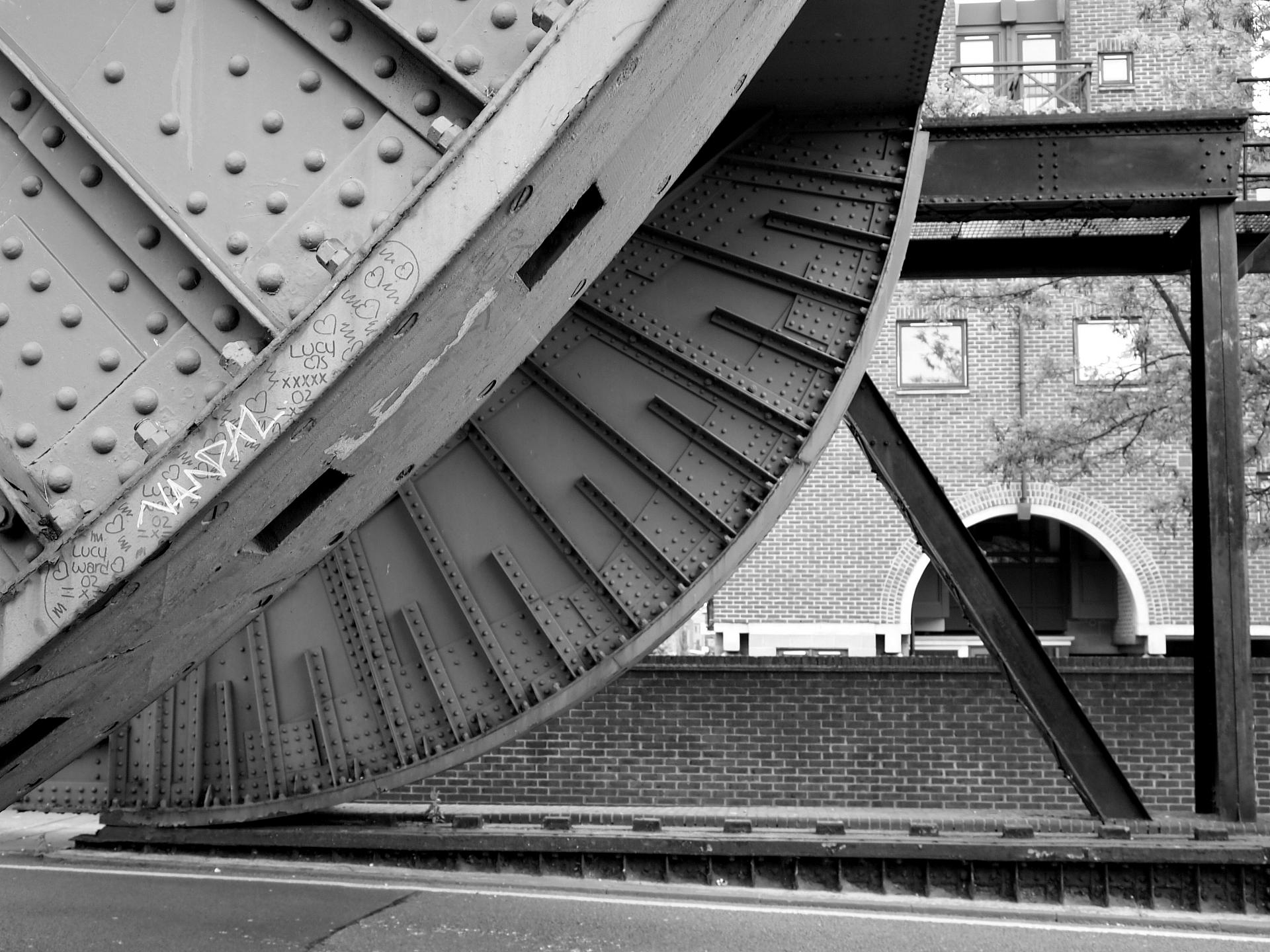
From Tower Hill - avoid the underpass and turn left outside the station to reach Minories, and cross to Shorter Street. From Tower Gateway - take the escalators to street level, turn left on to Minories then left again along Shorter Street. From Shorter Street - Cross Mansell Street and walk along Royal Mint Street. Continue along the street for a few minutes, passing the Artful Dodger pub, then crossing John Fisher Street and Dock Street. After Dock Street, take the next right (Ensign Street), and shortly afterwards turn left along a footpath, Grace’s Alley. Wilton’s Music Hall is halfway down on the left.
You have now entered the vanished neighbourhood of Wellclose.
This tiny neighbourhood was built on land belonging to Eastminster - the lost abbey of St. Mary Graces, just east of the Tower of London.
Grace’s Alley is the last remaining fragment of Wellclose Square, a seventeenth century square which was mostly demolished after the Second World War. While the other three corners of the square were torn down in the 1960s, plans to build a tower block on this corner were abandoned giving us a small glimpse at what was lost.
In the East End he built two squares, Wellclose (here) and Swedenborg (which we’ll visit next), with quality houses for merchants and sea captains who needed to be close to the new wharves at Ratcliff.
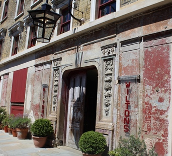
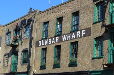
Wilton’s Music Hall, the oldest remaining music hall in the country, dates from 1858. It was relatively short-lived, and closed by 1880. After closure it was used as a Methodist Mission Hall, and then as a rag warehouse until after the Second World War. Then it lay empty for years. The notorious, banned video for Frankie Goes to Hollywood’s ‘Relax’ was shot here in 1983, and it gradually became a top filming location for almost any Victorian drama. The building has finally been restored after years of structural problems and is well worth a visit to catch a show or just a drink.
Directions
Continue along Grace’s Alley and walk straight ahead along Wellclose Square towards the tower blocks. Turn right with the street, and then left into Swedenborg Gardens.
2 Swedenborg Gardens
This leafy park is Swedenborg Gardens. It marks the site of Swedenborg Square which like Wellclose is a lost London square that was completely demolished.
For two hundred years the neighbourhood of Wellclose was the centre of Danish and Swedish London The timber trade brought Scandinavian ships and merchants to the East London docks and this is where many of them settled. A Danish church was built in the centre of Wellclose Square in 1694. A smaller Swedish chapel was built in nearby Swedenborg Square in 1729. Both churches had closed by 1911 as their congregations moved away, but the font from the Swedish chapel remains in the middle of this park as one of the last reminders we have of the area’s Scandinavian past.
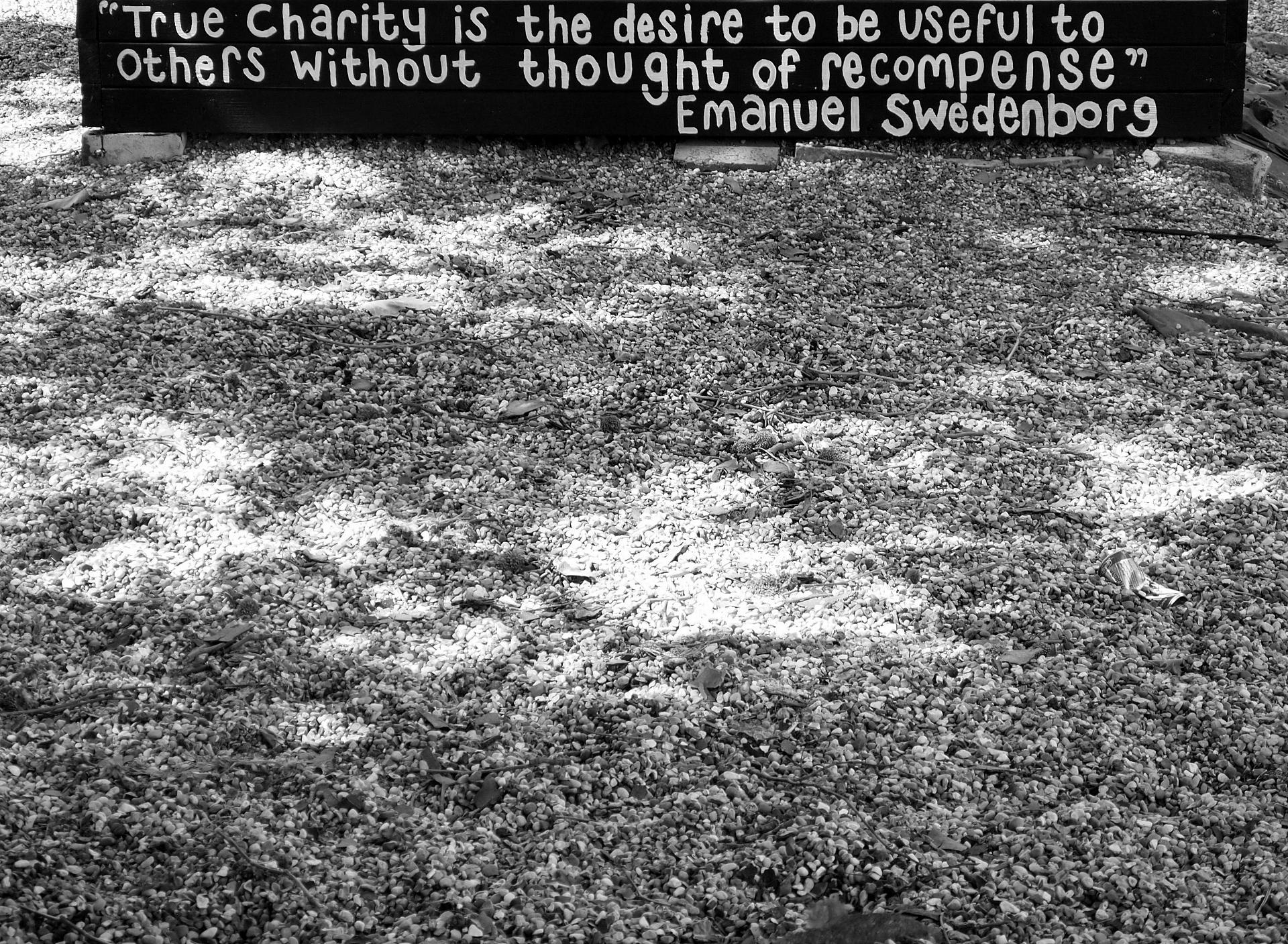
Swedenborg Square was named in tribute to Emmanuel Swedenborg. Swedenborg was a remarkable man whose genius led him to a series of scientific achievements that were years ahead of their time, including the invention of a submarine and a flying machine. However, he is remembered instead as a mystic Christian visionary.
In 1745 he was having dinner in a private room at a London inn, when a strange man suddenly appeared in the corner and revealed himself to be God. He showed Swedenborg how the Bible should be interpreted. Swedenborg spent the rest of his life writing theological works and travelling between Stockholm, Holland and Wellclose Square. He claimed that the Last Judgement was over, having already taken place in 1759 in the World of Spirits, located halfway between heaven and hell. He became both revered and feared, and stories circulated of his psychic powers.
Swedenborg died aged 84 in 1772 having correctly predicted the day of his death. He was buried in the Swedish Chapel. When it closed the Swedish Navy sent a warship to repatriate his remains. However, his skull vanished en route, substituted for a fake which then also disappeared. The saga lasted until the 1970s, when the real skull mysteriously resurfaced in an antique shop in Swansea.
Despite, being relatively undamaged by bombing, both Wellclose and Swedenborg squares were almost entirely demolished during the 1970s. They were replaced by the St. George’s Estate, which eliminated the basic shapes of the two squares. Three brutalist tower blocks occupy what was the north side of Swedenborg Square and the highest, Shearsmith House, is among the tallest buildings in Britain.
Directions
Walk straight across the park, and at the exit on the opposite side turn left along an unmarked street of sandy-coloured brick houses called Swedenborg Gardens. Turn right at a T-junction by a painted wall, left at the next T-junction onto Crowder Street, and then right along Cable Street. The Crown and Dolphin is on the next corner.
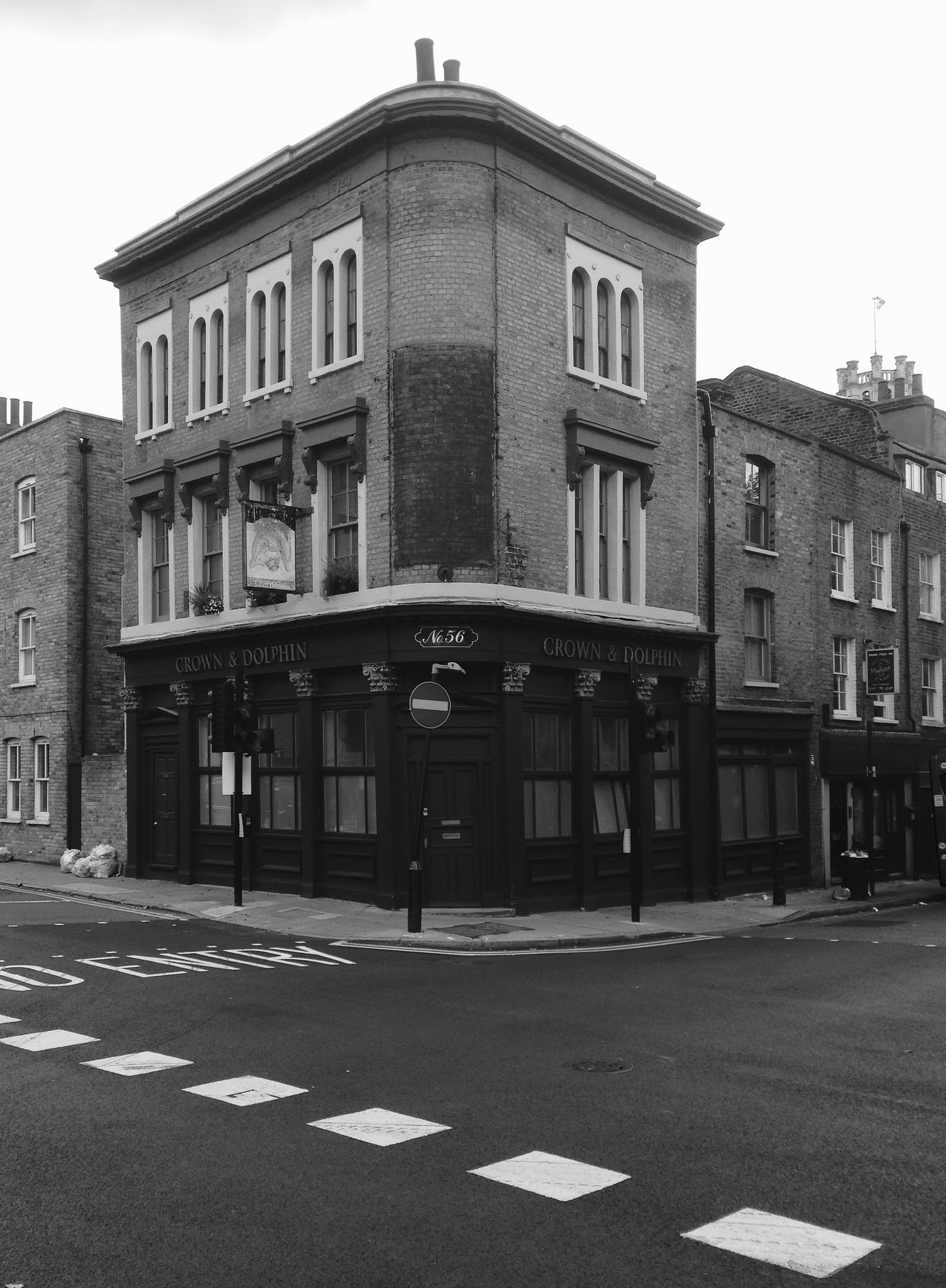
3 Crown and Dolphin pub
From the middle of the nineteenth century until the First World War, the East End developed a special notoriety as sailors from all parts of the world enjoyed their shore leave here in the neighbourhood of Wellclose. Its reputation as a place as strange and dangerous as the furthest corners of the British Empire fascinated and repelled the Victorians.
Both London and the Docks were expanding very fast. Conditions deteriorated as people flooded into the East End. Overcrowding, unemployment, malnourishment, disease and alcoholism were common.
The real East End was coloured and embellished by journalists, who wrote delightedly about how terrible it was. Reporters would visit as though on an expedition, and this area was at the centre of their stories.
Foreigners took the blame for much of the mayhem. The East London Observer reported in 1857: “Either a gin-mad Malay runs a much [sic] with glittering kreese [a Malay dagger], and the innocent and respectable wayfarer is in as much danger as the brawler and the drunkard; or the Lascar, or the Chinese, or the Italian flash their sea knives in the air, or the American ‘bowies’ a man, or gouges him, or jumps on him, or indulges in some other of those innocent amusements in which his countrymen delight.”
The Crown and Dolphin pub lay the heart of the dark East End. Here at the crossroads of Cable Street and Cannon Street Road was the strange burial place of John Williams, the supposed Ratcliff Highway murderer. Williams was arrested after a series of senseless attacks in the neighbourhood which gained huge publicity, and prefigured the Jack the Ripper frenzy.
He was buried outside the Crown and Dolphin pub in 1811. His skeleton was rediscovered in 1886 by workmen digging a gas main, and his skull is said to have ended up behind the bar. If true, it has since disappeared, just as Swedenborg’s skull did. The pub closed in 2002 and has been converted to flats.
Directions
Turn right along Cannon Street Road. Turn left at the church gates, to reach St. George-in-the-East Church.
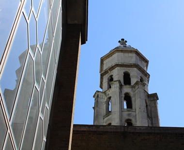
4 St. George-in-the-East Church
Architect Nicholas Hawksmoor is closely associated with the East End, and has gathered a posthumous occult reputation through the writings of Iain Sinclair and Peter Ackroyd. St. George-in-the-East is one of his churches, built in a particularly unsettling English Baroque that seems suited to the 19th century East End of sensation and horror. It was finished in 1729 but, although the exterior is still intact, it is a shell. The church was gutted in the Blitz, and a new church and flats built inside in the 1960s.
No East End walk would be complete without a Jack the Ripper link, and St. George-in the-East provides it. In 1888 Sven Olsson was the clerk at the Swedish Chapel. He was a friend of Swedish-born Liz Stride who, despite help from Olsson, had been a prostitute for many years on the streets of the East End. Her body was discovered early on the morning of 30th September 1888, throat cut, in a yard just north of Wellclose. She was taken to the mortuary here at St. George-in-the-East, where Olsson identified her.
Her murder was the first of two on same night, and the next day the police received the infamous ‘Saucy Jacky’ postcard which claimed responsibility for the “double event” and was signed “Jack the Ripper”.
Directions
From St. George-in-the-East, turn right (standing on the front steps, facing away from the church) and walk around the side of the church and across the churchyard, St. George's Gardens. Bear left to head towards the brightly coloured mural at the north-east corner.
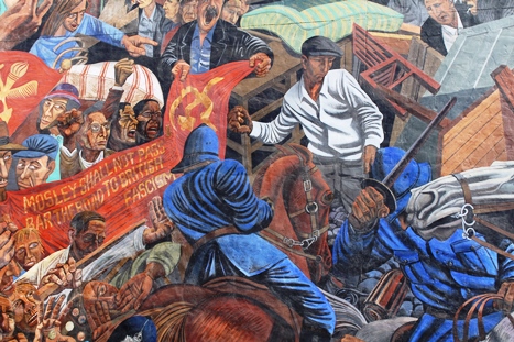
5 Cable Street Mural
First look along Cable Street. Today it’s the main east-west road through the area, a non-descript highway but in 1936 it was the site of a hugely important struggle. On 4th October 1936, 100,000 anti-fascist marchers successfully prevented Oswald Moseley’s anti-Semitic British Union of Fascists from marching through the Jewish East End.
Looking at the narrow street of terraced houses depicted in the mural, Cable Street doesn’t look familiar to the thoroughfare we can see today. War-time destruction led to major redevelopment, resulting in new-build council estates and roads on a scale unsuited to a residential area.
However, although Cable Street was no longer commercially significant, and had suffered from bombing and demolition, its reputation lingered past the Second World War. Ian Nairn, writing in 1966, reflected a familiar 19th century image: “‘Cable Street, the whore's retreat': a shameful blot on the moral landscape of London: an outworn slum area ...all that is left of lurid Dockland. Its crime is not that it contains vice but that it is unashamed and exuberant about it.”
For better or for worse, exuberance is no longer a word associated with this particular part of London.
The commemorative mural on the side of the former Stepney Town Hall has been vandalised several times and artists who have worked on it have suffered intimidation from the far-right, suggesting the battle is not yet over.
Directions
Walk back through St. George's Gardens, but this time straight across to The Highway, with the church to your right. This busy street was once the infamous Ratcliff Highway. Turn right, walk to the junction with Cannon Street Hill and cross the Highway at the pedestrian lights. Turn right down Chigwell Hill, stopping briefly to notice the plaque dated 1678 above the characterful but closed-down Old Rose pub and stop by the brick wall at the bottom.
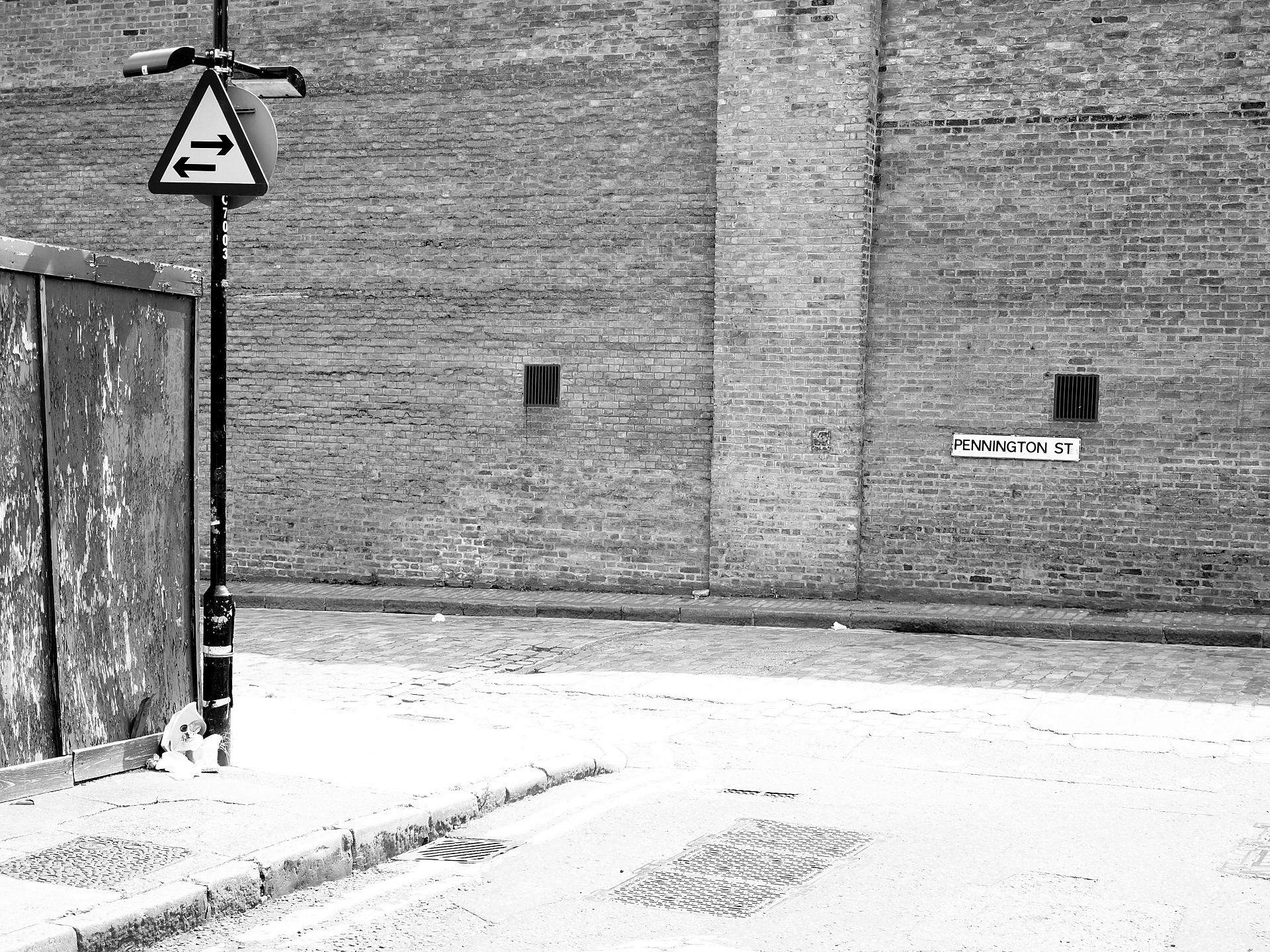
6 Pennington Street
The first question you might ask, is why is there an imposing high brick wall here and what’s behind it?
In the early nineteenth century new basins, canals and enclosed docks dug to shelter new, larger ships trading from around the globe, punched Wapping and Limehouse full of holes. The long, high walls here on Pennington Street were part of the West Dock, which was completed in 1837. The walls were designed to protect valuable goods such as spices, wine, wool and tobacco from theft.
The Wapping docks were mostly filled in during the 1980s, but the Tobacco Dock warehouse remains behind this wall. It was relaunched as a shopping centre, ‘the Covent Garden of the east’, in the 1990s but this was a resounding failure and the huge building remains mostly empty.
The wall also conceals the former Wapping Print Works, where News International was based. Pennington Street was the site of tense confrontations in 1986 as workers sacked by Rupert Murdoch spent a year picketing the plant. The plant, with a print room said to contain a million tons of steel, is being converted to housing.
Look back up the hill to the left of the Old Rose pub and you can just make out the green roof of a garage. This was the site of the first of the grisly Ratcliff Highway Murders. Late on Saturday 7th December 1811 a man named Timothy Marr, a draper at 29 Ratcliff Highway, sent his maid Margaret out for oysters. When she returned the door was locked and there was no answer. Eventually, Marr was discovered dead behind the counter; his wife Celia stretched out nearby; their apprentice, James Gowen, at the back of the shop; and their three-month old baby Timothy in his cradle. Their throats had been cut and their skulls crushed with a shipwright’s hammer.
This apparently motiveless attack caused consternation, but there was more to come as we will discover at the next stop.
Directions
Facing the dock wall, turn left on Pennington Street, and right at the next junction along Wapping Lane. Follow Wapping Lane until you reach the Tobacco Dock and waterway. Opposite turn left along a footpath beside the canal signposted to Shadwell Station. Follow the patch through trees to the large metal bridge structure.
7 Garnet Street bridge
This street was also witness to another senseless act of violence, the second Ratcliff Highway murders just twelve days after the first. Passers-by witnessed a terrified man using knotted sheets to climb from an upstairs window at the King’s Arms pub, once on this street. He was a lodger, fleeing from the slaughter taking place inside. The pub’s landlord, John Williamson, his wife Elizabeth and their maid Anna Harrington had all been murdered, in the same gruesome manner as the Marrs. Meanwhile their granddaughter, Kitty, had slept through it all on the top floor.
The fury and panic over these inexplicable killings found a focus two weeks later when the rudimentary police force of the time arrested a sailor called John Williams at the Pear Tree pub on nearby Cinnamon Street. Four days later he hanged himself in his cell, leaving unresolved doubts over whether he was the real murderer. Cheated of an execution, the authorities instead chose to parade his body on a cart through Ratcliff to the Crown and Dolphin junction where, for reasons that remain unclear, they drove a stake through his heart before burying his body at the crossroads, the traditional grave of a suicide.
Thomas de Quincey wrote an infamous satirical essay, ‘On Murder Considered as One of the Fine Arts’, in which he declares the killings “The most superb of the century by many degrees” and says of John Williams “All other murders look pale by the deep crimson of his.”
Directions
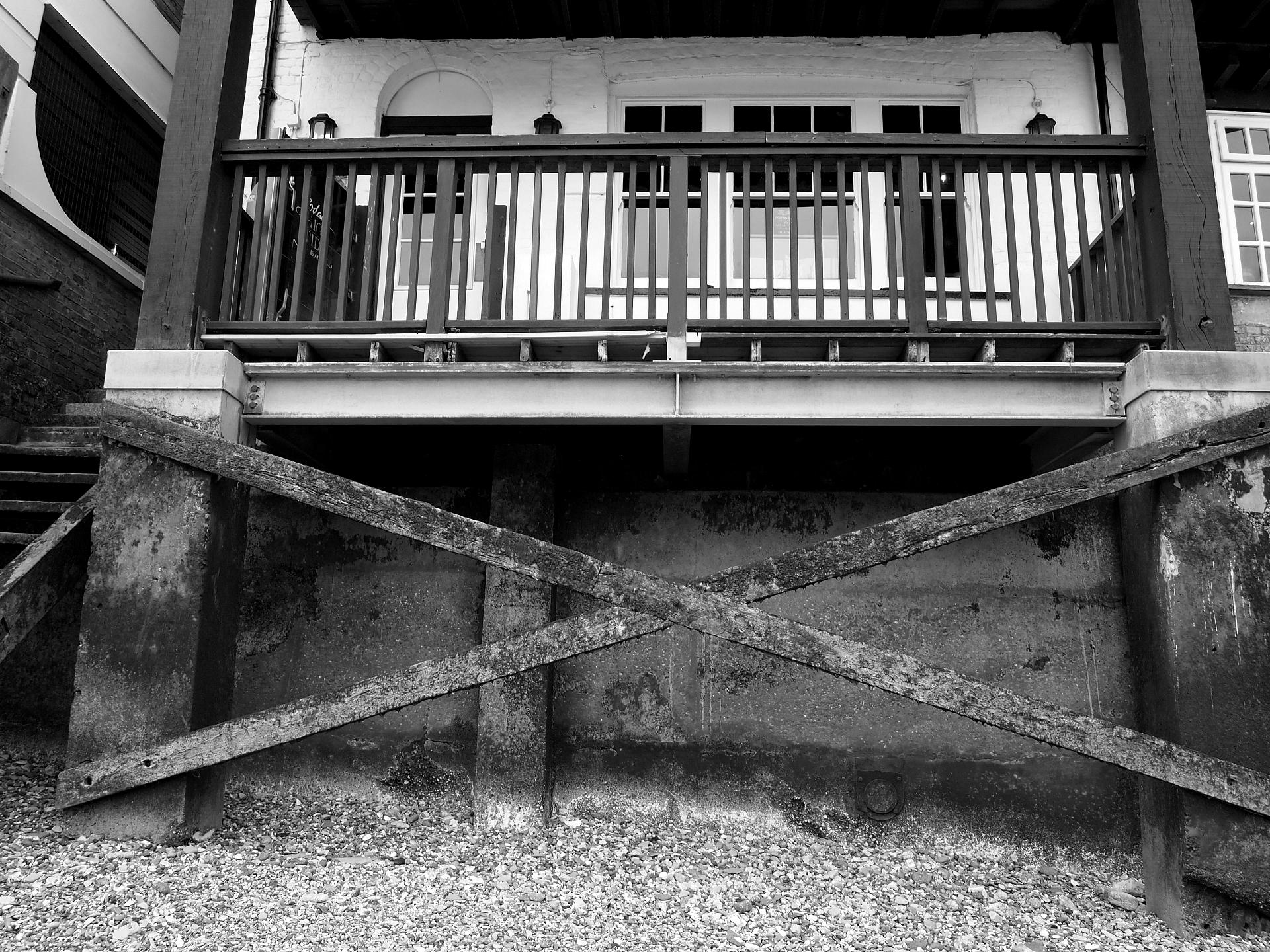
Cross the street (Garnet Lane) to continue along a path to Wapping Basin. Follow the path to the right alongside the basin, until you reach Wapping Wall and another bascule bridge. Turn right to reach The Prospect of Whitby pub, where the road bends.
8 The Prospect of Whitby
The Prospect of Whitby on Wapping Wall is a famous relic of the nineteenth century riverside. There has been a pub here since the early sixteenth century, but the Prospect became famous when Charles Dickens disguised it (thinly) as The Six Jolly Fellowship Porters and set much of Our Mutual Friend at its bar.
The pub is of a 'dropsical appearance' with 'not a straight floor and hardly a straight line'. It served reviving Victorian drinks such as 'burnt sherry', 'mellow flip' and hot brandy and water.
The pub is a favourite stop-off for tourist coaches, but still a highly atmospheric place. However its history is more than just a picturesque story. In Our Mutual Friend the river is described as a 'harbour of everlasting mud' that oozes into the streets.
Dickens' Limehouse is a 'place of poverty and desperation, where accumulated scum of humanity seemed to be washed from higher grounds, like so much moral sewage, and to be pausing until its own weight forced it over the bank and sunk it into the river'. It was depicted as isolated and semi-derelict, with boatmen inhabiting disused mills beside the river and making a living fishing dead bodies from the Thames.
Directions
Retrace your steps along Wapping Wall, crossing the bridge. By a fenced hard football pitch turn right along a footpath signposted 'Thames Path'. Follow the path into King Edward VII Memorial Park, and walk to the left of the round brick building to find the memorial plaque.
9 Memorial to Sir Hugh Willoughby
The walk has now reached Ratcliff, a semi-forgotten neighbourhood that was one of the original ‘Tower Hamlets’ – villages beyond the walls of the Tower of London. It was London’s first port, and was once the centre of Tudor England’s growing dominance of the seas. From here, early explorers departed on ambitious and dangerous voyages, not always making it back.
This plaque is a reminder of this seafaring era and the prominent role, London and in particular the East End played in this part of our history. In 1553 Sir Hugh Willoughby sailed the Bona Aventura and two other ships, to the seas north of Russia, looking for a north-east passage to Cathay. Sir Hugh died, along with the crew of two of his ships, off the coast of North Norway, but the third captain, Richard Chancellor, reached Archangel and opened a new trade route to Moscow.
Another explorer, Sir Martin Frobisher, sailed from Ratcliff on three expeditions in the 1570s, reaching Greenland and Canada and ‘discovering’ the mythical Atlantic island of Buss.
When subsequent explorers failed to confirm the existence of Buss, it was reported as having sunk.
In Greenland Frobisher discovered a type of black rock that he believed contained gold which, after a major expedition to bring tons of it back to England, turned out to be worthless. It was instead used for building, and a black stone wall in Dartford survives today, made from Frobisher’s fool’s gold.
Directions
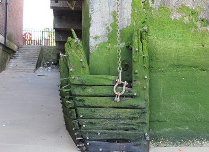
With the river on your right, continue across King Edward VII Memorial Park, and along the Thames Path. Walk beside the river for around a quarter of a mile, until the path turns sharp left away from the river and then right to reach Narrow Street. On your immediate right, find a gate which looks closed but can in fact be pushed open.
10 Ratcliff Cross Stairs
Throughout the trail we’ve been a stone’s throw from the Thames, but this is our first opportunity to get close to it.
If the tide allows, walk down on to the ‘beach’ for views towards Canary Wharf (left) and across the river to Rotherhithe.
In its heyday, the neighbourhood of Ratcliff was known as ‘Sailor Town’ and its heart was here at Ratcliff Cross, then an important landing place on the Thames. The Cross itself was removed some time after 1732, but the stone slipway at Ratcliff Cross Stairs where we’re stood now still marks the location of the old quay.
Early 20th century accounts describe children who “would stand on Ratcliff Cross Stairs and gaze out upon the rushing tide and upon the ships that passed up and down. At low tide they ran out upon the mud, with bare feet, and picked up apronfuls of coal to bring home”.
Ratcliff Cross was notable as a place where boats could be hired to cross to the south side of the Thames. Samuel Pepys, like other Londoners of his time, travelled so frequently by water that his diaries specify when journeys that were made ‘by land’. He would walk to Ratcliff from his house near the Tower of London, and take a boat to the naval dockyards at Deptford where he often had business.
The East End still has no Thames bridge of its own, and this gives Ratcliff and this stretch of riverside a continued air of separation.
Directions
Follow Narrow Street all the way to the junction with Three Colt Street, next to green space on the left.
11 Three Colt Street
We are standing in the built up neighbourhood of Limehouse which, by the start of the 18th century, consisted of just a few houses grouped around Three Colt Street and a series of wharves along the Thames shore. It was still in many ways a country village.
The Parish Commission featured some very rural-sounding names, including Mr Crotchrode Whiffing and Mr Sweet Wood. However, the parish burial registers from the 1730s and 1740s include two Venetians, two West Indians, a Dane and a Lascar (an Indian), showing that Limehouse was no ordinary parish, already linked far and wide by sea.
Limehouse, like most of the Docks neighbourhoods, combined the respectable with the squalid. Gill Street, Jamaica Place and Rich Street, all nearby, were streets of serious ill-repute.
According to late 19th century social surveyor, Charles Booth: “a nest of brothels frequented by common seamen of every nationality. Twenty of the 24 houses in Jamaica Place were brothels. The same was the case in Rich Street. The business is profitable. There’s a lot of money to be made by robbing the sailors.”
Today this feels like an affluent neighbourhood. The wharves are fashionable apartments, many freshly painted in nautical colours where hanging baskets spill colourful flowers onto the street. A Gordon Ramsay restaurant on the river and cosy gastropub are indicators how much it has changed in the last hundred or so years.
Directions
Continue straight ahead along Limehouse Causeway to the railway bridge at Westferry Station. Take the right fork under the arches, turn left along Westferry Road. Turn right at the T-junction to cross both lanes of Westferry Road at the lights, then left to cross both lanes of West India Dock Road. Turn right to the junction with Pennyfields.
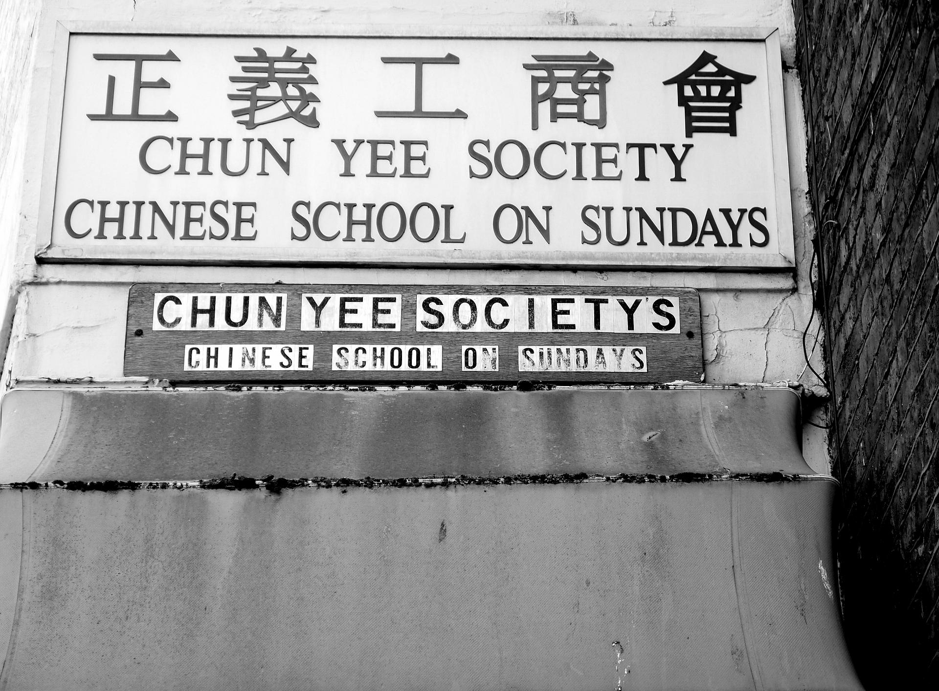
12 Pennyfields
The most English sounding ‘Pennyfields’ was once the heart of London’s first Chinatown, a place of fear, fascination and wild stories. From the late nineteenth century until the Second World War, Limehouse was synonymous with poverty, crime, drugs, violence and, above all, foreigners. Its malign influence supposedly reached into respectable London, luring and corrupting the innocent.
The two streets synonymous with Chinatown were Limehouse Causeway (which we just walked along) and Pennyfields (facing the park). Both streets were bywords for an entire world of strange, degenerate, foreign doings that existed, for the most part, in the imagination rather than in Limehouse itself.
The expansion of the docks in the mid-1800s created a place that mixed Scandinavian sailors, Irish dock workers, German tailors, shoemakers, and bakers. In 1805 ‘John Anthony’, the East India Company’s accommodation fixer for Chinese sailors in East London, was the first Chinese man to take British citizenship. His naturalisation required a special Act of Parliament.
Later, The East India Company imported spices, tea and wine from the Orient via the nearby West India Docks (which they also owned). The trade brought sailors from the East, and a century of huge change for Limehouse. As a later author commented “To thousands and thousands of foreigners, London means the West India Dock Road and nothing more”.
The 1881 census shows only 224 Chinese people living in the whole of Britain, although more were doubtless unrecorded. It was not until the 1890s that a permanent Chinese population, probably around 300 people, became established in Limehouse, based at first on Limehouse Causeway. Later, Chinatown expanded east along Pennyfields and along a few of the surrounding streets.
Directions
Walk back along West India Dock Road, and turn right along Birchfield Street by the Westferry Arms pub. A little way along the street, a pedestrian turning to the left is marked Amoy Place.
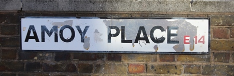
13 Amoy Place
The modern map of Limehouse features a cluster of streets with Chinese names. As well as Amoy Place there is Canton Street, Pekin Street, and Ming Street (neatly renamed from King Street in 1938, a concession to its Chinese residents). Before post-war reconstruction there was also an Oriental Street, its site now lost somewhere under the Birchfield Street council blocks.
Relations between China and the West were volatile at the start of the 20th century, with China forced to trade against its will by the west, the USA, Japan and Russia. In 1901 Britain was part of an eight-nation alliance which put down the anti-colonial Boxer Rebellion, generating anti-oriental hysteria back home. The racist concept of the ‘Yellow Peril’, the threat from the east, took root in British culture where it remained embedded until the Second World War. Anti-Chinese riots took place here in Limehouse on several occasions between 1906 and 1919, targeting Chinese sailors said to have taken jobs from locals.
In Limehouse, tensions were stoked by provocative press reports of which this from the Daily Express is a good example: “Turn down Burdett Road into the West India Dock Road. That is the way to the narrow, dirty streets where San Sing squats on the pavement of a night, smoking his long pipe and blinking up at the moon through its smoke…. Chinatown is growing. There are more Chinese in the purlieus of Rock Street and Pennyfields than ever before.”
The myths around Chinatown grew uncontrollably. Chinese novelist Lao She wrote in 1929 that “If there were twenty living in Chinatown, their accounts would say five thousand; moreover every one of these five thousand yellow devils would certainly smoke opium, smuggle arms, murder people then stuff the corpses under beds, and rape women regardless of age…” Many of the stories featured opium, which was legal until the First World War and cheaper than beer. The image of the opium dens and criminal hideaways of Limehouse remains powerful even today, and still surfaces in depictions of the late 19th century East End. Although the Chinese population were real, the world they inhabited was a strange fiction.
The war had a major effect on Limehouse. Intense bombing of the docks on 7 September 1940 caused serious damage to Chinatown, and many people left straight away. The vast majority of buildings on the streets of Chinatown received some level of bomb damage, as indeed did the whole of Limehouse.
Almost every building was marked for clearance, a very different approach to that taken in damaged but prosperous areas of London. Much of this clearance was indeed carried out, leaving little physical trace of the pre-War neighbourhood. Chinatown relocated to Soho, and the old Limehouse lived on only in myth.
Directions
Walk back to West India Dock road and cross over to Westferry DLR station to finish the trail.
Your browser is out of date, and unsupported by this website. Please upgrade to the latest version to use this website.
The East End starts where the City of London ends, east of the Tower. A short walk from this tourist hub leads to places that are much less visited.
Some of the names are famous: Cable Street, where locals held back the fascist blackshirts; or Limehouse, where Britain’s first Chinese population gained mythical status. Some are less known, such as Wellclose Square, a Scandinavian square with an occult reputation, and Ratcliff, where ships set sale to explore the New World.
These parts of London were once notorious, reputed to be wild and lawless. Now they hold clues to their past, which can be decoded by retracing their borders beside the Thames.
")
.jpg "Swedenborg Square 1945 (City of London, London Metropolitan Archives)")


.jpg "Three Colt Street in 1900 © wikimedia cc")