1 Welcome to Startop’s End

Startop’s End is right on the boundary of Buckinghamshire and Hertfordshire. It is also in the Chiltern Hills which might at first seem a strange place to build a canal.

If you look at the information board you will see Startop’s End is one of four reservoirs. These were built as part of the canal infrastructure and you will find out more about them later. 

This walk uncovers why the Grand Junction Canal was built near Tring and the effects it has had on the landscape ever since.

Along the way you will see how canal builders overcame many environmental and engineering challenges. You will see where they found the water to fill the canal. You will also discover how a transport route that grew out of the Industrial Revolution is now enjoyed for leisure activities.

The walk was created by Mike Jackson, a Fellow of the Royal Geographical Society. It follows the yellow route shown on the information board and there are yellow trail markers along the way if you need them.

Mike: I enjoy walking and finding out about new places. I’m particularly interested in landscapes that have been shaped by both nature and human activity. If you share my interest then this walk will not disappoint you.


Sluice gate at Startop’s End Reservoir
Mike Jackson © RGS-IBG Discovering Britain

Directions

From the Information Board, walk away from the road to the far end of the car park. Go through the gate and stop when you reach the canal

2 London’s first Super Highway

This is the Grand Union Canal, originally called the Grand Junction Canal, which stretches 137 miles between London and Birmingham.

There are now many transport routes to and from London but this could probably be described as the capital’s first Super Highway.

Canal building took off in England from the late 1750s as a new way to transport goods into cities. Previously goods were transported by pack horses which could be very slow.

When the Duke of Bridgewater opened a canal from his coalfields at Worsley to the centre of Manchester in 1763 the price of coal halved overnight. It started a period of canal building that fuelled the Industrial Revolution.

By 1790 London became connected to Birmingham and the industrial heartland of the country by way of the River Thames and the Oxford Canal. However there were problems with this route.

The upper reaches of the Thames at that time were shallow and difficult to navigate. The Oxford Canal meanwhile had been designed to follow the contours of the land. This reduced the need for expensive cuttings and embankments and it also reduced the number of locks. However it resulted in a long and meandering route that was rather narrow.

A new route was needed. Something faster, shorter and wider - rather like modern motorways. So when engineers proposed the Grand Junction Canal they chose a different approach. They built a direct route through the Chiltern Hills using a channel known as the Tring Gap.

You are in part of the Tring Gap at the moment. The walk will take you towards London and will climb past six locks on the way to the summit of the canal. From there the canal runs for 38 miles down through 56 locks to the River Thames at Brentford.

When it opened in 1799 the Grand Junction Canal cut 60 miles off the existing route to Birmingham via Oxford and it was an immediate success.

Imagine standing here in the first half of the nineteenth century watching barges heading to London laden with coal, agricultural products and manufactured goods from the Midlands. Barges travelling in the other direction might be carrying sugar, teas or spices from the London docks.

There are very few working barges left today but the Grand Union Canal continues to act as a Super Highway. In the nineteenth century telegraph poles were erected along the towpaths. Today fibre optic cables are buried under towpaths, providing telecommunications links to many of our towns and cities.


Grand Union Canal
Mike Jackson © RGS-IBG Discovering Britain

Directions

Continue along the towpath and keep right up a small slope following the yellow arrow post. Stop after about 50 metres where the path divides again and you are standing on the edge of two reservoirs.

3 Water in reserve

We are now beside two of the Tring Reservoirs - Startop’s End and Marsworth. The navvies that built them could never have imagined the way they are used today.

What started off as an engineering project to support the industrial development of the nineteenth century has become a haven for wildlife and a place of leisure activities.

We will find out more about the history of the reservoirs later in the walk. For now this is a good place to think about the first challenge faced by the canal engineers.

The Chiltern Hills are made of chalk rock which was laid down between 65 and 95 million years ago when global sea levels were much higher. Northern Europe, including the British Isles, was covered by a shallow and warm sea.

Over millions of years, the remains of microscopic sea creatures accumulated on the sea bed and these were gradually compressed, eventually becoming chalk.

Chalk rock is porous which means that water can pass through it. As you can imagine this caused all sorts of problems for building a canal which needs to be watertight.

The chalk bedrock also means that natural lakes in the Chilterns are rare. As a result these manmade reservoirs attract birds from a wide area. As you walk along Marsworth Reservoir to the next stop look over to the far side of it at the banks of reeds. These have been encouraged to grow and provide ideal cover for wildlife. The reservoirs are also popular with anglers who come to fish for bream, tench, roach and carp.


Depth gauges in Startop’s End Reservoir
Mike Jackson © RGS-IBG Discovering Britain

Directions

Keep left following the yellow arrow. Keep the canal on your left and Marsworth Reservoir on your right. Stop when you reach the first lock, number 40.

4 Pond savers

Standing by Lock 40 you may see boats making their way up or down the canal. The locks here are quite wide – in fact they are twice as wide as those on the narrow
Oxford Canal and can take barges up to 14 feet wide, or two narrowboats side by side.

Locks are used where the level of the waterway changes. To climb to a higher level boats enter an empty lock and close the gates behind them. Water is then allowed into the lock from the higher side of the canal, thereby lifting the boats. When the lock is full the top gate is opened and the boats continue on their way. It’s the opposite for boats going down the canal.

The engineering of locks is simple but effective. Their heavy gates are finely balanced so that they hold back the weight of the water yet can be easily opened using the beam as a lever.

A bigger challenge, however, is supplying water to the canal. Every time a lock is emptied about 250,000 litres (56,000 gallons) of water flows out. The water from just 10 locks would be enough to fill an Olympic size swimming pool.

When the engineers built the canal, they realised that it was very important to save as much water as possible. So instead of simply allowing the water to flow into the canal below it was first allowed to fill the ponds you can see to the side of the lock here. Some of the water could be stored each time the lock was emptied and used the next time the lock had to be filled.

Today these ponds are no longer used to save water but they have become home to moorhens, dragonflies and other wildlife.


Pond beside Lock 40
Mike Jackson © RGS-IBG Discovering Britain

Directions

Continue along the towpath past four more locks. Stop when you reach Lock 45 which is Marsworth Top Lock.

5 Taking a toll

Groups of locks close together are known as a ‘flight’ and the highest in the flight is known as the ‘top lock’. This is Marsworth Top Lock. At 120 metres (390 feet) it is the highest point on the original Grand Junction Canal.

From here the canal continues for 3½ miles at this level going through a cutting before descending towards London. The cutting was dug by hand and is an average of 30 feet deep – quite an engineering feat.

Working a barge up through a flight of locks to the summit would have been hard work in the early nineteenth century. There were no motors on barges then so they were towed by men or horses. The climb might have taken a physical toll on the barge towers but the grand house overlooking Marsworth Top Lock took a financial toll. Look for the name plate by the front door - this was the Toll House.

Tolls were collected based on the type and weight of cargo being carried and the distance travelled. In 1804 the toll per ton per mile was a farthing for lime and limestone, to a halfpenny for livestock, threehalfpence for coal and coke, and a penny for other goods.

Heavy work would have taken a toll on the barges too. Across the lock you can see a building which houses a ‘dry dock’. This is a place where boats can enter before the dock is sealed off and the water drained out. That exposes the underside of the boats so that they can be repaired or painted.


The Toll House
Mike Jackson © RGS-IBG Discovering Britain

Directions

Continue past Lock 45 and stop almost immediately on the bridge over the Wendover Arm.

6 Wendover water

This is Bulbourne Junction where a branch waterway joins the main Grand Union Canal. From here we will follow this branch, the Wendover Arm.

Although this carried goods from Wendover, which is about seven miles away, that was not the prime reason the arm was built.

You have already seen that locks need a lot of water. The surveyors who planned the Grand Junction Canal could not find enough water from streams and springs along the line of the summit so they had to look further afield.

The porous chalk rock that the Chilterns are comprised of acts like a sponge. Rain water that filters through the chalk from the surface is stored in a massive underground reservoir known as an aquifer.

Natural springs can occur at places where the chalk sits on top of clay or other rock which is not porous. One such spring emerges close to Wendover. This was at the same height as the canal summit and the engineers decided to divert its stream for almost seven miles to feed the canal.

It was relatively easy for them to build the channel wide enough to carry narrowboats, so Wendover also benefited from access by canal to London. There was one problem, though. The stream originally drove a number of water mills and the canal company had to buy out their water rights.


Boat on the Wendover Arm
Mike Jackson © RGS-IBG Discovering Britain

Directions

Cross over the bridge then double back on yourself to walk under it. Follow the towpath of the Wendover Arm for just over half a mile until you reach a road bridge. Cross over and rejoin the canal towpath on the other side. Stop after 50 metres opposite Heygates Flour Mill.

7 Windy miller

Across the canal is Heygates Flour Mill. There has been a flour mill here since 1875 and it is still operational today. It employs about 80 staff and mills over 100,000 tons of wheat per year. The mill produces mainly bakers’ flour but also wholemeal flour for biscuits and 1 ½ kilogram bags for the consumer market.

The mill was originally powered by wind, though as you can see the windmill has long gone. 

The canal was an ideal location for milling. Besides the water needed to power the mill, barges both brought in grain and transported away the flour.

Today Heygates use sixteen trucks to deliver flour throughout the South of England though barges were still used up until the end of the Second World War.

As well as flour, the Wendover Arm carried agricultural produce to London including hay and straw which supplied the many horses used on the streets of the capital for transporting goods and people. In return horse dung was collected up and manure was sent back by canal to be spread on the fields.


Gamnel Wharf Mill
© Ian Petticrew and Wendy Austin

Directions

Continue along the towpath for about half a mile until you reach an iron gate just before the canal bends to the left. Stop by the large brick building which is behind a metal fence to your right.

8 Powerful pumps

The building behind the fence here might not look very special from the outside but it has a very important role to play. This is Tringford pumping station which was opened in 1817.

It maintains the level of water at the canal summit by pumping water from the reservoirs into the canal. It was originally driven by a Boulton and Watt Steam engine until electric pumps took over in 1927.

The success of the canal meant that more water was required than had been anticipated so additional reservoirs were built.

The first reservoir was Wilstone which we have yet to reach but we have already seen Startop’s End and Marsworth reservoirs. The fourth is Tringford which is located a short way behind the pumping station. When Tringford Reservoir was built all pumping was concentrated here. It is connected to the other reservoirs by deep wells and underground brick-lined tunnels.

Water is normally pumped from Wilstone first with Startop’s End used as a back-up. The water from Marsworth isn’t pumped but it can be used to supply the canal by a stream next to the car park where we set off.

Where do you think the water pumped into the canal ends up? From the summit some of it flows south and eventually into the River Thames at Brentford or Limehouse Basin. Water that flows north enters the Aylesbury Arm and joins the River Thame which enters the Thames near Dorchester. The rest continues north into the rivers Ouzel, Neen and Great Ouse before eventually reaching The Wash.


Tringford pumping station c.1910
© Ian Petticrew and Wendy Austin

Directions

Continue on the towpath for about 50 metres and stop where the canal narrows.

9 Puddling and patching

Here where the canal narrows is the remains of a lock. You might be wondering why a lock was put here since there is no change in water level.

This was a different kind of lock - a stop lock. Stop locks are used to isolate parts of a canal. The reason this one was needed was because the next section of the Wendover Arm leaked almost from the day it opened.

From the outset engineers knew it would be difficult to divert the Tring stream through highly porous chalk. To make canals hold water they were lined with puddling clay. This was clay mixed with water to become more plastic. A layer of about 3 feet (90 centimetres) was usually built up in stages on the bottom with about 1 foot (30 centimetres) on the sides.

It’s not certain why this section of canal leaked. One suggestion is that the puddling clay was sub-standard. It was made from the material excavated from the Tring Cutting. Another suggestion is that seasonal springs punctured the lining. Whatever the reason, leaking was a continual problem.

In 1855 the Arm was closed and a lining of asphalt installed. This helped for a while but by 1897 the canal was so leaky that water was actually flowing back from the Tring summit. The stop lock was built to isolate the canal but in 1904 navigation was abandoned. The Wendover stream was diverted into the Wilstone Reservoir.

The canal is now open again for a short way as a result of the efforts of the Wendover Arm Trust which is working to restore the canal. You will see more of their work shortly.


Wendover Arm stop lock
Mike Jackson © RGS-IBG Discovering Britain

Directions

Continue for about 100 metres and stop by bridge number 3, Little Tring Bridge.

10 A concrete core

Take a look at this canal bridge – how old do you think it is? The plaque on the side will give you the answer.

The original bridge was built around 1797 by William Jessop. He was the Chief Engineer for the Grand Junction Canal Company.

By 1973 the canal was disused and the original bridge was in need of repair so it was demolished. It was rebuilt in 2001 as part of the ongoing restoration project to reopen the Wendover Arm of the canal.

There are over 200 bridges on the Grand Union Canal main line between Brentford and Braunston. That is in addition to 102 locks, an aqueduct over the River Great Ouse and two very long tunnels.

Blisworth tunnel is over 2,800 metres (3,000 yards) long and was Jessop’s biggest engineering challenge. There Jessop encountered quicksand and the tunnel collapsed killing 14 workmen. A temporary tramway was built over the hill but it was another eight years before the tunnel opened.

Look again at the bridge and see if you can tell how it was built. At first it might look just like any of the canal bridges you have seen before. In fact this bridge is not like the original bridges at all. Its brick face hides a modern concrete structure.


Little Tring Bridge
Mike Jackson © RGS-IBG Discovering Britain

Directions

Go up the steps to the right of the bridge. Carefully cross the road and follow the signpost to take the path immediately back down to the canal. Continue with the canal to your right for about 150 metres. Stop where the canal widens and turns to the right.

11 A tight turn

At the time of creating this walk, in summer 2013, this was the end of the current navigation. Just beyond the bend there is a dam across the canal and beyond it the canal is ‘dry’.

Volunteers from the Wendover Arm Trust are working to restore the canal. They reopened it to this point in 2005.

Notice here how wide the canal is where it bends to the right. This is known as a ‘winding hole’ and is a place where the canal has been deliberately widened so that narrowboats can be turned round.

The locks on the Grand Junction Canal were built long enough to take boats up to 72 feet in length but the canal itself is not that wide.

In the early days there were not many places where boats could turn. The canals were primarily used for transporting goods for long distances and the boats did not need to turn round until the end of their journey.

Today the canal is used by leisure craft that need to turn more frequently. As a result more winding holes have been added but they are still often several miles apart.


Winding hole at the end of the Wendover Arm
Mike Jackson © RGS-IBG Discovering Britain

Directions

Take the footpath to the left directly away from the canal. After about 150 metres is a kissing gate. Go through it then turn right to go through another gate by a hedge. Cross the field keeping the hedge on your right. Go through another gate at the bottom of the field and follow the track to the left. Go up onto the wooden footbridge (number 4) and stop halfway across.

12 A new lining

This wooden footbridge has been installed by the Wendover Arm Trust as part of their efforts to restore the canal to full navigable use.

If you are here before the restoration is complete then you will be able to see the dry bed of the canal.

Many canals were left to deteriorate after roads and railways became quicker and cheaper ways to transport goods. However, canals have now become popular for leisure activities; not just boating but also for walking and cycling along towpaths, as well as angling.

Across the country, groups of enthusiasts have got together to restore disused canals. The Wendover Arm Trust was formed in 1989 and since then volunteers have been raising money and taking part in working parties to restore it.

The volunteers who are working on the canal may not have the numbers and time that the original navvies had, but they do have some advantages. They have machinery rather than just shovels and instead of puddling clay they are using a modern liner called Bentomat to seal the channel.

This phase of restoration is expected to cost about £1million and the Trust is always looking for donations and volunteers to help. On the bridge you can see plaques that name many people and organisations that have contributed.


Wendover Arm Trust working group
Mike Jackson © RGS-IBG Discovering Britain

Directions

Cross the footbridge, looking out for the plaques on the steps and posts. At the end of the bridge turn left and continue along the towpath with the canal on your left. After about 200 metres is an information board on the right which is opposite some arches on the other bank. Stop here.

13 Pumps and pipes

Across the canal is another example of restoration work. The section of wall is the remains of Whitehouses pumping station.

It stood alongside two houses for canal maintenance workers. A steam-driven pump here lifted water up from Wilstone Reservoir and provided enough to fill 30 locks a day.

This pumping station was demolished after the Tringford pumping station took over but you can still see some remains. The Kent and East Sussex Canal Recovery Group are restoring parts of it in support of the Wendover Arm Trust.

When the canal was eventually abandoned in 1904 Wendover lost its narrowboat connection to London. The Tring summit also lost its water supply. A section of the canal from Wendover as far as Drayton Beauchamp was relined with a reduced water level. This allowed the stream to flow far enough to be diverted into the Wilstone Reservoir. The water could then be pumped back into the canal beyond the dry section.

Wilstone is the lowest reservoir and it was expensive to pump so much water 75 feet back up to the canal. So an 18 inch earthenware pipe was installed along the bottom of the abandoned canal bed. It runs for almost two miles to the Tringford pumping station. A connection to the pipe was made here so that water could be diverted to the Wilstone Reservoir if required.

The Wendover stream still flows though this pipe. The pipe will become redundant once the restoration is complete and the canal is full of water once more.


Remains of Whitehouses pumping station
Mike Jackson © RGS-IBG Discovering Britain

Directions

Continue for about 100 metres then take the path on your right downhill away from the canal. Keep to the right of the fields by following the yellow arrows. Cross a stile and then follow the telegraph poles across the clearing. When you reach a hedgerow bear right and follow the path into the trees. Follow the signs to a bird hide (at one point you need to go through a gate by a stream). Stop inside the hide.

14 Hidden from view

This bird hide provides a good view over Wilstone Reservoir which was the first of the four to be built. It was sited here because this was a marshy area with several natural springs. Any surplus water from the Wendover Arm could also be stored in it.

In 1981 the four Tring Reservoirs were collectively designated as a Site of Special Scientific Interest (SSSI) which means that they are protected by legislation. The citation points out that water bodies on the chalk of South East England are scarce and that these lakes and the surrounding marshy grassland support diverse communities of plants and animals.

These habitats provide important breeding grounds for birds. What you spot today will depend on the time of year. For example large numbers of sedge and reed warblers nest in here in the summer while buntings and starlings roost here in winter.

As well as native birds migrant species pass through the area in spring and autumn. Large numbers of wildfowl spend the winter here. In fact the Tring Reservoirs are one of the most notable birding spots in southern England, welcoming over 250 different species.

From the hide you should also be able to see the reed beds which have been encouraged to grow. They are a very valuable habitat for a great variety of wildlife. In many parts of the country reed beds have been lost where water is used for irrigation, industrial use or for drinking water supplies.

So it is encouraging to see an area where reed beds exist because of an industrial requirement, albeit one from the nineteenth century.


Geese at Wilstone Reservoir
Mike Jackson © RGS-IBG Discovering Britain

Directions

When you are ready leave the bird hide. Follow the path through the trees then turn right at the information board. Follow the woodland path which emerges at a small bridge at the corner of the reservoir. Stop at the bench just beyond the bridge.

15 Extra reserves

This is another good spot to look over Wilstone Reservoir. From here you can see how big it is and how it was constructed. The original reservoir was only about a quarter of the current size, covering the southern corner near the bird hide. From here you can still see the dividing banks of the original reservoir which support trees that are home to cormorants and nesting herons.

The commercial success of the canal meant that more boats were crossing the summit than originally expected so more reservoir capacity was needed. The other three reservoirs were built and then in the 1830s this reservoir was doubled in size twice.

Today on a peak summer day about 18 million litres (4 million gallons) of water has to be pumped to the summit of the canal to cater for all the boats wishing to pass through the locks.

Wilstone is now the largest of the reservoirs with a capacity of 1,102 megalitres, enough to fill over 4,000 locks. Startop’s End Reservoir is about half this size, while Marsworth and Tringford are both less than half the size of Startop’s End.

As you continue the walk look at the reservoir banks. If the water is low enough you will be able to see the original retaining walls.


Wilstone Reservoir dividing wall
Mike Jackson © RGS-IBG Discovering Britain

Directions

Continue along the edge of the reservoir until you reach a set of steps on the left. Take these down to a car park and turn right. Follow the path at the base of the reservoir for about 250 metres keeping the road on your left. Initially follow a hedgerow then where the hedge stops emerge carefully onto the pavement. Take great care for traffic and cross over into Tring Road. Take care here as well as there are no footpaths on the first ½ mile. Continue into Wilstone village and stop outside the Half Moon Pub on the right.

16 Death by drowning

This is the attractive village of Wilstone. Until the end of the eighteenth century it was a small farming settlement where crops were grown in open fields. The area where we have just come from was marshy and streams flowed from there to power small corn mills.

The enclosure of the fields in 1798 and the arrival of the canal soon after significantly changed the community. The reservoirs cut off the streams to the corn mills but canal construction also brought labourers to the area. Many came from the north of England, Wales and Ireland.

New houses were built for these workers and by the 1841 census Wilstone’s population had grown to 407, not many fewer than today. The village developed and had four ale houses, a chapel, a church, two or three shops and a forge.

The Half Moon is the only ale house that remains. It dates back to the sixteenth century but it is best known for the events that happened here in 1751. These also involve water.

It was here that an inquest was held into the death by drowning of Ruth Osbourn. She had been suspected of witchcraft and subjected to ducking in a pond, a practice that had been outlawed 16 years earlier. Local chimney sweep, Thomas Colley, was found to be the main perpetrator and was hanged for the crime.


Half Moon, Wilstone
Mike Jackson © RGS-IBG Discovering Britain

Directions

Continue past the Half Moon. After 50 metres, follow the road to the right past the Village Hall. Immediately look for a path on your left by a noticeboard. Follow the path past a small playground until you reach the Aylesbury Canal. Stop on the towpath by the wooden bridge number 4.

17 An extra arm

We have now reached another arm of the Grand Junction Canal, the Aylesbury Arm. We will follow it for a mile past eight locks to the main canal at Marsworth Junction. Aylesbury itself is five miles the other way, also past eight locks.

The Aylesbury Arm was approved by Parliament as part of the second Grand Junction Canal Act. However, when the main canal reached Marsworth in 1800 the canal company was reluctant to build it. They were already struggling to supply enough water and a new arm would demand more. Construction was also over budget.

Aylesbury traders were unhappy to miss out on the benefits that Wendover had gained from its arm. Initially Aylesbury was offered an alternative - a horse-drawn railway to the canal. This had the advantages of being cheaper and not requiring water.

The traders continued to lobby for a canal and eventually they won. This was when the Startop’s End and Marsworth reservoirs were built to increase the water supply. The opening of the Aylesbury Arm in 1814 was greeted with a half day holiday in the town!

The new arm was well used from the start and the price of coal soon halved. Agricultural products were sent to London and new businesses were encouraged to set up in Aylesbury. These included the book printer Hazel, Watson and Viney and the Aylesbury Condensed Milk Company which later became Nestlés.


Bridge 4, Aylesbury Arm
Mike Jackson © RGS-IBG Discovering Britain

Directions

Turn right and walk along the towpath with the canal on your left. Continue for just under one mile past 6 locks until you reach bridge number 1. Stop by locks 1 and 2 which are just on the other side of the bridge.

18 Climbing the stairs

Can you see a difference between these locks and the others that you have passed today?

Here two locks are joined together and share one gate in the middle. This is sometimes called a double lock or a staircase lock. They were used by the engineers where the canal had to drop steeply.

This is the only example on the original Grand Junction Canal. These two locks drop the canal by 4.4 metres and the total fall on the Arm between here and Aylesbury is almost 30 metres.

As early as 1810 proposals were made to extend the Aylesbury Arm another 36 miles to Abingdon. There it would cross the River Thames on an aqueduct and join with the Wilts and Berks Canal which served the Somerset coalfields south of Bath.

However the link was never built. The Wilts and Berks Canal was abandoned in 1914 as the coalfields were exhausted and other goods were transported by the Great Western Railway.

Commercial boat traffic from Aylesbury lasted much longer but eventually came to an end in 1964. Aylesbury Council then wanted to fill in the canal basin and abandon the whole Arm but by this time there were a growing number of leisure users and other groups interested in keeping the canal open


Staircase lock gate
Mike Jackson © RGS-IBG Discovering Britain

Directions

Follow the towpath turning right along the Grand Union Canal. Stop after about 200 metres where there is a sign for Marsworth Long Term Mooring Site.

19 Maintaining a mooring

You should be able to see boats moored here on both sides of the canal. There are boats of all shapes and sizes but the most common are the traditional narrowboats which are 7 feet wide and up to 72 feet long.

At one time, boats like these would have had very small living quarters at one end with most of the boat used for carrying heavy cargoes. Today most are comfortably fitted out for short leisure trips although it is estimated that over 15,000 people live permanently on their boats.

Canal cruising is now a popular leisure activity with over 30,000 boats holding annual licenses for the waterways managed by the Canal & River Trust. This body took over from British Waterways in 2012 and is responsible for maintaining 2,000 miles of canals and rivers in England and Wales.

In most places the Trust owns and maintains moorings on the side of the canal where the towpath is and some private land owners have right to moorings on the other bank. Here the Trust manages moorings on both sides of the canal. The Trust provides places for short-term mooring as well as leasing some longterm moorings like the ones here.


Mooring ring
Mike Jackson © RGS-IBG Discovering Britain

Directions

Continue along the towpath for about 100 metres and stop by the road bridge that has two arches.

20 Doubling up

Why do you think that the road bridge has two arches but only one crosses the canal? 

Engineers were not inclined to waste money on building unnecessary bridges so this might at first seem strange.

The explanation is that the second arch was a later addition. You have already heard how the canal was very successful and, just like motorways today, it wasn’t long before people were looking for ways to increase capacity.

Plans were made to add an additional narrow lock alongside all the wide locks. Not only would that increase the capacity it would also use less water when a single narrowboat wanted to pass.

An additional lock was built here and the bridge was widened to accommodate it. However after a few years the scheme was abandoned. The lock was filled in but the additional bridge arch remains.


Startop's End double bridge
© Ian Petticrew and Wendy Austin

Directions

Go up the steps to the right of the bridge. Carefully cross the road and go down the steps on the other side to continue along the towpath. Stop just after the lock by the Bluebells Tearooms.

21 Time for tea

Bluebells Tearooms brings us to the end of the walk. This building is an ideal place to conclude as it sums up some of the story of the Tring Reservoirs.

Bluebells Tearooms was originally a lock keeper’s cottage. It is another good example of a piece of industrial infrastructure being adapted to a new use. Throughout the walk were other instances such as the converted barges, the toll house and the reservoirs now being a habitat for birds.

The Bluebell Tearooms also reflects the change in use of the canal for walking, cycling and pleasure boating. You have probably seen people enjoying the canal - walkers, cyclists, boaters, anglers and birdspotters.

This walk has explored how an area in the Chilterns transformed by the Industrial Revolution has changed again into a place of leisure activity and a haven for wildlife. Along the way we discovered the geographical history of the Grand Junction Canal, including why it was built here and the engineering challenges posed by the chalky Chiltern Hills.

We followed the Wendover and Aylesbury Arms to find out how water was diverted to feed the canal and to see the reservoirs and the pumping station that still ensure a sufficient supply.

The walk also revealed how the canal affected local communities and industries. It passed where the Wendover Arm sprang a leak and explained the efforts of enthusiasts to restore this navigation. We hope you have also enjoyed exploring this unique watery area.


Bluebells Tearooms
Mike Jackson © RGS-IBG Discovering Britain

Directions

Startop’s End car park, where the walk began, is just behind the tearooms. You may like to stop in the tearoom or The Angler’s Retreat pub for refreshments. To return to Tring town centre or the railway station you can take a bus from Lower Icknield Way.

Water in reserve

Narrowboat going through Marsworth lock © Mike Jackson

Tring Reservoirs walk

A waterside walk in Hertfordshire

The Chilterns are a chain of chalk hills arching through southern England. They aren’t very high compared to other British hills and mountains but have often been an obstacle to routes in and out of London.

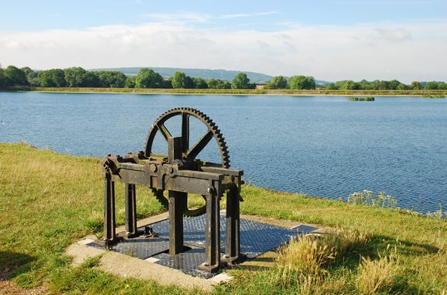
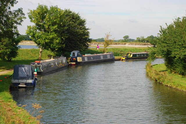
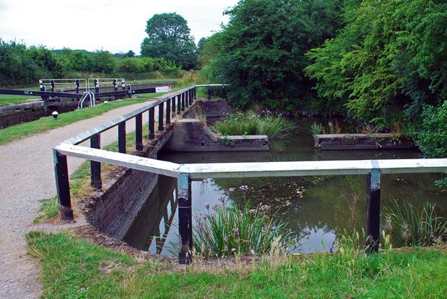
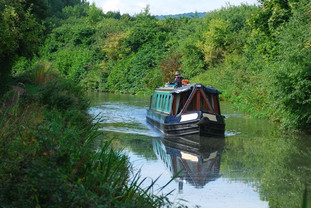
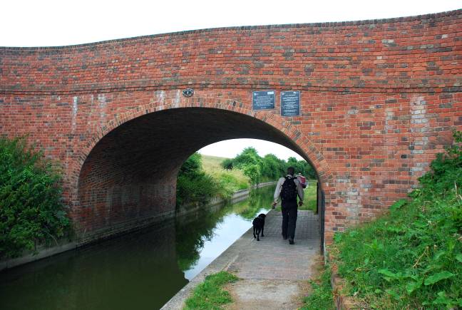
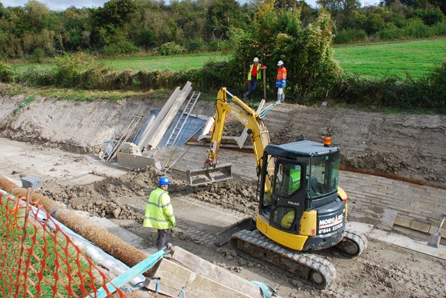
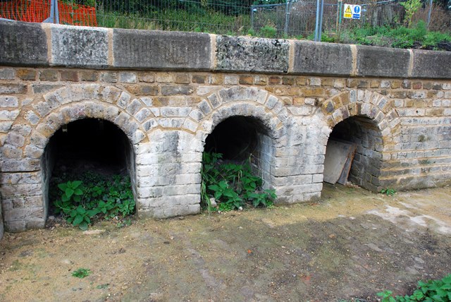
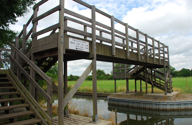
Just over 200 years ago new canals were being built all over the country to drive the Industrial Revolution. London couldn’t afford to be left out. So engineers built the Grand Junction Canal through a gap in the Chilterns near Tring. The canal changed this area for ever.

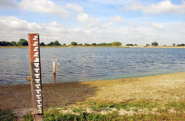
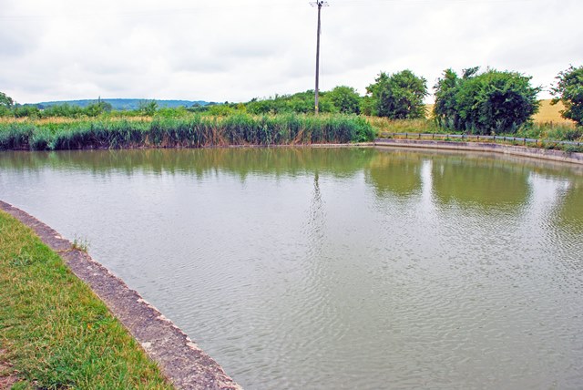
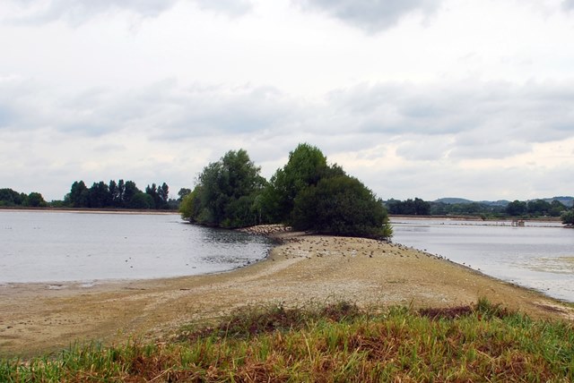
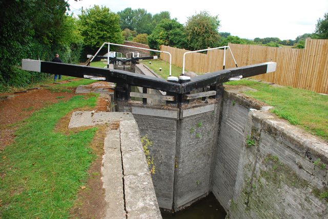
Discover how the canal was constructed and the challenges to supply it with water. Watch boats navigate specially-designed locks and anglers hoping for a bite in one of four reservoirs.

Follow the walk by clicking on the map pins or
downloading the guides below

Please note that part of this walk is along a busy road without a footpath - please take extra care between stops 15 and 16 and while crossing roads at other points.

Location: Tring, Hertfordshire
Start and finish point: Startop’s End Reservoir car park, Lower Icknield Way HP23 4LJ
Keep an eye out for: Over 250 bird species visit the reservoirs

Tring Reservoirs walk credits

Thanks to - 

Mike Jackson for creating the walk, providing photos and the audio commentary

Gary Gray for his valuable assistance creating the walk

Henry for testing the walk’s suitability for fellow canines

Jenny Lunn, Rory Walsh and Caroline Millar for editing the walk materials

Roger Leishman, Chris Sargeant, Jon Brooman and fellow members of The Wendover Arm Trust for their invaluable assistance 

Ian Petticrew and Wendy Austin for kind permission to reproduce archive images of the Grand Junction Canal 

Colin Park, Chris Reynolds and L B Tettenborn for additonal images reproduced under Creative Commons Licenses

Every landscape has a story to tell