1 Welcome to Harwich

When many people think of Essex, retail parks and new towns may come to mind - but the county actually has a glorious coastline. At 350 miles long the Essex coast is one of the longest of any county in Britain.

It’s a place where land and sea are constantly changing places. The sea and the many rivers that flow into it (the Stour, Orwell, Colne, Blackwater, Crouch, Roach and Thames) have shaped every aspect of this landscape.

When you look at a map you’ll see the eastern edge of the county is intersected by twisting lines, like a crooked finger, or the creeping roots of a plant. This is an estuarine landscape and Harwich, at the very tip of the county at the mouth of two rivers, is a good place to start exploring it.

The story of Harwich is a maritime story. It’s about how the sea has formed not only the physical aspect of the town but its character.

Our walk will focus on three main themes. First, we’ll discover what coastal processes have shaped the town and its fortunes. Second, we’ll find out how it’s prime location on the east coast has influenced the industries that grew up here, including trade, travel and tourism. Third, we’ll see the changing fortunes of this seaside town and find out how its rise and fall and recent renewal are all inextricably linked to location.

Along the way we’ll hear about a famous ship that set sail for the New World, a devastating flood that submerged the town for five days and why Harwich had a record number of pubs!

This walk was created by Neil D’Arcy Jones, a local writer and journalist who has lived in north Essex all his life. 


An early photo of Harwich Town station
© The Harwich Society
Directions

From Harwich Town railway station, walk out of the station approach road and past the grass roundabout. Cross over the road and stop beside the large red and white buoy.

2 Oh buoy

This metal buoy once floated in Harwich harbour but now provides a very apt welcome sign to the town. It was donated by Trinity House, the organisation which looks after the safe navigation of the country’s coastline - something we’ll find out more about later.

As you walk along the seafront look for buoys bobbing out at sea. Like the other maritime navigation aids we’ll come across on this walk, they’re designed to help ships navigate away from dangers or guide them through a safe shipping channel.

Buoys come in various sizes, shapes and colours and are distinguished from each other by a marking system. This one is a Class One buoy, the largest of its type. Class One buoys are typically used to mark major waypoints or hazards in deeper water.

Buoys are made-up of three parts: a top mark with a light or bell, a buoy body, and a tail tube to counter-balance the top mark. Like an iceberg, most of a buoy is submerged underwater.

This red and white striped buoy acted as a Safe Water Mark and was situated in the middle of an open channel to indicate the presence of safe, navigable water all around it. If you see a red and black buoy it’s a warning of small, isolated dangers surrounded by navigable water. A yellow buoy, known as a Special Mark, indicates features under the sea such as cables and pipelines.

To us they might seem quaint, colourful features but for mariners knowing the difference between the markings can be a matter of life and death.


Harwich town buoy
Caroline Millar © RGS-IBG Discovering Britain
Directions

Go round the buoy and stop beside the tall brick lighthouse.

3 Leave a light on for me

This impressive 90-foot tower is the High Lighthouse. Built in 1818 it is one of two land-based lighthouses in Harwich. We’ll see its partner, the Low Lighthouse, at the next stop.

Before radio signals (and later satelite signals) lighthouses were essential to warn ships away from dangerous water and guide them safely into harbour. For the weary sailor, a lighthouse was literally a lifesaver.

Harwich’s two lighthouses were built under the supervision of engineer John Rennie, who also built the original London Bridge. They were commissioned by General Rebow who lived locally at Wivenhoe Park near Colchester.

Rebow didn’t build them purely out of concern for the fate of sailors navigating the treacherous water here. He built them for business reasons, charging a penny for each ship that safely sailed into the channel.

When General Rebow sold both the lighthouses to Trinity House in 1836 he managed to negotiate the healthy sum of £31,730, a huge amount of money in those days. One of many examples of the entrepreneurial spirit you’ll find along the Essex coast.

 
Harwich high lighthouse and arsenal
© The Harwich Society
Directions

From the High Lighthouse head directly across the Green towards the Low Lighthouse.

4 Misleading light

This distinctive white building is the Low Lighthouse. We have only just left the High Lighthouse so you might wonder why two lighthouses were needed so close together, in fact just 150 metres apart.

Look at a map and you can see that Harwich sits at the mouth of two rivers and offers a safe harbour from the choppy waters of the North Sea. In fact Harwich is the largest natural harbour between Tilbury and Hull, making it one of the most important towns on the east coast of England.

The deep waters here have made an attractive anchorage for all sorts of vessels over the centuries. According to some sources the harbour was created in the twelfth century when a tidal wave broke through the salt marshes, diverting the course of the Stour and Orwell rivers and creating the sandy promontory upon which Harwich was built.

If you look across the channel you can see a long spit of land called Landguard Point. Between here and there are a number of sandbanks upon which ships could easily become grounded. The High and Low Lighthouses were built here to assist boats navigating through this channel.

They worked together as a pair of what’s called ‘leading lights’. Boats out at sea would line up the two lights, one positioned directly over the other then, rather like a plane using a runway, follow their course to enter the harbour.

Over time this area around Landguard Point began to silt up, however, and the lights could no longer keep ships off the expanding mud banks. The leading lights became defunct and were nicknamed ‘misleading lights’.

After they became redundant, new cast iron lighthouses were erected further round the coast at Dovercourt. They are worth a small diversion if you have time.


The low lighthouse
© Oxyman, Geograph (CCL)
Directions

From here you have a good view of the mouth of the estuary with Felixstowe on the other side. When you are ready follow the seawall with the sea on your right and the Green on your left. Stop when you reach a black timber building.

5 People power

The wheel you can see inside this wooden shed is a treadwheel crane and is the only example of its kind in the country. Treadwheel cranes date back to Roman times but were used extensively during the Middle Ages to build cathedrals and castles.

This one was built in 1667 and located at the town’s naval shipyard. There it was used to lift timbers for shipbuilding and load heavy cannons onto the many warships that were built at the yard.

As the name indicates the crane is worked by two people walking inside the inner wheel - a bit like a very large hamster wheel. Rope attached to a pulley is turned onto a spindle by the rotation of the wheel, allowing the crane to lift and lower heavy loads into place. Because there wasn’t much space inside the wheel the operators were often young boys.

One feature of this crane is the lack of any braking mechanism; if a heavy load ever started to slide back down the slope the wheels would reverse with disastrous consequences for the boys inside.

 
Treadwheel train on Harwich Green
Caroline Millar © RGS-IBG Discovering Britain
Directions

From the Treadwheel crane continue alongside the seawall. Stop when you get to the white sandy beach.

6 Life's a beach

There are very few sandy beaches on the Essex coast but as you can see there is a small one here in Harwich. This beach and sandbank were created artificially using sand dredged up from the harbour. The beach acts as a defensive barrier, preventing waves from lapping against the promenade and gradually eroding it away.

Due to the height of the sandbank, the sea no longer laps over the shore so a dune system has developed with its own plant life. The extensive root systems bind the sand together to provide an even more stable defence against the sea.

Some very rare species have established themselves here. For example, this is one of only two sites in the county where sea pea (Lathyrus japonicus) can be found. Meanwhile Ray’s Knotgrass (Polygonum oxyspermum) exists here and in only four other places in Essex.

As well as protecting the sea wall and esplanade from erosion the sandbank is a real environmental success story. Harwich Beach foreshore has been designated an Site of Special Scientific Interest (SSSI) by Natural England.

 
Harwich beach
Caroline Millar © RGS-IBG Discovering Britain
Directions

Continue along the promenade until it ends. Turn left and stop in front of the building that looks a bit like a chapel.

7 Lifesavers

As an island nation Britain has always been at the mercy of the sea. This attractive brick and timber building is Harwich’s Lifeboat Museum.

In 1824 Sir William Hillary founded The National Institution for the Preservation of Life from Shipwreck. Hillary had witnessed massive loss of life at sea from his home on the Isle of Man. His organisation, which later became the Royal National Lifeboat Institution (RNLI), has since saved over 139,000 lives.

The earliest recorded lifeboat in Harwich dates back to 1821 when a group of philanthropic citizens raised enough money to buy one. Unfortunately they didn’t raise enough to run it so, despite owning a boat, Harwich didn’t have a working lifeboat.

In 1875 the ship Deutschland, which was carrying German immigrants to New York, ran aground on a sandbank 25 miles off Harwich’s coast. When it sank 78 people died, many of them children. Such a huge loss of life led to a public outcry and so the following year money was found to buy a new lifeboat, the Springwell, and built this lifeboat house to keep it in.

By 1881 the new lifeboat with all its equipment and oars outgrew the lifeboat house, so the building was used for storage. Now it’s a museum which tells the story of the brave men who risked their lives to save those in peril at sea.

 
Lifeboat Museum
Caroline Millar © RGS-IBG Discovering Britain
Directions

From the Lifeboat Museum follow the road between the Harwich Sailing Club and a row of houses. Stop when you reach a small square of old almshouses on the left (opposite a car park with a large anchor in the middle).

8 Flood!

These attractive red brick houses were built in the mid-nineteenth century on the site of an old cement factory. They were originally coastguard’s cottages. The modern glass and brick control tower standing opposite is today’s Harwich Haven Authority Pilot Station.

Some of the bricks in the houses here still hold seawater from a great flood that hit England’s east coast. Water reached just below the second storey windows. Angelgate was just one area of the town that was devastated by the floods on the fateful night of 31 January 1953.

A winter storm had moved south from Scotland towards the southeast coast. Low atmospheric pressure caused a rise in sea level and this water surge travelled southward along with the storm. By 31 January gale force winds blowing up to 80mph and gusts of 100mph created waves up to 8 metres high.

Lincolnshire, Norfolk and Suffolk were hit first and inundated with seawater. Phone lines were down so Essex could not be forewarned. By 10.30pm that night water began to breach the wall here at Angel Quay. An hour later it flooded the largely residential Bathside area on the west side of the town near the railway station.

By the early hours of the morning most of Old Harwich was under an average of six feet of water. Residents were quickly evacuated by police and rescue work continued throughout the next day. Harwich remained underwater for five days. In all 700 families in the town were made homeless and eight people lost their lives.

As a result of the disaster a major programme of rebuilding floodwalls along the east coast was begun. The Thames Barrier was built (albeit 30 years later) and the early warning system instigated to give at least 12 hours notice of rising sea levels. But how long can we continue to defend ourselves against the sea? Could it happen again?

 
Angelgate cottages
Caroline Millar © RGS-IBG Discovering Britain
Directions

Pass the cottages and follow the road around to the left. This road is Outpart Eastward which leads to Wellington Road. Pass Wellingotn Road and go along King’s Quay Street. Carry on for about 100 metres. Stop when you reach a wire fence on the right where you’ll see two wooden boards and a bell.

9 Shipshape

The unprepossessing site through the wire fence is Navyard Wharf. This was once the site of Harwich’s naval shipyard. Harwich’s shipyard was developed from 1660 and built some of the finest naval ships of the day.

One of these, HMS Conqueror, was part of the fleet that won the Battle of Trafalgar in 1805. The Conqueror was the ship that eventually took the surrender of the French flagship following the battle.

On the board is a list of the ‘Men-of-war’ built here between 1660 and 1827 - see if you can find the Conqueror on the list. ‘Man-of-war’ was a Royal Navy expression for a type of warship armed with cannon and propelled by sails rather than oars. Such vessels were often popular subjects for paintings.

To the right of the board is the John Darby bell which was cast in 1666 at the height of the Navyard’s prominence. Its ring summonned shipbuilders to work until 1927 when the bell disappeared. A few years later the MP for Harwich, Mr P J Pybus, discovered it in a London antiques shop. He bought the bell and presented it back to the town.

Nowadays, rather than building ships the yard is used for importing and exporting goods to and from Scandinavia. The vessels used here now are roll-on / roll-off vessels built to carry cargo like cars, trucks, trailers and tractors that are driven on and off the ship on their own wheels (rather than lifted by crane).

Keep your eye out for JCB tractors and Range Rovers which are shipped from here to ports in Finland, Sweden, Norway, Denmark and Belgium.


Naval Shipyard, 1852
© The Harwich Society
Directions

Continue on the path. Take care crossing the entrance to the Navyard as it is still a working dockyard. Follow the path up to the Quay and stop when you can see a red and white boat moored offshore.

10 A lonely life

We’ve already seen two land-based lighthouses and a floating buoy. Here’s another kind of warning for shipping: a lightship. Put simply it’s a ship that acts as a lighthouse.

The advantage of a lightship is that it can be situated in deeper waters where it might be unsuitable to build a lighthouse; it is also portable and can be moved to wherever needed.

Once there were lightships like this one dotted all along the coast of Britain. What makes the LV18 different is that this is the last remaining example of a manned lightship in Britain.

Built in 1958 the ship had a crew of nine. At various stages in its service it was located on some of the most remote coastal stations around the country. It must have been a lonely and rather monotonous life.

The men worked in shifts round the clock to keep the lightship working. In the middle of winter, through storms and dashing waves, the ship had to be maintained and the light had to be on. Six diesel generators powered the lantern, foghorn and the ship’s equipment. Once a week a supply vessel visited LV18 bringing food, drink and medical supplies

LV18 is now a museum. The original interior includes the accommodation, mess room and galley. Now it tells the story of the brave people who kept the seas safe, their lonely life and the sacrifices they made.

 
Lightship LV18
Caroline Millar © RGS-IBG Discovering Britain
Directions

Continue a short way along the Quay to the Ha’penny Pier.

11 Pier with a view

Like a lot of other piers, including Southend further along the coast, Harwich’s Ha’penny Pier was initially built for entirely practical reasons. It was a landing stage for ships.

Because of the mudflats around this part of the Essex coast boats weren’t able to dock close to the shore. A pier was built stretching over 100 metres into the harbour which was deep enough for cross-Channel ships, as well as local paddle steamers that came up from the Thames.

As more Victorian holidaymakers arrived by train the need for landing stages waned and piers turned into amusement arcades and places for simply looking out to sea. The ‘pleasure pier’ was born and became a feature of all Victorian seaside resorts.

This one opened in 1853 and was called the Ha’penny Pier because of the half penny charge to get onto it – another example of the enterprising people of Harwich making money out of their favourable position on the coast.

Due to a fire the pier is considerably shorter today than it was originally but it’s still popular for a bracing stroll and a good place to enjoy watching boats bustling in the harbour. The nineteenth century ticket office is now a visitor information centre.

Look across the water at the various colourful cranes and container boxes of Felixstowe, the UK’s busiest container port. You might be lucky enough to spot one of the container ships with their colourful metal boxes on board looking like huge blocks of Lego.

Today we rather take it for granted but containerisation brought about a revolution in the efficiency and amount of goods that could be transported by sea. About 80 per cent of everything we buy today is brought in by sea.

 
Ha'penny Pier view
Caroline Millar © RGS-IBG Discovering Britain
Directions

Remain at the pier. Look across the road at the large, four storey, yellow brick building with the clock in the centre.

12 The end of the line

This grand building was Harwich’s Great Eastern Hotel, built by the Great Eastern Railway Company. You’ve probably seen this style of building many times before. In fact the railway company used this design for all their hotels, including ones at nearby Colchester and at the end of the Great Eastern railway line at London’s Liverpool Street station.

The railway reached Harwich in 1854 with the tracks originally running right up to the waterfront. In 1862 the Great Eastern Railway began running steamships to the Continent and three years later opened the hotel for the passengers staying in Harwich before making the crossing.

Unfortunately, building a hotel on this grand scale proved costly and short-sighted. Less than 20 years later a new port was built further along the coast at Parkeston Quay and most of the shipping trade moved away from Harwich harbour.

In 1914 the hotel had a temporary reprieve when its quayside position made it the ideal place to house a military hospital for those who had been injured on the Western Front.

Between the wars it was purchased by Harwich Borough Council but relinquished to the Navy at the outbreak of the Second World War.

Following the war it was refurbished and temporarily became Harwich’s Town Hall and the Magistrate Court. Now it has been converted into residential flats.


The Great Eastern Hotel, 1920
© The Harwich Society
Directions

Continue along the Quay. Stop by the grey obelisk of the Merchant Navy memorial.

13 In memorial

This memorial for the Merchant Navy is a striking reminder of another danger out at sea: not tidal waves or sandbanks but enemy action during wartime.

While the Royal Navy is Britain’s military fleet, the Merchant Navy is the name given to the commercial shipping industry. The Merchant Navy includes vessels such as cruise ships, passenger ferries, container ships, oil and gas tankers.

After the First World War King George V conferred the title ‘Merchant Navy’ on these vessels and their crew in recognition of their bravery and sacrifice.

During both the world wars the Merchant Navy were at risk of attack from enemy forces and suffered many losses from German attacks. Some 30,000 seamen were killed in the Second World War alone.

In memory of those who lost their lives the Merchant Navy now lays a wreath alongside the other armed forces on Remembrance Day. After many years of lobbying a Merchant Navy Day was introduced in 2000.

As Harwich is still a busy port, particularly for commercial ships, the Merchant Navy continues to play an important role in the life of the town.

 
Merchant Navy ensign
Rory Walsh © RGS-IBG Discovering Britain
Directions

Continue a little further along the Quay to a mini roundabout. Stand by the sea wall and look across to the cranes of Harwich International Port.

14 Harwich for the Continent

The story of Harwich is one of progress and change. For years the harbour where we’re standing now was hugely valued by ships seeking shelter in its deep, natural anchorage.

Daniel Defoe, on his eighteenth century tour around Britain, was impressed by the harbour, describing it as “able to receive the biggest ships and the greatest number that ever the world saw together”. The harbour reached its peak in the nineteenth century but as bigger boats were built it soon became too small.

For Harwich to retain its status as an important port a new facility was needed. The Great Eastern Railway Company, anxious to expand its operations, decided to create an entirely new port based on reclaimed marshland about a mile further along the river.

Parkeston Quay (named after Great Eastern’s chairman Charles Parkes) was opened in 1883. It quickly became Britain’s most important passenger port, linking England with Belgium and the Netherlands. While it created prosperity and jobs for the Parkeston area it had an adverse effect on Old Harwich - particularly some of the buildings and businesses situated on the old quay such as the Great Eastern Hotel and Ha’penny Pier.

Today Harwich International Port is one of the country’s leading freight and passenger ports. It also hosts more than 30 cruise ships a year, which make quite a majestic sight when they glide through the harbour.

 
Harwich for the Continent railway poster
© NRM
Directions

Remain on the Quay but turn to face the modern grey building on the opposite side of the street.

15 The lighthouse family

This grey building with a round tower that looks a bit like a lighthouse is Trinity House. Taking its name from the church of Holy Trinity and St Clement, which was next to King Henry’s dockyard at Deptford, Trinity House is the official General Lighthouse Authority for England, Wales, and other British territorial waters.

Ever since Henry VIII granted a Royal Charter in 1514 this organisation has been responsible for ensuring the safety of shipping and the welfare of sailors. Trinity House provides and maintains navigational aids such as lighthouses, light vessels and buoys. Just past the building you can see the depot where all the different buoys are kept and maintained.

Lighthouses were once run by a dedicated lighthouse keeper whose job was to keep the lights on in all weathers, all year round. But since 1998 all of Trinity House’s lighthouses have been automated. From the isolated rock tower of Eddystone in Devon to the iconic mainland tower at Southwold in Suffolk, they are all controlled by computers in this building.

 
Trinity House Depot
Wikimedia Commons (CCL)
Directions

Retrace your steps a short way and use the traffic island to cross the road. Turn left and walk back along the Quay in the opposite direction to the way you have just been. Cross over Church Street and then take the next right down King’s Head Street. Stop by the first white house on the right.

16 America starts here

We’ve already heard about Harwich’s connection to the Continent but the town has been the embarkation point for longer journeys too. This simple white house was the home of Christopher Jones, perhaps Harwich’s most famous son.

Jones was the captain of the Mayflower, the ship that made its voyage to America carrying the ‘Pilgrim Fathers’ in 1620. Before making its famous voyage the Mayflower was based in Harwich and was used to transport cargo including wine, spices and furs between England, France, Germany, Spain and Norway. 

Jones owned a quarter of the ship and was its master. In 1620 he captained the Mayflower on her voyage across the Atlantic, starting out from Rotherhithe in southeast London. In Southampton the Mayflower met up with another boat, the Speedwell, with the plan to journey across the ocean together.

The Speedwell sprung a leak however and both ships returned to Plymouth. It was from there, on its own, that the Mayflower finally made the famous crossing. If not for a stroke of fate the ‘Pilgrim Fathers’ might have named their landing place Rotherhithe Rock!

After leaving his passengers at Plymouth, Jones sailed the Mayflower back to England. Within two years of his death in 1622 the ship had fallen into disrepair and was dismantled and sold for scrap lumber.

 
Passenger list for the Mayflower
Caroline Millar © RGS-IBG Discovering Britain
Directions

Cross the road and stop outside The Alma Inn.

17 Battle for a pint

We’ve already passed several on our walk but did you know Harwich once held the record for the most pubs in Essex?

With thirsty sailors, shipbuilders and passengers waiting to make the crossing to Europe there was more than enough trade for the town’s publicans.There were once more than 35 pubs dotted around the streets of Old Harwich. Many had maritime-related names such as The Eagle Packquet Boat, The Lifeboat and The Anchor. 

The Alma was originally built as a merchantman’s house. There are records from 1871 when it was trading as the Alma Dining Rooms. It was named after the famous Battle of Alma of the Crimean War in 1854, at which the combined Anglo-French army claimed victory against Russia.

 
The Alma Inn pub sign
Caroline Millar © RGS-IBG Discovering Britain
Directions

Continue along King’s Head Street until you reach St Austin’s Lane. Turn left follow the lane to the end. Turn right into King’s Quay Street. At the junction where there is a small grassy area go straight ahead into a narrow lane. Stop outside the second building on the left (house numbers 42, 44 and 45).

18 Oh captain, my captain

This is Harwich’s old school house. It gives us the opportunity to hear the story of the most heroic of all Harwich’s citizens, Captain Charles Fryatt. The son of a sea captain, Fryatt grew up in the town and went to school here.

Charles followed his father into the Merchant Navy and, like many men in Harwich, made a career out of captaining the paddle steamers that ran from London up and down the Essex coast. Paddle steamers have sailed these coastal waters since the early nineteenth century.

First built of wood or iron and propelled by a paddle wheel, paddle steamers were comparatively slow. Their open decks were exposed to all weathers so there was little comfort for their passengers. The arrival of modern steamers made journeys quicker and more comfortable - but the trip from London to Harwich still took almost a day.

Despite being civilian ships steamers were still liable to German attacks in the First World War. On one such occasion in 1915 Captain Fryatt attempted to ram a German U-Boat to defend his own vessel. The following year his boat was surrounded by five German destroyers. Captain Fryatt was arrested and his boat seized. His hastily-arranged trial and execution that followed caused an international outrage.

A memorial to Captain Fryatt now stands on Liverpool Street station in London while the local hospital in Dovercourt is named after him.

 
The Old School House
Caroline Millar © RGS-IBG Discovering Britain
Directions

Move along to the next building, the Electric Palace cinema.

19 Electric dreams

While Harwich’s pubs did a roaring trade, the travelling picture show emerged around the turn of the twentieth century. This new entertainment was initially set up on Harwich Green under canvas but the threat of fire from the highly flammable nitrate film led to the building of the town’s own cinema. 

In an ironic twist, the cinema sits on the site of a furniture warehouse which burnt down. Even when the cinema was built the projection room had to be kept separate from the main auditorium because of the risk of fire. At the side of the building you can still see the iron stairs the projectionist would have climbed to get into his room.

In its heyday between 1912 and the 1920s the Electric Palace was the centre of entertainment in Harwich. For the number of sailors stationed here during the First World War ‘the pictures’ were a welcome diversion. Almost as soon as the war was over the cinema went into decline due to the loss of population from Harwich to nearby Dovercourt and competition from the newer, plusher, cinemas there.

The Palace struggled on for nearly four decades. In 1953, like much of Harwich, it was severely affected by the Great Flood. The cinema was inundated by seawater and forced to close. Although it was dried-out, repaired and re-opened, the flood had affected more than just the cinema. Nearby housing had also been devastated, reducing the local population even further. This proved to be the nail in the coffin and the cinema closed.

However, that was not the end of the story. In 1981 the Palace was restored and re-opened, mainly by volunteers. It is now one of the oldest purpose-built cinemas to survive complete with its silent screen, original projection room and ornamental frontage still intact.

It’s small but perfectly-formed opulence demonstrates what a wealthy town Harwich was when it was built in 1911 and how proud the people of Harwich still are of their picture palace today.

 
Harwich's Electric Palace cinema
Caroline Millar © RGS-IBG Discovering Britain
Directions

Continue along King’s Quay Street and pass Cow Lane on your left. Ahead you will see a church. Take the path that leads to the churchyard and stop outside the rear of the church.

20 Say a little prayer

As we have already heard, going to sea – whether crossing the Atlantic to start a new life, sailing over the Channel for a holiday or going out fishing for the day – is not without risk. Some people like to seek divine or spiritual protection and maybe say a little prayer before embarking on a voyage.

A chapel has stood on this site since the twelfth century. Crusaders rested here before setting sail for the Holy Land. Christopher Jones, the Mayflower captain that we head about earlier, was twice married here.

In the seventeenth century the diarist Samuel Pepys, who was MP for Harwich, worshipped here. A century later, so did writers Dr Samuel Johnson and James Boswell. Parish records also show that Christopher Newport, the commander of the expedition which established the Jamestown settlement in America, was christened here, as were Pilgrim Fathers Richard Gardiner and John Alden.

The original church was rebuilt on a much larger scale in 1821 as the building you can see today. It was designed to seat 1,500 people and was the largest church in the district, demonstrating how big a town Harwich was and what a god-fearing lot they were!

 
St Nicholas Church, 1177
© The Harwich Society
Directions

Continue along the path through the churchyard which takes you into a continuation of King’s Quay Street. Stop outside the houses on the right hand side (Numbers 25 to 34).

21 They must earn a packet

Throughout the walk we have heard how Harwich’s favourable location has provided opportunities for people to make money. Prosperity and the sea is pretty much the story of Harwich - so where better to end our walk than with some of the town’s finest buildings?

This gorgeous row of Georgian houses were not the homes of judges, politicians, factory owners or the landed gentry. Rather they were sea captains’ houses – and not naval captains but the captains of Harwich’s packet ships.

Packet ships originally carried mail packets over to the Continent for the Post Office. Harwich packet boats had the Post Office contract for more than 150 years. Later on ‘packet’ came to mean any regular service which could carry mail, freight or even passengers.

Take a closer look at house number 32. You might notice that it’s slightly different from the others next to it. A new front was put on it in 1830 using double bow windows from an earlier house. In the early eighteenth century a man called Madison Hunt, Master of the Packets, lived here.

Hunt could afford to live in this grand house as the Master of the Packets had the same income as a Vice Admiral. Not only did he operate the packet ships but he also made considerable sums from renting out his cabins to rich passengers. He probably also indulged in smuggling to supplement his sizable income even further!

 
Nautical house name
Caroline Millar © RGS-IBG Discovering Britain
Directions

Continue to the end of the road and cross over onto Harwich Green. Go up onto the sea wall for a view of the mouth of the harbour.

22 Harwich's maritime legacy

This walk has told the story of Harwich, a town by the sea and shaped by the sea - physically, economically and socially. Along the way we have heard about the twelfth-century tidal wave that inundated the salt marshes, the flood of 1953 that caused widespread devastation, and the silting up of the harbour that put the town’s lighthouses out of business.

We have seen a wide estuary used by international shipping and a tranquil new set of manmade sand dunes now home to rare species. We also learned about different measures to warn and protect shipping from the dangerous waters here, including lighthouses, a lightship, a buoy and a lifeboat.

We have seen how the sea has driven Harwich’s development and prosperity over the centuries. From the days of the earliest settlement money has been made from the sea. The Duke of Norfolk started the trend by placing a fort at the harbour entrance and demanding tolls. Later the leading lighthouses were a great source of income for their owner, Major Rebow.

We’ve heard about the money to be made from all kinds of maritime trade – from continental ferries to cruise ships and container vessels. Harwich's seaside location has also brought tourists, who have enjoyed the town’s many entertainments over the centuries including its hotels, pubs, elegant cinema and pier.

Harwich continues to thrive because of its relationship with the sea. The operational headquarters of Trinity House and Harwich International Port are both significant employers and symbols of Harwich’s continued importance on the east coast of England.

We hope you’ve enjoyed discovering Harwich and feel you know more about this small Essex town that became the gateway to the Continent.


Harwich beach and view of Felixstowe cranes
Caroline Millar © RGS-IBG Discovering Britain
Directions

To return to Harwich Town railway station, head towards the High Lighthouse. Main Road which takes you back up to the station is directly opposite. Alternatively you may wish to visit one of the musuems or spend time on the beach.

Deep water

Harwich dock cranes © Alvin Leong, Flickr (CCL)

Harwich walk

A short walk around Harwich Harbour

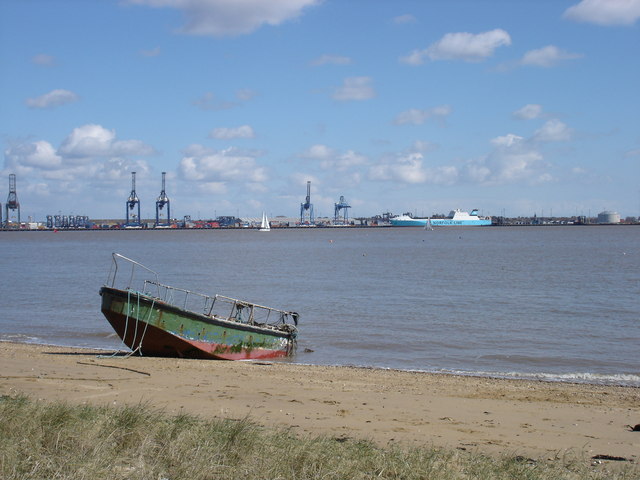
At 350 miles, Essex has one of Britain's longest county coastlines. The eastern edge is cut with jagged indentations, like crooked fingers. These are the county’s many river estuaries.

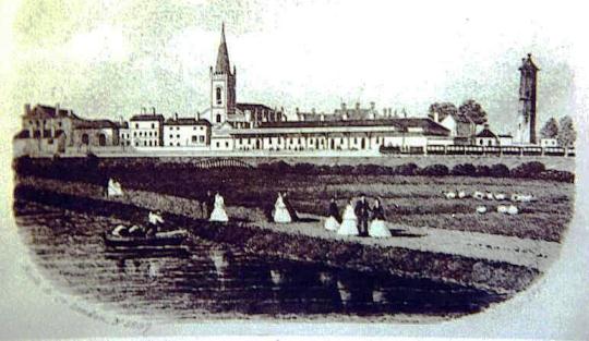
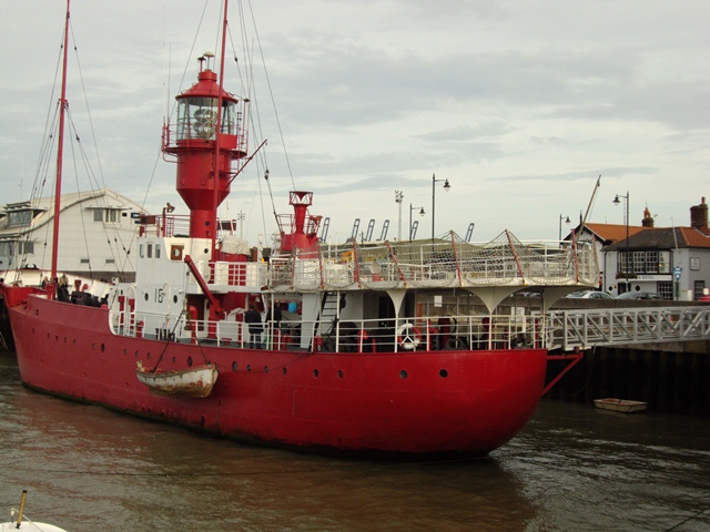
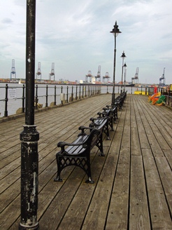
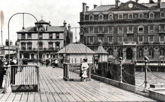
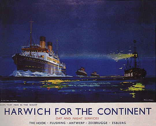
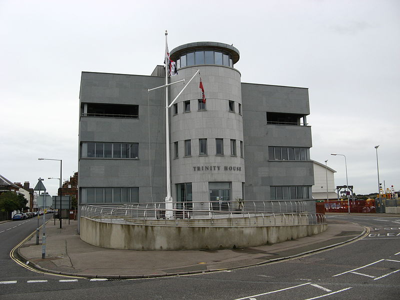
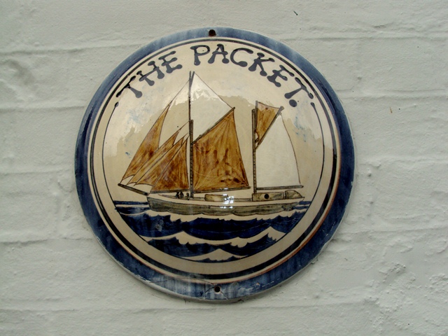
Harwich, located at the mouth of the Orwell and the Stour rivers, is a good place to explore this landscape. Water has shaped the town and its character. 

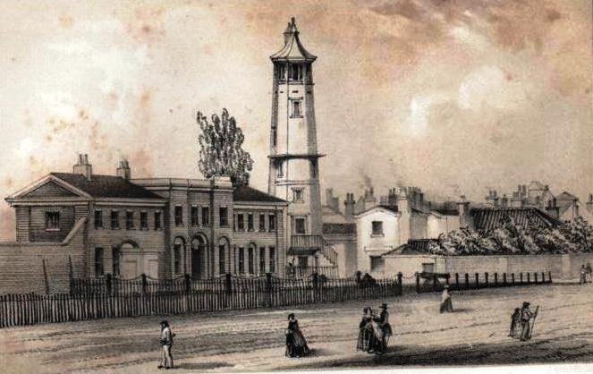
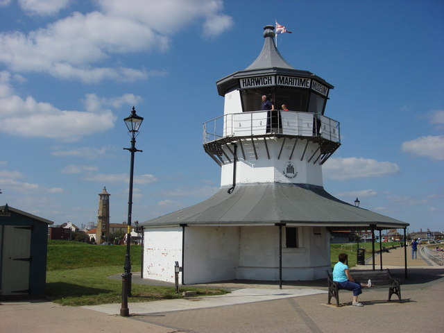
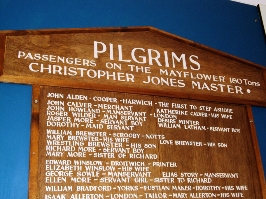
Uncover Harwich's secrets as you wander along the seafront and explore the old town. Hear stories of the town’s seafaring past and its present role in keeping mariners safe. 

Discover for yourself 'one of the best-kept secrets in Essex'...

Follow the walk by clicking on the map pins or
downloading the guides below

Location: Harwich, Essex
Start point: Harwich Town railway station, CO12 3NA
Finish point: The Esplanade near the Low Lighthouse, CO12 3NJ

Harwich walk credits

Thanks to - 

Neil D’Arcy Jones for creating this walk 

Caroline Millar for compiling the walk resources and editing the audio 

Rory Walsh and Jenny Lunn for editing the walk materials 

David Whittle for his invaluable assistance and local knowledge 

The Harwich Society for helpful information and kind permission to use archive images 

Adrian Murphy for testing the walk and providing useful feedback

Ross Millar for providing photos

Other images reproduced under Creative Commons Licences

"The harbour is of a vast extent ... as two rivers empty themselves here ... where they joyn they make a large bay or road, able to receive the biggest ships, and the greatest number that ever the world saw together" - Daniel Defoe