1 Welcome to the Essex Estuary

This is Estuary Essex - a flat landscape that seems barren and bleak. Yet this apparently grey and lifeless place is actually a dramatic and constantly changing environment.

The Thames Estuary is home to a diversity of speciallyadapted wildlife. On this walk we will discover more about the physical environment of the estuary’s marshes, mud flats and embankments including the diverse and unique plant and wildlife found here.

People too have learned to live in this marginal environment between the land and sea and we will discover some of the rich history of human habitation and activity.

This walk was suggested by the writer and environmentalist Ken Worpole, who grew up here on the Essex coast, and developed with Dr Helene Burningham from University College London.

Ken: “I’ve lived back in London for forty years now but I’ve always retained an affection for Essex and particularly the coastline where I grew up. I’ve been rather annoyed at the bad image that Essex has generated in the last couple of decades. For example, a long piece in Country Life magazine gave different areas of England points out of ten for landscape value. They scored Essex zero points for landscape quality - but actually the coastline of Essex is very beautiful in many places.”

Helene: “I am a lecturer in the Department of Geography at University College London. I am particularly interested in coastal and estuarine systems. Much of my research focuses on exploring the processes and behaviour in environments like these here. We hope you enjoy the walk!”


Two Tree Island
 © Adrian Murphy
Directions

Exit Benfleet railway station on the London-bound side. Go past the bus stops and cross the road at the pedestrian crossing. Stop on the footpath overlooking the creek.

2 An Arcadian land

Ken: “I was born in London at the end of the Second World War. Like many other families, my parents decided to get out of London after the war and move to the coast. We left East London in 1951 and went to Canvey Island.”

“We rented a bungalow – one of the so-called ‘plotland’ bungalows – and stayed there for a very happy year. Then we moved to Hadleigh, which is quite close by.“

“In the school holidays between the ages of about 8 and 13, my school mates and I played around Hadleigh Castle. It became a bit of an Arcadian land for us, so I’ve always had a special attachment to that place.”

“Five major rivers flow through the landscape and the coast has wonderful estuaries. In 2005 I worked with a photographer called Jason Orton and we literally walked, cycled (and very occasionally drove) the whole the Essex coastline. The book about our journey is called ‘350 Miles: An Essex Journey’.”

“On this walk you have two very distinct landscapes on either side of you. On one side you’ve got Hadleigh Downs and Hadleigh Castle – which is a kind of agrarian
landscape with lots of sheep and cattle and wildlife – and on the other side you’ve got the wonderful marshlands and tidal estuary landscapes and the River Thames
beyond.”


Hadleigh Castle and Hadleigh Marsh
© Jenny Lunn
Directions

Continue along the path towards the road bridge. Cross the road into Ferry Road and walk parallel to railway lines. Go through the metal gates ahead into the marina.

3 Messing around in boats

Along the estuary we will see a lot of boats and a number of boatyards. This is Benfleet Marina. Most of the boats here are very old - and most of them are still used for fishing, unlike the leisure craft at lots of very expensive marinas around the coast of Britain.

Look out for the gangways connecting the boats. These are very much needed because at low tide the marina is layered with a lot of mud.

Ken: “This is a working boatyard and people do use these boats. On a nice day it’s a lovely sight, because some of them have real character.“


Benfleet Marina
© Jenny Lunn
Directions

Walk the full length of the marina on the tarmac road. At the end, go through the gate into Hadleigh Castle Country Park and follow the footpath along the embankment. Stop after a short distance.

4 Not just mud

Here at Benfleet, saltmarshes, mudflats and creeks line the edge of the estuary. This is the intertidal zone – the environment between the level of low tide and high tide – and much of this area is covered and uncovered twice a day.

In the Thames the tide from the North Sea reaches as far as Teddington, which is about 55 miles upstream from Benfleet. Benfleet is on the northern side of the inner Thames estuary. At this point the estuary starts to widen from about 1.5 miles to over 4 miles wide at Southend, where it meets the North Sea in the outer Thames estuary.

As we continue we are going to walk towards this connection between the Thames and the North Sea.

Helene: “Estuaries are fascinating places as they occupy the transition zone between land and sea. There is so much to explore as they are dynamic and living systems.“ 

“The estuary here may look bleak, featureless and lifeless but these environments are very important and productive natural ecosystems. They support a unique group of wildlife that can cope with variable salty conditions and the repeated changes in water level associated with the tide. They also provide a range of ecosystem services – supporting wildlife elsewhere along the coast and inland.”

“The challenge is to understand what makes them work and to determine how past, present and future changes in climate, sea-level or human intervention influence the functioning of these systems.

“We’re going to learn more about these further along the walk. For now, keep your eyes open and see what plants, flowers, birds and insects you can spot. In particular, look out for birds wading in the mud and for the purple haze of sea lavender across the saltmarsh.”


Sea lavender (limonium)
© Helene Burningham 
Directions

Continue along the embankment. Stop after a short distance.

5 Taming the tide

The low-lying areas surrounding estuaries have long been popular places for humans to settle, but the marshy conditions aren’t easy to deal with. For centuries, though, people have used embankments and drainage ditches to protect villages and towns from flooding, and to make the land more suitable for agriculture.

We are currently on top of an embankment built in the 1980s, although there have been earth embankments here for much longer. Around 300 miles of the Essex coast is lined with embankments like these. Canvey Island, across the creek on your right, is entirely surrounded by embankments.

Ken: “Around 1620, Dutch engineers and construction workers were recruited to create a large part of Canvey Island. They built a sea wall around a whole series of distinct small bits of island to create this large, uniform mass.“

“Some of the Dutch community stayed on afterwards and their houses are still on Canvey Island. The Dutch influence can still be seen in the street names - nearly a third of them have Dutch origins.”


Octagonal Dutch cottage on Canvey Island
© Oneblackline (Creative Commons License)
Directions

Continue along the embankment. Stop after a short distance.

6 Flood!

The embankments have provided people and settlements with protection from the daily ebb and flow of the tide for centuries. However, they can be breached during occasional storms or surges. These occur when elevated water levels and storm waves coincide with high tide.

This happened here in 1953 in one of the worst peace-time disasters the country has ever experienced. In late January, a winter storm, driven by a low pressure system out in the North Sea, moved south from Scotland toward the southeast coast of England. Low atmospheric pressure causes a positive surge – or rise – in sea level, and this surge travelled south with the storm.

By Saturday 31st of January, gale-force winds blowing at 60 to 80mph and gusts hitting 100mph had produced waves up to 8 metres high out in the North Sea. At the coast, the storm conditions, combined with elevated water levels of the surge and coincident with a high tide, brought major destruction.

Coastal areas were inundated with sea water. Lincolnshire, Norfolk and Suffolk were affected first but as telephone and telegraph poles were pulled down by the winds there was no way to warn the people of Essex.

The storm surge continued south into the Thames estuary and broke through Canvey Island’s sea wall just after midnight, moving swiftly across the low-lying coast. The island was inundated. Across southeast England, 307 people died in the flood - 58 of them on Canvey Island. Many people drowned in their beds; others were swept away in the surge or died of cold as they clung to their rooftops.

Afterwards, a new sea wall was built and replaced by a much larger construction in the 1980s. A government enquiry recommended setting up a warning service, which still exists today. There is also an evacuation plan and residents get annual reminders of what to do when they hear the sirens.


The Canvey Island floods (1953)
By kind permission of www.canveyisland.org.uk   
Directions

Continue along the embankment. Stop after a short distance.

7 Rising sea levels

Sea level changes considerably over time. Tides vary the level over hours, months and decades but over longer timescales – hundreds to thousands of years – sea level responds to climate and tectonic changes.

At the moment, the average sea level is rising. This is due to global warming causing the ice caps of the Arctic and Antarctic to melt. Melted water released into the sea, combines with thermal expansion to increase the volume of the oceans.

Even small variations have a significant impact on environments like these marginal systems that lie at the boundary between land and sea. As the next decades pass, the average high tide is going to get higher here and these embankments will increasingly be vulnerable to overtopping.

Further upstream nearer to London is the Thames Flood Barrier, which can be raised to protect the city from surges or very high tides. But down here nearer to the mouth of the estuary, the defence is just the earthen embankment that you are standing on. It’s hard to imagine this place as it would have been during the surge of 1953 – the land here is so low that without the embankments, much of it would be flooded on a daily basis.


Benfleet Creek flood barrier
© Jenny Lunn
Directions

Continue along the embankment. Stop after a short distance.

8 Fresh air

As we have already discovered many families moved out of London after the Second World War to live in this area. The coast, with its fresh air, was an attraction to many - not just tourists and day-trippers but also somewhere for the sick to convalesce.

This part of Essex has always been a place where East London welfare institutions or social reformers have located various experimental communities, for reforming people or for respite and health.

On Canvey Island, the first of these was set up in 1902 by a woman who was very active in the Suffragette Movement. It was a place for young women to recuperate from their backbreaking work as seamstresses or in factories the city.

In the 1920s and 1930s, a large number of big hotels were established on Canvey Island and it was promoted as a place for healthy, fresh air. One of the largest hotels, with 60 bedrooms, was called the Ozonia.

Ken: “The Ozonia was a temperance hotel. The temperance movement began in the early-ninetenth century and encouraged people to abstain from alcohol. The movement was still quite strong when the hotels began on Canvey Island. There were also big bicycle parks, camping grounds and caravan sites on Canvey. So from the 1920s through to the 1980s, Canvey Island was actually regarded as a holiday resort as much as a place to live.”


Old postcard from Canvey Island
By kind permission of www.canveyisland.org.uk   
Directions

Continue along the embankment. Stop where the embankment bends and the footpath passes through a gate.

9 Second chance

This area also played an important part in the history of welfare and social reform. Look up to the ridge of the hill and just to the left of the castle ruins you will see a collection of buildings. This is Home Farm the site of Hadleigh Salvation Army Colony.

The Colony was established in 1891 by William Booth, the founder of the Salvation Army. Originally it was a labour colony for men from London’s East End who had hit hard times. The idea was that their lives were going to be reformed by working on the land.

Around 400 men passed through the Colony each year, with around 230 there at any one time. They received their board and lodging plus a cash ‘grant’ of between 6d and 5s per week depending on their ability. The farm produced a variety of crops including wheat, cabbages, onions and tomatoes, and also kept poultry. However, the Colony regularly ran at a loss – probably because over 90 per cent of the labour force had a history of drink problems.

Ken: “When I was growing up here in the 1950s it was then mostly used as a place for retraining what that generation called juvenile delinquents – young men who got into trouble. So of course our parents warned us against getting too close to it!”

“In recent years it’s become an organic farm and they sell lots of organic produce. They have a café-restaurant used as a training scheme for people with learning difficulties who learn cookery and serve in the restaurant.”


Residents of Hadleigh Colony at work in the fields (c1910)
© Peter Higginbotham / www.workhouses.org.uk
Directions

Remain in the same place.

10 A romantic ruin

Up on the hillside to the right of Home Farm are the ruins of Hadleigh Castle. The castle was completed in 1232 in the reign of Henry III. In the thirteenth century, England was concerned about attacks from France, so the castle was deliberately situated on this hill, which has good views over the Thames estuary.

The embankment we are on is a relatively recent construction, so at the time of Henry III‘s reign the sea would have reached the base of the hill. The hill provided an ideal vantage point and quick access to the estuary, allowing soldiers to defend the realm.

Hadleigh Castle is very popular in the English imagination because it was painted by John Constable. He sketched it a number of times and the finished painting was exhibited in 1829.

Ken: “I have heard that Constable completed it after his wife died. He was obviously very much in love with his wife - his earlier paintings are full of life and images of serenity, like church towers and lush vegetation. But the painting of Hadleigh Castle is of a ruin, of emptiness and with bleak skies beyond it. You can say that it represents a change in his mind because of circumstances that happened in his personal life.”


Hadleigh Castle by John Constable (1829)
Wikimedia Commons
Directions

Continue along the embankment. After a short distance the embankment turns 90 degrees to the right. Stop on the corner overlooking the fields.

11 Working the land

Embankments are built to reclaim land from the sea. On our left hand side between this embankment and the hills is Hadleigh Marsh. In the sixteenth century much of this land would have been saltmarsh and mudflats.

Once defended from the sea and drained, the ground was used for farming. This environment is often called a working landscape as it has been shaped over hundreds of years by people working the land. Hadleigh Marsh is still a working arable farm.

The ground is very low as it is the same height as the saltmarsh would have been when it was embanked hundreds of years ago. Saltmarsh and mudflats still exist here but they cover a much smaller and more fragmented area on the seaward side of the embankment.


Arable fields on Hadleigh Marsh
© Jenny Lunn
Directions

Continue along the embankment until you are alongside Two Tree Island on the right. There is a footpath that crosses the creek onto the island. This is passable most of the time, although you might get muddy. Once on the island, keep on the right-hand footpath and walk along to the bird hide.

Note:
If the tide is too high to cross the creek read Stops 12 and 13 here then continue along theembankment. Rejoin the walk route by the road bridge off the island (see Directions 13).

12 Bird paradise

The Thames estuary is a very important area for migrating birds, especailly wildfowl and waders. Many species come from northern Europe, eastern Europe and Russia to spend the winter at various sites in the Thames Estuary corridor, including this one. From this bird hide on Two Tree Island, looking west back to Benfleet, we are overlooking artificial lagoons that were created when this site was made into a wildlife centre.

The marshes from Benfleet to Southend are internationally important and are protected under European designation as a Special Protection Area. This recognises the value of the local saltmarsh, mudflats, lagoons and grassland environments in supporting birds.

One of the most notable visitors are Brent geese, who arrive in their thousands in late September. Also of great importance are avocets, a type of wading bird. Look out in particular for pied avocets - white birds with black markings on their wings, back and head. They like shallow coastal lagoons and estuaries such as this where they can feed on a variety of aquatic insects and crustaceans in the mudflats. They use their long thin up-curved bills to sweep from side to side through the water and surface sediment.

Avocets can be seen here all year round but April to June is their nesting period. This site is one of the most important avocet breeding grounds in Britain. During nesting season, volunteers monitor the lagoon day and night to protect the eggs from collectors and predators.


Pied avocets
© Lip Kee Yap, Flickr (Creative Commons License)
Directions

From the bird hide, take the footpath to the right and follow it round the edge of the island. Stop part way along this path.

13 From dump to sanctuary

Today Two Tree Island is a peaceful haven for birds but it has a long and varied history common to many Essex coastal sites. The earth embankment here was built in the eighteenth century when the saltmarsh was drained and the land used for grazing and subsistence farming.

By the early-twentieth century, the land was taken out of agricultural use. A sewage works was built at the eastern end of the island in 1910 and in the 1930s Southend Borough Council converted the island to a landfill site. By the 1970s the landfill in the eastern part of the island had reached capacity so the Council gave a long lease to the Nature Conservancy Council (now Natural England) to create a nature reserve.

Landfill continued in a smaller section of the island for many more years. Despite years of neglect and mistreatment, the landfill site now supports some interesting non native plants and ‘escapees’ which are not normally found in this kind of habitat. The whole island is now dedicated to nature and wildlife and is designated as a Site of Special Scientific Interest, a Special Protected Area and a National Nature Reserve.


Aerial view of Two Tree Island
© Sandra M Dean www.sandramdean.co.uk
Directions

Make your way across the island towards the road bridge. After crossing the bridge, take the footpath on the right around the back of Leigh Motorboat Club. Follow the footpath on the embankment for about half a mile. On the approach to Leigh railway station, take the small road to the right which runs between the railway line and the boatyard. Stop by the cockle sheds.

14 Cockles and mussels

Ken: “At low tide you’ve got miles and miles of mudflats here. It’s very shallow water and the whole expanse of the Thames estuary is very good for fishing. Leigh-on- Sea has been a fishing village for hundreds of years but in the twentieth century it became known particularly for cockles.”

“There are several families who have been in the cockle business for 50 years or more. The cockle sheds down here at Leigh-on-Sea still have an authentic feel. It’s a
real industry; there are real boats and real fishermen and the food is absolutely delicious!”

Methods of fishing for cockles have changed over the years. Fishermen used to collect cockles by wading out into the mud and using a hand rake. At the right time of day you may still see people out in the mud collecting cockles - but most are collected by boats which drag nets along the sea floor. As you walk along the sea front, look out for the colourful nets and rakes, as well as the heaps of cockle shells.

Much of the population of Leigh were once dependent on cockling for their livelihood. Now only a handful of local families are involved, although demand for cockles has
risen, as has their commercial value.

Some of the catch is sold here, at the cockle sheds and in the cafés and restaurants along the waterfront but most is sent to Billingsgate Market in London and sold to the capital’s restaurants.


Fishing nets, Leigh harbour
© Jenny Lunn
Directions

Continue past the cockle sheds to the seafront at Old Leigh. Follow the seafront path past the cafés and pubs. Follow the cobbled High Street past Leigh Heritage Centre. At the sign for Leigh-on-Sea Sailing Club, cross the pedestrian bridge over the railway. Turn right up Leigh Hill, cross at the pedestrian crossing and take the next left, which is Church Hill. Climb Church Hill and at the top turn right into St Clement’s churchyard.

15 Cockleshell heroes

Being near the mouth of the Thames estuary, Leigh-on-Sea had a strategic position during the Second World War. First of all the harbour was involved in Dunkirk evacuations in 1940, which saw 700 private boats travel to northern France and rescue 338,000 British and French soldiers trapped on the beaches. Local cockling boats were requisitioned for the evacuation.

Ken: “A flotilla of hundreds and hundreds of boats was commandeered from the south coast. Some of these boats came from Leigh and you can still see one of them, a cockling boat called the Endeavour.

The Osborne family, who still trade in Leigh-on-Sea, took part in the evacuation but they hit a mine on the way back and two of them were lost to sea. They are marked on the memorial in St Clement’s churchyard.”

The Estuary was also at risk because German planes on their way to bomb London used the Thames as a landmark. So a series of defenses were built in the estuary to defend the Thames and its gateway to the capital city.

Seven sets of Maunsell Forts were positioned in the sea across the outer Thames estuary. The nearest to this coast were located at Red Sands. They are still standing and sometimes visible from here on a clear day. The fortresses were operated by the Army and Royal Navy to report on German air raids and shoot down enemy planes. Anti-aircraft guns were also sited at Leigh-on-Sea.

Ken: “I’m told that a lot of the population were told to leave Leigh-on-Sea during the war because it was considered so vulnerable to enemy attack. But not by planes coming in. After a bombing raid German planes leaving London would discharge whatever firepower or bombs they had left over the estuary.”


Red Sands Fort
© Webb Aviation http://webbaviation.co.uk  
Directions

Leave the churchyard the way you went in. Cross over the top of Church Hill and go through the gate. Follow the path through the Library Gardens. Near the end of the gardens, take the footpath on the left that drops diagonally downwards. Exit the gardens at the gate and steps at the bottom corner and turn right up Leigh Park Road (becomes Hadleigh Road). Follow the road upwards round the curve. At the junction, turn left along Marine Parade. Stay on the upper footpath to enjoy the views over the estuary.

16 A bleak affection

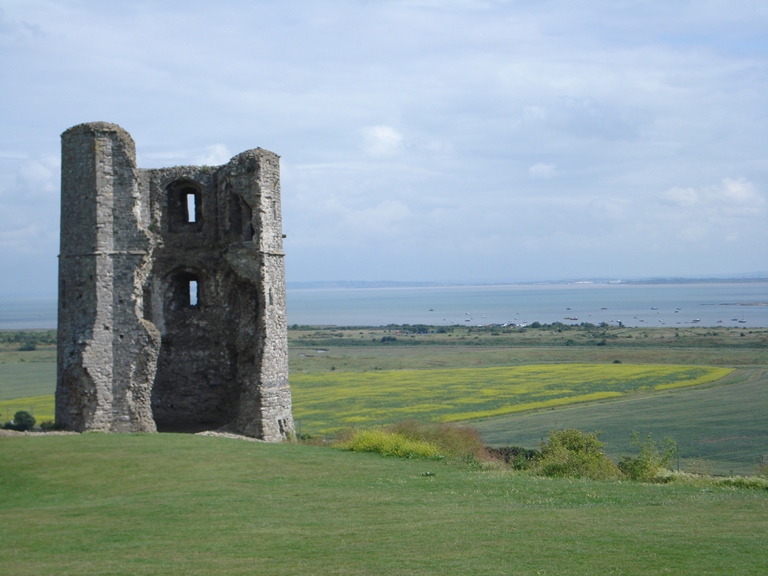
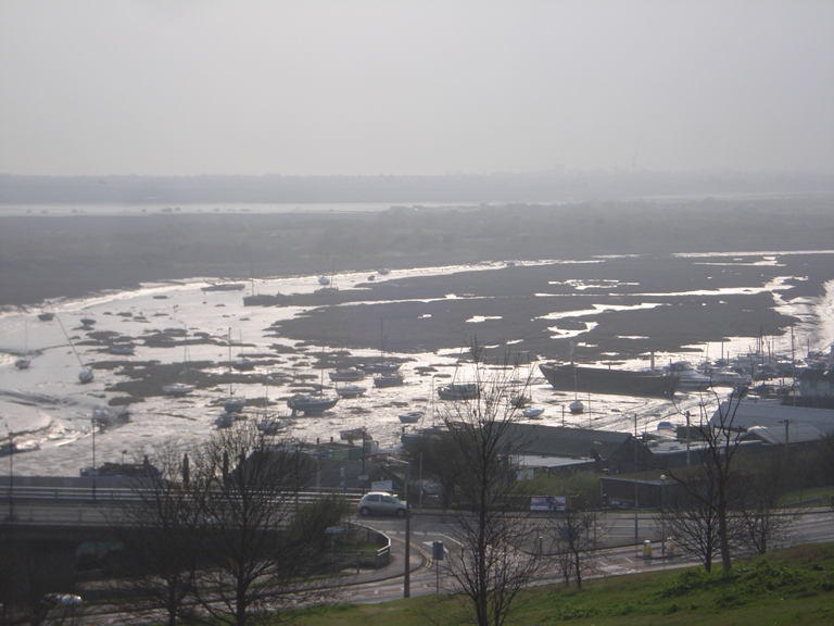
We are nearly at the end of the walk but the climb up Church Hill should have been worth it for this view from Marine Drive.

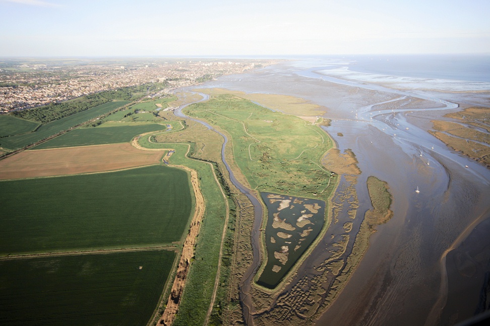
In front of you is a full panorama of the Thames estuary. To the far right is Benfleet – where we started the walk – and Canvey Island. Below you and slightly to the right is Two Tree Island where we visited the bird sanctuary. Below and to the left is Old Leigh. If it’s a nice day, you should be able to see Kent on the south side of the Thames estuary.

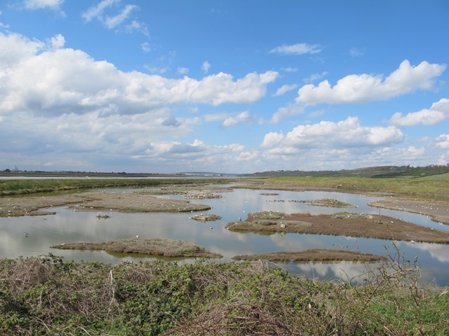
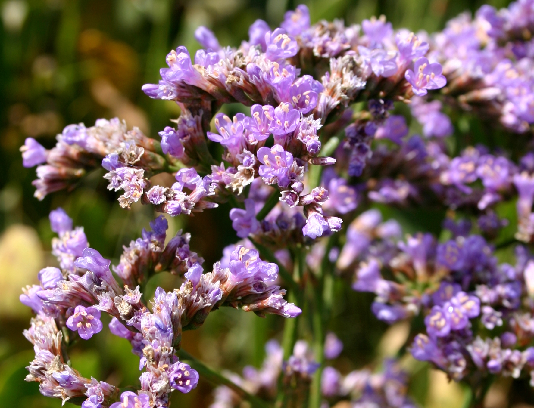
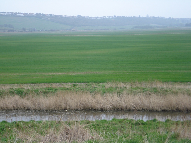
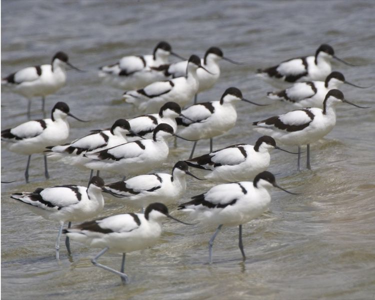
We hope that you have appreciated that this is an in-between landscape which is neither land nor sea. The physical landscape is continually evolving, shaped daily by tides. We have seen how the saltmarshes and mudflats form a very special environment for particular plants, flowers, birds and insects which thrive in the rich inter-tidal habitats. But this environment is less suitable for people.

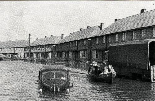
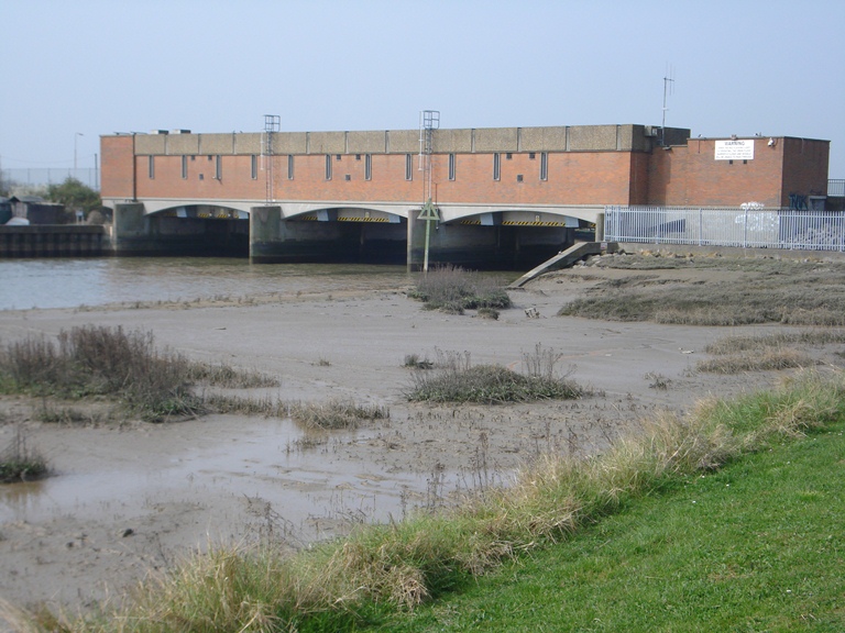
Over the centuries, people who have wanted to settle here have needed to protect themselves from the sea. They have built embankments and sea walls to protect their villages and towns and to create farmland for growing crops.

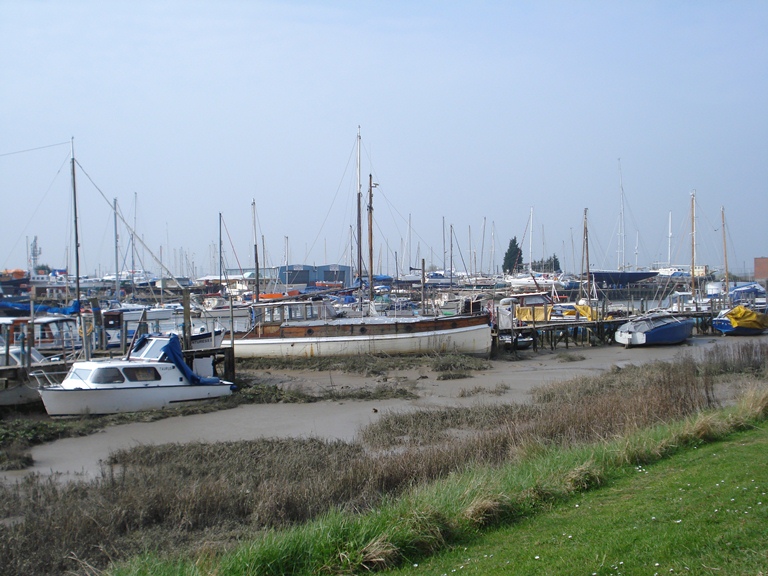
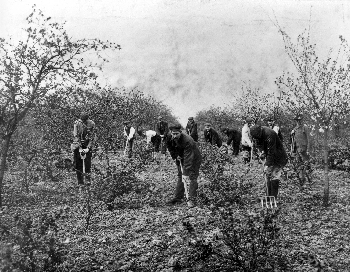
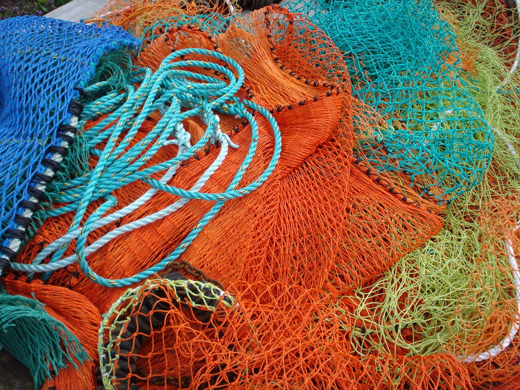
Others have earned a living from the sea, particularly from the shellfish that are found in abundance on the mudflats. Over the last century, Londoners have been drawn out to this part of Essex, attracted to the healthy sea air. The area expanded after the Second World War as people moved out of the city for a better quality of life.

Ken: “You’ve got to have a certain kind of character, I think, to appreciate this sort of landscape, and not everybody does.”

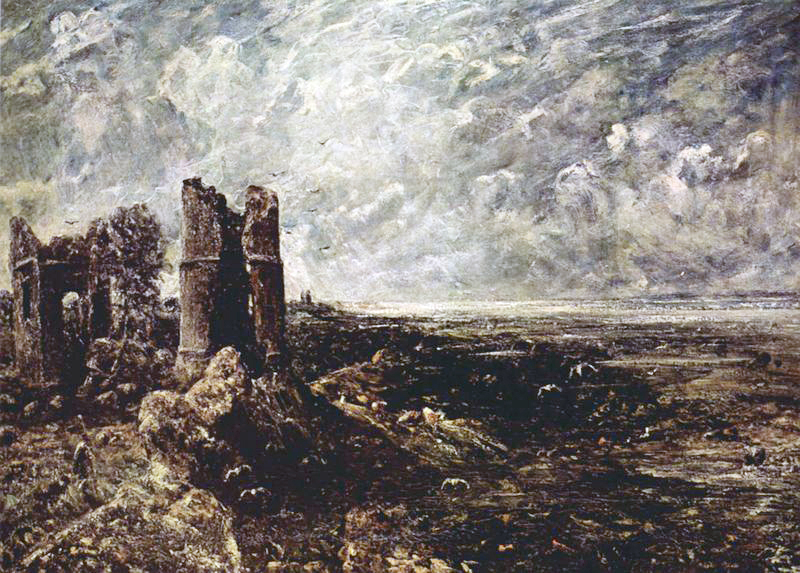
The writer John Fowles grew up in Leigh-on-Sea and often looked down upon Two Tree Island and the Benfleet Creek from here. This is an extract from one of his diaries, written on 2nd of January 1950:

“A raw, dull day with a wind and all-pervading greyness. The tide full in and the sea faintly greygreen, ugly. Few people about. At sea the hulls of the small yachts and motorboats wintering at their moorings. No birds but seagulls resting silently on the sea or uneasily flying up. The fishing fleet moved out of Leigh into the gloom of the east coast, smacks painted grey and green with their crews on deck. I envy their free life...”

“Old Leigh is a single narrow street with salty, muddy houses still retaining the character of fishing and naivety. The railway line in this case preserves the community, its special nature. Past Old Leigh the cockle sheds a line of dark huts. The boat building shed, the beginnings of the seawall, the corporation dump, the loneliness, in a sense all nicely divided and gradated. A bleak sort of affection is possible.”

Helene: “We hope that you leave this walk also feeling a ‘bleak sort of affection’ as John Fowles put it. Hopefully you have seen that the apparently flat, lifeless and grey expanses of the estuary are actually a very dynamic environment, a specialist habitat and a rich resource.”


Late winter sun on Leigh Creek
© Jenny Lunn
Directions

You may wish to retrace your steps back into Leigh-on-Sea for rest and refreshments. To return to Benfleet, continue along Marine Drive then bear left down the slope to Leigh-on- Sea railway station from where regular services run. Alternatively you can return on foot via Hadleigh Castle and Country Park.

Neither land nor sea

Two Tree Island © Adrian Murphy

Essex Estuary walk

A walk along Benfleet Creek, near Southend-on-Sea

Thirty miles from central London, the River Thames widens into a great estuary on its way to the North Sea. Mud, marsh and water blend into one. 

This often seems like a barren and bleak landscape. It can appear grey and lifeless, even on a sunny day. But it is actually a dramatic and constantly changing environment. 

This walk between Benfleet and Leigh-on-Sea explores the tidal creeks, salt marshes, mudflats on the edge of the estuary. Discover how dynamic they are and meet a range of wildlife specially-adapted to existing here.

Also find out how people have learned to live in this marginal environment between the land and sea.  

Follow the walk by clicking on the map pins or
downloading the guides below

Location: Benfleet to Leigh-on-Sea, Essex
Start point: Benfleet railway station, SS7 1NF
Finish point: Marine Drive, Leigh-on-Sea, SS9 2HP

Essex Estuary walk credits

Thanks to - 

Ken Worpole for creating the walk and sharing his passion for the Essex coast 

Helene Burningham for her commentary and excellent photos 

Caroline Millar and Jenny Lunn for researching and editing the walk materials and taking photos

Adrian Murphy for testing the walk, providing photos and useful feedback 

Nick Stanworth, Gemma Coate and Rory Walsh for additional assistance

Jonathan Webb and Sandra M Dean for aerial photos 

Peter Higginbotham, Dave Bullock and Andrew Areoff for kind permission to use images from their collections

"A raw, dull day with a wind and all-pervading greyness. The tide full in and the sea faintly greygreen .... A bleak sort of affection is possible"

John Fowles