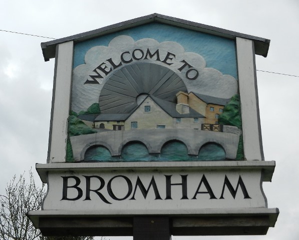
Superficially Bromham may look like many other commuter villages in the Home Counties. It’s a historic settlement where a scattering of old cottages have been converted into desirable homes. The fields where crops once grew and cattle grazed are now filled in with twentieth-century housing with yet more new houses being built and planned.
But look beneath the surface and you’ll discover there’s more to Bromham than first meets the eye.
This walk was created by Pat Wilson who lived in the area for twenty years. She was drawn to Bromham for its village feel and the opportunity to fulfil her childhood dream of living in a thatched cottage. Pat: ‘After moving into my home here, I started to ask questions about the village. Why was it located so far from the parish church? Why was such a long bridge built over and beyond the river? Just why were so many ‘thatches’ built in the mid-seventeenth century? These questions and many others led me on a quest to find out more about the local area by looking more closely at the landscape.’
This walk is a journey through several millennia of human settlement from prehistoric habitation to the Anglo-Saxon period and from medieval feudalism to the twenty-first century commuter village. Each historical period has left its legacy in road layouts and street names, in building locations and architectural style, in fields and woods.
This walk is about being a landscape detective – searching for clues in the landscape to piece together the story of how this settlement has grown and changed over time. We would like to share with you some of the surprising stories and well-kept secrets lying beneath an apparently ordinary and insignificant English parish.
From the entrance to Bromham Mill turn left onto the main road and onto Bromham Bridge. Take great care as there is no pavement across the bridge. Stop at the first pedestrian refuge and look down over the river.
2 Meanders
The river flowing below is the Great Ouse. At 143 miles long it is the fourth longest river in the UK. It begins in Northamptonshire and flows through parts of Buckinghamshire, Bedfordshire, Cambridgeshire and Norfolk before entering The Wash at King’s Lynn.
Here in north Bedfordshire the Great Ouse meanders across the landscape in great loops. If you look at a map you’ll see that Bromham village lies within one of these great meanders.
In geological terms, underlying this area is soft boulder clay which was formed under glaciers and ice sheets tens of thousands of years ago. Over thousands of years the powerful river has continually eroded the soft rock beneath and gradually widened its valley.
Appreciating how the natural landscape has been carved by the river over thousands of years is important for understanding the human imprint on this area.
There are few suitable places to cross the meandering river and its wide valley so this influenced where routeways developed and, in turn, where humans chose to settle.
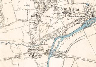
1881 map of Bromham and Great Ouse
Directions
Remain on the bridge.
3 Crossing points
Archaeologists have dated a human presence in Bromham as far back as 50 BC. The evidence suggests that these were small farming communities which established their settlement beside the great bend in the river where there was a ford. The ford was the area’s main crossing point until this bridge was built. There is an option to visit the ford later in the walk.
Local excavations have found evidence of a pottery industry as well as imported Roman Samian Ware and a Romanised gold ring. A Roman Road was built to the west of the village and seems to have been routed deliberately to avoid having to cross the big meander in the river. We will walk along part of the Roman Road later on.
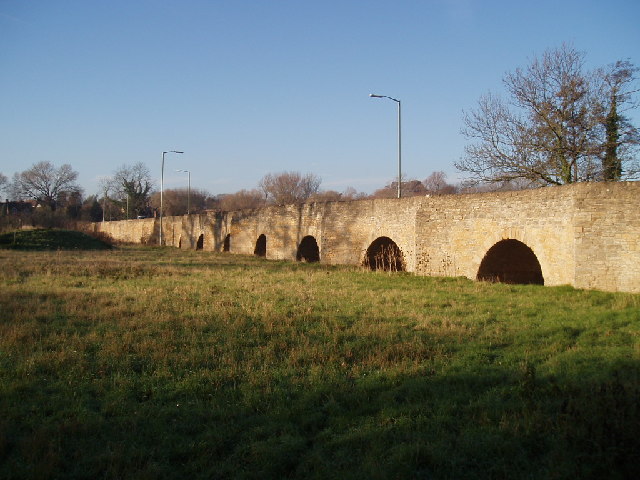
The ford at the bend of the Great Ouse was not ideal for all forms of traffic so a bridge was first built here in the thirteenth century. It was originally six feet wide with 22 arches, just wide enough for pedestrians and horses. In 1812 a second bridge was added which comprised a solid causeway then an arch over the river; it was built to be 11 feet wide to accommodate carts. Throughout the 1800s various changes and repairs were made to both bridges and eventually they were merged into the single bridge that you can see today.
You might be wondering why the bridge itself is so long and continues over fields far beyond the river. If you count the number of arches you’ll find there are an incredible twenty six. The bridge was built to carry people and transport across the river itself and safely over the flat land beyond which is prone to flooding.
Having looked at the river which has influenced this landscape so much we’re now going to explore the village and find out how it has grown and developed over time.
Retrace your steps back over Bromham Bridge with care. Stand in the wide V-shaped refuge and peer down over the stone wall to get a good view of the mill race.
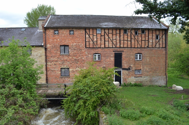
4 Flour power
From the evidence of prehistoric people who first settled in this area, we fast-forward about five hundred years to the Anglo Saxon period. By the time of the Domesday Survey of 1086 there was a settlement here called Bruneham. Bruna was a person’s name and the widely-used suffix ‘ham’ meant ‘settlement’ or ‘homestead’ in Old English. The modern spelling of Bromham first appears in 1227.
The Domesday Survey recorded that there were two mills in Bromham. One was here on the site of the current Bromham Mill buildings. You can see from the fast flowing water beneath the bridge that this was the ideal site to locate a water-powered mill.
The mill here belonged to the local lord, Hugh de Beauchamp, who paid 20 shillings and 125 eels for it. None of the original mill buildings remain today. Parts of the building that you can see date from the seventeenth century but most of it is from the eighteenth and nineteenth centuries.
Look at the route map on page 8 and you will see that the river here divides around a small island. The mill sits across the narrower western branch. Throughout the Middle Ages water was one of the main sources of power for mechanical processes and here the flowing river powered two waterwheels. These turned millstones which ground wheat to make flour. The miller also made money from catching and selling eels from the river.
Walk back to the entrance to Bromham Mill. Facing the mill buildings, stop by a green ‘Bromham Mill’ sign next to a low stone wall on the right. There is a small white gate that leads down to some steps. Peer over the wall into the pool of water.
5 Holy waters
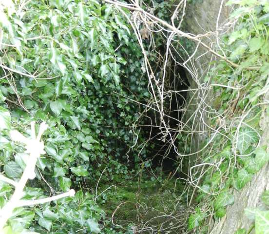
While the Domesday Book provides a marvellous written record of human settlements and activities a thousand years ago, there are also visible clues in the landscape that reveal more history. And here is one of them.
Look over the stone wall and you should be able to see some worn, moss-covered steps leading down to a pool of water below an arched structure in the bridge. For centuries there appears to have been a ‘holy well’ here. A holy well is a natural spring that in Christian legend is set flowing by a saint. It is thought that this spring provided water for travellers and was also reported to have healing qualities.
A Chantry Chapel to Our Lady and St Katherine was also built here in 1295 which looked after the ‘safety of travellers who were in danger from thieves’. The chapel survived until the Dissolution of the Monasteries by Henry VIII in the sixteenth century.
The steps and stone arch were built when the road was widened in 1902. As late as the 1950s the well was easily accessed and often photographed but today it’s overgrown and easy to miss! Although at first glance there’s not much to see, its a good example of how a small feature in the landscape can tell a bigger story of the history and geography of our landscapes.
From the mill entrance turn right onto the main road. Go past the thatched cottages (including the Old Smithy which was once the blacksmiths) then turn right into a narrow lane (by a black and white pole) called Millfield. Follow the lane past several houses to a bridge over Bromham Brook. Cross the bridge then continue through a kissing gate. Follow the grass path ahead. Stop by the large tree and take in the landscape around you.
6 Landscape transformation
Back at the mill we heard about Hugh de Beauchamp who was a local landowner and the lord of the manor of Bromham. After the Beauchamp line died out in the thirteenth century, the manor was divided into four separate medieval manors each with its own manor house and lord. We are going to visit the sites of all four manor houses on this walk.
In the mid-sixteenth century a nobleman called Sir Lewis Dyve took ownership of all four manors. He began to consolidate his grip on the land that was evident in a physical way that we can still see today. First he began to enclose the fields by fencing off arable land from the common land. Then he started creating a vast landscaped park. The peasants who lived and farmed in this area were completely displaced. This area of open parkland is part of this legacy.
By the mid-seventeenth century the actions of the Dyve family had changed the landscape completely. From this time Bromham became a closed estate village, allowing no newcomers to move in. The village stayed this way until the estate was broken up and sold in the 1920s.
We can get an excellent impression of how the village has changed over the last 150 years from looking at the Tithe Survey. The map of Bromham from 1844 shows the roads and lanes, manor houses and cottages, fields and woods. We can see exactly what activity went on where as the map is well labelled with sheep pasture, wet lands, ox yard, orchard, swine pits, dovecote, osier beds (where willows were grown for basket making) and so on. It’s a fascinating insight into preindustrial Britain. Nowadays the land’s historical use lives on in names given to twentieth-century residential streets including Orchard Close, Dovehouse Close, Woodland Road and Pear Tree Close.
Continue towards the church ahead. After a short distance the path becomes a surfaced track. Stop when you reach the stone wall of the new churchyard. With your back to the corner of the wall, look at the field ahead of you and to the right.
7 Nobles and peasants
In the Middle Ages England was under a feudal system. William the Conqueror had rewarded his supporters for their help in the conquest of England by giving land previously belonging to the English to Norman knights and nobles. These estates were known as manors. A typical manor would include a manor house in which the lord lived and a village where the peasants lived, along with a parish church.
All the land around you was part of a manor called Brayes. Manors consisted of up to three classes of land: land directly controlled by the lord and used for the benefit of his household; land and holdings tended by peasants (the lord’s tenants) who were obliged to supply the lord with products or tithes, like a share of their crops, cuts of meat or labour; and ‘free’ peasant land without such obligations but still subject to manorial rules including rents.
Medieval manors were laid out in an open field system. There were generally three large open fields each containing a different crop. These fields were split into sections called furlongs which in turn were divided into strips.
Each villager was allocated by lot a set number of strips in a field every year. On the one hand this meant that no single farmer would end up with all the good or bad land; on the other hand it meant that their strips were scattered across the estate which was not a very efficient way of working.
Look at the field ahead and to your right. In places you can see bumpy or ‘hummocky’ ground. This is the remaining evidence of these individually-farmed strips – the pattern is called ridge and furrow and was made by ploughing. As the plough cast the earth inwards it created a ridge effect.
In addition to the three main fields, a manor also had large common meadows. These were made up of common pasture land where the villagers would graze their livestock, woodland for pigs and timber, and a village green for social events. We’ll visit three such greens later.
Along with their land, lords of the manor could exploit additional sources of income such as charges for use of his mill, bakery or wine-press or the right to hunt or graze pigs in his woodland. The flour mill that we saw earlier belonged to the Manor of Brayes. The local peasants would have been obliged to have their grain milled there too – exclusively and for a charge! Clearly, noble lords in feudal England were in a rather comfortable position.
Ridge and furrow field Matt Neale, Wikimedia Commons (CCL)
Directions
Walk just a little further and stop outside the church gate.
8 The missing village
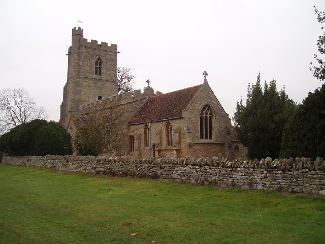
This is Bromham’s parish church, parts of which date back to the eleventh century. Though it looks like a traditional church, it’s peculiar in several different ways.
First of all it is named after the seventh-century French saint Owen (Ouen). It’s an unusual dedication – in fact there is only one other church dedicated to St Owen in the whole country. Second it has two names – historical records show that it was also called St Andrew’s Church.
The third unusual thing is its setting. Parish churches are usually at the centre of a village yet this one is isolated in open parkland. But the landscape hasn’t always looked like this. When the church was built it would have been sited at the junction of the old village footpaths and the medieval village would have been scattered around it.
We heard at the last stop how the Dyve family transformed the landscape when they created the park and this involved razing the original village. There is very little evidence of the original village left.
The Bedfordshire Historical and Environmental Record shows two areas near here which are marked as ‘DMV’ for Deserted Medieval Village. It also notes that ‘adjoining St Owens Church are traces of earthworks which are the part of the remains of the medieval village of Bromham’.
Aerial photographs have revealed linear and circular features embedded in the ground here but subsequent archaeological work suggested that these were the remnants of the ancient open field system rather than village buildings. So the site of the original village remains a mystery. The lord’s new park completely erased all traces of it. As for the displaced villagers, we will find out where they moved to later in the walk.
From the church continue on the driveway and through a gate marked ‘Public Footpath over Private Land’. Follow the path down which bends right past a yellow stone house then left to reach the black iron gates of Bromham Hall. Walk a few metres and look over the low stone wall to see the back of the large house below.
9 Hereditary possession
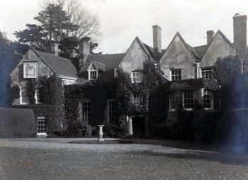
We discovered earlier that Bromham originally had one manor and this was subsequently divided into four, each with its own manor house. This was the original manor, Brayes Manor, now known as Bromham Hall.
It is difficult to get a good view of the building as it is well tucked away beneath us, but part of it is thought to date to the late medieval period with enlargements in the seventeenth century, new windows in the eighteenth century and various subsequent additions.
Various lords of the manor have lived here. We heard earlier about Sir Lewis Dyve who acquired all four manors in the village. It was subsequently passed through several generations of the Dyve family and then into the possession of the Trevors, Rices and Wingfields.
When the last in the hereditary line died the estate’s assets – comprising the manors, cottages, farms and 1,500 acres of land – were broken up into 60 lots and sold at auction between 1924 and 1926. Bromham Hall and Park was bought by the Skinner family.
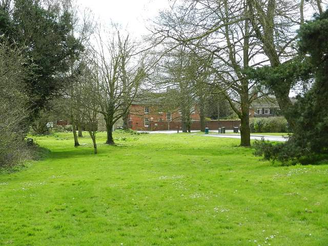
In 1938 Robert Skinner agreed a covenant with the parish council that Bromham Park should be accessible to the local population. That is why you have been able to walk through the park today; it remains private land but public access is allowed in certain places. This arrangement also meant that no new building work was allowed. As a result this part of the village has been preserved as an open green space in contrast to other open spaces which were filled in by residential housing in the post-war era.
Retrace your steps back towards the church. Cross over the stile at the metal gate. At the stone wall on the right climb over the narrow stone stile in the wall, turn left and walk back to the church porch. Follow the path around the church to the north gate. Take the right hand footpath across an open field then into a narrow footpath between hedges. At the end of the footpath is a lane. Turn left and immediately you are on the bend of a main road alongside which is a green space called Vicarage Green. Stop here.
10 The village meeting place
Earlier we heard how the lord of the manor destroyed the original village in order to create his landscaped park but the peasants still needed somewhere to live. In the mid-1600s the new village emerged here along Village Road to the left and Oakley Road to the right.
The grassy area alongside the road here is Vicarage Green. This is one of three greens in different parts of the post-sixteenth century village and we’ll visit the other two later in the walk.
Traditionally village greens were an area of common grassland at the centre of a settlement that was used for grazing. Some have a pond which served as the drinking place for livestock. Village greens also provided an open-air meeting place for local people, which could be used for festivities and public celebrations such as May Day.
This walk began on Bromham Bridge over the Great Ouse. Before a bridge was first built in the thirteenth century, the Old Ford here was the original river crossing point. The ford is just about passable today (though we strongly advise against it, especially if you are with children).
The route to the ford leads past farmland that once belonged to the estate including the original entrance to the manor. It also passes the Bromham Lake Nature Reserve which was developed out of one of the many gravel pits which have been exploited locally in the last 60 years. Unfortunately these pits destroyed several of the Romano-British settlement sites in the area. The 25-acre Nature Reserve is free to enter and we recommend a visit if you have time.
Retrace your steps away from the road and look for a yellow dirt path. This takes you across an area of open ground called The Paddock and you’ll emerge at Lower Farm Road.
From here there is an optional extension of about 3 miles there and back to visit the Old Ford. To do this follow the directions on the next page.
To continue the walk turn left at Lower Farm Road to the junction with Oakley Road. Turn right along Oakley Road. After about 50 metres stop outside a large L-shaped building on the left side called Mollivers House.
Extension directions From the exit of The Paddock, turn right along Lower Farm Road. Continue for just under a mile when the lane becomes a path. Follow the path for the last third of a mile down to the ford. The path can be very muddy after wet weather and is not advised for pushchairs and wheelchairs.
Return directions Retrace your steps and return the same way along Lower Farm Road. At the end of Lower Farm Road, turn right onto Oakley Road to resume the walk. After about 50 metres stop outside a large L-shaped building on the left side called Mollivers House.
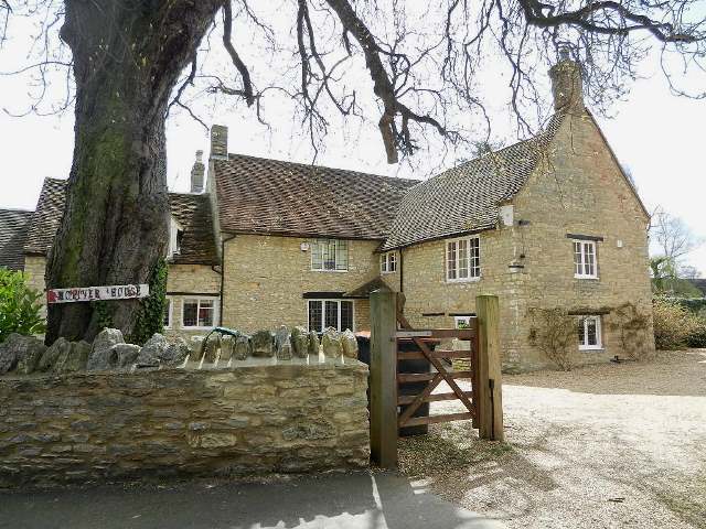
11 A second manor
This is Mollivers House which was once Bromham Manor, the second of the four medieval manor houses in the village. When the Bromham estate was sold for auction in 1926, Mollivers Farm was one of the biggest lots for sale with over 430 acres of arable land, pasture and woodland.
As well as the farmhouse there were outbuildings, gardens, farm cottages and even a blacksmith’s shop. It was described as carrying with it the title of ‘Lord of the Manor of Bromham’ and came with rights over Vicarage Green that we have just seen, as well as common land lying between Stevington Lane and Oakley Road.
Some of the buildings, including the main house here and its outbuildings, have been renovated, modernised and sensitively extended. Some of the arable fields beyond the village that belonged to the Mollivers Farm are still used for agriculture, with boundaries unchanged from when the Dyve family enclosed the land in the sixteenth century.
However some of the fields closer to the village were later sold off to property developers. Immediately behind Mollivers House is an estate of 1970s houses called Manor Close. Though not much of the original manor exists today at least its legacy lives on in the street name.
Continue along Oakley Road for another 100 metres then turn left into Manor Close. Where the road splits, keep left. Follow the road to the end where there is a footpath between house numbers 14 and 15. Follow this footpath until you come to Village Road by a bus stop. Turn left and walk 50 metres until you come to the post box by Old Yews Cottage.
12 The 'new' village
We heard earlier how the original village was destroyed to create the Dyve family’s new parkland. This was where the ‘new’ village started to emerge from the 1640s onwards.
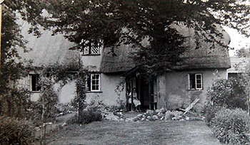
Old Yews Cottage is one of the original houses that date back to this period. Inside the cottage is a stone inscribed with the year 1651.
Like most of the other cottages of this period it was constructed from a timber frame. The walls were made of wattle and daub (a lattice of thin sticks covered in a sticky mixture made from clay, animal dung and straw) and covered in plaster. The thatched roof was made from locally-available materials such as reeds, straw and rushes.
Although considerably expanded since, Old Yews was originally a two-room cottage with back-toback hearths. This means that the two rooms each had a fireplace and since these were on the adjoining wall there was only the need for one chimney. See if you can spot other cottages like this on your walk around the village.
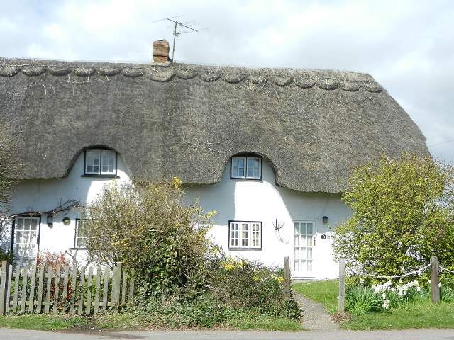
Retrace your steps back along Village Road. Immediately after crossing over the end of Wingfield Road on the right side is a row of three whitewashed thatched cottages.
13 Two chimneys, three hearths
These three cottages are known as Vine Cottages; they date back to the 1640s and are Grade II Listed. Like Old Yews Cottage that we saw at the last stop these would have been the houses of the estate’s tenant farmers in the seventeenth century.
Three centuries later it was here at number 113 that the creator of this walk, Pat Wilson, fulfilled her childhood dream of living in a thatched ‘chocolate box’ cottage.
Pat: ‘When I lived in Number 113 there was still evidence of the original plaster over wattle and daub walls. I remember how on 21st December, the Winter Solstice, the sun’s rays used to strike exactly the middle of the hearth.’
According to historical records this seems to be the only row of three cottages left in the village that have remained as separate properties rather than being knocked through into one larger house. Although the frontage is original, each of the cottages has been enlarged and modernised. The middle cottage still has the original two rooms (one downstairs and one upstairs) with modern extensions on the back.
Look up at the roof line and you can see that there are two chimneys for the three cottages. You can also see that they are not evenly spaced along the roof. That’s because Numbers 111 and 113 have back-to-back hearths and share a chimney whereas Number 109 has its own hearth and chimney.
After the ‘new’ village was established in the mid-1600s there was very little change over the next three centuries. Most of the village’s expansion and house building came after 1950 but from here we can see a few exceptions. Look back the way you came and on the right side of the road you should be able to spot a crescent-shaped access road to some red-brick houses. These were built by Robert Skinner, who had bought Bromham Hall and Park at auction in the 1920s. They were built to house his estate workers. See if you can spot the grey plaque with the initials RS and the date – 1937 – high on the wall.
Continue along Village Road for about 200 metres. When you reach the start of the triangular-shaped Village Green on the right side of the road, bear right on the grass path along the right hand edge of the green. Stop outside Greenwood Cottage which is set back on the right.
14 The heart of the village
When we stopped at Vicarage Green earlier we discovered that this village actually had three greens. On a map of 1765 this one is named as Town Green. Today it is usually referred to simply as the Village Green.
Around the periphery of the Green are some more seventeenth-century cottages including Greenwood Cottage here. It is probably Bromham’s oldest home and has dated medieval beams in its central hall.
You might also be able to spot Kerry Thatch, a house set back on the edge of the Green and Village Road. This building is another example of an extended two room back-to-back hearth cottage now converted into a modern home.
The idyllic nature of the village was described in an article in the Bedford Times from 1879 which notes that “In Bromham one finds exquisitely neat little grounds of well-kept cottages...they cannot be fairly put in competition with villages of ordinary character”.
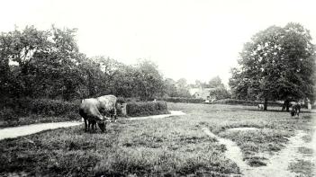
A photograph taken in 1915 shows the Green as a lovely rural scene criss-crossed by footpaths and grazed by cows. Although it was the centre of the village it was still a peaceful place. Now it is not so tranquil. The green has been cut in half by Mollivers Lane and Village Road acts as a short cut (or ‘rat run’) to Oakley Bridge and the A6.
Continue on the path at the edge of the Village Green. Cross over Mollivers Lane and continue around the paved path at the edge of the Green. At the end of the Green pass the entrance to the Village Hall on the right and stop outside the village school (almost opposite the Baptist Church).
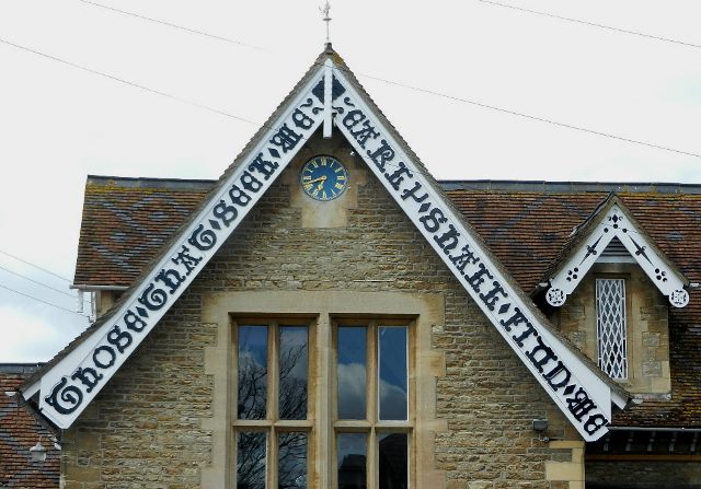
15 Those that seek me early shall find me
For Bromham Estate’s tenant farmers in the seventeenth and eighteenth centuries, life continued for generation after generation. Sons would have followed their fathers to plough the fields and graze the cattle; daughters would have followed their mothers to feed the hens and gather firewood.
It was only during the Victorian period that education emerged as something accessible to ordinary people. In this case, education was funded by the Lord of the Manor.
This is the village school which dates from 1861. It was built in the ‘Cottage Orné’ style which was very popular in the 1800s. This was a trend of designing houses which recalled ‘rustic’ cottages of the eighteenth and nineteenth centuries but were more stylised with picturesque roof shapes and ornate timberwork. They are often known as ‘chocolate box cottages’ after being portrayed on decorative boxes of chocolates.
The Lord of the Manor at the time when the school was established was actually a lady, Miss Eleanore Rice-Trevor. She emblazoned all new buildings with her initials, ERT. You can still see them to the right of the blue door. The original inscription on the gable end – ‘Those that seek me early shall find me’ – left no one in any doubt that religious knowledge was the prime aim of education.
Although Rice-Trevor brought a form of education to the village children, she was unmarried and died childless in 1897. The hereditary title passed to distant relatives who had no real interest in the estate and this was what ultimately led to its sale by auction in the 1920s. This sale and the break-up of the estate changed the character of the village forever.
Continue along Village Road then turn right into Grange Lane. Continue for about 350 metres until you reach the turning into Springfield Drive on the right. Just beyond is fenced off woodland. Stop where you have a good view into the woodland.
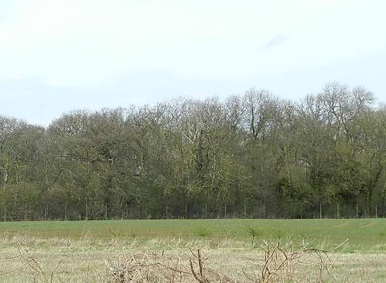
16 Ancient woodland
This wooded area is part of Bowels Wood. The name comes from Bowels Manor, the third of the four medieval manors in the village. Archaeological evidence and field names on the 1844 Tithe map suggest a possible location of the manor house but there is no evidence of the building remaining today, unlike the other two manors that we have already seen.
If you look through the fence into Bowels Wood you can see evidence that it was coppiced. Coppicing is the practice of cutting trees down to the base of the trunk. This encourages the trunk to re-grow into several poles. These poles grow faster and can be harvested periodically to provide woodland products. It was mainly hazel that was coppiced here in Bowels Wood and it would have been used for making fences, tool handles, bean poles, building poles and furniture.
Bromham village was largely self-sufficient for many centuries. The fields and meadows, woods and spinneys (small groves), orchards and the river provided all the food and materials that the tenant farmers needed to meet their obligations to supply the Lord of the Manor and to live themselves.
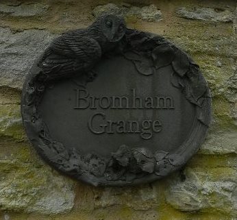
Continue along Grange Lane to the junction where there is a village sign. Turn left along Northampton Road. After about 50 metres and just before the bus stop turn right down a lane signposted as ‘Leading to Bromham Grange, Grange Court and 55 Northampton Road’, which is also signposted as a Public Bridleway. Go past several stone houses. Stop by the last house on the right called Bromham Grange just before the field gate.
17 The fourth manor
This house, Bromham Grange, is thought to be the site of Wakes, the fourth medieval manor in the village. Though there’s no sign of the manor house here now, the clue is in the name.
Buildings called Grange usually have a religious connection and we know that Wakes Manor was bequeathed to Cauldwell Priory in Bedford in medieval times. When King Henry VIII ordered the Dissolution of the Monasteries in the 1530s church buildings, land and assets were requisitioned. Bromham Grange and Bromham Church were given to Eton College but acquired by the Dyve family shortly afterwards. Later, Oliver Cromwell is reputed to have stayed here.
This small stream now running through private gardens gives us another clue to the area’s past.
Close by was the site of Bromham’s second mill as mentioned in the Domesday Survey. This was the mill stream and the flat area on the opposite side of the lane (not visible from here but you’ll see it shortly) was probably the location of a spring-fed moat used to retain water to power the mill.
On the way to the next stop you will pass Grange Court and some of Bromham’s newer buildings. When Bromham Estate was sold in 1924, one of the auction lots was Bromham Grange. In addition to the house this was a site of 130 acres with land and out-buildings. Some of these have been converted, while others were knocked down and new houses built on the site.
Grange Court is a good example. It was built in the 1990s but the use of local stone gives the houses a more traditional, older feel and helps them to blend sympathetically into the landscape
Now retrace your steps back down the lane for about 50 metres. Look for a stream running through a garden on the left.
Directions 17b Continue along the lane back to Northampton Road. Turn right and walk along the pavement for about 50 metres to a mini-roundabout where there is a right turn into Peacock Road. Walk up Peacock Road until you can see the low, bowl-shaped playing field on the right, thought to have been a mill pond.
18 Proud as a peacock
As we have already discovered, Bromham village hardly changed from the mid-seventeenth century to the early-twentieth century when the estate was broken up and sold. In the 1921 Census the population of the village was just 328. Shortly after, the division of the estate into lots for sale marked the start of a new era in the built landscape, the economic development and the social make-up of the village.
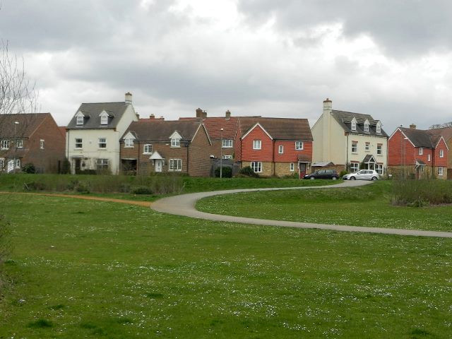
The new owners of the various plots of land each had different plans. Many fields were earmarked for housing developments. Earlier we walked along Manor Close which is an example of housing from the 1970s. Here along Peacock Road we can see a twenty-first century development of new houses which is quite typical in design of the new residential estates.
By 1961 Bromham’s population was over 2,700 and today it is about 5,000. Bromham has become a fashionable place to live. It’s also popular with commuters. It’s easy to get into Bedford town centre and access direct train services into London and Gatwick Airport. It’s also close to the M1 and Milton Keynes in the other direction. As we continue along Northampton Road look on both sides for a range of post-1950s housing. On the earlier maps this land was all open fields.
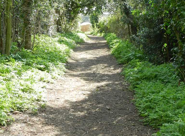
Continue along Northampton Road for a further 350 metres until you reach the junction with Stagsden Road. Do not turn right or left here but go straight ahead into an unpaved private road called Thistley Lane. Stop after passing some cottages by a wooden fence on the left.
19 How Romans built their roads
Did you notice that Northampton Road that you have just walked along was particularly straight? That straight line continues along this track, Thistley Lane, as this was originally a Roman Road.
Take a closer look at the cobbled track here just beyond the cottages. You can just see that the path is raised in the centre and falls away to ditches on each side.
The material found here and on the rest of the track has been identified by archaeologists as ‘agger’. Agger is loose material thrown up from digging ditches on either side and then consolidated to raise a cambered road up in the middle; this was how the Romans built roads.
We’re going to retrace our steps now, but the track continues past an area where a substantial Roman villa has been identified.
Retrace your steps along Thistley Lane to the road junction. Turn right along Stagsden Road and continue walking along it for about half a mile until you come to a green triangular area on the left near The Swan pub.
20 Bridges and bypasses
This is the third of the three village greens that we have visited on our walk around Bromham. This area of the village is known as Bridge End which, as the name indicates, is near the end of Bromham Bridge. This also means that we have almost come full circle on our walk.
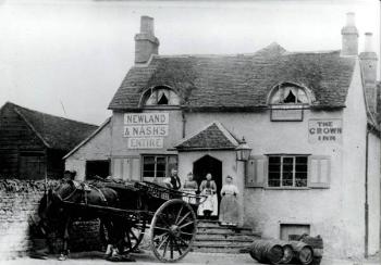
The small community at Bridge End grew to service the needs of tenant farmers at this end of the village and travellers using the bridge. Besides the mill and smithy, there were two inns – The Swan Inn on the green and the Crown Inn. Unfortunately The Crown was demolished when the bridge was widened in the early 1900s.
Bromham was located on strategic routes between Bedford and Northampton to the northwest and Bedford and Newport Pagnell (now part of Milton Keynes) to the southwest so there was certainly plenty of passing traffic. In fact, records show that by the end of the 1800s 1,021 people used Bromham Bridge daily.
A century later the situation was completely different: 2,700 heavy lorries and 12,300 other vehicles crossed the bridge every day and passed along this road. The bridge was in danger of imminent collapse and the village was suffering from the heavy traffic. The solution was the Bromham Bypass which included a new bridge over the river just downstream from the old one. The southern section of the bypass was built in 1986 and you can access it from the road past the Swan Inn here.
Meanwhile Bedford’s western bypass is due for completion in 2015. It will start about 500 metres east of the bridge and then cut northwards across the big meander in the Great Ouse to join the A6. This scheme is about more than just a road. The development includes 1,200 new houses and an industrial estate between the Bedford bypass road and the river. When it is finished there will be an almost unbroken built landscape between central Bedford and Bromham.
From Swan Green continue along Stagsden Road for another 100 metres back to Bromham Mill.
21 Continuity and change
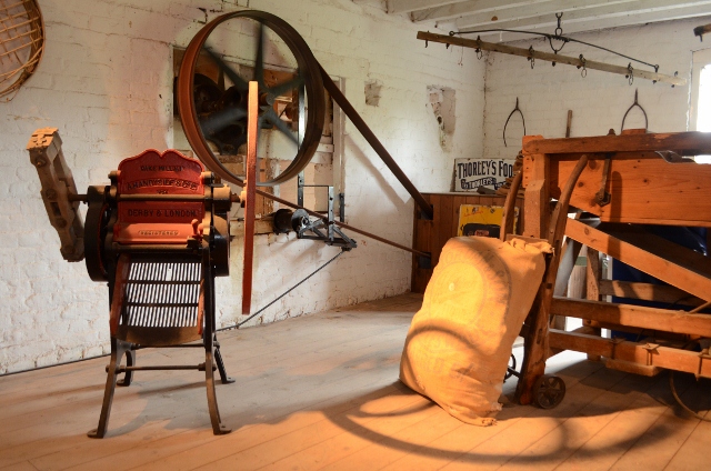
Earlier we heard how Bromham Mill was owned by the lord of the manor. It became a commercial enterprise after the medieval period and milling continued here as late as the twentieth century. The mill eventually closed in 1971.
The building became dilapidated and was also damaged by fire but it was bought by Bedfordshire County Council, restored and opened to the public in 1983. Some of the machinery has been restored and happily the mill is now in use again. You can take a guided tour or a bakery class!
Today the mill is publicly owned by the parish and Bedford Borough Council. There are proposals to develop the outbuildings into a café, meeting rooms and small workshops. There are also plans to develop Bromham Park. At the time of creating this walk it was uncertain whether the landowners, the Skinner Trust, would sell, develop or leave it as a community resource for locals.
The development plans for the mill and the park capture the themes of continuity and change that have run throughout this walk. We have explored an area that has been settled by humans for the last two millennia yet we have seen how the centre of the village has shifted several times; from the prehistoric settlers on the riverbank to the Anglo Saxon settlement around the mill; and from the old village by the feudal manor to the new village outside the park.
From the medieval period to the early-twentieth century, we have seen the continuity of generations of lords of the manor but also how they changed the physical landscape of Bromham Estate to suit their interests. We have also discovered how the peasants of Bromham lived in an enclosed and relatively self-sufficient village for many centuries until the sale of the estate brought rapid and widespread change.
With evidence of the ford, the Roman road, Bromham Bridge and the A428 bypass we have seen the contrasting and changing needs of the communication routes to and through Bromham over almost 3,000 years.
Bromham has shifted from being a rather unusual village with a fascinating heritage and some remarkable buildings to become a commuter settlement like so many others in the Home Counties. As the bypass project goes ahead and yet more new houses are built this landscape will continue to change.
We could perhaps compare twenty-first century property developers with the feudal lords in the way in which they have the power to transform vast swathes of landscape. Hopefully future developments will not erode the heritage of this special place too much.
We hope you have enjoyed this walk around the village and have discovered some of its secrets. Its growth in the last fifty years and future developments should also have given you some food for thought.
You have now reached the end of the walk. Do visit Bromham Mill and the café if it is open. To get to Bedford you can catch a bus from the stop on Swan Green.
Your browser is out of date, and unsupported by this website. Please upgrade to the latest version to use this website.
At first sight Bromham near Bedford might seem like a typical commuter village in the Home Counties. Along the main road is a mixture of old and new houses, churches, schools and pubs.
But go off the beaten track and you will discover a village with a fascinating history.
Find out why the church is isolated from its parish. Visit a vast landscaped park where a village once stood. Discover why Bromham Bridge is so much longer than the river it crosses. Also see the sites of four manor houses, three village greens and a Roman Road.
Modern Bromham is full of clues to the past and this walk explores how much the village has changed over the centuries.
Follow the walk by clicking on the map pins or downloading the guides below
You can extend the walk by visiting Bromham Old Ford
Bromham walk credits
Thanks to -
Pat Wilson for creating the walk, providing photos and the audio
Jenny Lunn, Caroline Millar and Rory Walsh for editing the walk resources
Staff at Bromham Library, Julie Betts (Bromham Parish Clerk), Lorraine Daley (Bromham Mill), Susan Edwards and Beds & Luton Archives & Records Service for their valuable assistance
David McNeil (RGS-IBG Map Librarian) and Ordnance Survey for researching and providing archive maps
Other images reproduced under Creative Commons Licences