Just before you step into Holme Fen nature reserve, stop a moment and think of the journey you took to get here.
Whether by car, train, bike or on foot you probably passed a flat landscape of vast green or yellow fields. Divided by long straight hedges and intersected by roads, these fields are occasionally broken up by large modern farm buildings or the odd clump of trees.
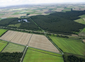
Look at the aerial picture above. The size and monotony of these fields is overwhelming. The dark green areas of trees is Holme Fen.
On this trail we’ll be asking a number of questions. Why is this small pocket of damp, forest so different to the vast fields of arable land around it? What can this place tell us about our past and future? And how do our needs (and tastes) for different landscapes change over time?
Directions
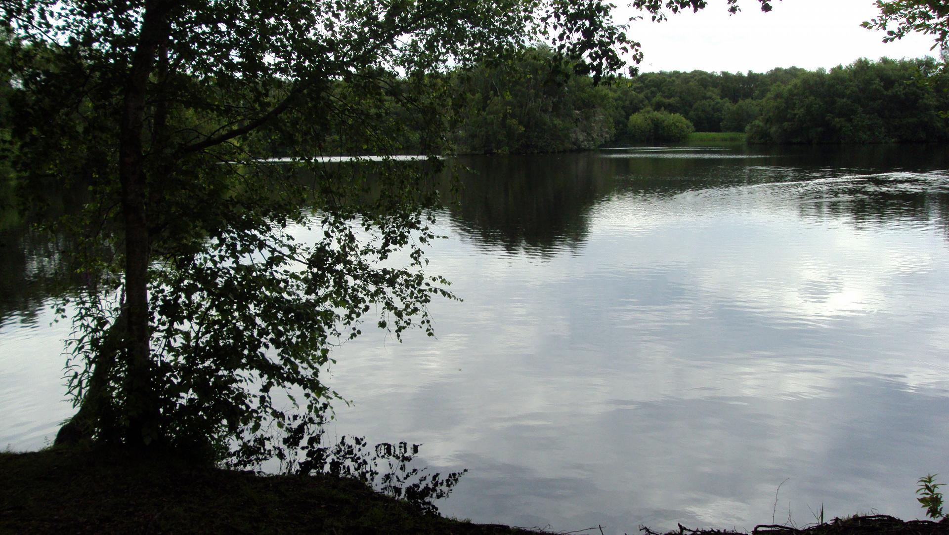
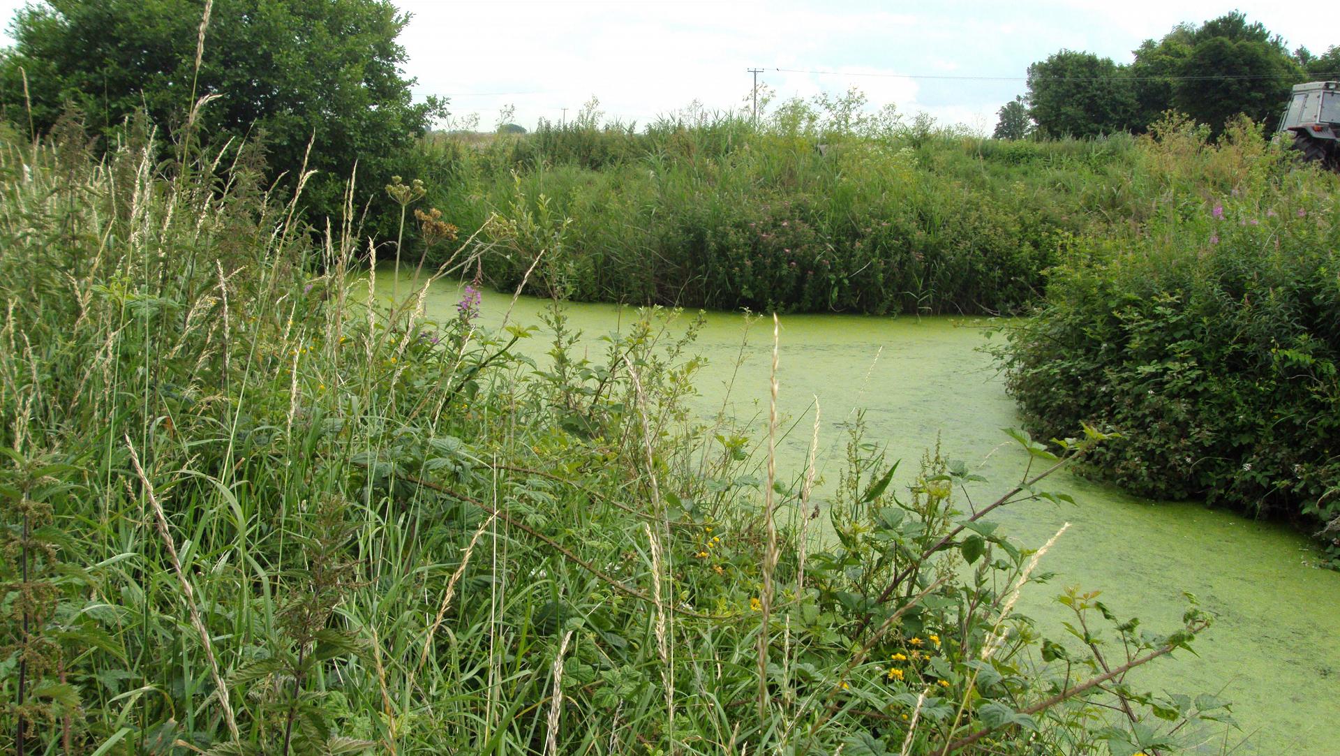
Go through the wooden gate. Follow the path ahead with the train line on your left and silver birch forest on the right. Stop in the meadow just beyond the line of the forest where you can see drainage ditches (grown over with bulrushes and reeds) either side of you.
2 Open meadow at line of forest
Stop for a moment here and close your eyes.
The first sense you'll become aware of is sound. Particularly in summer, the hum of insects like crickets, dragonflies and bees is overwhelming.
Listen out too for the calls of different birds in the woodlands and the meadow.
Now open your eyes and see if you can spot the long, straight ditches either side of you grown in with reeds, bulrushes and other water loving plants. They are literally buzzing with life. You might be lucky enough to see otters swimming in the dykes, or deer and foxes stopping to drink from them.
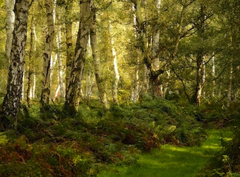
To your right the lush forest is the largest silver birch woodland in lowland Britain. This landscape feels luxuriant, brimming with life and colour. It’s been described as like a sponge. You can sense the dampness in the ground and in the air.
It's a very different experience from the arid monoculture of wheat and barley fields that make up much of inland East Anglia.
But East Anglia wasn’t always like this. The Fens of eastern England were once huge, stretching from Cambridge into North Yorkshire. This was a wild place, a vast floodplain of swamps, reed beds, slow meandering rivers and damp forests.
Myths arose that the local Fenmen had webbed feet – in reality they used stilts, punts and ice skates to make their way across the watery Fens!
Directions
Go straight ahead and stop when you reach a wooden bridge over a waterway.
3 Bridge over Caldecote Dyke
Stop here on the bridge and look down. Notice that the waterway you are crossing over is long and straight, completely unlike the rivers and streams that meander across the landscape naturally. This is one of many ditches dug across the Fens to transport water off the land.
Between 1750 and 1850 a population explosion almost tripled the number of people in Britain. Food was scarce, many faced starvation. To answer the problem, the Fens were systematically drained and this natural wilderness transformed into miles of intensive farmland. Hundreds of miles of regimentally straight drainage ditches like these were dug to drain the soil for growing crops and grazing sheep.
Draining the land
The Romans first tried to drain the Fens, but it wasn’t until the seventeenth century that work began in earnest to separate the water from the land. A group of wealthy landowners the ‘Gentlemen Adventurers’ hired the Dutch engineer Cornelius Vermuyden to help them turn these 'unproductive wetlands' into valuable fields.
Vermuyden created a scheme using drains and wind power to pump water out of the Fens and into major rivers, which in turn emptied into the North Sea at the Wash. Captured Scottish soldiers and Dutch sailors were pressed into service cutting ditches by hand.
Protest and progress
Imagine being a peasant here in the Middle Ages. You make your living from the water – shooting waterfowl for the London markets, fishing for eels, cutting reeds for thatching and peat for fuel.
Draining the Fens spells an end to your livelihood. What would you do?
A group of men known as The Fen Tigers tore down the dykes, ditches and sluices, and set reedbeds on fire but they couldn’t prevent ‘progress’ and by the end of the seventeenth century much of the Fens had been drained.
Directions
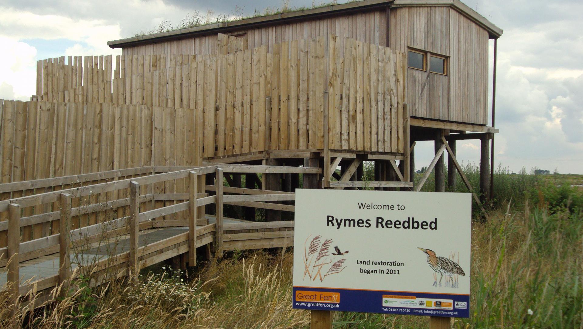
Cross the bridge and continue on the well marked path straight ahead until you reach the wooden lookout building.
4 Trundle Mere lookout
Look at the map and see if you can find an area labelled Engine Farm. From the windows of the lookout, you’re looking for a row of tall trees at roughly two o’clock.
This flat, featureless farmland might not look like much today, but the location of Engine Farm was once the site of Whittlesea mere, the largest lake in England south of the Lake District.
At three miles across, the mere was vast. In the summer sailing regattas were held, in winter ice skating races. People travelled from London to sail on the mere, and some skated here all the way from Cambridge and Ely. It was both a livelihood for local people and a tourist destination.
Seventeenth century travel writer Celia Fiennes described it as: "a great water…which looked like some sea it being so high and of a great length…when you enter the mouth of the mere it looks formidable"
The picture below shows the site of the mere today. The most powerful steam pump of the time was brought from the Great Exhibition in London to drain off the water, and by 1852 the mere had disappeared.
This lookout is a good place to understand the effect this had on the landscape. From here you can see both the cultivated farmland and fields of colorful grasses and reedbeds which have been untouched by the plough and encouraged to return back to their natural state. At the final stop on this trail you’ll be able to see for yourself the dramatic effects that human intervention had to utterly transform the land right under your feet.
Directions
From the lookout turn right and continue skirting the edge of the woodland. At the end of these woodlands, turn right again and follow the path with the woods on your right and field on the left. When you reach a bridge over a dyke with farm buildings ahead, turn right and continue to follow the edge of the woodlands to your right. Keep a look out for a small wooden bridge, which crosses over the Caldecote ditch to your left. Cross over the bridge. You will immediately turn left to continue the walk. However, it’s a short detour straight ahead to a pause point at Burnham’s Mere.
5 Burnham's Mere
Sit quietly here at the edge of the mere amongst the silver birch trees and watch the bird life on the lake.
Though this lake was man-made in the 1980s and isn't natural at all, it’s gives you some idea of how Whittlesea Mere might once have looked like (albeit on a much smaller scale).
It's a good spot for a picnic or to play at the water's edge for a while and enjoy the birds and animals who are returning to the Fens.
Directions
Head back to the bridge (but don’t cross over) and follow the other side of the ditch, back in the direction you came from earlier but on the other side. Continue until the edge of the woods, and turn right, continuing to follow the edge of the woods to your right. At the road, turn right and follow the road until you reach a small parking bay on your right, opposite a bridge on your left. Cross the bridge to reach two tall green posts sunk in the ground.
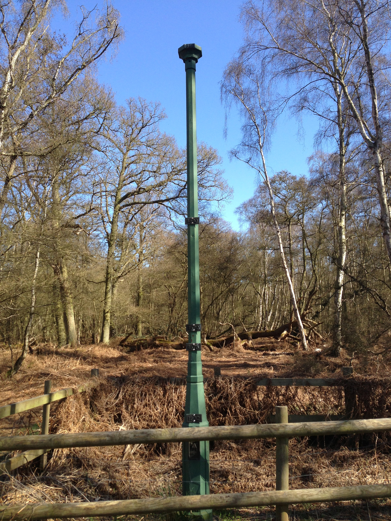
6 Holme Fen posts
Take a look at the green post on the right. Around 150 years ago the very top of this post was level with the land. It’s now 4 metres above ground level.
So what happened to shrink the land so dramatically?
After the Fens were drained, the water levels in the ground were vastly reduced and the peaty soils dried out.
Without water the peat began to decay and its light, dry particles were easily transported by the wind. The land was literally blown away, and the ground was scoured down lower and lower. Today the Fens are the only large expanse of Britain that lies below sea level.
But why has this pocket of Fens survived the transformation from wild wetlands to industrial scale farming?
Despite drainage, the area around Holme Fen was still considered too wet to be put under the plough. The result is a pocket of fenland history.
Today we value these places and are shocked, angered even, at how landscapes like this were destroyed to create hundreds of acres of sanitised farmland. Yet we all enjoy the 5,774 million loaves of bread, 2.5 million pints of beer and 228 million litres of milk produced in East Anglia and value the jobs that farming and food provides.
Do we preserve our rare landscapes or develop the land for food? Today we’re lucky in that we can (almost) have both.
An ambitious 50-year scheme, the Great Fen Project, is restoring 3,700 hectares of Fenland by linking up two reserves at Woodwalton and Holme Fen. By buying back the land from local farmers and returning it to wetlands, reedbeds and forest, the Fens are now expanding rather than shrinking!
In many ways the Great Fen will be a man-made artificial reconstruction of a lost wilderness. But is it more natural than the arable fields that surround it?
There is no single view of what is natural or even what we mean by countryside, but hopefully this trail has opened your eyes to some of these issues and shown you how in even a small pocket of Britain, our landscapes are truly diverse.
Directions
To return to the start of the trail, return to the road and turn left. Walk a short distance back to the layby and information board where you started.
Your browser is out of date, and unsupported by this website. Please upgrade to the latest version to use this website.
At seven metres below sea level, Holme Fen is the lowest place in Britain. It's also the largest birch woodland in lowland Europe and the most south-easterly example of a raised bog in England.
Holme Fen is also an island, although not the kind of island you might expect. It's one of the few tiny areas of surviving wild fen to exist among hundreds of square miles of arable fields.
Discover what happened to our Fenland and why its loss has been described as ‘the greatest single ecological catastrophe that ever occurred in England’.
Follow the trail by clicking on the map pins or downloading the guide below

.jpg "Stalking wildfowl in the Fens © Yaxley history society")
.jpg)