Lady Anne’s Drive is where most people park their car to access one of the best-loved beaches in Britain. Not many stop to think about the car park. But before we head for the beach lets look around for clues that point to how this landscape has changed.
At the top of the drive, to the right of the path, the first thing to notice is the overgrown body of water. This is not a natural pond. It is a ditch and one of many that were deliberately dug to transform the landscape for human advantage. We’ll find out why later on the trail, but for now let’s see what other ‘man-made’ features we can spot as we continue down the drive.
A gentle speed bump halfway down the road slows down cars anxious to get their parking space. Even this bump in the road has a story! Until 50 years ago there was a train line here. The bump in the road is all that’s left of Holkham’s railway station. Built in 1866 it connected Wells, Holkham and Burnham Market but due to falling passenger and freight numbers it closed in 1952.
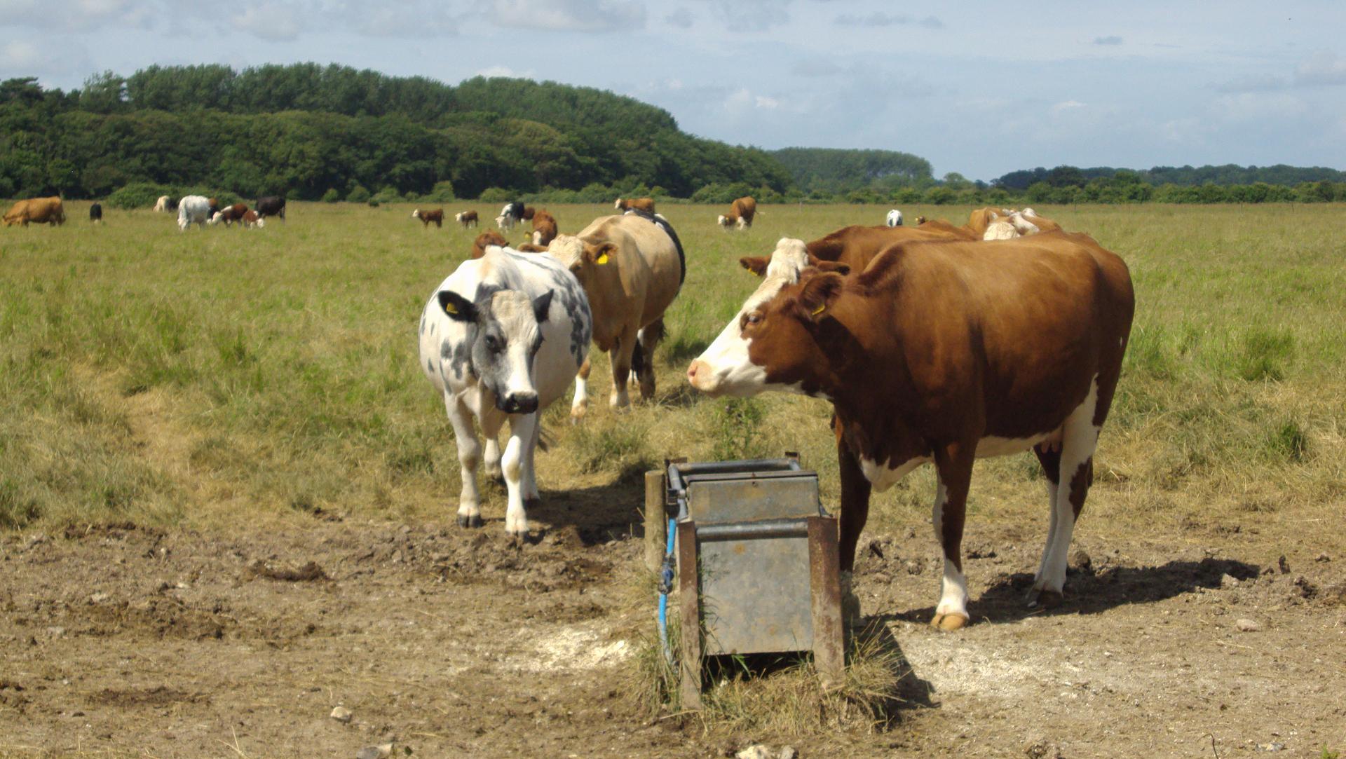
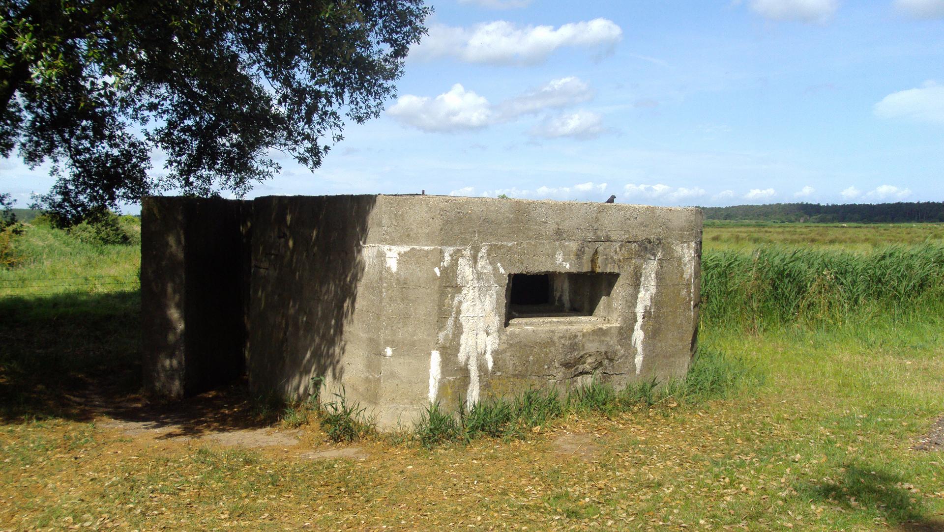
On the left hand side of the drive about halfway down, keep an eye out for a square grey concrete building. This is a Second World War pillbox built to defend the coast from a possible Nazi invasion. You’ll see more (on the other side) as you continue down towards Holkham Gap. Hopefully you’ll also see Jersey cows grazing in these fields; none of these would have been here if it hadn’t been for man’s intervention in the landscape beginning almost 400 years ago.
Just before you reach the trees and picnic benches at the end of the drive, look up to the right and you’ll see an embankment of elevated land. This is another artificial feature - a wall built to keep the sea out. Remember these clues as we continue on our trail.
Directions
Where the drive ends, continue ahead to a signpost and take the path to Holkham Beach. Follow the wooden boardwalk until you come to a forest of conifer trees on the right.
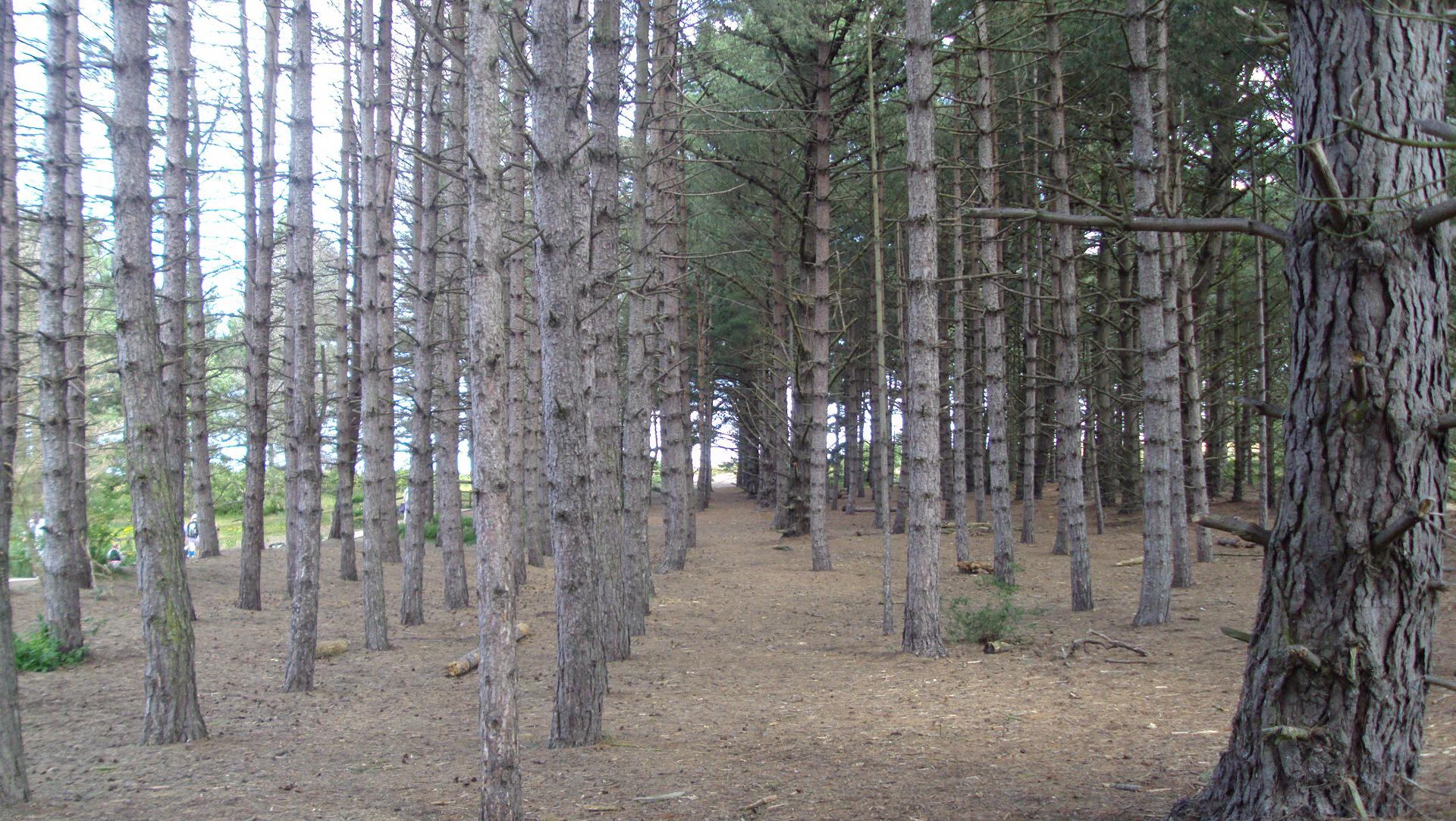
2 Pine woods
Step off the boardwalk and into the woods. Take a deep breath and enjoy the delicious crunch underfoot as you snap the pine needles releasing their unmistakeable scent. Now look again. Have you noticed that all these trees are the same? Notice too that unlike natural woodland, they have all been planted out in straight lines like rows of soldiers.
The trees here are a mix of Scots Pines, Corsican Pines and Maritime Pines. You’ll often find these trees planted in coastal areas because they’re fast growing and tough. This forest was deliberately planted here as a windbreak to shelter the grazing fields behind. The trees absorb both the winds coming off the sea and sand blown across from Holkham’s dunes. They also help to create a sense of expectation and suspense for what lies beyond...
Directions
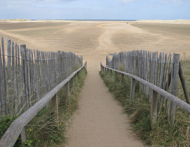
Return to the boardwalk emerging to the wide-open view of Holkham beach and sand dunes. Stop here by the benches overlooking the beach.
3 Holkham Gap
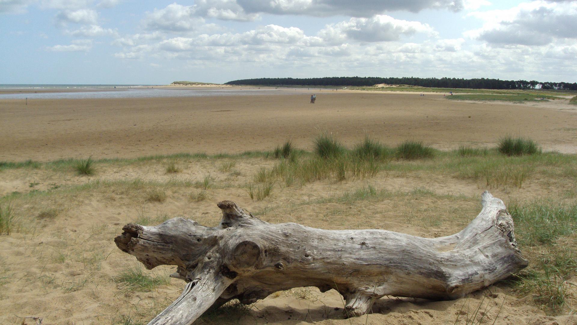
The reward for our long walk down Lady Anne’s Drive and through the woods is this stunning view of the beach. The wide endless sands, huge skies, blue water and backdrop of cool green pines lure those looking for peace, solitude, wilderness and an antidote to the fast pace of the world.
The beach might seem ‘untouched’, ‘natural’ and wild but Holkham beach is carefully managed and rules govern what people can and can’t do here. The area below the high water line is managed by Natural England and further along the beach you’ll see areas fenced off to protect nesting birds. The area above the high water line is owned by the Holkham Estate who controls access to the sand dunes.
But look around and you’ll see that there’s more to Holkham than just its glorious beach. This is a complex landscape that rewards a closer look.
We’ve already passed through grazing fields and a pine forest - two very distinct landscapes. The beach area is divided into areas of sand dunes, saltmarsh and the foreshore.
You’ll notice that the open sea is still quite a walk from here. To reach it, bathers have to cross a wide expanse of sand and pass through a row of sand dunes. It’s almost as if the beach area is divided in two. This area ahead is a lagoon. At high tide it can be filled with water but if the tide is out you’ll see grass growing on the sand. This is an emerging salt marsh.
Salt marsh is a key feature of the North Norfolk coast. They can take thousands of years to form and are hugely important as storm barriers to combat coastal erosion. These dynamic environments have not been created or manicured by humans and provide habitats for rare birds, plants and other marine life we can all enjoy.
Directions
Turn left and follow the Norfolk Coast Path signs along the top of the foreshore towards Burnham Overy Staithe.
4 Along the high water mark
As you continue following the Norfolk Coast Path see if you can trace the high water mark on the sand. This is the furthest point the waves reach inland and is marked by the sand changing colour from dark to light. Notice the unbroken, wavy line of shells and seaweed deposited by the waves. This is known as the wrack line. The natural and man-made debris washed up here is tide wrack.
Like much of the coastline the wrack line is dynamic, moving debris around the coast. The hilly sand dunes to our left are another dynamic coastal feature. Washed by the tide and whipped by the wind, the sand has formed into drifts and dunes on old shingle ridges. The dunes are established when sand is trapped in the ridges and stabilised by tough plants, like spiky marram grass, whose roots bind it together. Over time the dunes develop vegetation and become permanent grassland.
Directions
Continue ahead keeping an eye out for a viewing area (with a wooden platform on the left (marked on the map as Burrow Gap). Go left through the gap and enter the pine trees. Follow the path then take the path off right to the bird hide tower and go inside.
5 Bird hide
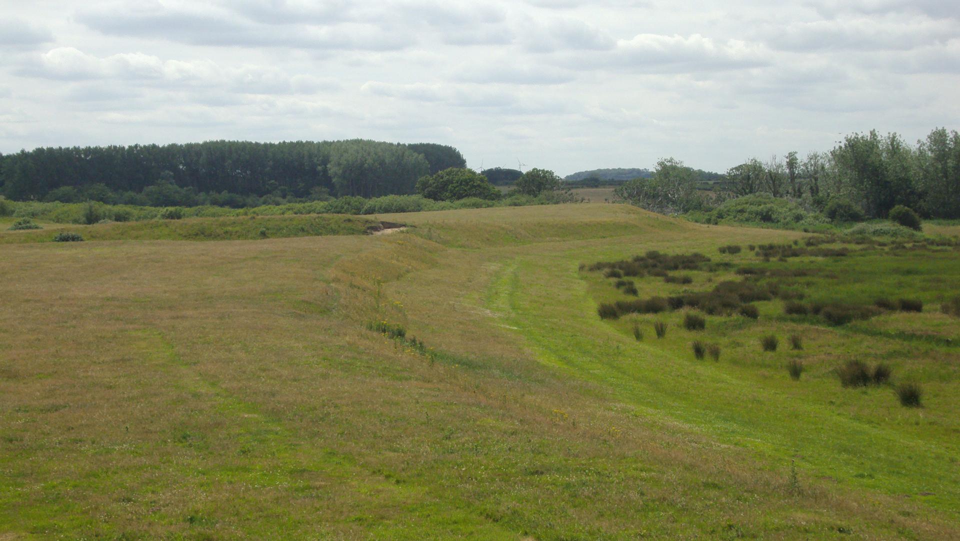
Take a seat inside the bird hide and enjoy the view out across the fields to a line of trees and the coast road. Peeping out over the treetops you can also make out the tower of St Withburga’s church and the top of a tall monument.
Directly ahead look for a raised embankment of land. This is probably the earliest example of human intrusion on Holkham’s landscape. This raised bank is all that’s left of an Iron Age fort built between 650 BC to AD 43 by the Iceni, the local warrior tribe led by Boudicca.
Compare the artist’s impression of the fort above with the landscape you can see beyond the hide. You can still see the ditches and embankments and also the long, flat causeway that led to the fort. On either side is lush, green grazing pasture. But look again at the artist’s impression and you’ll see that the Iron Age fort was surrounded by twisting creeks and marshland.
The warriors who established this fort chose the location because it was easy to defend. The fort was built on what was then a spit of sand isolated from the mainland by tidal salt marshes and creeks. The only access was along the raised causeway. Cows now graze grass-rich fields, which would have been home to seabirds and otters. Soon we’ll find out why.
Directions
Return to the main path and turn right to continue on the track. Stop on the road between a large red-tiled house on one side of the track and a barn on the other.
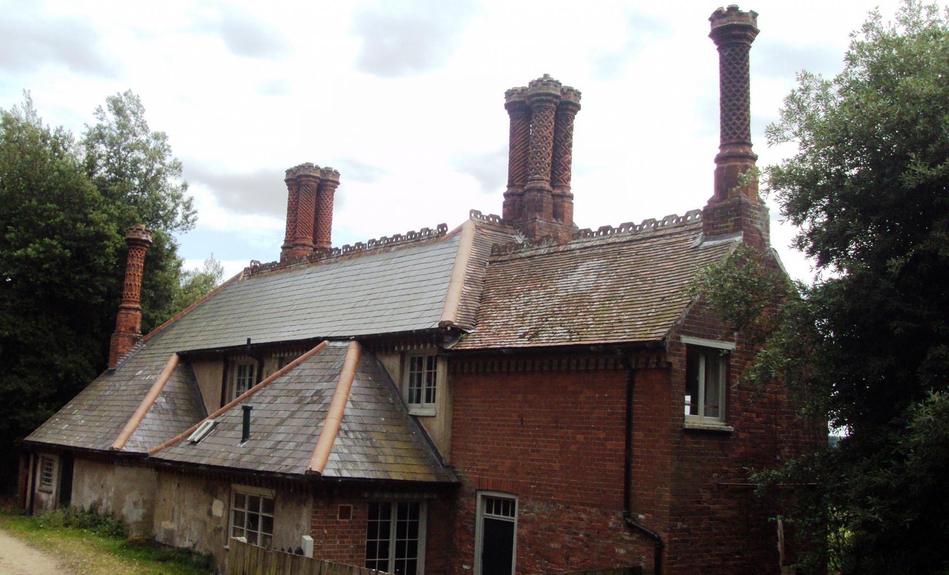
6 Meals House
The house and barn are further clues to the way this landscape has been shaped over time. This building is marked on the map as Meals House. But who would live out here in this remote and lonely spot?
If you’ve visited the gift shop for Holkham Hall then the ornate chimneys might look familiar. This house belongs to the Holkham estate, the seat of the Coke family who became famous for (and rich from) pioneering new methods of agriculture. We’ll find out more as we continue the trail.
Directions
Pass Meals House (noticing another drainage ditch in the garden) to continue on the path until you reach a pond called Salt’s Hole.
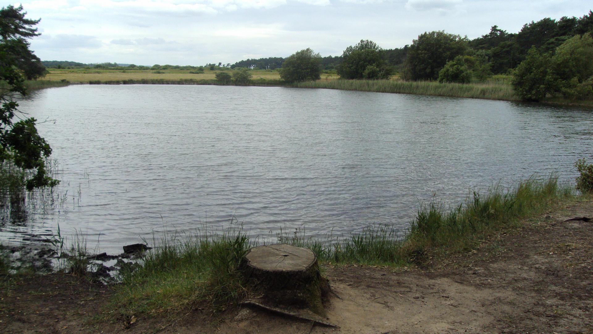
7 Salt's Hole
Stop for a while and rest here at this pond. This is Salt’s Hole and as it’s name suggests it is filled with salt not fresh water. Taste it and you’ll find it’s salty. Look closely and you’ll see animals like sea anemones. So why do we find a salt-water pond here not connected to the sea?
Look on an OS map and you’ll see this pond is one of many odd-shaped bodies of water that dot this coastal landscape. This unassuming pond is in fact evidence of a huge landscape change. The ponds are the last vestiges of a large system of tidal creeks and salt marsh that once stretched from the beach behind us to where the coast road runs through Holkham village ahead. Look again at the map and you’ll see the coastline east and west of Holkham is marked as salt marsh indented with twisty creeks. So why is the landscape at Holkham so different to its neighbours?
Directions
Continue on the path towards Lady Anne’s Drive where we started the walk. Stop by the picnic benches and signpost where you have a good view of the top of the monument through the trees.
8 Picnic benches top of Lady Anne's Drive
The monument was built to commemorate Thomas Coke, a celebrated pioneer of Britain’s agricultural revolution who inherited Holkham Hall in 1776. Among his improvements were advanced breeds of sheep and cattle and the Norfolk four-course crop rotation, which increased yields and reduced disease.
It was the Coke family and other local landowners who redesigned this landscape and transformed what were once natural creeks and salt marshes into productive farmland. From 1639 onwards embankments and sea walls were constructed and ditches dug to separate the sea from the land, draining the salt water away to create new land. This wasn’t the only impact the Coke’s had on the area. The original village of Holkham was moved to make way for Holkham Hall and its estate. Thomas Coke himself bragged ‘I am Giant of Giant Castle, and have ate up all my neighbours…’
Look at the map of below and you’ll see ‘Holkham Staith’. Staithe is Old Norse for landing stage. Holkham village was once a busy port where cargo was unloaded from boats that were able to sail in via a navigable creek. You can also see from the map that the ‘staithe’ is connected to the sea at Holkham Gap via a straight channel of water. This straightened creek is now Lady Anne’s Drive and the car park.
From ditches to cows, a raised sea wall to conifer trees, farm buildings and saltwater ponds, we’ve found several clues on the walk today that have pointed to this hidden story of landscape change and how Holkham was transformed and made productive and profitable.
On a windy, wintery day the beach and the dunes can still feel wild and unruly but it’s worth remembering how much humans have intervened in our desire for progress, improvement and profit.
Directions
Continue up Lady Anne's Drive to return to the start point.
Your browser is out of date, and unsupported by this website. Please upgrade to the latest version to use this website.
.jpg)