1 Welcome to the heart of The National Forest

Welcome to this Discovering Britain walk near the village of Overseal in The National Forest created by Dot Morson, a retired Geography teacher and local walk leader.

The walk takes you through what was once the Leicestershire and South Derbyshire coalfields, since transformed into The National Forest.

The National Forest is a forest in the making. It’s a bold, ambitious scheme to create a brand new woodland by planting millions of trees over 200 square miles spanning South Derbyshire, Northwest Leicestershire and East Staffordshire.

On this walk we’ll find out how this area of the Midlands was transformed by the discovery of coal and how local villages like Overseal and Moira were affected by industrialisation. We’ll hear about the impact not just on the physical landscape but also on the local economy and wildlife. We’ll see the last traces of these industries and discover how they have been transformed from sites of derelict buildings, pit waste and subsidence into brand new woods, lakes, walking trails and parkland. As we walk, we’ll look for clues left in the landscape of its past use. So keep your eyes open, be curious and ask questions.

This walk is a moderate circular route of seven miles on field paths, all-ability tracks and woodland rides. Some are rights of way and others are permissive paths where landowners have provided access to their ‘new’ woodlands. There are four stiles to cross and some of the ground can be muddy after heavy rain so good walking shoes or boots are needed. Binoculars would be useful too. We hope you enjoy the walk!


Burnet moth
© Barry Morson 
Directions

From Conkers Waterside car park, walk between the children’s play area and the canal basin keeping the miniature railway on your left. Just before the tunnel turn left over the level crossing onto the Ennstone Trail. Stop when you reach a grassy area to the left of the path with a stone picnic table.

2 From black coal to green trees

Sitting in this peaceful, wooded spot it might surprise you to learn that there was once a smoky, noisy coal mine right here. Rawdon Colliery was located just on the other side of the steep railway embankment across from us.

Railway sidings covered a large part of this area. Trains were shunted along tracks and wagons filled to take ‘black sugar’ to the nearby thermal power stations in the Trent Valley. The environment was dirty, dusty and noisy. Colliery waste was dumped in the area just behind us.

This part of the East Midlands is very rich in coal and there were once hundreds of mines in the area. The Coal Measures – layers of sandstone, clay, mudstone and coal – were formed during the Carboniferous period about 310 million years ago (carboniferous means coal bearing). Much of England was once a hot, humid environment just like the Amazon rainforests of today. Plants grew quickly and rotting vegetation built up over time then became buried and compressed to form coal seams. We can still see fossilised plant remains – like ferns and thick plant stalks – impressed in the coal.

At Conkers Waterside where we started the walk a large range of buildings once provided support for the nearby coal mines. There was pit prop storage and repair workshops, offices and a laboratory, garages for lorries and a shed to repair the diesel locomotives. All these signs of past industry have now gone.


Fossilised stem in coal
© Dot Morson 
Directions

Walk under the railway bridge and follow the gravel track uphill. Stop at the next stone bench.

3 Merry go round

This rural landscape of fields, trees and hedgerows was once the site of one of Derbyshire’s biggest collieries. If you’d stood here 25 years ago the area would be entirely different.

Along with the colliery structures the landscape was dominated by a sprawl of concrete and steel in the form of a ‘merry-go-round’ built to transport the coal. Trains pulled empty wagons slowly past long chutes which filled each wagon with coal. The train then transported the coal on to nearby power stations in the Trent Valley to generate electricity.

The system was effective as the trains could be filled on the move but, as you can see from the photograph, the merry-go-round took up a lot of space and was something of an eyesore. Domestic coal was transported by road on uncovered lorries which made the surrounding areas even more dirty and congested.

Coal mining was hard work. The coal was also prone to spontaneous combustion. The underground coal seams varied in thickness and were badly faulted making mining it dangerous work. Yet the mines provided jobs and brought prosperity to the area.

Rawdon Colliery was worked for about 150 years until it became uneconomic and the government’s energy policy changed to promote cleaner sources of power generation. When Rawdon Colliery closed in 1989 over a thousand jobs were lost. It wasn’t just the mine that suffered. The UK Mining Research establishment was affected. Their research to reduce working hazards and develop new machinery was privatised. So was the mine rescue service. Local firms that serviced the industry such as haulage contractors were also forced to find new business opportunities.


Rawdon Colliery over Woodville Road, c1984
© Graham Knight
Directions

Continue up the track until you reach a footpath sign on the left. Take the route signposted towards Measham. At the next junction go through the narrow metal barrier straight ahead between the modern Youth Hostel on the left and a Camping and Caravanning site on the right. Stop on the access road to look over at the Youth Hostel building.

4 Wake up in the forest

Twenty years ago this was one of the last places anybody would choose to come on holiday. Spoils from disused coal mines and clay pits scarred the landscape. People who lived here describe the area then as uniformly grey. Now it’s a very popular place to come to get away from it all.

The striking wooden building is a brand new Youth Hostel with beds for 80 people; opposite is a Camping and Caravanning site. Both of these are often fully booked especially during school holidays.

Since the creation of The National Forest twenty years ago tourism has brought more and more visitors to the area. It’s not just forests they’ve come to enjoy but the whole area has been reinvented as a place of outdoor recreation. Walking, cycling, horse-riding, fishing and husky dog rides are just some of the things to enjoy. There are outdoor concerts in the summer, comedy festivals, forest theatre and food festivals.

The eco-friendly Youth Hostel with its glinting solar panel roof has won awards for its sustainable design. The solar panels form a shaded veranda over the south facing side of the building and as much natural light is used as possible. The building’s design includes measures to reduce energy consumption and the drainage system is sustainable and rainwater is recycled. A woodchip boiler heats the hostel with fuel sourced from trees grown in The National Forest. Food is locally sourced keeping food-miles down and supporting local producers.


YHA National Forest
© Dot Morson
Directions

Cross the access road and follow a surfaced path to the right. The path goes downhill to reach a road at the edge of Spring Cottage. Cross the road and turn left. Pass the county boundary sign to a metal gate on the right and a footpath sign. Follow the hardcore path uphill and walk alongside a canal on the right. Pass several ponds on the left. Stop when you reach a low black post listing the names of the different coal seams.

5 Where there's muck there's brass

Stand here for a moment and enjoy this scenic spot. There are new woodland plantations off to one side and ahead is a landscape of heathland and ponds. You might hear skylarks overhead or the plop as a great crested newt or grass snake explores the ponds. 

But just forty years ago this landscape looked very different. This was once a huge industrial site dominated by a coal mine and a clay pipe factory.

Look closely at the photograph. You can see the terminus of the Ashby Canal on the right. Coal barges are moored on the canal and the railway sidings are visible at the extreme right. An opencast clay hole is top left and the pipe works factory is in the middle, complete with its drying sheds and kilns. There’s absolutely nothing left of these industries today; the only evidence they ever existed are photographs.

What these images don’t show is the air pollution. Great swathes of smoke belched from the kilns and chimneys. Salt glazing, an important process in the production of pipes, produced hydrochloric acid when salt was thrown onto them and this gave off an acrid smell that permeated the area especially on foggy mornings. Noise, dust and grime were the norm. Locals described the area as Dickensian even as recently as the 1970s. Wildlife was lacking apart from fox families and rabbits that made their homes in the clay holes.

The Robinson and Dowler factory was one of four different companies located here to make sanitation pipes using the local fireclays. Fireclays are ‘fossil soils’ on which the coal forming plants grew in the Carboniferous period. They’re found underlying the coal seams.

They are called fireclays because they can resist heat and they were originally used to produce the bricks to line blast furnaces. Fireclays are still used in the manufacture of a wide range of clay products including bricks, chimney pots and clay pipes.

After the Second World War open cast mining developed here; coal could also be extracted as a by-product at the same time as the clay. When Robinson and Dowler had their factory on this site it was a classic example of ‘where there’s muck there’s brass’!

The clay itself couldn’t be used immediately and had to be stockpiled to ‘weather’ before use. These piles of drying clay and huge open cast holes gave the local landscape an ugly appearance. The clay industry did have a positive side, though, and not just in providing employment for local people. In Victorian times, people’s health improved worldwide as drainage pipes were sold throughout the Empire to establish sewage systems in major cities like London, Birmingham and Calcutta.


Robinson and Dowler pipeworks in the 1920s
© Magic Attic Archives 


Directions

Continue along the towpath. Stop at the end of the short stretch of canal on the right.

6 Black gold

We heard at the start of the walk about the deep underground mine at Rawdon Colliery (now transformed into the Conkers Waterside park). Rawdon was just one of several coal mines in this part of the East Midlands. In fact coal has been mined in this area for over 600 years.

The inspiration, power and finance behind the district’s industrialisation came from Frances Rawdon Hastings. He established the Moira Mining Company during the
Victorian era and owned over five deep mines.

One of these coal mines was sited just a few yards from where we are now - Reservoir Colliery. The coal dug here was six feet thick and the mine proved to be very productive. The coal from Reservoir Colliery was excellent for domestic use; it burnt clean and bright and was particularly popular in the Oxford colleges and in London.

Reservoir Colliery was also known as Cut End Pit. A ‘cut’ is another name for a canal and the short stretch of water we can see here was once the terminus of the Ashby Canal. The Ashby Canal was built to transport coal from the local mines. Coal was carried from the pit by horse-drawn wagon and then loaded on to coal barges here at Wadlands Wharf. Most of the coal was shipped south along the Ashby Canal which linked to the Coventry Canal and then the Grand Union Canal all the way to London. Reservoir Colliery closed in 1947.


Wadlands Wharf coal barges
© Magic Attic Archives 
Directions

Just after the end of the canal turn left. Turn left again at a fork in the path. With a pond on your left follow a stony path uphill towards the plantation of tall straight trees. When the stony path bends up to the right, turn left through a gap in the fence. Turn right then walk uphill to the edge of woodland. Stop on the woodland edge and turn round to look back across the site we have just walked along.

7 Wildlife returns

Mining, whether surface or deep underground, is very destructive and damaging to the natural landscape but, as we can see here, this damage is reversible.

The wetland area we have just walked through (known locally and rather prosaically as Towpath Site) is a fantastic example of how The National Forest scheme has re-landscaped areas that were once scarred and redundant.

Planning permission for the restoration of this site was approved in 1999 and by 2003 the area was relandscaped. Open woodland was planted with a mix of native shrubs and trees.

A string of ponds created along the valley bottom (the county boundary between Derbyshire and Leicestershire) provide a habitat for over-wintering waterfowl. Great crested newts, grass snakes, frogs and toads all find homes in the smaller ponds on the edge of Overseal village where a nature reserve has been established.

Marsh orchids flourish in the wetland areas, as do dragonflies and damselflies. The scrub of willow and hawthorn provide cover for many summer migrant birds. As we walk along listen for sedge warblers and the distinctive call of cuckoos.

On balmy summer evenings you might see a long-tailed swallow, a swift (recognisable by their distinctive sickle-shaped wings) or a house martin feeding over the ponds. The open grassy areas are nesting sites for skylarks - their distinctive sweet song, sung on the wing, is a common sound here in South Derbyshire.

From April through to October you can see a wide variety of butterflies feeding alongside the grassy tracks and paths here. Some rare species have colonised the area including the delightfullynamed dingy skipper and grizzled skipper. Their favoured habitat is old quarries where a yellowflowered plant called bird’s foot trefoil is found growing.

A heathland habitat has begun creeping back with heather starting to colonise one corner of the site. This area of the Ashby Woulds was originally heathland before it was industrialised, so this is natural regeneration of the landscape that was found here before the extractive industries shored it up for coal and clay. It’s a place to stop and wonder at the recuperative power of nature.


Kestrel
© Gordon Hudson 
Directions

Take the middle track through the poplar plantation which veers left through rows of trees eventually heading for a phone mast up on higher ground. Turn right at the top of the hill and then left to a gate and a stile. Stop by the stile and turn round to find out about the wood in front of you.

8 Timber!

Dot: “The first time I came to this spot, in the summer of 1972, I was faced with an earth bank and fence masking a large hole in the ground that was being mined for clay and coal. I was staggered by its size and colour. There was no green to be seen, only mounds of grey clay, deep hollows and earth-moving machinery. I didn’t use this right of way again for another fifteen years or so. Nothing attracted me to this landscape on my doorstep.”

We can see that this former mining land has since been converted to woodland as part of The National Forest scheme.

The poor quality heavy clay soil here has little agricultural value so it has been planted with poplar trees to generate a quick timber crop. Notice that it doesn’t look like a normal forest. The trees are all the same species and have been planted in straight lines. The forest has been deliberately designed like this for easy woodland management. These trees grow rapidly and will be thinned soon to provide woodchip for the increasing number of wood fuel boilers being installed in the area.

In one respect this continues to be a commercially-exploited landscape. The poplars are planted, felled and sold but unlike coal or clay they are renewable and can be planted again.

As well as the poplar plantation, a mixture of broad leaf trees including oak, ash, silver birch and other native species have been planted here to add variety and habitat
diversity.

There is also a small reservoir which is home to plenty of freshwater invertebrates and insects such as dragonflies.

While you’re here see if you can spot a kestrel hovering overhead or a sparrowhawk suddenly dropping from the sky to attack its prey. You might see them hunting over the mown woodland paths or hear the distinctive sound of buzzards mewing above you. There has even been a sighting of a nightingale in these woods, the first in this part of South Derbyshire for over 50 years

 
Wadlands Wood
© Barry Morson 
Directions

Cross the stile then follow the lane to a road. Turn left at the busy A444 then walk downhill. When you reach the fenced-in reservoir on your left cross over the road carefully. Turn right down Green Lane which becomes unsurfaced. At the end bear left at the metal gate into Green Lane Wood where the path splits in two. Follow the hedgerow on the right round a corner. Where the path bends to the left, walk between two posts and stop to view the surrounding area of newly-planted trees.

9 From farms to forests

This landscape of fields, small copses and hedgerows is typical of rural South Derbyshire, an area referred to as the Mease Lowlands. The River Mease acts as the county boundary between Derbyshire and Leicestershire.

It’s a gently rolling landscape of low, rounded hills and valleys characterised by flat, arable lands around the river. The sandy and well-drained soil once supported a mixed farming economy that dominated the area. Barley and wheat cultivation was common. Some farmers had herds of dairy cows and flocks of sheep.

Farming is a variable business, though, with good years and bad. Dairy farmers in particular are suffering. Competitive supermarket pricing and the centralised way we buy our food are pushing two dairy farmers out of business every week. You might be surprised to learn that it is landowners and farmers who are driving much of the planting in The National Forest. The National Forest Changing Landscapes Scheme encourages local landowners to give up some of their (normally less arable) land to plant trees or create other wildlife habitats.

Sam Lattaway of The National Forest Company explains: “We have a series of grant schemes and landowners can then come to us saying, we want to create forest habitat - woodland, grassland, wetlands, and this is where we want to do it. We look at their ideas, we look at the costs, we look at the value, and then if we’re happy we support that work.’”

Landowners are not just encouraged to plant trees but to diversify their businesses. Look across two fields to see a black roofed brick building. This is Sealwood Cottage. Once a farmhouse, it’s now a holiday let. The farmer has planted a vineyard producing very drinkable white and red wine.


Mease Lowlands
© Barry Morson 
Directions

Go through the gap and head for the information board in the middle of the new plantation. Bear left to another gap in the hedgerow with a wooden plank bridge. Go over the bridge and keep the hedge on your right. Where the woodland finishes stop by the stile. Look across the fields to a mature wood on the horizon.

10 Ancient and modern

Straight ahead we can see one of England’s oldest forests, the ancient woodland of Grangewood. ‘Ancient woodland’ is defined as land that has had continuous woodland cover since at least AD 1600. Some ancient woods may even link back to the original wildwood that covered Britain around 10,000 years ago after the last Ice Age.

The National Forest is bookended by ancient woodlands. In medieval times Charnwood Forest 20 miles to the east and Needwood Forest 15 miles to the west were the King’s royal hunting grounds in the Midlands. Once wild animals - including deer, wild cattle, wolves and bears - were hunted in these woods. In between these two ancient forests woodland cover was scarce. One of the aims of The National Forest is to link them up by planting trees.

Now turn around and look back downhill across the newly-planted woodland. You should be able to make out a peak on the horizon and maybe see a telecommunications mast on top of the hill. This is Bardon Hill, the highest point in Leicestershire. The National Forest reaches another five miles beyond this to the eastern edge of the Charnwood plateau.

Our walk today is only taking in a fraction of the forest’s two hundred square miles. The ambition is to cover a third of that with trees. Since the National Forest scheme launched in 1995, forest cover has increased from six per cent to 19 per cent and over eight million new trees have been planted.


Gunby Lea woodlands
© Barry Morson 
Directions

Cross the stile into Gunby Lea Woodland. Take the middle path to reach the power cables. Turn right to cross another stile. Keep the hedge on your left. At the junction of paths turn right. Continue on the path with a fence on your left and a row of trees on the right. When you reach the road, cross over with care and turn right. Go uphill until you reach a metal gate and gap on the left into Broomfields Wood.

11 A forest in the making

We’ve stopped here at Broomfields Wood to look at another part of The National Forest planting scheme. This wood was planted in 2004 and, like the plantation we just saw at Gunby Lea, it is another forest in the making. These woods will look very different 20 or 30 years from now when the trees have grown and even more wildlife has returned.

Notice that the plantation to the right of the path is protected by rabbit fencing but the small plantation on the left has tree guards around individual trees. These guards expand as the trees grow. They provide protection from rodents like field voles and rabbits that can ring bark the trees and ultimately kill them.

To improve biodiversity the paths are mown regularly to benefit butterflies. The planting scheme provides spring blossom when the wild cherry trees are at their best. Fruit and berry-bearing shrubs are an important food source for a wide variety of birds and other animals.

Look out for spindle trees with their interesting pink and orange fruits. Ripe sloes can be picked from the blackthorn shrubs. The red berries of the guelder rose provide food for the birds and hazelnuts for the woodland mammals. There is plenty of cover for ground dwelling birds. Pheasant, partridges and woodcock are common.

All of this diversity on land that was purely arable. These same fields were once used to cultivate barley, wheat and potatoes for the Walkers Crisps factory in nearby Leicester.

The paths here are also used by horse riders, dog walkers and for carriage driving. Community health walking groups enjoy the developing woodland and there are geocaches hidden on the site.


Broomfield Wood
© Jonathan Clitheroe via Geograph
Directions

Take the path on the left and walk downhill keeping the hedgerow on your left. Ignore the first plank bridge off on your left. When you reach the second plank bridge, walk up
to a gap in the hedge just to your right where you should have a view of a large pond 50 metres ahead.

12 Wildlife motorways

Here at Dead Dane’s Bottom a small brook flows through the valley and there are plenty of mature trees in the hedgerows. It’s a perfect spot for wildlife.

Many creatures exist in small populations and they need help to move through the landscape to connect with others. They need to find food, shelter, breeding partners and over-wintering opportunities or places to hibernate.

Wildlife corridors like this are important. Increasing these connections is part of The National Forest Company’s work. Look out for lines of trampled grass showing the route of badger runs. There is plenty of evidence of rabbits: look out for their burrows and droppings along the path. Foxes often visit the slope ahead: look out for them resting in the long grass. Field vole runs show as a series of holes in the long grass along the edge of the rabbit fencing.

The pond ahead might look like part of the natural landscape that has existed for thousands of years. Instead it appeared overnight about 25 years ago as the result of mining subsidence. It’s a good example of how the damage from mining can be turned to an advantage.

The southern bank has since been purposely built up by the farmer so it can hold a larger volume of water. Before planting the woodland he used the water to irrigate the
potatoes he grew in the nearby fields.

The pond is now home to kingfishers, tufted ducks and little grebe. Herons visit regularly and woodland birds make use of the surrounding scrubby vegetation. It’s become a popular spot for people who live in the nearby villages of Overseal and Netherseal. They walk as far as the pond and then return.

If you have the energy a walk up Cadborough Hill, the steep slope ahead, will reward you with fantastic views.


Subsidence pond, Dead Dane's Bottom 
© Dot Morson 
Directions

Return to the second plank bridge. Cross over it and bear left uphill. Follow a clear path straight ahead through fields towards the house with solar panels on the roof. Emerge onto a residential road and continue ahead to reach the A444. Turn right onto the main road (Acresford Road, Overseal). Cross the road and find the footpath bearing left just past the white cottages. Walk along the rough track and go through the gate with a red brick bungalow on your left. Then turn right through the farm buildings. Turn left and stop facing an open barn.

13 Forests for the future

We’ve already heard how some farmers are converting their fields to woodlands. Here at Poplars Farm in Overseal we have a good example. This was a dairy farm until 2011 when its owner, Mr Steele, decided to retire.

Dairying is hard work and The National Forest planting scheme has appealed to many farmers as they reach retirement age. Once trees are invested in, their management is easier than the daily grind of milking cows for little financial return. Now Mr Steele’s son, Tim, is taking the opportunity to get involved with tree planting and woodland management. Tim effectively works as a contractor for The National Forest Company. He mows woodland rides during summer months and does fencing work, plants trees and maintains hedgerows over the winter.

A dairy herd used to graze the fields to the right. The grass was cut for silage and the milk produced went to a local dairy in Ashby. Now the land is rented to another local farmer who has planted an arable crop. Wheat, barley or oil seed rape could be growing when you walk through.


Poplars Farm barns
© Barry Morson 
Directions

Bear right by a line of fence posts to cut diagonally across the field. Go through a gap in the hedge and turn right. Keeping the hedge on your right walk towards the brick cottage with two chimneys. Go through a gap to the left of the cottage then turn left to the bottom of the lane. Then turn right to follow a permissive path signposted Mary’s Wood. Stop just before the concrete bridge at the bottom of the hill.

14 A lasting legacy

On the right just before the bridge you can find a small plot of memorial trees dedicated to different people. The National Forest actively encourages groups and individuals to plant trees and it’s an ideal gift to celebrate a birthday, wedding, a new birth or a loved one. There are lots of woodlands in the forest named after individual people such as Harry’s Wood, Sir Bob’s Wood and Sarah’s Wood. It’s a chance to leave a lasting legacy in a special place.

Community tree planting is fun and residents have planted a large number of trees throughout the forest. School groups in particular are encouraged to plant in the area as part of the Woodland Trust’s Discovery scheme. Corporate days are also popular; staff can enjoy a day out of the office and go home tired, muddy and hopefully rejuvenated! Penguin Wood was planted out by the staff of Penguin Books.

This six-hectare woodland is Mary’s Wood, named after a local farmer’s wife. It has been planted deliberately to give horse riders and walkers permissive tracks that link Overseal with Donisthorpe Woodland Park.

We will come to this park next. When we cross the bridge over the Hooborough Brook we will step from Derbyshire into Leicestershire. The brook eventually joins up with the River Mease, a Special Area of Conservation protected under European law. Planting trees rather than traditional agricultural practices also means a reduction of fertilisers reaching these watercourses. This helps protect this important habitat which provides homes for water voles, crayfish and otters.


Tree planting at Overseal
© Barry Morson  
Directions

Cross the brook and continue ahead, veering left through the woodlands. Cross two wooden bridges then up the steps to a road. Cross over and enter Donisthorpe Woodland Park at the gap between two thick wooden posts. Bear left at the brick bridge. Stop at the bench at the junction of the Ashby Woulds Heritage Trail.

15 From pit to park

This long, straight footpath follows the route of a railway line that linked the towns of Burton-upon-Trent and Nuneaton. The railway line was built to serve all the local collieries and transport coal from the pits south to London and Oxford.

When it opened in 1873 it soon replaced the Ashby Canal as a more efficient means to move greater amounts of coal. Though railways used more fuel, crucially they were much quicker than canal barges. Even by the 1850s trains could get from Birmingham to London in half a day while a canal barge would take a couple of days.

Trains could carry more coal too simply by adding more trucks. The railways also killed off the Ashby Canal in another way: the coal companies dug under the canal to get to the coal seams which caused problems with subsidence.

This area, known as Donisthorpe Woodland Park, was once the site of another huge colliery. When the mine closed in 1990 the abandoned pit bank (sometimes known as a slag heap) and the railway sidings became a classic example of a ‘brownfield’ site. Brownfield sites are land areas left derelict after industrialisation.

The County Council already had plans to turn Donisthorpe Colliery into a Woodland Park so it became one of the first areas to be developed as part of The National Forest. Some 300 000 cubic metres of the colliery waste was landscaped. Then 74,000 trees were planted including oak, ash, poplar, alder and Corsican pine to create a brand new park from a spoil heap.


Donisthorpe Woodland Park
© The National Forest Company
Directions

Follow the Ashby Woulds Heritage Trail signposted towards Moira. Go through the gate and turn right onto Ivanhoe Way. At junction of paths continue on the stony track straight ahead along a woodland tunnel. Turn left and go downhill alongside a wooden fence. Stop with a view of the stone archways.

16 Sweetening the land

We heard earlier how this area, known as the Ashby Woulds, was once described as a trackless waste where nothing much grew. When the Woulds were enclosed in 1800 the land needed to be improved before it could be used for farming.

Heavy clay soils like the ones here could be improved by adding lime to ‘sweeten’ the soil. Lime is produced by heating limestone. Crushed up limestone was dropped into the top of these bottle-shaped kilns which were heated by coal from below. This heating process produced quicklime which was spread onto the surrounding farmland to improve their fertility.

This map of 1791 was one of the earliest detailed maps to include local industries like windmills and even coalmines. We can see that ‘the Wolds’ was something of an untamed, barren place. This is borne out by local village name’s including the enigmatic ‘Dead Man’s Heath’.


Moira limekilns
© Barry Morson 
Directions

Walk back up the hill to rejoin the path at the top. On your way up look over to the right to see the large round holes (now covered over) through which the coal and limestone was dropped straight into the kilns. Turn left when you reach the towpath and stop by the large red brick building next to the canal.

17 Blast from the past

This waterway is the Ashby Canal - the same stretch of canal that we passed earlier at the area known as Towpath Site. The canal was crucial in supporting local industry. Barges brought in coal from the nearby coalfields and limestone from Ticknall and Dimminsdale seven miles away.

These resources were used to fire the limekilns we’ve just seen and to power this large brick building which is the Moira Furnace where cast iron was produced.

Take a closer look at the back of the building. There are six brick arches with another arch at the bottom. This is where the furnace itself was housed. The remains of the hearth are still visible at the bottom.

Raw materials such as iron ore, coke and limestone were carried across the bridge over the canal. They were placed in the bridge house (the vaulted building behind the furnace) to be weighed and mixed then tipped down into the furnace.

In its heyday the furnace would have been an unpleasant place and not a beauty spot like it is today. The furnace rang to the noise of hammers and blowing engines. There were not only terrible smells from the furnace itself but fumes from the nearby limekilns.

It’s an interesting place to stop and reflect upon how much industrial heritage is valued now and how places of dangerous work and industry have become places of leisure and spectacle. The furnace itself is now a museum. There’s a nearby craft village, café, gift shop and business units. A short stretch of the canal has been restored and you can take short boat trips and enjoy the annual Canal Festival.


Moira Furnace
© Magic Attic Archives 
Directions

Continue along the canal towpath until you reach the Moira Lock.

18 A forest state of mind

As you walk along the canal you might see local families out for a stroll, dog walkers, joggers and cyclists all enjoying the tranquillity of this spot. This area, once the
heartland of the Midlands coalfield, has now been transformed into a place of leisure and recreation. For locals it’s nature on their doorstep; for those in the nearby towns it’s a welcome rural escape.

Eighty years ago this sturdy footpath we’re strolling on was a working towpath churned into mud by the tramping of shire horses. Horse-drawn narrow boats plied the
canal bringing limestone to the kilns and transporting coal and clay products south. Local stables and blacksmiths managed the pit ponies and shire horses. The canal, the furnace, the limekilns, coal and clay works were significant employers.

On this walk we’ve heard a story of change and transformation. We’ve found out how the natural wilderness of the Ashby Woulds was radically transformed by the discovery of coal.

Hundreds of coal mines were established here along with clay pits, pipeworks, brickworks and railways, creating a heavily industrialised landscape. When these industrial sites closed down they left buildings derelict, land scarred and people redundant.

Now The National Forest scheme has transformed landscape, livelihoods and attitudes once again.

Enjoy your remaining short journey along the canal back to the start of the walk. Keep an eye out for wildlife and chat to any anglers and other local residents about how the area has changed. The National Forest is not just about planting trees. The development has many environmental and social benefits including economic progress. The area’s tourist industry is growing fast; tourism is now worth £270 million a year. It’s become a place local people are proud of and that visitors want to come to and enjoy. I hope you have enjoyed the walk and feel inspired by its story of regeneration and renewal.


Moira Lock
© Cris Sloane via Geograph
Directions

Continue along the canal towpath until you reach Conkers Waterside where you started the walk.

From pit to plantation

Sunlight in the forest © Ben Hall / 2020Vision

National Forest walk

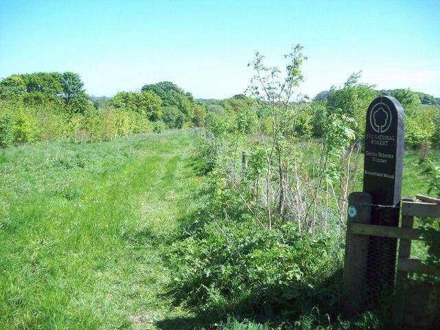
An inspiring walk through a forest in the making

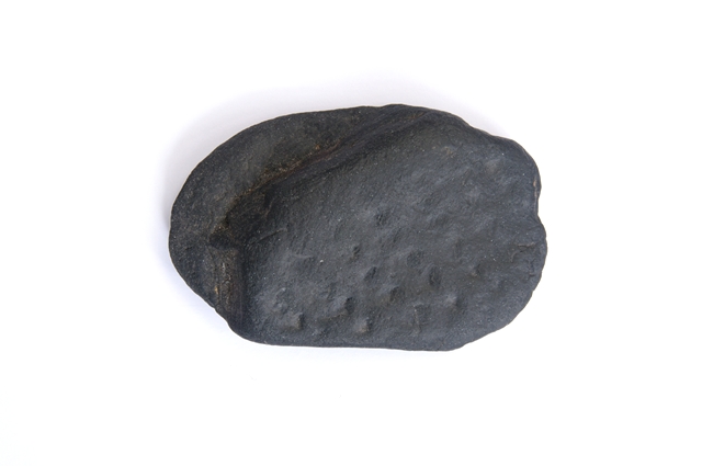
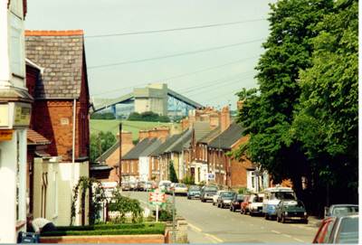
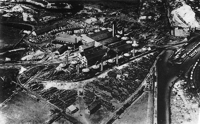
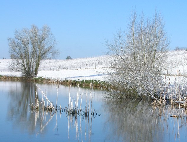
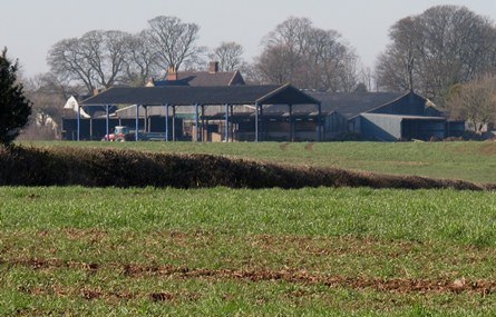
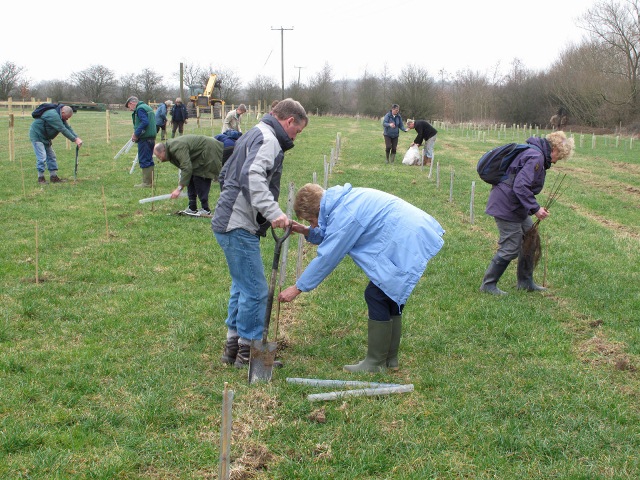
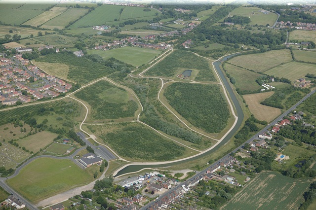
In a tranquil corner of north west Leicestershire and south Derbyshire, a maligned and scarred landscape of clay pits and coal mines is becoming a brand new forest.

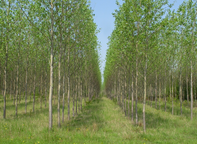
Derelict buildings and pit waste are now lakes and parks. Farmers and landowners are converting their land to woods and ponds. Rare butterflies, flowers, skylarks and even nightingales are returning.

Find out how this area was transformed not once but twice - first by coal and second in one of Europe’s boldest environmental projects.

Follow the walk by clicking on the map pins
or downloading the guides below

Location:

Overseal, The National Forest, Derbyshire

Start and finish point: Conkers Waterside, Overseal, DE12 6BA

National Forest walk credits

Thanks to - 

Dot Morson for creating this walk and providing photos 

Mark Knight, Sam Lattaway, The National Forest Company and Geoff Pursglove of The Ashby Canal Trust for audio and assistance

Caroline Millar and Rory Walsh for editing the walk materials

Barry Morson for providing photos 

The Magic Attic Archives, Derby Museums and Art Gallery and Graham Knight for supplying archive images 

Other images reproduced under Creative Commons Licences

"The clearest way into the Universe is through a forest wilderness" - John Muir